MISSION
DATE / TIME |
LAUNCH
LOCATION |
CALLSIGNS
FREQUENCIES
MODES |
WEB PAGES, EMAILS
and TRACKING |
ADDITIONAL INFORMATION |
Showing future flights and flights 99999 days back. Listing: 1083 of 1072 missions
|
Friday
10:00:00 EDT
14:00:00 UTC
2024-05-17
Sunrise:06:33:09
Sunset:20:41:26
Concord Community Schools
(CCS)
Record # 1119 |
41.6314, -85.9302
(N41° 37' 53", W85° 55' 49")
Grid: EN71AP
Map of Launch Site: | East and West 2024
Latex, 1200g, Helium
N9QIE-11
APRS: 144.390Mhz
|
Elizabeth King, N9QIE-11
[email protected]
Tracking Options:
Google Maps APRS (aprs.fi)
HABHUB | 1200 Using: Helium
School Project for elementary students.
|
Wednesday
10:30:00
2023-07-26
Sunrise:06:12:45
Sunset:21:16:31
Boys and girls club of goshen
(107707)
Record # 1079 |
Mill Street Park, Goshen, Indiana, Elkhart
41.5925, -85.8353
(N41° 35' 33", W85° 50' 7")
Grid: EN71BO
Map of Launch Site: | BGG-1
Latex, 1200g, Helium
N9QIE-10
APRS: 144.390Mhz
Space Available |
Ben Flores Singer, N/A
[email protected]
Tracking Options:
Google Maps APRS (aprs.fi)
HABHUB | 1200 Using: Helium
Student experiments
|
Wednesday
10:30:00 EDT
14:30:00 UTC
2023-07-26
Sunrise:06:12:45
Sunset:21:16:31
Boys and girls club of goshen
(107707)
Record # 1077 |
Mill Street Park, Goshen, Indiana, Elkhart
41.5925, -85.8353
(N41° 35' 33", W85° 50' 7")
Grid: EN71BO
Map of Launch Site: | BGG-1
Latex, 1200g, Helium
N9QIE-10
APRS: 144.390Mhz
Space Available |
Ben Flores Singer, N/A
[email protected]
Tracking Options:
Google Maps APRS (aprs.fi)
HABHUB | 1200 Using: Helium
Student experiments
|
Wednesday
10:30:00
2023-07-26
Sunrise:06:12:45
Sunset:21:16:31
Boys and girls club of goshen
(107707)
Record # 1078 |
Mill Street Park, Goshen, Indiana, Elkhart
41.5925, -85.8353
(N41° 35' 33", W85° 50' 7")
Grid: EN71BO
Map of Launch Site: | BGG-1
Latex, 1200g, Helium
N9QIE-10
APRS: 144.390Mhz
Space Available |
Ben Flores Singer, N/A
[email protected]
Tracking Options:
Google Maps APRS (aprs.fi)
HABHUB | 1200 Using: Helium
Student experiments
|
Wednesday
10:30:00
2023-07-26
Sunrise:06:12:45
Sunset:21:16:31
Boys and girls club of goshen
(107707)
Record # 1079 |
Mill Street Park, Goshen, Indiana, Elkhart
41.5925, -85.8353
(N41° 35' 33", W85° 50' 7")
Grid: EN71BO
Map of Launch Site: | BGG-1
Latex, 1200g, Helium
N9QIE-10
APRS: 144.390Mhz
Space Available |
Ben Flores Singer, N/A
[email protected]
Tracking Options:
Google Maps APRS (aprs.fi)
HABHUB | 1200 Using: Helium
Student experiments
|
Wednesday
10:30:00
2023-07-26
Sunrise:06:12:45
Sunset:21:16:31
Boys and girls club of goshen
(107707)
Record # 1078 |
Mill Street Park, Goshen, Indiana, Elkhart
41.5925, -85.8353
(N41° 35' 33", W85° 50' 7")
Grid: EN71BO
Map of Launch Site: | BGG-1
Latex, 1200g, Helium
N9QIE-10
APRS: 144.390Mhz
Space Available |
Ben Flores Singer, N/A
[email protected]
Tracking Options:
Google Maps APRS (aprs.fi)
HABHUB | 1200 Using: Helium
Student experiments
|
Wednesday
10:30:00
2023-07-26
Sunrise:06:12:45
Sunset:21:16:31
Boys and girls club of goshen
(107707)
Record # 1079 |
Mill Street Park, Goshen, Indiana, Elkhart
41.5925, -85.8353
(N41° 35' 33", W85° 50' 7")
Grid: EN71BO
Map of Launch Site: | BGG-1
Latex, 1200g, Helium
N9QIE-10
APRS: 144.390Mhz
Space Available |
Ben Flores Singer, N/A
[email protected]
Tracking Options:
Google Maps APRS (aprs.fi)
HABHUB | 1200 Using: Helium
Student experiments
|
Wednesday
10:30:00 EDT
14:30:00 UTC
2023-07-26
Sunrise:06:12:45
Sunset:21:16:31
Boys and girls club of goshen
(107707)
Record # 1077 |
Mill Street Park, Goshen, Indiana, Elkhart
41.5925, -85.8353
(N41° 35' 33", W85° 50' 7")
Grid: EN71BO
Map of Launch Site: | BGG-1
Latex, 1200g, Helium
N9QIE-10
APRS: 144.390Mhz
Space Available |
Ben Flores Singer, N/A
[email protected]
Tracking Options:
Google Maps APRS (aprs.fi)
HABHUB | 1200 Using: Helium
Student experiments
|
Wednesday
10:30:00
2023-07-26
Sunrise:06:12:45
Sunset:21:16:31
Boys and girls club of goshen
(107707)
Record # 1078 |
Mill Street Park, Goshen, Indiana, Elkhart
41.5925, -85.8353
(N41° 35' 33", W85° 50' 7")
Grid: EN71BO
Map of Launch Site: | BGG-1
Latex, 1200g, Helium
N9QIE-10
APRS: 144.390Mhz
Space Available |
Ben Flores Singer, N/A
[email protected]
Tracking Options:
Google Maps APRS (aprs.fi)
HABHUB | 1200 Using: Helium
Student experiments
|
Wednesday
10:30:00
2023-07-26
Sunrise:06:12:45
Sunset:21:16:31
Boys and girls club of goshen
(107707)
Record # 1079 |
Mill Street Park, Goshen, Indiana, Elkhart
41.5925, -85.8353
(N41° 35' 33", W85° 50' 7")
Grid: EN71BO
Map of Launch Site: | BGG-1
Latex, 1200g, Helium
N9QIE-10
APRS: 144.390Mhz
Space Available |
Ben Flores Singer, N/A
[email protected]
Tracking Options:
Google Maps APRS (aprs.fi)
HABHUB | 1200 Using: Helium
Student experiments
|
Wednesday
10:30:00 EDT
14:30:00 UTC
2023-07-26
Sunrise:06:12:45
Sunset:21:16:31
Boys and girls club of goshen
(107707)
Record # 1077 |
Mill Street Park, Goshen, Indiana, Elkhart
41.5925, -85.8353
(N41° 35' 33", W85° 50' 7")
Grid: EN71BO
Map of Launch Site: | BGG-1
Latex, 1200g, Helium
N9QIE-10
APRS: 144.390Mhz
Space Available |
Ben Flores Singer, N/A
[email protected]
Tracking Options:
Google Maps APRS (aprs.fi)
HABHUB | 1200 Using: Helium
Student experiments
|
Friday
14:00:00 EDT
18:00:00 UTC
2023-05-19
Sunrise:06:30:27
Sunset:20:43:30
Concord Community Schools
(CCS)
Record # 1070 |
Concord High School, Elkhart, IN 46516
41.6314, -85.9302
(N41° 37' 53", W85° 55' 49")
Grid: EN71AP
Map of Launch Site: | East and South WB 2023
Latex, 1200g, Helium
N9QIE-13
APRS: 144.390Mhz
|
Leann Kniller, N9QIE-13
[email protected]
Tracking Options:
Google Maps APRS (aprs.fi)
HABHUB | 1200 Using: Helium
This is a 4th grade student project from Concord Community Schools. We are launching two balloons on the same day.
|
Friday
10:00:00 EDT
14:00:00 UTC
2023-05-19
Sunrise:06:30:27
Sunset:20:43:30
Concord Community Schools
(CCS)
Record # 1069 |
Concord High School, Elkhart, IN 46516
41.6314, -85.9302
(N41° 37' 53", W85° 55' 49")
Grid: EN71AP
Map of Launch Site: | Ox and West WB 2023
Latex, 1200g, Helium
N9QIE-11
APRS: 144.390Mhz
|
Elizabeth King, N9QIE-11
[email protected]
Tracking Options:
Google Maps APRS (aprs.fi)
HABHUB | 1200 Using: Helium
This is a 4th grade weather balloon project from Concord Community Schools.
|
Tuesday
09:00:00 CDT
14:00:00 UTC
2023-05-16
Sunrise:06:02:52
Sunset:20:07:48
Young Scientest Space Program
(YSSP)
Record # 1071 |
Pella Christian High School
41.4, -92.9
(N41° 24' 0", W92° 54' 0")
Grid: EN31NJ
Map of Launch Site: | PENS-15
Latex, 1500g, Hydrogen

N0MPM-11
APRS: 144.390Mhz
n0mpm-12 on 144.34
|
Mike Morgan, N0MPM
[email protected]
Tracking Options:
Google Maps APRS (aprs.fi)
HABHUB | 1500 Using: Hydrogen
Senior Physics Class/6 Experiments
|
Friday
08:30:00 EST
13:30:00 UTC
2023-03-03
Sunrise:08:19:36
Sunset:18:54:45
SVAA
(106803)
Record # 1068 |
Wasaga Beach
44.5208, -80.0248
(N44° 31' 15", W80° 1' 29")
Grid: EN94XM
Map of Launch Site: | LAB SES 1
Latex, 105g, Helium
VE3SVF-01
Space Available |
Sasha Tim, VE3SVF
[email protected]
Tracking Options:
Google Maps APRS (aprs.fi)
HABHUB | 105 Using: Helium
|
Friday
12:30:00 EDT
16:30:00 UTC
2022-10-07
Sunrise:07:27:07
Sunset:19:32:48
BARS
(106710)
Record # 1067 |
Lexington, KY, USA
38.048, -84.5016
(N38° 2' 53", W84° 30' 6")
Grid: EM78RB
Map of Launch Site: | BARS Hamfest
Mylar, 13g, Helium
AI4SR-11
APRS: 144.390Mhz
|
Jim Schings, AI4SR
[email protected]
Tracking Options:
Google Maps APRS (aprs.fi)
HABHUB | 13 Using: Helium
Being launched during the Bluegrass Amateur Radio Club Hamfest. Alternative launch date is 7AM Oct. 8th
|
Saturday
10:00:00 EDT
14:00:00 UTC
2022-08-06
Sunrise:06:30:55
Sunset:20:50:58
West Georgia Amateur Radio Society
(106307)
Record # 1063 |
VFW Fairgrounds Carrollton
33.6009, -85.0242
(N33° 36' 3", W85° 1' 27")
Grid: EM73LO
Map of Launch Site: | Unnamed Flight
Latex, 1000g, Hydrogen
W4FWD-11
APRS: 144.390Mhz
|
Blake Raab, N4BWR
[email protected]
Tracking Options:
Google Maps APRS (aprs.fi)
HABHUB | 1000 Using: Hydrogen
APRS will include payload temperature, outside temperature, humidity, and UV/IR light levels
|
Thursday
11:00:00 EDT
15:00:00 UTC
2022-08-04
Sunrise:06:22:21
Sunset:21:12:27
ETITB
(106608)
Record # 1066 |
Andrew Jackson Middle School, South Bend, IN USA
41.6232, -86.2366
(N41° 37' 24", W86° 14' 12")
Grid: EN61VO
Map of Launch Site: | ETITB2022
Latex, 1200g, Helium
N9QIE-13
APRS: 144.390Mhz
|
Elizabeth King, N9QIE-13
[email protected]
Tracking Options:
Google Maps APRS (aprs.fi)
HABHUB | 1200 Using: Helium
This balloon launch is part of EdTech in the Bend 2022.
|
Thursday
10:00:00
2022-07-21
Sunrise:06:18:10
Sunset:21:17:53

Balloon Assisted Stratospheric Experiments (DePauw University)
(BASE)
Record # 1065 |
North Montgomery Schools, Cherry Grove, IN, USA
40.12, -86.9
(N40° 7' 12", W86° 54' 0")
Grid: EN60NC
Map of Launch Site: | BASE 113
Latex, 600g, Hydrogen
W9YJ-11
APRS: 144.390Mhz
W9YJ-13
| http://www.depauw.edu/academics/departments-programs/physics-astronomy/department-research/base/
Howard Brooks, KC9QBN
[email protected]
Twitter/Facebook:
#BASE_DePauw
Tracking Options:
Google Maps APRS (aprs.fi)
HABHUB | 600 Using: Hydrogen
Tandem balloons, equal size, equal lift, planning to cut one away at 15 km (50000 feet). Geiger array to explore the middle layers of the stratosphere.
|
Tuesday
08:30:00 EDT
12:30:00 UTC
2022-07-19
Sunrise:06:18:17
Sunset:21:16:39
Balloon Assisted Stratospheric Experiments (DePauw University)
(BASE)
Record # 1064 |
Julian Science and Mathematics Center, DePauw University, Greencastle, IN, USA
39.64, -86.86
(N39° 38' 24", W86° 51' 36")
Grid: EM69NP
Map of Launch Site: | BASE 112
Latex, 350g, Hydrogen
W9YJ-11
APRS: 144.390Mhz
W9YJ-13
| http://www.depauw.edu/academics/departments-programs/physics-astronomy/department-research/base/
Howard Brooks, KC9QBN
[email protected]
Twitter/Facebook:
#BASE_DePauw
Tracking Options:
Google Maps APRS (aprs.fi)
HABHUB | 350 Using: Hydrogen
Tandem balloon launch. 350 gram balloon should cut away at 15 km using the HAB Bounder from Balloon Ascent Technologies. 600 gram balloon should carry Geiger counter array up to 30 km. Hoping 600 gram solo ascent at 1.5 m/s.
|
Saturday
10:00:00 CST
16:00:00 UTC
2022-07-16
Sunrise:05:41:36
Sunset:22:30:06

Saskatoon Amateur Balloon Radio Experiments
(SABRE)
Record # 1062 |
Saskatoon, Saskatchewan Canada
52.0963, -106.633
(N52° 5' 47", W106° 37' 59")
Grid: DO62QC
Map of Launch Site: | SABRE-P3
Mylar, 35g, Hydrogen
VA5BNC-15
APRS: 144.390Mhz
| http://ve5aa.dyndns.org/balloon/
Bruce Coates, VE5BNC
[email protected]
Tracking Options:
Google Maps APRS (aprs.fi)
HABHUB | 35 Using: Hydrogen
Pico floater.
|
Monday
09:30:00
2022-07-11
Sunrise:06:12:47
Sunset:21:19:01
Balloon Assisted Stratospheric Experiments (DePauw University)
(BASE)
Record # 1061 |
North Montgomery Schools, Cherry Grove, IN
40.12, -86.9
(N40° 7' 12", W86° 54' 0")
Grid: EN60NC
Map of Launch Site: | BASE 111
Latex, 350g, Helium
W9YJ-13
APRS: 144.390Mhz
W9YJ-14
| http://www.depauw.edu/academics/departments-programs/physics-astronomy/department-research/base/
Howard L Brooks, KC9QBN
[email protected]
Twitter/Facebook:
#BASE_DePauw
Tracking Options:
Google Maps APRS (aprs.fi)
HABHUB | 350 Using: Helium
Tandem balloons - 600 gram carrying the parachute, two APRS radios, and the Geiger Counter Array
350 gram balloon for additional lift during first 50 minutes of the flight
Cutaway of the lift balloon via HAB Bounder from Loonatec.com
|
Tuesday
08:30:00 EDT
12:30:00 UTC
2022-06-28
Sunrise:06:11:44
Sunset:21:13:57
Balloon Assisted Stratospheric Experiments (DePauw University)
(BASE)
Record # 1060 |
Julian Science and Mathematics Center, DePauw University, Greencastle, IN
39.64, -86.86
(N39° 38' 24", W86° 51' 36")
Grid: EM69NP
Map of Launch Site: | BASE 110
Latex, 600g, Helium
W9YJ-12
APRS: 144.390Mhz
W9YJ-13
| http://www.depauw.edu/academics/departments-programs/physics-astronomy/department-research/base/
Howard Brooks, KC9QBN
[email protected]
Twitter/Facebook:
#BASE_DePauw
Tracking Options:
Google Maps APRS (aprs.fi)
HABHUB | 600 Using: Helium
First flight of reassembled Geiger Counter Array with Altimeter onboard for simultaneous logging of Geiger outputs, coincidences, and altitude.
|
Tuesday
08:30:00 EDT
12:30:00 UTC
2022-06-28
Sunrise:06:11:44
Sunset:21:13:57
Balloon Assisted Stratospheric Experiments (DePauw University)
(BASE)
Record # 1059 |
Julian Science and Mathematics Center, DePauw University, Greencastle, IN
39.64, -86.86
(N39° 38' 24", W86° 51' 36")
Grid: EM69NP
Map of Launch Site: | BASE 110
Latex, 600g, Helium
W9YJ-12
APRS: 144.390Mhz
W9YJ-13
| http://www.depauw.edu/academics/departments-programs/physics-astronomy/department-research/base/
Howard Brooks, KC9QBN
[email protected]
Twitter/Facebook:
#BASE_DePauw
Tracking Options:
Google Maps APRS (aprs.fi)
HABHUB | 600 Using: Helium
First flight of reassembled Geiger Counter Array with Altimeter onboard for simultaneous logging of Geiger outputs, coincidences, and altitude.
|
Tuesday
00:00:00 EDT
04:00:00 UTC
2022-06-21
Sunrise:06:12:44
Sunset:21:10:16
Balloon Assisted Stratospheric Experiments (DePauw University)
(BASE)
Record # 1058 |
Julian Science and Mathematics Center, DePauw University, Greencastle, IN
39.64, -86.86
(N39° 38' 24", W86° 51' 36")
Grid: EM69NP
Map of Launch Site: | BASE 109
Latex, 300g, Helium
W9YJ-11
APRS: 144.390Mhz
W9YJ-15
WSPR at 14.097 MHz under W9YJ-14 call
W9YJ-14
| http://www.depauw.edu/academics/departments-programs/physics-astronomy/department-research/base/
Howard Brooks, KC9QBN
[email protected]
Twitter/Facebook:
#BASE_DePauw
Tracking Options:
Google Maps APRS (aprs.fi)
HABHUB | 300 Using: Helium
Radio test flight. Doongara cutdown test flight - by pressure(altitude), time, or balloon burst. Checking performance of Cloudbuster chloreprene balloon.
|
Tuesday
10:45:00 EDT
14:45:00 UTC
2022-05-24
Sunrise:06:25:25
Sunset:20:49:52
Ryan Wallick
(105705)
Record # 1057 |
41.623, -86.2432
(N41° 37' 23", W86° 14' 36")
Grid: EN61VO
Map of Launch Site: | South Bend Community School Weather Balloon
Latex, 1200g, Helium
N9QIE-13
APRS: 144.390Mhz
|
Ryan Wallick, N9QIE-13
[email protected]
Tracking Options:
Google Maps APRS (aprs.fi)
HABHUB | 1200 Using: Helium
1,200 gram unmanned free balloon launched for a student experiment by 6th, 7th, and 8th grade students from Jefferson Traditional Middle School.
|
Friday
10:00:00
2022-05-20
Sunrise:
Sunset:
Concord Community Schools
(CCS)
Record # 1055 |
Concord East Side School
41.6651, -85.9151
(N41° 39' 54", W85° 54' 54")
Grid: EN71BP
Map of Launch Site: | West/East
Latex, 1200g, Helium
N9QIE-10
APRS: 144.390Mhz
|
Marsh/Kniller, N9QIE-10
[email protected]
Tracking Options:
Google Maps APRS (aprs.fi)
HABHUB | 1200 Using: Helium
This is a 4th grade student experiment.
|
Wednesday
09:00:00
2022-05-18
Sunrise:
Sunset:
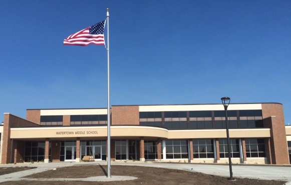
Watertown Middle School
(WMS)
Record # 1056 |
Watertown Regional Airport
44.9213, 97.1612
(N44° 55' 17", E97° 9' 40")
Grid: NN84NW
Map of Launch Site: | BOREALIS XIII
Latex, 2000g, Helium
KE0RVJ-11
APRS: 144.390Mhz
|
Mark Iverson, KE0RVJ
[email protected]
Tracking Options:
Google Maps APRS (aprs.fi)
HABHUB | 2000 Using: Helium
|
Friday
10:00:00 EDT
14:00:00 UTC
2022-05-13
Sunrise:06:38:42
Sunset:20:37:14
Concord Community Schools
(CCS)
Record # 1053 |
Concord Ox Bow Elementary School, Elkhart, IN, USA
41.6366, -85.9156
(N41° 38' 12", W85° 54' 56")
Grid: EN71BP
Map of Launch Site: | Ox and South WB Launch 2022
Latex, 1200g, Helium
N9QIE-11
APRS: 144.390Mhz
|
Elizabeth King, N9QIE-11
[email protected]
Tracking Options:
Google Maps APRS (aprs.fi)
HABHUB | 1200 Using: Helium
This is a student project, and the balloon will be carrying experiments.
|
Tuesday
09:00:00 EDT
13:00:00 UTC
2022-05-10
Sunrise:06:38:25
Sunset:20:30:34
Quincy High School
(105405)
Record # 1054 |
Quincy High School
41.9428, -84.8782
(N41° 56' 34", W84° 52' 42")
Grid: EN71NW
Map of Launch Site: | Oriole-HAB-1
Latex, 1200g, Helium
KC8TRN-4
APRS: 144.390Mhz
|
Ben Miller, KC8TRN
[email protected]
Tracking Options:
Google Maps APRS (aprs.fi)
HABHUB | 1200 Using: Helium
|
Thursday
09:00:00 CDT
14:00:00 UTC
2021-09-23
Sunrise:06:44:48
Sunset:19:30:30

Pella Explores Near Space
(PENS)
Record # 1052 |
Jefferson Intermediate School Pella, IA
41.4, -92.9
(N41° 24' 0", W92° 54' 0")
Grid: EN31NJ
Map of Launch Site: | brw-10
Plastic, 107g, Helium
APRS: 144.390Mhz
| http://www.pellaarc.com
Mike Morgan, N0MPM
[email protected]
Tracking Options:
Google Maps APRS (aprs.fi)
HABHUB | 107 Using: Helium
Pico Flight
SBS-13 Balloon/WB8ELK Skytracker
7.55 gms free lift
|
Tuesday
10:00:00 CDT
15:00:00 UTC
2021-08-03
Sunrise:05:48:44
Sunset:20:39:12
Pella Explores Near Space
(PENS)
Record # 1051 |
Jefferson Intermediate School
41.4056, -92.9028
(N41° 24' 20", W92° 54' 10")
Grid: EN31NJ
Map of Launch Site: | PENS-13p
Mylar, 107g, Helium
N0MPM
APRS: 144.390Mhz
N0MPM-13
| http://www.pellaarc.com
Mike Morgan, N0MPM
[email protected]
Tracking Options:
Google Maps APRS (aprs.fi)
HABHUB | 107 Using: Helium
20 meter WSPR gated to APRS
WB8ELK Skytracker
Flying for Pella Girl Scouts
|
Friday
10:00:00 EDT
14:00:00 UTC
2021-06-04
Sunrise:06:12:32
Sunset:20:59:24
Concord Community Schools
(CCS)
Record # 1050 |
Concord Ox Bow Elementary School, Elkhart, IN, USA
41.6366, -85.9156
(N41° 38' 12", W85° 54' 56")
Grid: EN71BP
Map of Launch Site: | CCS 5th Grade WB Launch
Latex, 1200g, Helium
N9QIE-10
APRS: 144.390Mhz
|
Elizabeth King, N9QIE-10
[email protected]
Tracking Options:
Google Maps APRS (aprs.fi)
HABHUB | 1200 Using: Helium
This is a student experiment and will be launched by 5th grade students.
|
Monday
09:00:00
2021-05-24
Sunrise:
Sunset:
Watertown Middle School
(WMS)
Record # 1049 |
Watertown Regional Airport
44.9213, 97.1612
(N44° 55' 17", E97° 9' 40")
Grid: NN84NW
Map of Launch Site: | BOREALIS XII
Latex, 2000g, Helium
KE0RVJ-11
APRS: 144.390Mhz
|
Mark Iverson, KE0RVJ
[email protected]
Tracking Options:
Google Maps APRS (aprs.fi)
HABHUB | 2000 Using: Helium
BOREALIS XII will consist of a 2000g weather balloon equipped with an ArduinoTrack APRS GPS tracker sending back telemetry and temperature readings every minute throughout the flight, 2 HD Contour video cameras, one facing down the other facing to the horizon and an Arduino running a BPM180 with an SD data logger, taking recordings every 10 seconds. All of which was designed, coded and build by WMS 8th graders.
|
Friday
10:00:00 EDT
14:00:00 UTC
2021-05-21
Sunrise:06:27:43
Sunset:20:45:34
Concord Community Schools
(CCS)
Record # 1048 |
Concord East Side Elementary School
41.6646, -85.9134
(N41° 39' 53", W85° 54' 48")
Grid: EN71BP
Map of Launch Site: | Concord
Latex, 1200g, Helium
N9QIE-10
APRS: 144.390Mhz
|
Ryan Wallick, N9QIE-10
[email protected]
Tracking Options:
Google Maps APRS (aprs.fi)
HABHUB | 1200 Using: Helium
This balloon is being launched by a group of 4th grade students!
|
Friday
10:00:00 EDT
14:00:00 UTC
2021-05-14
Sunrise:06:43:08
Sunset:20:34:07
Concord Community Schools
(CCS)
Record # 1046 |
Concord Ox Bow Elementary School, Elkhart, IN, USA
41.6366, -85.9156
(N41° 38' 12", W85° 54' 56")
Grid: EN71BP
Map of Launch Site: | Woxbow Dream Team
Latex, 1200g, Helium
N9QIE-11
APRS: 144.390Mhz
|
Elizabeth King, N9QIE-11
[email protected]
Tracking Options:
Google Maps APRS (aprs.fi)
HABHUB | 1200 Using: Helium
This balloon will be launched, tracked and retrieved by a 4th grade class.
|
Thursday
09:00:00
2021-05-13
Sunrise:
Sunset:
Pella Explores Near Space
(PENS)
Record # 1047 |
Pella Christian High School, Pella, IA USA
41.3936, -92.8897
(N41° 23' 37", W92° 53' 23")
Grid: EN31NJ
Map of Launch Site: | PENS-14
Latex, 1500g, Hydrogen
N0MPM-11
APRS: 144.340Mhz
N0MPM-12
| http://www.pellaarc.com
Mike Morgan, N0MPM
[email protected]
Tracking Options:
Google Maps APRS (aprs.fi)
HABHUB | 1500 Using: Hydrogen
6 Experiments for PCHS Senior Physics Class
|
Tuesday
10:00:00 CST
16:00:00 UTC
2020-12-01
Sunrise:08:09:25
Sunset:17:50:32
Pella Explores Near Space
(PENS)
Record # 1045 |
Pella Christian HS
41.3936, -92.8897
(N41° 23' 37", W92° 53' 23")
Grid: EN31NJ
Map of Launch Site: | PENS=12p
Plastic, 104g, Helium
WB0URW-12
WB0URW(WSPR)
20m WSPR
| http://www.pellaarc.com
Mike Morgan, N0MPM
[email protected]
Tracking Options:
Google Maps APRS (aprs.fi)
HABHUB | 104 Using: Helium
SBS-13 Balloon with WB4ELK WSPR Skytracker.
PCHS Senior Physics Class
|
Friday
09:15:00 CST
15:15:00 UTC
2020-11-06
Sunrise:07:36:49
Sunset:18:18:04
Choose
(95705)
Record # 1044 |
Pella Christian Grade School, Pella, IA USA
41.405, -92.908
(N41° 24' 18", W92° 54' 29")
Grid: EN31NJ
Map of Launch Site: | PENS-11p
Mylar, 104g, Helium
WB0URW-9
APRS: 144.390Mhz
|
Mike Morgan, N0MPM
[email protected]
Tracking Options:
Google Maps APRS (aprs.fi)
HABHUB | 104 Using: Helium
SBS-13 Balloon/WB4ELK Skytracker
7.0gm Free Lift
|
Thursday
09:15:00 CST
15:15:00 UTC
2020-11-05
Sunrise:07:35:31
Sunset:18:19:27
Pella Explores Near Space
(PENS)
Record # 1043 |
Jefferson School, Pella IA USA
41.406, -92.902
(N41° 24' 22", W92° 54' 7")
Grid: EN31NJ
Map of Launch Site: | PENS-10p
Mylar, 104g, Helium
WB0URW-8
APRS: 144.390Mhz
| http://www.pellaarc.com
Mike Morgan, N0MPM
[email protected]
Tracking Options:
Google Maps APRS (aprs.fi)
HABHUB | 104 Using: Helium
SBS-13 Balloon/WB8ELK APRS Skytracker7gm Free Lift
|
Saturday
08:00:00 CDT
13:00:00 UTC
2020-07-11
Sunrise:05:47:00
Sunset:20:59:44

Near Space Ventures Inc.
(NSV)
Record # 1035 |
OMAHA, NB
366m / 1,201ft
41.0179, -96.32
(N41° 1' 4", W96° 19' 12")
Grid: EN11UA
Map of Launch Site: | NSV-100
Latex, 700g, Hydrogen
W0NSV-11
APRS: 144.390Mhz
Space Available | http://nearspaceventures.com
Keith Kaiser, WA0TJT
[email protected]
Tracking Options:
Google Maps APRS (aprs.fi)
HABHUB | 700 Using: Hydrogen
Near Space Ventures will be at the 2020 GPSL, the launch coordinates will almost certainly change.
|
Friday
08:00:00 CDT
13:00:00 UTC
2020-07-10
Sunrise:05:47:00
Sunset:20:59:44
Near Space Ventures Inc.
(NSV)
Record # 1036 |
OMAHA, NB
366m / 1,201ft
41.0179, -96.32
(N41° 1' 4", W96° 19' 12")
Grid: EN11UA
Map of Launch Site: | NSV-100
Latex, 700g, Hydrogen
W0NSV-11
APRS: 144.390Mhz
Space Available | http://nearspaceventures.com
Keith Kaiser, WA0TJT
[email protected]
Tracking Options:
Google Maps APRS (aprs.fi)
HABHUB | 700 Using: Hydrogen
Near Space Ventures will be at the 2020 GPSL, the launch coordinates will almost certainly change.
|
Sunday
08:30:00 PDT
15:30:00 UTC
2020-07-05
Sunrise:05:38:56
Sunset:20:25:59
Larry Phegley
(104207)
Record # 1042 |
Casa de Fruta lot 5, Hollister, CA
85m / 279ft
36.9967, -121.376
(N36° 59' 48", W121° 22' 34")
Grid: CM96HX
Map of Launch Site: |
Latex, 1000g, Helium
KJ6PBS-3
APRS: 144.390Mhz
|
Larry Phegley, KJ6PBS-3
[email protected]
Tracking Options:
Google Maps APRS (aprs.fi)
HABHUB | 1000 Using: Helium
|
Wednesday
05:00:00 EDT
13:00:00 UTC
2020-06-10
Sunrise:06:01:20
Sunset:20:19:33
Viking HAB
(103806)
Record # 1038 |
Latta High School Football Field, Latta, SC, USA
31m / 102ft
34.3408, -79.4225
(N34° 20' 27", W79° 25' 21")
Grid: FM04GI
Map of Launch Site: | VIKING 7
Latex, 600g, Helium
AD4XX-11
APRS: 144.390Mhz
RTTY 434.650MHz 50/470
|
Jim O'Hern, AD4XX
[email protected]
Tracking Options:
Google Maps APRS (aprs.fi)
HABHUB | 600 Using: Helium
Telemetry includes internal and external temperature, vertical and horizontal speed, altitude, and satellite count. This should be a pre-dawn launch. Three cameras will record the view which will be available later on Youtube. We will also have a bright blinking LED flashing downwards to help track the launch visually until sunrise.
|
Saturday
06:30:00 MDT
12:30:00 UTC
2020-05-30
Sunrise:05:35:13
Sunset:20:01:40

Edge of Space Sciences
(EOSS)
Record # 1041 |
Deer Trail, Colorado, USA
1589m / 5,213ft
39.6091, -104.042
(N39° 36' 33", W104° 2' 31")
Grid: DM79XO
Map of Launch Site: | EOSS-299
Latex, 3000g, Hydrogen
AE0SS-12
APRS: 144.340Mhz
KC0D-12
APRS 144.905 MHz
| http://www.eoss.org/
Jim Langsted, KC0RPS
[email protected]
Twitter/Facebook:
@eossorg
Tracking Options:
Google Maps APRS (aprs.fi)
HABHUB | 3000 Using: Hydrogen
This balloon carried an experiment for NOAA Boulder.
This flight was flown in honor of EOSS founding member Rick von Glahn, NØKKZ(SK). The flight beacons indicated, "In Memory NØKKZ(SK)EOSS Ultimate Prognosticator" throughout the flight.
|
Sunday
08:45:00 MDT
14:45:00 UTC
2020-03-15
Sunrise:07:34:43
Sunset:18:53:28
Choose
(95705)
Record # 1040 |
Windsor, Colorado, USA
1496m / 4,908ft
40.4737, -104.962
(N40° 28' 25", W104° 57' 43")
Grid: DN70ML
Map of Launch Site: | EOSS-298
Latex, 1500g, Hydrogen
AE0SS-12
APRS: 144.340Mhz
KC0D-14
APRS 145.765 MHz
|
Jim Langsted, KC0RPS
[email protected]
Tracking Options:
Google Maps APRS (aprs.fi)
HABHUB | 1500 Using: Hydrogen
This balloon carried four additional beacons for EOSS flight qualification.
EOSS conducted this flight in memory of Merle McCaslin KØYUK (SK), one of the founders of Edge of Space Sciences. The balloon beaconed, in the APRS Status line, "In memory of KØYUK(SK), EOSS original Balloonmeister." Merle will be missed.
|
Sunday
00:00:00 MDT
06:00:00 UTC
2020-03-15
Sunrise:07:34:43
Sunset:18:53:28
Edge of Space Sciences
(EOSS)
Record # 1039 |
Windsor, Colorado, USA
1496m / 4,908ft
40.4737, -104.962
(N40° 28' 25", W104° 57' 43")
Grid: DN70ML
Map of Launch Site: | EOSS-297
Latex, 1500g, Hydrogen
K0SCC-14
APRS: 144.340Mhz
KC0D-2
APRS 144.905 MHz
| http://www.eoss.org/
Jim Langsted, KC0RPS
[email protected]
Twitter/Facebook:
@eossorg
Tracking Options:
Google Maps APRS (aprs.fi)
HABHUB | 1500 Using: Hydrogen
Exempt balloon carrying STEM payloads, sponsored by National Defense Industrial Association, Rocky Mountain Chapter.
EOSS conducted this flight in memory of Merle McCaslin KØYUK (SK), one of the founders of Edge of Space Sciences. The balloon beaconed, in the APRS Status line, "In memory of KØYUK(SK), EOSS original Balloonmeister." Merle will be missed.
|
Tuesday
15:00:00 CST
21:00:00 UTC
2020-01-14
Sunrise:08:45:08
Sunset:17:54:33
Pella Explores Near Space
(PENS)
Record # 1037 |
Pella Middle School
265m / 869ft
41.4052, -92.9002
(N41° 24' 19", W92° 54' 1")
Grid: EN31NJ
Map of Launch Site: | PENS-9p
Mylar, 35g, Helium
WB0URW-7
APRS: 144.390Mhz
144.34 Europe
| http://www.pellaarc.com
Mike Morgan, N0MPM
morgamp52@mchsicom
Tracking Options:
Google Maps APRS (aprs.fi)
HABHUB | 35 Using: Helium
Using 2 35g 3ft mylar with 6g lift. WB4ELK Skytracker
|
Saturday
08:00:00 CST
14:00:00 UTC
2019-11-23
Sunrise:07:43:49
Sunset:17:42:33
Rogers Park Space Program
(103411)
Record # 1034 |
Church St. Park Peru Il, USA
187m / 614ft
41.3315, -89.1394
(N41° 19' 53", W89° 8' 22")
Grid: EN51KH
Map of Launch Site: | Carter II
Latex, 3000g, Hydrogen
KD9FRD-12
APRS: 144.390Mhz
|
Brian Koehleer, KD9FRD
[email protected]
Tracking Options:
Google Maps APRS (aprs.fi)
HABHUB | 3000 Using: Hydrogen
|
Friday
09:15:00 CST
15:15:00 UTC
2019-11-15
Sunrise:07:48:31
Sunset:18:06:15
Pella Explores Near Space
(PENS)
Record # 1033 |
Pella Christian Grade School, Pella IA
267m / 876ft
41.406, -92.91
(N41° 24' 22", W92° 54' 36")
Grid: EN31NJ
Map of Launch Site: | PENS-7p
Mylar, 35g, Helium
WB0URW-6
APRS: 144.390Mhz
| http://www.pellaarc.com
Mike Morgan, N0MPM
[email protected]
Tracking Options:
Google Maps APRS (aprs.fi)
HABHUB | 35 Using: Helium
Pico Balloon Floater flying wb8elk APRS Skytracker
|
Friday
09:30:00 EDT
13:30:00 UTC
2019-10-18
Sunrise:07:34:46
Sunset:19:09:37
StratOhio
(SOhio)
Record # 1032 |
Wyandot County Airport (56D)
248m / 814ft
40.8833, -83.3145
(N40° 52' 60", W83° 18' 52")
Grid: EN80IV
Map of Launch Site: | SOhio 2019-1
Latex, 800g, Hydrogen
KB8PVR-3
APRS: 144.390Mhz
| https://stratohio.wordpress.com/
David Snyder, KB8PVR
[email protected]
Tracking Options:
Google Maps APRS (aprs.fi)
HABHUB | 800 Using: Hydrogen
Sphere ProjectIn addition to APSSwith 4 networked Pi Flight Complete (payload still in a tree)
|
Monday
15:00:00 PDT
22:00:00 UTC
2019-09-23
Sunrise:06:22:44
Sunset:19:01:48
Overlook Horizon High Altitude Balloons
(OLHZN)
Record # 1031 |
Death Valley, California, USA
726m / 2,382ft
36.5679, -116.542
(N36° 34' 4", W116° 32' 31")
Grid: DM16RN
Map of Launch Site: | OLHZN-21
Latex, 1000g, Helium
KD2KPZ-12
APRS: 144.390Mhz
KD2KPZ-9
KD2KPZ-15
KD2KPZ-16
| http://www.OverlookHorizon.com
Tory Carissimo, KD2KPZ
[email protected]
Tracking Options:
Google Maps APRS (aprs.fi)
HABHUB | 1000 Using: Helium
|
Thursday
07:30:00 EDT
11:30:00 UTC
2019-09-05
Sunrise:06:19:26
Sunset:19:59:56
Overlook Horizon High Altitude Balloons
(OLHZN)
Record # 1030 |
Canandaigua Academy, Canandaigua, NY, USA
251m / 823ft
42.9072, -77.2735
(N42° 54' 26", W77° 16' 25")
Grid: FN12IV
Map of Launch Site: | OLHZN-20
Latex, 1500g, Helium
KD2KPZ-11
APRS: 144.390Mhz
KD2KPZ-12
KD2KPZ-9
KD2KPZ-15
KD2KPZ-16
| http://www.OverlookHorizon.com
Tory Carissimo, KD2KPZ
[email protected]
Tracking Options:
Google Maps APRS (aprs.fi)
HABHUB | 1500 Using: Helium
Full flight details and recovered data available at http://overlookhorizon.com/flight-20
Follow Overlook Horizon HABs:
Facebook | Twitter | Instagram | YouTube
|
Saturday
11:00:00 EDT
15:00:00 UTC
2019-08-24
Sunrise:06:37:01
Sunset:20:58:47
MCARC Marshall County Amateur Radio Club - Ind.
(102708)
Record # 1027 |
Argos Community Park
248m / 814ft
41.2384, -86.256
(N41° 14' 18", W86° 15' 22")
Grid: EN61UF
Map of Launch Site: |
Latex, 1500g, Helium
KQ9A-11
APRS: 144.390Mhz
K9ILU-11
|
Richard Basham, K9ILU
[email protected]
Tracking Options:
Google Maps APRS (aprs.fi)
HABHUB | 1500 Using: Helium
Due to weather we changed the date. 2 tracker on board 1 metric and 1 english also carring a low power fox on 146.565MHz
|
Saturday
09:00:00 CDT
14:00:00 UTC
2019-08-24
Sunrise:06:07:02
Sunset:19:34:40
2019 Edge of Space Project
(102908)
Record # 1029 |
Brewton Area YMCA
56m / 184ft
31.136, -87.0757
(N31° 8' 10", W87° 4' 33")
Grid: EM61LD
Map of Launch Site: | BARU-2
Latex, 1000g, Helium
WD4SBV-11
APRS: 144.390Mhz
|
LeRoy Weaver, WD4SBV
[email protected]
Tracking Options:
Google Maps APRS (aprs.fi)
HABHUB | 1000 Using: Helium
ATV on 439.25 Mhz (Cable channel 60)
Cross band repeater (Check 2019 Edge of Space facebook page for frequencies on 23 Aug 2019)
|
Saturday
10:00:00 PDT
17:00:00 UTC
2019-08-17
Sunrise:05:40:41
Sunset:20:35:16
Federal Way Amateur Radio Club
(102007)
Record # 1025 |
Enumclaw Soccer Fields
1322m / 4,337ft
47.188, -121.304
(N47° 11' 17", W121° 18' 14")
Grid: CN97IE
Map of Launch Site: | FWARC HAB 2.2
Latex, 1500g, Helium
WA7FW-12
APRS: 144.390Mhz
WA7DR-11
|
Mike McCoy, N7VWD
[email protected]
Tracking Options:
Google Maps APRS (aprs.fi)
HABHUB | 1500 Using: Helium
Payload to include two APRS transmitters, three GoPro type cameras, and a radar reflector. Call signs will be WA7FW-12 & WA7DR-11. http://fwarc.org/hab/
|
Saturday
08:45:00 EDT
12:45:00 UTC
2019-08-17
Sunrise:06:04:24
Sunset:20:29:17
Moraine Trails Council Amateur Radio Activities
(98810)
Record # 1028 |
Elk Lick Scout Reserve, Smethport, PA
475m / 1,558ft
41.8495, -78.4955
(N41° 50' 58", W78° 29' 44")
Grid: FN01SU
Map of Launch Site: | 2019 Calumet International Camporee
Latex, 30g, Helium
KC3AFB-4
APRS: 144.390Mhz
|
Bruce Gibson, K3BEG
[email protected]
Tracking Options:
Google Maps APRS (aprs.fi)
HABHUB | 30 Using: Helium
This flight is a program of the 54th Calumet International Camporee, hosted by the Allegheny Highlands Council of the Boy Scouts of America. We are using a mylar party balloon, with a WB8ELK Skytracker module.
|
Monday
07:30:00 EDT
11:30:00 UTC
2019-08-05
Sunrise:05:43:49
Sunset:20:39:36
Overlook Horizon High Altitude Balloons
(OLHZN)
Record # 1026 |
Canandaigua, NY USA
300m / 984ft
42.8347, -77.2975
(N42° 50' 5", W77° 17' 51")
Grid: FN12IU
Map of Launch Site: | OLHZN-20
Latex, 1500g, Helium
KD2KPZ-11
APRS: 144.390Mhz
KD2KPZ-12
KD2KPZ-15
KD2KPZ-16
KD2KPZ-9
| http://www.OverlookHorizon.com
Tory Carissimo, KD2KPZ
[email protected]
Tracking Options:
Google Maps APRS (aprs.fi)
HABHUB | 1500 Using: Helium
Live broadcast on launch day via Facebook and YouTube
Full flight details and recovered data available at http://overlookhorizon.com/flight-20
Follow Overlook Horizon HABs:
Facebook | Twitter | Instagram | YouTube
|
Saturday
06:00:00 BST
07:00:00 UTC
2019-08-03
Sunrise:04:54:53
Sunset:21:10:08
PTE - Pushing the Envelope
(98008)
Record # 1024 |
Elsworth, Cambridshire UK
55m / 180ft
52.2511, -0.0927
(N52° 15' 4", W0° 5' 34")
Grid: IO92WG
Map of Launch Site: | PTE3
Latex, 7600g, Hydrogen
XPI
Lora mode 1: Xpi 434.17MHz (inc SSDV)
UBX
UBX & L80 434.45MHz
L80
PTE 434.325MHz (inc SSDV)
PTE
|
Steve Randall, G8KHW
[email protected]
Tracking Options:
Google Maps APRS (aprs.fi)
HABHUB | 7600 Using: Hydrogen
Altitude record attempt by Steve Randall (G8KHW) & Dave Akerman (M6RPI) sending SSDV & gathering pfotzer data. SSDV images on Xpi and PTE available via http://ssdv.habhub.org/ launch streamed https://www.youtube.com/watch?v=5y7uF4oq5Ec and https://www.youtube.com/watch?v=c9jqiE_6DRc
|
Friday
11:00:00 EDT
15:00:00 UTC
2019-08-02
Sunrise:05:40:28
Sunset:20:42:12
Overlook Horizon High Altitude Balloons
(OLHZN)
Record # 1023 |
Canandaigua Academy, Canandaigua, NY USA
251m / 823ft
42.9072, -77.2735
(N42° 54' 26", W77° 16' 25")
Grid: FN12IV
Map of Launch Site: | OLHZN-19
Latex, 1500g, Helium
KD2KPZ-11
APRS: 144.390Mhz
KD2KPZ-12
KD2KPZ-15
KD2KPZ-16
KD2KPZ-9
| http://www.OverlookHorizon.com
Tory Carissimo, KD2KPZ
[email protected]
Tracking Options:
Google Maps APRS (aprs.fi)
HABHUB | 1500 Using: Helium
Live broadcast on launch day via Facebook and YouTube
Full flight details and recovered data available at http://overlookhorizon.com/flight-19
Follow Overlook Horizon HABs:
Facebook | Twitter | Instagram | YouTube
|
Thursday
10:00:00 EDT
14:00:00 UTC
2019-08-01
Sunrise:06:19:30
Sunset:21:14:41
Concord Community Schools
(CCS)
Record # 1021 |
Jackson Middle School
262m / 860ft
41.6232, -86.2381
(N41° 37' 24", W86° 14' 17")
Grid: EN61VO
Map of Launch Site: | Ed Tech in the Bend
Latex, 1200g, Helium
N9QIE-10
APRS: 144.390Mhz
|
Elizabeth King, N9QIE-10
[email protected]
Tracking Options:
Google Maps APRS (aprs.fi)
HABHUB | 1200 Using: Helium
We are launching this weather balloon as part of the Ed Tech in the Bend educator conference.
|
Monday
10:00:00 EDT
14:00:00 UTC
2019-07-29
Sunrise:06:07:35
Sunset:20:44:59
World Scout Jamboree
(101607)
Record # 1019 |
Bechtel Summit Reserve, Glen Jean, WV, USA
550m / 1,804ft
37.9168, -81.1244
(N37° 55' 0", W81° 7' 28")
Grid: EM97KW
Map of Launch Site: | 24WSJ-04
Mylar, 30g, Helium
NA1WJ-8
APRS: 144.390Mhz
|
Mike Cullen, K1NPT
[email protected]
Tracking Options:
Google Maps APRS (aprs.fi)
HABHUB | 30 Using: Helium
At the 24th World Scout Jamboree in West Virginia. Follow us on Twitter @NA1WJ
|
Saturday
10:00:00 EDT
14:00:00 UTC
2019-07-27
Sunrise:06:04:37
Sunset:20:46:42
World Scout Jamboree
(101607)
Record # 1018 |
Bechtel Summit Reserve, Glen Jean, WV, USA
550m / 1,804ft
37.9168, -81.1244
(N37° 55' 0", W81° 7' 28")
Grid: EM97KW
Map of Launch Site: | 24WSJ-03
Mylar, 30g, Helium
NA1WJ-7
APRS: 144.390Mhz
|
Mike Cullen, K1NPT
[email protected]
Tracking Options:
Google Maps APRS (aprs.fi)
HABHUB | 30 Using: Helium
At the 24th World Scout Jamboree in West Virginia. Follow us on Twitter @NA1WJ
|
Thursday
10:30:00 EDT
14:30:00 UTC
2019-07-25
Sunrise:05:33:10
Sunset:20:47:14
Overlook Horizon High Altitude Balloons
(OLHZN)
Record # 1022 |
Canandaigua Academy, Canandaigua, NY USA
246m / 807ft
42.9087, -77.2727
(N42° 54' 31", W77° 16' 22")
Grid: FN12IV
Map of Launch Site: | OLHZN-18
Latex, 1500g, Helium
KD2KPZ-11
APRS: 144.390Mhz
KD2KPZ-9
KD2KPZ-12
KD2KPZ-15
KD2KPZ-16
| http://www.OverlookHorizon.com
Tory Carissimo, KD2KPZ
[email protected]
Tracking Options:
Google Maps APRS (aprs.fi)
HABHUB | 1500 Using: Helium
Live broadcast on launch day via Facebook and YouTube
Full flight details and recovered data available at http://overlookhorizon.com/flight-18
Follow Overlook Horizon HABs:
Facebook | Twitter | Instagram | YouTube
|
Wednesday
10:00:00 EDT
14:00:00 UTC
2019-07-24
Sunrise:06:03:15
Sunset:20:47:22
World Scout Jamboree
(101607)
Record # 1017 |
Bechtel Summit Reserve, Glen Jean, WV, USA
550m / 1,804ft
37.9168, -81.1244
(N37° 55' 0", W81° 7' 28")
Grid: EM97KW
Map of Launch Site: | 24WSJ-02
Mylar, 30g, Helium
NA1WJ-6
APRS: 144.390Mhz
|
Mike Cullen, K1NPT
[email protected]
Tracking Options:
Google Maps APRS (aprs.fi)
HABHUB | 30 Using: Helium
At the 24th World Scout Jamboree in West Virginia. Follow us on Twitter @NA1WJ
|
Sunday
11:45:00 EDT
14:00:00 UTC
2019-07-21
Sunrise:06:01:57
Sunset:20:47:54
World Scout Jamboree
(101607)
Record # 1016 |
Bechtel Summit Reserve, Glen Jean, WV, USA
550m / 1,804ft
37.9168, -81.1244
(N37° 55' 0", W81° 7' 28")
Grid: EM97KW
Map of Launch Site: | 24WSJ-01
Mylar, 30g, Helium
NA1WJ-5
APRS: 144.390Mhz
|
Mike Cullen, K1NPT
[email protected]
Tracking Options:
Google Maps APRS (aprs.fi)
HABHUB | 30 Using: Helium
At the 24th World Scout Jamboree in West Virginia. Follow us on Twitter @NA1WJ
|
Saturday
10:00:00 PDT
17:00:00 UTC
2019-07-20
Sunrise:05:11:19
Sunset:21:05:10
Federal Way Amateur Radio Club
(102007)
Record # 1020 |
Enumclaw Soccer Fields
222m / 728ft
47.188, -122.014
(N47° 11' 17", W122° 0' 50")
Grid: CN87XE
Map of Launch Site: |
Latex, 1500g, Helium
WA7FW-12
APRS: 144.390Mhz
WA7DR-11
Space Available |
Mike McCoy, N7VWD
[email protected]
Tracking Options:
Google Maps APRS (aprs.fi)
HABHUB | 1500 Using: Helium
Payload includes three GoPro type cameras, a Big Red Bee APRS tracker, a Trackuino APRS tracker with temp probes, and a radar reflector. Using call signs WA7FW-12 and WA7DR-11. http://fwarc.org/hab/
|
Saturday
08:45:00 EDT
12:45:00 UTC
2019-07-20
Sunrise:06:19:45
Sunset:21:15:41
Balloon Assisted Stratospheric Experiments (DePauw University)
(BASE)
Record # 1015 |
Blackstock Stadium, DePauw, Greencastle, IN, USA
246m / 807ft
39.64, -86.87
(N39° 38' 24", W86° 52' 12")
Grid: EM69NP
Map of Launch Site: | BASE 108
Latex, 1500g, Hydrogen
W9YJ-11
APRS: 144.390Mhz
W9YJ-13
| http://www.depauw.edu/academics/departments-programs/physics-astronomy/department-research/base/
Howard Brooks, KC9QBN
[email protected]
Twitter/Facebook:
#BASE_DePauw
Tracking Options:
Google Maps APRS (aprs.fi)
HABHUB | 1500 Using: Hydrogen
Flight commemorating the 50th Anniversary of the Landing of the Eagle from Apollo 11 on the Moon. Carrying various items from members of the community to near space.
|
Saturday
06:00:00 PDT
15:00:00 UTC
2019-07-20
Sunrise:05:33:17
Sunset:20:07:27
RisingTides
(101307)
Record # 1013 |
Rosamond, CA, USA
727m / 2,385ft
34.8303, -118.236
(N34° 49' 49", W118° 14' 10")
Grid: DM04VT
Map of Launch Site: | BB-LT-01
Mylar, 86g, Hydrogen
N6CVO-11
APRS frequency GeoFenced based on location
|
Brian Basura, N6CVO
[email protected]
Tracking Options:
Google Maps APRS (aprs.fi)
HABHUB | 86 Using: Hydrogen
Launched at 06:00. Picked up tracking at 07:32. Woo hoo.. Launch rescheduled for 20-Jul-2019 due to high winds. Pico-Balloon to float at 10km with a LightAPRS payload GeoFenced based on location.
|
Friday
10:00:00 EDT
14:00:00 UTC
2019-07-19
Sunrise:06:15:01
Sunset:21:17:32

Spaceport Indiana
(SPI)
Record # 1014 |
FKR-Frankfort Indiana Airport
263m / 863ft
40.2734, -86.5622
(N40° 16' 24", W86° 33' 44")
Grid: EN60RG
Map of Launch Site: | INSpace Camp 2019
Latex, 600g, Hydrogen
WB8MSJ-11
APRS: 144.390Mhz
Space Available | http://www.spaceportindiana.com/Index/index.php
Brian L Tanner, WB8ELK
[email protected]
Tracking Options:
Google Maps APRS (aprs.fi)
HABHUB | 600 Using: Hydrogen
Space Camp launch with student experiments. Hams could add a payload and are welcome to track and aid in recovery if desired
|
Monday
11:00:00 EDT
15:00:00 UTC
2019-06-24
Sunrise:05:23:31
Sunset:20:46:56
Overlook Horizon High Altitude Balloons
(OLHZN)
Record # 1012 |
Henrietta, NY
209m / 686ft
43.029, -77.6523
(N43° 1' 44", W77° 39' 8")
Grid: FN13EA
Map of Launch Site: | OLHZN-17
Latex, 1500g, Helium
KD2KPZ-11
APRS: 144.390Mhz
KD2KPZ-12
KD2KPZ-9
KD2KPZ-15
KD2KPZ-16
| http://www.OverlookHorizon.com
Tory Carissimo, KD2KPZ
[email protected]
Tracking Options:
Google Maps APRS (aprs.fi)
HABHUB | 1500 Using: Helium
Live broadcast on launch day via Facebook and YouTube
Full flight details and recovered data available at http://overlookhorizon.com/flight-17
Follow Overlook Horizon HABs:
Facebook | Twitter | Instagram | YouTube
|
Sunday
08:15:00
2019-06-09
Sunrise:05:30:40
Sunset:20:32:31
Overlook Horizon High Altitude Balloons
(OLHZN)
Record # 1011 |
Canandaigua Academy, Canandaigua, NY, USA
251m / 823ft
42.9072, -77.2735
(N42° 54' 26", W77° 16' 25")
Grid: FN12IV
Map of Launch Site: | OLHZN-17
Latex, 1500g, Helium
KD2KPZ-11
APRS: 144.390Mhz
KD2KPZ-12
KD2KPZ-9
KD2KPZ-15
KD2KPZ-16
| http://www.OverlookHorizon.com
Tory Carissimo, KD2KPZ
[email protected]
Tracking Options:
Google Maps APRS (aprs.fi)
HABHUB | 1500 Using: Helium
Live broadcast on launch day via Facebook and YouTube
Full flight details and recovered data available at http://overlookhorizon.com/flight-17
Follow Overlook Horizon HABs:
Facebook | Twitter | Instagram | YouTube
|
Wednesday
07:00:00 PDT
14:00:00 UTC
2019-06-05
Sunrise:05:12:09
Sunset:20:35:53

Near Space Systems
(NEARSYS)
Record # 1010 |
Ellensburg, WA
692m / 2,270ft
46.86, -120.4
(N46° 51' 36", W120° 24' 0")
Grid: CN96TU
Map of Launch Site: | NearSys-19B, NearSys-19C
Latex, 1500g, Hydrogen
KD4STH-2
APRS: 144.390Mhz
-3
-7
-13
| http://nearsys.com
L. Paul Verhage, KD4STH
[email protected]
Twitter/Facebook:
@NearSys
Tracking Options:
Google Maps APRS (aprs.fi)
HABHUB | 1500 Using: Hydrogen
|
Friday
10:00:00 EDT
14:00:00 UTC
2019-05-24
Sunrise:06:24:16
Sunset:20:48:56
Concord Community Schools
(CCS)
Record # 1008 |
Concord West Side Elementary
232m / 761ft
41.6669, -85.9843
(N41° 40' 1", W85° 59' 3")
Grid: EN71AQ
Map of Launch Site: | Concord West Side
Latex, 1200g, Helium
N9QIE-10
APRS: 144.390Mhz
|
Cynthia Jay, N9QIE-10
[email protected]
Tracking Options:
Google Maps APRS (aprs.fi)
HABHUB | 1200 Using: Helium
4th Grade Science Project
|
Monday
09:00:00
2019-05-20
Sunrise:07:10:33
Sunset:21:39:08
Watertown Middle School
(WMS)
Record # 1009 |
Watertown Regional Airport
-9999m / -32,805ft
44.5531, 97.1005
(N44° 33' 11", E97° 6' 2")
Grid: NN84NN
Map of Launch Site: | Project: BOREALIS XII
Latex, 1600g, Helium
KE0RVJ-12
APRS: 144.390Mhz
|
Mark Iverson, KE0RVJ
[email protected]
Tracking Options:
Google Maps APRS (aprs.fi)
HABHUB | 1600 Using: Helium
BOREALIS XI will consist of a 1600g Hyowee weather balloon equipped with an ArduinoTrack APRS GPS tracker sending back telemetry and temperature readings every minute throughout the flight, 1 HD Contour video camera, facing to the horizon and an Arduino running a BPM180 with an SD data logger, taking recordings every 10 seconds. The package will also include a Geiger Counter that makes an audible beep each time a particle is found. The beep will be recorded on the video to give us an idea of radiation at different levels. All of which was designed, coded and build by WMS 8th graders.
|
Friday
10:00:00 EDT
14:00:00 UTC
2019-05-17
Sunrise:06:31:24
Sunset:20:38:54
Concord Community Schools
(CCS)
Record # 1007 |
South Side School
281m / 922ft
41.4536, -85.3954
(N41° 27' 13", W85° 23' 43")
Grid: EN71HK
Map of Launch Site: | The South Side Earth Aliens
Latex, 1200g, Helium
N9QIE-10
APRS: 144.390Mhz
|
Amy Marsh, N9QIE-10
[email protected]
Tracking Options:
Google Maps APRS (aprs.fi)
HABHUB | 1200 Using: Helium
4th-grade student science project
|
Monday
09:00:00 CDT
14:00:00 UTC
2019-05-13
Sunrise:06:07:04
Sunset:20:04:39
Pella Explores Near Space
(PENS)
Record # 1006 |
Pella, IA Pella Christian High School
263m / 863ft
41.3936, -92.8897
(N41° 23' 37", W92° 53' 23")
Grid: EN31NJ
Map of Launch Site: | PENS-13
Latex, 1500g, Hydrogen
N0MPM-11
APRS: 144.390Mhz
| http://www.pellaarc.com
Mike Morgan, N0MPM
[email protected]
Tracking Options:
Google Maps APRS (aprs.fi)
HABHUB | 1500 Using: Hydrogen
6 Experiments designed and build by Senior Physics Class
|
Friday
10:00:00 EDT
14:00:00 UTC
2019-05-10
Sunrise:06:43:04
Sunset:20:34:10
Concord Community Schools
(CCS)
Record # 1003 |
Concord East Side Elementary School
236m / 774ft
41.6648, -85.9133
(N41° 39' 53", W85° 54' 48")
Grid: EN71BP
Map of Launch Site: | Jet Stream Dream Team Balloon Launch 2019
Latex, 1200g, Helium
N9QIE-12
APRS: 144.390Mhz
|
Ryan Wallick, N9QIE-12
[email protected]
Tracking Options:
Google Maps APRS (aprs.fi)
HABHUB | 1200 Using: Helium
4th-grade student weather balloon experiment.
|
Saturday
15:00:00 CEST
17:00:00 UTC
2019-05-04
Sunrise:06:24:27
Sunset:20:35:57
Strato Geeks
(SGHAB)
Record # 1005 |
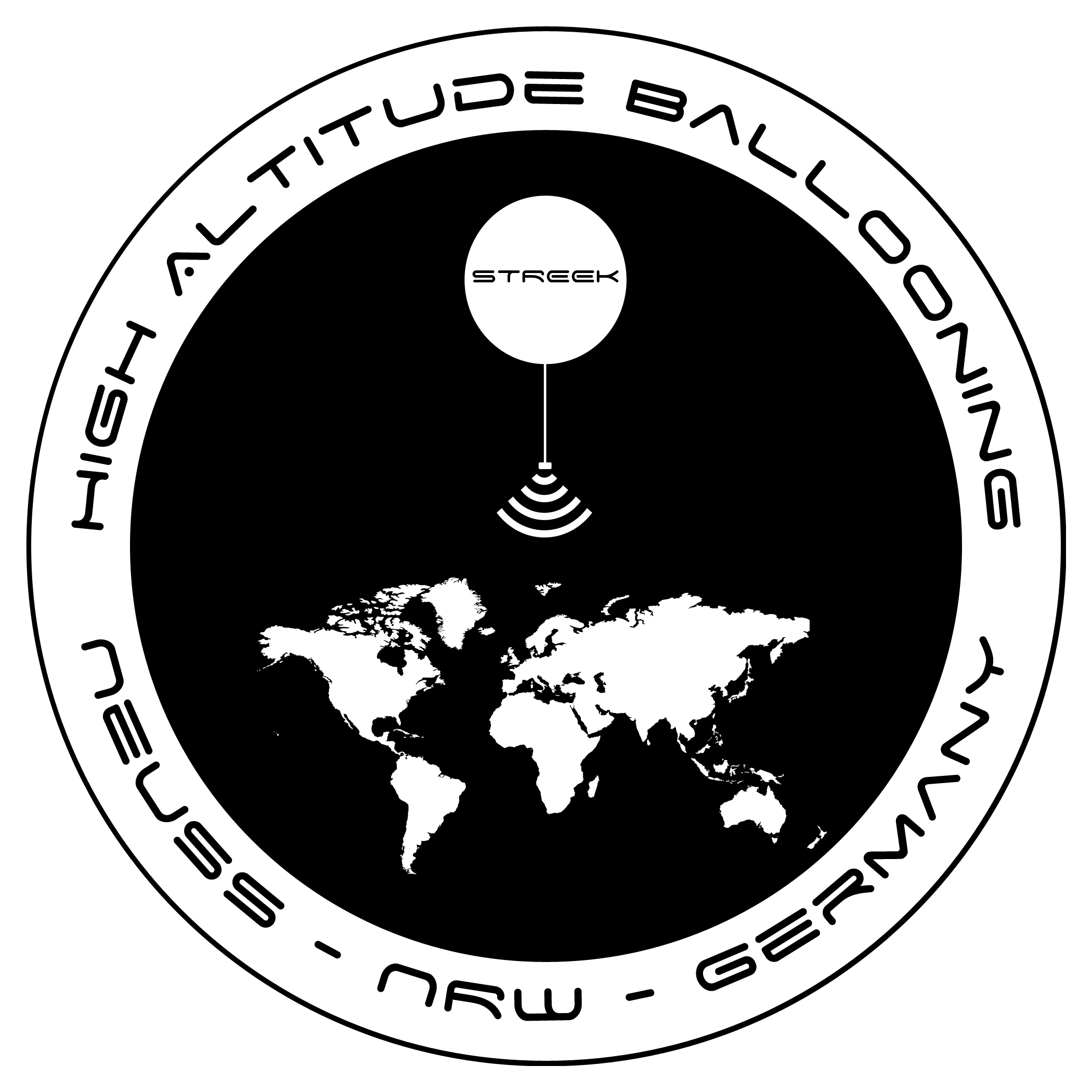
Neuss, NRW, Germany
49m / 161ft
51.1683, 6.64239
(N51° 10' 6", E6° 38' 33")
Grid: JO31HE
Map of Launch Site: | STREEKVIII
Latex, 1600g, Hydrogen
DO7WWW
APRS: 144.800Mhz
| http://www.Strato-Geeks.de
Paul Michael Becker, DO7WWW
[email protected]
Twitter/Facebook:
StratoGeeks
Tracking Options:
Google Maps APRS (aprs.fi)
HABHUB | 1600 Using: Hydrogen
|
Friday
10:00:00 EDT
14:00:00 UTC
2019-05-03
Sunrise:06:54:03
Sunset:20:26:53
Concord Community Schools
(CCS)
Record # 1004 |
Concord Ox Bow Elementary School
238m / 781ft
41.6363, -85.9158
(N41° 38' 11", W85° 54' 57")
Grid: EN71BP
Map of Launch Site: | StratoSOARus Squad Balloon Launch
Latex, 1200g, Helium
N9QIE-11
APRS: 144.390Mhz
|
Elizabeth King, N9QIE-11
[email protected]
Tracking Options:
Google Maps APRS (aprs.fi)
HABHUB | 1200 Using: Helium
4th Grade student weather balloon experiment.
|
Friday
14:30:00 EDT
13:30:00 UTC
2019-04-26
Sunrise:07:37:15
Sunset:20:01:25

Ivy Near Space Program for Computing Technologies
(INSPCT)
Record # 1000 |
Eastwood Elementary, Elkhart, Indiana USA
238m / 781ft
41.7213, -85.9063
(N41° 43' 17", W85° 54' 23")
Grid: EN71BR
Map of Launch Site: | INSPCT-17
Latex, 1500g, Helium
KC9VVJ-11
APRS: 144.390Mhz
|
Dave Bohlmann, KC9VVJ
[email protected]
Tracking Options:
Google Maps APRS (aprs.fi)
HABHUB | 1500 Using: Helium
Student experiments on-board (biological)Still finalizing use of FM ATV 1280 MHZStill finalizing use of crossband repeater for FM voice - 445.75 Up and 145.75 down, 131.8 PL
|
Saturday
10:00:00 EDT
14:00:00 UTC
2019-04-06
Sunrise:07:17:07
Sunset:19:35:09
Moraine Trails Council Amateur Radio Activities
(98810)
Record # 999 |
Butler County Community College
385m / 1,263ft
40.831, -79.9133
(N40° 49' 52", W79° 54' 48")
Grid: FN00BT
Map of Launch Site: | 2019 Radio Merit Badge Class Flight
Plastic, 106g, Helium
KC3AFB-3
APRS: 144.390Mhz
|
Bruce Gibson, K3BEG
[email protected]
Tracking Options:
Google Maps APRS (aprs.fi)
HABHUB | 106 Using: Helium
Launch is part of our Radio Merit Badge Class at the 2019 Moraine Trails Council BSA Technology Merit Badge Academy.
We are using the SBS-13 Superpressure Balloon with a Skytracker APRS PICO Balloon tracker made by Bill Brown (WB8ELK).
Follow us on Facebook.com/Moraine Trails Council BSA Amateur Radio Activities.
|
Friday
10:45:00 CDT
15:45:00 UTC
2019-04-05
Sunrise:07:10:56
Sunset:19:26:33
Pella Explores Near Space
(PENS)
Record # 1001 |
Liberty E-Free Church, Pella, IA
258m / 846ft
41.4254, -92.9701
(N41° 25' 31", W92° 58' 12")
Grid: EN31MK
Map of Launch Site: | PENS-5p
Mylar, 38g, Helium
WB0URW-5
APRS: 144.340Mhz
| http://www.pellaarc.com
Mike Morgan, N0MPM
[email protected]
Tracking Options:
Google Maps APRS (aprs.fi)
HABHUB | 38 Using: Helium
Pico Balloon Flight with WB8ELK APRS Skytracker
Flying for Pella Home School Association
|
Tuesday
08:30:00 CDT
13:30:00 UTC
2019-03-26
Sunrise:07:28:27
Sunset:19:16:13
Pella Explores Near Space
(PENS)
Record # 998 |
Twin Cedars HS, Bussey, IA
222m / 728ft
41.2183, -92.9242
(N41° 13' 6", W92° 55' 27")
Grid: EN31MF
Map of Launch Site: | PENS-a3p
Mylar, 35g, Helium
WB0URW-3
APRS: 144.390Mhz
144.34 Alt APRS
| http://www.pellaarc.com
Mike Morgan, N0MPM
[email protected]
Tracking Options:
Google Maps APRS (aprs.fi)
HABHUB | 35 Using: Helium
Pico Flight with WB8ELK SkyTracker
|
Thursday
09:15:00
2019-01-10
Sunrise:
Sunset:
Pella Explores Near Space
(PENS)
Record # 997 |
Pella, IA Pella Christian High School
41.3936, -92.8897
(N41° 23' 37", W92° 53' 23")
Grid: EN31NJ
Map of Launch Site: | PENS-4p
Mylar, 35g, Helium
WB0URW-4
APRS: 144.390Mhz
| http://www.pellaarc.com
Mike Morgan, N0MPM
[email protected]
Tracking Options:
Google Maps APRS (aprs.fi)
HABHUB | 35 Using: Helium
Pico Balloon flying WB8ELK SkyTracker for PCHS Winterim STEM class (9th and 10th graders)
|
Sunday
16:00:00 PST
00:00:00 UTC
2018-12-23
Sunrise:07:40:07
Sunset:17:44:22
San Diego Near Space Project
(SDNSP)
Record # 993 |
Fletcher Elementary, San Diego, CA
100m / 328ft
32.7843, -117.16
(N32° 47' 3", W117° 9' 36")
Grid: DM12KS
Map of Launch Site: | SDNSP-4
Latex, 1600g, Hydrogen
KJ6YXG-11
APRS: 144.390Mhz
| http://sdnsp.com
Douglas Ryan Hanson, KJ6YXG
[email protected]
Tracking Options:
Google Maps APRS (aprs.fi)
HABHUB | 1600 Using: Hydrogen
Flight looked good for the first 2 hours then it made a hard right and circled for hours at 107k ft.. Burst occurred about 14 hours after launch at 121k ft (lower than anticipated). Balloon and payload landed somewhere in the Barry M. Goldwater Range southeast of Yuma Arizona.
|
Monday
10:30:00 CST
10:30:00 UTC
2018-12-17
Sunrise:08:28:21
Sunset:17:43:40
Pella Explores Near Space
(PENS)
Record # 996 |
Pella, IA Pella Christian High School
263m / 863ft
41.3936, -92.8897
(N41° 23' 37", W92° 53' 23")
Grid: EN31NJ
Map of Launch Site: | PENS-3p
Mylar, 35g, Helium
WB0URW-3
APRS: 144.390Mhz
| http://www.pellaarc.com
Mike Morgan, N0MPM
[email protected]
Tracking Options:
Google Maps APRS (aprs.fi)
HABHUB | 35 Using: Helium
Long duration pico balloon flight.Flying wb8elk Skytracker for Senior Physics Class
|
Friday
09:00:00 CST
15:00:00 UTC
2018-12-07
Sunrise:08:17:12
Sunset:17:47:03
Pella Explores Near Space
(PENS)
Record # 995 |
Pella, IA Jefferson School
259m / 850ft
41.4063, -92.8998
(N41° 24' 23", W92° 53' 59")
Grid: EN31NJ
Map of Launch Site: | PENS-2p
Latex, 35g, Helium
WB0URW-2
APRS: 144.340Mhz
| http://www.pellaarc.com
Mike Morgan, N0MPM
[email protected]
Tracking Options:
Google Maps APRS (aprs.fi)
HABHUB | 35 Using: Helium
Flying 3ft Mylar with wb8elk skytracker. Payload: 14gm. Free Lift 2.6gmLaunch Time was 09:09 CST
|
Wednesday
10:30:00
2018-11-28
Sunrise:
Sunset:
Team Scream 4522
(99211)
Record # 992 |
Smith Cotton High School, Sedalia, MO. USA
38.6724, -93.2607
(N38° 40' 21", W93° 15' 39")
Grid: EM38IQ
Map of Launch Site: | Team Scream-02
Latex, 600g, Helium
N0XG-11
APRS: 144.390Mhz
Temperature and battery voltage telemetry
|
John Cline, N0XG
[email protected]
Tracking Options:
Google Maps APRS (aprs.fi)
HABHUB | 600 Using: Helium
Launch postponed to 11-28-18 at 16:30Z (10:30 AM CST) due to weather.
|
Saturday
08:30:00
2018-11-17
Sunrise:
Sunset:
APRSCHILE
(99411)
Record # 994 |
Rocas de Santo Domingo CHILE
-33.39, -71.36
(S33° 23' 24", W71° 21' 36")
Grid: FF46HO
Map of Launch Site: | XR0T-11
Latex, 1200g, Hydrogen
XR0T-11
APRS: 144.390Mhz
|
Marco Beltrami, CE2EK
[email protected]
Tracking Options:
Google Maps APRS (aprs.fi)
HABHUB | 1200 Using: Hydrogen
CRONONAUTA audiovisual project. First cartoon to get to space in Chile. Altitude reached 108.671 feet
|
Wednesday
09:00:00 CDT
14:00:00 UTC
2018-11-14
Sunrise:07:07:17
Sunset:18:06:39
Ivy Near Space Program for Computing Technologies
(INSPCT)
Record # 990 |
Northerly Island Park, Chicago IL
178m / 584ft
41.8655, -87.6064
(N41° 51' 56", W87° 36' 23")
Grid: EN61EU
Map of Launch Site: | INSPCT-12
Latex, 2000g, Helium
KC9VVJ-11
APRS: 144.390Mhz
|
Dave Bohlmann, KC9VVJ
[email protected]
Tracking Options:
Google Maps APRS (aprs.fi)
HABHUB | 2000 Using: Helium
Simple flight for altitude, with some camera work.
|
Thursday
10:15:00 CAT
12:15:00 UTC
2018-11-01
Sunrise:07:19:55
Sunset:19:09:11
Choose
(95705)
Record # 991 |
Ashville Ohio Usa
-9999m / -32,805ft
12, 23
(N12° 0' 0", E23° 0' 0")
Grid: KK11MX
Map of Launch Site: | Vs1
Latex, 1500g, Hydrogen
W0NSV-11
APRS: 144.390Mhz
Space Available |
Noah Taylor , OKAY
[email protected]
Tracking Options:
Google Maps APRS (aprs.fi)
HABHUB | 1500 Using: Hydrogen
I Love You All!
|
Saturday
09:00:00 EDT
13:00:00 UTC
2018-10-20
Sunrise:07:24:39
Sunset:18:53:47
Moraine Trails Council Amateur Radio Activities
(98810)
Record # 988 |
Camp Agawam
354m / 1,161ft
40.9885, -80.1894
(N40° 59' 19", W80° 11' 22")
Grid: EN90VX
Map of Launch Site: | Family Camp JOTA flight
Mylar, 30g, Helium
KC3AFB-2
APRS: 144.390Mhz
|
Bruce Gibson, K3BEG
[email protected]
Tracking Options:
Google Maps APRS (aprs.fi)
HABHUB | 30 Using: Helium
Jamboree on the Air flight, part of the Moraine Trails Council Cub Scout Family Camp Weekend
Using a mylar party balloon with a WB8ELK Skytracker module
Post flight pictures and info will be posted on www.KC3AFB.com
|
Saturday
08:30:00 EDT
12:30:00 UTC
2018-10-20
Sunrise:07:51:20
Sunset:19:21:08
AMET
(AMET)
Record # 989 |
KLAF, West Lafayette, IN, United States
185m / 607ft
40.4163, -86.9439
(N40° 24' 59", W86° 56' 38")
Grid: EN60MJ
Map of Launch Site: | AMET1
Latex, 2000g, Helium
KD9AIQ-11
APRS: 144.390Mhz
|
Davin Huston, KD9AIQ
[email protected]
Tracking Options:
Google Maps APRS (aprs.fi)
HABHUB | 2000 Using: Helium
Launching between 8:15 - 8:45. Should be on a heading towards Minster, OH according to our prediction sites.
|
Monday
12:00:00 BST
13:00:00 UTC
2018-10-08
Sunrise:06:50:18
Sunset:18:53:29
PTE
(98710)
Record # 987 |
Elsworth, Suffolk UK
55m / 180ft
52.2511, -0.0927
(N52° 15' 4", W0° 5' 34")
Grid: IO92WG
Map of Launch Site: | PTE2
Latex, 8500g, Hydrogen
X2 PTE2
X2: 434.2125MHz RTTY/LoRa PTE2:LoRa 434.450 + RTTY 434.350 MHz LoRa
|
Steve Randall, G6KHW AJ4XE
[email protected]
Tracking Options:
Google Maps APRS (aprs.fi)
HABHUB | 8500 Using: Hydrogen
Joint flight by Steve Randall and Dave Akerman UKHAS
|
Saturday
11:00:00 SAST
14:00:00 UTC
2018-10-06
Sunrise:06:56:19
Sunset:19:03:09
notlisted
(98610)
Record # 986 |
Arrowe Park, Benoni
-9999m / -32,805ft
-26.1717, 28.2829
(S26° 10' 18", E28° 16' 58")
Grid: KG43DT
Map of Launch Site: | TEST1
Plastic, 45g, Helium
ZS6LMG-11
434.075Mhz
|
Leon Lessing, ZS6LMG
[email protected]
Tracking Options:
Google Maps APRS (aprs.fi)
HABHUB | 45 Using: Helium
First attempt
|
Saturday
10:00:00 EDT
14:00:00 UTC
2018-09-29
Sunrise:07:17:49
Sunset:19:41:03
N4JWW
(96105)
Record # 984 |
Hoschton Park, Hoschton, GA, USA
298m / 978ft
34.1039, -83.7656
(N34° 6' 14", W83° 45' 56")
Grid: EM84CC
Map of Launch Site: | N4JWW-A
Latex, 1600g, Helium
N4JWW-11
APRS: 144.390Mhz
Space Available |
Jonathan Weaver, N4JWW
[email protected]
Tracking Options:
Google Maps APRS (aprs.fi)
HABHUB | 1600 Using: Helium
Trackduino APRS Tracker 144.390 MHz
Crossband FM Repeater
Uplink: 445.65 MHz
Downlink: 145.65 MHz
Website: http://jonw0224.weebly.com/hab.html
|
Friday
11:30:00 BST
12:30:00 UTC
2018-09-28
Sunrise:06:46:30
Sunset:19:33:12

UK High Altitude Society
(UKHAS)
Record # 981 |
Bangor LL32 8DW
10m / 33ft
53.286, -3.85166
(N53° 17' 10", W3° 51' 6")
Grid: IO83BG
Map of Launch Site: | RAPTOR3
Latex, 6500g, Hydrogen
RAPTOR3
434.550Mhz
| http://wiki.ukhas.org.uk
Mark Deegan, RAPTOR
[email protected]
Tracking Options:
Google Maps APRS (aprs.fi)
HABHUB | 6500 Using: Hydrogen
Trying for 40km+ height
|
Saturday
09:00:00 CST
15:00:00 UTC
2018-09-22
Sunrise:07:28:18
Sunset:20:36:56
Choose
(95705)
Record # 985 |
Saskatoon, SK, Canada
-9999m / -32,805ft
52.1, -106.617
(N52° 6' 0", W106° 37' 1")
Grid: DO62QC
Map of Launch Site: | SABRE-27
Latex, 1000g, Hydrogen
VE5AA-11
APRS: 144.390Mhz
VE5AA-12
Voice repeater 147.540 Simplex
|
Bruce Coates, VE5BNC
[email protected]
Tracking Options:
Google Maps APRS (aprs.fi)
HABHUB | 1000 Using: Hydrogen
http://ve5aa.dyndns.org/balloon
|
Saturday
00:00:00 CDT
05:00:00 UTC
2018-09-15
Sunrise:06:23:51
Sunset:19:56:40
Central Missouri Composite Squadron - CAP
(CMCS)
Record # 983 |
National Guard Armory, Columbia, MO USA
233m / 764ft
39.0068, -92.3076
(N39° 0' 24", W92° 18' 27")
Grid: EM39UA
Map of Launch Site: | CAP1
Latex, 1000g, Hydrogen
N0ESE
APRS: 144.390Mhz
| https://www.mowgcap.us/index.php/ncr-mo-018
Mike McCrady, N0ESE
[email protected]
Tracking Options:
Google Maps APRS (aprs.fi)
HABHUB | 1000 Using: Hydrogen
Trying for 100k+ feet.
|
Wednesday
05:00:00 EDT
09:00:00 UTC
2018-09-05
Sunrise:06:19:26
Sunset:19:59:56
Overlook Horizon High Altitude Balloons
(OLHZN)
Record # 982 |
Canandaigua Academy, Canandaigua, NY, USA
251m / 823ft
42.9072, -77.2735
(N42° 54' 26", W77° 16' 25")
Grid: FN12IV
Map of Launch Site: | OLHZN-16
Latex, 1500g, Helium
KD2KPZ-11
APRS: 144.390Mhz
KD2KPZ-12
KD2KPZ-9
KD2KPZ-15
| http://www.OverlookHorizon.com
Tory Carissimo, KD2KPZ
[email protected]
Tracking Options:
Google Maps APRS (aprs.fi)
HABHUB | 1500 Using: Helium
Live broadcast on launch day via Facebook and YouTube
Full flight details and recovered data available at http://overlookhorizon.com/flight-16
Follow Overlook Horizon HABs:
Facebook | Twitter | Instagram | YouTube
|
Friday
12:00:00 BST
13:00:00 UTC
2018-08-31
Sunrise:05:52:38
Sunset:20:30:21
PTE - Pushing the Envelope
(98008)
Record # 980 |
Ross-On-Wye, Herefordshire UK
140m / 459ft
51.95, -2.54
(N51° 57' 0", W2° 32' 24")
Grid: IO81RW
Map of Launch Site: | PTE1
Latex, 1600g, Hydrogen
X1
DRAGINO
X1: 434.3125MHz RTTY/LoRa DRAGINO: 869.850MHz LoRa
|
Steve Randall, G8KHW
[email protected]
Tracking Options:
Google Maps APRS (aprs.fi)
HABHUB | 1600 Using: Hydrogen
Flight by Steve Randall and Dave Akerman UKHAS
|
Wednesday
10:00:00 BST
11:00:00 UTC
2018-08-15
Sunrise:05:20:00
Sunset:21:01:04

Project Horizon
(PH)
Record # 979 |
Queen Mary's Grammar School, Walsall, UK
137m / 449ft
52.5775, -1.96492
(N52° 34' 39", W1° 57' 54")
Grid: IO92AN
Map of Launch Site: | Oculus
Latex, 1200g, Helium
OCULUS
Space Available | http://horizon.qmgs.walsall.sch.uk/
Project Horizon, OCULUS
[email protected]
Tracking Options:
Google Maps APRS (aprs.fi)
HABHUB | 1200 Using: Helium
11th launch of our School's near space programme, featuring a 360 camera.
|
Wednesday
12:00:00 CDT
17:00:00 UTC
2018-08-08
Sunrise:06:33:38
Sunset:20:28:52
Ravage Near Space Balloon
(RNSB)
Record # 942 |
Hillsboro, Texas, USA
207m / 679ft
32.0836, -97.0973
(N32° 5' 1", W97° 5' 50")
Grid: EM12KC
Map of Launch Site: | SC-2
Latex, 1000g, Helium
KC3FBS-11
APRS: 144.390Mhz
|
Patrick Hresko, KC3FBS
[email protected]
Tracking Options:
Google Maps APRS (aprs.fi)
HABHUB | 1000 Using: Helium
Our groups second flight
|
Tuesday
09:00:00 MDT
15:00:00 UTC
2018-08-07
Sunrise:06:21:09
Sunset:21:11:29

Nebraska Stratospheric Amateur Radio
(NSTAR)
Record # 978 |
Nebr Star Party, Merritt Reservoir
904m / 2,966ft
42.5991, -100.91
(N42° 35' 57", W100° 54' 36")
Grid: DN92NO
Map of Launch Site: | NSTAR 18-B
Latex, 1000g, Hydrogen
N9XTN-11
APRS: 144.390Mhz
| http://www.nstar.org/
Mark Conner, N9XTN
[email protected]
Twitter/Facebook:
@N9XTN
Tracking Options:
Google Maps APRS (aprs.fi)
HABHUB | 1000 Using: Hydrogen
Joint flight with Nearsys
|
Monday
07:30:00 EDT
11:30:00 UTC
2018-08-06
Sunrise:05:44:32
Sunset:20:38:51
Overlook Horizon High Altitude Balloons
(OLHZN)
Record # 977 |
Canandaigua Academy, Canandaigua, NY USA
251m / 823ft
42.9072, -77.2735
(N42° 54' 26", W77° 16' 25")
Grid: FN12IV
Map of Launch Site: | OLHZN-15
Latex, 1500g, Helium
KD2KPZ-11
APRS: 144.390Mhz
KD2KPZ-12
KD2KPZ-9
KD2KPZ-15
| http://www.OverlookHorizon.com
Tory Carissimo, KD2KPZ
[email protected]
Tracking Options:
Google Maps APRS (aprs.fi)
HABHUB | 1500 Using: Helium
Live broadcast on launch day via Facebook and YouTube
Full flight details and recovered data available at http://overlookhorizon.com/flight-15
Follow Overlook Horizon HABs:
Facebook | Twitter | Instagram | YouTube
|
Saturday
10:00:00 EDT
14:00:00 UTC
2018-07-28
Sunrise:06:30:30
Sunset:20:24:24
N4JWW
(96105)
Record # 961 |
Hoschton Park, Hoschton, GA
284m / 932ft
34.1038, -83.7634
(N34° 6' 14", W83° 45' 48")
Grid: EM84CC
Map of Launch Site: | N4JWW-A
Latex, 1600g, Helium
N4JWW-11
APRS: 144.390Mhz
|
Jonathan Weaver, N4JWW
[email protected]
Tracking Options:
Google Maps APRS (aprs.fi)
HABHUB | 1600 Using: Helium
FM Voice Crossband RepeaterUplink 445.25 MHzDownlink 145.25 MHz
|
Saturday
10:00:00 BST
11:00:00 UTC
2018-07-14
Sunrise:04:38:22
Sunset:21:35:02
Horizon
(HORIZON)
Record # 976 |
Queen Mary's Grammar School, Walsall, UK
137m / 449ft
52.5775, -1.96492
(N52° 34' 39", W1° 57' 54")
Grid: IO92AN
Map of Launch Site: | Oculus
Latex, 1200g, Helium
OCULUS
|
Project Horizon, OCULUS
[email protected]
Tracking Options:
Google Maps APRS (aprs.fi)
HABHUB | 1200 Using: Helium
11th launch of our School's near space programme, featuring a 360 camera.
|
Thursday
08:00:00 MDT
14:00:00 UTC
2018-07-05
Sunrise:04:54:16
Sunset:22:06:33
St. Albert Balloon Launch Experiment
(SABLE)
Record # 975 |
St. Albert, AB
-9999m / -32,805ft
53.6211, -113.624
(N53° 37' 16", W113° 37' 26")
Grid: DO33EO
Map of Launch Site: | SABLE 12
Latex, 1600g, Helium
VA6TNY-11
APRS: 144.390Mhz
| http://sable.spschools.org
Tony Rafaat, VA6TNY
[email protected]
Tracking Options:
Google Maps APRS (aprs.fi)
HABHUB | 1600 Using: Helium
We are launching from Sir George Simpson Jr. high. Our school. The "Eye in the Sky" mission.
|
Saturday
08:30:00 CDT
13:30:00 UTC
2018-06-23
Sunrise:05:26:11
Sunset:19:55:55
HABanero
(97206)
Record # 973 |
5000 BRADFORD, HUNTSVILLE, AL, USA
209m / 686ft
34.7287, -86.6637
(N34° 43' 43", W86° 39' 49")
Grid: EM64QR
Map of Launch Site: | AHAB-SP1
Latex, 350g, Helium
KN4KZN-11
APRS: 144.390Mhz
|
Joshua Hauser, KN4KZN
[email protected]
Tracking Options:
Google Maps APRS (aprs.fi)
HABHUB | 350 Using: Helium
|
Saturday
08:30:00 CDT
13:30:00 UTC
2018-06-23
Sunrise:05:26:11
Sunset:19:55:55
HABanero
(97206)
Record # 972 |
5000 BRADFORD, HUNTSVILLE, AL, USA
209m / 686ft
34.7287, -86.6637
(N34° 43' 43", W86° 39' 49")
Grid: EM64QR
Map of Launch Site: | AHAB-SP1
Latex, 350g, Helium
KN4KZN-11
APRS: 144.390Mhz
|
Joshua Hauser, KN4KZN
[email protected]
Tracking Options:
Google Maps APRS (aprs.fi)
HABHUB | 350 Using: Helium
|
Saturday
08:30:00 CDT
13:30:00 UTC
2018-06-23
Sunrise:05:26:11
Sunset:19:55:55
Auburn University Student Space Program
(AHAB)
Record # 971 |
5000 BRADFORD DR, HUNTSVILLE, AL, USA
209m / 686ft
34.7287, -86.6637
(N34° 43' 43", W86° 39' 49")
Grid: EM64QR
Map of Launch Site: | AHAB-SP1
Latex, 300g, Helium
KN4KZN-11
APRS: 144.390Mhz
| http://www.space.auburn.edu/ahab/
Joshua Hauser, KN4KZN
[email protected]
Tracking Options:
Google Maps APRS (aprs.fi)
HABHUB | 300 Using: Helium
|
Monday
12:00:00 EDT
16:00:00 UTC
2018-06-18
Sunrise:05:24:21
Sunset:20:41:02
Overlook Horizon High Altitude Balloons
(OLHZN)
Record # 974 |
Canandaigua Academy, Canandaigua, NY USA
236m / 774ft
42.927, -77.2735
(N42° 55' 37", W77° 16' 25")
Grid: FN12IW
Map of Launch Site: | OLHZN-14
Latex, 1000g, Helium
KD2KPZ-11
APRS: 144.390Mhz
KD2KPZ-12
KD2KPZ-9
KD2KPZ-15
| http://www.OverlookHorizon.com
Tory Carissimo, KD2KPZ
[email protected]
Tracking Options:
Google Maps APRS (aprs.fi)
HABHUB | 1000 Using: Helium
Live broadcast on launch day via Facebook and YouTube
Full flight details and recovered data available at http://overlookhorizon.com/flight-14
Follow Overlook Horizon HABs:
Facebook | Twitter | Instagram | YouTube
|
Saturday
09:30:00 EDT
13:30:00 UTC
2018-06-09
Sunrise:06:22:37
Sunset:20:03:13

Aether Missions
(AETHER)
Record # 969 |
Dyer Park, Palm Beach County, Florida USA
25m / 82ft
26.7837, -80.1233
(N26° 47' 1", W80° 7' 24")
Grid: EL96WS
Map of Launch Site: | YSSP-2 & YSSP-3
Latex, 3000g, Helium
KM4DRI-11
APRS: 144.390Mhz
SSTV @ 145.600Mhz
|
Andres Paris, KM4DRI
[email protected]
Tracking Options:
Google Maps APRS (aprs.fi)
HABHUB | 3000 Using: Helium
Two 3000g Totex balloons filled with Helium. Each balloon includes two GoPros, a Kodak SP-360, a Canon Powershot SD880IS, sensor data logging (GPS, temperature, barometric pressure, hygrometer), GSM/GPRS tracking, and SPOT tracker.
APRS tracking call sign KM4DRI
SSTV in 10-minute intervals @ 145.600 Mhz in Scottie 1 mode
|
Sunday
10:00:00 CDT
14:00:00 UTC
2018-05-27
Sunrise:06:03:09
Sunset:20:32:38
Nebraska Stratospheric Amateur Radio
(NSTAR)
Record # 966 |
Treynor IA
351m / 1,152ft
41.231, -95.608
(N41° 13' 52", W95° 36' 29")
Grid: EN21EF
Map of Launch Site: | NSTAR 18-A
Latex, 1200g, Hydrogen
N9XTN-11
APRS: 144.390Mhz
N9XTN-12
APRS 144.340 MHz
| http://www.nstar.org/
Mark Conner, N9XTN
[email protected]
Twitter/Facebook:
@N9XTN
Tracking Options:
Google Maps APRS (aprs.fi)
HABHUB | 1200 Using: Hydrogen
Launch site subject to change depending on wind forecast
|
Saturday
12:00:00 EDT
15:00:00 UTC
2018-05-26
Sunrise:05:43:48
Sunset:20:19:52
Overlook Horizon High Altitude Balloons
(OLHZN)
Record # 970 |
Farmington Town Park, Farmington, NY USA
186m / 610ft
42.9884, -77.3272
(N42° 59' 18", W77° 19' 38")
Grid: FN12IX
Map of Launch Site: | KD2KPZ-11,KD2KPZ-12,KD2KPZ-15
Latex, 1500g, Helium
KD2KPZ-11
APRS: 144.390Mhz
KD2KPZ-12
KD2KPZ-15
KD2KPZ-9
| http://www.OverlookHorizon.com
Tory Carissimo, KD2KPZ
[email protected]
Tracking Options:
Google Maps APRS (aprs.fi)
HABHUB | 1500 Using: Helium
Live broadcast on launch day via Facebook and YouTube
Full flight details and recovered data available at http://overlookhorizon.com/flight-12
Follow Overlook Horizon HABs:
Facebook | Twitter | Instagram | YouTube
|
Saturday
10:00:00 CDT
15:00:00 UTC
2018-05-26
Sunrise:06:36:37
Sunset:20:10:26
Rose State College High Altitude Balloon (RHAB)
(96205)
Record # 962 |
Choctaw Creek Park, Choctaw, OK. Oklahoma County
355m / 1,165ft
35.4846, -97.2748
(N35° 29' 5", W97° 16' 29")
Grid: EM15IL
Map of Launch Site: | RHAB2
Latex, 1500g, Helium
KG5SGQ-11
APRS: 144.390Mhz
|
Bill Richards, KG5SGQ
[email protected]
Tracking Options:
Google Maps APRS (aprs.fi)
HABHUB | 1500 Using: Helium
RHAB2 Equipment: - Raspberry Pi 3 w/sense hat, camera, Ozone sensor and Altimeter - (2) Raspberry Pi Zero
|
Friday
10:00:00 EDT
14:00:00 UTC
2018-05-25
Sunrise:06:22:55
Sunset:20:49:36
Concord Community Schools
(CCS)
Record # 960 |
Concord South Side
237m / 778ft
41.6318, -85.92
(N41° 37' 54", W85° 55' 12")
Grid: EN71AP
Map of Launch Site: | Launchsquad
Latex, 1200g, Helium
N9QIE-11
APRS: 144.390Mhz
Space Available |
Amy Marsh, N9QIE - 11
[email protected]
Tracking Options:
Google Maps APRS (aprs.fi)
HABHUB | 1200 Using: Helium
South Side Elementary School student weather balloon project.
|
Tuesday
09:00:00 CDT
14:00:00 UTC
2018-05-22
Sunrise:06:03:01
Sunset:20:40:10
Watertown Middle School
(WMS)
Record # 967 |
Watertown Regional Airport - ATY
532m / 1,745ft
44.9199, -97.1667
(N44° 55' 12", W97° 10' 0")
Grid: EN14JW
Map of Launch Site: | BOREALIS IX
Latex, 2000g, Helium
KE0RVJ-11
APRS: 144.390Mhz
|
Mark Iverson, KE0RVJ
[email protected]
Tracking Options:
Google Maps APRS (aprs.fi)
HABHUB | 2000 Using: Helium
BOREALIS IX will consist of a 2000g weather balloon equipped with an ArduinoTrack APRS GPS tracker sending back telemetry and temperature readings every minute throughout the flight, 2 HD Contour video cameras, one facing down the other facing to the horizon and an Arduino running a BPM180 with an SD data logger, taking recordings every 10 seconds. All of which was designed, coded and build by WMS 8th graders.
|
Tuesday
09:00:00 CDT
14:00:00 UTC
2018-05-22
Sunrise:06:03:01
Sunset:20:40:10
Watertown Middle School
(WMS)
Record # 968 |
Watertown Regional Airport - ATY
532m / 1,745ft
44.9199, -97.1667
(N44° 55' 12", W97° 10' 0")
Grid: EN14JW
Map of Launch Site: | BOREALIS X
Latex, 2000g, Helium
KE0RVJ-12
APRS: 144.390Mhz
Twitter @WMSHighFlyers
Space Available |
Mark Iverson, KE0RVJ
[email protected]
Tracking Options:
Google Maps APRS (aprs.fi)
HABHUB | 2000 Using: Helium
BOREALIS X will consist of a 2000g weather balloon equipped with an ArduinoTrack APRS GPS tracker sending back telemetry and temperature readings every minute throughout the flight, 1 HD Contour video camera facing to the horizon and a 360Fly 360 degree view camera aimed upwards.
|
Friday
10:00:00 EDT
14:00:00 UTC
2018-05-18
Sunrise:06:31:54
Sunset:20:42:40
Concord Community Schools
(CCS)
Record # 956 |
Concord West Side Elementary
233m / 764ft
41.6531, -85.9684
(N41° 39' 11", W85° 58' 6")
Grid: EN71AP
Map of Launch Site: | Soaring Wildcats
Latex, 1200g, Helium
N9QIE-10
APRS: 144.390Mhz
Space Available |
Carol Kratzer, N9QIE-10
[email protected]
Tracking Options:
Google Maps APRS (aprs.fi)
HABHUB | 1200 Using: Helium
Concord West Side Elementary student weather balloon project.
|
Friday
09:45:00 EDT
13:45:00 UTC
2018-05-18
Sunrise:06:41:23
Sunset:20:34:42
Ivy Near Space Program for Computing Technologies
(INSPCT)
Record # 959 |
Goshen High School, Goshen, Indiana
243m / 797ft
41.5812, -85.8256
(N41° 34' 52", W85° 49' 32")
Grid: EN71CN
Map of Launch Site: | INSPCT-11a GSH
Latex, 1500g, Helium
KC9VVJ-11
APRS: 144.390Mhz
|
Dave Bohlmann, KC9VVJ
[email protected]
Tracking Options:
Google Maps APRS (aprs.fi)
HABHUB | 1500 Using: Helium
"Return to Flight" mission for Goshen High School, Chandler Elementary and INSPCT teams, after a couple not-so-successful previous ones. Using Arduino Mega with Weather Shield and Iridium Rock7 modem. Various cameras.
|
Friday
06:00:00 PDT
13:00:00 UTC
2018-05-18
Sunrise:05:36:46
Sunset:20:14:36
Near Space Systems
(NEARSYS)
Record # 965 |
Ellensburg, WA
459m / 1,506ft
46.99, -120.55
(N46° 59' 24", W120° 33' 0")
Grid: CN96RX
Map of Launch Site: | NearSys 18D, NearSys 18E
Latex, 1500g, Hydrogen
KD4STH-7
APRS: 144.390Mhz
KD4STH-9
KD4STH-11
| http://nearsys.com
Paul Verhage, KD4STH
[email protected]
Twitter/Facebook:
@NearSys
Tracking Options:
Google Maps APRS (aprs.fi)
HABHUB | 1500 Using: Hydrogen
|
Wednesday
09:30:00 EDT
13:30:00 UTC
2018-05-16
Sunrise:06:37:53
Sunset:20:36:45
Balloon Assisted Stratospheric Experiments (DePauw University)
(BASE)
Record # 964 |
Thorpe Creek Elementary School, Fishers, Indiana, USA
258m / 846ft
39.975, -85.9
(N39° 58' 30", W85° 54' 0")
Grid: EM79BX
Map of Launch Site: | BASE 107
Latex, 1200g, Hydrogen
W9YJ-11
APRS: 144.390Mhz
W9YJ-13
| http://www.depauw.edu/academics/departments-programs/physics-astronomy/department-research/base/
Howard Brooks, KC9QBN
[email protected]
Twitter/Facebook:
#BASE_DePauw
Tracking Options:
Google Maps APRS (aprs.fi)
HABHUB | 1200 Using: Hydrogen
Flight for Miss Berry's third grade class - investigating popcorn, marshmallows, and eggs.
Flight may be delayed until Thursday, 17 May if storms interfere.
|
Saturday
00:00:00 PDT
07:00:00 UTC
2018-05-12
Sunrise:06:10:53
Sunset:19:49:27
Stanford Student Space Initiative
(SSSI)
Record # 963 |
Brigantino Park
78m / 256ft
36.8491, -121.434
(N36° 50' 57", W121° 26' 2")
Grid: CM96GU
Map of Launch Site: | SSI-67
Latex, 1500g, Hydrogen
N/A
Iridium
Space Available | http://stanfordssi.org/
Kai Marshland, N/A
[email protected]
Tracking Options:
Google Maps APRS (aprs.fi)
HABHUB | 1500 Using: Hydrogen
ValBal
|
Friday
10:00:00 EDT
14:00:00 UTC
2018-05-11
Sunrise:06:41:35
Sunset:20:35:13
Concord Community Schools
(CCS)
Record # 958 |
Concord East Side Elementary School. Elkhart, Indiana
237m / 778ft
41.665, -85.9142
(N41° 39' 54", W85° 54' 51")
Grid: EN71BP
Map of Launch Site: | East Side Explorers
Latex, 1200g, Helium
N9QIE-12
APRS: 144.390Mhz
Space Available |
Ryan Wallick, N9QIE-12
[email protected]
Tracking Options:
Google Maps APRS (aprs.fi)
HABHUB | 1200 Using: Helium
Concord East Side Elementary School Student Weather Balloon Project
|
Sunday
15:00:00 MDT
21:00:00 UTC
2018-05-06
Sunrise:06:51:22
Sunset:20:36:58
Choose
(95705)
Record # 957 |
Jordan Valley
1339m / 4,393ft
42.97, -117.05
(N42° 58' 12", W117° 3' 0")
Grid: DN12LX
Map of Launch Site: | NearSys 18A
Latex, 1200g, Hydrogen
KD4STH-7
APRS: 144.390Mhz
KD4STH-9
|
L. Paul Verhage, KD4STH
[email protected]
Tracking Options:
Google Maps APRS (aprs.fi)
HABHUB | 1200 Using: Hydrogen
Second near space flight for BalloonSat without Borders
|
Friday
10:00:00 EDT
14:00:00 UTC
2018-05-04
Sunrise:06:52:27
Sunset:20:27:55
Concord Community Schools
(CCS)
Record # 955 |
Concord Ox Bow Elementary
238m / 781ft
41.6368, -85.9159
(N41° 38' 12", W85° 54' 57")
Grid: EN71BP
Map of Launch Site: | Eagle 2.0
Latex, 1200g, Helium
N9QIE-11
APRS: 144.390Mhz
Space Available |
Elizabeth King, N9QIE-11
[email protected]
Tracking Options:
Google Maps APRS (aprs.fi)
HABHUB | 1200 Using: Helium
Ox Bow Elementary School student weather balloon project.
|
Sunday
12:30:00 EDT
16:30:00 UTC
2018-04-29
Sunrise:06:24:19
Sunset:19:49:59
Overlook Horizon High Altitude Balloons
(OLHZN)
Record # 953 |
Canandaigua Academy, Canandaigua, NY USA
251m / 823ft
42.9101, -77.2749
(N42° 54' 36", W77° 16' 30")
Grid: FN12IV
Map of Launch Site: | OLHZN-11
Latex, 1500g, Helium
KD2KPZ-11
APRS: 144.390Mhz
KD2KPZ-12
| http://www.OverlookHorizon.com
Tory Carissimo, KD2KPZ
[email protected]
Tracking Options:
Google Maps APRS (aprs.fi)
HABHUB | 1500 Using: Helium
Live broadcast on launch day via Facebook and YouTube
Full flight details and recovered data available at http://overlookhorizon.com/flight-11
Follow Overlook Horizon HABs:
Facebook | Twitter | Instagram | YouTube
|
Saturday
12:00:00 EDT
16:00:00 UTC
2018-04-28
Sunrise:06:43:17
Sunset:19:49:11
NC Near Space Research
(NCNS)
Record # 952 |
Burlington Maker Faire
203m / 666ft
36.0794, -79.4883
(N36° 4' 46", W79° 29' 18")
Grid: FM06GB
Map of Launch Site: | NSL-63
Latex, 600g, Hydrogen
KN4LHA-11
APRS: 144.390Mhz
| http://www.ncnearspace.org/
Paul Lowell, KD4BFP
[email protected]
Tracking Options:
Google Maps APRS (aprs.fi)
HABHUB | 600 Using: Hydrogen
Burlington Maker Faire
|
Monday
09:00:00 CDT
19:00:00 UTC
2018-04-23
Sunrise:06:38:57
Sunset:19:44:21
Pella Explores Near Space
(PENS)
Record # 951 |
Pella Christian High School Pella, IA, USA
257m / 843ft
41.405, -92.903
(N41° 24' 18", W92° 54' 11")
Grid: EN31NJ
Map of Launch Site: | PENS-12
Latex, 1500g, Hydrogen
N0MPM-11
APRS: 144.390Mhz
N0MPM-12
n0mpm-12 APRS 147.55
| http://www.pellaarc.com
Mike Morgan, N0MPM
[email protected]
Tracking Options:
Google Maps APRS (aprs.fi)
HABHUB | 1500 Using: Hydrogen
Flying 5 student experimental payloads
|
Saturday
08:00:00 EDT
12:00:00 UTC
2018-04-21
Sunrise:07:19:26
Sunset:20:17:28
()
Record # 950 |
Purdue University
191m / 627ft
40.4285, -86.9283
(N40° 25' 43", W86° 55' 42")
Grid: EN60MK
Map of Launch Site: | HABBLE-EAGLE
Latex, 3000g, Hydrogen
KD9KFF
APRS: 144.340Mhz
|
Leopoldo Aguerrevere, N/A
[email protected]
Tracking Options:
Google Maps APRS (aprs.fi)
HABHUB | 3000 Using: Hydrogen
|
Tuesday
09:00:00
2018-04-17
Sunrise:
Sunset:
Peoria Near Space Probe
(PNSP)
Record # 945 |
Peoria Academy
40.7778, -89.6351
(N40° 46' 40", W89° 38' 6")
Grid: EN50ES
Map of Launch Site: | Peoria Academy-1
Latex, 1500g, Helium
W9UVI-11
APRS: 144.390Mhz
| http://www.w9uvi.org/?page_id=729
Fritz Bock, WD9FMB
[email protected]
Tracking Options:
Google Maps APRS (aprs.fi)
HABHUB | 1500 Using: Helium
|
Tuesday
09:00:00
2018-04-17
Sunrise:
Sunset:
Peoria Near Space Probe
(PNSP)
Record # 946 |
Peoria Academy
40.7778, -89.6351
(N40° 46' 40", W89° 38' 6")
Grid: EN50ES
Map of Launch Site: | Peoria Academy-1
Latex, 1500g, Helium
W9UVI-11
APRS: 144.390Mhz
| http://www.w9uvi.org/?page_id=729
Fritz Bock, WD9FMB
[email protected]
Tracking Options:
Google Maps APRS (aprs.fi)
HABHUB | 1500 Using: Helium
|
Saturday
12:00:00 EDT
16:00:00 UTC
2018-04-14
Sunrise:06:57:56
Sunset:19:35:35

HacDC
(HacDC)
Record # 948 |
Strasburg, VA
206m / 676ft
38.9972, -78.3505
(N38° 59' 50", W78° 21' 2")
Grid: FM08TX
Map of Launch Site: | SpaceBlimp-7
Latex, 1500g, Helium
KC3JWB-11
APRS: 144.390Mhz
KJ4VTM-11
432.225 MHz
| http://hacdc.org
samarth chugh, KC3JWB
[email protected]
Twitter/Facebook:
Tracking Options:
Google Maps APRS (aprs.fi)
HABHUB | 1500 Using: Helium
This is a joint project between HacDC, Rockville Makerspace, Unallocated Space and other local specialists.
|
Saturday
12:00:00 EDT
16:00:00 UTC
2018-04-14
Sunrise:06:39:09
Sunset:19:19:41

Columbia Space Initiative
(CSI)
Record # 949 |
Black Rock Forest, NY, NY, USA
303m / 994ft
41.4108, -74.0075
(N41° 24' 39", W74° 0' 27")
Grid: FN21XJ
Map of Launch Site: | ROAREE-2
Latex, 1600g, Helium
KF7YAF
APRS: 144.390Mhz
| http://columbiaspace.org/mission-balloons/
Jake Lee, KF7YAF
[email protected]
Tracking Options:
Google Maps APRS (aprs.fi)
HABHUB | 1600 Using: Helium
|
Saturday
10:00:00 PDT
17:00:00 UTC
2018-04-14
Sunrise:06:51:16
Sunset:19:26:46
Stanford Student Space Initiative
(SSSI)
Record # 947 |
Brigantino Park
78m / 256ft
36.8491, -121.434
(N36° 50' 57", W121° 26' 2")
Grid: CM96GU
Map of Launch Site: | SSI-66
Latex, 1500g, Helium
N/A
APRS: 144.390Mhz
Space Available | http://stanfordssi.org/
Kai Marshland, N/A
[email protected]
Tracking Options:
Google Maps APRS (aprs.fi)
HABHUB | 1500 Using: Helium
ValBal Flight
|
Saturday
13:30:00 EDT
17:30:00 UTC
2018-04-07
Sunrise:07:15:21
Sunset:19:36:08
()
Record # 943 |
Butler County Community College, Butler PA Campus
382m / 1,253ft
40.8306, -79.9123
(N40° 49' 50", W79° 54' 44")
Grid: FN00BT
Map of Launch Site: | Wanderer I
Plastic, 108g, Helium
KC3AFB-1
APRS: 144.340Mhz
|
Bruce Gibson, K3BEG
[email protected]
Tracking Options:
Google Maps APRS (aprs.fi)
HABHUB | 108 Using: Helium
Using SBS-13 Balloon from Scientific Balloon Solutions and Skytracker APRS Pico Balloon Payload by Bill Brown WB8ELK.
Follow us on Facebook.com/Moraine Trails Council BSA Amateur Radio Activities
|
Saturday
10:15:00 CDT
15:15:00 UTC
2018-04-07
Sunrise:06:58:19
Sunset:19:20:22
()
Record # 944 |
Decorah, IA, USA
235m / 771ft
42.8531, -90.8092
(N42° 51' 11", W90° 48' 33")
Grid: EN42OU
Map of Launch Site: | UWPLattville HAB
Latex, 600g, Helium
W9UWP
APRS: 144.390Mhz
Space Available |
Zach VanDenBosch, KD9IPM
[email protected]
Tracking Options:
Google Maps APRS (aprs.fi)
HABHUB | 600 Using: Helium
|
Wednesday
13:30:00 EDT
17:30:00 UTC
2018-03-21
Sunrise:07:35:41
Sunset:19:07:37
Overlook Horizon High Altitude Balloons
(OLHZN)
Record # 941 |
Canandaigua, NY
258m / 846ft
42.8895, -77.3104
(N42° 53' 22", W77° 18' 37")
Grid: FN12IV
Map of Launch Site: | OLHZN-10
Latex, 200g, Helium
KD2KPZ-11
APRS: 144.390Mhz
| http://www.OverlookHorizon.com
Tory Carissimo, KD2KPZ
[email protected]
Tracking Options:
Google Maps APRS (aprs.fi)
HABHUB | 200 Using: Helium
Live broadcast on launch day via Facebook and YouTube
Full flight details and recovered data available at http://overlookhorizon.com/flight-10
Follow Overlook Horizon HABs:
Facebook | Twitter | Instagram | YouTube
|
Saturday
08:00:00 EST
13:00:00 UTC
2018-03-03
Sunrise:08:04:51
Sunset:18:56:00
()
Record # 940 |
Strasburg, VA
206m / 676ft
38.9972, -78.3505
(N38° 59' 50", W78° 21' 2")
Grid: FM08TX
Map of Launch Site: | SpaceBlimp-7
Latex, 1500g, Helium
KC3JWB-11
APRS: 144.390Mhz
KJ4VTM-11
445.925
|
Samarth Chugh, KC3JWB
[email protected]
Tracking Options:
Google Maps APRS (aprs.fi)
HABHUB | 1500 Using: Helium
Weather permitting
|
Monday
09:00:00 CST
15:00:00 UTC
2018-02-26
Sunrise:08:14:55
Sunset:18:43:54
Pella Explores Near Space
(PENS)
Record # 939 |
Jefferson Elem. Pella, IA
257m / 843ft
41.405, -92.903
(N41° 24' 18", W92° 54' 11")
Grid: EN31NJ
Map of Launch Site: |
Mylar, 0g, Helium
WB0URW-2
APRS: 144.340Mhz
| http://www.pellaarc.com
Mike Morgan, N0MPM
[email protected]
Tracking Options:
Google Maps APRS (aprs.fi)
HABHUB | 0 Using: Helium
36in Mylar picoballoon flight
WB9ELK tracker at 12.5 gms
3.1 gram free lift
|
Saturday
13:30:00 PST
21:30:00 UTC
2017-12-09
Sunrise:08:01:22
Sunset:17:52:21
()
Record # 938 |
Brigantino Park, Hollister, CA, United States
75m / 246ft
36.8499, -121.434
(N36° 50' 60", W121° 26' 2")
Grid: CM96GU
Map of Launch Site: | ValBal Mk VIII-B
Latex, 7000g, Helium
SSI-63
Satellite Communication
|
Jonathan Zwiebel, N/A
[email protected]
Tracking Options:
Google Maps APRS (aprs.fi)
HABHUB | 7000 Using: Helium
Payload is a Valve Ballast (ValBal) design by the Stanford Student Space Initiative.
Live flight data can be found at: habmc.stanfordssi.org
|
Saturday
09:15:00
2017-11-18
Sunrise:
Sunset:

Arizona Near Space Research
(ANSR)
Record # 928 |
UofA Ag Station Maricopa, AZ
33, -111
(N33° 0' 0", W111° 0' 0")
Grid: DM43MA
Map of Launch Site: | ANSR 113/ASCEND 29
Latex, 3000g, Helium
KA7NSR-8
APRS: 144.340Mhz
| http://www.ansr.org, http://groups.yahoo.com/group/Ballooning/
Bill McLean, K7WWM
[email protected]
Tracking Options:
Google Maps APRS (aprs.fi)
HABHUB | 3000 Using: Helium
Arizona Near Space Research Launch for Arizona Space Grant
| After Flight Report: NearSat Recovered | | Stage | Time | Altitude | Latitude, Longitude | Notes |
|---|
Launch or
First: |
17:30:07
UTC |
1,368 ft.
0.42 Km |
32.95433, -112.71850
DM32PW
|
Distance from launch
Ascent/Descent Rates |
Burst or Max
Altitude: |
18:12:36
UTC |
62,437 ft.
19.03 Km |
32.93700, -112.12867
DM32WW
|
34.2 Mi / 55.1 Km
1437 ft/min
|
Touchdown
or Last: |
18:46:04
UTC |
3,510 ft.
1.07 Km |
32.91583, -111.69500
DM42DV
|
59.4 Mi / 95.6 Km
1761 ft/min
|
| Max Speed was: 89.76 MPH, reached at 26169 feet @ DM42CW |
|
Saturday
09:00:00
2017-11-18
Sunrise:
Sunset:
Arizona Near Space Research
(ANSR)
Record # 927 |
UofA Ag Station Maricopa, AZ
33, -111
(N33° 0' 0", W111° 0' 0")
Grid: DM43MA
Map of Launch Site: | ANSR 112/ASCEND 28
Latex, 3000g, Helium
KA7NSR-6
APRS: 144.340Mhz
| http://www.ansr.org, http://groups.yahoo.com/group/Ballooning/
Bill McLean, K7WWM
[email protected]
Tracking Options:
Google Maps APRS (aprs.fi)
HABHUB | 3000 Using: Helium
Arizona Near Space Research Launch for Arizona Space Grant
| After Flight Report: NearSat Recovered | | Stage | Time | Altitude | Latitude, Longitude | Notes |
|---|
Launch or
First: |
17:11:23
UTC |
8,149 ft.
2.48 Km |
32.94650, -112.73450
DM32PW
|
Distance from launch
Ascent/Descent Rates |
Burst or Max
Altitude: |
17:59:53
UTC |
72,744 ft.
22.17 Km |
32.92267, -111.97667
DM42AW
|
44 Mi / 70.8 Km
1332 ft/min
|
Touchdown
or Last: |
21:06:52
UTC |
3,005 ft.
0.92 Km |
32.91683, -111.10100
DM42KW
|
94.7 Mi / 152.5 Km
373 ft/min
|
| Max Speed was: 128.89 MPH, reached at 38577 feet @ DM32TW |
|
Tuesday
10:00:00
2017-11-14
Sunrise:
Sunset:
Peoria Near Space Probe
(PNSP)
Record # 936 |
Dunlap Middle School
40.8477, -89.6783
(N40° 50' 52", W89° 40' 42")
Grid: EN50DU
Map of Launch Site: | PNSP12
Latex, 1500g, Helium
W9WGN-11
APRS: 144.390Mhz
WD9FMB-12
| http://www.w9uvi.org/?page_id=729
Fritz Bock, WD9FMB
[email protected]
Tracking Options:
Google Maps APRS (aprs.fi)
HABHUB | 1500 Using: Helium
NearSat Recovered
No Post Flight APRS Data Available
|
Tuesday
10:00:00 CST
16:00:00 UTC
2017-11-14
Sunrise:
Sunset:
Peoria Near Space Probe
(PNSP)
Record # 937 |
40.8483916
40.8484, -89.6782
(N40° 50' 54", W89° 40' 42")
Grid: EN50DU
Map of Launch Site: | PNSP-13
Latex, 3g, Helium
W9UVI-11
APRS: 144.390Mhz
| http://www.w9uvi.org/?page_id=729
Fritz bock, WD9FMB
[email protected]
Tracking Options:
Google Maps APRS (aprs.fi)
HABHUB | 3 Using: Helium
NearSat Recovered
No Post Flight APRS Data Available
|
Sunday
15:00:00 EDT
19:00:00 UTC
2017-10-29
Sunrise:
Sunset:
Ballon Radioamateur du Quebec
(BRAQ)
Record # 932 |
Parc de la commune, Varennes, Pq, Canada
45.68, -73.44
(N45° 40' 48", W73° 26' 24")
Grid: FN35GQ
Map of Launch Site: | BRAQ
Latex, 1200g, Helium
VA2RMG-11
APRS: 144.390Mhz
VE2WMG-11
VOICE CTRL 144.640T141.3
| http://raqi.ca/braq/
Michel Graveline, VE2WMG
[email protected]
Tracking Options:
Google Maps APRS (aprs.fi)
HABHUB | 1200 Using: Helium
High Altitude photography,http://va2rmg.hopto.org/braq/braq.html
NearSat Recovered
No Post Flight APRS Data Available
|
Saturday
09:00:00
2017-10-28
Sunrise:
Sunset:
Arizona Near Space Research
(ANSR)
Record # 926 |
CopaFest, Maricopa, AZ
33, -112
(N33° 0' 0", W112° 0' 0")
Grid: DM33XA
Map of Launch Site: | ANSR 111
Latex, 2000g, Helium
KA7NSR-6
APRS: 144.340Mhz
Space Available | http://www.ansr.org, http://groups.yahoo.com/group/Ballooning/
Bill McLean, K7WWM
[email protected]
Tracking Options:
Google Maps APRS (aprs.fi)
HABHUB | 2000 Using: Helium
Arizona Near Space Research Launch with live video streaming from the flight to the the Ultrascreen as part of the 2017 CopaFest being held at the UltraStar Multi-tainment Center at Ak-Chin Circle next door to Harrah's Ak-Chin Casino and Resort, in Maricopa, AZ
| After Flight Report: NearSat Recovered | | Stage | Time | Altitude | Latitude, Longitude | Notes |
|---|
Launch or
First: |
16:15:56
UTC |
17,840 ft.
5.44 Km |
32.99017, -112.05467
DM32XX
|
Distance from launch
Ascent/Descent Rates |
Burst or Max
Altitude: |
17:23:25
UTC |
97,467 ft.
29.71 Km |
32.82567, -111.89150
DM42BT
|
14.8 Mi / 23.8 Km
1180 ft/min
|
Touchdown
or Last: |
17:12:24
UTC |
9,369 ft.
2.86 Km |
32.94433, -112.73283
DM32PW
|
39.4 Mi / 63.5 Km
3 ft/min
|
| Max Speed was: 128.89 MPH, reached at 38577 feet @ DM32TW |
|
Wednesday
11:00:00 PDT
18:00:00 UTC
2017-10-25
Sunrise:
Sunset:
Millswood Middle School
(MMS)
Record # 935 |
Millswood Middle School, Lodi, CA, USA
38.1373, -121.299
(N38° 8' 14", W121° 17' 56")
Grid: CM98ID
Map of Launch Site: | Lodi Millswood Middle
Latex, 1200g, Helium
KK6UUQ-1
APRS: 144.390Mhz
|
Ted Tagami, KK6UUQ
[email protected]
Tracking Options:
Google Maps APRS (aprs.fi)
HABHUB | 1200 Using: Helium
| After Flight Report: NearSat Recovered | | Stage | Time | Altitude | Latitude, Longitude | Notes |
|---|
Launch or
First: |
18:13:22
UTC |
75 ft.
0.02 Km |
38.13683, -121.29967
CM98ID
|
Distance from launch
Ascent/Descent Rates |
Burst or Max
Altitude: |
21:39:03
UTC |
117,275 ft.
35.75 Km |
37.96867, -121.14133
CM97KX
|
14.5 Mi / 23.3 Km
570 ft/min
|
Touchdown
or Last: |
22:26:16
UTC |
620 ft.
0.19 Km |
37.92150, -121.03250
CM97LW
|
20.8 Mi / 33.5 Km
2471 ft/min
|
| Max Speed was: 43.73 MPH, reached at 59384 feet @ CM97KW |
|
Wednesday
09:00:00 EDT
13:00:00 UTC
2017-10-11
Sunrise:
Sunset:
()
Record # 934 |
Southside Christian School
39.6657, -86.146
(N39° 39' 57", W86° 8' 46")
Grid: EM69WP
Map of Launch Site: | HiBall-SCS
Latex, 800g, Hydrogen
WB4ELK-12
APRS: 144.390Mhz
|
Spaceport Indiana, WB4ELK-12
[email protected]
Tracking Options:
Google Maps APRS (aprs.fi)
HABHUB | 800 Using: Hydrogen
Student Launch Spaceport Applied Sciences Class at Southside Christian School
| After Flight Report: NearSat Recovered | | Stage | Time | Altitude | Latitude, Longitude | Notes |
|---|
Launch or
First: |
14:03:47
UTC |
872 ft.
0.27 Km |
39.69467, -86.06917
EM69XQ
|
Distance from launch
Ascent/Descent Rates |
Burst or Max
Altitude: |
15:36:51
UTC |
91,034 ft.
27.75 Km |
39.92917, -84.70933
EM79PW
|
74 Mi / 119 Km
969 ft/min
|
Touchdown
or Last: |
17:31:09
UTC |
1,102 ft.
0.34 Km |
40.07567, -84.08050
EN70XB
|
108.7 Mi / 174.9 Km
787 ft/min
|
| Max Speed was: 109.32 MPH, reached at 37987 feet @ EM79RX |
|
Saturday
07:00:00 EDT
11:00:00 UTC
2017-10-07
Sunrise:
Sunset:
NC Near Space Research
(NCNS)
Record # 933 |
Apex nc
35.73, -78.83
(N35° 43' 48", W78° 49' 48")
Grid: FM05OR
Map of Launch Site: | NSL-60
Latex, 1600g, Hydrogen
KD4BFP-11
APRS: 144.390Mhz
| http://www.ncnearspace.org/
Paul Lowell, KD4BFP
[email protected]
Tracking Options:
Google Maps APRS (aprs.fi)
HABHUB | 1600 Using: Hydrogen
NearSat Recovered
No Post Flight APRS Data Available
|
Saturday
10:00:00 CDT
15:00:00 UTC
2017-09-30
Sunrise:
Sunset:
University of Southern Indiana
(USI)
Record # 930 |
Fairfield HS. Fairfield, IL
38.374, -88.362
(N38° 22' 26", W88° 21' 43")
Grid: EM58TI
Map of Launch Site: | HAB-27
Latex, 1500g, Helium
KC9ZUY-2
APRS: 144.390Mhz
| http://usinearspace.com
Glen Kissel, KC9ZUY
[email protected]
Tracking Options:
Google Maps APRS (aprs.fi)
HABHUB | 1500 Using: Helium
NearSat Recovered
No Post Flight APRS Data Available
|
Saturday
10:00:00 CDT
15:00:00 UTC
2017-09-30
Sunrise:
Sunset:

South Texas Balloon Launch Team
(BLT)
Record # 924 |
Wharton Intergalactic Spaceport, Wharton, TX
29.2543, -96.1544
(N29° 15' 15", W96° 9' 16")
Grid: EL19WG
Map of Launch Site: | BLT-49
Latex, 1600g, Helium
KG5FQX-11
APRS: 144.390Mhz
W5ACM-11
| http://www.w5acm.net/
John Maca, AB5SS
[email protected]
Tracking Options:
Google Maps APRS (aprs.fi)
HABHUB | 1600 Using: Helium
Check our BLT-49 website or contact Andy MacAllister, [email protected] for the latest flight/payload information. Current Payload Manifest includes: - NEW Payload is a DMR Repeater on 446.5 MHz Up / 441.000 Down
(Color Code 1, Timeslot 1, Talkgroup 99 - Standard DMR Simplex settings) - Crossband FM Repeater on 446.000 Up / 147.435 Down
- Live DVB-T Digital ATV on 434 MHz
- Digital Camera with a picture every 15 seconds
- Balloon Burst Video Camera and several GoPro's
- SmartBeacon sending temp in CW on 28.322 MHz
- and a WSPR beacon on 20M
NearSat Recovered
No Post Flight APRS Data Available
|
Saturday
10:00:00 CDT
15:00:00 UTC
2017-09-30
Sunrise:
Sunset:
University of Southern Indiana
(USI)
Record # 929 |
Fairfield HS. Fairfield, IL
38.374, -88.362
(N38° 22' 26", W88° 21' 43")
Grid: EM58TI
Map of Launch Site: | HAB-27
Latex, 1500g, Helium
KC9ZUY-2
APRS: 144.390Mhz
| http://usinearspace.com
Glen Kissel, KC9ZUY
[email protected]
Tracking Options:
Google Maps APRS (aprs.fi)
HABHUB | 1500 Using: Helium
NearSat Recovered
No Post Flight APRS Data Available
|
Saturday
08:45:00 PDT
15:45:00 UTC
2017-09-30
Sunrise:
Sunset:
Stanford Student Space Initiative
(SSSI)
Record # 931 |
Brigantino Park, Hollister, CA, United States
36.8527, -121.427
(N36° 51' 10", W121° 25' 37")
Grid: CM96GU
Map of Launch Site: | SSI-59
Latex, 1500g, Helium
RockBlock Satellite Communications
| http://stanfordssi.org/
Paige Brown, KK6MIS
[email protected]
Tracking Options:
Google Maps APRS (aprs.fi)
HABHUB | 1500 Using: Helium
ValBal long range payload.
Target altitude: 14.5km
Testing radio communications system and 3D printed mechanical structure
NearSat Recovered
No Post Flight APRS Data Available
|
Wednesday
17:00:00 EDT
21:00:00 UTC
2017-09-20
Sunrise:
Sunset:
()
Record # 925 |
Pittsburgh Zoo, Pittsburgh PA USA
40.484, -79.9171
(N40° 29' 2", W79° 55' 2")
Grid: FN00AL
Map of Launch Site: |
Latex, 0g, Helium
W3CDG-11
APRS: 144.390Mhz
|
Cory Gibson, W3CDG
[email protected]
Tracking Options:
Google Maps APRS (aprs.fi)
HABHUB | 0 Using: Helium
APRS Tracking for the launch of the PA Cyber School Science Club balloon.
| After Flight Report: NearSat Recovered | | Stage | Time | Altitude | Latitude, Longitude | Notes |
|---|
Launch or
First: |
17:16:54
UTC |
997 ft.
0.30 Km |
40.48467, -79.91700
FN00AL
|
Distance from launch
Ascent/Descent Rates |
Burst or Max
Altitude: |
19:25:10
UTC |
101,776 ft.
31.02 Km |
40.62167, -79.75917
FN00CO
|
12.6 Mi / 20.2 Km
786 ft/min
|
Touchdown
or Last: |
19:50:09
UTC |
5,741 ft.
1.75 Km |
40.63200, -79.73433
FN00DP
|
14 Mi / 22.5 Km
3844 ft/min
|
| Max Speed was: 36.82 MPH, reached at 47810 feet @ FN00BM |
|
Saturday
12:15:00 EDT
16:15:00 UTC
2017-09-09
Sunrise:
Sunset:
Balloon Assisted Stratospheric Experiments (DePauw University)
(BASE)
Record # 887 |
Putnam County Regional Airport, Greencastle, IN, USA
39.635, -86.816
(N39° 38' 6", W86° 48' 58")
Grid: EM69OP
Map of Launch Site: | BASE 103
Latex, 1200g, Hydrogen
W9YJ-11
APRS: 144.390Mhz
| http://www.depauw.edu/academics/departments-programs/physics-astronomy/department-research/base/
Howard Brooks, KC9QBN
[email protected]
Twitter/Facebook:
#BASE_DePauw
Tracking Options:
Google Maps APRS (aprs.fi)
HABHUB | 1200 Using: Hydrogen
Airport Appreciation Days
NearSat Recovered
No Post Flight APRS Data Available
|
Monday
17:00:00 MDT
23:00:00 UTC
2017-08-21
Sunrise:
Sunset:
()
Record # 922 |
Ontario, OR
44.06, -117
(N44° 3' 36", W117° 0' 0")
Grid: DN14LB
Map of Launch Site: | NearSys 17I
Latex, 1200g, Hydrogen
KD4STH-7
APRS: 144.390Mhz
KD4STH-9
|
L. Paul Verhage, KD4STH
[email protected]
Tracking Options:
Google Maps APRS (aprs.fi)
HABHUB | 1200 Using: Hydrogen
Another near space attempt on the total solar eclipse of 2017
| After Flight Report: NearSat Recovered | | Stage | Time | Altitude | Latitude, Longitude | Notes |
|---|
Launch or
First: |
16:35:41
UTC |
3,336 ft.
1.02 Km |
44.02217, -117.01250
DN14LA
|
Distance from launch
Ascent/Descent Rates |
Burst or Max
Altitude: |
18:27:41
UTC |
90,496 ft.
27.58 Km |
43.78917, -117.15633
DN13KS
|
17.6 Mi / 28.4 Km
778 ft/min
|
Touchdown
or Last: |
19:12:41
UTC |
3,835 ft.
1.17 Km |
43.71783, -117.19717
DN13JR
|
23 Mi / 36.9 Km
1926 ft/min
|
| Max Speed was: 43.73 MPH, reached at 41552 feet @ DN13KU |
|
Monday
14:00:00 EDT
18:00:00 UTC
2017-08-21
Sunrise:
Sunset:
NC Near Space Research
(NCNS)
Record # 923 |
Murphy, NC
35.108, -84.007
(N35° 6' 29", W84° 0' 25")
Grid: EM75XC
Map of Launch Site: | NSL-59
Latex, 600g, Helium
KJ4CQQ-11
APRS: 144.390Mhz
Space Available | http://www.ncnearspace.org/
Christopher Gorski, KJ4CQQ
[email protected]
Tracking Options:
Google Maps APRS (aprs.fi)
HABHUB | 600 Using: Helium
Eclipse flight, 2nd of 2
NearSat Recovered
No Post Flight APRS Data Available
|
Monday
13:15:00 EDT
17:15:00 UTC
2017-08-21
Sunrise:
Sunset:
NC Near Space Research
(NCNS)
Record # 921 |
Eastern TN
35.44, -84.59
(N35° 26' 24", W84° 35' 24")
Grid: EM75QK
Map of Launch Site: | NSL-58
Latex, 600g, Hydrogen
KD4BFP-11
APRS: 144.390Mhz
| http://www.ncnearspace.org/
Paul Lowell, KD4BFP
[email protected]
Tracking Options:
Google Maps APRS (aprs.fi)
HABHUB | 600 Using: Hydrogen
NCNEARSPACE.ORG
NearSat Recovered
No Post Flight APRS Data Available
|
Monday
13:15:00 EDT
17:15:00 UTC
2017-08-21
Sunrise:
Sunset:
Overlook Horizon High Altitude Balloons
(OLHZN)
Record # 912 |
Canandaigua Academy, Canandaigua, NY USA
42.9072, -77.2734
(N42° 54' 26", W77° 16' 24")
Grid: FN12IV
Map of Launch Site: | OLHZN-9
Latex, 1500g, Helium
KD2KPZ-11
APRS: 144.390Mhz
| http://www.OverlookHorizon.com
Tory Carissimo, KD2KPZ
[email protected]
Tracking Options:
Google Maps APRS (aprs.fi)
HABHUB | 1500 Using: Helium
Live broadcast on launch day via Facebook and YouTube
Full flight details and recovered data available at http://overlookhorizon.com/flight-9
Follow Overlook Horizon HABs:
Facebook | Twitter | Instagram | YouTube
NearSat Recovered
No Post Flight APRS Data Available
|
Monday
12:30:00 CDT
23:30:00 UTC
2017-08-21
Sunrise:
Sunset:
Shadow Chasers
(SHDOCS)
Record # 920 |
Carbondale, IL
37.7584, -89.1498
(N37° 45' 30", W89° 8' 59")
Grid: EM57KS
Map of Launch Site: | ECLIPSE-1
Latex, 1500g, Hydrogen
KC9URZ-1
APRS: 144.390Mhz
|
Aaron Savka, KC9URZ
[email protected]
Tracking Options:
Google Maps APRS (aprs.fi)
HABHUB | 1500 Using: Hydrogen
Flight to capture 2017 Eclipse in video and still imagery.
NearSat Recovered
No Post Flight APRS Data Available
|
Monday
11:30:00 CDT
16:30:00 UTC
2017-08-21
Sunrise:
Sunset:
Ivy Near Space Program for Computing Technologies
(INSPCT)
Record # 911 |
Perryville Elementary, Perryville MO
37.7171, -89.8581
(N37° 43' 2", W89° 51' 29")
Grid: EM57BR
Map of Launch Site: | INSPCT-ED/10
Latex, 1600g, Helium
KC9VVJ-11
APRS: 144.390Mhz
|
Dave Bohlmann, KC9VVJ
[email protected]
Tracking Options:
Google Maps APRS (aprs.fi)
HABHUB | 1600 Using: Helium
One of seven balloons launching in Perryville for the Eclipse. We will not be transmitting 23cm TV as planned, but two of the other teams will.
We have 120 ping pong balls and a couple of paper airplanes as payloads... and several cameras. Will monitor ADS-B for any eclipse effects (not expecting any)
NearSat Recovered
No Post Flight APRS Data Available
|
Monday
10:45:00 MDT
16:45:00 UTC
2017-08-21
Sunrise:
Sunset:
Arizona Near Space Research
(ANSR)
Record # 902 |
Glendo State Park, WY
42.4691, -104.967
(N42° 28' 9", W104° 58' 1")
Grid: DN72ML
Map of Launch Site: | ANSR-109, 110
Latex, 3000g, Helium
KA7NSR-6
APRS: 144.390Mhz
-7
-8
-9
| http://www.ansr.org, http://groups.yahoo.com/group/Ballooning/
Bill McLean, K7WWM
[email protected]
Tracking Options:
Google Maps APRS (aprs.fi)
HABHUB | 3000 Using: Helium
ANSR is proud to announce our support of NASA's Eclipse Ballooning project. We will be 1 of 52 different teams launching balloons across the nation and providing live video to NASA during the Eclipse.
| After Flight Report: NearSat Recovered | | Stage | Time | Altitude | Latitude, Longitude | Notes |
|---|
Launch or
First: |
16:15:56
UTC |
17,840 ft.
5.44 Km |
32.99017, -112.05467
DM32XX
|
Distance from launch
Ascent/Descent Rates |
Burst or Max
Altitude: |
17:23:25
UTC |
97,467 ft.
29.71 Km |
32.82567, -111.89150
DM42BT
|
14.8 Mi / 23.8 Km
1180 ft/min
|
Touchdown
or Last: |
17:12:24
UTC |
9,369 ft.
2.86 Km |
32.94433, -112.73283
DM32PW
|
39.4 Mi / 63.5 Km
3 ft/min
|
| Max Speed was: 128.89 MPH, reached at 38577 feet @ DM32TW |
|
Monday
10:45:00 MDT
16:45:00 UTC
2017-08-21
Sunrise:
Sunset:
Edge of Space Sciences
(EOSS)
Record # 910 |
Guernsey, Wyoming
42.2296, -105.019
(N42° 13' 47", W105° 1' 8")
Grid: DN72LF
Map of Launch Site: | EOSS #261
Latex, 1500g, Hydrogen
AE0SS-13
APRS: 145.575Mhz
144.360 MHz
| http://www.eoss.org/
Marty Griffin, WA0GEH
[email protected]
Twitter/Facebook:
@eossorg
Tracking Options:
Google Maps APRS (aprs.fi)
HABHUB | 1500 Using: Hydrogen
Flight in coordination with 2017 Total Solar Eclipse, NASA Colorado Space Grant Consortium
NearSat Recovered
No Post Flight APRS Data Available
|
Monday
10:30:00 MDT
16:30:00 UTC
2017-08-21
Sunrise:
Sunset:
Edge of Space Sciences
(EOSS)
Record # 909 |
Guernsey, Wyoming
42.2296, -105.019
(N42° 13' 47", W105° 1' 8")
Grid: DN72LF
Map of Launch Site: | EOSS #260
Latex, 1500g, Hydrogen
APRS: 145.575Mhz
144.360 MHz
| http://www.eoss.org/
Marty Griffin, WA0GEH
[email protected]
Twitter/Facebook:
@eossorg
Tracking Options:
Google Maps APRS (aprs.fi)
HABHUB | 1500 Using: Hydrogen
Flight in coordination with 2017 Total Solar Eclipse, NASA Colorado Space Grant Consortium
NearSat Recovered
No Post Flight APRS Data Available
|
Monday
09:15:00
2017-08-21
Sunrise:
Sunset:
()
Record # 919 |
Madras, OR
44.6181, -121.175
(N44° 37' 5", W121° 10' 30")
Grid: CN94JO
Map of Launch Site: | KI7CUX
Latex, 1200g, Helium
KI7CUX
RTTY: 434.35Mhz
|
Travis Eaton, KI7CUX
[email protected]
Tracking Options:
Google Maps APRS (aprs.fi)
HABHUB | 1200 Using: Helium
Sending a HAB to photograph the totality of the eclipse and the shadow racing across the ground. Also will have a 360 video camera recording the entire flight.
NearSat Recovered
No Post Flight APRS Data Available
|
Monday
07:00:00 PDT
14:00:00 UTC
2017-08-21
Sunrise:
Sunset:
()
Record # 913 |
Madras, OR, USA
44.631, -121.129
(N44° 37' 52", W121° 7' 44")
Grid: CN94KP
Map of Launch Site: | Rahu 1, Rahu 2, Rahu 3, Rahu 4
Latex, 1000g, Helium
KJ6DYP-11
APRS: 144.390Mhz
KJ6DYP-12
KJ6DYP-13
KJ6DYP-14
|
Craig Butz, KJ6DYP
[email protected]
Tracking Options:
Google Maps APRS (aprs.fi)
HABHUB | 1000 Using: Helium
Launching four balloons with cameras to record the eclipse. Tentatively planning to time slot transmissions at :33, :36, :39, :42. http://goo.gl/XRGUeF
| After Flight Report: NearSat Recovered | | Stage | Time | Altitude | Latitude, Longitude | Notes |
|---|
Launch or
First: |
14:30:53
UTC |
3,142 ft.
0.96 Km |
44.71833, -121.04433
CN94LR
|
Distance from launch
Ascent/Descent Rates |
Burst or Max
Altitude: |
18:00:40
UTC |
107,707 ft.
32.83 Km |
44.44400, -121.45900
CN94GK
|
27.9 Mi / 44.8 Km
498 ft/min
|
Touchdown
or Last: |
18:40:49
UTC |
4,170 ft.
1.27 Km |
44.42333, -121.50683
CN94FK
|
30.6 Mi / 49.2 Km
2579 ft/min
|
| Max Speed was: 37.98 MPH, reached at 46792 feet @ CN94KL |
|
Monday
01:15:00 EDT
05:15:00 UTC
2017-08-21
Sunrise:
Sunset:
NJ High Altitude Ballooning
(NJHAB)
Record # 907 |
Camp Barstow - Columbia, SC
34.0692, -81.598
(N34° 4' 9", W81° 35' 53")
Grid: EM94EB
Map of Launch Site: | Helios
Latex, 1500g, Helium
WA4LOQ
APRS on 144.390 LoRa on 434.250 and RTTY on 434.500
|
Mike Terruso, WA4LOQ
[email protected]
Tracking Options:
Google Maps APRS (aprs.fi)
HABHUB | 1500 Using: Helium
Launch time expected at 1:13pm. Payload carrying 6 cameras to capture the Eclipse and some scientific instruments to capture temperature, humidity and pressure during totality.Will be streaming the event live of Facebook.https://www.facebook.com/NJ-High-Altitude-Ballooning-441800606000388/
NearSat Recovered
No Post Flight APRS Data Available
|
Saturday
17:00:00
2017-08-19
Sunrise:
Sunset:
()
Record # 917 |
Adventure Science Center, Nashville, TN, USA
36.1465, 86.7754
(N36° 8' 47", E86° 46' 31")
Grid: NM36JD
Map of Launch Site: | EclipseParty2
Latex, 1500g, Hydrogen
KG4MRV-11
APRS: 144.390Mhz
|
Carlton Corbitt, KI4NHK
[email protected]
Tracking Options:
Google Maps APRS (aprs.fi)
HABHUB | 1500 Using: Hydrogen
ASC payload, cameras and experimental parachute
NearSat Recovered
No Post Flight APRS Data Available
|
Saturday
16:30:00
2017-08-19
Sunrise:
Sunset:
()
Record # 918 |
Adventure Science Center, Nashville, TN, USA
36.1465, 86.7754
(N36° 8' 47", E86° 46' 31")
Grid: NM36JD
Map of Launch Site: | EclipseParty3
Plastic, 0g, Hydrogen
KI4NHK-11
110Baud ASCII
|
Carlton Corbitt, KI4NHK
[email protected]
Tracking Options:
Google Maps APRS (aprs.fi)
HABHUB | 0 Using: Hydrogen
Experimental super pressure plastic balloon
| After Flight Report: NearSat Recovered | | Stage | Time | Altitude | Latitude, Longitude | Notes |
|---|
Launch or
First: |
17:38:57
UTC |
860 ft.
0.26 Km |
36.14817, -86.77467
EM66OD
|
Distance from launch
Ascent/Descent Rates |
Burst or Max
Altitude: |
18:22:56
UTC |
25,894 ft.
7.89 Km |
35.99067, -86.46533
EM65SX
|
20.4 Mi / 32.9 Km
569 ft/min
|
Touchdown
or Last: |
19:01:57
UTC |
3,873 ft.
1.18 Km |
35.83467, -86.18817
EM65VU
|
39.3 Mi / 63.2 Km
564 ft/min
|
| Max Speed was: 50.63 MPH, reached at 20354 feet @ EM66RB |
|
Saturday
15:00:00
2017-08-19
Sunrise:
Sunset:
()
Record # 916 |
Adventure Science Center, Nashville, TN, USA
36.1465, 86.7754
(N36° 8' 47", E86° 46' 31")
Grid: NM36JD
Map of Launch Site: | Eclipse Party 1
Latex, 1500g, Hydrogen
KI4NHK-11
APRS: 144.390Mhz
Space Available |
Carlton Corbitt, KI4NHK
[email protected]
Tracking Options:
Google Maps APRS (aprs.fi)
HABHUB | 1500 Using: Hydrogen
| After Flight Report: NearSat Recovered | | Stage | Time | Altitude | Latitude, Longitude | Notes |
|---|
Launch or
First: |
17:38:57
UTC |
860 ft.
0.26 Km |
36.14817, -86.77467
EM66OD
|
Distance from launch
Ascent/Descent Rates |
Burst or Max
Altitude: |
18:22:56
UTC |
25,894 ft.
7.89 Km |
35.99067, -86.46533
EM65SX
|
20.4 Mi / 32.9 Km
569 ft/min
|
Touchdown
or Last: |
19:01:57
UTC |
3,873 ft.
1.18 Km |
35.83467, -86.18817
EM65VU
|
39.3 Mi / 63.2 Km
564 ft/min
|
| Max Speed was: 50.63 MPH, reached at 20354 feet @ EM66RB |
|
Saturday
08:00:00 CST
14:00:00 UTC
2017-08-19
Sunrise:
Sunset:
Saskatoon Amateur Balloon Radio Experiments
(SABRE)
Record # 915 |
Saskatoon, Saskatchewan, Canada
52.1, -106.617
(N52° 6' 0", W106° 37' 1")
Grid: DO62QC
Map of Launch Site: | SABRE-26
Latex, 1200g, Hydrogen
VE5AA-11
APRS: 144.390Mhz
VE5AA-12
CW - 433 MHz
| http://ve5aa.dyndns.org/balloon/
Bruce Coates, VE5BNC
[email protected]
Tracking Options:
Google Maps APRS (aprs.fi)
HABHUB | 1200 Using: Hydrogen
NearSat Recovered
No Post Flight APRS Data Available
|
Saturday
09:45:00 EDT
13:45:00 UTC
2017-08-12
Sunrise:
Sunset:
StratOhio
(SOhio)
Record # 914 |
Wyandot County Airport 56D
40.8834, -83.3145
(N40° 53' 0", W83° 18' 52")
Grid: EN80IV
Map of Launch Site: | SOhio-2017-1
Latex, 800g, Hydrogen
KB8PVR-3
APRS: 144.390Mhz
| https://stratohio.wordpress.com/
David B. Snyder, KB8PVR
[email protected]
Tracking Options:
Google Maps APRS (aprs.fi)
HABHUB | 800 Using: Hydrogen
Bionics Micro-Trak 1000Raspberry Pi with CameraSenseHatSunfounder Li Battery PackCanon A495https://stratohio.wordpress.com/
NearSat Recovered
No Post Flight APRS Data Available
|
Saturday
10:30:00 EDT
14:30:00 UTC
2017-08-05
Sunrise:
Sunset:
Hobby Lobby in Carrollton
(HLCar)
Record # 904 |
Hobby Lobby in Carrollton
33.5562, -85.0752
(N33° 33' 22", W85° 4' 31")
Grid: EM73LN
Map of Launch Site: | BTS-1Z
Latex, 800g, Helium
N4BWR-11
APRS: 144.390Mhz
|
Blake Raab, N4BWR
[email protected]
Tracking Options:
Google Maps APRS (aprs.fi)
HABHUB | 800 Using: Helium
Simplex repeater on 146.550
NearSat Recovered
No Post Flight APRS Data Available
|
Saturday
07:45:00
2017-08-05
Sunrise:
Sunset:
Balloon Assisted Stratospheric Experiments (DePauw University)
(BASE)
Record # 886 |
Space Jam 11, Rantoul Aviation Center, Rantoul, IL, USA
40.2934, -88.148
(N40° 17' 36", W88° 8' 53")
Grid: EN50WH
Map of Launch Site: | BASE 102
Latex, 1500g, Hydrogen
WB9SA-11
APRS: 144.390Mhz
Also flying 900 MHz communications
| http://www.depauw.edu/academics/departments-programs/physics-astronomy/department-research/base/
Howard Brooks, KC9QBN
[email protected]
Twitter/Facebook:
#BASE_DePauw
Tracking Options:
Google Maps APRS (aprs.fi)
HABHUB | 1500 Using: Hydrogen
Boy Scouts of America flight:
Cross-Band Repeater: The transmit frequency (talking into repeater) will be 144.34 MHz. The receive frequency (hearing from the repeater) will be 446.025 MHz.
DF beacon at 443 MHz
NearSat Recovered
No Post Flight APRS Data Available
|
Tuesday
10:30:00 EDT
21:30:00 UTC
2017-08-01
Sunrise:
Sunset:
Overlook Horizon High Altitude Balloons
(OLHZN)
Record # 908 |
Canandaigua Academy, Canandaigua, NY USA
42.9072, -77.2734
(N42° 54' 26", W77° 16' 24")
Grid: FN12IV
Map of Launch Site: | OLHZN-8
Latex, 1200g, Helium
KD2KPZ-11
APRS: 144.390Mhz
| http://www.OverlookHorizon.com
Tory Carissimo, KD2KPZ
[email protected]
Tracking Options:
Google Maps APRS (aprs.fi)
HABHUB | 1200 Using: Helium
Live broadcast on launch day via Facebook and YouTube
Full flight details and recovered data available at http://overlookhorizon.com/flight-8
Follow Overlook Horizon HABs:
Facebook | Twitter | Instagram | YouTube
NearSat Recovered
No Post Flight APRS Data Available
|
Tuesday
09:00:00 EDT
13:00:00 UTC
2017-08-01
Sunrise:
Sunset:
Balloon Assisted Stratospheric Experiments (DePauw University)
(BASE)
Record # 885 |
Julian Science Center, DePauw University, Greencastle, IN, USE
39.64, -86.86
(N39° 38' 24", W86° 51' 36")
Grid: EM69NP
Map of Launch Site: | BASE 101
Latex, 2g, Hydrogen
W9YJ-11
APRS: 144.390Mhz
| http://www.depauw.edu/academics/departments-programs/physics-astronomy/department-research/base/
Howard Brooks, KC9QBN
[email protected]
Twitter/Facebook:
#BASE_DePauw
Tracking Options:
Google Maps APRS (aprs.fi)
HABHUB | 2 Using: Hydrogen
Final summer flight Science Research Fellows program 2017
NearSat Recovered
No Post Flight APRS Data Available
|
Saturday
09:00:00 MST
16:00:00 UTC
2017-07-29
Sunrise:
Sunset:
Arizona Near Space Research
(ANSR)
Record # 901 |
TBD
34.6164, -112.451
(N34° 36' 59", W112° 27' 4")
Grid: DM34SO
Map of Launch Site: | ERAU-29
Latex, 2000g, Hydrogen
N7ERU-11
APRS: 144.390Mhz
| http://www.ansr.org, http://groups.yahoo.com/group/Ballooning/
Bill McLean, K7WWM
[email protected]
Tracking Options:
Google Maps APRS (aprs.fi)
HABHUB | 2000 Using: Hydrogen
Embry-Riddle Aeronautical University (ERAU) Project HiBall is pleased to announce the flight of ERAU-29. This high altitude balloon flight will take place on Saturday, July 29, 2017 at 9:00 A.M. MST (1600 UTC). The launch site is currently TBD but will be chosen to provide a flyover of the student ground station at the ERAU campus.
The lift vehicle will be a 2000 gram weather balloon, filled with hydrogen. The expected burst altitude will about 90,000 feet. The flight is anticipated to last about 2 hours from launch to touchdown.
The balloon will carry student-built BalloonSat payloads destined to fly during the Solar Eclipse of August 2017. This will be a test flight to exercise the automatic tracking system and determine practical range distance for the improved video, still camera and tracking payloads
APRS Beacons will accompany the flight transmitting position information as follows:
N7ERU-11 on 144.340 MHz, 0,30 sec Mic-E format APRS
N7ERU-12 on 144.340 MHz, 10,40 sec, Mic-E format APRS
KA7NSR-7 on 445.925 MHz,
NearSat Recovered
No Post Flight APRS Data Available
|
Tuesday
10:15:00 EDT
14:15:00 UTC
2017-07-25
Sunrise:
Sunset:
Summit Bechtel Reserve Space Port
(K2BSA)
Record # 906 |
Summit Bechtel Reserve Spaceport
37.9158, -81.1237
(N37° 54' 57", W81° 7' 25")
Grid: EM97KV
Map of Launch Site: | SBR-6
Mylar, 12g, Helium
K2BSA-12
APRS: 144.340Mhz
| http://bsajamboree.org
Keith Kaiser,
[email protected]
Tracking Options:
Google Maps APRS (aprs.fi)
HABHUB | 12 Using: Helium
The Skytracker weighs just 12 grams (less than half an ounce). It is totally solar-powered and uses special lightweight flexible solar cells. It transmits the GPS position, altitude, solar panel voltage and temperature every 2 minutes on a ham radio frequency that many amateur radio operators listen to across the World. When a ground station receives the transmission, their software automatically sends the report to an online map (aprs.fi
NearSat Recovered
No Post Flight APRS Data Available
|
Tuesday
09:00:00 EDT
13:00:00 UTC
2017-07-25
Sunrise:
Sunset:
()
Record # 905 |
SBR
37.9169, -81.147
(N37° 55' 1", W81° 8' 49")
Grid: EM97KW
Map of Launch Site: | CASIS
Latex, 1000g, Helium
KK6UUQ-2
APRS: 144.390Mhz
Space Available |
Ted Tagami, KK6UUQ
[email protected]
Tracking Options:
Google Maps APRS (aprs.fi)
HABHUB | 1000 Using: Helium
Magnitude.io
| After Flight Report: NearSat Recovered | | Stage | Time | Altitude | Latitude, Longitude | Notes |
|---|
Launch or
First: |
13:49:47
UTC |
1,890 ft.
0.58 Km |
37.91683, -81.14783
EM97KW
|
Distance from launch
Ascent/Descent Rates |
Burst or Max
Altitude: |
15:28:27
UTC |
92,094 ft.
28.07 Km |
37.80233, -80.86433
EM97NT
|
17.4 Mi / 28 Km
914 ft/min
|
Touchdown
or Last: |
14:49:32
UTC |
41,540 ft.
12.66 Km |
37.83083, -80.89900
EM97NT
|
14.8 Mi / 23.8 Km
-1299 ft/min
|
| Max Speed was: 59.84 MPH, reached at 38623 feet @ EM97MT |
|
Tuesday
00:00:00 EDT
04:00:00 UTC
2017-07-25
Sunrise:
Sunset:
Balloon Assisted Stratospheric Experiments (DePauw University)
(BASE)
Record # 884 |
Julian Science Center, DePauw University, Greencastle, IN, USE
39.64, -86.86
(N39° 38' 24", W86° 51' 36")
Grid: EM69NP
Map of Launch Site: | BASE 100
Latex, 600g, Hydrogen
W9YJ-11
APRS: 144.390Mhz
| http://www.depauw.edu/academics/departments-programs/physics-astronomy/department-research/base/
Howard Brooks, KC9QBN
[email protected]
Twitter/Facebook:
#BASE_DePauw
Tracking Options:
Google Maps APRS (aprs.fi)
HABHUB | 600 Using: Hydrogen
Science Research Fellows program.
| After Flight Report: NearSat Recovered | | Stage | Time | Altitude | Latitude, Longitude | Notes |
|---|
Launch or
First: |
15:04:46
UTC |
1,010 ft.
0.31 Km |
40.26883, -86.04067
EN60XG
|
Distance from launch
Ascent/Descent Rates |
Burst or Max
Altitude: |
16:14:53
UTC |
68,804 ft.
20.97 Km |
40.01967, -85.80983
EN70CA
|
21.1 Mi / 33.9 Km
967 ft/min
|
Touchdown
or Last: |
16:49:46
UTC |
1,443 ft.
0.44 Km |
39.90717, -85.69017
EM79DV
|
31.1 Mi / 50.1 Km
1931 ft/min
|
| Max Speed was: 52.94 MPH, reached at 49481 feet @ EM79CX |
|
Friday
10:00:00 EDT
14:00:00 UTC
2017-07-21
Sunrise:
Sunset:
Summit Bechtel Reserve Space Port
(K2BSA)
Record # 792 |
Summit Bechtel Reserve Spaceport
37.9158, -81.1237
(N37° 54' 57", W81° 7' 25")
Grid: EM97KV
Map of Launch Site: | SBR-5
Mylar, 10g, Helium
K2BSA-11
APRS: 144.390Mhz
| http://bsajamboree.org
Keith Kaiser, WA0TJT
[email protected]
Tracking Options:
Google Maps APRS (aprs.fi)
HABHUB | 10 Using: Helium
This is a floater attempting to circumnavigate the Earth.
In conjunction with the 2017 National BSA Jamboree at the
Summit Bechtel Reserve, Scout reservation in West Virginia.
Launch will be done by Bill Brown (WB8ELK), Keith Kaiser (WA0TJT) and other members of the K2BSA Radio Scouting team.
Watch for updates here on how to follow this flight using DL-fldigi on its trip around the world.
The Skytracker weighs just 12 grams (less than half an ounce). It is totally solar-powered and uses special lightweight flexible solar cells. It transmits the GPS position, altitude, solar panel voltage and temperature every 2 minutes on a ham radio frequency that many amateur radio operators listen to across the World. When a ground station receives the transmission, their software automatically sends the report to an online map (aprs.fi and tracker.habhub.org). The callsign for one balloon is K2BSA-11 and the other one is K2BSA-12. The balloon is a 36-inch silver Mylar foil party balloon that costs around $3.00 and we are using helium for the lifting gas. The balloon is only filled about one-thirds full to allow the balloon to float without bursting once it achieves an altitude of around 28,000 feet. Once it achieves that altitude, it will float along at that altitude for days and weeks and can possibly fly across the Altantic Ocean and even around the World.
The frequencies that it uses are the national APRS tracking frequency of 144.390 MHz FM and transmits every two minutes followed 10 seconds later with a repeat transmission on 144.340 MHz FM. It will transmit as long as it is daylight.
- Bill WB8ELK
NearSat Recovered
No Post Flight APRS Data Available
|
Tuesday
09:00:00 EDT
13:00:00 UTC
2017-07-18
Sunrise:
Sunset:
Balloon Assisted Stratospheric Experiments (DePauw University)
(BASE)
Record # 883 |
Julian Science Center, DePauw University, Greencastle, IN, USE
39.64, -86.86
(N39° 38' 24", W86° 51' 36")
Grid: EM69NP
Map of Launch Site: | BASE 99
Latex, 600g, Hydrogen
W9YJ-11
APRS: 144.390Mhz
| http://www.depauw.edu/academics/departments-programs/physics-astronomy/department-research/base/
Howard Brooks, KC9QBN
[email protected]
Twitter/Facebook:
#BASE_DePauw
Tracking Options:
Google Maps APRS (aprs.fi)
HABHUB | 600 Using: Hydrogen
Science Research Fellows program
NearSat Recovered
No Post Flight APRS Data Available
|
Monday
17:30:00 EDT
21:30:00 UTC
2017-07-17
Sunrise:
Sunset:
Overlook Horizon High Altitude Balloons
(OLHZN)
Record # 903 |
Canandaigua Academy, Canandaigua, NY, USA
42.9072, -77.2735
(N42° 54' 26", W77° 16' 25")
Grid: FN12IV
Map of Launch Site: | OLHZN-7
Latex, 1200g, Helium
KD2KPZ-11
APRS: 144.390Mhz
| http://www.OverlookHorizon.com
Tory Carissimo, KD2KPZ
[email protected]
Tracking Options:
Google Maps APRS (aprs.fi)
HABHUB | 1200 Using: Helium
Live broadcast on launch day via Facebook and YouTube
Full flight details and recovered data available at http://overlookhorizon.com/flight-7
Follow Overlook Horizon HABs:
Facebook | Twitter | Instagram | YouTube
NearSat Recovered
No Post Flight APRS Data Available
|
Tuesday
09:00:00 EDT
13:00:00 UTC
2017-07-11
Sunrise:
Sunset:
Balloon Assisted Stratospheric Experiments (DePauw University)
(BASE)
Record # 882 |
Julian Science Center, DePauw University, Greencastle, IN, USE
39.64, -86.86
(N39° 38' 24", W86° 51' 36")
Grid: EM69NP
Map of Launch Site: | BASE 98
Latex, 600g, Hydrogen
W9YJ-11
APRS: 144.390Mhz
| http://www.depauw.edu/academics/departments-programs/physics-astronomy/department-research/base/
Howard Brooks, KC9QBN
[email protected]
Twitter/Facebook:
#BASE_DePauw
Tracking Options:
Google Maps APRS (aprs.fi)
HABHUB | 600 Using: Hydrogen
Science Research Fellows program
| After Flight Report: NearSat Recovered | | Stage | Time | Altitude | Latitude, Longitude | Notes |
|---|
Launch or
First: |
13:29:12
UTC |
899 ft.
0.27 Km |
39.63833, -86.86350
EM69NP
|
Distance from launch
Ascent/Descent Rates |
Burst or Max
Altitude: |
14:36:45
UTC |
87,041 ft.
26.53 Km |
39.25683, -87.12650
EM69KG
|
29.9 Mi / 48.1 Km
1275 ft/min
|
Touchdown
or Last: |
15:02:46
UTC |
1,036 ft.
0.32 Km |
39.11533, -87.19883
EM69JC
|
40.3 Mi / 64.9 Km
3306 ft/min
|
| Max Speed was: 75.95 MPH, reached at 42078 feet @ EM69JF |
|
Tuesday
09:00:00 EDT
13:00:00 UTC
2017-07-11
Sunrise:
Sunset:
Balloon Assisted Stratospheric Experiments (DePauw University)
(BASE)
Record # 881 |
Julian Science Center, DePauw University, Greencastle, IN, USE
39.64, -86.86
(N39° 38' 24", W86° 51' 36")
Grid: EM69NP
Map of Launch Site: | BASE 97
Latex, 1000g, Hydrogen
W9YJ-11
APRS: 144.390Mhz
| http://www.depauw.edu/academics/departments-programs/physics-astronomy/department-research/base/
Howard Brooks, KC9QBN
[email protected]
Twitter/Facebook:
#BASE_DePauw
Tracking Options:
Google Maps APRS (aprs.fi)
HABHUB | 1000 Using: Hydrogen
Science Research Fellows programAttempt to stay at stratospheric altitude for extended time.
| After Flight Report: NearSat Recovered | | Stage | Time | Altitude | Latitude, Longitude | Notes |
|---|
Launch or
First: |
13:29:12
UTC |
899 ft.
0.27 Km |
39.63833, -86.86350
EM69NP
|
Distance from launch
Ascent/Descent Rates |
Burst or Max
Altitude: |
14:36:45
UTC |
87,041 ft.
26.53 Km |
39.25683, -87.12650
EM69KG
|
29.9 Mi / 48.1 Km
1275 ft/min
|
Touchdown
or Last: |
15:02:46
UTC |
1,036 ft.
0.32 Km |
39.11533, -87.19883
EM69JC
|
40.3 Mi / 64.9 Km
3306 ft/min
|
| Max Speed was: 75.95 MPH, reached at 42078 feet @ EM69JF |
|
Monday
11:00:00 EDT
15:00:00 UTC
2017-07-10
Sunrise:
Sunset:
Spaceport Indiana
(SPI)
Record # 893 |
Spaceport South
39.665, -86.146
(N39° 39' 54", W86° 8' 46")
Grid: EM69WP
Map of Launch Site: | INSpace Camp 2017
Latex, 800g, Hydrogen
WB4ELK-12
APRS: 144.390Mhz
Space Available | http://www.spaceportindiana.com/Index/index.php
Brian Tanner, SPACEPORT
[email protected]
Tracking Options:
Google Maps APRS (aprs.fi)
HABHUB | 800 Using: Hydrogen
INSpace Camp 2017 HI-Ball Launch on Friday. Open to HAM tracking and recovery. Please DO NOT move the Payload if found.
| After Flight Report: NearSat Recovered | | Stage | Time | Altitude | Latitude, Longitude | Notes |
|---|
Launch or
First: |
13:19:13
UTC |
1,866 ft.
0.57 Km |
39.66417, -86.14433
EM69WP
|
Distance from launch
Ascent/Descent Rates |
Burst or Max
Altitude: |
14:27:52
UTC |
77,625 ft.
23.66 Km |
39.64417, -85.68067
EM79DP
|
24.7 Mi / 39.8 Km
1104 ft/min
|
Touchdown
or Last: |
19:40:12
UTC |
0 ft.
0.00 Km |
0, 0
JJ00AA
|
6218.1 Mi / 10007.1 Km
-0 ft/min
|
| Max Speed was: 49.48 MPH, reached at 39214 feet @ EM79CQ |
|
Saturday
12:00:00 EDT
16:00:00 UTC
2017-07-08
Sunrise:
Sunset:
Ivy Near Space Program for Computing Technologies
(INSPCT)
Record # 891 |
Ashland County Airport (3G4)
40.903, -82.2556
(N40° 54' 11", W82° 15' 20")
Grid: EN80UV
Map of Launch Site: | INSPCT-9
Latex, 1600g, Helium
KC9VVJ-11
APRS: 144.390Mhz
ATV FM 1258 MHz
|
Dave Bohlmann, KC9VVJ
[email protected]
Tracking Options:
Google Maps APRS (aprs.fi)
HABHUB | 1600 Using: Helium
Practice for eclipse, and an introductory flight for the ARS group in this area.Hopefully we will get the TV working this time.
NearSat Recovered
No Post Flight APRS Data Available
|
Friday
10:00:00 EDT
14:00:00 UTC
2017-07-07
Sunrise:
Sunset:
()
Record # 876 |
Miracle Place
39.789, -86.119
(N39° 47' 20", W86° 7' 8")
Grid: EM69WS
Map of Launch Site: | Miracle Place Hi-Ball
Latex, 600g, Hydrogen
WB4ELK-12
APRS: 144.390Mhz
|
Spaceport Indiana, WB4ELK
[email protected]
Tracking Options:
Google Maps APRS (aprs.fi)
HABHUB | 600 Using: Hydrogen
Student Payloads
| After Flight Report: NearSat Recovered | | Stage | Time | Altitude | Latitude, Longitude | Notes |
|---|
Launch or
First: |
13:19:13
UTC |
1,866 ft.
0.57 Km |
39.66417, -86.14433
EM69WP
|
Distance from launch
Ascent/Descent Rates |
Burst or Max
Altitude: |
14:27:52
UTC |
77,625 ft.
23.66 Km |
39.64417, -85.68067
EM79DP
|
24.7 Mi / 39.8 Km
1104 ft/min
|
Touchdown
or Last: |
13:21:13
UTC |
0 ft.
0.00 Km |
0, 0
JJ00AA
|
6218.1 Mi / 10007.1 Km
-0 ft/min
|
| Max Speed was: 49.48 MPH, reached at 39214 feet @ EM79CQ |
|
Thursday
09:00:00 EDT
13:00:00 UTC
2017-07-06
Sunrise:
Sunset:
Balloon Assisted Stratospheric Experiments (DePauw University)
(BASE)
Record # 880 |
Julian Science Center, DePauw University, Greencastle, IN, USE
39.64, -86.86
(N39° 38' 24", W86° 51' 36")
Grid: EM69NP
Map of Launch Site: | BASE 96
Latex, 1000g, Hydrogen
W9YJ-11
APRS: 144.390Mhz
| http://www.depauw.edu/academics/departments-programs/physics-astronomy/department-research/base/
Howard Brooks, KC9QBN
[email protected]
Twitter/Facebook:
#BASE_DePauw
Tracking Options:
Google Maps APRS (aprs.fi)
HABHUB | 1000 Using: Hydrogen
Science Research Fellows program.
| After Flight Report: NearSat Recovered | | Stage | Time | Altitude | Latitude, Longitude | Notes |
|---|
Launch or
First: |
14:24:29
UTC |
784 ft.
0.24 Km |
40.12533, -86.91367
EN60ND
|
Distance from launch
Ascent/Descent Rates |
Burst or Max
Altitude: |
15:36:45
UTC |
88,150 ft.
26.87 Km |
40.13317, -86.70717
EN60PD
|
10.9 Mi / 17.6 Km
1209 ft/min
|
Touchdown
or Last: |
12:49:46
UTC |
908 ft.
0.28 Km |
39.63850, -86.86350
EM69NP
|
33.7 Mi / 54.3 Km
6 ft/min
|
| Max Speed was: 75.95 MPH, reached at 42078 feet @ EM69JF |
|
Tuesday
13:30:00 EDT
17:30:00 UTC
2017-07-04
Sunrise:
Sunset:
NC Near Space Research
(NCNS)
Record # 900 |
Apex nc
35.66, -78.73
(N35° 39' 36", W78° 43' 48")
Grid: FM05PP
Map of Launch Site: | NSL-57
Latex, 600g, Hydrogen
KD4BFP-11
APRS: 144.390Mhz
| http://www.ncnearspace.org/
Paul Lowell, KD4BFP
[email protected]
Tracking Options:
Google Maps APRS (aprs.fi)
HABHUB | 600 Using: Hydrogen
Girl Scout Flight
| After Flight Report: NearSat Recovered | | Stage | Time | Altitude | Latitude, Longitude | Notes |
|---|
Launch or
First: |
17:51:28
UTC |
1,293 ft.
0.39 Km |
35.66217, -78.73400
FM05PP
|
Distance from launch
Ascent/Descent Rates |
Burst or Max
Altitude: |
19:08:42
UTC |
85,413 ft.
26.03 Km |
35.64833, -78.54783
FM05RP
|
10.5 Mi / 16.9 Km
1089 ft/min
|
Touchdown
or Last: |
19:48:42
UTC |
230 ft.
0.07 Km |
35.63550, -78.39550
FM05TP
|
19.1 Mi / 30.7 Km
2130 ft/min
|
| Max Speed was: 43.73 MPH, reached at 45860 feet @ FM05RP |
|
Saturday
10:00:00 BST
11:00:00 UTC
2017-07-01
Sunrise:
Sunset:
Project Horizon
(PH)
Record # 899 |
Queen Mary's Grammar School
52.5775, -1.96501
(N52° 34' 39", W1° 57' 54")
Grid: IO92AN
Map of Launch Site: | CELSIUS
Latex, 1600g, Helium
CELSIUS
| http://horizon.qmgs.walsall.sch.uk/
Project Horizon, CELSIUS
[email protected]
Tracking Options:
Google Maps APRS (aprs.fi)
HABHUB | 1600 Using: Helium
NearSat Recovered
No Post Flight APRS Data Available
|
Saturday
08:00:00
2017-07-01
Sunrise:
Sunset:
St. Albert Balloon Launch Experiment
(SABLE)
Record # 898 |
Sir George Simpson Junior High, St. Albert, AB Canada
53, -113
(N53° 0' 0", W113° 0' 0")
Grid: DO33MA
Map of Launch Site: | SABLE 11
Latex, 1600g, Helium
VA6TNY-11
APRS: 144.390Mhz
| http://sable.spschools.org
Tony Rafaat, VA6TNY
[email protected]
Tracking Options:
Google Maps APRS (aprs.fi)
HABHUB | 1600 Using: Helium
We are launching on Canada Day. Canada's 150th Birthday.
| After Flight Report: NearSat Recovered | | Stage | Time | Altitude | Latitude, Longitude | Notes |
|---|
Launch or
First: |
14:37:12
UTC |
2,429 ft.
0.74 Km |
53.62167, -113.62583
DO33EO
|
Distance from launch
Ascent/Descent Rates |
Burst or Max
Altitude: |
16:52:11
UTC |
117,832 ft.
35.92 Km |
53.63467, -113.37583
DO33HP
|
10.3 Mi / 16.5 Km
855 ft/min
|
Touchdown
or Last: |
19:40:12
UTC |
2,316 ft.
0.71 Km |
53.72950, -113.00367
DO33LR
|
26.5 Mi / 42.7 Km
688 ft/min
|
| Max Speed was: 58.69 MPH, reached at 107698 feet @ DO33FP |
|
Saturday
09:15:00 EDT
13:15:00 UTC
2017-06-24
Sunrise:
Sunset:
()
Record # 895 |
Palm Beach County, Florida, USA
26.787, -80.1242
(N26° 47' 13", W80° 7' 27")
Grid: EL96WS
Map of Launch Site: | YSSP-1
Latex, 3000g, Helium
KM4DRI-11
APRS: 144.390Mhz
|
Andres Paris, KM4DRI
[email protected]
Tracking Options:
Google Maps APRS (aprs.fi)
HABHUB | 3000 Using: Helium
Young Scientists Space Program: a STEM program sponsored by the South Florida Science Center and Aquarium (https://www.sfsciencecenter.org/). Payload built by 6 middle-school students (ages 10-13).
Target altitude 120,000 feet (37 km or 23 miles).
| After Flight Report: NearSat Recovered | | Stage | Time | Altitude | Latitude, Longitude | Notes |
|---|
Launch or
First: |
14:37:59
UTC |
461 ft.
0.14 Km |
26.49533, -80.08550
EL96WL
|
Distance from launch
Ascent/Descent Rates |
Burst or Max
Altitude: |
16:34:54
UTC |
112,430 ft.
34.27 Km |
26.59983, -80.95000
EL96MO
|
53.9 Mi / 86.8 Km
958 ft/min
|
Touchdown
or Last: |
16:58:53
UTC |
885 ft.
0.27 Km |
26.62517, -81.04367
EL96LP
|
59.9 Mi / 96.4 Km
4651 ft/min
|
| Max Speed was: 63.29 MPH, reached at 97093 feet @ EL96PN |
|
Friday
09:00:00 EDT
13:00:00 UTC
2017-06-23
Sunrise:
Sunset:
Balloon Assisted Stratospheric Experiments (DePauw University)
(BASE)
Record # 879 |
Julian Science Center, DePauw University, Greencastle, IN, USE
39.64, -86.86
(N39° 38' 24", W86° 51' 36")
Grid: EM69NP
Map of Launch Site: | BASE 95
Latex, 600g, Hydrogen
W9YJ-11
APRS: 144.390Mhz
| http://www.depauw.edu/academics/departments-programs/physics-astronomy/department-research/base/
Howard Brooks, KC9QBN
[email protected]
Twitter/Facebook:
#BASE_DePauw
Tracking Options:
Google Maps APRS (aprs.fi)
HABHUB | 600 Using: Hydrogen
Another flight in the Science Research Fellows summer program.
| After Flight Report: NearSat Recovered | | Stage | Time | Altitude | Latitude, Longitude | Notes |
|---|
Launch or
First: |
04:44:27
UTC |
18,742 ft.
5.71 Km |
40.18817, -86.11167
EN60WE
|
Distance from launch
Ascent/Descent Rates |
Burst or Max
Altitude: |
04:44:27
UTC |
18,742 ft.
5.71 Km |
40.18817, -86.11167
EN60WE
|
6218.1 Mi / 10007.1 Km
invalid value ft/min
|
Touchdown
or Last: |
12:12:25
UTC |
0 ft.
0.00 Km |
0, 0
JJ00AA
|
6218.1 Mi / 10007.1 Km
-0 ft/min
|
| Max Speed was: 27.62 MPH, reached at 18742 feet @ EN60WE |
|
Saturday
08:00:00 CDT
13:00:00 UTC
2017-06-17
Sunrise:
Sunset:
Balloon Assisted Stratospheric Experiments (DePauw University)
(BASE)
Record # 878 |
Hutchinson Municipal Airport, Hutchinson, KS, USA
38.067, -97.867
(N38° 4' 1", W97° 52' 1")
Grid: EM18BB
Map of Launch Site: | BASE 94
Latex, 1200g, Hydrogen
W9YJ-11
APRS: 144.340Mhz
Also flying 900 MHz communications
| http://www.depauw.edu/academics/departments-programs/physics-astronomy/department-research/base/
Howard Brooks, KC9QBN
[email protected]
Twitter/Facebook:
#BASE_DePauw
Tracking Options:
Google Maps APRS (aprs.fi)
HABHUB | 1200 Using: Hydrogen
Great Plains Superlaunch also flying balloon-to-balloon repeater with Plano Amateur Radio Klub
| After Flight Report: NearSat Recovered | | Stage | Time | Altitude | Latitude, Longitude | Notes |
|---|
Launch or
First: |
13:50:07
UTC |
1,519 ft.
0.46 Km |
38.06667, -97.86783
EM18BB
|
Distance from launch
Ascent/Descent Rates |
Burst or Max
Altitude: |
15:40:07
UTC |
102,680 ft.
31.30 Km |
38.02233, -97.53183
EM18FA
|
18.5 Mi / 29.8 Km
920 ft/min
|
Touchdown
or Last: |
12:12:25
UTC |
856 ft.
0.26 Km |
39.63867, -86.86417
EM69NP
|
601.5 Mi / 968.1 Km
15 ft/min
|
| Max Speed was: 71.35 MPH, reached at 48575 feet @ EN60UD |
|
Wednesday
10:00:00 EDT
14:00:00 UTC
2017-06-14
Sunrise:
Sunset:
()
Record # 896 |
Clinton, MA, USA
42.4, -71.7
(N42° 24' 0", W71° 42' 0")
Grid: FN42DJ
Map of Launch Site: | SMRS-03
Latex, 2000g, Helium
NW1X-11
APRS: 144.390Mhz
|
Larry Palmer, NW1X
[email protected]
Tracking Options:
Google Maps APRS (aprs.fi)
HABHUB | 2000 Using: Helium
flight time 3hr 15min (est)
target altitude 34000m
water landing - buzzards bay, ma
| After Flight Report: NearSat Recovered | | Stage | Time | Altitude | Latitude, Longitude | Notes |
|---|
Launch or
First: |
14:11:32
UTC |
462 ft.
0.14 Km |
42.37133, -71.72150
FN42DI
|
Distance from launch
Ascent/Descent Rates |
Burst or Max
Altitude: |
16:36:28
UTC |
102,431 ft.
31.22 Km |
41.88300, -71.09267
FN41KV
|
46.7 Mi / 75.1 Km
704 ft/min
|
Touchdown
or Last: |
17:33:51
UTC |
127 ft.
0.04 Km |
41.59933, -70.58400
FN41QO
|
79.1 Mi / 127.3 Km
1783 ft/min
|
| Max Speed was: 124.28 MPH, reached at 38107 feet @ FN42KB |
|
Sunday
13:30:00 EDT
17:30:00 UTC
2017-06-11
Sunrise:
Sunset:
NC Near Space Research
(NCNS)
Record # 894 |
Garner, NC
35.67, -78.62
(N35° 40' 12", W78° 37' 12")
Grid: FM05QQ
Map of Launch Site: | NSL-56
Latex, 1000g, Hydrogen
KD4BFP-11
APRS: 144.390Mhz
| http://www.ncnearspace.org/
Paul Lowell, KD4BFP
[email protected]
Tracking Options:
Google Maps APRS (aprs.fi)
HABHUB | 1000 Using: Hydrogen
LoRa 915.00 Turbo
| After Flight Report: NearSat Recovered | | Stage | Time | Altitude | Latitude, Longitude | Notes |
|---|
Launch or
First: |
18:01:23
UTC |
300 ft.
0.09 Km |
35.67300, -78.62733
FM05QQ
|
Distance from launch
Ascent/Descent Rates |
Burst or Max
Altitude: |
19:38:43
UTC |
103,682 ft.
31.60 Km |
35.61133, -78.61067
FM05QO
|
4.4 Mi / 7 Km
1062 ft/min
|
Touchdown
or Last: |
20:03:46
UTC |
2,459 ft.
0.75 Km |
35.59033, -78.58450
FM05QO
|
6.2 Mi / 10 Km
4041 ft/min
|
| Max Speed was: 40.28 MPH, reached at 84715 feet @ FM05RO |
|
Wednesday
12:15:00 EDT
16:15:00 UTC
2017-06-07
Sunrise:
Sunset:
Balloon Assisted Stratospheric Experiments (DePauw University)
(BASE)
Record # 877 |
Fishers High School, Fishers, IN, USA
39.976, -85.966
(N39° 58' 34", W85° 57' 58")
Grid: EM79AX
Map of Launch Site: | BASE 93
Latex, 1200g, Hydrogen
W9YJ-11
APRS: 144.390Mhz
Also flying 900 MHz and Global Sat communications
| http://www.depauw.edu/academics/departments-programs/physics-astronomy/department-research/base/
Howard Brooks, KC9QBN
[email protected]
Twitter/Facebook:
#BASE_DePauw
Tracking Options:
Google Maps APRS (aprs.fi)
HABHUB | 1200 Using: Hydrogen
Flight for the Lauching INquiry conference. https://launchinginquiry.com/
| After Flight Report: NearSat Recovered | | Stage | Time | Altitude | Latitude, Longitude | Notes |
|---|
Launch or
First: |
16:15:46
UTC |
833 ft.
0.25 Km |
39.97667, -85.96783
EM79AX
|
Distance from launch
Ascent/Descent Rates |
Burst or Max
Altitude: |
17:30:09
UTC |
91,189 ft.
27.79 Km |
39.79983, -86.05817
EM69XT
|
13.1 Mi / 21.1 Km
1215 ft/min
|
Touchdown
or Last: |
18:05:46
UTC |
961 ft.
0.29 Km |
39.68767, -86.12533
EM69WQ
|
21.6 Mi / 34.8 Km
2533 ft/min
|
| Max Speed was: 47.18 MPH, reached at 28215 feet @ EM69WU |
|
Sunday
10:00:00 MDT
16:00:00 UTC
2017-06-04
Sunrise:
Sunset:
6J Goes to Space
(6J)
Record # 892 |
Carbon, Alberta Canada
51.4857, -113.154
(N51° 29' 9", W113° 9' 14")
Grid: DO31KL
Map of Launch Site: | 6JGoesToSpace
Latex, 1200g, Helium
VE6JBJ-14
APRS: 144.390Mhz
VE6JBJ-11
|
Brian Jackson , VE6JBJ
[email protected]
Tracking Options:
Google Maps APRS (aprs.fi)
HABHUB | 1200 Using: Helium
This is the first flight as a group of grade six students. Payload contains cameras, Pi tracker, science sensor package developed by the University of Regina, along with personal artifacts from each student. Students are developing thier own hypotheses related to the question, "What changes occur in our atmosphere between the Earth and the top of the stratosphere?"
| After Flight Report: NearSat Recovered | | Stage | Time | Altitude | Latitude, Longitude | Notes |
|---|
Launch or
First: |
16:16:33
UTC |
3,270 ft.
1.00 Km |
51.48267, -113.13967
DO31KL
|
Distance from launch
Ascent/Descent Rates |
Burst or Max
Altitude: |
18:10:17
UTC |
101,230 ft.
30.85 Km |
52.09850, -112.77133
DO32OC
|
45.4 Mi / 73 Km
861 ft/min
|
Touchdown
or Last: |
18:42:13
UTC |
2,706 ft.
0.82 Km |
52.28517, -112.63867
DO32QG
|
59.4 Mi / 95.6 Km
3085 ft/min
|
| Max Speed was: 85.16 MPH, reached at 38002 feet @ DO31OT |
|
Wednesday
08:15:00 EDT
12:15:00 UTC
2017-05-31
Sunrise:
Sunset:
()
Record # 897 |
Heavenbound Aviation Airport
40.1939, -82.6591
(N40° 11' 38", W82° 39' 33")
Grid: EN80QE
Map of Launch Site: | TET-1
Latex, 3000g, Helium
KD8PPJ-11
APRS: 144.390Mhz
|
Victor Brewer, KD8PPJ
[email protected]
Tracking Options:
Google Maps APRS (aprs.fi)
HABHUB | 3000 Using: Helium
APRS data available for download
| After Flight Report: NearSat Recovered | | Stage | Time | Altitude | Latitude, Longitude | Notes |
|---|
Launch or
First: |
12:15:14
UTC |
2,127 ft.
0.65 Km |
40.19450, -82.65567
EN80QE
|
Distance from launch
Ascent/Descent Rates |
Burst or Max
Altitude: |
13:39:30
UTC |
118,561 ft.
36.14 Km |
40.28300, -82.68733
EN80PG
|
6.3 Mi / 10.2 Km
7 ft/min
|
Touchdown
or Last: |
11:28:03
UTC |
1,233 ft.
0.38 Km |
40.19383, -82.65900
EN80QE
|
0.2 Mi / 0.3 Km
-893 ft/min
|
| Max Speed was: 133.49 MPH, reached at 40214 feet @ EM89TT |
|
Tuesday
09:00:00 CDT
14:00:00 UTC
2017-05-23
Sunrise:
Sunset:
Watertown Middle School
(WMS)
Record # 890 |
Watertown Municipal Airport
44.9116, -97.1495
(N44° 54' 42", W97° 8' 58")
Grid: EN14KV
Map of Launch Site: | Project: BOREALIS VI and VII
Latex, 1600g, Helium
WD0FKC-11
APRS: 144.390Mhz
WD0FKC-12
|
Mark Iverson, WD0FKC
[email protected]
Tracking Options:
Google Maps APRS (aprs.fi)
HABHUB | 1600 Using: Helium
Project: BOREALIS (Balloon Of Resilient Educational Achievement Launched Into Stratosphere) IV and V will consist of a 1600g Hyowee weather balloon equipped with an ArduinoTrack APRS GPS tracker sending back telemetry, temperature and barometric pressure readings via an imbedded BMP180, every minute throughout the flight, 2 HD Contour video cameras, one facing down the other facing to the horizon and an Arduino running an additional BPM180 with an SD data logger, taking recordings every 10 seconds from the outside of the capsule. All of which was designed, coded and build by WMS 8th graders. Four additional packages will trail behind each balloon this year with student designed experiments.
| After Flight Report: NearSat Recovered | | Stage | Time | Altitude | Latitude, Longitude | Notes |
|---|
Launch or
First: |
15:09:25
UTC |
25,784 ft.
7.86 Km |
44.74517, -97.20500
EN14JR
|
Distance from launch
Ascent/Descent Rates |
Burst or Max
Altitude: |
16:26:23
UTC |
116,981 ft.
35.66 Km |
44.47833, -97.23867
EN14JL
|
18.5 Mi / 29.8 Km
1185 ft/min
|
Touchdown
or Last: |
17:13:27
UTC |
3,907 ft.
1.19 Km |
44.14933, -97.32283
EN14ID
|
41.6 Mi / 66.9 Km
2402 ft/min
|
| Max Speed was: 71.35 MPH, reached at 29392 feet @ EN14JQ |
|
Saturday
12:00:00 EDT
16:00:00 UTC
2017-05-20
Sunrise:
Sunset:
Overlook Horizon High Altitude Balloons
(OLHZN)
Record # 872 |
Canandaigua Academy, Canandaigua, NY, USA
42.9072, -77.2735
(N42° 54' 26", W77° 16' 25")
Grid: FN12IV
Map of Launch Site: | OLHZN-6
Latex, 1200g, Helium
KD2KPZ-11
APRS: 144.390Mhz
| http://www.OverlookHorizon.com
Tory Carissimo, KD2KPZ
[email protected]
Tracking Options:
Google Maps APRS (aprs.fi)
HABHUB | 1200 Using: Helium
Live broadcast on launch day via Facebook and YouTube
Full flight details and recovered data available at http://overlookhorizon.com/flight-6
Follow Overlook Horizon HABs:
Facebook | Twitter | Instagram | YouTube
NearSat Recovered
No Post Flight APRS Data Available
|
Saturday
08:00:00 EDT
12:00:00 UTC
2017-05-20
Sunrise:
Sunset:
NC Near Space Research
(NCNS)
Record # 889 |
Apex nc
35.73, -78.83
(N35° 43' 48", W78° 49' 48")
Grid: FM05OR
Map of Launch Site: | NSL-55
Latex, 1600g, Hydrogen
KD4BFP-11
APRS: 144.390Mhz
| http://www.ncnearspace.org/
Paul Lowell, KD4BFP
[email protected]
Tracking Options:
Google Maps APRS (aprs.fi)
HABHUB | 1600 Using: Hydrogen
| After Flight Report: NearSat Recovered | | Stage | Time | Altitude | Latitude, Longitude | Notes |
|---|
Launch or
First: |
12:03:26
UTC |
650 ft.
0.20 Km |
35.73083, -78.83150
FM05OR
|
Distance from launch
Ascent/Descent Rates |
Burst or Max
Altitude: |
14:40:37
UTC |
135,555 ft.
41.32 Km |
35.65650, -78.65733
FM05QP
|
11 Mi / 17.8 Km
858 ft/min
|
Touchdown
or Last: |
15:20:50
UTC |
349 ft.
0.11 Km |
35.63067, -78.62000
FM05QP
|
13.7 Mi / 22.1 Km
3362 ft/min
|
| Max Speed was: 36.82 MPH, reached at 47451 feet @ FM05QP |
|
Friday
14:00:00 EDT
18:00:00 UTC
2017-05-19
Sunrise:
Sunset:

WB8ELK Balloon Flights
(WB8ELK)
Record # 888 |
39.6978, -83.9386
(N39° 41' 52", W83° 56' 19")
Grid: EM89AQ
Map of Launch Site: | Dayton2017
Latex, 0g, Hydrogen
K5ARB-3
APRS: 144.390Mhz
K5ARB-2
K5ARB-1
| http://www.wb8elk.com/
Keith Kaiser, WA0TJT
[email protected]
Tracking Options:
Google Maps APRS (aprs.fi)
HABHUB | 0 Using: Hydrogen
3 Pico Balloons in a race at the 2017 Dayton Hamvention near Xenia, OH.
| After Flight Report: NearSat Recovered | | Stage | Time | Altitude | Latitude, Longitude | Notes |
|---|
Launch or
First: |
18:24:21
UTC |
2,572 ft.
0.78 Km |
39.71400, -83.94033
EM89AR
|
Distance from launch
Ascent/Descent Rates |
Burst or Max
Altitude: |
20:24:54
UTC |
27,547 ft.
8.40 Km |
40.14050, -82.76233
EN80OD
|
69 Mi / 111.1 Km
207 ft/min
|
Touchdown
or Last: |
15:20:50
UTC |
0 ft.
0.00 Km |
0, 0
JJ00AA
|
6218.1 Mi / 10007.1 Km
-0 ft/min
|
| Max Speed was: 49.48 MPH, reached at 17678 feet @ EM89CT |
|
Friday
09:45:00
2017-05-19
Sunrise:
Sunset:
Concord Community Schools
(CCS)
Record # 875 |
Ox Bow Elementary School, Dunlap, Indiana USA
41.6368, -85.9178
(N41° 38' 12", W85° 55' 4")
Grid: EN71AP
Map of Launch Site: | Ox Bow Eagle
Latex, 1200g, Helium
N9QIE-11
APRS: 144.390Mhz
Space Available |
Matthew Jerlecki, N9QIE
[email protected]
Tracking Options:
Google Maps APRS (aprs.fi)
HABHUB | 1200 Using: Helium
Ox Bow Elementary School Student Weather Balloon Project: Sponsor Elizabeth King
| After Flight Report: NearSat Recovered | | Stage | Time | Altitude | Latitude, Longitude | Notes |
|---|
Launch or
First: |
13:59:51
UTC |
967 ft.
0.29 Km |
41.63500, -85.91617
EN71BP
|
Distance from launch
Ascent/Descent Rates |
Burst or Max
Altitude: |
19:10:51
UTC |
103,702 ft.
31.61 Km |
42.60067, -83.93417
EN82AO
|
121.5 Mi / 195.6 Km
330 ft/min
|
Touchdown
or Last: |
19:50:51
UTC |
1,414 ft.
0.43 Km |
42.72367, -83.48183
EN82GR
|
145.6 Mi / 234.3 Km
2557 ft/min
|
| Max Speed was: 80.55 MPH, reached at 39283 feet @ EN72OC |
|
Friday
09:30:00 CST
17:30:00 UTC
2017-05-12
Sunrise:
Sunset:
()
Record # 874 |
40.2703, -86.0396
(N40° 16' 13", W86° 2' 23")
Grid: EN60XG
Map of Launch Site: | Tipton Elementary School Project
Latex, 600g, Hydrogen
WB4ELK-12
APRS: 144.390Mhz
|
Spaceport Indiana, WB4ELK
[email protected]
Tracking Options:
Google Maps APRS (aprs.fi)
HABHUB | 600 Using: Hydrogen
Anyone who wants to track and join recovery is welcome. Please DO NOT remove payload from site if you arrive before our team. Thank you.
| After Flight Report: NearSat Recovered | | Stage | Time | Altitude | Latitude, Longitude | Notes |
|---|
Launch or
First: |
14:28:30
UTC |
2,464 ft.
0.75 Km |
40.26650, -86.04467
EN60XG
|
Distance from launch
Ascent/Descent Rates |
Burst or Max
Altitude: |
15:30:31
UTC |
71,181 ft.
21.70 Km |
40.24383, -85.63000
EN70EF
|
21.9 Mi / 35.3 Km
1108 ft/min
|
Touchdown
or Last: |
UTC |
0 ft.
0.00 Km |
0, 0
JJ00AA
|
6218.1 Mi / 10007.1 Km
-0 ft/min
|
| Max Speed was: 75.95 MPH, reached at 32357 feet @ EN70BG |
|
Friday
09:00:00 CDT
14:00:00 UTC
2017-05-12
Sunrise:
Sunset:
Pella Explores Near Space
(PENS)
Record # 873 |
Pella Christian High School
41.393, -92.89
(N41° 23' 35", W92° 53' 24")
Grid: EN31NJ
Map of Launch Site: | PENS-10
Latex, 1500g, Helium
n0mpm-11
APRS: 144.390Mhz
Backup APRS 147.550
| http://www.pellaarc.com
Mike Morgan, N0MPM
[email protected]
Tracking Options:
Google Maps APRS (aprs.fi)
HABHUB | 1500 Using: Helium
6 Student Experiment Payloads
| After Flight Report: NearSat Recovered | | Stage | Time | Altitude | Latitude, Longitude | Notes |
|---|
Launch or
First: |
13:56:26
UTC |
1,692 ft.
0.52 Km |
41.39200, -92.89133
EN31NJ
|
Distance from launch
Ascent/Descent Rates |
Burst or Max
Altitude: |
15:53:01
UTC |
94,091 ft.
28.68 Km |
40.96467, -92.71500
EN30PX
|
30.9 Mi / 49.8 Km
793 ft/min
|
Touchdown
or Last: |
16:39:01
UTC |
2,782 ft.
0.85 Km |
40.74783, -92.63917
EN30QR
|
46.4 Mi / 74.7 Km
1985 ft/min
|
| Max Speed was: 51.79 MPH, reached at 25958 feet @ EN31NF |
|
Wednesday
08:00:00 EEST
11:00:00 UTC
2017-05-10
Sunrise:
Sunset:
()
Record # 849 |
Copsa Mica, Romania
46.1089, 24.2228
(N46° 6' 32", E24° 13' 22")
Grid: KN26CC
Map of Launch Site: | LTNT-1
Latex, 1000g, Helium
YO6MP-11
APRS: 144.800Mhz
|
Berger Denis Adrian, YO6MP
[email protected]
Tracking Options:
Google Maps APRS (aprs.fi)
HABHUB | 1000 Using: Helium
NearSat Recovered
No Post Flight APRS Data Available
|
Monday
09:00:00 EDT
13:00:00 UTC
2017-05-08
Sunrise:
Sunset:
NC Near Space Research
(NCNS)
Record # 871 |
Greensboro, NC
36.08, -79.81
(N36° 4' 48", W79° 48' 36")
Grid: FM06CB
Map of Launch Site: | NSL-53
Latex, 600g, Hydrogen
KD4BFP-11
APRS: 144.390Mhz
| http://www.ncnearspace.org/
Paul Lowell, KD4BFP
[email protected]
Tracking Options:
Google Maps APRS (aprs.fi)
HABHUB | 600 Using: Hydrogen
School flight
| After Flight Report: NearSat Recovered | | Stage | Time | Altitude | Latitude, Longitude | Notes |
|---|
Launch or
First: |
13:09:38
UTC |
1,454 ft.
0.44 Km |
36.08433, -79.81517
FM06CC
|
Distance from launch
Ascent/Descent Rates |
Burst or Max
Altitude: |
14:39:56
UTC |
102,232 ft.
31.16 Km |
35.69267, -78.90600
FM05NQ
|
57.6 Mi / 92.8 Km
1116 ft/min
|
Touchdown
or Last: |
16:31:17
UTC |
277 ft.
0.08 Km |
35.66983, -78.56317
FM05RQ
|
75.7 Mi / 121.8 Km
916 ft/min
|
| Max Speed was: 123.13 MPH, reached at 37721 feet @ FM05OP |
|
Saturday
15:00:00 CEST
17:00:00 UTC
2017-05-06
Sunrise:
Sunset:
Strato Geeks
(SGHAB)
Record # 870 |
Rheinwiesen, Neuss, NRW, Germany
51.2054, 6.72651
(N51° 12' 19", E6° 43' 35")
Grid: JO31IE
Map of Launch Site: | STREEK VII
Latex, 1600g, Hydrogen
STRICO1
434.300Mhz
| http://www.Strato-Geeks.de
Paul Becker, N / A
[email protected]
Twitter/Facebook:
StratoGeeks
Tracking Options:
Google Maps APRS (aprs.fi)
HABHUB | 1600 Using: Hydrogen
434.3000Mhz - 450Hz Shift - 50 Baud - 7 Data Bits - Parity None - 2 Stop Bits
NearSat Recovered
No Post Flight APRS Data Available
|
Saturday
08:30:00 CDT
13:30:00 UTC
2017-05-06
Sunrise:
Sunset:
Nebraska Stratospheric Amateur Radio
(NSTAR)
Record # 868 |
Valley, NE, USA
41.335, -96.366
(N41° 20' 6", W96° 21' 58")
Grid: EN11TI
Map of Launch Site: | NSTAR 17-A
Latex, 1200g, Hydrogen
N9XTN-11
APRS: 144.390Mhz
N9XTN-12
APRS 144.36 MHz
| http://www.nstar.org/
Mark Conner, N9XTN
[email protected]
Twitter/Facebook:
@N9XTN
Tracking Options:
Google Maps APRS (aprs.fi)
HABHUB | 1200 Using: Hydrogen
| After Flight Report: NearSat Recovered | | Stage | Time | Altitude | Latitude, Longitude | Notes |
|---|
Launch or
First: |
13:35:17
UTC |
1,197 ft.
0.36 Km |
41.33450, -96.36600
EN11TI
|
Distance from launch
Ascent/Descent Rates |
Burst or Max
Altitude: |
15:05:47
UTC |
104,258 ft.
31.78 Km |
40.82367, -96.17983
EN10VT
|
36.6 Mi / 58.9 Km
1139 ft/min
|
Touchdown
or Last: |
15:45:47
UTC |
1,003 ft.
0.31 Km |
40.54233, -96.06767
EN10XN
|
56.9 Mi / 91.6 Km
2581 ft/min
|
| Max Speed was: 66.75 MPH, reached at 42707 feet @ EN10VX |
|
Saturday
08:00:00 EDT
12:00:00 UTC
2017-05-06
Sunrise:
Sunset:
Balloon Assisted Stratospheric Experiments (DePauw University)
(BASE)
Record # 869 |
Pool Parking Lot, Clifty Falls State Park, Madison, Indiana, USA
38.753, -85.417
(N38° 45' 11", W85° 25' 1")
Grid: EM78GS
Map of Launch Site: | BASE 93
Latex, 1200g, Hydrogen
W9YJ-11
APRS: 144.390Mhz
| http://www.depauw.edu/academics/departments-programs/physics-astronomy/department-research/base/
Howard Brooks, KC9QBN
[email protected]
Twitter/Facebook:
#BASE_DePauw
Tracking Options:
Google Maps APRS (aprs.fi)
HABHUB | 1200 Using: Hydrogen
Flight for Cub Scout Pack 140 from Fishers, Indiana. Additional tracking on 900 MHz spread spectrum. Will be flying protection systems for fragile items at altitude (keeping an egg from breaking).
|
Tuesday
08:00:00 EDT
12:00:00 UTC
2017-05-02
Sunrise:
Sunset:
()
Record # 867 |
West Jackson Elementary School, Braselton, GA
34.104, -83.761
(N34° 6' 14", W83° 45' 40")
Grid: EM84CC
Map of Launch Site: | WJES-1
Latex, 1600g, Helium
N4JWW-11
APRS: 144.390Mhz
|
Jonathan Weaver, N4JWW
[email protected]
Tracking Options:
Google Maps APRS (aprs.fi)
HABHUB | 1600 Using: Helium
Successful launch and recovery! Eagle flight computer, GoPro Camera, APRS Beacon, backup Verizon GPS
NearSat Recovered
No Post Flight APRS Data Available
|
Thursday
08:15:00 EDT
12:15:00 UTC
2017-04-27
Sunrise:
Sunset:
Balloon Assisted Stratospheric Experiments (DePauw University)
(BASE)
Record # 866 |
Greencastle Middle School, Greencastle, Indiana , USA
39.64, -86.84
(N39° 38' 24", W86° 50' 24")
Grid: EM69NP
Map of Launch Site: | BASE 92
Latex, 1200g, Hydrogen
W9YJ-11
APRS: 144.390Mhz
| http://www.depauw.edu/academics/departments-programs/physics-astronomy/department-research/base/
Howard Brooks, KC9QBN
[email protected]
Twitter/Facebook:
#BASE_DePauw
Tracking Options:
Google Maps APRS (aprs.fi)
HABHUB | 1200 Using: Hydrogen
Flying a set of experiments for the Eighth Grade Science classes at Greencastle Middle School. Payloads include a light sensor, Geiger counter, temperature probes in a variety of fruits and water using Vernier LabQuest, assorted seeds, a water balloon and several partially inflated air balloons.
| After Flight Report: NearSat Recovered | | Stage | Time | Altitude | Latitude, Longitude | Notes |
|---|
Launch or
First: |
12:23:47
UTC |
836 ft.
0.25 Km |
39.63917, -86.84333
EM69NP
|
Distance from launch
Ascent/Descent Rates |
Burst or Max
Altitude: |
15:22:45
UTC |
98,102 ft.
29.90 Km |
41.33800, -85.75917
EN71CI
|
130.5 Mi / 210 Km
543 ft/min
|
Touchdown
or Last: |
17:08:47
UTC |
817 ft.
0.25 Km |
41.62450, -86.12367
EN61WO
|
142.3 Mi / 228.9 Km
917 ft/min
|
| Max Speed was: 126.59 MPH, reached at 37291 feet @ EN60WV |
|
Saturday
11:30:00 EDT
15:30:00 UTC
2017-04-22
Sunrise:
Sunset:
NC Near Space Research
(NCNS)
Record # 865 |
Holly Hill Mall
36.0789, -79.4895
(N36° 4' 44", W79° 29' 22")
Grid: FM06GB
Map of Launch Site: | NSL-52
Latex, 600g, Hydrogen
KD4BFP-11
APRS: 144.390Mhz
| http://www.ncnearspace.org/
Paul Lowell, KD4BFP
[email protected]
Tracking Options:
Google Maps APRS (aprs.fi)
HABHUB | 600 Using: Hydrogen
Burlington Maker Faire (FREE)
| After Flight Report: NearSat Recovered | | Stage | Time | Altitude | Latitude, Longitude | Notes |
|---|
Launch or
First: |
16:15:44
UTC |
922 ft.
0.28 Km |
36.07917, -79.48750
FM06GB
|
Distance from launch
Ascent/Descent Rates |
Burst or Max
Altitude: |
17:39:12
UTC |
100,895 ft.
30.75 Km |
36.42917, -78.49667
FM06SK
|
60.3 Mi / 97 Km
1198 ft/min
|
Touchdown
or Last: |
23:18:20
UTC |
380 ft.
0.12 Km |
35.87000, -78.71717
FM05PU
|
45.4 Mi / 73.1 Km
296 ft/min
|
| Max Speed was: 118.53 MPH, reached at 45077 feet @ FM06TL |
|
Friday
13:00:00 CDT
18:00:00 UTC
2017-04-21
Sunrise:
Sunset:
Peoria Near Space Probe
(PNSP)
Record # 864 |
Washington Gifted School, Peoria IL
40.7324, -89.5705
(N40° 43' 57", W89° 34' 14")
Grid: EN50FR
Map of Launch Site: | PNSP-11
Latex, 1300g, Helium
W9UVI-11
APRS: 144.390Mhz
WD9FMB-11
| http://www.w9uvi.org/?page_id=729
Fritz Bock, WD9FMB
[email protected]
Tracking Options:
Google Maps APRS (aprs.fi)
HABHUB | 1300 Using: Helium
A simplex repeater will also be in the payload with transmit frequency of 446.000 with 100 Hz tone.
| After Flight Report: NearSat Recovered | | Stage | Time | Altitude | Latitude, Longitude | Notes |
|---|
Launch or
First: |
18:46:58
UTC |
580 ft.
0.18 Km |
40.73383, -89.56900
EN50FR
|
Distance from launch
Ascent/Descent Rates |
Burst or Max
Altitude: |
20:44:52
UTC |
96,556 ft.
29.43 Km |
40.99733, -88.42817
EN50SX
|
62.3 Mi / 100.3 Km
814 ft/min
|
Touchdown
or Last: |
21:07:36
UTC |
1,118 ft.
0.34 Km |
41.05200, -88.13667
EN51WB
|
78 Mi / 125.5 Km
4198 ft/min
|
| Max Speed was: 1058.72 MPH, reached at feet @ EN50SX |
|
Saturday
11:30:00 CDT
16:30:00 UTC
2017-04-15
Sunrise:
Sunset:
Nebraska Stratospheric Amateur Radio
(NSTAR)
Record # 852 |
Wilber-Clatonia HS, Wilber, NE
40.476, -96.97
(N40° 28' 34", W96° 58' 12")
Grid: EN10ML
Map of Launch Site: | NSTAR 17-A
Latex, 1200g, Helium
N9XTN-11
APRS: 144.390Mhz
N9XTN-12
APRS 144.36 MHz
| http://www.nstar.org/
Mark Conner, N9XTN
[email protected]
Twitter/Facebook:
@N9XTN
Tracking Options:
Google Maps APRS (aprs.fi)
HABHUB | 1200 Using: Helium
Severe Weather Workshop
|
Thursday
10:30:00 CDT
15:30:00 UTC
2017-04-13
Sunrise:
Sunset:
Ivy Near Space Program for Computing Technologies
(INSPCT)
Record # 859 |
Perryville Elementary
37.7171, -89.8581
(N37° 43' 2", W89° 51' 29")
Grid: EM57BR
Map of Launch Site: | INSPCT-8
Latex, 1500g, Helium
KC9VVJ-11
APRS: 144.390Mhz
ATV (FM) 1258 MHz
|
Dave Bohlmann, KC9VVJ
[email protected]
Tracking Options:
Google Maps APRS (aprs.fi)
HABHUB | 1500 Using: Helium
Practicing for Eclipse. Includes student payloads.
| After Flight Report: NearSat Recovered | | Stage | Time | Altitude | Latitude, Longitude | Notes |
|---|
Launch or
First: |
15:44:02
UTC |
1,728 ft.
0.53 Km |
37.71800, -89.85600
EM57BR
|
Distance from launch
Ascent/Descent Rates |
Burst or Max
Altitude: |
17:48:29
UTC |
98,747 ft.
30.10 Km |
37.51833, -89.10733
EM57KM
|
43.2 Mi / 69.6 Km
780 ft/min
|
Touchdown
or Last: |
18:19:39
UTC |
429 ft.
0.13 Km |
37.46283, -88.90167
EM57NL
|
55.1 Mi / 88.7 Km
3155 ft/min
|
| Max Speed was: 674.36 MPH, reached at feet @ CM07TN |
|
Saturday
10:00:00
2017-04-01
Sunrise:
Sunset:
University of Southern Indiana
(USI)
Record # 862 |
southwest of Mt Vernon, IL
38.25, -88.93
(N38° 15' 0", W88° 55' 48")
Grid: EM58MF
Map of Launch Site: | HAB-23
Latex, 1500g, Helium
KC9ZUY-2
APRS: 144.390Mhz
HAB-23: APRS
Iridium
| http://usinearspace.com
Glen Kissel, KC9ZUY
[email protected]
Tracking Options:
Google Maps APRS (aprs.fi)
HABHUB | 1500 Using: Helium
HAB-23 is test flight of Eclipse Ballooning Pods
Live coverage provided at:
https://www.facebook.com/USINearSpace/
| After Flight Report: NearSat Recovered | | Stage | Time | Altitude | Latitude, Longitude | Notes |
|---|
Launch or
First: |
15:35:41
UTC |
1,509 ft.
0.46 Km |
38.32483, -89.03483
EM58LH
|
Distance from launch
Ascent/Descent Rates |
Burst or Max
Altitude: |
17:13:02
UTC |
97,994 ft.
29.87 Km |
38.31567, -88.05900
EM58XH
|
52.9 Mi / 85.1 Km
991 ft/min
|
Touchdown
or Last: |
17:36:41
UTC |
4,669 ft.
1.42 Km |
38.29533, -87.77317
EM68CH
|
68.4 Mi / 110.1 Km
3946 ft/min
|
| Max Speed was: 90.91 MPH, reached at 42426 feet @ EM58RG |
|
Saturday
10:00:00 CST
18:00:00 UTC
2017-04-01
Sunrise:
Sunset:
Ivy Near Space Program for Computing Technologies
(INSPCT)
Record # 855 |
Goshen Municipal Airport
41.5234, 85.7935
(N41° 31' 24", E85° 47' 37")
Grid: NN21VM
Map of Launch Site: | INSPCT-7
Latex, 1500g, Helium
KC9VVJ-11
APRS: 144.390Mhz
ATV (FM) 1258 MHz
|
Dave Bohlmann, KC9VVJ
[email protected]
Tracking Options:
Google Maps APRS (aprs.fi)
HABHUB | 1500 Using: Helium
Follow us via Twitter (@HawkenOrbital) or Facebook (INSPCT HIBAL group).
NearSat Recovered
No Post Flight APRS Data Available
|
Saturday
10:00:00 CDT
15:00:00 UTC
2017-04-01
Sunrise:
Sunset:
University of Southern Indiana
(USI)
Record # 863 |
southwest of Mt Vernon, IL
38.25, -88.93
(N38° 15' 0", W88° 55' 48")
Grid: EM58MF
Map of Launch Site: | HAB-24
Latex, 1500g, Helium
Globalstar EyePod
CW: 900 MHz
Space Available | http://usinearspace.com
Glen Kissel, KC9ZUY
[email protected]
Tracking Options:
Google Maps APRS (aprs.fi)
HABHUB | 1500 Using: Helium
HAB-24 carries cameras, temperature sensors and CubeSat prototype.
Activities can be monitored at:
https://www.facebook.com/USINearSpace/
| After Flight Report: NearSat Recovered | | Stage | Time | Altitude | Latitude, Longitude | Notes |
|---|
Launch or
First: |
04:45:08
UTC |
59 ft.
0.02 Km |
35.91400, 140.17583
QM05CV
|
Distance from launch
Ascent/Descent Rates |
Burst or Max
Altitude: |
04:45:08
UTC |
59 ft.
0.02 Km |
35.91400, 140.17583
QM05CV
|
6218.1 Mi / 10007.1 Km
invalid value ft/min
|
Touchdown
or Last: |
17:36:41
UTC |
0 ft.
0.00 Km |
0, 0
JJ00AA
|
6218.1 Mi / 10007.1 Km
-2 ft/min
|
|
Saturday
10:00:00 CDT
15:00:00 UTC
2017-04-01
Sunrise:
Sunset:
Nebraska Stratospheric Amateur Radio
(NSTAR)
Record # 851 |
UNL Innovation Campus, Lincoln, NE
40.833, -96.692
(N40° 49' 59", W96° 41' 31")
Grid: EN10PT
Map of Launch Site: | NSTAR 17-A
Latex, 1200g, Helium
N9XTN-11
APRS: 144.390Mhz
N9XTN-12
APRS 144.36 MHz
| http://www.nstar.org/
Mark Conner, N9XTN
[email protected]
Twitter/Facebook:
@N9XTN
Tracking Options:
Google Maps APRS (aprs.fi)
HABHUB | 1200 Using: Helium
Central Plains Severe Weather Symposium
|
Saturday
09:30:00
2017-04-01
Sunrise:
Sunset:
Arizona Near Space Research
(ANSR)
Record # 861 |
Maricopa Agricultural Center, Maricopa, AZ
33.0737, -111.983
(N33° 4' 25", W111° 58' 59")
Grid: DM43AB
Map of Launch Site: | ANSR-106, ASCEND-27
Latex, 3000g, Hydrogen
KA7NSR-8
APRS: 144.340Mhz
KA7NSR-9
445.925
| http://www.ansr.org, http://groups.yahoo.com/group/Ballooning/
Stephen Thomas, KE7TLS
[email protected]
Tracking Options:
Google Maps APRS (aprs.fi)
HABHUB | 3000 Using: Hydrogen
| After Flight Report: NearSat Recovered | | Stage | Time | Altitude | Latitude, Longitude | Notes |
|---|
Launch or
First: |
16:30:42
UTC |
1,174 ft.
0.36 Km |
33.07417, -111.98300
DM43AB
|
Distance from launch
Ascent/Descent Rates |
Burst or Max
Altitude: |
17:56:03
UTC |
92,382 ft.
28.16 Km |
32.79200, -111.81217
DM42CT
|
21.9 Mi / 35.2 Km
1069 ft/min
|
Touchdown
or Last: |
18:34:05
UTC |
1,551 ft.
0.47 Km |
32.62700, -111.67450
DM42DP
|
35.7 Mi / 57.5 Km
2388 ft/min
|
| Max Speed was: 66.75 MPH, reached at 34013 feet @ DM42BV |
|
Saturday
09:00:00
2017-04-01
Sunrise:
Sunset:
Arizona Near Space Research
(ANSR)
Record # 860 |
Maricopa Agricultural Center, Maricopa, AZ
33.0737, -111.983
(N33° 4' 25", W111° 58' 59")
Grid: DM43AB
Map of Launch Site: | ANSR-105, ASCEND-26
Latex, 3000g, Hydrogen
KA7NSR-6
APRS: 144.340Mhz
KA7NSR-7
445.925Mhz
| http://www.ansr.org, http://groups.yahoo.com/group/Ballooning/
Stephen Thomas, KE&TLS
[email protected]
Tracking Options:
Google Maps APRS (aprs.fi)
HABHUB | 3000 Using: Hydrogen
| After Flight Report: NearSat Recovered | | Stage | Time | Altitude | Latitude, Longitude | Notes |
|---|
Launch or
First: |
15:57:57
UTC |
1,177 ft.
0.36 Km |
33.07433, -111.98300
DM43AB
|
Distance from launch
Ascent/Descent Rates |
Burst or Max
Altitude: |
17:11:52
UTC |
102,821 ft.
31.34 Km |
32.84150, -111.76017
DM42CU
|
20.6 Mi / 33.2 Km
1375 ft/min
|
Touchdown
or Last: |
17:42:21
UTC |
2,480 ft.
0.76 Km |
32.68983, -111.64450
DM42EQ
|
33 Mi / 53.2 Km
3292 ft/min
|
| Max Speed was: 71.35 MPH, reached at 33885 feet @ DM42BV |
|
Sunday
12:00:00 EDT
13:00:00 UTC
2017-03-26
Sunrise:
Sunset:
Overlook Horizon High Altitude Balloons
(OLHZN)
Record # 856 |
Canandaigua Academy, Canandaigua, NY USA
42.9072, -77.2734
(N42° 54' 26", W77° 16' 24")
Grid: FN12IV
Map of Launch Site: | OLHZN-5
Latex, 800g, Helium
KD2KPZ-11
APRS: 144.390Mhz
| http://www.OverlookHorizon.com
Tory Carissimo, KD2KPZ
[email protected]
Tracking Options:
Google Maps APRS (aprs.fi)
HABHUB | 800 Using: Helium
Live broadcast on launch day via Facebook and YouTube
Full flight details and recovered data available at http://overlookhorizon.com/flight-5
Twitter | Instagram
NearSat Recovered
No Post Flight APRS Data Available
|
Saturday
09:00:00 CDT
14:00:00 UTC
2017-03-25
Sunrise:
Sunset:
Forestview Middle School HAB Club
(FMS)
Record # 858 |
Motley, MN
46.2405, -94.5816
(N46° 14' 26", W94° 34' 54")
Grid: EN26RF
Map of Launch Site: | FMS HAB
Latex, 3000g, Helium
W0NY-3
APRS: 144.390Mhz
| http://hab.forestviewmultimedia.com
Jim Reed, N/A
[email protected]
Twitter/Facebook:
Tracking Options:
Google Maps APRS (aprs.fi)
HABHUB | 3000 Using: Helium
For pictures and more info visit our FB page. http://Facebook.com/fmsstem. We flew a 360 fly and got a really good balloon burst picture. Successful. Reached 109,957 feet. Our second best. Fun day. Perfect fligh.
NearSat Recovered
No Post Flight APRS Data Available
|
Saturday
10:00:00 PDT
17:00:00 UTC
2017-03-18
Sunrise:
Sunset:
East Bay Amateur Radio Club
(EBARC)
Record # 853 |
Memorial Glade, UC Berkeley, CA
37.8732, -122.259
(N37° 52' 24", W122° 15' 32")
Grid: CM87UU
Map of Launch Site: | HENRI-1
Latex, 1500g, Helium
W6BB-11
APRS: 144.390Mhz
Space Available |
Martin Rothfield, W6MRR
[email protected]
Tracking Options:
Google Maps APRS (aprs.fi)
HABHUB | 1500 Using: Helium
Please see: https://www.meetup.com/East-Bay-Amateur-Radio/events/237984314/ or EBARC.org
| After Flight Report: NearSat Recovered | | Stage | Time | Altitude | Latitude, Longitude | Notes |
|---|
Launch or
First: |
17:34:09
UTC |
284 ft.
0.09 Km |
37.87317, -122.25917
CM87UU
|
Distance from launch
Ascent/Descent Rates |
Burst or Max
Altitude: |
19:37:00
UTC |
108,346 ft.
33.02 Km |
38.42883, -121.32633
CM98IK
|
63.6 Mi / 102.3 Km
880 ft/min
|
Touchdown
or Last: |
20:06:40
UTC |
2,319 ft.
0.71 Km |
38.71100, -121.02983
CM98LR
|
88.3 Mi / 142.1 Km
3574 ft/min
|
| Max Speed was: 105.87 MPH, reached at 36435 feet @ CM98JL |
|
Saturday
09:00:00 MST
16:00:00 UTC
2017-02-18
Sunrise:
Sunset:
Arizona Near Space Research
(ANSR)
Record # 850 |
Yuma Hamfest, Yuma, AZ
32.6712, -114.592
(N32° 40' 16", W114° 35' 31")
Grid: DM22QQ
Map of Launch Site: | ANSR-105
Latex, 2000g, Hydrogen
KA7NSR-6
APRS: 144.390Mhz
| http://www.ansr.org, http://groups.yahoo.com/group/Ballooning/
Bill McLean, K7WWM
[email protected]
Tracking Options:
Google Maps APRS (aprs.fi)
HABHUB | 2000 Using: Hydrogen
In association with the Yuma Hamfest. launch site may change due to winds.
Cancelled due to weather in Yuma, AZ.
|
Thursday
08:00:00 CST
14:00:00 UTC
2017-02-09
Sunrise:
Sunset:
Peoria Near Space Probe
(PNSP)
Record # 848 |
Central Illinois Christian School, Washington IL, USA
40.7201, -89.5108
(N40° 43' 12", W89° 30' 39")
Grid: EN50FR
Map of Launch Site: | PNSP-9
Latex, 1200g, Helium
W9UVI-11
APRS: 144.390Mhz
| http://www.w9uvi.org/?page_id=729
Fritz Bock, WD9FMB
[email protected]
Tracking Options:
Google Maps APRS (aprs.fi)
HABHUB | 1200 Using: Helium
Payload will contain student experiments ranging from marshmallow expansion to radiation detection. APRS will be on board.
| After Flight Report: NearSat Recovered | | Stage | Time | Altitude | Latitude, Longitude | Notes |
|---|
Launch or
First: |
15:24:25
UTC |
763 ft.
0.23 Km |
40.72050, -89.50983
EN50FR
|
Distance from launch
Ascent/Descent Rates |
Burst or Max
Altitude: |
17:31:00
UTC |
92,194 ft.
28.10 Km |
40.32800, -87.80950
EN60CH
|
93.3 Mi / 150.2 Km
722 ft/min
|
Touchdown
or Last: |
19:52:06
UTC |
0 ft.
0.00 Km |
0, 0
JJ00AA
|
6218.1 Mi / 10007.1 Km
-0 ft/min
|
| Max Speed was: 125.43 MPH, reached at 92125 feet @ EN60EI |
|
Sunday
11:00:00 PST
19:00:00 UTC
2016-12-11
Sunrise:
Sunset:
Stanford Student Space Initiative
(SSSI)
Record # 846 |
Laird Park, Modesto CA, USA
37.5617, -121.151
(N37° 33' 42", W121° 9' 4")
Grid: CM97KN
Map of Launch Site: | SSi-48
Latex, 1500g, Helium
N/A
Iridium Satellite Network
Space Available | http://stanfordssi.org/
Kai Marshland, KM4SEE
[email protected]
Tracking Options:
Google Maps APRS (aprs.fi)
HABHUB | 1500 Using: Helium
NearSat Recovered
No Post Flight APRS Data Available
|
Sunday
05:00:00 GMT
05:00:00 UTC
2016-12-11
Sunrise:
Sunset:

University of Bristol Students for the Exploration and Development of Space
(UBSEDS)
Record # 847 |
Bristol, UK
51.456, -2.613
(N51° 27' 22", W2° 36' 47")
Grid: IO81QK
Map of Launch Site: | UBSEDS21
Mylar, 340g, Helium
UBSEDS21
APRS: 144.620Mhz
M0SBU-13
Contestia 16/1000
AD6AM-13
| http://www.bristol-seds.co.uk
Richard Meadows, M0SBU
[email protected]
Tracking Options:
Google Maps APRS (aprs.fi)
HABHUB | 340 Using: Helium
Also APRS on 145.825MHz
NearSat Recovered
No Post Flight APRS Data Available
|
Thursday
14:00:00 PST
16:00:00 UTC
2016-12-01
Sunrise:
Sunset:
Protofusion
(PROTO)
Record # 845 |
Fairview Park, Costa Mesa, CA
33.6589, -117.937
(N33° 39' 32", W117° 56' 13")
Grid: DM13AP
Map of Launch Site: | FEATHER-3
Mylar, 37g, Helium
KD8TDF-11
APRS: 144.390Mhz
| http://protofusion.org/wordpress/
Ethan Zonca, KD8TDF
[email protected]
Tracking Options:
Google Maps APRS (aprs.fi)
HABHUB | 37 Using: Helium
36" mylar balloon launch, Protofusion.org featherHAB tracker. APRS telemetry every 120 seconds. Attempting float around 5000m.
NearSat Recovered
No Post Flight APRS Data Available
|
Sunday
09:30:00
2016-11-20
Sunrise:
Sunset:
()
Record # 842 |
Hanover Illinois, USA
42.2564, 269.722
(N42° 15' 23", E269° 43' 19")
Grid: WN42UG
Map of Launch Site: | JG1
Latex, 600g, Helium
KD9FRD-11
APRS: 144.390Mhz
|
Brian Koehler, KD9FRD
[email protected]
Tracking Options:
Google Maps APRS (aprs.fi)
HABHUB | 600 Using: Helium
| After Flight Report: NearSat Recovered | | Stage | Time | Altitude | Latitude, Longitude | Notes |
|---|
Launch or
First: |
17:17:02
UTC |
26,562 ft.
8.10 Km |
42.07583, -90.02600
EN42XB
|
Distance from launch
Ascent/Descent Rates |
Burst or Max
Altitude: |
17:59:59
UTC |
64,386 ft.
19.62 Km |
41.59833, -89.14717
EN51KO
|
56 Mi / 90.1 Km
881 ft/min
|
Touchdown
or Last: |
19:16:58
UTC |
3,895 ft.
1.19 Km |
41.16800, -88.47933
EN51SE
|
101.6 Mi / 163.4 Km
786 ft/min
|
| Max Speed was: 132.34 MPH, reached at 35564 feet @ EN51DV |
|
Saturday
10:00:00 CST
16:00:00 UTC
2016-11-19
Sunrise:
Sunset:
Ivy Near Space Program for Computing Technologies
(INSPCT)
Record # 830 |
Perryville High School Perryville MO
37.718, -89.8595
(N37° 43' 5", W89° 51' 34")
Grid: EM57BR
Map of Launch Site: | INSPCT-6
Latex, 1500g, Helium
KC9VVJ-11
APRS: 144.390Mhz
FM ATV at 1258 MHz
RHCP
|
Dave Bohlmann, KC9VVJ
[email protected]
Tracking Options:
Google Maps APRS (aprs.fi)
HABHUB | 1500 Using: Helium
First practice flight for Great American Eclipse. Catch us on Twitter @HawkenOrbital
| After Flight Report: NearSat Recovered | | Stage | Time | Altitude | Latitude, Longitude | Notes |
|---|
Launch or
First: |
16:28:24
UTC |
406 ft.
0.12 Km |
37.86333, -89.86700
EM57BU
|
Distance from launch
Ascent/Descent Rates |
Burst or Max
Altitude: |
18:37:00
UTC |
99,364 ft.
30.29 Km |
37.00783, -88.00600
EM57XA
|
118 Mi / 189.8 Km
770 ft/min
|
Touchdown
or Last: |
19:59:17
UTC |
898 ft.
0.27 Km |
36.30733, -86.62917
EM66QH
|
208.3 Mi / 335.3 Km
1197 ft/min
|
| Max Speed was: 245.12 MPH, reached at feet @ EM57XB |
|
Saturday
09:30:00 MST
16:30:00 UTC
2016-11-19
Sunrise:
Sunset:
Arizona Near Space Research
(ANSR)
Record # 840 |
UofA Ag Station, Maricopa, AZ
33.0736, -111.983
(N33° 4' 25", W111° 58' 59")
Grid: DM43AB
Map of Launch Site: | ANSR-104
Latex, 3000g, Hydrogen
KA7NSR-8
APRS: 144.390Mhz
| http://www.ansr.org, http://groups.yahoo.com/group/Ballooning/
Bill McLean, K7WWM
[email protected]
Tracking Options:
Google Maps APRS (aprs.fi)
HABHUB | 3000 Using: Hydrogen
Arizona Near Space Research (ANSR) is pleased to announce the flights of ANSR-103-104. This high altitude balloon flights will take place on Saturday,November 19th, 2016 at 9:00 A.M and 9:30 A. M.. The baseline launch site will be the University of Arizona Maricopa Agricultural Center 37860 W Smith Enke Rd, Maricopa, AZ 85138 (33.073274, -111.982793). The final launch site choice will depend on the predicted winds aloft.
The balloons will be 3000-gram latex weather balloon, filled with hydrogen. The expected burst altitude will be 90,000 feet or more. The flight is anticipated to last about 2.5 hours from launch to touchdown. These flights are part of the ASCEND! program and as such flights include lunch the lunch menu is attached
APRS Beacons will transmit position information for the balloon on 144.34 MHz and 445.925 MHz. and a CW beacon on 147.515 MHz and Mode C Transponders will also be flown. Call signs and -SSIDs will be published closer to the flight day.Our mobile cross band Digipeater will repeat locally the beacons' APRS data to the 144.390 MHz standard APRS frequency and subsequently will be I-GATED to the Internet for out-of-area trackers. You can track the flight using the link: http://aprs.fi.
| After Flight Report: NearSat Recovered | | Stage | Time | Altitude | Latitude, Longitude | Notes |
|---|
Launch or
First: |
16:33:34
UTC |
6,603 ft.
2.01 Km |
32.72517, -111.94467
DM42AR
|
Distance from launch
Ascent/Descent Rates |
Burst or Max
Altitude: |
17:37:31
UTC |
91,388 ft.
27.86 Km |
32.98567, -111.59767
DM42EX
|
27 Mi / 43.5 Km
1326 ft/min
|
Touchdown
or Last: |
18:11:34
UTC |
3,237 ft.
0.99 Km |
33.18000, -111.45017
DM43GE
|
42.5 Mi / 68.5 Km
2589 ft/min
|
| Max Speed was: 66.75 MPH, reached at 35391 feet @ DM43GA |
|
Saturday
09:00:00 MST
16:00:00 UTC
2016-11-19
Sunrise:
Sunset:
Arizona Near Space Research
(ANSR)
Record # 839 |
UofA Ag Station, Maricopa, AZ
33.0736, -111.983
(N33° 4' 25", W111° 58' 59")
Grid: DM43AB
Map of Launch Site: | ANSR-103
Latex, 3000g, Hydrogen
KA7NSR-6
APRS: 144.390Mhz
| http://www.ansr.org, http://groups.yahoo.com/group/Ballooning/
Bill McLean, K7WWM
[email protected]
Tracking Options:
Google Maps APRS (aprs.fi)
HABHUB | 3000 Using: Hydrogen
Arizona Near Space Research (ANSR) is pleased to announce the flights of ANSR-103-104. This high altitude balloon flights will take place on Saturday,November 19th, 2016 at 9:00 A.M and 9:30 A. M.. The baseline launch site will be the University of Arizona Maricopa Agricultural Center 37860 W Smith Enke Rd, Maricopa, AZ 85138 (33.073274, -111.982793). The final launch site choice will depend on the predicted winds aloft.
The balloons will be 3000-gram latex weather balloon, filled with hydrogen. The expected burst altitude will be 90,000 feet or more. The flight is anticipated to last about 2.5 hours from launch to touchdown. These flights are part of the ASCEND! program and as such flights include lunch the lunch menu is attached
APRS Beacons will transmit position information for the balloon on 144.34 MHz and 445.925 MHz. and a CW beacon on 147.515 MHz and Mode C Transponders will also be flown. Call signs and -SSIDs will be published closer to the flight day.Our mobile cross band Digipeater will repeat locally the beacons' APRS data to the 144.390 MHz standard APRS frequency and subsequently will be I-GATED to the Internet for out-of-area trackers. You can track the flight using the link: http://aprs.fi.
| After Flight Report: NearSat Recovered | | Stage | Time | Altitude | Latitude, Longitude | Notes |
|---|
Launch or
First: |
16:33:52
UTC |
48,917 ft.
14.91 Km |
32.93950, -111.81083
DM42CW
|
Distance from launch
Ascent/Descent Rates |
Burst or Max
Altitude: |
17:12:19
UTC |
100,987 ft.
30.78 Km |
32.95317, -111.52883
DM42FW
|
16.4 Mi / 26.4 Km
1354 ft/min
|
Touchdown
or Last: |
17:46:54
UTC |
2,161 ft.
0.66 Km |
33.12133, -111.37150
DM43HC
|
28.4 Mi / 45.7 Km
2858 ft/min
|
| Max Speed was: 72.5 MPH, reached at 35693 feet @ DM42HX |
|
Thursday
12:30:00 CST
18:30:00 UTC
2016-11-17
Sunrise:
Sunset:
WB8ELK Balloon Flights
(WB8ELK)
Record # 841 |
FALKVILLE, AL
34.4083, -86.8133
(N34° 24' 30", W86° 48' 48")
Grid: EM64OJ
Map of Launch Site: | Skytracker HF WSPR
Latex, 104g, Helium
WB8ELK-2
APRS: 144.390Mhz
WB8ELK
WB8ELK on 20m WSPR
| http://www.wb8elk.com/
Bill Brown, WB8ELK
[email protected]
Tracking Options:
Google Maps APRS (aprs.fi)
HABHUB | 104 Using: Helium
20m WSPR with callsign: WB8ELK every 10 minutes. Linked to APRS.FI with callsign WB8ELK-2. Pico balloon long duration floater.
| After Flight Report: NearSat Recovered | | Stage | Time | Altitude | Latitude, Longitude | Notes |
|---|
Launch or
First: |
16:30:03
UTC |
38,845 ft.
11.84 Km |
44.85400, -33.62500
HN34EU
|
Distance from launch
Ascent/Descent Rates |
Burst or Max
Altitude: |
13:10:03
UTC |
41,535 ft.
12.66 Km |
38.35400, -24.62500
HM78QI
|
645.7 Mi / 1039.1 Km
-0 ft/min
|
Touchdown
or Last: |
19:52:06
UTC |
0 ft.
0.00 Km |
0, 0
JJ00AA
|
6218.1 Mi / 10007.1 Km
-0 ft/min
|
| Max Speed was: 0 MPH, reached at 38845 feet @ HN34EU |
|
Sunday
15:00:00 EST
23:30:00 UTC
2016-11-13
Sunrise:
Sunset:
()
Record # 835 |
Lillie Park, Ann Arbor, Michigan, USA
42.2263, -83.6964
(N42° 13' 35", W83° 41' 47")
Grid: EN82DF
Map of Launch Site: | FEATHERW-1
Mylar, 20g, Helium
KD8TDF
Reporting on 30M WSPR
|
Ethan Zonca, KD8TDF
[email protected]
Tracking Options:
Google Maps APRS (aprs.fi)
HABHUB | 20 Using: Helium
36" Mylar floater, first flight of the FeatherHAB WSPR-only balloon tracker. Battery-only flight; expected battery life of 18-24hours. Reporting on 30M WSPR as KD8TDF.
NearSat Recovered
No Post Flight APRS Data Available
|
Saturday
18:00:00
2016-11-12
Sunrise:
Sunset:
()
Record # 834 |
Lillie Park, Ann Arbor, Michigan, USA
42.2263, -83.6964
(N42° 13' 35", W83° 41' 47")
Grid: EN82DF
Map of Launch Site: | FEATHER-3
Mylar, 20g, Helium
KE8BPV-11
APRS: 144.390Mhz
|
Ethan Zonca, KD8TDF
[email protected]
Tracking Options:
Google Maps APRS (aprs.fi)
HABHUB | 20 Using: Helium
36" Mylar floater, third flight using the FeatherHAB balloon tracker. Battery-only flight; expected battery life of 12-18hours. APRS telemetry.
NearSat Recovered
No Post Flight APRS Data Available
|
Saturday
07:00:00 MST
14:00:00 UTC
2016-11-12
Sunrise:
Sunset:
Edge of Space Sciences
(EOSS)
Record # 838 |
Limon Colorado
39.2367, -103.696
(N39° 14' 12", W103° 41' 46")
Grid: DM89DF
Map of Launch Site: | EOSS-236
Latex, 3000g, Hydrogen
APRS: 144.340Mhz
APRS 144.950
| http://www.eoss.org/
Marty Griffin, WA0GEH
[email protected]
Twitter/Facebook:
@eossorg
Tracking Options:
Google Maps APRS (aprs.fi)
HABHUB | 3000 Using: Hydrogen
This will be three 3000g balloons or six 1200g balloons carrying payloads for the University of Colorado Boulder and Colorado Space Grant collage programs. Three 3000g balloons is preferable, but if cloud cover is predicted to be a problem, three 1200g balloons launched at 7:00am and three 1200g balloons launched at 10:30am.
| After Flight Report: NearSat Recovered | | Stage | Time | Altitude | Latitude, Longitude | Notes |
|---|
Launch or
First: |
19:50:21
UTC |
217 ft.
0.07 Km |
53.86750, -2.40467
IO83TU
|
Distance from launch
Ascent/Descent Rates |
Burst or Max
Altitude: |
16:06:58
UTC |
870 ft.
0.27 Km |
43.16300, -79.23100
FN03JD
|
3414.4 Mi / 5494.9 Km
-0 ft/min
|
Touchdown
or Last: |
16:44:42
UTC |
0 ft.
0.00 Km |
0, 0
JJ00AA
|
6218.1 Mi / 10007.1 Km
-4 ft/min
|
|
Saturday
07:00:00
2016-11-12
Sunrise:
Sunset:
Edge of Space Sciences
(EOSS)
Record # 836 |
Limon Colorado
39.2367, -103.696
(N39° 14' 12", W103° 41' 46")
Grid: DM89DF
Map of Launch Site: | EOSS-234
Latex, 3000g, Hydrogen
APRS: 144.340Mhz
APRS 147.420
| http://www.eoss.org/
Marty Griffin, WA0GEH
[email protected]
Twitter/Facebook:
@eossorg
Tracking Options:
Google Maps APRS (aprs.fi)
HABHUB | 3000 Using: Hydrogen
This will be three 3000g balloons or six 1200g balloons carrying payloads for the University of Colorado Boulder and Colorado Space Grant collage programs. Three 3000g balloons is preferable, but if cloud cover is predicted to be a problem, three 1200g balloons launched at 7:00am and three 1200g balloons launched at 10:30am.
| After Flight Report: NearSat Recovered | | Stage | Time | Altitude | Latitude, Longitude | Notes |
|---|
Launch or
First: |
19:50:21
UTC |
217 ft.
0.07 Km |
53.86750, -2.40467
IO83TU
|
Distance from launch
Ascent/Descent Rates |
Burst or Max
Altitude: |
16:06:58
UTC |
870 ft.
0.27 Km |
43.16300, -79.23100
FN03JD
|
3414.4 Mi / 5494.9 Km
-0 ft/min
|
Touchdown
or Last: |
16:44:42
UTC |
0 ft.
0.00 Km |
0, 0
JJ00AA
|
6218.1 Mi / 10007.1 Km
-4 ft/min
|
|
Saturday
00:00:00 MST
07:00:00 UTC
2016-11-12
Sunrise:
Sunset:
Edge of Space Sciences
(EOSS)
Record # 837 |
Limon Colorado
39.2367, -103.696
(N39° 14' 12", W103° 41' 46")
Grid: DM89DF
Map of Launch Site: | EOSS-235
Latex, 3000g, Hydrogen
APRS: 144.340Mhz
APRS 145.360
| http://www.eoss.org/
Marty Griffin, WA0GEH
[email protected]
Twitter/Facebook:
@eossorg
Tracking Options:
Google Maps APRS (aprs.fi)
HABHUB | 3000 Using: Hydrogen
This will be three 3000g balloons or six 1200g balloons carrying payloads for the University of Colorado Boulder and Colorado Space Grant collage programs. Three 3000g balloons is preferable, but if cloud cover is predicted to be a problem, three 1200g balloons launched at 7:00am and three 1200g balloons launched at 10:30am.
| After Flight Report: NearSat Recovered | | Stage | Time | Altitude | Latitude, Longitude | Notes |
|---|
Launch or
First: |
19:50:21
UTC |
217 ft.
0.07 Km |
53.86750, -2.40467
IO83TU
|
Distance from launch
Ascent/Descent Rates |
Burst or Max
Altitude: |
16:06:58
UTC |
870 ft.
0.27 Km |
43.16300, -79.23100
FN03JD
|
3414.4 Mi / 5494.9 Km
-0 ft/min
|
Touchdown
or Last: |
16:44:42
UTC |
0 ft.
0.00 Km |
0, 0
JJ00AA
|
6218.1 Mi / 10007.1 Km
-4 ft/min
|
|
Saturday
10:00:00 PDT
17:00:00 UTC
2016-11-05
Sunrise:
Sunset:
Stanford Student Space Initiative
(SSSI)
Record # 844 |
Laird Park, Modesto CA, USA
37.5617, -121.151
(N37° 33' 42", W121° 9' 4")
Grid: CM97KN
Map of Launch Site: | SSI-47
Latex, 1500g, Helium
N/A
Iridium Satellite Network
Space Available | http://stanfordssi.org/
Kai Marshland, KM4SEE
[email protected]
Tracking Options:
Google Maps APRS (aprs.fi)
HABHUB | 1500 Using: Helium
NearSat Recovered
No Post Flight APRS Data Available
|
Saturday
07:00:00 MDT
13:00:00 UTC
2016-10-29
Sunrise:
Sunset:
Edge of Space Sciences
(EOSS)
Record # 831 |
Deer Trail, CO
39.6106, -104.041
(N39° 36' 38", W104° 2' 28")
Grid: DM79XO
Map of Launch Site: | EOSS-232
Latex, 1400g, Hydrogen
AE0SS-13
APRS: 144.340Mhz
KC0D-11
| http://www.eoss.org/
Marty Griffin, WA0GEH
[email protected]
Twitter/Facebook:
@eossorg
Tracking Options:
Google Maps APRS (aprs.fi)
HABHUB | 1400 Using: Hydrogen
Flying three balloons, EOSS-232, 233, 234. One 1400g and two 1200g balloons to support Metro State University Introduction to Space program. Weather date on October 30th.
| After Flight Report: NearSat Recovered | | Stage | Time | Altitude | Latitude, Longitude | Notes |
|---|
Launch or
First: |
14:01:31
UTC |
5,220 ft.
1.59 Km |
39.61017, -104.04200
DM79XO
|
Distance from launch
Ascent/Descent Rates |
Burst or Max
Altitude: |
15:31:31
UTC |
97,496 ft.
29.72 Km |
39.56867, -103.19267
DM89JN
|
45.3 Mi / 72.9 Km
1025 ft/min
|
Touchdown
or Last: |
16:26:02
UTC |
4,358 ft.
1.33 Km |
39.53817, -102.71667
DM89PM
|
70.8 Mi / 113.9 Km
1708 ft/min
|
| Max Speed was: 94.36 MPH, reached at 95166 feet @ DM89JN |
|
Saturday
07:00:00 MDT
13:00:00 UTC
2016-10-29
Sunrise:
Sunset:
Edge of Space Sciences
(EOSS)
Record # 832 |
Deer Trail, CO
39.6106, -104.041
(N39° 36' 38", W104° 2' 28")
Grid: DM79XO
Map of Launch Site: | EOSS-233
Latex, 1200g, Hydrogen
KC0D-12
APRS: 144.340Mhz
KE0BMV-11
APRS 145.600 Mhz
| http://www.eoss.org/
Marty Griffin, WA0GEH
[email protected]
Twitter/Facebook:
@eossorg
Tracking Options:
Google Maps APRS (aprs.fi)
HABHUB | 1200 Using: Hydrogen
Flying three balloons, EOSS-232, 233, 234. One 1400g and two 1200g balloons to support Metro State University Introduction to Space program. Weather date on October 30th.
| After Flight Report: NearSat Recovered | | Stage | Time | Altitude | Latitude, Longitude | Notes |
|---|
Launch or
First: |
14:19:41
UTC |
5,308 ft.
1.62 Km |
39.61033, -104.04200
DM79XO
|
Distance from launch
Ascent/Descent Rates |
Burst or Max
Altitude: |
15:34:41
UTC |
95,747 ft.
29.18 Km |
39.56783, -103.36700
DM89HN
|
36.1 Mi / 58 Km
1206 ft/min
|
Touchdown
or Last: |
16:44:42
UTC |
9,624 ft.
2.93 Km |
39.54633, -102.62933
DM89QN
|
75.4 Mi / 121.3 Km
1230 ft/min
|
| Max Speed was: 63.29 MPH, reached at 42505 feet @ DM89KM |
|
Saturday
00:00:00 MDT
06:00:00 UTC
2016-10-29
Sunrise:
Sunset:
Edge of Space Sciences
(EOSS)
Record # 833 |
Deer Trail, CO
39.6106, -104.041
(N39° 36' 38", W104° 2' 28")
Grid: DM79XO
Map of Launch Site: | EOSS-234
Latex, 1200g, Hydrogen
KC0D-14
APRS: 144.340Mhz
K0SCC-11
APRS 147.42 MHz
Space Available | http://www.eoss.org/
Marty Griffin, WA0GEH
[email protected]
Twitter/Facebook:
@eossorg
Tracking Options:
Google Maps APRS (aprs.fi)
HABHUB | 1200 Using: Hydrogen
Flying three balloons, EOSS-232, 233, 234. One 1400g and two 1200g balloons to support Metro State University Introduction to Space program. Weather date on October 30th.
NearSat Recovered
No Post Flight APRS Data Available
|
Friday
19:30:00 EDT
23:30:00 UTC
2016-10-21
Sunrise:
Sunset:
FLVCTVAT
(it floats)
(FLVCTVAT)
Record # 828 |
Pittsburgh, PA
40.4362, -79.8971
(N40° 26' 10", W79° 53' 50")
Grid: FN00BK
Map of Launch Site: | FLVCTVAT-3
Latex, 600g, Hydrogen
KB3ZFF-11
APRS: 144.390Mhz
| http://flvctvat.wordpress.com
David Guillou, KB3ZFF
[email protected]
Twitter/Facebook:
@flvctvat_hab
Tracking Options:
Google Maps APRS (aprs.fi)
HABHUB | 600 Using: Hydrogen
| After Flight Report: NearSat Recovered | | Stage | Time | Altitude | Latitude, Longitude | Notes |
|---|
Launch or
First: |
04:09:38
UTC |
958 ft.
0.29 Km |
40.45567, -79.95400
FN00AK
|
Distance from launch
Ascent/Descent Rates |
Burst or Max
Altitude: |
04:00:54
UTC |
1,102 ft.
0.34 Km |
40.45550, -79.95400
FN00AK
|
6218.1 Mi / 10007.1 Km
-16 ft/min
|
Touchdown
or Last: |
16:44:42
UTC |
0 ft.
0.00 Km |
0, 0
JJ00AA
|
6218.1 Mi / 10007.1 Km
-4 ft/min
|
| Max Speed was: 1150.66 MPH, reached at feet @ A36XZ |
|
Wednesday
13:30:00 EDT
17:30:00 UTC
2016-10-19
Sunrise:
Sunset:
KD2EAT Wisp Flights
(KD2EAT)
Record # 829 |
Cornell University, Ithaca NY USA
42.2636, -76.2727
(N42° 15' 49", W76° 16' 22")
Grid: FN12UG
Map of Launch Site: | wisp1c_12
Latex, 14g, Hydrogen
KD2EAT-12
APRS: 144.390Mhz
WSPR 20m on KD2EAT
|
Mike Hojnowski, KD2EAT
[email protected]
Tracking Options:
Google Maps APRS (aprs.fi)
HABHUB | 14 Using: Hydrogen
Pico flight. 13.9g tracker. 5g free lift. 5
NearSat Recovered
No Post Flight APRS Data Available
|
Saturday
10:00:00
2016-10-08
Sunrise:
Sunset:
HacDC
(HacDC)
Record # 825 |
Strasburg, VA
38.9887, -78.3586
(N38° 59' 19", W78° 21' 31")
Grid: FM08TX
Map of Launch Site: | SB6
Latex, 1500g, Helium
W3HAC-11
APRS: 144.390Mhz
Also APRS @ 433.500
Space Available | http://hacdc.org
Ethan Waldo, KF5UFH
[email protected]
Twitter/Facebook:
Tracking Options:
Google Maps APRS (aprs.fi)
HABHUB | 1500 Using: Helium
Details subject to change on launch date.
NearSat Recovered
No Post Flight APRS Data Available
|
Saturday
06:30:00 CEST
08:30:00 UTC
2016-10-01
Sunrise:
Sunset:
Groszki Bydgoszcz
(GB)
Record # 826 |
Ma
53.3934, 18.0659
(N53° 23' 36", E18° 3' 57")
Grid: JO93AJ
Map of Launch Site: | ROBERTO 5
Latex, 2000g, Hydrogen
APRS: 144.390Mhz
| google.com/+RobertGrochalski
Robert, N/A
Grochalski
Tracking Options:
Google Maps APRS (aprs.fi)
HABHUB | 2000 Using: Hydrogen
NearSat Recovered
No Post Flight APRS Data Available
|
Saturday
06:30:00 CEST
08:30:00 UTC
2016-10-01
Sunrise:
Sunset:
Groszki Bydgoszcz
(GB)
Record # 827 |
Ma
53.3934, 18.0659
(N53° 23' 36", E18° 3' 57")
Grid: JO93AJ
Map of Launch Site: | ROBERTO 5
Latex, 2000g, Hydrogen
| google.com/+RobertGrochalski
Robert, N/A
Grochalski
Tracking Options:
Google Maps APRS (aprs.fi)
HABHUB | 2000 Using: Hydrogen
NearSat Recovered
No Post Flight APRS Data Available
|
Saturday
17:00:00 EDT
21:00:00 UTC
2016-09-24
Sunrise:
Sunset:
NC Near Space Research
(NCNS)
Record # 823 |
Greensboro "The Forge"
36.06, -79.79
(N36° 3' 36", W79° 47' 24")
Grid: FM06CB
Map of Launch Site: | NSL-50
Latex, 600g, Hydrogen
KJ4CQQ-11
APRS: 144.390Mhz
| http://www.ncnearspace.org/
Paul Lowell, KD4BFP
[email protected]
Tracking Options:
Google Maps APRS (aprs.fi)
HABHUB | 600 Using: Hydrogen
Greensboro Mini Maker Faire
Public Welcome
| After Flight Report: NearSat Recovered | | Stage | Time | Altitude | Latitude, Longitude | Notes |
|---|
Launch or
First: |
17:29:07
UTC |
1,676 ft.
0.51 Km |
36.06500, -79.79233
FM06CB
|
Distance from launch
Ascent/Descent Rates |
Burst or Max
Altitude: |
19:11:35
UTC |
105,205 ft.
32.07 Km |
36.00300, -79.71717
FM06DA
|
6 Mi / 9.7 Km
1010 ft/min
|
Touchdown
or Last: |
19:52:06
UTC |
2,181 ft.
0.66 Km |
35.94867, -79.69000
FM05DW
|
9.9 Mi / 15.9 Km
2543 ft/min
|
| Max Speed was: 43.73 MPH, reached at 46084 feet @ FM06DA |
|
Saturday
10:15:00 EDT
14:15:00 UTC
2016-09-24
Sunrise:
Sunset:
KD2EAT Wisp Flights
(KD2EAT)
Record # 824 |
Chemung County Fairgrounds, Elmira NY USA
42.1458, -76.8195
(N42° 8' 45", W76° 49' 10")
Grid: FN12OD
Map of Launch Site: | wisp1c_11
Mylar, 13g, Hydrogen
KD2EAT-11
APRS: 144.390Mhz
WSPR 20m on KD2EAT
|
Mike Hojnowski, KD2EAT
[email protected]
Tracking Options:
Google Maps APRS (aprs.fi)
HABHUB | 13 Using: Hydrogen
Pico flight. 13.4g tracker. 6g free lift. (2) 36" mylar balloons with hydrogen. http://hojoham.blogspot.com/2016/09/flight-wisp1c11.html
NearSat Recovered
No Post Flight APRS Data Available
|
Tuesday
08:00:00 EDT
12:00:00 UTC
2016-09-20
Sunrise:
Sunset:

Peach Flight
(W7QO)
Record # 854 |
Buford, GA
34.05, -83.92
(N34° 3' 0", W83° 55' 12")
Grid: EM84AB
Map of Launch Site: | HIRF-6
Plastic, 108g, Hydrogen
HIRF-6
APRS: 144.390Mhz
K4JCW - 14.0956Mhz 20mtr WSPR every 10 mins (HIRFW-6 on aprs.fi)
| http://peachflight.blogspot.com/
Alan Adamson, W7QO
[email protected]
Tracking Options:
Google Maps APRS (aprs.fi)
HABHUB | 108 Using: Hydrogen
HIRF-6 long duration solar only flight, SBS-13 envelope, Peach-Tiny tracker - final board. WSPR will occur every 10 mins starting after launch. WSPR frequency is 20mtrs - 14.0956mhz. WSPR decode software available @http://physics.princeton.edu/pulsar/k1jt/wspr.html. WSPR tracking via second callsign HIRFW-6 at aprs.fi
NearSat Recovered
No Post Flight APRS Data Available
|
Sunday
11:00:00
2016-09-18
Sunrise:
Sunset:
Peoria Near Space Probe
(PNSP)
Record # 819 |
Expo Gardens, Peoria IL
40.7651, -89.6166
(N40° 45' 54", W89° 36' 60")
Grid: EN50ES
Map of Launch Site: | PNSP-8
Mylar, 30g, Helium
W9UVI-11
APRS: 144.800Mhz
| http://www.w9uvi.org/?page_id=729
Fritz Bock, WD9FMB
[email protected]
Tracking Options:
Google Maps APRS (aprs.fi)
HABHUB | 30 Using: Helium
Bill Brown Special !!! Our first pico-balloon
NearSat Recovered
No Post Flight APRS Data Available
|
Sunday
11:00:00 CDT
16:00:00 UTC
2016-09-18
Sunrise:
Sunset:
Peoria Near Space Probe
(PNSP)
Record # 818 |
Expo Gardens, Peoria, IL
40.7651, -89.6166
(N40° 45' 54", W89° 36' 60")
Grid: EN50ES
Map of Launch Site: | PNSP-7
Latex, 1200g, Helium
W9UVI-11
APRS: 144.390Mhz
| http://www.w9uvi.org/?page_id=729
Fritz Bock, WD9FMB
[email protected]
Tracking Options:
Google Maps APRS (aprs.fi)
HABHUB | 1200 Using: Helium
Simplex repeater on 444.600 mHz, additional beacon on 144.565
NearSat Recovered
No Post Flight APRS Data Available
|
Sunday
08:30:00 PDT
22:30:00 UTC
2016-09-18
Sunrise:
Sunset:
Monterey Ballooning
(MB)
Record # 822 |
Casa De Fruta, Hollister, CA
36.9828, -121.375
(N36° 58' 58", W121° 22' 30")
Grid: CM96HX
Map of Launch Site: | MB3
Latex, 1000g, Helium
KJ6PBS-2
APRS: 144.390Mhz
|
Larry Phegley, KJ6PBS
[email protected]
Tracking Options:
Google Maps APRS (aprs.fi)
HABHUB | 1000 Using: Helium
Tomato field behind resort off Walnut Ave
|
Thursday
12:15:00 EDT
16:15:00 UTC
2016-09-15
Sunrise:
Sunset:
()
Record # 820 |
Cornell University, Ithaca, NY USA
42.2659, -76.2889
(N42° 15' 57", W76° 17' 20")
Grid: FN12UG
Map of Launch Site: | wisp1c_10
Mylar, 13g, Hydrogen
KD2EAT-10
APRS: 144.390Mhz
WSPR 20m gatewayed to APRS
|
Mike Hojnowski, KD2EAT
[email protected]
Tracking Options:
Google Maps APRS (aprs.fi)
HABHUB | 13 Using: Hydrogen
http://hojoham.blogspot.com/2016/09/flight-wisp1c10.html
|
Thursday
08:15:00 EDT
12:15:00 UTC
2016-09-15
Sunrise:
Sunset:
KD2EAT Wisp Flights
(KD2EAT)
Record # 821 |
Ithaca, NY USA
42.2678, -76.2889
(N42° 16' 4", W76° 17' 20")
Grid: FN12UG
Map of Launch Site: | wisp1c_10
Mylar, 13g, Hydrogen
KD2EAT-10
APRS: 144.390Mhz
WSPR 20m gatewayed to APRS
|
Mike Hojnowski, KD2EAT
[email protected]
Tracking Options:
Google Maps APRS (aprs.fi)
HABHUB | 13 Using: Hydrogen
Dual 36" Qualatex balloons. 13.4g payload. 7.6g free lift. http://hojoham.blogspot.com/2016/09/flight-wisp1c10.html
NearSat Recovered
No Post Flight APRS Data Available
|
Saturday
12:15:00
2016-09-10
Sunrise:
Sunset:
Balloon Assisted Stratospheric Experiments (DePauw University)
(BASE)
Record # 791 |
Putnam County Regional Airport, Greencastle, IN, USA
39.6335, -86.8138
(N39° 38' 1", W86° 48' 50")
Grid: EM69OP
Map of Launch Site: | BASE 91
Latex, 600g, Hydrogen
W9YJ-11
Iridium satellite and 900 MHz
| http://www.depauw.edu/academics/departments-programs/physics-astronomy/department-research/base/
Howard Brooks, KC9QBN
[email protected]
Twitter/Facebook:
#BASE_DePauw
Tracking Options:
Google Maps APRS (aprs.fi)
HABHUB | 600 Using: Hydrogen
Flight during the Putnam County Regional Airport Appreciation Days. Maybe delayed or postponed due to thunderstorms.
NearSat Recovered
No Post Flight APRS Data Available
|
Saturday
10:00:00 EDT
14:00:00 UTC
2016-09-10
Sunrise:
Sunset:
NC Near Space Research
(NCNS)
Record # 817 |
Apex
35.73, -78.83
(N35° 43' 48", W78° 49' 48")
Grid: FM05OR
Map of Launch Site: | NSL-49
Latex, 1000g, Hydrogen
KD4BFP-11
APRS: 144.390Mhz
| http://www.ncnearspace.org/
Paul Lowell, KD4BFP
[email protected]
Tracking Options:
Google Maps APRS (aprs.fi)
HABHUB | 1000 Using: Hydrogen
Glider test flight with new cameras
| After Flight Report: NearSat Recovered | | Stage | Time | Altitude | Latitude, Longitude | Notes |
|---|
Launch or
First: |
15:00:28
UTC |
948 ft.
0.29 Km |
35.73117, -78.83200
FM05OR
|
Distance from launch
Ascent/Descent Rates |
Burst or Max
Altitude: |
16:52:28
UTC |
114,495 ft.
34.90 Km |
35.77750, -79.31017
FM05IS
|
27 Mi / 43.5 Km
1014 ft/min
|
Touchdown
or Last: |
18:40:23
UTC |
964 ft.
0.29 Km |
35.76750, -79.45383
FM05GS
|
35 Mi / 56.3 Km
1052 ft/min
|
| Max Speed was: 127.74 MPH, reached at 70738 feet @ FM05IS |
|
Saturday
09:00:00
2016-09-10
Sunrise:
Sunset:
OV P09 DARC
(81109)
Record # 811 |
Bad Waldsee
47.9427, 9.7395
(N47° 56' 34", E9° 44' 22")
Grid: JN47UW
Map of Launch Site: | Test Flight
Plastic, 600g, Helium
DR0V-11
APRS: 144.800Mhz
| http://www.darc.de/distrikte/p/09/
Stefan, DO4NOB
[email protected]
Tracking Options:
Google Maps APRS (aprs.fi)
HABHUB | 600 Using: Helium
This will be an film balloon test flight, with an 64m3 Balloon. The expected high will be about 30000m.
| After Flight Report: NearSat Recovered | | Stage | Time | Altitude | Latitude, Longitude | Notes |
|---|
Launch or
First: |
07:49:10
UTC |
3,326 ft.
1.01 Km |
47.94233, 9.73467
JN47UW
|
Distance from launch
Ascent/Descent Rates |
Burst or Max
Altitude: |
12:42:20
UTC |
89,394 ft.
27.25 Km |
47.97467, 9.00600
JN47MX
|
33.8 Mi / 54.4 Km
294 ft/min
|
Touchdown
or Last: |
13:45:42
UTC |
2,902 ft.
0.88 Km |
47.99917, 8.90933
JN47KX
|
38.4 Mi / 61.8 Km
1365 ft/min
|
| Max Speed was: 33.37 MPH, reached at 39769 feet @ JN47LX |
|
Monday
10:00:00 EDT
14:00:00 UTC
2016-09-05
Sunrise:
Sunset:
Ballon Radioamateur du Quebec
(BRAQ)
Record # 816 |
St-Charles sur le Richelieu, PQ, Canada
45.709, -73.1862
(N45° 42' 32", W73° 11' 10")
Grid: FN35JR
Map of Launch Site: | BRAQ 2016-02
Latex, 800g, Helium
VA2RMG-11
APRS: 144.390Mhz
VE2WMG-11
Control Commands via DTMF on 144.990
| http://raqi.ca/braq/
Michel Graveline, VE2WMG
[email protected]
Tracking Options:
Google Maps APRS (aprs.fi)
HABHUB | 800 Using: Helium
CROSSBAND REPEATER IN:445.525 OUT:145.650
|
Saturday
18:15:00 EDT
22:15:00 UTC
2016-08-27
Sunrise:
Sunset:
KD2EAT Wisp Flights
(KD2EAT)
Record # 815 |
Itha
42.2636, -76.2727
(N42° 15' 49", W76° 16' 22")
Grid: FN12UG
Map of Launch Site: | wisp1c_9
Mylar, 16g, Helium
KD2EAT-8
APRS: 144.390Mhz
WSPR 20m on KD2EAT
|
Mike Hojnowski, KD2EAT
[email protected]
Tracking Options:
Google Maps APRS (aprs.fi)
HABHUB | 16 Using: Helium
Pico flight. Solar only. Using WSPR and gatewayed to APRS. 15.7g payload with 5g free lift. Two 36" Qualatex mylar balloons.
NearSat Recovered
No Post Flight APRS Data Available
|
Wednesday
20:00:00
2016-08-24
Sunrise:
Sunset:

California Near Space Project
(CNSP)
Record # 814 |
San Jose, CA
37.2645, -121.843
(N37° 15' 52", W121° 50' 35")
Grid: CM97BG
Map of Launch Site: | CNSP-30
Other, 0g, Hydrogen
K6RPT-11
APRS: 144.390Mhz
| http://www.cnsp-inc.com/
Ron Meadows, K6RPT
[email protected]
Twitter/Facebook:
@K6RPT
Tracking Options:
Google Maps APRS (aprs.fi)
HABHUB | 0 Using: Hydrogen
SBS-16 Super Pressure
NearSat Recovered
No Post Flight APRS Data Available
|
Monday
08:45:00 EDT
12:45:00 UTC
2016-08-22
Sunrise:
Sunset:
Peach Flight
(W7QO)
Record # 807 |
Buford, GA
34.05, -83.92
(N34° 3' 0", W83° 55' 12")
Grid: EM84AB
Map of Launch Site: | HIRF-3
Plastic, 108g, Hydrogen
HIRF-3
APRS: 144.390Mhz
K4MEA - 14.0956Mhz 20mtr WSPR ever 10 mins (HIRFW-3 on aprs.fi)
| http://peachflight.blogspot.com/
Alan Adamson, W7QO
[email protected]
Tracking Options:
Google Maps APRS (aprs.fi)
HABHUB | 108 Using: Hydrogen
HIRF-3 long duration solar only flight, SBS-13 envelope, Peach-Tiny tracker - final board. WSPR will occur every 10 mins starting after launch. WSPR frequency is 20mtrs - 14.0956mhz. WSPR decode software available @http://physics.princeton.edu/pulsar/k1jt/wspr.html. WSPR tracking via second callsign HIRFW-3 at aprs.fi
NearSat Recovered
No Post Flight APRS Data Available
|
Sunday
16:00:00 EDT
20:00:00 UTC
2016-08-21
Sunrise:
Sunset:
FLVCTVAT
(it floats)
(FLVCTVAT)
Record # 812 |
Pittsburgh, PA
40.445, -79.901
(N40° 26' 42", W79° 54' 4")
Grid: FN00BK
Map of Launch Site: | FLVCTVAT-2
Latex, 1500g, Hydrogen
KB3ZFF-11
APRS: 144.390Mhz
| http://flvctvat.wordpress.com
Dave Guillou, KB3ZFF
[email protected]
Twitter/Facebook:
@flvctvat_hab
Tracking Options:
Google Maps APRS (aprs.fi)
HABHUB | 1500 Using: Hydrogen
| After Flight Report: NearSat Recovered | | Stage | Time | Altitude | Latitude, Longitude | Notes |
|---|
Launch or
First: |
21:02:15
UTC |
889 ft.
0.27 Km |
40.44567, -79.90050
FN00BK
|
Distance from launch
Ascent/Descent Rates |
Burst or Max
Altitude: |
08:10:49
UTC |
935 ft.
0.28 Km |
40.45517, -79.95367
FN00AK
|
2.9 Mi / 4.6 Km
-0 ft/min
|
Touchdown
or Last: |
18:05:47
UTC |
0 ft.
0.00 Km |
0, 0
JJ00AA
|
6218.1 Mi / 10007.1 Km
-4 ft/min
|
|
Sunday
13:00:00 CDT
18:00:00 UTC
2016-08-21
Sunrise:
Sunset:
Nebraska Stratospheric Amateur Radio
(NSTAR)
Record # 805 |
Edgerton Explorit Center, Aurora, NE, USA
40.848, -97.995
(N40° 50' 53", W97° 59' 42")
Grid: EN10AU
Map of Launch Site: | NSTAR 14-D
Latex, 1200g, Helium
N9XTN-11
APRS: 144.390Mhz
N9XTN-12
APRS 144.360 MHz
Space Available | http://www.nstar.org/
Mark Conner, N9XTN
[email protected]
Twitter/Facebook:
@N9XTN
Tracking Options:
Google Maps APRS (aprs.fi)
HABHUB | 1200 Using: Helium
Landing was near Utica NE in a cornfield. Had to work for this one a little - very hard to spot in the fully mature corn. Could not pinpoint direction on beeper until about 50 ft away and could not see until 10 ft away. Used Aprsdroid to zero in to right general area.
Horizon-pointing GoPro and still cameras ran launch to landing. Upward-pointing Kodak Zi6 quit after 10 minutes (3rd time in last 4 flights). Time for it to retire.
73 de Mark N9XTN
| After Flight Report: NearSat Recovered | | Stage | Time | Altitude | Latitude, Longitude | Notes |
|---|
Launch or
First: |
18:45:17
UTC |
1,794 ft.
0.55 Km |
40.85833, -97.99550
EN10AU
|
Distance from launch
Ascent/Descent Rates |
Burst or Max
Altitude: |
20:10:16
UTC |
102,045 ft.
31.10 Km |
40.86200, -97.59500
EN10EU
|
20.9 Mi / 33.7 Km
1180 ft/min
|
Touchdown
or Last: |
20:50:47
UTC |
1,567 ft.
0.48 Km |
40.84217, -97.29817
EN10IU
|
36.5 Mi / 58.7 Km
2480 ft/min
|
| Max Speed was: 57.54 MPH, reached at 51216 feet @ EN10ET |
|
Sunday
10:45:00 MDT
16:45:00 UTC
2016-08-21
Sunrise:
Sunset:
Edge of Space Sciences
(EOSS)
Record # 802 |
Camp Guernsey, WY
42.378, -104.747
(N42° 22' 41", W104° 44' 49")
Grid: DN72PJ
Map of Launch Site: | EOSS-227
Latex, 2000g, Hydrogen
AE0SS-12
APRS: 144.340Mhz
KE0BMV-11
KE0BMV-11 on 145.600 MHz; APRS + DF
| http://www.eoss.org/
Mike Manes, W5VSI
[email protected]
Twitter/Facebook:
@eossorg
Tracking Options:
Google Maps APRS (aprs.fi)
HABHUB | 2000 Using: Hydrogen
Practice and test flight for 2017 eclipse flight. Carrying 3@ CU payloads (Irridium tracker, video downlink, still camera).
| After Flight Report: NearSat Recovered | | Stage | Time | Altitude | Latitude, Longitude | Notes |
|---|
Launch or
First: |
16:44:46
UTC |
5,007 ft.
1.53 Km |
42.37683, -104.74617
DN72PJ
|
Distance from launch
Ascent/Descent Rates |
Burst or Max
Altitude: |
17:31:17
UTC |
65,435 ft.
19.94 Km |
42.30450, -104.46167
DN72SH
|
15.4 Mi / 24.7 Km
1299 ft/min
|
Touchdown
or Last: |
18:05:47
UTC |
15,747 ft.
4.80 Km |
42.21667, -104.21317
DN72VF
|
29.4 Mi / 47.3 Km
1440 ft/min
|
| Max Speed was: 60.99 MPH, reached at 34555 feet @ DN72TG |
|
Sunday
09:00:00 EDT
13:00:00 UTC
2016-08-21
Sunrise:
Sunset:
University of Maine High Altitude Balloon Team
(UMHAB)
Record # 813 |
Orono
44.9033, -68.6684
(N44° 54' 12", W68° 40' 6")
Grid: FN54PV
Map of Launch Site: | UMHAB-53
Latex, 1600g, Hydrogen
UMHAB-53
APRS: 144.390Mhz
|
Rick Eason, AA1PJ
[email protected]
Tracking Options:
Google Maps APRS (aprs.fi)
HABHUB | 1600 Using: Hydrogen
|
Saturday
17:00:00 EDT
21:00:00 UTC
2016-08-20
Sunrise:
Sunset:
Overlook Horizon High Altitude Balloons
(OLHZN)
Record # 810 |
Canandaigua, NY
42.8963, -77.4281
(N42° 53' 47", W77° 25' 41")
Grid: FN12GV
Map of Launch Site: | OLHZN-4 Butchy
Latex, 600g, Helium
KD2KPZ-11
APRS: 144.390Mhz
| http://www.OverlookHorizon.com
Tory Carissimo, KD2KPZ
[email protected]
Tracking Options:
Google Maps APRS (aprs.fi)
HABHUB | 600 Using: Helium
Live video broadcast starts around 4:30pm EDT (20:30 UTC). Full flight details, information, live videos and details about past flights available at http://overlookhorizon.com/flight-4
|
Saturday
10:30:00 EDT
14:30:00 UTC
2016-08-20
Sunrise:
Sunset:
Ivy Near Space Program for Computing Technologies
(INSPCT)
Record # 795 |
Goshen Municipal Airport, Goshen, Indiana
41.5263, -85.7942
(N41° 31' 35", W85° 47' 39")
Grid: EN71CM
Map of Launch Site: | INSPCT-5
Latex, 1500g, Helium
KC9VVJ-11
APRS: 144.390Mhz
1258Mhz ATV
|
Dave Bohlmann, KC9VVJ
[email protected]
Tracking Options:
Google Maps APRS (aprs.fi)
HABHUB | 1500 Using: Helium
Second test with Android "flight computer", and improvements to ADS-B telemetry recording. Also shooting for altitude record for our team.
| After Flight Report: NearSat Recovered | | Stage | Time | Altitude | Latitude, Longitude | Notes |
|---|
Launch or
First: |
15:19:20
UTC |
1,046 ft.
0.32 Km |
41.52500, -85.79400
EN71CM
|
Distance from launch
Ascent/Descent Rates |
Burst or Max
Altitude: |
20:19:53
UTC |
17,882 ft.
5.45 Km |
42.50450, -84.55900
EN72RM
|
92.7 Mi / 149.2 Km
56 ft/min
|
Touchdown
or Last: |
20:42:18
UTC |
915 ft.
0.28 Km |
42.64717, -84.44383
EN72SP
|
103.9 Mi / 167.3 Km
757 ft/min
|
| Max Speed was: 52.94 MPH, reached at 17882 feet @ EN72RM |
|
Saturday
10:00:00 CDT
15:00:00 UTC
2016-08-20
Sunrise:
Sunset:
South Texas Balloon Launch Team
(BLT)
Record # 809 |
Wharton Intergalactic Spaceport, Wharton, TX
29.2543, -96.1544
(N29° 15' 15", W96° 9' 16")
Grid: EL19WG
Map of Launch Site: | BLT-45
Latex, 1600g, Helium
W5ACM-7
APRS: 144.390Mhz
AB5SS-11
| http://www.w5acm.net/
John Maca, AB5SS
[email protected]
Tracking Options:
Google Maps APRS (aprs.fi)
HABHUB | 1600 Using: Helium
Check http://www.w5acm.net/b45.html or contact Andy MacAllister, [email protected] for the latest flight/payload information.DVB-T - 4 MHz BW Live Digital Video - 500 mW - 434 MHzCross-Band FM Voice Repeater - 446.000 MHz Input - 147.435 MHz OutputAPRS - AB5SS-11 - 144.390 MHz - 300 mW FM - 30 second cycle timeAPRS - W5ACM-7 - 144.390 MHz - 500 mW FM - 60 second cycle timeSSTV ROBOT36 on 144.500 MHz with APRS beacons in 90-second loopHi-speed Data - NanoStation Loco with AREDN F/W - WiFi Channel -2 5MHz channel spacingSpace Shuttle Glider with 900 MHz Live Video and RC Control to be dropped from Altitude...Two Go-Pro Cameras recording whole flightBalloon Burst Cam RecorderAudio Beeper
| After Flight Report: NearSat Recovered | | Stage | Time | Altitude | Latitude, Longitude | Notes |
|---|
Launch or
First: |
16:26:27
UTC |
48,205 ft.
14.69 Km |
29.38150, -96.03867
EL19XJ
|
Distance from launch
Ascent/Descent Rates |
Burst or Max
Altitude: |
16:52:35
UTC |
70,966 ft.
21.63 Km |
29.37500, -96.11117
EL19WJ
|
4.4 Mi / 7.1 Km
871 ft/min
|
Touchdown
or Last: |
19:15:00
UTC |
200 ft.
0.06 Km |
29.47700, -96.58983
EL19QL
|
33.8 Mi / 54.4 Km
497 ft/min
|
| Max Speed was: 72.5 MPH, reached at 129 feet @ EL19TI |
|
Wednesday
07:00:00 BST
08:00:00 UTC
2016-08-17
Sunrise:
Sunset:
University of Bristol Students for the Exploration and Development of Space
(UBSEDS)
Record # 808 |
Bristol, UK
51.467, -2.58
(N51° 28' 1", W2° 34' 48")
Grid: IO81RL
Map of Launch Site: | UBSEDS18
Mylar, 250g, Helium
M0SBU-12
APRS: 144.620Mhz
AD6AM-12
Contest 16/1000
| http://www.bristol-seds.co.uk
Richard Meadows, M0SBU
[email protected]
Tracking Options:
Google Maps APRS (aprs.fi)
HABHUB | 250 Using: Helium
NearSat Recovered
No Post Flight APRS Data Available
|
Sunday
05:00:00 CEST
07:00:00 UTC
2016-08-14
Sunrise:
Sunset:
University of Bristol Students for the Exploration and Development of Space
(UBSEDS)
Record # 806 |
Bristol, UK
51.467, 2.58
(N51° 28' 1", E2° 34' 48")
Grid: JO11GL
Map of Launch Site: | UBSEDS17
Plastic, 350g, Helium
M0SBU-12
APRS: 144.620Mhz
AD6AM-12
Contestia 16/1000
300 baud RTTY
| http://www.bristol-seds.co.uk
Richard Meadows, M0SBU
[email protected]
Tracking Options:
Google Maps APRS (aprs.fi)
HABHUB | 350 Using: Helium
NearSat Recovered
No Post Flight APRS Data Available
|
Saturday
14:00:00 EDT
18:00:00 UTC
2016-08-13
Sunrise:
Sunset:
NC Near Space Research
(NCNS)
Record # 804 |
Weeks Park, Newton Grove, NC
35.24, -78.35
(N35° 14' 24", W78° 21' 0")
Grid: FM05TF
Map of Launch Site: | NSL-48
Latex, 600g, Hydrogen
KD4BFP-11
APRS: 144.390Mhz
| http://www.ncnearspace.org/
Paul Lowell, KD4BFP
[email protected]
Tracking Options:
Google Maps APRS (aprs.fi)
HABHUB | 600 Using: Hydrogen
| After Flight Report: NearSat Recovered | | Stage | Time | Altitude | Latitude, Longitude | Notes |
|---|
Launch or
First: |
14:16:48
UTC |
1,022 ft.
0.31 Km |
35.24183, -78.35217
FM05TF
|
Distance from launch
Ascent/Descent Rates |
Burst or Max
Altitude: |
15:48:03
UTC |
87,665 ft.
26.72 Km |
35.36017, -78.59383
FM05QI
|
15.9 Mi / 25.6 Km
950 ft/min
|
Touchdown
or Last: |
16:18:27
UTC |
479 ft.
0.15 Km |
35.45450, -78.66167
FM05QK
|
22.8 Mi / 36.7 Km
2868 ft/min
|
| Max Speed was: 52.94 MPH, reached at 72303 feet @ FM05SI |
|
Saturday
09:30:00 EDT
12:30:00 UTC
2016-08-13
Sunrise:
Sunset:
Pack 888
(PACK888)
Record # 803 |
Goshen, OH
39.1763, -84.127
(N39° 10' 35", W84° 7' 37")
Grid: EM79WE
Map of Launch Site: | Phoenix-01
Latex, 600g, Helium
K8SCH-11
APRS: 144.390Mhz
|
Jason Day, N/A
[email protected]
Tracking Options:
Google Maps APRS (aprs.fi)
HABHUB | 600 Using: Helium
Launch is being coordinated by Phoenix Patrol, Pack888 from Loveland, OH Special Help from The amateur radio club: http://www.ohkyin.org/
| After Flight Report: NearSat Recovered | | Stage | Time | Altitude | Latitude, Longitude | Notes |
|---|
Launch or
First: |
13:48:48
UTC |
2,230 ft.
0.68 Km |
39.18050, -84.12133
EM79WE
|
Distance from launch
Ascent/Descent Rates |
Burst or Max
Altitude: |
15:44:11
UTC |
91,246 ft.
27.81 Km |
39.38733, -84.06350
EM79XJ
|
14.6 Mi / 23.5 Km
771 ft/min
|
Touchdown
or Last: |
16:21:28
UTC |
1,384 ft.
0.42 Km |
39.50050, -83.94783
EM89AM
|
24 Mi / 38.6 Km
2410 ft/min
|
| Max Speed was: 219.8 MPH, reached at feet @ EM89BI |
|
Saturday
08:00:00 CDT
13:00:00 UTC
2016-08-06
Sunrise:
Sunset:
Balloon Assisted Stratospheric Experiments (DePauw University)
(BASE)
Record # 801 |
Rantoul National Aviation Center Airport-Frank Elliott Field Rantoul, IL
40.294, -88.142
(N40° 17' 38", W88° 8' 31")
Grid: EN50WH
Map of Launch Site: | BASE PICO 1
Mylar, 60g, Hydrogen
W9YJ-12
APRS: 144.800Mhz
144.39 Mhz
| http://www.depauw.edu/academics/departments-programs/physics-astronomy/department-research/base/
Howard Brooks, KC9QBN
[email protected]
Twitter/Facebook:
#BASE_DePauw
Tracking Options:
Google Maps APRS (aprs.fi)
HABHUB | 60 Using: Hydrogen
Floater with tracker from Bill WB8ELK. Launch will follow release of BASE 90.
| After Flight Report: NearSat Recovered | | Stage | Time | Altitude | Latitude, Longitude | Notes |
|---|
Launch or
First: |
14:05:39
UTC |
13,855 ft.
4.22 Km |
40.13783, -88.00033
EN50XD
|
Distance from launch
Ascent/Descent Rates |
Burst or Max
Altitude: |
16:18:46
UTC |
30,503 ft.
9.30 Km |
39.85617, -86.62100
EM69QU
|
75.6 Mi / 121.6 Km
125 ft/min
|
Touchdown
or Last: |
16:21:28
UTC |
0 ft.
0.00 Km |
0, 0
JJ00AA
|
6218.1 Mi / 10007.1 Km
-0 ft/min
|
| Max Speed was: 46.03 MPH, reached at 29043 feet @ EM89TE |
|
Saturday
07:45:00
2016-08-06
Sunrise:
Sunset:
Balloon Assisted Stratospheric Experiments (DePauw University)
(BASE)
Record # 776 |
Rantoul National Aviation Center Airport-Frank Elliott Field Rantoul, IL
40.294, -88.142
(N40° 17' 38", W88° 8' 31")
Grid: EN50WH
Map of Launch Site: | BASE 90
Latex, 1200g, Hydrogen
WB9SA-11
APRS: 144.390Mhz
WB9SA-12
| http://www.depauw.edu/academics/departments-programs/physics-astronomy/department-research/base/
Howard Brooks, KC9QBN
[email protected]
Twitter/Facebook:
#BASE_DePauw
Tracking Options:
Google Maps APRS (aprs.fi)
HABHUB | 1200 Using: Hydrogen
Flight for Space Jam 10 Boy Scout Jamboree. Will feature cross band repeater.
| After Flight Report: NearSat Recovered | | Stage | Time | Altitude | Latitude, Longitude | Notes |
|---|
Launch or
First: |
12:49:15
UTC |
794 ft.
0.24 Km |
40.29333, -88.14783
EN50WH
|
Distance from launch
Ascent/Descent Rates |
Burst or Max
Altitude: |
02:34:14
UTC |
109,373 ft.
33.34 Km |
40.29367, -88.14800
EN50WH
|
0 Mi / 0 Km
-177 ft/min
|
Touchdown
or Last: |
12:51:47
UTC |
1,926 ft.
0.59 Km |
40.29083, -88.15150
EN50WG
|
0.3 Mi / 0.4 Km
174 ft/min
|
| Max Speed was: 73.65 MPH, reached at 44339 feet @ EN60BD |
|
Thursday
12:30:00 EDT
16:30:00 UTC
2016-08-04
Sunrise:
Sunset:
KD2EAT Wisp Flights
(KD2EAT)
Record # 800 |
Cornell University, Ithaca, NY USA
42.4439, -76.482
(N42° 26' 38", W76° 28' 55")
Grid: FN12SK
Map of Launch Site: | wisp1c_7
Latex, 14g, Helium
KD2EAT-7
WSPR gatewayed to APRS
|
Mike Hojnowski, KD2EAT
[email protected]
Tracking Options:
Google Maps APRS (aprs.fi)
HABHUB | 14 Using: Helium
Pico balloon. 14.2g payload. 5g free lift. Solar only. Custom mylar envelope.
NearSat Recovered
No Post Flight APRS Data Available
|
Saturday
10:00:00 CDT
15:00:00 UTC
2016-07-30
Sunrise:
Sunset:
Peoria Near Space Probe
(PNSP)
Record # 793 |
Jubilee State Park, Peoria County, IL
40.8206, -89.7952
(N40° 49' 14", W89° 47' 43")
Grid: EN50CT
Map of Launch Site: | PNSP-7
Mylar, 10g, Helium
W9UVI-11
APRS: 144.800Mhz
| http://www.w9uvi.org/?page_id=729
Matthew Behnke, KD9ERS
[email protected]
Tracking Options:
Google Maps APRS (aprs.fi)
HABHUB | 10 Using: Helium
A re do of Field Day Flight....
| After Flight Report: NearSat Recovered | | Stage | Time | Altitude | Latitude, Longitude | Notes |
|---|
Launch or
First: |
16:34:46
UTC |
15,420 ft.
4.70 Km |
40.74183, -89.73967
EN50DR
|
Distance from launch
Ascent/Descent Rates |
Burst or Max
Altitude: |
17:23:41
UTC |
21,559 ft.
6.57 Km |
40.71850, -89.32867
EN50IR
|
21.6 Mi / 34.7 Km
125 ft/min
|
Touchdown
or Last: |
18:51:18
UTC |
7,569 ft.
2.31 Km |
40.63867, -88.86117
EN50NP
|
46.6 Mi / 74.9 Km
160 ft/min
|
| Max Speed was: 31.07 MPH, reached at 21083 feet @ EN50JR |
|
Saturday
08:00:00 CST
14:00:00 UTC
2016-07-30
Sunrise:
Sunset:
Saskatoon Amateur Balloon Radio Experiments
(SABRE)
Record # 799 |
52.1, -106.617
(N52° 6' 0", W106° 37' 1")
Grid: DO62QC
Map of Launch Site: | SABRE-25
Latex, 1200g, Hydrogen
VE5AA-11
APRS: 144.390Mhz
VE5AA-12
CW 433 mhz
| http://ve5aa.dyndns.org/balloon/
Bruce Coates, VE5BNC
[email protected]
Tracking Options:
Google Maps APRS (aprs.fi)
HABHUB | 1200 Using: Hydrogen
| After Flight Report: NearSat Recovered | | Stage | Time | Altitude | Latitude, Longitude | Notes |
|---|
Launch or
First: |
14:18:22
UTC |
1,692 ft.
0.52 Km |
52.09900, -106.61667
DO62QC
|
Distance from launch
Ascent/Descent Rates |
Burst or Max
Altitude: |
16:40:22
UTC |
121,860 ft.
37.14 Km |
52.02050, -106.37450
DO62TA
|
11.6 Mi / 18.7 Km
846 ft/min
|
Touchdown
or Last: |
17:35:22
UTC |
1,781 ft.
0.54 Km |
52.04133, -106.11583
DO62WA
|
21.6 Mi / 34.8 Km
2183 ft/min
|
| Max Speed was: 60.99 MPH, reached at 115688 feet @ DO62TA |
|
Saturday
07:00:00 MDT
13:00:00 UTC
2016-07-30
Sunrise:
Sunset:
Edge of Space Sciences
(EOSS)
Record # 794 |
Limon, CO
39.236, -103.697
(N39° 14' 10", W103° 41' 49")
Grid: DM89DF
Map of Launch Site: | EOSS-226
Latex, 3000g, Hydrogen
AE0SS-12
APRS: 144.340Mhz
KE0BMV-11
KE0BMV-11 on 145.600 MHz; APRS + DF
| http://www.eoss.org/
Mike Manes, W5VSI
[email protected]
Twitter/Facebook:
@eossorg
Tracking Options:
Google Maps APRS (aprs.fi)
HABHUB | 3000 Using: Hydrogen
7@ Colo Space Grant DemoSats, 1 Dougco summer STEM experiment.
| After Flight Report: NearSat Recovered | | Stage | Time | Altitude | Latitude, Longitude | Notes |
|---|
Launch or
First: |
13:01:31
UTC |
5,391 ft.
1.64 Km |
39.23600, -103.69667
DM89DF
|
Distance from launch
Ascent/Descent Rates |
Burst or Max
Altitude: |
14:45:01
UTC |
104,521 ft.
31.86 Km |
39.06417, -103.95467
DM89AB
|
18.2 Mi / 29.3 Km
958 ft/min
|
Touchdown
or Last: |
15:23:31
UTC |
7,284 ft.
2.22 Km |
38.96433, -103.86867
DM88BX
|
20.9 Mi / 33.7 Km
2526 ft/min
|
| Max Speed was: 85.16 MPH, reached at 94946 feet @ DM89AB |
|
Sunday
12:45:00 EDT
16:45:00 UTC
2016-07-24
Sunrise:
Sunset:
KD2EAT Wisp Flights
(KD2EAT)
Record # 796 |
Ithaca, NY USA
42.2636, -76.2727
(N42° 15' 49", W76° 16' 22")
Grid: FN12UG
Map of Launch Site: | Wisp1c_6
Mylar, 78g, Helium
KD2EAT-6
APRS: 144.390Mhz
|
Mike Hojnowski, KD2EAT
[email protected]
Tracking Options:
Google Maps APRS (aprs.fi)
HABHUB | 78 Using: Helium
Pico flight. 14.0g, 5g free lift.
Blog: http://hojoham.blogspot.com/2016/07/flight-wisp1c6.html
NearSat Recovered
No Post Flight APRS Data Available
|
Saturday
10:00:00 EDT
14:00:00 UTC
2016-07-23
Sunrise:
Sunset:
WB8ELK Balloon Flights
(WB8ELK)
Record # 797 |
Lebanon, Ohio
39.5, -84.182
(N39° 30' 0", W84° 10' 55")
Grid: EM79VL
Map of Launch Site: | WB8MSJ 91st birthday balloon
Latex, 37g, Helium
WB8MSJ-12
APRS: 144.340Mhz
| http://www.wb8elk.com/
Bill Brown, WB8MSJ-12
[email protected]
Tracking Options:
Google Maps APRS (aprs.fi)
HABHUB | 37 Using: Helium
36-inch Mylar party balloon with 11 gram Skytracker APRS solar-powered payload.
| After Flight Report: NearSat Recovered | | Stage | Time | Altitude | Latitude, Longitude | Notes |
|---|
Launch or
First: |
14:26:38
UTC |
1,030 ft.
0.31 Km |
39.51200, -84.18150
EM79VM
|
Distance from launch
Ascent/Descent Rates |
Burst or Max
Altitude: |
18:37:10
UTC |
28,459 ft.
8.67 Km |
37.95867, -83.97683
EM87AX
|
107.9 Mi / 173.6 Km
9 ft/min
|
Touchdown
or Last: |
16:01:02
UTC |
0 ft.
0.00 Km |
0, 0
JJ00AA
|
6218.1 Mi / 10007.1 Km
-0 ft/min
|
| Max Speed was: 28.77 MPH, reached at 23314 feet @ EM79XG |
|
Saturday
09:00:00 MST
16:00:00 UTC
2016-07-23
Sunrise:
Sunset:
Arizona Near Space Research
(ANSR)
Record # 762 |
Williams HamFest, Williams, Arizona
35.2587, -112.185
(N35° 15' 31", W112° 11' 6")
Grid: DM35VG
Map of Launch Site: | ANSR-101
Latex, 2000g, Hydrogen
KA7NSR-6
APRS: 144.340Mhz
KA7NSR-7
Also 445.925
both digipeated to 144.39
| http://www.ansr.org, http://groups.yahoo.com/group/Ballooning/
Bill McLean, K7WWM
[email protected]
Tracking Options:
Google Maps APRS (aprs.fi)
HABHUB | 2000 Using: Hydrogen
2 Cross band repeaters #1 input 146.56 CTCSS 162.2 output 445.925 #2 Input 147.56 CTCSS 89.1 Output 446.025. Live video streaming on 440 Mhz and 2.4 Ghz to ground station at HamFest.
| After Flight Report: Recovery Undetermined | | Stage | Time | Altitude | Latitude, Longitude | Notes |
|---|
Launch or
First: |
15:59:51
UTC |
6,748 ft.
2.06 Km |
35.25900, -112.18483
DM35VG
|
Distance from launch
Ascent/Descent Rates |
Burst or Max
Altitude: |
17:05:23
UTC |
84,509 ft.
25.76 Km |
35.27033, -112.35717
DM35TG
|
9.8 Mi / 15.7 Km
1187 ft/min
|
Touchdown
or Last: |
19:57:23
UTC |
6,748 ft.
2.06 Km |
35.25933, -112.18567
DM35VG
|
0.1 Mi / 0.1 Km
452 ft/min
|
| Max Speed was: 44.88 MPH, reached at 83449 feet @ DM35TG |
|
Saturday
08:30:00 EDT
12:30:00 UTC
2016-07-23
Sunrise:
Sunset:
Aether Missions
(AETHER)
Record # 749 |
Fisheating Creek Outpost, Palmdale, Florida, USA
26.9397, -81.3192
(N26° 56' 23", W81° 19' 9")
Grid: EL96IW
Map of Launch Site: | AETHER-3
Latex, 3000g, Hydrogen
KM4DRI-11
APRS: 144.390Mhz
|
Andres Paris, KM4DRI
[email protected]
Tracking Options:
Google Maps APRS (aprs.fi)
HABHUB | 3000 Using: Hydrogen
Payload:
*Trackuino APRS tracker
*MS5607 barometric pressure sensor
*DHT22 temperature humidity sensor
*K-type thermocouple
*Adafruit ultimate GPS logger shield
*FONA GSM breakout board
*1 Arduino UNO & 2 Arduino Mega
*SPOT Personal Tracker
*Canon Powershot SD880 IS
*Canon Powershot S100
*GoPro Hero
| After Flight Report: Recovery Undetermined | | Stage | Time | Altitude | Latitude, Longitude | Notes |
|---|
Launch or
First: |
21:28:10
UTC |
92 ft.
0.03 Km |
26.81500, -80.06333
EL96XT
|
Distance from launch
Ascent/Descent Rates |
Burst or Max
Altitude: |
21:28:10
UTC |
92 ft.
0.03 Km |
26.81500, -80.06333
EL96XT
|
6218.1 Mi / 10007.1 Km
invalid value ft/min
|
Touchdown
or Last: |
13:45:42
UTC |
0 ft.
0.00 Km |
0, 0
JJ00AA
|
6218.1 Mi / 10007.1 Km
-4 ft/min
|
| Max Speed was: 1.15 MPH, reached at 92 feet @ EL96XT |
|
Tuesday
11:15:00 BST
12:15:00 UTC
2016-07-19
Sunrise:
Sunset:
XABEN
(XABEN)
Record # 798 |
Elsworth, Cambridgeshire UK
52.25, -0.09
(N52° 15' 0", W0° 5' 24")
Grid: IO92WF
Map of Launch Site: | XABEN-100
Latex, 1600g, Hydrogen
X0
434.405MHz RTTY & interspersed LoRa
|
Steve Randall, G8KHW
[email protected]
Tracking Options:
Google Maps APRS (aprs.fi)
HABHUB | 1600 Using: Hydrogen
NearSat Recovered
No Post Flight APRS Data Available
|
Saturday
10:00:00 BST
11:00:00 UTC
2016-07-09
Sunrise:
Sunset:
Project Horizon
(PH)
Record # 788 |
Queen Mary
52.5775, -1.96492
(N52° 34' 39", W1° 57' 54")
Grid: IO92AN
Map of Launch Site: | Polaris
Latex, 1600g, Helium
NSR-P
dl-fldigi RTTY
Space Available | http://horizon.qmgs.walsall.sch.uk/
Project Horizon, NSR-P
[email protected]
Tracking Options:
Google Maps APRS (aprs.fi)
HABHUB | 1600 Using: Helium
NearSat Recovered
No Post Flight APRS Data Available
|
Wednesday
07:00:00 EDT
11:00:00 UTC
2016-07-06
Sunrise:
Sunset:
KD2EAT Wisp Flights
(KD2EAT)
Record # 790 |
Ithaca, NY USA
42.2678, -76.2889
(N42° 16' 4", W76° 17' 20")
Grid: FN12UG
Map of Launch Site: | Wisp1c_5
Latex, 37g, Helium
KD2EAT-15
APRS: 144.390Mhz
WSPR
|
Mike Hojnowski, KD2EAT
[email protected]
Tracking Options:
Google Maps APRS (aprs.fi)
HABHUB | 37 Using: Helium
Pico launch. 14.4g payload. (2) Qualatex 36" Mylar balloons. 5g Free Lift. WSPR telemetry on 20m & 30m gatewayed to APRS on KD2EAT-15. Mission Blog: http://hojoham.blogspot.com/2016/07/flight-wisp1c5.html
NearSat Recovered
No Post Flight APRS Data Available
|
Saturday
10:00:00 BST
11:00:00 UTC
2016-07-02
Sunrise:
Sunset:
Project Horizon
(PH)
Record # 787 |
Queen Mary
52.5775, -1.96492
(N52° 34' 39", W1° 57' 54")
Grid: IO92AN
Map of Launch Site: | Luna
Latex, 1600g, Helium
NSR-L
dl-fldigi RTTY
Space Available | http://horizon.qmgs.walsall.sch.uk/
Project Horizon, NSR-L
[email protected]
Tracking Options:
Google Maps APRS (aprs.fi)
HABHUB | 1600 Using: Helium
NearSat Recovered
No Post Flight APRS Data Available
|
Saturday
08:00:00 CST
14:00:00 UTC
2016-07-02
Sunrise:
Sunset:
Saskatoon Amateur Balloon Radio Experiments
(SABRE)
Record # 789 |
Saskatoon, SK
52.1, -106.617
(N52° 6' 0", W106° 37' 1")
Grid: DO62QC
Map of Launch Site: | SABRE-25
Latex, 1200g, Hydrogen
VE5AA-11
APRS: 144.390Mhz
VE5AA-12
CW 433.9 Mhz
| http://ve5aa.dyndns.org/balloon/
Bruce Coates, VE5BNC
[email protected]
Tracking Options:
Google Maps APRS (aprs.fi)
HABHUB | 1200 Using: Hydrogen
http://ve5aa.dyndns.org/balloon
|
Monday
13:00:00 EDT
17:00:00 UTC
2016-06-27
Sunrise:
Sunset:

Marathon to the Sky
(M2TS)
Record # 786 |
Olean Middle School Track
42.0842, -78.4371
(N42° 5' 3", W78° 26' 14")
Grid: FN02SC
Map of Launch Site: | M2TS-4
Latex, 1600g, Helium
KD2FZW-11
APRS: 144.390Mhz
| http://www.facebook.com/marathontothesky
Saad Mirza, KD2FZW
[email protected]
Tracking Options:
Google Maps APRS (aprs.fi)
HABHUB | 1600 Using: Helium
Will test a composite rocket motor firing using a pyrogen igniter at 85,000 feet (26,000 meters).
Part of Project Rockoon.
6lb payload. Contains APRS beacon, 2 HD cameras, power, and ignition MOSFET transistor/power source. 6ft Rocketman 'chute.
See www.facebook.com/marathontothesky
NearSat Recovered
No Post Flight APRS Data Available
|
Thursday
08:30:00 CDT
13:30:00 UTC
2016-06-23
Sunrise:
Sunset:

Two Harbors High School Agates
(THHSA)
Record # 785 |
Two Harbors High School, Two Harbors, MN USA
47.0487, -91.6634
(N47° 2' 55", W91° 39' 48")
Grid: EN47EB
Map of Launch Site: | Agate-01
Latex, 600g, Helium
N0LCR-11
APRS: 144.390Mhz
|
Jeffrey Nast, KC0MKS
[email protected]
Tracking Options:
Google Maps APRS (aprs.fi)
HABHUB | 600 Using: Helium
Payload:
* 3 SJCam 4000 cameras
* Flight Computer
* Remote Temperature/Pressure sensors
* APRS Radio Bug - N0LCR-11
* SPOT Locator - http://www.findmespot.com
Launch may be at another location near Duluth MN if surface winds are not favorable.
| After Flight Report: NearSat Recovered | | Stage | Time | Altitude | Latitude, Longitude | Notes |
|---|
Launch or
First: |
14:47:27
UTC |
1,456 ft.
0.44 Km |
47.03083, -91.69767
EN47DA
|
Distance from launch
Ascent/Descent Rates |
Burst or Max
Altitude: |
16:48:27
UTC |
102,573 ft.
31.26 Km |
46.70750, -91.16350
EN46KQ
|
33.7 Mi / 54.2 Km
836 ft/min
|
Touchdown
or Last: |
17:15:27
UTC |
12,585 ft.
3.84 Km |
46.61633, -90.97233
EN46MO
|
44.7 Mi / 71.9 Km
3333 ft/min
|
| Max Speed was: 72.5 MPH, reached at 40313 feet @ EN46HV |
|
Saturday
14:00:00 CDT
19:00:00 UTC
2016-06-18
Sunrise:
Sunset:
WB8ELK Balloon Flights
(WB8ELK)
Record # 784 |
Pecan Plantation, TX
32.364, -97.646
(N32° 21' 50", W97° 38' 46")
Grid: EM12EI
Map of Launch Site: | Skytracker GPSL
Latex, 1200g, Hydrogen
WB8ELK-12
APRS: 144.390 MHz
144.340Mhz
14.0956 WSPR
Space Available | http://www.wb8elk.com/
Bill Brown, WB8ELK
[email protected]
Tracking Options:
Google Maps APRS (aprs.fi)
HABHUB | 1200 Using: Hydrogen
Latex balloon will use WB8ELK-11 and WB8ELK-12 APRS. Mylar Pico balloon will be using WB8ELK-4 and also may fly with 20m WSPR transmitter.
| After Flight Report: NearSat Recovered | | Stage | Time | Altitude | Latitude, Longitude | Notes |
|---|
Launch or
First: |
14:10:00
UTC |
1,358 ft.
0.41 Km |
32.35867, -97.67367
EM12DI
|
Distance from launch
Ascent/Descent Rates |
Burst or Max
Altitude: |
15:23:07
UTC |
79,301 ft.
24.17 Km |
32.13583, -98.04433
EM02XD
|
26.6 Mi / 42.8 Km
1066 ft/min
|
Touchdown
or Last: |
16:01:02
UTC |
4,065 ft.
1.24 Km |
31.99933, -98.20750
EM01VX
|
39.9 Mi / 64.2 Km
1984 ft/min
|
| Max Speed was: 70.2 MPH, reached at 62358 feet @ EM12BD |
|
Saturday
14:00:00 CDT
19:00:00 UTC
2016-06-18
Sunrise:
Sunset:
WB8ELK Balloon Flights
(WB8ELK)
Record # 765 |
Pecan Plantation, TX
32.364, -97.646
(N32° 21' 50", W97° 38' 46")
Grid: EM12EI
Map of Launch Site: | Skytracker GPSL
Latex, 1200g, Hydrogen
KK4RPQ-11
APRS: 144.390 MHz
144.340Mhz
14.0956 WSPR
Space Available | http://www.wb8elk.com/
Bill Brown, WB8ELK
[email protected]
Tracking Options:
Google Maps APRS (aprs.fi)
HABHUB | 1200 Using: Hydrogen
Latex balloon will use WB8ELK-11 and WB8ELK-12 APRS. Mylar Pico balloon will be using WB8ELK-4 and also may fly with 20m WSPR transmitter.
| After Flight Report: NearSat Recovered | | Stage | Time | Altitude | Latitude, Longitude | Notes |
|---|
Launch or
First: |
16:44:05
UTC |
1,341 ft.
0.41 Km |
31.97500, -98.20583
EM01VX
|
Distance from launch
Ascent/Descent Rates |
Burst or Max
Altitude: |
15:19:04
UTC |
75,666 ft.
23.06 Km |
32.12567, -97.99367
EM12AD
|
16.2 Mi / 26.1 Km
-874 ft/min
|
Touchdown
or Last: |
UTC |
0 ft.
0.00 Km |
0, 0
JJ00AA
|
6218.1 Mi / 10007.1 Km
-0 ft/min
|
| Max Speed was: 0 MPH, reached at feet @ EM12DI |
|
Saturday
14:00:00 CDT
19:00:00 UTC
2016-06-18
Sunrise:
Sunset:
WB8ELK Balloon Flights
(WB8ELK)
Record # 783 |
Pecan Plantation, TX
32.364, -97.646
(N32° 21' 50", W97° 38' 46")
Grid: EM12EI
Map of Launch Site: | Skytracker GPSL
Latex, 1200g, Hydrogen
WB8MSJ-11
APRS: 144.390 MHz
144.340Mhz
14.0956 WSPR
Space Available | http://www.wb8elk.com/
Bill Brown, WB8ELK
[email protected]
Tracking Options:
Google Maps APRS (aprs.fi)
HABHUB | 1200 Using: Hydrogen
Latex balloon will use WB8ELK-11 and WB8ELK-12 APRS. Mylar Pico balloon will be using WB8ELK-4 and also may fly with 20m WSPR transmitter.
| After Flight Report: NearSat Recovered | | Stage | Time | Altitude | Latitude, Longitude | Notes |
|---|
Launch or
First: |
14:52:45
UTC |
5,872 ft.
1.79 Km |
32.35267, -97.64383
EM12EI
|
Distance from launch
Ascent/Descent Rates |
Burst or Max
Altitude: |
18:06:14
UTC |
26,248 ft.
8.00 Km |
30.31617, -116.08300
DM10XH
|
1095.8 Mi / 1763.6 Km
3 ft/min
|
Touchdown
or Last: |
16:01:02
UTC |
0 ft.
0.00 Km |
0, 0
JJ00AA
|
6218.1 Mi / 10007.1 Km
-0 ft/min
|
| Max Speed was: 40.28 MPH, reached at 24410 feet @ DL87MS |
|
Saturday
09:00:00
2016-06-18
Sunrise:
Sunset:
Nebraska Stratospheric Amateur Radio
(NSTAR)
Record # 775 |
Granbury TX (GPSL)
32.3541, -97.6761
(N32° 21' 15", W97° 40' 34")
Grid: EM12DI
Map of Launch Site: | NSTAR 16-C
Latex, 1200g, Hydrogen
N9XTN-11
APRS: 144.390Mhz
N9XTN-12
APRS 144.360 MHz
| http://www.nstar.org/
Mark Conner, N9XTN
[email protected]
Twitter/Facebook:
@N9XTN
Tracking Options:
Google Maps APRS (aprs.fi)
HABHUB | 1200 Using: Hydrogen
Great Plains Super Launch
| After Flight Report: NearSat Recovered | | Stage | Time | Altitude | Latitude, Longitude | Notes |
|---|
Launch or
First: |
15:29:16
UTC |
83,482 ft.
25.45 Km |
32.13150, -98.07683
EM02XD
|
Distance from launch
Ascent/Descent Rates |
Burst or Max
Altitude: |
15:29:16
UTC |
83,482 ft.
25.45 Km |
32.13150, -98.07683
EM02XD
|
6218.1 Mi / 10007.1 Km
invalid value ft/min
|
Touchdown
or Last: |
14:38:41
UTC |
0 ft.
0.00 Km |
0, 0
JJ00AA
|
6218.1 Mi / 10007.1 Km
-0 ft/min
|
| Max Speed was: 16.11 MPH, reached at 83482 feet @ EM02XD |
|
Saturday
09:00:00 CDT
14:00:00 UTC
2016-06-18
Sunrise:
Sunset:
Near Space Ventures Inc.
(NSV)
Record # 770 |
GPSL 2016: Grandbury, TX
32.3541, -97.6761
(N32° 21' 15", W97° 40' 34")
Grid: EM12DI
Map of Launch Site: | VentureStar-29
Latex, 600g, Hydrogen
W0NSV-11
APRS: 144.390Mhz
Offset :05
| http://nearspaceventures.com
Keith Kaiser, WA0TJT
[email protected]
Tracking Options:
Google Maps APRS (aprs.fi)
HABHUB | 600 Using: Hydrogen
Special Message in APRS for the wedding of fellow Near Space Ventures member John (W0GPS) & Sheri Morelli.
NearSat Recovered
No Post Flight APRS Data Available
|
Saturday
09:00:00 CDT
14:00:00 UTC
2016-06-18
Sunrise:
Sunset:
Balloon Assisted Stratospheric Experiments (DePauw University)
(BASE)
Record # 764 |
Pecan Airport. Pecan Plantation, TX
32.364, -97.645
(N32° 21' 50", W97° 38' 42")
Grid: EM12EI
Map of Launch Site: | BASE 89
Latex, 600g, Hydrogen
W9YJ-11
APRS: 144.340Mhz
| http://www.depauw.edu/academics/departments-programs/physics-astronomy/department-research/base/
Howard Brooks, KC9QBN
[email protected]
Twitter/Facebook:
#BASE_DePauw
Tracking Options:
Google Maps APRS (aprs.fi)
HABHUB | 600 Using: Hydrogen
GPSL 2016 flight. Will also transmit via 900 MHz spread spectrum.
| After Flight Report: NearSat Recovered | | Stage | Time | Altitude | Latitude, Longitude | Notes |
|---|
Launch or
First: |
14:10:31
UTC |
1,758 ft.
0.54 Km |
32.35867, -97.67200
EM12DI
|
Distance from launch
Ascent/Descent Rates |
Burst or Max
Altitude: |
14:29:31
UTC |
18,703 ft.
5.70 Km |
32.32467, -97.68717
EM12DH
|
2.5 Mi / 4 Km
892 ft/min
|
Touchdown
or Last: |
UTC |
0 ft.
0.00 Km |
0, 0
JJ00AA
|
6218.1 Mi / 10007.1 Km
-0 ft/min
|
| Max Speed was: 27.62 MPH, reached at 18161 feet @ EM12DH |
|
Saturday
09:00:00 CDT
14:00:00 UTC
2016-06-18
Sunrise:
Sunset:
Edge of Space Sciences
(EOSS)
Record # 768 |
Pecan Plantation Airport, Granbury, TX
32.3541, -97.6761
(N32° 21' 15", W97° 40' 34")
Grid: EM12DI
Map of Launch Site: | EOSS-225
Latex, 1200g, Hydrogen
AE0SS-12
APRS: 144.340Mhz
K0SCC-11
K0SCC-11 on 147.42 MHz. AE0SS-12 slotted 0:15 & 0:45
Space Available | http://www.eoss.org/
Nick Hanks, N0LP
[email protected]
Twitter/Facebook:
@eossorg
Tracking Options:
Google Maps APRS (aprs.fi)
HABHUB | 1200 Using: Hydrogen
GPSL-2016. Also carrying some additional APRS beacons for flight qualifications, KC0D-*.
| After Flight Report: NearSat Recovered | | Stage | Time | Altitude | Latitude, Longitude | Notes |
|---|
Launch or
First: |
13:01:31
UTC |
5,391 ft.
1.64 Km |
39.23600, -103.69667
DM89DF
|
Distance from launch
Ascent/Descent Rates |
Burst or Max
Altitude: |
14:45:01
UTC |
104,521 ft.
31.86 Km |
39.06417, -103.95467
DM89AB
|
18.2 Mi / 29.3 Km
958 ft/min
|
Touchdown
or Last: |
15:23:31
UTC |
7,284 ft.
2.22 Km |
38.96433, -103.86867
DM88BX
|
20.9 Mi / 33.7 Km
2526 ft/min
|
| Max Speed was: 85.16 MPH, reached at 94946 feet @ DM89AB |
|
Saturday
09:00:00 CDT
14:00:00 UTC
2016-06-18
Sunrise:
Sunset:
South Texas Balloon Launch Team
(BLT)
Record # 769 |
Pecan Airport, Granbury, Texas
32.364, -97.645
(N32° 21' 50", W97° 38' 42")
Grid: EM12EI
Map of Launch Site: | BLT-44.5
Mylar, 0g, Helium
AB5SS-11
APRS: 144.390Mhz
| http://www.w5acm.net/
John Maca, AB5SS
[email protected]
Tracking Options:
Google Maps APRS (aprs.fi)
HABHUB | 0 Using: Helium
http://ab5ss.blogspot.com
Floater Mission using Pecan Pico 5 tracker, 350mA LiPo with Solar Cells. Balloon is a Qualatex 36" Round Mylar balloon.
| After Flight Report: NearSat Recovered | | Stage | Time | Altitude | Latitude, Longitude | Notes |
|---|
Launch or
First: |
01:51:08
UTC |
23,901 ft.
7.29 Km |
29.57800, -101.15233
DL99KN
|
Distance from launch
Ascent/Descent Rates |
Burst or Max
Altitude: |
00:59:21
UTC |
25,260 ft.
7.70 Km |
29.81750, -100.79100
DL99OT
|
27.3 Mi / 43.9 Km
-26 ft/min
|
Touchdown
or Last: |
18:27:04
UTC |
0 ft.
0.00 Km |
0, 0
JJ00AA
|
6218.1 Mi / 10007.1 Km
-0 ft/min
|
| Max Speed was: 33.37 MPH, reached at 24467 feet @ DL99MQ |
|
Saturday
09:00:00 MDT
15:00:00 UTC
2016-06-18
Sunrise:
Sunset:
()
Record # 782 |
Carbon, Alberta, Canada
51.485, -113.154
(N51° 29' 6", W113° 9' 14")
Grid: DO31KL
Map of Launch Site: | Airdrie Space Science Club- ABE
Latex, 1600g, Helium
VE6JBJ-13
APRS: 144.390Mhz
|
Brian Jackson, VE6JBJ
[email protected]
Tracking Options:
Google Maps APRS (aprs.fi)
HABHUB | 1600 Using: Helium
| After Flight Report: NearSat Recovered | | Stage | Time | Altitude | Latitude, Longitude | Notes |
|---|
Launch or
First: |
15:42:05
UTC |
15,833 ft.
4.83 Km |
51.52467, -113.02117
DO31LM
|
Distance from launch
Ascent/Descent Rates |
Burst or Max
Altitude: |
17:47:05
UTC |
131,122 ft.
39.97 Km |
52.00050, -112.47550
DO32SA
|
40.3 Mi / 64.9 Km
922 ft/min
|
Touchdown
or Last: |
18:27:04
UTC |
9,353 ft.
2.85 Km |
52.21117, -112.02450
DO32XF
|
63.7 Mi / 102.5 Km
3045 ft/min
|
| Max Speed was: 116.23 MPH, reached at 36115 feet @ DO31SQ |
|
Saturday
09:00:00 CDT
14:00:00 UTC
2016-06-18
Sunrise:
Sunset:
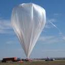
StratoCasters
(SC)
Record # 778 |
Pecan Plantation Airport, Granbury, TX
32.3537, -97.6763
(N32° 21' 13", W97° 40' 35")
Grid: EM12DI
Map of Launch Site: | StratoCasters 16 GPSL
Latex, 1200g, Hydrogen
KG5CA-11
APRS: 144.390Mhz
| http://www.twitter.com/stratocasters1
Chuck Goldsmith, KG5CA
[email protected]
Twitter/Facebook:
#stratocasters1
Tracking Options:
Google Maps APRS (aprs.fi)
HABHUB | 1200 Using: Hydrogen
GPSL 2015. Flight qual of hardware.
| After Flight Report: NearSat Recovered | | Stage | Time | Altitude | Latitude, Longitude | Notes |
|---|
Launch or
First: |
14:07:11
UTC |
734 ft.
0.22 Km |
32.35800, -97.67400
EM12DI
|
Distance from launch
Ascent/Descent Rates |
Burst or Max
Altitude: |
15:57:23
UTC |
104,838 ft.
31.95 Km |
32.09417, -98.27517
EM02UC
|
39.6 Mi / 63.7 Km
945 ft/min
|
Touchdown
or Last: |
02:41:25
UTC |
688 ft.
0.21 Km |
33.05017, -96.72883
EM13PB
|
72.8 Mi / 117.2 Km
13 ft/min
|
| Max Speed was: 49.48 MPH, reached at 40833 feet @ EM12BE |
|
Saturday
09:00:00 CDT
14:00:00 UTC
2016-06-18
Sunrise:
Sunset:
Near Space Systems
(NEARSYS)
Record # 773 |
GPSL
32.5, -97.75
(N32° 30' 0", W97° 45' 0")
Grid: EM12CM
Map of Launch Site: | NearSys 16C, NearSys 16D
Latex, 1200g, Hydrogen
KD4STH-7
APRS: 144.390Mhz
AND KD4STH-9
Space Available | http://nearsys.com
L. Paul Verhage, KD4STH
[email protected]
Twitter/Facebook:
@NearSys
Tracking Options:
Google Maps APRS (aprs.fi)
HABHUB | 1200 Using: Hydrogen
| After Flight Report: NearSat Recovered | | Stage | Time | Altitude | Latitude, Longitude | Notes |
|---|
Launch or
First: |
14:09:41
UTC |
987 ft.
0.30 Km |
32.35817, -97.67383
EM12DI
|
Distance from launch
Ascent/Descent Rates |
Burst or Max
Altitude: |
15:57:41
UTC |
94,413 ft.
28.78 Km |
43.47633, -116.82150
DN13OL
|
1290.6 Mi / 2077.1 Km
5 ft/min
|
Touchdown
or Last: |
14:38:41
UTC |
4,609 ft.
1.40 Km |
43.49950, -116.80417
DN13OL
|
1290.7 Mi / 2077.2 Km
-1137 ft/min
|
| Max Speed was: 63.29 MPH, reached at 34571 feet @ EM02UB |
|
Friday
10:00:00 EDT
14:00:00 UTC
2016-06-17
Sunrise:
Sunset:
Midland Public Schools Electronics and Wireless Communications Club
(MPSEWC)
Record # 780 |
Secord Township Hall, Gladwin, Michigan, USA
44.0405, -84.3073
(N44° 2' 26", W84° 18' 26")
Grid: EN74UA
Map of Launch Site: | MHSARC3
Latex, 800g, Helium
W8MHS-11
APRS: 144.390Mhz
|
Dennis Klipa, N8ERF
[email protected]
Tracking Options:
Google Maps APRS (aprs.fi)
HABHUB | 800 Using: Helium
Third Flight for the Midland High School Electronics and Wireless Communications Club. Happening in conjunction with the Northeast Middle School E&WCC Launch.
| After Flight Report: NearSat Recovered | | Stage | Time | Altitude | Latitude, Longitude | Notes |
|---|
Launch or
First: |
14:58:17
UTC |
3,296 ft.
1.00 Km |
44.08283, -84.29800
EN74UB
|
Distance from launch
Ascent/Descent Rates |
Burst or Max
Altitude: |
16:02:17
UTC |
73,800 ft.
22.49 Km |
43.67967, -84.25483
EN73UQ
|
27.9 Mi / 45 Km
1102 ft/min
|
Touchdown
or Last: |
22:14:17
UTC |
698 ft.
0.21 Km |
43.48783, -84.45600
EN73SL
|
41.9 Mi / 67.4 Km
197 ft/min
|
| Max Speed was: 67.9 MPH, reached at 37536 feet @ EN73UV |
|
Friday
10:00:00 EDT
14:00:00 UTC
2016-06-17
Sunrise:
Sunset:
Northeast Middle School Electronics and Wireless Communications Club
(NEMS)
Record # 779 |
Secord Township Hall, Gladwin, Michigan, USA
44.0405, -84.3073
(N44° 2' 26", W84° 18' 26")
Grid: EN74UA
Map of Launch Site: | NEMS1
Latex, 800g, Helium
N8ERF-11
APRS: 144.390Mhz
|
Dennis Klipa, N8ERF
[email protected]
Tracking Options:
Google Maps APRS (aprs.fi)
HABHUB | 800 Using: Helium
First Launching of the Northeast Middle School Electronics and Wireless Communications Club.
| After Flight Report: NearSat Recovered | | Stage | Time | Altitude | Latitude, Longitude | Notes |
|---|
Launch or
First: |
15:00:47
UTC |
6,871 ft.
2.09 Km |
44.07800, -84.30517
EN74UB
|
Distance from launch
Ascent/Descent Rates |
Burst or Max
Altitude: |
15:40:46
UTC |
55,350 ft.
16.87 Km |
43.73533, -84.20417
EN73VR
|
24.2 Mi / 39 Km
1212 ft/min
|
Touchdown
or Last: |
14:38:41
UTC |
0 ft.
0.00 Km |
0, 0
JJ00AA
|
6218.1 Mi / 10007.1 Km
-0 ft/min
|
| Max Speed was: 72.5 MPH, reached at 41013 feet @ EN73UV |
|
Friday
07:00:00 CDT
12:00:00 UTC
2016-06-17
Sunrise:
Sunset:
Mayberry Galactic
(MG)
Record # 766 |
Eastern South Dakota / Western Minnesota Near Ortonville
43.9, -97
(N43° 54' 0", W97° 0' 0")
Grid: EN13MV
Map of Launch Site: | Mayberry Galactic Flight #2 / Betty Lynn
Latex, 1200g, Helium
N0NQN-11
APRS: 144.390Mhz
|
Jeff Ducklow, N0NQN
jeffducklow@@comcast.net
Tracking Options:
Google Maps APRS (aprs.fi)
HABHUB | 1200 Using: Helium
Exact launch location will be set based on flight prediction tools with the aim of landing in soybean fields in western Minnesota just SE of Boyd, MN. Flying three cameras: GoPro, Canon S110, Canon A1100 each running CHDK. Two trackers: Bionics MT-1000 and SPOT Trace mounted on a gimbal. Will record temperature inside the payload box and outside with a Adafruit / Ardunio SD card data logger.
| After Flight Report: Recovery Undetermined | | Stage | Time | Altitude | Latitude, Longitude | Notes |
|---|
Launch or
First: |
17:07:30
UTC |
1,580 ft.
0.48 Km |
45.37950, -96.56450
EN15RJ
|
Distance from launch
Ascent/Descent Rates |
Burst or Max
Altitude: |
20:01:45
UTC |
111,201 ft.
33.89 Km |
45.69500, -96.51633
EN15RQ
|
21.9 Mi / 35.3 Km
629 ft/min
|
Touchdown
or Last: |
20:39:50
UTC |
2,164 ft.
0.66 Km |
45.77567, -96.42467
EN15SS
|
28.2 Mi / 45.4 Km
2863 ft/min
|
| Max Speed was: 631.78 MPH, reached at 13251 feet @ EN15SK |
|
Wednesday
04:15:00
2016-06-15
Sunrise:
Sunset:
Stanford Student Space Initiative
(SSSI)
Record # 843 |
Laird Park, Modesto CA, USA
37.5617, -121.151
(N37° 33' 42", W121° 9' 4")
Grid: CM97KN
Map of Launch Site: | SSI-41
Latex, 1500g, Helium
N/A
Iridium Satellite Network
Space Available | http://stanfordssi.org/
Kai, KM4SEE
[email protected]
Tracking Options:
Google Maps APRS (aprs.fi)
HABHUB | 1500 Using: Helium
NearSat Recovered
No Post Flight APRS Data Available
|
Monday
10:15:00
2016-06-13
Sunrise:
Sunset:
NC Near Space Research
(NCNS)
Record # 777 |
35, -78
(N35° 0' 0", W78° 0' 0")
Grid: FM05XA
Map of Launch Site: | Once again with feeling
Latex, 600g, Hydrogen
KM4QLE-7
APRS: 144.390Mhz
| http://www.ncnearspace.org/
Paul Lowell, KD4BFP
[email protected]
Tracking Options:
Google Maps APRS (aprs.fi)
HABHUB | 600 Using: Hydrogen
| After Flight Report: Recovery Undetermined | | Stage | Time | Altitude | Latitude, Longitude | Notes |
|---|
Launch or
First: |
14:57:17
UTC |
85 ft.
0.03 Km |
35.91483, -78.91933
FM05MV
|
Distance from launch
Ascent/Descent Rates |
Burst or Max
Altitude: |
16:42:56
UTC |
30,208 ft.
9.21 Km |
35.42583, -78.94067
FM05MK
|
33.8 Mi / 54.4 Km
285 ft/min
|
Touchdown
or Last: |
17:06:45
UTC |
1,473 ft.
0.45 Km |
35.27150, -78.88850
FM05NG
|
44.5 Mi / 71.6 Km
1207 ft/min
|
| Max Speed was: 84.01 MPH, reached at 12365 feet @ FM05PO |
|
Friday
08:45:00 MDT
14:45:00 UTC
2016-06-10
Sunrise:
Sunset:
St. Albert Balloon Launch Experiment
(SABLE)
Record # 774 |
St. Albert, Alberta
53.6215, -113.625
(N53° 37' 17", W113° 37' 30")
Grid: DO33EO
Map of Launch Site: | SABLE X
Latex, 2000g, Helium
VA6TNY-11
APRS: 144.390Mhz
12
| http://sable.spschools.org
Tony Rafaat, VA6TNY
[email protected]
Tracking Options:
Google Maps APRS (aprs.fi)
HABHUB | 2000 Using: Helium
This is our tenth launch, a bit of a milestone for us.
We are launching on a weekday so that all of our students may attend.
Recovery Undetermined
No Post Flight APRS Data Available
|
Wednesday
08:15:00 EDT
12:15:00 UTC
2016-06-08
Sunrise:
Sunset:
Balloon Assisted Stratospheric Experiments (DePauw University)
(BASE)
Record # 763 |
Julian Science Center, DePauw University
39.64, -86.86
(N39° 38' 24", W86° 51' 36")
Grid: EM69NP
Map of Launch Site: | BASE 88
Latex, 800g, Hydrogen
W9YJ-11
APRS: 144.390Mhz
| http://www.depauw.edu/academics/departments-programs/physics-astronomy/department-research/base/
Howard Brooks, KC9QBN
[email protected]
Twitter/Facebook:
#BASE_DePauw
Tracking Options:
Google Maps APRS (aprs.fi)
HABHUB | 800 Using: Hydrogen
Flight with K-12 teachers participating in the Math Science Partnership Workshop
| After Flight Report: Recovery Undetermined | | Stage | Time | Altitude | Latitude, Longitude | Notes |
|---|
Launch or
First: |
12:30:35
UTC |
882 ft.
0.27 Km |
39.63833, -86.86350
EM69NP
|
Distance from launch
Ascent/Descent Rates |
Burst or Max
Altitude: |
13:19:46
UTC |
68,909 ft.
21.00 Km |
39.27350, -86.21083
EM69VG
|
43 Mi / 69.2 Km
1383 ft/min
|
Touchdown
or Last: |
13:55:46
UTC |
1,282 ft.
0.39 Km |
39.00217, -85.74317
EM79DA
|
74.3 Mi / 119.5 Km
1879 ft/min
|
| Max Speed was: 101.27 MPH, reached at 43545 feet @ EM69TH |
|
Tuesday
10:00:00 EDT
14:00:00 UTC
2016-05-31
Sunrise:
Sunset:
University of Maine High Altitude Balloon Team
(UMHAB)
Record # 771 |
Sebasticook Middle School
44.8789, -69.2943
(N44° 52' 44", W69° 17' 39")
Grid: FN54IV
Map of Launch Site: | UMHAB-51
Latex, 1600g, Hydrogen
N1YIP-11
APRS: 144.390Mhz
|
Rick Eason, AA1PJ
[email protected]
Tracking Options:
Google Maps APRS (aprs.fi)
HABHUB | 1600 Using: Hydrogen
| After Flight Report: Recovery Undetermined | | Stage | Time | Altitude | Latitude, Longitude | Notes |
|---|
Launch or
First: |
12:59:36
UTC |
892 ft.
0.27 Km |
44.89817, -68.72633
FN54PV
|
Distance from launch
Ascent/Descent Rates |
Burst or Max
Altitude: |
14:30:36
UTC |
100,587 ft.
30.66 Km |
44.91517, -68.56083
FN54RV
|
8.2 Mi / 13.2 Km
1096 ft/min
|
Touchdown
or Last: |
15:01:38
UTC |
1,184 ft.
0.36 Km |
44.92867, -68.45800
FN54SW
|
13.3 Mi / 21.4 Km
3203 ft/min
|
| Max Speed was: 44.88 MPH, reached at 44844 feet @ FN54RW |
|
Saturday
10:30:00 EDT
21:30:00 UTC
2016-05-28
Sunrise:
Sunset:
Overlook Horizon High Altitude Balloons
(OLHZN)
Record # 767 |
Canandaigua Academy, Canandaigua, NY, USA
42.9071, -77.2735
(N42° 54' 26", W77° 16' 25")
Grid: FN12IV
Map of Launch Site: | OLHZN-3
Latex, 600g, Helium
KD2KPZ-11
APRS: 144.390Mhz
| http://www.OverlookHorizon.com
Tory Carissimo, KD2KPZ
[email protected]
Tracking Options:
Google Maps APRS (aprs.fi)
HABHUB | 600 Using: Helium
Live broadcast on launch day as well as full flight details and recovered data available at http://overlookhorizon.com/flight-3
|
Saturday
08:00:00 EDT
12:00:00 UTC
2016-05-28
Sunrise:
Sunset:
Peach Flight
(W7QO)
Record # 759 |
Buford, Ga
34.05, -83.9
(N34° 3' 0", W83° 54' 0")
Grid: EM84BB
Map of Launch Site: | HIRF-1
Plastic, 108g, Helium
W7QO-7
APRS: 144.390Mhz
W7QO - 14.0965mhz 20mtr WSPR every 10 mins (W7QO-9 on aprs.fi)
| http://peachflight.blogspot.com/
Alan Adamson, W7QO
[email protected]
Tracking Options:
Google Maps APRS (aprs.fi)
HABHUB | 108 Using: Helium
HIRF-1 long duration solar only flight, SBS-13 envelope, Peach-Tiny tracker - final board. WSPR will occur every 10 mins starting after launch. WSPR frequency is 20mtrs - 14.0956mhz. WSPR decode software available @http://physics.princeton.edu/pulsar/k1jt/wspr.html. WSPR tracking via second callsign W7QO-9 at aprs.fi
Recovery Undetermined
No Post Flight APRS Data Available
|
Saturday
08:00:00 CST
14:00:00 UTC
2016-05-28
Sunrise:
Sunset:
Saskatoon Amateur Balloon Radio Experiments
(SABRE)
Record # 761 |
Saskatoon
52.098, -106.617
(N52° 5' 53", W106° 37' 1")
Grid: DO62QC
Map of Launch Site: | SABRE-24
Latex, 1200g, Hydrogen
VE5AA-11
APRS: 144.390Mhz
VE5AA-12
CW 433.9Mhz
| http://ve5aa.dyndns.org/balloon/
Bruce Coates, VE5BNC
[email protected]
Tracking Options:
Google Maps APRS (aprs.fi)
HABHUB | 1200 Using: Hydrogen
http://ve5aa.dyndns.org/balloon/live_tracking.html
| After Flight Report: NearSat Recovered | | Stage | Time | Altitude | Latitude, Longitude | Notes |
|---|
Launch or
First: |
14:22:17
UTC |
1,702 ft.
0.52 Km |
52.09850, -106.61483
DO62QC
|
Distance from launch
Ascent/Descent Rates |
Burst or Max
Altitude: |
16:21:17
UTC |
122,837 ft.
37.44 Km |
52.50450, -107.07167
DO62LM
|
34 Mi / 54.8 Km
1018 ft/min
|
Touchdown
or Last: |
17:09:19
UTC |
2,480 ft.
0.76 Km |
52.72033, -107.24283
DO62JR
|
50.5 Mi / 81.2 Km
2506 ft/min
|
| Max Speed was: 52.94 MPH, reached at 26207 feet @ DO62KP |
|
Saturday
08:00:00 CST
14:00:00 UTC
2016-05-28
Sunrise:
Sunset:
Saskatoon Amateur Balloon Radio Experiments
(SABRE)
Record # 760 |
Saskatoon
52.098, -106.617
(N52° 5' 53", W106° 37' 1")
Grid: DO62QC
Map of Launch Site: | SABRE-24
Latex, 1200g, Hydrogen
VE5AA-11
APRS: 144.390Mhz
VE5AA-12
CW 433.9Mhz
| http://ve5aa.dyndns.org/balloon/
Bruce Coates, VE5BNC
[email protected]
Tracking Options:
Google Maps APRS (aprs.fi)
HABHUB | 1200 Using: Hydrogen
http://ve5aa.dyndns.org/balloon/live_tracking.html
| After Flight Report: NearSat Recovered | | Stage | Time | Altitude | Latitude, Longitude | Notes |
|---|
Launch or
First: |
14:22:17
UTC |
1,702 ft.
0.52 Km |
52.09850, -106.61483
DO62QC
|
Distance from launch
Ascent/Descent Rates |
Burst or Max
Altitude: |
16:21:17
UTC |
122,837 ft.
37.44 Km |
52.50450, -107.07167
DO62LM
|
34 Mi / 54.8 Km
1018 ft/min
|
Touchdown
or Last: |
17:09:19
UTC |
2,480 ft.
0.76 Km |
52.72033, -107.24283
DO62JR
|
50.5 Mi / 81.2 Km
2506 ft/min
|
| Max Speed was: 52.94 MPH, reached at 26207 feet @ DO62KP |
|
Wednesday
10:15:00 CDT
15:15:00 UTC
2016-05-25
Sunrise:
Sunset:
Watertown Middle School
(WMS)
Record # 758 |
Watertown Regional Airport
44.9224, -97.1629
(N44° 55' 21", W97° 9' 46")
Grid: EN14KW
Map of Launch Site: | BOREALIS V
Latex, 1200g, Helium
WD0FKC-12
APRS: 144.390Mhz
|
Mark Iverson, WD0FKC
[email protected]
Tracking Options:
Google Maps APRS (aprs.fi)
HABHUB | 1200 Using: Helium
BOREALIS V will consist of a 1200g weather balloon equipped with an ArduinoTrack APRS GPS tracker sending back telemetry and temperature readings every minute throughout the flight, 2 HD Contour video cameras, one facing down the other facing to the horizon and an Arduino running a BPM180 with an SD data logger, taking recordings every 10 seconds. All of which was designed, coded and build by WMS 8th graders.
| After Flight Report: Recovery Undetermined | | Stage | Time | Altitude | Latitude, Longitude | Notes |
|---|
Launch or
First: |
14:38:15
UTC |
2,540 ft.
0.77 Km |
44.92467, -97.16667
EN14JW
|
Distance from launch
Ascent/Descent Rates |
Burst or Max
Altitude: |
16:17:55
UTC |
98,858 ft.
30.13 Km |
45.34500, -96.61583
EN15QI
|
39.5 Mi / 63.6 Km
966 ft/min
|
Touchdown
or Last: |
16:44:29
UTC |
6,854 ft.
2.09 Km |
45.45633, -96.57383
EN15RK
|
46.7 Mi / 75.2 Km
3463 ft/min
|
| Max Speed was: 90.91 MPH, reached at 41099 feet @ EN15NG |
|
Wednesday
10:00:00
2016-05-25
Sunrise:
Sunset:
Watertown Middle School
(WMS)
Record # 757 |
Watertown Regional Airport
44.9224, -97.1629
(N44° 55' 21", W97° 9' 46")
Grid: EN14KW
Map of Launch Site: | BOREALIS IV
Latex, 1200g, Helium
WD0FKC-11
APRS: 144.390Mhz
|
Mark Iverson, WD0FKC
[email protected]
Tracking Options:
Google Maps APRS (aprs.fi)
HABHUB | 1200 Using: Helium
BOREALIS IV will consist of a 1200g weather balloon equipped with an ArduinoTrack APRS GPS tracker sending back telemetry and temperature readings every minute throughout the flight, 2 HD Contour video cameras, one facing down the other facing to the horizon and an Arduino running a BPM180 with an SD data logger, taking recordings every 10 seconds. All of which was designed, coded and build by WMS 8th graders.
| After Flight Report: Recovery Undetermined | | Stage | Time | Altitude | Latitude, Longitude | Notes |
|---|
Launch or
First: |
14:38:54
UTC |
1,960 ft.
0.60 Km |
44.92300, -97.16633
EN14KW
|
Distance from launch
Ascent/Descent Rates |
Burst or Max
Altitude: |
16:19:03
UTC |
94,062 ft.
28.67 Km |
45.36767, -96.58050
EN15RI
|
41.9 Mi / 67.5 Km
920 ft/min
|
Touchdown
or Last: |
UTC |
0 ft.
0.00 Km |
0, 0
JJ00AA
|
6218.1 Mi / 10007.1 Km
-0 ft/min
|
| Max Speed was: 51.79 MPH, reached at 6821 feet @ EN15TN |
|
Monday
10:30:00 EDT
14:30:00 UTC
2016-05-23
Sunrise:
Sunset:
Ballon Radioamateur du Quebec
(BRAQ)
Record # 756 |
Ste-Helene,Quebec,Canada
45.732, -72.736
(N45° 43' 55", W72° 44' 10")
Grid: FN35PR
Map of Launch Site: | BRAQ 2016-01
Latex, 800g, Helium
VE2WMG-11
144.390
VA2RMG-11
VE2WMG-10
| http://raqi.ca/braq/
Michel Graveline, VE2WMG
[email protected]
Tracking Options:
Google Maps APRS (aprs.fi)
HABHUB | 800 Using: Helium
Crossband Repeater In:445.525 tone 141.3out:145.560 tone 141.3
| After Flight Report: Recovery Undetermined | | Stage | Time | Altitude | Latitude, Longitude | Notes |
|---|
Launch or
First: |
14:11:46
UTC |
275 ft.
0.08 Km |
45.73033, -72.73650
FN35PR
|
Distance from launch
Ascent/Descent Rates |
Burst or Max
Altitude: |
15:48:26
UTC |
90,168 ft.
27.48 Km |
45.54000, -73.08317
FN35LM
|
21.3 Mi / 34.3 Km
930 ft/min
|
Touchdown
or Last: |
11:55:11
UTC |
420 ft.
0.13 Km |
45.65617, -72.56100
FN35RP
|
9.9 Mi / 15.9 Km
74 ft/min
|
| Max Speed was: 71.35 MPH, reached at 33750 feet @ FN35LM |
|
Saturday
07:15:00 MDT
13:15:00 UTC
2016-05-21
Sunrise:
Sunset:
Edge of Space Sciences
(EOSS)
Record # 754 |
Llimon, CO
39.2367, -103.696
(N39° 14' 12", W103° 41' 46")
Grid: DM89DF
Map of Launch Site: | EOSS-224
Latex, 1600g, Hydrogen
AE0SS-11
APRS: 144.340Mhz
AE0SS DF beacon on 147.555 MHz; KE0XFH-1 APRS on 144.39.
| http://www.eoss.org/
Mike Manes, W5VSI
[email protected]
Twitter/Facebook:
@eossorg
Tracking Options:
Google Maps APRS (aprs.fi)
HABHUB | 1600 Using: Hydrogen
3 X Denver Metro State balloonsats + 1 demosat. Douglas County STEM p/l + NSSTI p/l + Denver Sch. of Arts ARC beacon KE0FXH-1. Wx date Sun 5/22. This is 4th launch delay due to BKIN to OVC sky!
The landing lat/lon was:
39.58151, -103.06175
See some pix:
| After Flight Report: NearSat Recovered | | Stage | Time | Altitude | Latitude, Longitude | Notes |
|---|
Launch or
First: |
14:24:22
UTC |
10,639 ft.
3.24 Km |
39.26550, -103.68450
DM89DG
|
Distance from launch
Ascent/Descent Rates |
Burst or Max
Altitude: |
16:06:21
UTC |
102,288 ft.
31.18 Km |
39.46533, -103.22783
DM89JL
|
28 Mi / 45.1 Km
899 ft/min
|
Touchdown
or Last: |
UTC |
4,765 ft.
1.45 Km |
39.58151, -103.06175
DM89LN
|
39.8 Mi / 64 Km
-0 ft/min
|
| Max Speed was: 70.66 MPH, reached at feet @ DM89GK |
|
Saturday
07:00:30 MDT
13:30:00 UTC
2016-05-21
Sunrise:
Sunset:
Edge of Space Sciences
(EOSS)
Record # 734 |
Limon, CO
39.2367, -103.696
(N39° 14' 12", W103° 41' 46")
Grid: DM89DF
Map of Launch Site: | EOSS-223
Latex, 2000g, Hydrogen
AE0SS-12
APRS: 144.340Mhz
KE0BMV-11
KE0BMV-11 on 145.600 MHz
| http://www.eoss.org/
Mike Manes, W5VSI
[email protected]
Twitter/Facebook:
@eossorg
Tracking Options:
Google Maps APRS (aprs.fi)
HABHUB | 2000 Using: Hydrogen
1 X Denver Metro State balloonsats + Dougco STEM experiment + 1 Oaksat. Wx date Sun 5/22. This is 4th launch delay due to BKIN to OVC sky!
| After Flight Report: NearSat Recovered | | Stage | Time | Altitude | Latitude, Longitude | Notes |
|---|
Launch or
First: |
14:21:47
UTC |
9,726 ft.
2.96 Km |
39.25350, -103.68850
DM89DG
|
Distance from launch
Ascent/Descent Rates |
Burst or Max
Altitude: |
15:41:46
UTC |
98,798 ft.
30.11 Km |
39.41350, -103.33983
DM89HJ
|
21.7 Mi / 34.9 Km
1114 ft/min
|
Touchdown
or Last: |
16:18:16
UTC |
9,178 ft.
2.80 Km |
39.54250, -103.15000
DM89KN
|
35 Mi / 56.3 Km
2455 ft/min
|
| Max Speed was: 88.61 MPH, reached at 45885 feet @ DM89IK |
|
Saturday
07:00:00 MDT
13:00:00 UTC
2016-05-21
Sunrise:
Sunset:
Edge of Space Sciences
(EOSS)
Record # 733 |
Limon, CO
39.2367, -103.696
(N39° 14' 12", W103° 41' 46")
Grid: DM89DF
Map of Launch Site: | EOSS-222
Latex, 1200g, Hydrogen
KC0UUO-11
APRS: 144.340Mhz
K0SCC-11
K0SCC-11 on 147.42 MHz.
| http://www.eoss.org/
Mike Manes, W5VSI
[email protected]
Twitter/Facebook:
@eossorg
Tracking Options:
Google Maps APRS (aprs.fi)
HABHUB | 1200 Using: Hydrogen
5 X Denver Metro State balloonsats and 1 Demosat. Wx date Sun 5/22/16. This is 4th launch delay due to OVC to BKN sky!
| After Flight Report: NearSat Recovered | | Stage | Time | Altitude | Latitude, Longitude | Notes |
|---|
Launch or
First: |
14:21:02
UTC |
9,263 ft.
2.82 Km |
39.25150, -103.68950
DM89DG
|
Distance from launch
Ascent/Descent Rates |
Burst or Max
Altitude: |
15:41:01
UTC |
90,733 ft.
27.66 Km |
39.44533, -103.28833
DM89IK
|
25.3 Mi / 40.7 Km
1019 ft/min
|
Touchdown
or Last: |
16:27:01
UTC |
9,719 ft.
2.96 Km |
39.61950, -103.04317
DM89LO
|
42.8 Mi / 69 Km
1761 ft/min
|
| Max Speed was: 90.91 MPH, reached at 46909 feet @ DM89JL |
|
Friday
09:00:00
2016-05-20
Sunrise:
Sunset:
Concord Community Schools
(CCS)
Record # 755 |
Concord Junior High School, Elkhart, Indiana, United States of America
413754, 855704
(N413754° 0' 0", E855704° 0' 0")
Grid: 14XA
Map of Launch Site: | Concord Junior High
Latex, 1200g, Helium
BALLOON 1
APRS: 144.390Mhz
Space Available |
Matthew Jerlecki, N9QIE
[email protected]
Tracking Options:
Google Maps APRS (aprs.fi)
HABHUB | 1200 Using: Helium
Student Led Project
|
Wednesday
10:15:00 CDT
15:15:00 UTC
2016-05-18
Sunrise:
Sunset:
()
Record # 751 |
Watertown Regional Airport
44.9224, -97.1629
(N44° 55' 21", W97° 9' 46")
Grid: EN14KW
Map of Launch Site: | BOREALIS IV
Latex, 1200g, Helium
WD0FKC-2
APRS: 144.390Mhz
|
Mark Iverson, N/A
[email protected]
Tracking Options:
Google Maps APRS (aprs.fi)
HABHUB | 1200 Using: Helium
BOREALIS IV will consist of a 1200g weather balloon equipped with an ArduinoTrack APRS GPS tracker sending back telemetry and temperature readings every minute throughout the flight, 2 HD Contour video cameras, one facing down the other facing to the horizon and an Arduino running a BPM180 with an SD data logger, taking recordings every 10 seconds. All of which was designed, coded and build by WMS 8th graders.
|
Wednesday
10:00:00 HOVST
18:00:00 UTC
2016-05-18
Sunrise:
Sunset:
()
Record # 750 |
Watertown Regional Airport
44.9224, -97.1629
(N44° 55' 21", W97° 9' 46")
Grid: EN14KW
Map of Launch Site: | BOREALIS III
Latex, 1200g, Helium
WD0FKC-1
APRS: 144.390Mhz
|
Mark Iverson, N/A
[email protected]
Tracking Options:
Google Maps APRS (aprs.fi)
HABHUB | 1200 Using: Helium
BOREALIS III will consist of a 1200g weather balloon equipped with an ArduinoTrack APRS GPS tracker sending back telemetry and temperature readings every minute throughout the flight, 2 HD Contour video cameras, one facing down the other facing to the horizon and an Arduino running a BPM180 with an SD data logger, taking recordings every 10 seconds. All of which was designed, coded and build by WMS 8th graders.
|
Wednesday
08:30:00 EDT
12:30:00 UTC
2016-05-18
Sunrise:
Sunset:
Balloon Assisted Stratospheric Experiments (DePauw University)
(BASE)
Record # 753 |
Julian Science Center, DePauw University
39.64, -86.86
(N39° 38' 24", W86° 51' 36")
Grid: EM69NP
Map of Launch Site: | BASE 87
Latex, 800g, Hydrogen
W9YJ-11
APRS: 144.390Mhz
| http://www.depauw.edu/academics/departments-programs/physics-astronomy/department-research/base/
Howard Brooks, KC9QBN
[email protected]
Twitter/Facebook:
#BASE_DePauw
Tracking Options:
Google Maps APRS (aprs.fi)
HABHUB | 800 Using: Hydrogen
Also flying 900 MHz spread spectrum system and the next generation Geiger counter array.
| After Flight Report: Recovery Undetermined | | Stage | Time | Altitude | Latitude, Longitude | Notes |
|---|
Launch or
First: |
12:57:23
UTC |
908 ft.
0.28 Km |
39.63833, -86.86350
EM69NP
|
Distance from launch
Ascent/Descent Rates |
Burst or Max
Altitude: |
14:36:16
UTC |
105,744 ft.
32.23 Km |
39.70550, -86.00133
EM69XQ
|
46.1 Mi / 74.2 Km
1060 ft/min
|
Touchdown
or Last: |
15:20:16
UTC |
1,118 ft.
0.34 Km |
39.73017, -85.58150
EM79FR
|
68.5 Mi / 110.2 Km
2378 ft/min
|
| Max Speed was: 112.78 MPH, reached at 34220 feet @ EM69RP |
|
Sunday
10:30:00
2016-05-15
Sunrise:
Sunset:
Ivy Near Space Program for Computing Technologies
(INSPCT)
Record # 730 |
Goshen Airport, Goshen Indiana (KGSH)
41.5263, -85.7942
(N41° 31' 35", W85° 47' 39")
Grid: EN71CM
Map of Launch Site: | INSPCT-4a
Latex, 1500g, Helium
KC9VVJ-11
APRS: 144.390Mhz
Chase team will use 145.75MHz for FM Voice
|
Dave Bohlmann, KC9VVJ
[email protected]
Tracking Options:
Google Maps APRS (aprs.fi)
HABHUB | 1500 Using: Helium
Second attempt to use a surplus gas bag. We also will have a radio monitoring ADS-B aircraft telemetry on-board.
| After Flight Report: Recovery Undetermined | | Stage | Time | Altitude | Latitude, Longitude | Notes |
|---|
Launch or
First: |
14:24:33
UTC |
1,049 ft.
0.32 Km |
41.52333, -85.79183
EN71CM
|
Distance from launch
Ascent/Descent Rates |
Burst or Max
Altitude: |
15:20:29
UTC |
57,334 ft.
17.48 Km |
41.19650, -84.82900
EN71OE
|
54.8 Mi / 88.2 Km
1006 ft/min
|
Touchdown
or Last: |
16:18:14
UTC |
1,804 ft.
0.55 Km |
40.86417, -83.80967
EN80CU
|
112.7 Mi / 181.3 Km
962 ft/min
|
| Max Speed was: 97.82 MPH, reached at 32560 feet @ EN71IG |
|
Saturday
10:00:00 MDT
16:00:00 UTC
2016-05-14
Sunrise:
Sunset:
Near Space Systems
(NEARSYS)
Record # 752 |
Jordan Valley, OR
42.96, -117.05
(N42° 57' 36", W117° 3' 0")
Grid: DN12LX
Map of Launch Site: | NearSys 16A, NearSys 16B
Latex, 1200g, Hydrogen
KD4STH-7
APRS: 144.390Mhz
KD4STH-8
KD4STH-9
KD4STH-2
| http://nearsys.com
L. Paul Verhage, KD4STH
[email protected]
Twitter/Facebook:
@NearSys
Tracking Options:
Google Maps APRS (aprs.fi)
HABHUB | 1200 Using: Hydrogen
| After Flight Report: Recovery Undetermined | | Stage | Time | Altitude | Latitude, Longitude | Notes |
|---|
Launch or
First: |
16:23:31
UTC |
10,425 ft.
3.18 Km |
42.97983, -117.04417
DN12LX
|
Distance from launch
Ascent/Descent Rates |
Burst or Max
Altitude: |
17:09:31
UTC |
84,610 ft.
25.79 Km |
43.15200, -116.81350
DN13OD
|
16.6 Mi / 26.8 Km
1613 ft/min
|
Touchdown
or Last: |
17:36:31
UTC |
6,397 ft.
1.95 Km |
43.27617, -116.68867
DN13PG
|
27.2 Mi / 43.8 Km
2897 ft/min
|
| Max Speed was: 85.16 MPH, reached at 39830 feet @ DN13MD |
|
Saturday
09:30:00 CDT
14:30:00 UTC
2016-05-14
Sunrise:
Sunset:
Central Nebraska Near Space Program
(CNNSP)
Record # 717 |
Aurora, NE
40.8585, -97.9958
(N40° 51' 31", W97° 59' 45")
Grid: EN10AU
Map of Launch Site: | CNNSP-11
Latex, 1200g, Helium
KC0MWM-11
APRS: 144.360 MHz
KC0MWM-12
144.390 MHz
CW beacon 146.565 MHz
Space Available | http://www.cnnsp.org/
Roger Hammond, KC0MWM
[email protected]
Tracking Options:
Google Maps APRS (aprs.fi)
HABHUB | 1200 Using: Helium
Edgerton Explorit Center
| After Flight Report: Recovery Undetermined | | Stage | Time | Altitude | Latitude, Longitude | Notes |
|---|
Launch or
First: |
14:35:39
UTC |
1,789 ft.
0.55 Km |
40.85850, -97.99550
EN10AU
|
Distance from launch
Ascent/Descent Rates |
Burst or Max
Altitude: |
16:03:23
UTC |
90,529 ft.
27.59 Km |
40.40550, -97.02783
EN10LJ
|
59.6 Mi / 95.9 Km
1011 ft/min
|
Touchdown
or Last: |
16:32:07
UTC |
1,945 ft.
0.59 Km |
40.16250, -96.48450
EN10SD
|
92.8 Mi / 149.3 Km
3083 ft/min
|
| Max Speed was: 117.38 MPH, reached at 36118 feet @ EN10FO |
|
Saturday
09:30:00 CDT
14:30:00 UTC
2016-05-14
Sunrise:
Sunset:
Nebraska Stratospheric Amateur Radio
(NSTAR)
Record # 747 |
Aurora, NE
40.8585, -97.9958
(N40° 51' 31", W97° 59' 45")
Grid: EN10AU
Map of Launch Site: | NSTAR 16-B
Latex, 1500g, Helium
N9XTN-11
APRS: 144.390Mhz
N9XTN-12
APRS 144.360 MHz
| http://www.nstar.org/
Mark Conner, N9XTN
[email protected]
Twitter/Facebook:
@N9XTN
Tracking Options:
Google Maps APRS (aprs.fi)
HABHUB | 1500 Using: Helium
Edgerton Explorit Center
Dual flight with CNNSP
| After Flight Report: NearSat Recovered | | Stage | Time | Altitude | Latitude, Longitude | Notes |
|---|
Launch or
First: |
14:45:37
UTC |
14,308 ft.
4.36 Km |
40.79000, -97.93200
EN10AS
|
Distance from launch
Ascent/Descent Rates |
Burst or Max
Altitude: |
16:10:37
UTC |
96,987 ft.
29.56 Km |
40.33917, -96.93117
EN10MI
|
61.1 Mi / 98.3 Km
973 ft/min
|
Touchdown
or Last: |
16:58:07
UTC |
1,382 ft.
0.42 Km |
40.15933, -96.54400
EN10RD
|
85 Mi / 136.7 Km
2013 ft/min
|
| Max Speed was: 117.38 MPH, reached at 36788 feet @ EN10GO |
|
Saturday
09:00:00
2016-05-14
Sunrise:
Sunset:
Arizona Near Space Research
(ANSR)
Record # 739 |
U of A Ag Station, Maricopa, AZ
-111.976, 33.0727
(S111° 58' 34", E33° 4' 22")
Grid: KY69MD
Map of Launch Site: | ANSR-100
Latex, 3000g, Hydrogen
KA7NSR-6
APRS: 144.340Mhz
| http://www.ansr.org, http://groups.yahoo.com/group/Ballooning/
Bill McLean, K7WWM
[email protected]
Tracking Options:
Google Maps APRS (aprs.fi)
HABHUB | 3000 Using: Hydrogen
This will have a single 12.5 pound payload for ASU School of Engeneering
https://drive.google.com/folderview?id=0B1WGaRtcEro8YXR3RURmRmVETmc&usp=sharing
| After Flight Report: NearSat Recovered | | Stage | Time | Altitude | Latitude, Longitude | Notes |
|---|
Launch or
First: |
16:13:22
UTC |
1,761 ft.
0.54 Km |
32.83717, -112.11400
DM32WU
|
Distance from launch
Ascent/Descent Rates |
Burst or Max
Altitude: |
17:15:52
UTC |
92,176 ft.
28.10 Km |
32.91383, -111.88867
DM42BV
|
14.1 Mi / 22.7 Km
1447 ft/min
|
Touchdown
or Last: |
17:47:04
UTC |
2,309 ft.
0.70 Km |
32.98700, -111.73383
DM42DX
|
24.4 Mi / 39.2 Km
2880 ft/min
|
| Max Speed was: 54.09 MPH, reached at 48491 feet @ DM42BV |
|
Wednesday
09:00:00 CDT
14:00:00 UTC
2016-05-11
Sunrise:
Sunset:
()
Record # 748 |
Pella Christian High School
41.4, -92.9
(N41° 24' 0", W92° 54' 0")
Grid: EN31NJ
Map of Launch Site: | PENS-10
Latex, 1500g, Helium
N0MPM-11
APRS: 144.390Mhz
|
Mike Morgan, N0MPM
[email protected]
Tracking Options:
Google Maps APRS (aprs.fi)
HABHUB | 1500 Using: Helium
6 Payloads for Senior Physics class
Prediction: 40 miles NE of Pella
|
Saturday
12:30:00 EDT
16:30:00 UTC
2016-05-07
Sunrise:
Sunset:
Overlook Horizon High Altitude Balloons
(OLHZN)
Record # 746 |
Canandaigua, NY
42.9072, -77.2734
(N42° 54' 26", W77° 16' 24")
Grid: FN12IV
Map of Launch Site: | OLHZN-2
Latex, 600g, Helium
KD2KPZ-11
APRS: 144.390Mhz
| http://www.OverlookHorizon.com
Tory Carissimo, KD2KPZ
[email protected]
Tracking Options:
Google Maps APRS (aprs.fi)
HABHUB | 600 Using: Helium
Live broadcast, pre-flight full details and post-flight data and photos available at http://www.OverlookHorizon.com
Recovery Undetermined
No Post Flight APRS Data Available
|
Friday
09:00:00 CDT
14:00:00 UTC
2016-05-06
Sunrise:
Sunset:

Amateur Radio Balloons Over North East Texas
(ARBONET)
Record # 740 |
33.1571, -96.7072
(N33° 9' 26", W96° 42' 26")
Grid: EM13PD
Map of Launch Site: | ARBONET 21, OGLE ELEMENTARY
Latex, 600g, Helium
K5ARB-11
APRS: 144.390Mhz
| http://www.arbonet.net/
Michael Willett, K5NOT
[email protected]
Tracking Options:
Google Maps APRS (aprs.fi)
HABHUB | 600 Using: Helium
Launch of student experiments for Ogle Elementary
Will include APRS and RDF beacon
|
Thursday
08:15:00 EDT
12:15:00 UTC
2016-05-05
Sunrise:
Sunset:
Balloon Assisted Stratospheric Experiments (DePauw University)
(BASE)
Record # 724 |
Greencastle Middle School, Greencastle, Indiana, USA
39.64, -86.84
(N39° 38' 24", W86° 50' 24")
Grid: EM69NP
Map of Launch Site: | BASE 86
Latex, 800g, Hydrogen
W9YJ-11
APRS: 144.390Mhz
| http://www.depauw.edu/academics/departments-programs/physics-astronomy/department-research/base/
Howard Brooks, KC9QBN
[email protected]
Twitter/Facebook:
#BASE_DePauw
Tracking Options:
Google Maps APRS (aprs.fi)
HABHUB | 800 Using: Hydrogen
Flight with Greencastle Middle School 8th grade science experiments.
| After Flight Report: NearSat Recovered | | Stage | Time | Altitude | Latitude, Longitude | Notes |
|---|
Launch or
First: |
12:15:20
UTC |
853 ft.
0.26 Km |
39.64000, -86.84350
EM69NP
|
Distance from launch
Ascent/Descent Rates |
Burst or Max
Altitude: |
14:15:22
UTC |
88,150 ft.
26.87 Km |
38.86833, -86.73767
EM68PU
|
53.6 Mi / 86.3 Km
727 ft/min
|
Touchdown
or Last: |
14:50:46
UTC |
1,145 ft.
0.35 Km |
38.53600, -86.78500
EM68OM
|
76.3 Mi / 122.9 Km
2458 ft/min
|
| Max Speed was: 82.86 MPH, reached at 27014 feet @ EM68PR |
|
Wednesday
08:30:00 EDT
12:30:00 UTC
2016-05-04
Sunrise:
Sunset:
University of Maine High Altitude Balloon Team
(UMHAB)
Record # 745 |
Pittsfield, Maine, USA
44.7718, -69.3821
(N44° 46' 18", W69° 22' 56")
Grid: FN54HS
Map of Launch Site: | UMHAB-50
Latex, 1600g, Hydrogen
N1YIP-11
APRS: 144.390Mhz
KB1YOF-11
Space Available |
UMaineARC, AA1PJ
[email protected]
Tracking Options:
Google Maps APRS (aprs.fi)
HABHUB | 1600 Using: Hydrogen
| After Flight Report: Recovery Undetermined | | Stage | Time | Altitude | Latitude, Longitude | Notes |
|---|
Launch or
First: |
12:36:37
UTC |
895 ft.
0.27 Km |
44.77150, -69.38317
FN54HS
|
Distance from launch
Ascent/Descent Rates |
Burst or Max
Altitude: |
14:24:36
UTC |
112,664 ft.
34.34 Km |
45.31300, -68.37483
FN55TH
|
61.8 Mi / 99.5 Km
1035 ft/min
|
Touchdown
or Last: |
15:03:38
UTC |
2,774 ft.
0.85 Km |
45.56483, -67.88417
FN65BN
|
91.3 Mi / 146.9 Km
2815 ft/min
|
| Max Speed was: 107.02 MPH, reached at 38795 feet @ FN55NB |
|
Saturday
09:15:00 BST
10:15:00 UTC
2016-04-30
Sunrise:
Sunset:
University of Bristol Students for the Exploration and Development of Space
(UBSEDS)
Record # 781 |
City of Bristol, Bristol, United Kingdom
51.456, -2.613
(N51° 27' 22", W2° 36' 47")
Grid: IO81QK
Map of Launch Site: | UBSEDS15
Mylar, 185g, Helium
UHF: UBSEDS15
APRS: 144.620Mhz
APRS: M0SBU-11
Contestia 16/1000 434.600MHz
AD6AM-11
| http://www.bristol-seds.co.uk
Richard Meadows, M0SBU
[email protected]
Tracking Options:
Google Maps APRS (aprs.fi)
HABHUB | 185 Using: Helium
Payload Weight 20g, Free Lift 17.2g
See http://www.bristol-seds.co.uk/hab/flight/2016/04/30/ubseds15.html
The last APRS packet was received by LA9UI at 18:56 GMT on the 16th June.
NearSat Recovered
No Post Flight APRS Data Available
|
Tuesday
08:00:00 EDT
12:00:00 UTC
2016-04-26
Sunrise:
Sunset:
Peach Flight
(W7QO)
Record # 744 |
BUFORD
34.05, -83.9
(N34° 3' 0", W83° 54' 0")
Grid: EM84BB
Map of Launch Site: | TINY-1T
Plastic, 103g, Helium
W7QO-7
APRS: 144.390Mhz
WSPR every 10 mins on 20mtrs - 14.0956mhz - Ported to APRS as
| http://peachflight.blogspot.com/
Alan Adamson, W7QO
[email protected]
Tracking Options:
Google Maps APRS (aprs.fi)
HABHUB | 103 Using: Helium
Test flight, new envelop, new tracker, new radio(s). WSPR will occur every 10 mins starting after launch. WSPR frequency is 20mtrs - 14.0956mhz. WSPR decode software available @http://physics.princeton.edu/pulsar/k1jt/wspr.html. WSPR tracking via second callsign W7QO-9 at aprs.fi
Recovery Undetermined
No Post Flight APRS Data Available
|
Sunday
13:15:00 CDT
18:15:00 UTC
2016-04-24
Sunrise:
Sunset:
WB8ELK Balloon Flights
(WB8ELK)
Record # 743 |
FALKVILLE, AL
34.4083, -86.8133
(N34° 24' 30", W86° 48' 48")
Grid: EM64OJ
Map of Launch Site: | Skytracker 10
Plastic, 84g, Helium
WB8ELK-13
APRS: 144.340Mhz
| http://www.wb8elk.com/
Mike Manes,
[email protected]
Tracking Options:
Google Maps APRS (aprs.fi)
HABHUB | 84 Using: Helium
Long duration superpressure plastic film balloon. Scientific Balloon Solutions SBS-12 envelope. Totally solar-powered APRS transmitter with supercaps.
| After Flight Report: Recovery Undetermined | | Stage | Time | Altitude | Latitude, Longitude | Notes |
|---|
Launch or
First: |
19:31:40
UTC |
15,138 ft.
4.61 Km |
34.56050, -86.84000
EM64NN
|
Distance from launch
Ascent/Descent Rates |
Burst or Max
Altitude: |
14:54:01
UTC |
41,051 ft.
12.51 Km |
33.82267, -3.91900
IM83AT
|
4588.8 Mi / 7384.9 Km
6 ft/min
|
Touchdown
or Last: |
15:01:53
UTC |
0 ft.
0.00 Km |
0, 0
JJ00AA
|
6218.1 Mi / 10007.1 Km
-0 ft/min
|
| Max Speed was: 88.61 MPH, reached at 40484 feet @ IM45VV |
|
Sunday
08:00:00 EDT
12:00:00 UTC
2016-04-24
Sunrise:
Sunset:
University of Maine High Altitude Balloon Team
(UMHAB)
Record # 742 |
Hartland, ME
44.8825, -69.4481
(N44° 52' 57", W69° 26' 53")
Grid: FN54GV
Map of Launch Site: | UMHAB-48
Latex, 1600g, Hydrogen
N1YIP-11
APRS: 144.390Mhz
Beeline Beacon 433.6 MHz
|
Rick Eason, AA1PJ
[email protected]
Tracking Options:
Google Maps APRS (aprs.fi)
HABHUB | 1600 Using: Hydrogen
| After Flight Report: Recovery Undetermined | | Stage | Time | Altitude | Latitude, Longitude | Notes |
|---|
Launch or
First: |
12:22:53
UTC |
337 ft.
0.10 Km |
44.88117, -69.44467
FN54GV
|
Distance from launch
Ascent/Descent Rates |
Burst or Max
Altitude: |
14:28:11
UTC |
116,341 ft.
35.46 Km |
44.90800, -68.09117
FN54WV
|
66.3 Mi / 106.7 Km
926 ft/min
|
Touchdown
or Last: |
15:01:53
UTC |
2,699 ft.
0.82 Km |
44.88983, -67.53700
FN64FV
|
93.4 Mi / 150.3 Km
3372 ft/min
|
| Max Speed was: 111.63 MPH, reached at 25416 feet @ FN64CW |
|
Saturday
17:00:00 EDT
21:00:00 UTC
2016-04-23
Sunrise:
Sunset:
NC Near Space Research
(NCNS)
Record # 741 |
Burlington
36.0799, -79.4873
(N36° 4' 48", W79° 29' 14")
Grid: FM06GB
Map of Launch Site: | NSL-46
Latex, 600g, Hydrogen
KD4BFP-11
APRS: 144.390Mhz
| http://www.ncnearspace.org/
Paul Lowell, KD4BFP
[email protected]
Tracking Options:
Google Maps APRS (aprs.fi)
HABHUB | 600 Using: Hydrogen
Burlington Mini Maker Faire public launch
| After Flight Report: Recovery Undetermined | | Stage | Time | Altitude | Latitude, Longitude | Notes |
|---|
Launch or
First: |
16:15:48
UTC |
1,672 ft.
0.51 Km |
36.07583, -79.48817
FM06GB
|
Distance from launch
Ascent/Descent Rates |
Burst or Max
Altitude: |
17:25:54
UTC |
91,535 ft.
27.90 Km |
36.02233, -79.09183
FM06KA
|
22.4 Mi / 36.1 Km
1282 ft/min
|
Touchdown
or Last: |
18:10:18
UTC |
453 ft.
0.14 Km |
35.94267, -78.88083
FM05NW
|
35.2 Mi / 56.6 Km
2051 ft/min
|
| Max Speed was: 63.29 MPH, reached at 42185 feet @ FM05IX |
|
Saturday
09:00:00 CDT
14:00:00 UTC
2016-04-23
Sunrise:
Sunset:

Middle Tennessee Robotic Arts Society
(MTRAS)
Record # 719 |
Charlotte Elementary School 200 Humphries Street, Charlotte, TN, USA
36.1797, -87.3403
(N36° 10' 47", W87° 20' 25")
Grid: EM66HE
Map of Launch Site: | MTRAS2-Balloon
Latex, 1500g, Hydrogen
KI4NHK-11
APRS: 144.390Mhz
| http://www.mtras.com
Carlton Corbitt, KI4NHK
[email protected]
Tracking Options:
Google Maps APRS (aprs.fi)
HABHUB | 1500 Using: Hydrogen
This is a 3, 1500g balloon cluster
2 payloads, FoxHunt on 146.565MHz Morse Code on FM, Cameras on both payloads, and parachute return experiment, 433.97388MHz backup beacon, accelerameter position experiment
| After Flight Report: Recovery Undetermined | | Stage | Time | Altitude | Latitude, Longitude | Notes |
|---|
Launch or
First: |
16:13:03
UTC |
857 ft.
0.26 Km |
36.18350, -87.33867
EM66HE
|
Distance from launch
Ascent/Descent Rates |
Burst or Max
Altitude: |
16:13:03
UTC |
857 ft.
0.26 Km |
36.18350, -87.33867
EM66HE
|
6218.1 Mi / 10007.1 Km
invalid value ft/min
|
Touchdown
or Last: |
UTC |
0 ft.
0.00 Km |
0, 0
JJ00AA
|
6218.1 Mi / 10007.1 Km
-4 ft/min
|
| Max Speed was: 0 MPH, reached at 857 feet @ EM66HE |
|
Saturday
07:30:00 CDT
12:30:00 UTC
2016-04-23
Sunrise:
Sunset:
Central Missouri Composite Squadron - CAP
(CMCS)
Record # 721 |
5151 Roger I Wilson Mem Dr., Columbia, MO
39.0068, -92.3076
(N39° 0' 24", W92° 18' 27")
Grid: EM39UA
Map of Launch Site: | CAP-1
Latex, 600g, Hydrogen
N0ESE
APRS: 144.390Mhz
| https://www.mowgcap.us/index.php/ncr-mo-018
Mike McCrady, N0ESE
[email protected]
Tracking Options:
Google Maps APRS (aprs.fi)
HABHUB | 600 Using: Hydrogen
| After Flight Report: Recovery Undetermined | | Stage | Time | Altitude | Latitude, Longitude | Notes |
|---|
Launch or
First: |
12:46:21
UTC |
1,102 ft.
0.34 Km |
39.00683, -92.30833
EM39UA
|
Distance from launch
Ascent/Descent Rates |
Burst or Max
Altitude: |
13:14:39
UTC |
348,240 ft.
106.14 Km |
38.92733, -92.20767
EM38VW
|
7.7 Mi / 12.4 Km
12266 ft/min
|
Touchdown
or Last: |
13:19:22
UTC |
32,855 ft.
10.01 Km |
38.92017, -92.20050
EM38VW
|
8.3 Mi / 13.4 Km
66866 ft/min
|
| Max Speed was: 628.33 MPH, reached at 68296 feet @ GM38OR |
|
Tuesday
04:00:00 EDT
08:00:00 UTC
2016-04-19
Sunrise:
Sunset:
VE3KCL
(VE3KCL)
Record # 736 |
Toronto Canada
43, -79
(N43° 0' 0", W79° 0' 0")
Grid: FN03LA
Map of Launch Site: | S9
Latex, 74g, Hydrogen
VE3KCL
10.140265mhz wspr 10.140480 JT9
Space Available | http://qrp-labs.com/ultimate3/ve3kcl-balloons/ve3kcl-s9.html
Dave Beverstein, VE3KCL
[email protected]
Tracking Options:
Google Maps APRS (aprs.fi)
HABHUB | 74 Using: Hydrogen
Over Russia now at 10kilometers traveled 31000km so far live tracking here : ................... http://qrp-labs.com/ultimate3/ve3kcl-balloons/ve3kcl-s9.html
|
Tuesday
00:00:00 +06
06:00:00 UTC
2016-04-19
Sunrise:
Sunset:

QRP-Labs
(QRP)
Record # 737 |
Toronto Canada
43, -79
(N43° 0' 0", W79° 0' 0")
Grid: FN03LA
Map of Launch Site: | S-9
Mylar, 2g, Hydrogen
VE3KCL
10.140265mhz Wspr 10.140480 JT9 every 12min
|
Dave Beverstein, VE3KCL
[email protected]
Tracking Options:
Google Maps APRS (aprs.fi)
HABHUB | 2 Using: Hydrogen
THE BALLOON WENT MISSING ON APRIL 27 AFTER TRAVELING FOR 18 DAYS AND 51000 KM. IT WAS ONLY 1800KM FROM DOING A TOTAL CIRCUMNAVIGATION OF THE EARTH... THE ONLY POWER USED FOR THE FLIGHT WAS SUNSHINE AND A FEW CUBIC FEET OF HYDROGEN THAT COULD HAVE BEEN PRODUCED WITH ALUMINUM FOIL BALLS AND DRAIN CLEANER... IT WAS FUN TO TRACK AS IT AS TOOK THE MOST RIDICULOUS ROUTE AROUND THE WORLD.
Recovery Undetermined
No Post Flight APRS Data Available
|
Sunday
20:00:00 CDT
01:00:00 UTC
2016-04-17
Sunrise:
Sunset:
WB8ELK Balloon Flights
(WB8ELK)
Record # 735 |
FALKVILLE, AL
34.4083, -86.8133
(N34° 24' 30", W86° 48' 48")
Grid: EM64OJ
Map of Launch Site: | Skytracker 8
Latex, 103g, Helium
WB8ELK-10
WSPR on 20m ported to APRS.FI under WB8ELK-10
| http://www.wb8elk.com/
Bill Brown, WB8ELK-10
[email protected]
Tracking Options:
Google Maps APRS (aprs.fi)
HABHUB | 103 Using: Helium
Long duration WSPR balloon on 20 meters. Call: WB8ELK Ported with Python script to APRS.FI with call: WB8ELK-10. SBS-13 balloon.
| After Flight Report: Recovery Undetermined | | Stage | Time | Altitude | Latitude, Longitude | Notes |
|---|
Launch or
First: |
05:00:03
UTC |
27,624 ft.
8.42 Km |
34.47917, -87.20817
EM64JL
|
Distance from launch
Ascent/Descent Rates |
Burst or Max
Altitude: |
05:00:03
UTC |
27,624 ft.
8.42 Km |
34.47917, -87.20817
EM64JL
|
6218.1 Mi / 10007.1 Km
invalid value ft/min
|
Touchdown
or Last: |
18:46:12
UTC |
0 ft.
0.00 Km |
0, 0
JJ00AA
|
6218.1 Mi / 10007.1 Km
-0 ft/min
|
| Max Speed was: 0 MPH, reached at 27624 feet @ EM64JL |
|
Sunday
10:00:00 EDT
14:00:00 UTC
2016-04-17
Sunrise:
Sunset:
KE4ERF High Altitude Ballooning
(KE4ERF)
Record # 731 |
Palmyra Area HS, Palmyra PA
40.2981, -76.5861
(N40° 17' 53", W76° 35' 10")
Grid: FN10QH
Map of Launch Site: | TATHAB-2
Latex, 1200g, Helium
KE4ERF-11
APRS: 144.390Mhz
| https://trinket.io/cty_jgates_gmail_com/courses/near-space-balloon-project
Josh Gates, KE4ERF
[email protected]
Tracking Options:
Google Maps APRS (aprs.fi)
HABHUB | 1200 Using: Helium
Payload includes student-made Geiger-Muller detector for measuring muon flux as a function of altitude
Recovery Undetermined
No Post Flight APRS Data Available
|
Saturday
16:00:00 EDT
20:00:00 UTC
2016-04-16
Sunrise:
Sunset:
Columbia Space Initiative
(CSI)
Record # 738 |
Prattsville, New York, NY, USA
42.3266, -74.3911
(N42° 19' 36", W74° 23' 28")
Grid: FN22TH
Map of Launch Site: | ROAREE-1
Latex, 1600g, Helium
KF7YAF
APRS: 144.390Mhz
| http://columbiaspace.org/mission-balloons/
Jake Lee, KF7YAF
[email protected]
Tracking Options:
Google Maps APRS (aprs.fi)
HABHUB | 1600 Using: Helium
| After Flight Report: Recovery Undetermined | | Stage | Time | Altitude | Latitude, Longitude | Notes |
|---|
Launch or
First: |
19:54:38
UTC |
3,264 ft.
0.99 Km |
42.32650, -74.39100
FN22TH
|
Distance from launch
Ascent/Descent Rates |
Burst or Max
Altitude: |
21:59:58
UTC |
108,100 ft.
32.95 Km |
41.76933, -74.25300
FN21US
|
39.1 Mi / 63 Km
836 ft/min
|
Touchdown
or Last: |
02:30:56
UTC |
436 ft.
0.13 Km |
40.89950, -73.93783
FN30AV
|
101.3 Mi / 163.1 Km
397 ft/min
|
| Max Speed was: 58.69 MPH, reached at 488 feet @ FN21UI |
|
Saturday
12:00:00 CDT
17:00:00 UTC
2016-04-16
Sunrise:
Sunset:

HAB Education
(HABE)
Record # 723 |
Damiansville, IL, USA
38.5056, -89.6221
(N38° 30' 20", W89° 37' 20")
Grid: EM58EM
Map of Launch Site: | HAB.education-Loyola
Latex, 1200g, Helium
KD0PGM-11
APRS: 144.390 Mhz
CW: 146.656 Mhz
| http://hab.education
Dustin Mayfield-Jones,
[email protected]
Tracking Options:
Google Maps APRS (aprs.fi)
HABHUB | 1200 Using: Helium
Cessna 172N airplane to visually track & record video. DVB-t (High-def digital TV-70cm band), Slow Scan TV, 3 GoPro video cameras, 2 GPS-based trackers (Trackuino & experimental design by Don Bindner), 2 student designed/assembled payloads w/ Raspberry Pi-based temp. & humidity sensors by Loyola Academy of Saint Louis students, 1 SensorDrone, & 1 Spot GPS w/ gimbal on loan from the Mizzou-SEDS Chapter.
| After Flight Report: Recovery Undetermined | | Stage | Time | Altitude | Latitude, Longitude | Notes |
|---|
Launch or
First: |
18:07:26
UTC |
723 ft.
0.22 Km |
38.50867, -89.62717
EM58EM
|
Distance from launch
Ascent/Descent Rates |
Burst or Max
Altitude: |
19:59:27
UTC |
89,073 ft.
27.15 Km |
38.49667, -89.48433
EM58GL
|
7.8 Mi / 12.5 Km
789 ft/min
|
Touchdown
or Last: |
20:04:26
UTC |
63,226 ft.
19.27 Km |
38.50950, -89.43650
EM58GM
|
10.3 Mi / 16.6 Km
5187 ft/min
|
| Max Speed was: 1150.66 MPH, reached at feet @ RF79LM |
|
Saturday
10:00:00 CDT
15:00:00 UTC
2016-04-16
Sunrise:
Sunset:
Nebraska Stratospheric Amateur Radio
(NSTAR)
Record # 708 |
UNL Hardin Hall, Lincoln, NE, USA
40.8292, -96.6718
(N40° 49' 45", W96° 40' 18")
Grid: EN10PT
Map of Launch Site: | NSTAR 16-A
Latex, 1500g, Helium
N9XTN-11
APRS: 144.360Mhz
N9XTN-12
144.390MHz
| http://www.nstar.org/
Mark Conner, N9XTN
[email protected]
Twitter/Facebook:
@N9XTN
Tracking Options:
Google Maps APRS (aprs.fi)
HABHUB | 1500 Using: Helium
Launch time tentativeEvent at Central Plains Severe Weather Symposium
| After Flight Report: NearSat Recovered | | Stage | Time | Altitude | Latitude, Longitude | Notes |
|---|
Launch or
First: |
15:09:49
UTC |
1,170 ft.
0.36 Km |
40.82917, -96.67133
EN10PT
|
Distance from launch
Ascent/Descent Rates |
Burst or Max
Altitude: |
16:35:18
UTC |
98,585 ft.
30.05 Km |
41.12900, -96.52067
EN11RD
|
22.2 Mi / 35.7 Km
1140 ft/min
|
Touchdown
or Last: |
17:15:49
UTC |
1,761 ft.
0.54 Km |
41.35283, -96.45900
EN11SI
|
37.8 Mi / 60.9 Km
2390 ft/min
|
| Max Speed was: 63.29 MPH, reached at 41745 feet @ EN11QB |
|
Saturday
09:30:00 EDT
13:30:00 UTC
2016-04-16
Sunrise:
Sunset:
Pirates in Space
(PIS)
Record # 732 |
Berea Community High School lawn, Berea, KY, USA
37.5779, -84.2925
(N37° 34' 40", W84° 17' 33")
Grid: EM77UN
Map of Launch Site: | PIS-1
Latex, 1200g, Helium
KM4SKJ-11
APRS: 144.390Mhz
|
Joshua Woodward, KM4SJK
[email protected]
Tracking Options:
Google Maps APRS (aprs.fi)
HABHUB | 1200 Using: Helium
After Flight report: Recovery Successful.
| After Flight Report: Recovery Undetermined | | Stage | Time | Altitude | Latitude, Longitude | Notes |
|---|
Launch or
First: |
14:59:15
UTC |
1,834 ft.
0.56 Km |
37.57750, -84.29233
EM77UN
|
Distance from launch
Ascent/Descent Rates |
Burst or Max
Altitude: |
17:12:15
UTC |
106,924 ft.
32.59 Km |
37.48417, -84.17050
EM77VL
|
9.3 Mi / 14.9 Km
790 ft/min
|
Touchdown
or Last: |
17:44:15
UTC |
3,523 ft.
1.07 Km |
37.47383, -84.20700
EM77VL
|
8.6 Mi / 13.8 Km
3231 ft/min
|
| Max Speed was: 60.99 MPH, reached at 105362 feet @ EM77VL |
|
Monday
08:00:00 EDT
11:00:00 UTC
2016-04-11
Sunrise:
Sunset:
Peach Flight
(W7QO)
Record # 729 |
Buford, GA
34.05, -83.9
(N34° 3' 0", W83° 54' 0")
Grid: EM84BB
Map of Launch Site: | Peach Tiny test one
Plastic, 120g, Helium
W7QO-7
APRS: 144.390Mhz
W7QO-9
WSPR every 10 mins on 20mtrs - 14.0956mhz
| http://peachflight.blogspot.com/
Alan Adamson, W7QO
[email protected]
Tracking Options:
Google Maps APRS (aprs.fi)
HABHUB | 120 Using: Helium
Test flight, new envelop, new tracker, new radio(s). WSPR will occur every 10 mins starting after launch. WSPR frequency is 20mtrs - 14.0956mhz. WSPR decode software available @http://physics.princeton.edu/pulsar/k1jt/wspr.html. WSPR tracking via second callsign W7QO-9 at aprs.fi
|
Saturday
23:00:00 CDT
04:00:00 UTC
2016-04-09
Sunrise:
Sunset:
WB8ELK Balloon Flights
(WB8ELK)
Record # 728 |
FALKVILLE, AL
34.4083, -86.8133
(N34° 24' 30", W86° 48' 48")
Grid: EM64OJ
Map of Launch Site: | Skytracker 7
Latex, 37g, Helium
WB8ELK-8
APRS: 144.340Mhz
| http://www.wb8elk.com/
Bill Brown, WB8ELK
[email protected]
Tracking Options:
Google Maps APRS (aprs.fi)
HABHUB | 37 Using: Helium
Skytracker 7 long duration Mylar balloon in celebration of Yuri's Night.
| After Flight Report: Recovery Undetermined | | Stage | Time | Altitude | Latitude, Longitude | Notes |
|---|
Launch or
First: |
01:51:04
UTC |
21,077 ft.
6.42 Km |
33.57983, -85.67883
EM73DN
|
Distance from launch
Ascent/Descent Rates |
Burst or Max
Altitude: |
01:49:05
UTC |
21,086 ft.
6.43 Km |
33.59300, -85.70667
EM73DO
|
1.8 Mi / 3 Km
-5 ft/min
|
Touchdown
or Last: |
18:46:12
UTC |
0 ft.
0.00 Km |
0, 0
JJ00AA
|
6218.1 Mi / 10007.1 Km
-0 ft/min
|
| Max Speed was: 55.24 MPH, reached at 21086 feet @ EM73DO |
|
Saturday
11:00:00 EDT
15:00:00 UTC
2016-04-09
Sunrise:
Sunset:
Ivy Near Space Program for Computing Technologies
(INSPCT)
Record # 712 |
Goshen Airport, Goshen Indiana
41.5263, -85.7942
(N41° 31' 35", W85° 47' 39")
Grid: EN71CM
Map of Launch Site: | INSPCT-4
Latex, 1500g, Helium
KC9VVJ-11
APRS: 144.390Mhz
1258 MHZ (ATV)
|
Dave Bohlmann, KC9VVJ
[email protected]
Tracking Options:
Google Maps APRS (aprs.fi)
HABHUB | 1500 Using: Helium
Chase team will use 145.75 MHz FM Voice
|
Saturday
09:00:00 CDT
14:00:00 UTC
2016-04-09
Sunrise:
Sunset:
Amateur Radio Balloons Over North East Texas
(ARBONET)
Record # 720 |
Hillsboro Airport, TX
32.0836, -97.0973
(N32° 5' 1", W97° 5' 50")
Grid: EM12KC
Map of Launch Site: | ARBONET 20
Latex, 1200g, Helium
K5ARB-11
APRS: 144.390Mhz
SPOT TRACKER
| http://www.arbonet.net/
Michael, K5NOT
[email protected]
Tracking Options:
Google Maps APRS (aprs.fi)
HABHUB | 1200 Using: Helium
Flight to prove operation and path analysis for Capstone satellite project at Texas A & M.
A small group of students have worked hard this past year to create a 900MHz satellite communications system as part of their senior graduation project. I have had the privilege to guide them through parts of the project and this will be a fun flight to introduce them to ARHAB as well as an opportunity to put to test the ideas and efforts of their work!
| After Flight Report: Recovery Undetermined | | Stage | Time | Altitude | Latitude, Longitude | Notes |
|---|
Launch or
First: |
15:10:41
UTC |
1,400 ft.
0.43 Km |
32.09050, -97.09733
EM12KC
|
Distance from launch
Ascent/Descent Rates |
Burst or Max
Altitude: |
18:08:39
UTC |
106,971 ft.
32.60 Km |
32.28000, -95.97317
EM22AG
|
67 Mi / 107.9 Km
593 ft/min
|
Touchdown
or Last: |
19:12:40
UTC |
557 ft.
0.17 Km |
32.33600, -95.70733
EM22DI
|
83 Mi / 133.6 Km
1662 ft/min
|
| Max Speed was: 79.4 MPH, reached at 42809 feet @ EM22BG |
|
Saturday
07:15:00 MDT
13:15:00 UTC
2016-04-09
Sunrise:
Sunset:
Edge of Space Sciences
(EOSS)
Record # 727 |
Eaton Middle School, Eaton CO
40.527, -104.723
(N40° 31' 37", W104° 43' 23")
Grid: DN70PM
Map of Launch Site: | EOSS-221
Latex, 3000g, Hydrogen
AE0SS-12
APRS: 144.340Mhz
KC0D-11
KC0D-11 on 144.950 MHz
AE0SS
AE0SS DF on 147.555
| http://www.eoss.org/
Mike Manes, W5VSI
[email protected]
Twitter/Facebook:
@eossorg
Tracking Options:
Google Maps APRS (aprs.fi)
HABHUB | 3000 Using: Hydrogen
7 @ Colorado Space Grant College BalloonSats
| After Flight Report: NearSat Recovered | | Stage | Time | Altitude | Latitude, Longitude | Notes |
|---|
Launch or
First: |
13:19:41
UTC |
5,020 ft.
1.53 Km |
40.52600, -104.72350
DN70PM
|
Distance from launch
Ascent/Descent Rates |
Burst or Max
Altitude: |
14:12:41
UTC |
73,615 ft.
22.44 Km |
40.50267, -104.57017
DN70RM
|
8.2 Mi / 13.2 Km
1294 ft/min
|
Touchdown
or Last: |
14:42:42
UTC |
11,927 ft.
3.64 Km |
40.53950, -104.49500
DN70SM
|
12 Mi / 19.4 Km
2055 ft/min
|
| Max Speed was: 71.35 MPH, reached at 54170 feet @ DN70RL |
|
Saturday
07:00:00 MDT
13:00:00 UTC
2016-04-09
Sunrise:
Sunset:
Edge of Space Sciences
(EOSS)
Record # 726 |
Eaton Middle School, Eaton CO
40.527, -104.723
(N40° 31' 37", W104° 43' 23")
Grid: DN70PM
Map of Launch Site: | EOSS-220
Latex, 3000g, Hydrogen
KC0UUO-11
APRS: 144.340Mhz
KE0BMV-11
KE0BMV-11 on 145.600 MHz
| http://www.eoss.org/
Mike Manes, W5VSI
[email protected]
Twitter/Facebook:
@eossorg
Tracking Options:
Google Maps APRS (aprs.fi)
HABHUB | 3000 Using: Hydrogen
9 @ Colorado Space Grant College DemoSats.
| After Flight Report: NearSat Recovered | | Stage | Time | Altitude | Latitude, Longitude | Notes |
|---|
Launch or
First: |
13:07:11
UTC |
4,846 ft.
1.48 Km |
40.52633, -104.72333
DN70PM
|
Distance from launch
Ascent/Descent Rates |
Burst or Max
Altitude: |
14:08:12
UTC |
77,500 ft.
23.62 Km |
40.48550, -104.56100
DN70RL
|
9 Mi / 14.5 Km
1191 ft/min
|
Touchdown
or Last: |
14:46:11
UTC |
8,922 ft.
2.72 Km |
40.51733, -104.48050
DN70SM
|
12.8 Mi / 20.5 Km
1805 ft/min
|
| Max Speed was: 67.9 MPH, reached at 57120 feet @ DN70RL |
|
Saturday
06:45:00 MDT
12:45:00 UTC
2016-04-09
Sunrise:
Sunset:
Edge of Space Sciences
(EOSS)
Record # 725 |
Eaton Middle School, Eaton CO
40.527, -104.723
(N40° 31' 37", W104° 43' 23")
Grid: DN70PM
Map of Launch Site: | EOSS-219
Latex, 3000g, Hydrogen
AE0SS-13
APRS: 144.340Mhz
K0SCC-11
K0SCC-11 on 147.42 MHz.
| http://www.eoss.org/
Mike Manes, W5VSI
[email protected]
Twitter/Facebook:
@eossorg
Tracking Options:
Google Maps APRS (aprs.fi)
HABHUB | 3000 Using: Hydrogen
10 @ U. Colo Gateway to Space College BalloonSats
| After Flight Report: NearSat Recovered | | Stage | Time | Altitude | Latitude, Longitude | Notes |
|---|
Launch or
First: |
12:51:01
UTC |
4,853 ft.
1.48 Km |
40.52633, -104.72333
DN70PM
|
Distance from launch
Ascent/Descent Rates |
Burst or Max
Altitude: |
13:53:31
UTC |
77,690 ft.
23.68 Km |
40.47650, -104.54933
DN70RL
|
9.8 Mi / 15.7 Km
1165 ft/min
|
Touchdown
or Last: |
14:43:32
UTC |
4,715 ft.
1.44 Km |
40.51550, -104.43000
DN70SM
|
15.4 Mi / 24.8 Km
1459 ft/min
|
| Max Speed was: 86.31 MPH, reached at 55200 feet @ DN70RK |
|
Saturday
11:00:00 CDT
16:00:00 UTC
2016-04-02
Sunrise:
Sunset:
University of Southern Indiana
(USI)
Record # 722 |
Albers, IL
38.5464, -89.6192
(N38° 32' 47", W89° 37' 9")
Grid: EM58EN
Map of Launch Site: | HAB-19, HAB-20
Latex, 1600g, Helium
W9MOK-2
APRS: 144.390Mhz
| http://usinearspace.com
Glen Kissel, KC9ZUY
[email protected]
Tracking Options:
Google Maps APRS (aprs.fi)
HABHUB | 1600 Using: Helium
Two floaters will be attempted.
Final determination of launching site will be made on morning of launch.
Follow flight activities live at www.usinearspace.com
| After Flight Report: Recovery Undetermined | | Stage | Time | Altitude | Latitude, Longitude | Notes |
|---|
Launch or
First: |
16:42:55
UTC |
426 ft.
0.13 Km |
38.54600, -89.61983
EM58EN
|
Distance from launch
Ascent/Descent Rates |
Burst or Max
Altitude: |
16:41:49
UTC |
436 ft.
0.13 Km |
38.54600, -89.61983
EM58EN
|
6218.1 Mi / 10007.1 Km
-9 ft/min
|
Touchdown
or Last: |
15:46:30
UTC |
0 ft.
0.00 Km |
0, 0
JJ00AA
|
6218.1 Mi / 10007.1 Km
-2 ft/min
|
| Max Speed was: 1.15 MPH, reached at 426 feet @ EM58EN |
|
Saturday
09:00:00 MST
16:00:00 UTC
2016-04-02
Sunrise:
Sunset:
Arizona Near Space Research
(ANSR)
Record # 703 |
33.0729, -111.975
(N33° 4' 22", W111° 58' 30")
Grid: DM43AB
Map of Launch Site: | ANSR-97
Latex, 3000g, Hydrogen
KA7NSR-6
APRS: 144.340Mhz
Space Available | http://www.ansr.org, http://groups.yahoo.com/group/Ballooning/
Bill McLean, K7WWM
[email protected]
Tracking Options:
Google Maps APRS (aprs.fi)
HABHUB | 3000 Using: Hydrogen
Ascend Flight 22
| After Flight Report: Recovery Undetermined | | Stage | Time | Altitude | Latitude, Longitude | Notes |
|---|
Launch or
First: |
16:02:10
UTC |
1,171 ft.
0.36 Km |
33.07383, -111.98317
DM43AB
|
Distance from launch
Ascent/Descent Rates |
Burst or Max
Altitude: |
17:05:03
UTC |
96,335 ft.
29.36 Km |
33.04283, -111.82767
DM43CB
|
9.3 Mi / 14.9 Km
1513 ft/min
|
Touchdown
or Last: |
17:33:52
UTC |
2,083 ft.
0.63 Km |
33.00800, -111.79700
DM43CA
|
11.7 Mi / 18.8 Km
3271 ft/min
|
| Max Speed was: 65.59 MPH, reached at 93990 feet @ DM43CB |
|
Monday
12:00:00 PDT
19:00:00 UTC
2016-03-14
Sunrise:
Sunset:
East Bay Amateur Radio Club
(EBARC)
Record # 691 |
Caesar Chavez Park, Berkeley, CA USA
37.8685, -122.313
(N37° 52' 7", W122° 18' 47")
Grid: CM87UU
Map of Launch Site: | HENRY-1
Latex, 1500g, Helium
W6CUS-11
APRS: 144.390Mhz
|
Jack Burris, K6JEB
[email protected]
Tracking Options:
Google Maps APRS (aprs.fi)
HABHUB | 1500 Using: Helium
More details will be added as we get past the visioning stage
|
Monday
11:45:00 GMT
11:45:00 UTC
2016-03-07
Sunrise:
Sunset:

Rishworth School
(71803)
Record # 718 |
Rishworth School, Rishworth, UK
53.6614, -1.95928
(N53° 39' 41", W1° 57' 33")
Grid: IO93AP
Map of Launch Site: | RISHTI
Latex, 1200g, Helium
RISHTI
434.25MHz
|
Pete Bell, N/A
[email protected]
Tracking Options:
Google Maps APRS (aprs.fi)
HABHUB | 1200 Using: Helium
Recovery Undetermined
No Post Flight APRS Data Available
|
Sunday
03:00:00 CST
09:00:00 UTC
2016-03-06
Sunrise:
Sunset:
WB8ELK Balloon Flights
(WB8ELK)
Record # 716 |
FALKVILLE
34.4083, -86.8133
(N34° 24' 30", W86° 48' 48")
Grid: EM64OJ
Map of Launch Site: | Skytracker 7
Latex, 37g, Helium
WB8ELK-7
APRS: 144.390Mhz
20m WSPR call: WB8ELK
| http://www.wb8elk.com/
Bill Brown, WB8ELK
[email protected]
Tracking Options:
Google Maps APRS (aprs.fi)
HABHUB | 37 Using: Helium
20 meter WSPR balloon solar-powered Pico Balloon. Transmits at the 4 minute mark and the 8 minute mark. Uploaded to APRS.FI under the callsign: WB8ELK-7
| After Flight Report: Recovery Undetermined | | Stage | Time | Altitude | Latitude, Longitude | Notes |
|---|
Launch or
First: |
19:32:03
UTC |
27,624 ft.
8.42 Km |
38.18750, -47.04150
GM68LE
|
Distance from launch
Ascent/Descent Rates |
Burst or Max
Altitude: |
12:42:03
UTC |
29,461 ft.
8.98 Km |
29.31250, -52.95817
GL39MH
|
700.7 Mi / 1127.6 Km
-4 ft/min
|
Touchdown
or Last: |
18:46:12
UTC |
0 ft.
0.00 Km |
0, 0
JJ00AA
|
6218.1 Mi / 10007.1 Km
-0 ft/min
|
| Max Speed was: 0 MPH, reached at 27624 feet @ GM68LE |
|
Sunday
07:00:00 EST
12:00:00 UTC
2016-02-28
Sunrise:
Sunset:
NC Near Space Research
(NCNS)
Record # 715 |
Apex nc
35.46, -78.06
(N35° 27' 36", W78° 3' 36")
Grid: FM05XL
Map of Launch Site: | NSL-43
Latex, 1600g, Hydrogen
KD4BFP-11
APRS: 144.390Mhz
| http://www.ncnearspace.org/
Paul Lowell, KD4BFP
[email protected]
Tracking Options:
Google Maps APRS (aprs.fi)
HABHUB | 1600 Using: Hydrogen
glider
| After Flight Report: Recovery Undetermined | | Stage | Time | Altitude | Latitude, Longitude | Notes |
|---|
Launch or
First: |
12:05:45
UTC |
485 ft.
0.15 Km |
35.73033, -78.83200
FM05OR
|
Distance from launch
Ascent/Descent Rates |
Burst or Max
Altitude: |
14:46:43
UTC |
136,723 ft.
41.67 Km |
35.30633, -78.13100
FM05WH
|
49.1 Mi / 79 Km
846 ft/min
|
Touchdown
or Last: |
15:46:30
UTC |
460 ft.
0.14 Km |
35.16983, -77.69033
FM15DE
|
75 Mi / 120.7 Km
2279 ft/min
|
| Max Speed was: 155.36 MPH, reached at 103261 feet @ FM05WH |
|
Saturday
18:15:00 CST
00:15:00 UTC
2016-02-27
Sunrise:
Sunset:
WB8ELK Balloon Flights
(WB8ELK)
Record # 714 |
Falkville, AL
34.4083, -86.8133
(N34° 24' 30", W86° 48' 48")
Grid: EM64OJ
Map of Launch Site: | Skytracker 5
Latex, 37g, Helium
WB8ELK-6
APRS: 144.340Mhz
| http://www.wb8elk.com/
Bill, WB8ELK
[email protected]
Tracking Options:
Google Maps APRS (aprs.fi)
HABHUB | 37 Using: Helium
Long duration Pico balloon floater flight with 36-inch Mylar balloon.
| After Flight Report: Recovery Undetermined | | Stage | Time | Altitude | Latitude, Longitude | Notes |
|---|
Launch or
First: |
00:34:07
UTC |
4,068 ft.
1.24 Km |
34.46333, -86.72533
EM64PL
|
Distance from launch
Ascent/Descent Rates |
Burst or Max
Altitude: |
02:09:31
UTC |
19,098 ft.
5.82 Km |
34.12217, -86.31550
EM64UC
|
33.2 Mi / 53.4 Km
158 ft/min
|
Touchdown
or Last: |
14:29:04
UTC |
0 ft.
0.00 Km |
0, 0
JJ00AA
|
6218.1 Mi / 10007.1 Km
-0 ft/min
|
| Max Speed was: 29.92 MPH, reached at 6644 feet @ EM64QK |
|
Wednesday
10:00:00 CET
11:00:00 UTC
2016-02-24
Sunrise:
Sunset:
Analyse Mechatronischer Systeme Industrie
(AMESYS)
Record # 707 |
EAH-Jena, Jena, Thuringia, Germany
50.9177, 11.5677
(N50° 55' 4", E11° 34' 4")
Grid: JO50SW
Map of Launch Site: | Stroke-2
Latex, 1700g, Helium
DK0TUI-11
APRS: 144.800Mhz
Space Available | http://www.amesys.de
Joe Grabow, DL3AKB
[email protected]
Tracking Options:
Google Maps APRS (aprs.fi)
HABHUB | 1700 Using: Helium
http://www.mb.eah-jena.de/page/de/fachgebiete/mechatronik/studium/stroke
| After Flight Report: Recovery Undetermined | | Stage | Time | Altitude | Latitude, Longitude | Notes |
|---|
Launch or
First: |
10:27:18
UTC |
720 ft.
0.22 Km |
50.90383, 11.63183
JO50TV
|
Distance from launch
Ascent/Descent Rates |
Burst or Max
Altitude: |
11:47:29
UTC |
72,239 ft.
22.02 Km |
50.69767, 13.65967
JO60TQ
|
89.7 Mi / 144.3 Km
892 ft/min
|
Touchdown
or Last: |
06:40:11
UTC |
0 ft.
0.00 Km |
0, 0
JJ00AA
|
6218.1 Mi / 10007.1 Km
-0 ft/min
|
| Max Speed was: 1059.87 MPH, reached at 72079 feet @ JO61QW |
|
Wednesday
09:00:00
2016-02-24
Sunrise:
Sunset:
Forestview Middle School HAB Club
(FMS)
Record # 709 |
Forestview Middle School, Baxter, MN
46.3276, -94.2796
(N46° 19' 39", W94° 16' 47")
Grid: EN26UH
Map of Launch Site: | FMS Flight 07
Latex, 1500g, Helium
W0RC-12 & K0DCW-12
APRS: 144.390Mhz
| http://hab.forestviewmultimedia.com
Jim Reed, W0RC-12
[email protected]
Twitter/Facebook:
Tracking Options:
Google Maps APRS (aprs.fi)
HABHUB | 1500 Using: Helium
Recovery Undetermined
No Post Flight APRS Data Available
|
Saturday
12:30:00 CST
18:30:00 UTC
2016-02-20
Sunrise:
Sunset:
()
Record # 713 |
Rock Creek Public use area, Perry Lake, KS
39.1268, -95.453
(N39° 7' 36", W95° 27' 11")
Grid: EM29GD
Map of Launch Site: | The Nimbus
Latex, 600g, Helium
KE0EWJ
APRS: 144.390Mhz
|
Virginia Bernstein, KE0EWJ
[email protected]
Tracking Options:
Google Maps APRS (aprs.fi)
HABHUB | 600 Using: Helium
| After Flight Report: Recovery Undetermined | | Stage | Time | Altitude | Latitude, Longitude | Notes |
|---|
Launch or
First: |
21:16:26
UTC |
72,612 ft.
22.13 Km |
39.11450, -93.11133
EM39KC
|
Distance from launch
Ascent/Descent Rates |
Burst or Max
Altitude: |
21:36:30
UTC |
84,719 ft.
25.82 Km |
39.09783, -93.14117
EM39KC
|
2 Mi / 3.2 Km
603 ft/min
|
Touchdown
or Last: |
06:40:11
UTC |
692 ft.
0.21 Km |
39.10083, -92.65850
EM39QC
|
24.3 Mi / 39.1 Km
155 ft/min
|
| Max Speed was: 111.63 MPH, reached at 42069 feet @ EM39MC |
|
Saturday
09:00:00 MST
16:00:00 UTC
2016-02-20
Sunrise:
Sunset:
Arizona Near Space Research
(ANSR)
Record # 702 |
YumaHamFest
32.6704, -114.594
(N32° 40' 13", W114° 35' 38")
Grid: DM22QQ
Map of Launch Site: | ANSR-96
Latex, 1600g, Hydrogen
KA7NSR-6
APRS: 144.340Mhz
| http://www.ansr.org, http://groups.yahoo.com/group/Ballooning/
Bill McLean, K7WWM
[email protected]
Tracking Options:
Google Maps APRS (aprs.fi)
HABHUB | 1600 Using: Hydrogen
Launch will be part of YumaHamFest see their website at www.yumahamfest.org
| After Flight Report: Recovery Undetermined | | Stage | Time | Altitude | Latitude, Longitude | Notes |
|---|
Launch or
First: |
16:15:51
UTC |
23,850 ft.
7.27 Km |
32.66817, -114.53450
DM22RQ
|
Distance from launch
Ascent/Descent Rates |
Burst or Max
Altitude: |
17:10:25
UTC |
98,845 ft.
30.13 Km |
32.78583, -114.11600
DM22WS
|
25.6 Mi / 41.3 Km
1374 ft/min
|
Touchdown
or Last: |
17:24:23
UTC |
4,169 ft.
1.27 Km |
32.82117, -113.98950
DM32AT
|
33.4 Mi / 53.7 Km
6779 ft/min
|
| Max Speed was: 120.83 MPH, reached at 35709 feet @ DM22XT |
|
Saturday
07:00:00 MST
14:00:00 UTC
2016-02-13
Sunrise:
Sunset:
Edge of Space Sciences
(EOSS)
Record # 711 |
Eaton Middle School, Eaton, Colorado, USA
40.527, -104.723
(N40° 31' 37", W104° 43' 23")
Grid: DN70PM
Map of Launch Site: | EOSS-218
Latex, 3000g, Hydrogen
AE0SS-13
APRS: 144.340Mhz
KE0BMV-11
| http://www.eoss.org/
Jim Langsted, KC0RPS
[email protected]
Twitter/Facebook:
@eossorg
Tracking Options:
Google Maps APRS (aprs.fi)
HABHUB | 3000 Using: Hydrogen
University of Colorado Boulder, Graduate Student Project; Six STEM School payloads
| After Flight Report: NearSat Recovered | | Stage | Time | Altitude | Latitude, Longitude | Notes |
|---|
Launch or
First: |
20:49:31
UTC |
4,846 ft.
1.48 Km |
40.52633, -104.72317
DN70PM
|
Distance from launch
Ascent/Descent Rates |
Burst or Max
Altitude: |
22:12:01
UTC |
94,845 ft.
28.91 Km |
40.28850, -104.14217
DN70WG
|
34.7 Mi / 55.8 Km
1091 ft/min
|
Touchdown
or Last: |
22:44:01
UTC |
9,998 ft.
3.05 Km |
40.24733, -103.61450
DN80EF
|
61.4 Mi / 98.9 Km
2651 ft/min
|
| Max Speed was: 115.08 MPH, reached at 43880 feet @ DN70XG |
|
Saturday
10:00:00 CST
21:00:00 UTC
2016-01-30
Sunrise:
Sunset:
Amateur Radio Balloons Over North East Texas
(ARBONET)
Record # 710 |
http://aprs.fi/#!lat=33.3069&lng=-96.5055&mt=hybrid&z=14&timerange=3600&tail=3600
33.3069, -96.5055
(N33° 18' 25", W96° 30' 20")
Grid: EM13RH
Map of Launch Site: | Around the world or Burst!
Mylar, 36g, Helium
K5ARB-1
APRS: 144.390Mhz
Changes to various APRS freqs for country it is over
| http://www.arbonet.net/
Michael Willett, Doug Loughmiller, Bill Brown, WB8ELK, W5BL, K5NOT
[email protected]
Tracking Options:
Google Maps APRS (aprs.fi)
HABHUB | 36 Using: Helium
ARBONET Club Floater with WB8ELK, W5BL and K5NOT. Prototype APRS payload, Mylar balloon and flight string compliments of WB8ELK! Solar powered, no reports at night. 3-5 gr of lift. Changes freq to appropriate APRS frequency per territory it overflies. 144.390 / 144.340 over US.
| After Flight Report: Recovery Undetermined | | Stage | Time | Altitude | Latitude, Longitude | Notes |
|---|
Launch or
First: |
16:46:21
UTC |
5,466 ft.
1.67 Km |
33.46867, -96.33217
EM13UL
|
Distance from launch
Ascent/Descent Rates |
Burst or Max
Altitude: |
19:16:59
UTC |
26,474 ft.
8.07 Km |
33.63933, -94.81467
EM23OP
|
88.2 Mi / 141.9 Km
139 ft/min
|
Touchdown
or Last: |
22:44:01
UTC |
0 ft.
0.00 Km |
0, 0
JJ00AA
|
6218.1 Mi / 10007.1 Km
-0 ft/min
|
| Max Speed was: 43.73 MPH, reached at 13061 feet @ EM13WM |
|
Wednesday
06:45:00 AEDT
17:45:00 UTC
2015-12-30
Sunrise:
Sunset:
Picospace
(PSN)
Record # 706 |
Melbourne Australia
-35.5367, 144.82
(S35° 32' 12", E144° 49' 12")
Grid: QF24JL
Map of Launch Site: | PS-58
Mylar, 36g, Helium
VK3YT
VK3ANH
WSPR and JT9 on 10.1387Mhz dial frequency
| http://Picospace.net
Andy Nguyen , VK3YT
[email protected]
Tracking Options:
Google Maps APRS (aprs.fi)
HABHUB | 36 Using: Helium
http://picospace.net/?p=1118
WSPR callsign VK3ANH
http://wsprnet.org/olddb?findcall=vk3anh
Tracking:
http://tracker.habhub.org/#!mt=roadmap&mz=6&qm=All&f=PS-58&q=PS-58
Recovery Undetermined
No Post Flight APRS Data Available
|
Tuesday
19:15:00 CST
01:15:00 UTC
2015-12-15
Sunrise:
Sunset:
WB8ELK Balloon Flights
(WB8ELK)
Record # 705 |
FALKVILLE
34.4083, -86.8133
(N34° 24' 30", W86° 48' 48")
Grid: EM64OJ
Map of Launch Site: | Skytracker 4
Latex, 39g, Helium
WB8ELK-5
APRS: 144.340Mhz
| http://www.wb8elk.com/
Bill Brown, WB8ELK-5
[email protected]
Tracking Options:
Google Maps APRS (aprs.fi)
HABHUB | 39 Using: Helium
Solar-powered APRS pico balloon flight. 14 gram payload with 3 grams of free lift.
| After Flight Report: Recovery Undetermined | | Stage | Time | Altitude | Latitude, Longitude | Notes |
|---|
Launch or
First: |
19:33:39
UTC |
4,278 ft.
1.30 Km |
34.42650, -86.79500
EM64OK
|
Distance from launch
Ascent/Descent Rates |
Burst or Max
Altitude: |
13:22:27
UTC |
25,109 ft.
7.65 Km |
35.66317, -72.60467
FM35QP
|
806.5 Mi / 1297.9 Km
19 ft/min
|
Touchdown
or Last: |
14:29:04
UTC |
0 ft.
0.00 Km |
0, 0
JJ00AA
|
6218.1 Mi / 10007.1 Km
-0 ft/min
|
| Max Speed was: 52.94 MPH, reached at 24935 feet @ FM35PQ |
|
Sunday
06:15:00 AEDT
17:15:00 UTC
2015-12-13
Sunrise:
Sunset:
Picospace
(PSN)
Record # 704 |
-37.29, 144.82
(S37° 17' 24", E144° 49' 12")
Grid: QF22JR
Map of Launch Site: | PS-57
Mylar, 36g, Helium
VK3YT
WSPR and JT9 dial freq 10.1387Mhz USB
| http://Picospace.net
Andy Nguyen, VK3YT
[email protected]
Tracking Options:
Google Maps APRS (aprs.fi)
HABHUB | 36 Using: Helium
http://picospace.net
Recovery Undetermined
No Post Flight APRS Data Available
|
Saturday
16:30:00 MST
23:30:00 UTC
2015-12-12
Sunrise:
Sunset:
San Diego Near Space Project
(SDNSP)
Record # 682 |
Fletcher Elementary
32.16, -117.785
(N32° 9' 36", W117° 47' 6")
Grid: DM12CD
Map of Launch Site: | SDNSP-3
Latex, 1600g, Hydrogen
KJ6YXG-11
APRS: 144.390Mhz
| http://sdnsp.com
Ryan Hanson, KJ6YXG
[email protected]
Tracking Options:
Google Maps APRS (aprs.fi)
HABHUB | 1600 Using: Hydrogen
First attempt for a long distance floater. Would like to break the long distance record for a latex balloon. Thank you CNSP for the inspiration!
| After Flight Report: Recovery Undetermined | | Stage | Time | Altitude | Latitude, Longitude | Notes |
|---|
Launch or
First: |
00:59:04
UTC |
1,079 ft.
0.33 Km |
32.78033, -117.15567
DM12KS
|
Distance from launch
Ascent/Descent Rates |
Burst or Max
Altitude: |
14:27:04
UTC |
207,424 ft.
63.22 Km |
30.05567, -115.14567
DM20KB
|
222.4 Mi / 358 Km
255 ft/min
|
Touchdown
or Last: |
14:29:04
UTC |
107,956 ft.
32.90 Km |
30.05133, -115.14467
DM20KB
|
222.7 Mi / 358.4 Km
49734 ft/min
|
| Max Speed was: 1150.66 MPH, reached at feet @ U35HD |
|
Saturday
08:30:00 EST
13:30:00 UTC
2015-12-05
Sunrise:
Sunset:
NC Near Space Research
(NCNS)
Record # 701 |
Pittsboro, NC
35.71, -79.19
(N35° 42' 36", W79° 11' 24")
Grid: FM05JR
Map of Launch Site: | NSL-42
Latex, 600g, Hydrogen
KD4BFP-11
APRS: 144.390Mhz
| http://www.ncnearspace.org/
Paul Lowell, KD4BFP
[email protected]
Tracking Options:
Google Maps APRS (aprs.fi)
HABHUB | 600 Using: Hydrogen
|
Sunday
22:00:00 CST
04:00:00 UTC
2015-11-15
Sunrise:
Sunset:
WB8ELK Balloon Flights
(WB8ELK)
Record # 700 |
FALKVILLE
34.4083, -86.8133
(N34° 24' 30", W86° 48' 48")
Grid: EM64OJ
Map of Launch Site: | Skytracker 3 flight test
Latex, 36g, Helium
WB8ELK-4
APRS: 144.340Mhz
APRS once every 2 minutes
| http://www.wb8elk.com/
Bill Brown, WB8ELK
[email protected]
Tracking Options:
Google Maps APRS (aprs.fi)
HABHUB | 36 Using: Helium
Launch of a 36-inch Mylar pico balloon with 18 gram APRS payload with 3 grams of positive lift. Long duration flight hopefully across the Atlantic.
Recovery Undetermined
No Post Flight APRS Data Available
|
Saturday
07:00:00 MST
14:00:00 UTC
2015-11-07
Sunrise:
Sunset:
Edge of Space Sciences
(EOSS)
Record # 699 |
Deer Trail, CO
39.6106, -104.041
(N39° 36' 38", W104° 2' 28")
Grid: DM79XO
Map of Launch Site: | EOSS-215, EOSS-216
Latex, 3000g, Hydrogen
K0SCC-11
APRS: 144.340Mhz
KE0BMV-11
| http://www.eoss.org/
Thomas Londrigan, KE7KCK
[email protected]
Twitter/Facebook:
@eossorg
Tracking Options:
Google Maps APRS (aprs.fi)
HABHUB | 3000 Using: Hydrogen
EOSS-215 will be a flight on behalf of University of Colorado Gateway to Space. EOSS-216 will be a flight supporting the CU Demosats program with payloads from Colorado Space Grant Consortium Colleges.
| After Flight Report: NearSat Recovered | | Stage | Time | Altitude | Latitude, Longitude | Notes |
|---|
Launch or
First: |
14:13:40
UTC |
8,214 ft.
2.50 Km |
39.61700, -104.03650
DM79XO
|
Distance from launch
Ascent/Descent Rates |
Burst or Max
Altitude: |
15:33:29
UTC |
94,213 ft.
28.72 Km |
39.34667, -103.71083
DM89DI
|
25.5 Mi / 41 Km
1077 ft/min
|
Touchdown
or Last: |
16:02:48
UTC |
15,497 ft.
4.72 Km |
39.19067, -103.70833
DM89DE
|
34.3 Mi / 55.2 Km
2685 ft/min
|
| Max Speed was: 67.9 MPH, reached at 27780 feet @ DM89EG |
|
Tuesday
11:00:00 EST
16:00:00 UTC
2015-11-03
Sunrise:
Sunset:
Midland Public Schools Electronics and Wireless Communications Club
(MPSEWC)
Record # 698 |
Big Rapids, Michigan
43.6972, -85.4643
(N43° 41' 50", W85° 27' 51")
Grid: EN73GQ
Map of Launch Site: | E&WCC-2
Latex, 800g, Helium
W8MHS-11
APRS: 144.390Mhz
|
Dennis Klipa, N8ERF
[email protected]
Tracking Options:
Google Maps APRS (aprs.fi)
HABHUB | 800 Using: Helium
This is the second launch for the High School Club
NearSat Recovered
No Post Flight APRS Data Available
|
Saturday
11:00:00 CDT
16:00:00 UTC
2015-10-31
Sunrise:
Sunset:
University of Southern Indiana
(USI)
Record # 697 |
Anna, IL
37.41, -89.2
(N37° 24' 36", W89° 12' 0")
Grid: EM57JJ
Map of Launch Site: | HAB-18
Latex, 1600g, Helium
W9MOK-2
APRS: 144.390Mhz
plus CW 900 MHz
| http://usinearspace.com
Glen Kissel, KC9ZUY
[email protected]
Tracking Options:
Google Maps APRS (aprs.fi)
HABHUB | 1600 Using: Helium
The balloon carries a device to measure temperature inside and outside the balloon wake. Also, the balloon will attempt to float at 65,000 feet.
| After Flight Report: Recovery Undetermined | | Stage | Time | Altitude | Latitude, Longitude | Notes |
|---|
Launch or
First: |
15:59:06
UTC |
1,404 ft.
0.43 Km |
37.60833, -89.32517
EM57IO
|
Distance from launch
Ascent/Descent Rates |
Burst or Max
Altitude: |
17:13:35
UTC |
93,587 ft.
28.53 Km |
38.06950, -88.34350
EM58TB
|
62.3 Mi / 100.3 Km
1238 ft/min
|
Touchdown
or Last: |
17:40:50
UTC |
1,145 ft.
0.35 Km |
38.34433, -87.80150
EM68CI
|
97.3 Mi / 156.6 Km
3392 ft/min
|
| Max Speed was: 166.86 MPH, reached at 38607 feet @ EM58WD |
|
Friday
07:30:00 MDT
13:30:00 UTC
2015-10-30
Sunrise:
Sunset:
Edge of Space Sciences
(EOSS)
Record # 692 |
Windsor, Colorado
40.4737, -104.962
(N40° 28' 25", W104° 57' 43")
Grid: DN70ML
Map of Launch Site: | EOSS-213 and EOSS-214
Latex, 3000g, Hydrogen
KC0UUO-11
APRS: 144.340Mhz
K0SCC-11
| http://www.eoss.org/
Thomas Londrigan, KE7KCK
[email protected]
Twitter/Facebook:
@eossorg
Tracking Options:
Google Maps APRS (aprs.fi)
HABHUB | 3000 Using: Hydrogen
EOSS-213 is a flight with Metro State University from Denver Colorado.
EOSS-214 is a STEM flight for Summit Middle School in Boulder Co, with payloads from St. John Military School from Salina, Kansas and STEM academy in Douglas County Colorado
| After Flight Report: NearSat Recovered | | Stage | Time | Altitude | Latitude, Longitude | Notes |
|---|
Launch or
First: |
12:56:59
UTC |
3,281 ft.
1.00 Km |
12.57600, -123.76117
CK82CN
|
Distance from launch
Ascent/Descent Rates |
Burst or Max
Altitude: |
14:32:31
UTC |
89,181 ft.
27.18 Km |
39.35500, -103.56350
DM89FI
|
2223.6 Mi / 3578.5 Km
899 ft/min
|
Touchdown
or Last: |
15:18:02
UTC |
5,476 ft.
1.67 Km |
39.03217, -103.26050
DM89IA
|
2216.8 Mi / 3567.5 Km
1839 ft/min
|
| Max Speed was: 86.31 MPH, reached at 37324 feet @ DM89HH |
|
Saturday
10:00:00 CST
16:00:00 UTC
2015-10-24
Sunrise:
Sunset:
Saskatoon Amateur Balloon Radio Experiments
(SABRE)
Record # 696 |
Saskatoon, SK , Canada
52.138, -106.637
(N52° 8' 17", W106° 38' 13")
Grid: DO62QD
Map of Launch Site: | SABRE-23
Latex, 1000g, Hydrogen
VE5AA-11
APRS: 144.390Mhz
VE5AA-12
| http://ve5aa.dyndns.org/balloon/
Bruce Coates, VE5BNC
[email protected]
Tracking Options:
Google Maps APRS (aprs.fi)
HABHUB | 1000 Using: Hydrogen
This is the third joint flight with the University of Saskatchewan Space Design Team.
Recovery Undetermined
No Post Flight APRS Data Available
|
Friday
00:00:00 CDT
05:00:00 UTC
2015-10-23
Sunrise:
Sunset:
WB8ELK Balloon Flights
(WB8ELK)
Record # 695 |
FALKVILLE
34.4083, -86.8133
(N34° 24' 30", W86° 48' 48")
Grid: EM64OJ
Map of Launch Site: | Skytracker Flight Test 2 Solar
Latex, 30g, Helium
WB8ELK-2
APRS: 144.340Mhz
| http://www.wb8elk.com/
Bill Brown, WB8ELK-3
[email protected]
Tracking Options:
Google Maps APRS (aprs.fi)
HABHUB | 30 Using: Helium
Flight test 2 of my Skytracker Pico balloon APRS transmitter attached to a 36\" silver mylar party balloon. This one is totally solar-powered and weighs 17 grams with 3 grams of free lift in this flight test.
Recovery Undetermined
No Post Flight APRS Data Available
|
Friday
00:00:00 CDT
05:00:00 UTC
2015-10-23
Sunrise:
Sunset:
WB8ELK Balloon Flights
(WB8ELK)
Record # 694 |
FALKVILLE
34.4083, -86.8133
(N34° 24' 30", W86° 48' 48")
Grid: EM64OJ
Map of Launch Site: |
Latex, 30g, Helium
APRS: 144.340Mhz
| http://www.wb8elk.com/
Bill Brown, WB8ELK-3
[email protected]
Tracking Options:
Google Maps APRS (aprs.fi)
HABHUB | 30 Using: Helium
Flight test 2 of my Skytracker Pico balloon APRS transmitter attached to a 36\" silver mylar party balloon. This one is totally solar-powered and weighs 17 grams with 3 grams of free lift in this flight test.
| After Flight Report: Recovery Undetermined | | Stage | Time | Altitude | Latitude, Longitude | Notes |
|---|
Launch or
First: |
22:19:28
UTC |
217 ft.
0.07 Km |
53.86750, -2.40467
IO83TU
|
Distance from launch
Ascent/Descent Rates |
Burst or Max
Altitude: |
22:19:28
UTC |
217 ft.
0.07 Km |
53.86750, -2.40467
IO83TU
|
6218.1 Mi / 10007.1 Km
invalid value ft/min
|
Touchdown
or Last: |
16:02:48
UTC |
0 ft.
0.00 Km |
0, 0
JJ00AA
|
6218.1 Mi / 10007.1 Km
-9 ft/min
|
| Max Speed was: 0 MPH, reached at 217 feet @ IO83TU |
|
Sunday
10:30:00 CDT
15:30:00 UTC
2015-10-18
Sunrise:
Sunset:
Slartibartfast High Altitude Ballooning
(SHAB)
Record # 693 |
Weston State Park, Weston MO
39.3963, -94.8877
(N39° 23' 47", W94° 53' 16")
Grid: EM29NJ
Map of Launch Site: | Heart of Gold
Latex, 600g, Helium
KE0EWJ
APRS: 144.390Mhz
|
Virginia Bernstein, KE0EWJ
[email protected]
Tracking Options:
Google Maps APRS (aprs.fi)
HABHUB | 600 Using: Helium
| After Flight Report: NearSat Recovered | | Stage | Time | Altitude | Latitude, Longitude | Notes |
|---|
Launch or
First: |
17:11:21
UTC |
3,362 ft.
1.02 Km |
39.41083, -94.88683
EM29NJ
|
Distance from launch
Ascent/Descent Rates |
Burst or Max
Altitude: |
19:35:59
UTC |
98,504 ft.
30.02 Km |
39.06633, -93.65533
EM39EB
|
70.1 Mi / 112.8 Km
658 ft/min
|
Touchdown
or Last: |
20:52:10
UTC |
711 ft.
0.22 Km |
38.98317, -93.38483
EM38HX
|
85.7 Mi / 137.9 Km
1284 ft/min
|
| Max Speed was: 57.54 MPH, reached at 98504 feet @ EM39EB |
|
Sunday
05:15:00 CEST
07:15:00 UTC
2015-10-11
Sunrise:
Sunset:
Charles @ High Altitude Ballooning
(C@HAB)
Record # 689 |
Herzogenaurach, Bavaria, Germany
49.5703, 10.8926
(N49° 34' 13", E10° 53' 33")
Grid: JN59KN
Map of Launch Site: | Charles #12
Latex, 1600g, Hydrogen
DL1NBR-11
APRS: 144.800Mhz
| http://stratosphere-charles.blogspot.de/
Charles, DL1NBR-11
[email protected]
Tracking Options:
Google Maps APRS (aprs.fi)
HABHUB | 1600 Using: Hydrogen
| After Flight Report: Recovery Undetermined | | Stage | Time | Altitude | Latitude, Longitude | Notes |
|---|
Launch or
First: |
03:25:59
UTC |
1,229 ft.
0.37 Km |
49.56917, 10.89283
JN59KN
|
Distance from launch
Ascent/Descent Rates |
Burst or Max
Altitude: |
06:41:14
UTC |
107,774 ft.
32.85 Km |
48.98983, 11.70550
JN58UX
|
54.3 Mi / 87.3 Km
546 ft/min
|
Touchdown
or Last: |
UTC |
0 ft.
0.00 Km |
0, 0
JJ00AA
|
6218.1 Mi / 10007.1 Km
-0 ft/min
|
| Max Speed was: 44.88 MPH, reached at 39301 feet @ JN59LJ |
|
Saturday
06:30:00 AEDT
17:30:00 UTC
2015-10-10
Sunrise:
Sunset:
Picospace
(PSN)
Record # 690 |
Melbourne Australia
-37.86, 144.82
(S37° 51' 36", E144° 49' 12")
Grid: QF22JD
Map of Launch Site: | PS-55
Mylar, 36g, Helium
VK3YT
WSPR and JT9 on 10.1387Mhz and 14.0956Mhz
| http://Picospace.net
Andy Nguyen, VK3YT
[email protected]
Tracking Options:
Google Maps APRS (aprs.fi)
HABHUB | 36 Using: Helium
Recovery Undetermined
No Post Flight APRS Data Available
|
Thursday
10:30:00 EDT
14:30:00 UTC
2015-10-08
Sunrise:
Sunset:
AMET
(AMET)
Record # 686 |
West Lafayette, IN
40.4206, -86.9317
(N40° 25' 14", W86° 55' 54")
Grid: EN60MK
Map of Launch Site: | AMET Launch 2_2015
Latex, 1400g, Helium
KD9AIQ-11
APRS: 144.390Mhz
|
Davin Huston, KD9AIQ
[email protected]
Tracking Options:
Google Maps APRS (aprs.fi)
HABHUB | 1400 Using: Helium
http://www.purdueamet.org
| After Flight Report: Recovery Undetermined | | Stage | Time | Altitude | Latitude, Longitude | Notes |
|---|
Launch or
First: |
14:36:21
UTC |
619 ft.
0.19 Km |
40.42067, -86.93183
EN60MK
|
Distance from launch
Ascent/Descent Rates |
Burst or Max
Altitude: |
18:49:11
UTC |
102,729 ft.
31.31 Km |
40.62567, -84.36817
EN70TP
|
135.4 Mi / 217.9 Km
404 ft/min
|
Touchdown
or Last: |
21:23:54
UTC |
764 ft.
0.23 Km |
40.89283, -84.61917
EN70QV
|
125.5 Mi / 202 Km
659 ft/min
|
| Max Speed was: 70.2 MPH, reached at 764 feet @ EN70QV |
|
Monday
16:00:00 MDT
22:00:00 UTC
2015-10-05
Sunrise:
Sunset:
The Pegasus Mission
(TPM)
Record # 684 |
Cheyenne, WY, USA
41.1229, -104.895
(N41° 7' 22", W104° 53' 42")
Grid: DN71NC
Map of Launch Site: | Pegasus II
Latex, 2000g, Helium
KD9CVO-2
APRS: 144.390Mhz https://www.pegasusmission.io
| http://pegasusmission.com
Matt Long, KD9CVO-2
[email protected]
Twitter/Facebook:
@PegasusMission
Tracking Options:
Google Maps APRS (aprs.fi)
HABHUB | 2000 Using: Helium
Broadcasting live video, telemetry, and mapping on Web site: https://www.pegasusmission.ioSign up for SMS flight notifications and craft with text your phone on launch and as it receives flight milestones.Mobile apps available, please search app store for \\\\\\\"Pegasus Mission\\\\\\\"...live telemetry, mapping, and can send messages to craft inflight.
Recovery Undetermined
No Post Flight APRS Data Available
|
Sunday
21:15:00 CDT
02:15:00 UTC
2015-10-04
Sunrise:
Sunset:
WB8ELK Balloon Flights
(WB8ELK)
Record # 687 |
Bowling Green KY
37, -86.8
(N37° 0' 0", W86° 48' 0")
Grid: EM66OX
Map of Launch Site: | APRS Pico Flight Test 1
Mylar, 20g, Helium
WB8ELK-2
APRS: 144.390Mhz
| http://www.wb8elk.com/
Bill Brown, WB8ELK-2
[email protected]
Tracking Options:
Google Maps APRS (aprs.fi)
HABHUB | 20 Using: Helium
First flight test of my tiny frequency-agile APRS transmitter small enough to fly on a 36\" mylar party balloon.
Recovery Undetermined
No Post Flight APRS Data Available
|
Saturday
15:15:00 CST
23:15:00 UTC
2015-10-03
Sunrise:
Sunset:
DaTong Sky Dream Team
(DSDT)
Record # 688 |
Kuangqu DaTong ShanXi, China
40.234, 113.104
(N40° 14' 2", E113° 6' 14")
Grid: ON60NF
Map of Launch Site: | Axiom One
Latex, 1700g, Helium
N/A
APRS: 144.390Mhz
Space Available |
Yun Xim, N/Z
[email protected]
Tracking Options:
Google Maps APRS (aprs.fi)
HABHUB | 1700 Using: Helium
For more information and pictures, please contact me and my eMail [email protected]
Recovery Undetermined
No Post Flight APRS Data Available
|
Saturday
14:00:00 BST
15:00:00 UTC
2015-10-03
Sunrise:
Sunset:

Bello Mondo
(BELL)
Record # 685 |
Elsworth
52.2603, -0.1095
(N52° 15' 37", W0° 6' 34")
Grid: IO92WG
Map of Launch Site: | MONDO-14A
Latex, 1600g, Hydrogen
MONDO-14
434.325
| http://www.bellomondo.co.uk
Michael Cain, M6FSU
[email protected]
Tracking Options:
Google Maps APRS (aprs.fi)
HABHUB | 1600 Using: Hydrogen
Recovery Undetermined
No Post Flight APRS Data Available
|
Saturday
05:15:00 CEST
07:15:00 UTC
2015-10-03
Sunrise:
Sunset:
Charles @ High Altitude Ballooning
(C@HAB)
Record # 681 |
Herzogenaurach, Bavaria, Germany
49.5703, 10.8926
(N49° 34' 13", E10° 53' 33")
Grid: JN59KN
Map of Launch Site: | Charles #11
Latex, 1600g, Hydrogen
DL1NBR-11
APRS: 144.800Mhz
| http://stratosphere-charles.blogspot.de/
Charles, DL1NBR-11
[email protected]
Tracking Options:
Google Maps APRS (aprs.fi)
HABHUB | 1600 Using: Hydrogen
| After Flight Report: Recovery Undetermined | | Stage | Time | Altitude | Latitude, Longitude | Notes |
|---|
Launch or
First: |
03:17:03
UTC |
1,073 ft.
0.33 Km |
49.57000, 10.89317
JN59KN
|
Distance from launch
Ascent/Descent Rates |
Burst or Max
Altitude: |
06:20:05
UTC |
110,742 ft.
33.75 Km |
49.91650, 11.13683
JN59NV
|
26.3 Mi / 42.3 Km
599 ft/min
|
Touchdown
or Last: |
UTC |
0 ft.
0.00 Km |
0, 0
JJ00AA
|
6218.1 Mi / 10007.1 Km
-0 ft/min
|
| Max Speed was: 37.98 MPH, reached at 106420 feet @ JN59NV |
|
Thursday
17:00:00 EDT
21:00:00 UTC
2015-09-24
Sunrise:
Sunset:
QRP-Labs
(QRP)
Record # 683 |
Ontario, Canada
44.1, -80
(N44° 6' 0", W80° 0' 0")
Grid: FN04AC
Map of Launch Site: | S-6
Mylar, 37g, Hydrogen
VE3KCL
APRS: 144.390Mhz
http://www.qrp-labs.com/ultimate3/ve3kcl-balloons/ve3kcl-s6.html
|
David Beverstein, VE3KCL
[email protected]
Tracking Options:
Google Maps APRS (aprs.fi)
HABHUB | 37 Using: Hydrogen
http://www.qrp-labs.com/ultimate3/ve3kcl-balloons/ve3kcl-s6.html---telemetry Wspr, JT9 CW @18wpm
Recovery Undetermined
No Post Flight APRS Data Available
|
Saturday
09:00:00 CDT
14:00:00 UTC
2015-09-19
Sunrise:
Sunset:
Near Space Ventures Inc.
(NSV)
Record # 669 |
Line Creek Park, Kansas City, MO
39.204, -94.6103
(N39° 12' 14", W94° 36' 37")
Grid: EM29QE
Map of Launch Site: | VentureStar-28
Latex, 600g, Hydrogen
W0NSV-11
APRS: 144.390Mhz
Space Available | http://nearspaceventures.com
Keith Kaiser, WA0TJT
[email protected]
Tracking Options:
Google Maps APRS (aprs.fi)
HABHUB | 600 Using: Hydrogen
At least two Cub Scout Packs and a CAP Squadron from Columbia will be there for the launch and chase.
| After Flight Report: NearSat Recovered | | Stage | Time | Altitude | Latitude, Longitude | Notes |
|---|
Launch or
First: |
14:10:04
UTC |
790 ft.
0.24 Km |
39.20383, -94.61017
EM29QE
|
Distance from launch
Ascent/Descent Rates |
Burst or Max
Altitude: |
15:25:11
UTC |
88,911 ft.
27.10 Km |
39.10700, -93.93767
EM39AC
|
36.6 Mi / 59 Km
1173 ft/min
|
Touchdown
or Last: |
16:22:21
UTC |
1,013 ft.
0.31 Km |
39.01233, -93.33300
EM39IA
|
69.7 Mi / 112.2 Km
1538 ft/min
|
| Max Speed was: 1150.66 MPH, reached at feet @ VE02GX |
|
Sunday
06:45:00 PDT
13:45:00 UTC
2015-09-13
Sunrise:
Sunset:
Picospace
(PSN)
Record # 680 |
San Jose
37.79, -122.05
(N37° 47' 24", W122° 3' 0")
Grid: CM87XS
Map of Launch Site: | PS-53
Mylar, 36g, Hydrogen
VK3YT
WSPR and JT9 on 10.1387Mhz and 14.0956MhzR
| http://Picospace.net
Andy Nguyen, VK3YT
[email protected]
Tracking Options:
Google Maps APRS (aprs.fi)
HABHUB | 36 Using: Hydrogen
General info
http://picospace.net
Decoding
http://picospace.net/?cat=34
Recovery Undetermined
No Post Flight APRS Data Available
|
Saturday
07:00:00 PDT
14:00:00 UTC
2015-09-12
Sunrise:
Sunset:
Picospace
(PSN)
Record # 679 |
San Jose
37.29, -122.05
(N37° 17' 24", W122° 3' 0")
Grid: CM87XG
Map of Launch Site: | PS-54
Mylar, 36g, Hydrogen
VK3YT-11
APRS: 144.390Mhz
PS-54
Olivia 8/250 at 434.650Mhz over EU
| http://Picospace.net
Andy Nguyen, VK3YT
[email protected]
Tracking Options:
Google Maps APRS (aprs.fi)
HABHUB | 36 Using: Hydrogen
Recovery Undetermined
No Post Flight APRS Data Available
|
Thursday
13:50:00 EDT
13:30:00 UTC
2015-09-10
Sunrise:06:38:03
Sunset:19:56:10
Ravage Near Space Balloon
(RNSB)
Record # 636 |
Cochranton, PA
756m / 2,480ft
41.517, -80.0454
(N41° 31' 1", W80° 2' 43")
Grid: EN91XM
Map of Launch Site: | SC-1
Latex, 600g, Helium
KC3FBT-11
APRS: 144.390Mhz
|
Brian Popernack, KC3FBT
[email protected]
Tracking Options:
Google Maps APRS (aprs.fi)
HABHUB | 600 Using: Helium
First flight from our group.
| After Flight Report: Recovery Undetermined | | Stage | Time | Altitude | Latitude, Longitude | Notes |
|---|
Launch or
First: |
17:51:29
UTC |
1,634 ft.
0.50 Km |
41.51717, -80.04583
EN91XM
|
Distance from launch
Ascent/Descent Rates |
Burst or Max
Altitude: |
19:30:55
UTC |
97,836 ft.
29.82 Km |
41.97200, -79.42867
FN01GX
|
44.7 Mi / 72 Km
968 ft/min
|
Touchdown
or Last: |
20:01:28
UTC |
3,351 ft.
1.02 Km |
42.14117, -79.16017
FN02KD
|
62.7 Mi / 101 Km
3093 ft/min
|
| Max Speed was: 85.16 MPH, reached at 41788 feet @ FN02HA |
|
Sunday
08:00:00 PDT
15:00:00 UTC
2015-09-06
Sunrise:
Sunset:
San Diego Near Space Project
(SDNSP)
Record # 678 |
Fletcher Elementary, San Diego, CA
32.7845, -117.16
(N32° 47' 4", W117° 9' 36")
Grid: DM12KS
Map of Launch Site: | SDNSP-2
Latex, 1200g, Hydrogen
KJ6YXG-11
APRS: 144.390Mhz
| http://sdnsp.com
Ryan Hanson, KJ6YXG
[email protected]
Tracking Options:
Google Maps APRS (aprs.fi)
HABHUB | 1200 Using: Hydrogen
750g payload, 2 Canon PowerShot A480 cameras running CHDK, 10 sec. interval.
NearSat Recovered
No Post Flight APRS Data Available
|
Saturday
09:00:00 CDT
14:00:00 UTC
2015-09-05
Sunrise:
Sunset:
Plano Amateur Radio Klub
(PARK)
Record # 674 |
Bonham, TX
33.5911, -96.191
(N33° 35' 28", W96° 11' 28")
Grid: EM13VO
Map of Launch Site: | PHAB-12
Latex, 1200g, Hydrogen
W5ADC-11
APRS: 144.390Mhz
W5ADC-7
Space Available | http://www.k5prk.net
Anthony Campbell, W5ADC
[email protected]
Tracking Options:
Google Maps APRS (aprs.fi)
HABHUB | 1200 Using: Hydrogen
Will be flying a new Pi Camera with overlay of location and direction.
| After Flight Report: Recovery Undetermined | | Stage | Time | Altitude | Latitude, Longitude | Notes |
|---|
Launch or
First: |
14:11:00
UTC |
1,585 ft.
0.48 Km |
33.59300, -96.19017
EM13VO
|
Distance from launch
Ascent/Descent Rates |
Burst or Max
Altitude: |
15:25:50
UTC |
100,152 ft.
30.53 Km |
33.40367, -96.38633
EM13TJ
|
17.3 Mi / 27.8 Km
1317 ft/min
|
Touchdown
or Last: |
15:54:43
UTC |
4,882 ft.
1.49 Km |
33.33767, -96.40617
EM13TI
|
21.6 Mi / 34.7 Km
3298 ft/min
|
|
Saturday
08:00:00 CDT
13:00:00 UTC
2015-09-05
Sunrise:
Sunset:

Project Traveler
(TRAVELER)
Record # 675 |
Crossroads Christian Church
38.1015, -97.9399
(N38° 6' 5", W97° 56' 24")
Grid: EM18AC
Map of Launch Site: | Project: Traveler 2015d
Latex, 1200g, Hydrogen
W0ZC-11
APRS: 144.340Mhz
W0ZC-12
| http://www.projecttraveler.org
Zack Clobes, W0ZC
[email protected]
Tracking Options:
Google Maps APRS (aprs.fi)
HABHUB | 1200 Using: Hydrogen
| After Flight Report: Recovery Undetermined | | Stage | Time | Altitude | Latitude, Longitude | Notes |
|---|
Launch or
First: |
13:13:11
UTC |
2,826 ft.
0.86 Km |
38.10950, -97.93833
EM18AC
|
Distance from launch
Ascent/Descent Rates |
Burst or Max
Altitude: |
14:37:33
UTC |
79,902 ft.
24.35 Km |
37.98267, -97.61200
EM17EX
|
19.8 Mi / 31.9 Km
914 ft/min
|
Touchdown
or Last: |
15:08:42
UTC |
2,393 ft.
0.73 Km |
37.96800, -97.48483
EM17GX
|
26.5 Mi / 42.7 Km
2488 ft/min
|
| Max Speed was: 78.25 MPH, reached at 47784 feet @ EM18EB |
|
Saturday
08:00:00 CDT
13:00:00 UTC
2015-09-05
Sunrise:
Sunset:
Project Traveler
(TRAVELER)
Record # 676 |
Crossroads Christian Church
38.1015, -97.9399
(N38° 6' 5", W97° 56' 24")
Grid: EM18AC
Map of Launch Site: | Project: Traveler 2015e
Latex, 600g, Hydrogen
W0ZC-13
APRS: 144.390Mhz
Space Available | http://www.projecttraveler.org
Zack Clobes, W0ZC
[email protected]
Tracking Options:
Google Maps APRS (aprs.fi)
HABHUB | 600 Using: Hydrogen
| After Flight Report: Recovery Undetermined | | Stage | Time | Altitude | Latitude, Longitude | Notes |
|---|
Launch or
First: |
13:27:01
UTC |
1,947 ft.
0.59 Km |
38.10250, -97.93983
EM18AC
|
Distance from launch
Ascent/Descent Rates |
Burst or Max
Altitude: |
15:16:54
UTC |
26,473 ft.
8.07 Km |
37.96917, -97.72017
EM17DX
|
15.1 Mi / 24.3 Km
223 ft/min
|
Touchdown
or Last: |
15:26:47
UTC |
4,294 ft.
1.31 Km |
37.99500, -97.70150
EM17DX
|
14.9 Mi / 24 Km
2244 ft/min
|
| Max Speed was: 42.58 MPH, reached at 4162 feet @ EM18AC |
|
Friday
20:45:00 AEST
06:45:00 UTC
2015-09-04
Sunrise:
Sunset:
Picospace
(PSN)
Record # 677 |
Melbourne, Australia
-35.89, 144.928
(S35° 53' 24", E144° 55' 41")
Grid: QF24LC
Map of Launch Site: | PS-52
Mylar, 36g, Hydrogen
PS-52
VK3ANH
WSPR and JT9 on 10.1387Mhz and 14.0956Mhz
| http://Picospace.net
Andy Nguyen, VK3YT
[email protected]
Tracking Options:
Google Maps APRS (aprs.fi)
HABHUB | 36 Using: Hydrogen
info picospace.net
tracking http://picospace.net/tracker/new
wspr http://wsprnet.org/olddb?mode=html&band=all&limit=50&findcall=vk3anh
Recovery Undetermined
No Post Flight APRS Data Available
|
Saturday
10:00:00 CDT
15:00:00 UTC
2015-08-22
Sunrise:
Sunset:
South Texas Balloon Launch Team
(BLT)
Record # 668 |
Wharton Intergalactic Spaceport, Wharton, TX
29.2543, -96.1544
(N29° 15' 15", W96° 9' 16")
Grid: EL19WG
Map of Launch Site: | BLT-42
Latex, 1600g, Helium
AB5SS-11
APRS: 144.390Mhz
W5ACM-9
| http://www.w5acm.net/
John Maca, AB5SS
[email protected]
Tracking Options:
Google Maps APRS (aprs.fi)
HABHUB | 1600 Using: Helium
Check http://www.w5acm.net/b42.html or contact Andy MacAllister, [email protected] for the latest flight/payload information. Live DTV-B Color ATV = 434 Digital TV 0.3W, Crossband FM Repeater Up 147.435 & Down 446.000, Digital Camera with a picture every 15 seconds, Balloon Burst Cam Recorder. APRS Coconut v1.2 - AB5SS-11 - 144.390 MHz. APRS GPS Downlink = 144.390 W5ACM-9 250 mW, TWO GoPro Cameras for HD Recording, Micro Cam Recorder pointing down.New Surface Mount Fireball - 28.322 MHz & 50.000 MHz - 50 mWAustin Experiments - Raspberry Pi w/TP-Link WiFi & Omni AntennaDallas Experiments KE5GDB - SSTV System - 144.5 MHz FM - 0.5 W
| After Flight Report: Recovery Undetermined | | Stage | Time | Altitude | Latitude, Longitude | Notes |
|---|
Launch or
First: |
15:20:15
UTC |
92 ft.
0.03 Km |
29.25717, -96.15567
EL19WG
|
Distance from launch
Ascent/Descent Rates |
Burst or Max
Altitude: |
16:55:15
UTC |
84,007 ft.
25.61 Km |
29.30600, -96.39017
EL19TH
|
14.5 Mi / 23.4 Km
883 ft/min
|
Touchdown
or Last: |
17:09:16
UTC |
8,396 ft.
2.56 Km |
29.31683, -96.41250
EL19TH
|
16 Mi / 25.8 Km
5394 ft/min
|
| Max Speed was: 46.03 MPH, reached at 81741 feet @ EL19TH |
|
Friday
10:30:00 ALMT
16:30:00 UTC
2015-08-21
Sunrise:
Sunset:
QRP-Labs
(QRP)
Record # 672 |
Ontario Canada
44.08, 80.2
(N44° 4' 48", E80° 12' 0")
Grid: NN04CB
Map of Launch Site: | S-4 http://www.qrp-labs.com/ultimate3/ve3kcl-balloons/ve3kcl-s4.html
Mylar, 74g, Hydrogen
VE3KCL
http://www.qrp-labs.com/ultimate3/ve3kcl-balloons/ve3kcl-s4.html
|
David Beverstein, VE3KCL
[email protected]
Tracking Options:
Google Maps APRS (aprs.fi)
HABHUB | 74 Using: Hydrogen
Landed in the Norwegian Sea after a Trans-Atlantic flight of 10,288 km. Flew over France, Luxembourg, Germany, Denmark, Sweden, Estonia, Finland and Norway. Landed less than 20 degrees from the North Pole North of Iceland
Recovery Undetermined
No Post Flight APRS Data Available
|
Friday
10:00:00 EDT
17:00:00 UTC
2015-08-21
Sunrise:
Sunset:
QRP-Labs
(QRP)
Record # 671 |
Ontario Canada
44.08, -80.2
(N44° 4' 48", W80° 12' 0")
Grid: EN94VB
Map of Launch Site: | S-4
Latex, 74g, Hydrogen Mylar balloon
VE3KCL
http://www.qrp-labs.com/ultimate3/ve3kcl-balloons/ve3kcl-s4.html
|
David Beverstein, VE3KCL
[email protected]
Tracking Options:
Google Maps APRS (aprs.fi)
HABHUB | 74 Using: Hydrogen Mylar balloon
2 foil party balloons with Qrp Labs transmitter module .46\\\\\\\\
|
Saturday
10:00:00 EDT
14:00:00 UTC
2015-08-15
Sunrise:
Sunset:
Buddha Near Space Project
(BNSP)
Record # 662 |
Buddha Near Space Center, Buddha, Indiana, US
38.7918, -86.399
(N38° 47' 30", W86° 23' 56")
Grid: EM68TT
Map of Launch Site: | LittlePiggy
Latex, 0g, Helium
NA9VY-11
APRS: 144.390Mhz
RTTY: 434.450 Mhz
| http://bnsp.co
Chris Gilbert, KB9LTH
[email protected]
Tracking Options:
Google Maps APRS (aprs.fi)
HABHUB | 0 Using: Helium
This will be our first launch with the Pi in the Sky platform. One of the goals of this flight is to test systems for a long duraion flight later in the year.
Recovery Undetermined
No Post Flight APRS Data Available
|
Saturday
14:30:00 PDT
21:30:00 UTC
2015-08-08
Sunrise:
Sunset:
California Near Space Project
(CNSP)
Record # 670 |
San Jose, CA
37.254, -121.837
(N37° 15' 14", W121° 50' 13")
Grid: CM97BG
Map of Launch Site: | CNSP-26
Latex, 0g, Hydrogen
K6RPT-11
APRS: 144.390Mhz
Solar only
| http://www.cnsp-inc.com/
Ron Meadows, K6RPT
[email protected]
Twitter/Facebook:
@K6RPT
Tracking Options:
Google Maps APRS (aprs.fi)
HABHUB | 0 Using: Hydrogen
Custom Super Pressure
Recovery Undetermined
No Post Flight APRS Data Available
|
Saturday
13:00:00 BST
14:00:00 UTC
2015-08-08
Sunrise:
Sunset:
Bello Mondo
(BELL)
Record # 667 |
Elsworth UK
52.2511, -0.0927
(N52° 15' 4", W0° 5' 34")
Grid: IO92WG
Map of Launch Site: | MONDO-15
Latex, 1600g, Hydrogen
MONDO-15
434.325Mhz
| http://www.bellomondo.co.uk
Michael Cain, N/A
[email protected]
Tracking Options:
Google Maps APRS (aprs.fi)
HABHUB | 1600 Using: Hydrogen
Recovery Undetermined
No Post Flight APRS Data Available
|
Saturday
07:45:00 CDT
12:45:00 UTC
2015-08-08
Sunrise:05:37:46
Sunset:20:12:58
Balloon Assisted Stratospheric Experiments (DePauw University)
(BASE)
Record # 656 |
Chanute Air Museum, Rantoul, IL
227m / 745ft
40.3, -88.15
(N40° 18' 0", W88° 9' 0")
Grid: EN50WH
Map of Launch Site: | BASE 85
Latex, 1200g, Hydrogen
WB9SA-11
APRS: 144.390Mhz
| http://www.depauw.edu/academics/departments-programs/physics-astronomy/department-research/base/
Howard Brooks, KC9QBN
[email protected]
Twitter/Facebook:
#BASE_DePauw
Tracking Options:
Google Maps APRS (aprs.fi)
HABHUB | 1200 Using: Hydrogen
Cross-Band Repeater (same as last year courtesy of Jeff KC9QCD : The transmit frequency (talking into repeater) will be 144.34 MHz. The receive frequency (hearing from the repeater) will be 446.025 MHz. The SSTV unit will operate on 147.48 MHz using Scottie2 - 72 seconds on 30 seconds off. I will also fly the 900 MHz tracking system. DF beacon at 433.92 MHz . The flight string will include payloads utilizing the Iridium and GlobalStar satellites..
Recovery Undetermined
No Post Flight APRS Data Available
|
Saturday
06:45:00 MDT
12:45:00 UTC
2015-08-01
Sunrise:
Sunset:
Edge of Space Sciences
(EOSS)
Record # 664 |
I-76 Rest Area, Wiggins, Colorado
40.2453, -104.053
(N40° 14' 43", W104° 3' 11")
Grid: DN70XF
Map of Launch Site: | EOSS # 212
Latex, 3g, Hydrogen
AE0SS-12
APRS: 144.340Mhz
K0SCC-11
147.42
KE0BMU-11
147.555 MHz
| http://www.eoss.org/
Marty Griffin, WA0GEH
[email protected]
Twitter/Facebook:
@eossorg
Tracking Options:
Google Maps APRS (aprs.fi)
HABHUB | 3 Using: Hydrogen
The EOSS212 flight is a NOAA test flight comparing two AirCores (with different tubing and valves) carried on the same flight string. It is important to do this comparison test prior to a September field experiment in New Zealand, as the test results will be used to determine the final configuration for the field experiment.
| After Flight Report: NearSat Recovered | | Stage | Time | Altitude | Latitude, Longitude | Notes |
|---|
Launch or
First: |
12:12:47
UTC |
4,548 ft.
1.39 Km |
40.24533, -104.05300
DN70XF
|
Distance from launch
Ascent/Descent Rates |
Burst or Max
Altitude: |
13:44:16
UTC |
103,340 ft.
31.50 Km |
40.14767, -104.07583
DN70XD
|
6.9 Mi / 11 Km
1080 ft/min
|
Touchdown
or Last: |
14:34:47
UTC |
4,571 ft.
1.39 Km |
40.08117, -103.84667
DN80BB
|
15.7 Mi / 25.3 Km
1955 ft/min
|
| Max Speed was: 73.65 MPH, reached at 42699 feet @ DN70XD |
|
Saturday
06:45:00 MDT
12:45:00 UTC
2015-08-01
Sunrise:
Sunset:
Edge of Space Sciences
(EOSS)
Record # 663 |
I-76 Rest Area, Wiggins, Colorado
40.2453, -104.053
(N40° 14' 43", W104° 3' 11")
Grid: DN70XF
Map of Launch Site: | EOSS #211
Latex, 3g, Hydrogen
KC0UUO-11
APRS: 144.340Mhz
KE0BMV-11
KC0UUO-11
144.340
KE0BMV-11
145.600
| http://www.eoss.org/
Marty Griffin, WA0GEH
[email protected]
Twitter/Facebook:
@eossorg
Tracking Options:
Google Maps APRS (aprs.fi)
HABHUB | 3 Using: Hydrogen
Six Colorado Space Grant Demosats from CSU (2), Fort Lewis College, Red Rocks CC, University of Northern Colorado, and a High School group mentored by UNC.
|
Saturday
06:30:00 MDT
12:30:00 UTC
2015-08-01
Sunrise:
Sunset:
Edge of Space Sciences
(EOSS)
Record # 665 |
I-76 Rest Area, Wiggins, Colorado
40.2453, -104.053
(N40° 14' 43", W104° 3' 11")
Grid: DN70XF
Map of Launch Site: | EOSS #211
Latex, 3g, Hydrogen
KC0UUO-11
APRS: 144.340Mhz
KE0BMV-11
145.600 MHz in order
| http://www.eoss.org/
Marty Griffin, WA0GEH
[email protected]
Twitter/Facebook:
@eossorg
Tracking Options:
Google Maps APRS (aprs.fi)
HABHUB | 3 Using: Hydrogen
The Critical Design Reviews for the EOSS211 payloads were completed in early July. Five of the payloads are from post-secondary institutions (CSU x 2, Fort Lewis College, Red Rocks Community College, and UNC). In addition, 1 high school payload team is being mentored by the UNC team.
| After Flight Report: NearSat Recovered | | Stage | Time | Altitude | Latitude, Longitude | Notes |
|---|
Launch or
First: |
12:44:31
UTC |
4,548 ft.
1.39 Km |
40.24533, -104.05317
DN70XF
|
Distance from launch
Ascent/Descent Rates |
Burst or Max
Altitude: |
13:59:31
UTC |
92,715 ft.
28.26 Km |
40.15583, -103.96417
DN80AD
|
7.8 Mi / 12.5 Km
1176 ft/min
|
Touchdown
or Last: |
14:40:06
UTC |
4,682 ft.
1.43 Km |
40.10183, -103.76867
DN80CC
|
18 Mi / 29 Km
2169 ft/min
|
| Max Speed was: 75.95 MPH, reached at 47378 feet @ DN80AD |
|
Tuesday
11:30:00 EDT
15:30:00 UTC
2015-07-28
Sunrise:
Sunset:
QRP-Labs
(QRP)
Record # 666 |
Mansfield , Ontario
44.1, -80
(N44° 6' 0", W80° 0' 0")
Grid: FN04AC
Map of Launch Site: | S-3
Mylar, 36g, Hydrogen
VE3KCL
Jt9 10.139800 special wspr 10.140150
|
David Beverstein, VE3KCL
[email protected]
Tracking Options:
Google Maps APRS (aprs.fi)
HABHUB | 36 Using: Hydrogen
two party balloons vertical 30m dipole payload 36grams:::::::::::::::::::::::::::::::::: http://qrp-labs.com/ultimate3/ve3kcl-balloons/ve3kcl-s3.html
Recovery Undetermined
No Post Flight APRS Data Available
|
Saturday
12:00:00 EDT
16:00:00 UTC
2015-07-25
Sunrise:
Sunset:
NC Near Space Research
(NCNS)
Record # 661 |
35.8, -78.5
(N35° 48' 0", W78° 30' 0")
Grid: FM05ST
Map of Launch Site: | nsl-40
Latex, 600g, Hydrogen
KJ4CQQ-11
APRS: 144.390Mhz
| http://www.ncnearspace.org/
Christopher Gorski, KJ4CQQ
[email protected]
Tracking Options:
Google Maps APRS (aprs.fi)
HABHUB | 600 Using: Hydrogen
| After Flight Report: NearSat Recovered | | Stage | Time | Altitude | Latitude, Longitude | Notes |
|---|
Launch or
First: |
12:51:11
UTC |
1,100 ft.
0.34 Km |
35.89633, -78.65117
FM05QV
|
Distance from launch
Ascent/Descent Rates |
Burst or Max
Altitude: |
14:43:38
UTC |
104,233 ft.
31.77 Km |
35.63767, -78.80900
FM05OP
|
19.9 Mi / 32.1 Km
917 ft/min
|
Touchdown
or Last: |
15:00:00
UTC |
424 ft.
0.13 Km |
35.54917, -78.81000
FM05ON
|
25.6 Mi / 41.2 Km
6343 ft/min
|
| Max Speed was: 79.4 MPH, reached at 408 feet @ FM05ON |
|
Tuesday
08:00:00
2015-07-21
Sunrise:07:19:40
Sunset:19:27:01
Slartibartfast High Altitude Ballooning
(SHAB)
Record # 660 |
Watkins Mill State Park, Kearney, MO USA
-9999m / -32,805ft
39.2898, -94.4866
(N39° 17' 23", W94° 29' 12")
Grid: EM29SG
Map of Launch Site: | Slartibartfast
Latex, 600g, Helium
KE0EWJ
APRS: 144.390Mhz
|
Virginia Bernstein, KE0EWJ
[email protected]
Tracking Options:
Google Maps APRS (aprs.fi)
HABHUB | 600 Using: Helium
Recovery Undetermined
No Post Flight APRS Data Available
|
Sunday
12:00:00 BST
13:00:00 UTC
2015-07-19
Sunrise:04:36:49
Sunset:21:23:46
Bello Mondo
(BELL)
Record # 658 |
Elsworth UK
33m / 108ft
52.2603, -0.1093
(N52° 15' 37", W0° 6' 33")
Grid: IO92WG
Map of Launch Site: | MONDO
Latex, 1600g, Hydrogen
MONDO-13
APRS: 144.390Mhz
434.200
| http://www.bellomondo.co.uk
Michael Cain, N/A
[email protected]
Tracking Options:
Google Maps APRS (aprs.fi)
HABHUB | 1600 Using: Hydrogen
Recovery Undetermined
No Post Flight APRS Data Available
|
Sunday
08:00:00 EDT
22:00:00 UTC
2015-07-19
Sunrise:05:28:50
Sunset:20:34:42
NJ High Altitude Ballooning
(NJHAB)
Record # 657 |
Thomas B. Conley Elementary School
113m / 371ft
40.6831, -74.9916
(N40° 40' 59", W74° 59' 30")
Grid: FN20MQ
Map of Launch Site: | NJ-HAB02
Latex, 1200g, Helium
WA4LOQ
434.300Mhz RTTY USB
|
Mike Terruso, WA4LOQ
[email protected]
Tracking Options:
Google Maps APRS (aprs.fi)
HABHUB | 1200 Using: Helium
Pi-In-The-Sky RTTY 300BAUD 8/N/2
Recovery Undetermined
No Post Flight APRS Data Available
|
Friday
15:15:00 PDT
22:15:00 UTC
2015-07-17
Sunrise:05:41:25
Sunset:20:29:29
California Near Space Project
(CNSP)
Record # 659 |
San Jose, CA
50m / 164ft
37.2576, -121.837
(N37° 15' 27", W121° 50' 13")
Grid: CM97BG
Map of Launch Site: | CNSP-25
Other, 0g, Hydrogen
K6RPT-12
APRS: 144.390Mhz
| http://www.cnsp-inc.com/
Ron Meadows, K6RPT
[email protected]
Twitter/Facebook:
@K6RPT
Tracking Options:
Google Maps APRS (aprs.fi)
HABHUB | 0 Using: Hydrogen
Custom super pressure balloon.
Recovery Undetermined
No Post Flight APRS Data Available
|
Saturday
11:00:00 EDT
15:00:00 UTC
2015-07-11
Sunrise:05:24:42
Sunset:20:54:01
N2NXZ - James Zelazny
(N2NXZ)
Record # 655 |
Hilton,NY
87m / 285ft
43.3261, -77.7664
(N43° 19' 34", W77° 45' 59")
Grid: FN13CH
Map of Launch Site: | Test flight
Mylar, 365g, Hydrogen
N2NXZ-13
WSPR beacon 10.138.70Mhz
|
James Zelazny jr, N2NXZ
[email protected]
Tracking Options:
Google Maps APRS (aprs.fi)
HABHUB | 365 Using: Hydrogen
Testing new materials.Looking for longest flight possible using custom made balloons.30 meter band WSPR beacon only.
Recovery Undetermined
No Post Flight APRS Data Available
|
Saturday
09:00:00 CDT
14:00:00 UTC
2015-07-11
Sunrise:06:09:48
Sunset:20:36:21
Plano Amateur Radio Klub
(PARK)
Record # 652 |
Bonham, TX
190m / 623ft
33.5947, -96.1879
(N33° 35' 41", W96° 11' 16")
Grid: EM13VO
Map of Launch Site: | PHAB-11
Latex, 1200g, Hydrogen
W5ADC-11
APRS: 144.390Mhz
W5ADC-7
| http://www.k5prk.net
Anthony Campbell, W5ADC
[email protected]
Tracking Options:
Google Maps APRS (aprs.fi)
HABHUB | 1200 Using: Hydrogen
This will be a dual launch with the Stratocaster Team.
| After Flight Report: Recovery Undetermined | | Stage | Time | Altitude | Latitude, Longitude | Notes |
|---|
Launch or
First: |
14:31:53
UTC |
999 ft.
0.30 Km |
33.59233, -96.19050
EM13VO
|
Distance from launch
Ascent/Descent Rates |
Burst or Max
Altitude: |
16:57:15
UTC |
96,904 ft.
29.54 Km |
33.64617, -96.60917
EM13QP
|
24.4 Mi / 39.2 Km
660 ft/min
|
Touchdown
or Last: |
17:25:04
UTC |
582 ft.
0.18 Km |
33.67583, -96.62017
EM13QQ
|
25.4 Mi / 40.8 Km
3463 ft/min
|
|
Saturday
09:00:00 CDT
14:00:00 UTC
2015-07-11
Sunrise:06:09:48
Sunset:20:36:21
StratoCasters
(SC)
Record # 651 |
Bonham, TX
190m / 623ft
33.5947, -96.1879
(N33° 35' 41", W96° 11' 16")
Grid: EM13VO
Map of Launch Site: | StratoCasters XV
Latex, 1200g, Hydrogen
KG5CA-11
APRS: 144.390Mhz
147.46 MHz beacon - KG5CA
| http://www.twitter.com/stratocasters1
Chuck Goldsmith, KG5CA
[email protected]
Twitter/Facebook:
#stratocasters1
Tracking Options:
Google Maps APRS (aprs.fi)
HABHUB | 1200 Using: Hydrogen
Expected landing south of Sherman, TX Co-launch with PARK balloon group Check out our Twitter site https://twitter.com/stratocasters1 for comments, photos, live video, and position reports.
Payloads and chute entangled 50 ft high in a tree. Despite several attempts, hardware was not recovered. If it had floated 100 meters further, it would have landed in an open field. Murphy strikes again!
| After Flight Report: Recovery Undetermined | | Stage | Time | Altitude | Latitude, Longitude | Notes |
|---|
Launch or
First: |
15:08:46
UTC |
617 ft.
0.19 Km |
33.59083, -96.19117
EM13VO
|
Distance from launch
Ascent/Descent Rates |
Burst or Max
Altitude: |
16:35:30
UTC |
103,334 ft.
31.50 Km |
33.62683, -96.44350
EM13SP
|
14.7 Mi / 23.7 Km
1184 ft/min
|
Touchdown
or Last: |
17:55:12
UTC |
11,467 ft.
3.50 Km |
33.67517, -96.49900
EM13SQ
|
18.6 Mi / 30 Km
1153 ft/min
|
| Max Speed was: 65.59 MPH, reached at 100224 feet @ EM13TP |
|
Saturday
08:00:00 CDT
13:00:00 UTC
2015-07-11
Sunrise:05:43:48
Sunset:20:57:42
Near Space Systems
(NEARSYS)
Record # 649 |
Treynor HS, Treynor IA USA
372m / 1,220ft
41.23, -95.61
(N41° 13' 48", W95° 36' 36")
Grid: EN21EF
Map of Launch Site: | NearSys 15P
Latex, 1200g, Hydrogen
KD4STH-8
APRS: 144.390Mhz
KD4STH-9
| http://nearsys.com
Mark Conner, N9XTN
[email protected]
Twitter/Facebook:
@NearSys
Tracking Options:
Google Maps APRS (aprs.fi)
HABHUB | 1200 Using: Hydrogen
University of Omaha Aerospace Educator Workshop BalloonSat flight
| After Flight Report: Recovery Undetermined | | Stage | Time | Altitude | Latitude, Longitude | Notes |
|---|
Launch or
First: |
12:38:11
UTC |
1,308 ft.
0.40 Km |
41.23100, -95.60817
EN21EF
|
Distance from launch
Ascent/Descent Rates |
Burst or Max
Altitude: |
14:10:13
UTC |
92,474 ft.
28.19 Km |
41.31583, -95.38100
EN21HH
|
13.2 Mi / 21.2 Km
991 ft/min
|
Touchdown
or Last: |
14:57:12
UTC |
1,463 ft.
0.45 Km |
41.39283, -95.05317
EN21LJ
|
30.9 Mi / 49.7 Km
1937 ft/min
|
| Max Speed was: 65.59 MPH, reached at 41257 feet @ EN21IH |
|
Saturday
05:00:00 CEST
07:00:00 UTC
2015-07-11
Sunrise:05:10:32
Sunset:21:52:44
Strato Geeks
(SGHAB)
Record # 650 |
Neuss, NRW, Germany
49m / 161ft
51.1682, 6.6424
(N51° 10' 6", E6° 38' 33")
Grid: JO31HE
Map of Launch Site: | STREEKVI
Latex, 1600g, Hydrogen
STREEK
434.4000Mhz - 600Hz Shift - 300 Baud - 8 Data Bits - Parity None - 2 Stop Bits
| http://www.Strato-Geeks.de
Paul Becker,
[email protected]
Twitter/Facebook:
StratoGeeks
Tracking Options:
Google Maps APRS (aprs.fi)
HABHUB | 1600 Using: Hydrogen
http://www.Strato-Geeks.de
Recovery Undetermined
No Post Flight APRS Data Available
|
Wednesday
12:00:00
2015-07-08
Sunrise:
Sunset:
KE4ERF High Altitude Ballooning
(KE4ERF)
Record # 654 |
Bridgeton Elementary School, New Bern NC
34.849, -77.578
(N34° 50' 56", W77° 34' 41")
Grid: FM14FU
Map of Launch Site: | Tat1
Latex, 1200g, Helium
KE4ERF-11
APRS: 144.390Mhz
| https://trinket.io/cty_jgates_gmail_com/courses/near-space-balloon-project
Josh Gates, KE4ERF
[email protected]
Tracking Options:
Google Maps APRS (aprs.fi)
HABHUB | 1200 Using: Helium
First flight; Habduino GPS tracker/radio, Arduino running two temperature, one pressure sensor, and accelerometer, Raspberry Pi for imaging; custom 3D-printed enclosure; 1.5 meter parachute; 1600 g payload Recovery successful: 108,510 ft max altitude
NearSat Recovered
No Post Flight APRS Data Available
|
Monday
05:30:00 EDT
09:30:00 UTC
2015-07-06
Sunrise:04:59:29
Sunset:20:39:18
()
Record # 653 |
Essex, VT
159m / 522ft
44.5174, -73.0592
(N44° 31' 3", W73° 3' 33")
Grid: FN34LM
Map of Launch Site: | Leo #1
Latex, 1200g, Helium
WB2LJK-10
APRS: 144.390Mhz
WB2LJK-11
|
Kevin Wrenner, WB2LJK
[email protected]
Tracking Options:
Google Maps APRS (aprs.fi)
HABHUB | 1200 Using: Helium
https://www.youtube.com/watch?v=dmkHizj_YNU
| After Flight Report: NearSat Recovered | | Stage | Time | Altitude | Latitude, Longitude | Notes |
|---|
Launch or
First: |
09:34:25
UTC |
629 ft.
0.19 Km |
44.51750, -73.05933
FN34LM
|
Distance from launch
Ascent/Descent Rates |
Burst or Max
Altitude: |
11:22:47
UTC |
110,719 ft.
33.75 Km |
44.29733, -73.13667
FN34KH
|
15.7 Mi / 25.2 Km
1016 ft/min
|
Touchdown
or Last: |
11:41:39
UTC |
-265 ft.
-0.08 Km |
44.26650, -73.10033
FN34KG
|
17.5 Mi / 28.1 Km
5883 ft/min
|
| Max Speed was: 48.33 MPH, reached at 105563 feet @ FN34LH |
|
Thursday
14:00:00 EDT
18:00:00 UTC
2015-07-02
Sunrise:05:29:42
Sunset:20:50:20
Marathon to the Sky
(M2TS)
Record # 648 |
Olean Intermediate Middle School Track, Olean, NY, USA
436m / 1,430ft
42.0842, -78.4372
(N42° 5' 3", W78° 26' 14")
Grid: FN02SC
Map of Launch Site: | M2TS-3
Latex, 1600g, Hydrogen
KD2FZW-11
APRS: 144.390Mhz
Compressed packets
| http://www.facebook.com/marathontothesky
Saad Mirza, KD2FZW-11
[email protected]
Tracking Options:
Google Maps APRS (aprs.fi)
HABHUB | 1600 Using: Hydrogen
Hi all,
We are looking at a Marathon to the Sky high altitude balloon launch on Thursday, July 2nd at 2:00pm (1400EST) from the Olean Middle School Track.
We are shooting for an altitude of 40,000 meters, or around 130,000 feet, the length of a marathon. At these altitudes, known as near-space, one can see the black curvature of space, and the payload will be above 99% of the Earth\'s atmosphere!
Thursday\'s launch will be a 65 gram payload and a Hwoyee 1600 balloon. The payload includes a new addition, a high definition camera, along with a ham radio (Compressed APRS on 144.390mhz, callsign KD2FZW-11) beacon that transmits our GPS location, temperature and battery voltage so that we can retrieve the payload.
To live track our flight on Thursday, you can use this link:
http://aprs.fi/#!mt=roadmap&z=11&call=a%2FKD2FZW-11&timerange=43200&tail=43200
Since the balloon will be filled with hydrogen, smoking and other spark-sources are strictly prohibited for safety.
Thank you,
Saad Mirza
Project Manager
Recovery Undetermined
No Post Flight APRS Data Available
|
Saturday
17:00:00 CDT
22:00:00 UTC
2015-06-27
Sunrise:05:27:09
Sunset:20:09:51
Murray State University Amateur Radio Club
(MSUARC)
Record # 647 |
Murray State University Arboretum
172m / 564ft
36.6066, -88.3293
(N36° 36' 24", W88° 19' 45")
Grid: EM56UO
Map of Launch Site: | MSU ARC-1
Latex, 1200g, Helium
K4MSU-11
APRS: 144.390Mhz
| http://campus.murraystate.edu/org/msuarc/main.htm
Chuck Williams, K4MSU-11
[email protected]
Tracking Options:
Google Maps APRS (aprs.fi)
HABHUB | 1200 Using: Helium
This is the first launch ever attempted by the MSU ARC and is planned as a Field Day project and celebration! Happy Field Day All from K4MSU
| After Flight Report: Recovery Undetermined | | Stage | Time | Altitude | Latitude, Longitude | Notes |
|---|
Launch or
First: |
22:27:39
UTC |
590 ft.
0.18 Km |
36.60550, -88.32967
EM56UO
|
Distance from launch
Ascent/Descent Rates |
Burst or Max
Altitude: |
00:26:59
UTC |
78,831 ft.
24.03 Km |
36.73767, -87.09533
EM66KR
|
69 Mi / 111.1 Km
656 ft/min
|
Touchdown
or Last: |
01:17:38
UTC |
19,427 ft.
5.92 Km |
36.80500, -86.91917
EM66MT
|
79.3 Mi / 127.7 Km
1173 ft/min
|
| Max Speed was: 112.78 MPH, reached at 38428 feet @ EM66JR |
|
Saturday
07:00:00 EDT
11:00:00 UTC
2015-06-27
Sunrise:05:20:08
Sunset:20:27:41
NJ High Altitude Ballooning
(NJHAB)
Record # 596 |
Hillsborough, NJ
34m / 112ft
40.5118, -74.6789
(N40° 30' 42", W74° 40' 44")
Grid: FN20PM
Map of Launch Site: | HAB-02
Latex, 1200g, Helium
WA4LOQ-02
Space Available |
Mike Terruso, WA4LOQ
[email protected]
Tracking Options:
Google Maps APRS (aprs.fi)
HABHUB | 1200 Using: Helium
Exact location to be announced. Check website at www.njhab.com
|
Saturday
15:00:00 CDT
20:00:00 UTC
2015-06-20
Sunrise:05:31:27
Sunset:20:23:45
WB8ELK Balloon Flights
(WB8ELK)
Record # 646 |
Morris Mills, MO
149m / 489ft
38.95, -90.93
(N38° 57' 0", W90° 55' 48")
Grid: EM48MW
Map of Launch Site: | GPSL2015
Latex, 1600g, Hydrogen
WB8ELK-11
APRS: 144.390Mhz
Space Available | http://www.wb8elk.com/
Bill Brown, WB8ELK
[email protected]
Tracking Options:
Google Maps APRS (aprs.fi)
HABHUB | 1600 Using: Hydrogen
| After Flight Report: Recovery Undetermined | | Stage | Time | Altitude | Latitude, Longitude | Notes |
|---|
Launch or
First: |
13:38:57
UTC |
508 ft.
0.15 Km |
38.94933, -90.92883
EM48MW
|
Distance from launch
Ascent/Descent Rates |
Burst or Max
Altitude: |
14:28:58
UTC |
60,098 ft.
18.32 Km |
38.87183, -90.69950
EM48PU
|
13.4 Mi / 21.6 Km
1191 ft/min
|
Touchdown
or Last: |
15:07:58
UTC |
482 ft.
0.15 Km |
38.80650, -90.52017
EM48RT
|
24.1 Mi / 38.8 Km
1529 ft/min
|
| Max Speed was: 0 MPH, reached at 495 feet @ EM48RT |
|
Saturday
12:00:00 CDT
17:00:00 UTC
2015-06-20
Sunrise:05:31:37
Sunset:20:23:45

St. Louis Area Robotics Club
(RoBoMo)
Record # 645 |
GPSL 2015, Moscow Mills, MO
158m / 518ft
38.9229, -90.949
(N38° 55' 22", W90° 56' 56")
Grid: EM48MW
Map of Launch Site: | ROBOMO-7
Latex, 2g, Hydrogen
KI4NHK-11
439MHz & 2m beacons
Space Available | http://robomo.com
Carlton Corbitt, KI4NHK
[email protected]
Tracking Options:
Google Maps APRS (aprs.fi)
HABHUB | 2 Using: Hydrogen
Mike KD4MEQ Duel balloon flight
| After Flight Report: Recovery Undetermined | | Stage | Time | Altitude | Latitude, Longitude | Notes |
|---|
Launch or
First: |
14:17:17
UTC |
1,635 ft.
0.50 Km |
38.94983, -90.92633
EM48MW
|
Distance from launch
Ascent/Descent Rates |
Burst or Max
Altitude: |
16:42:21
UTC |
127,181 ft.
38.76 Km |
38.93083, -91.21000
EM48JW
|
15.3 Mi / 24.6 Km
865 ft/min
|
Touchdown
or Last: |
15:26:31
UTC |
0 ft.
0.00 Km |
0, 0
JJ00AA
|
6218.1 Mi / 10007.1 Km
-0 ft/min
|
| Max Speed was: 60.99 MPH, reached at 127181 feet @ EM48JW |
|
Saturday
11:00:00 CDT
16:00:00 UTC
2015-06-20
Sunrise:05:31:25
Sunset:20:23:42
Arch Reactor
(AR)
Record # 640 |
75 College Campus Drive, Moscow Mills, MO
161m / 528ft
38.9477, -90.919
(N38° 56' 52", W90° 55' 8")
Grid: EM48MW
Map of Launch Site: | AR5
Latex, 6g, Helium
KD0PGM-11
APRS: 144.390Mhz
|
Derek Sigler, Don Binder, Dustin Mayfield-Jones, KD0PFM, KD0PGM
[email protected]
Tracking Options:
Google Maps APRS (aprs.fi)
HABHUB | 6 Using: Helium
Great Plains Super Launch 2015
| After Flight Report: Recovery Undetermined | | Stage | Time | Altitude | Latitude, Longitude | Notes |
|---|
Launch or
First: |
13:41:17
UTC |
527 ft.
0.16 Km |
38.94950, -90.92917
EM48MW
|
Distance from launch
Ascent/Descent Rates |
Burst or Max
Altitude: |
15:09:17
UTC |
113,456 ft.
34.58 Km |
38.90167, -91.03717
EM48LV
|
6.7 Mi / 10.7 Km
1283 ft/min
|
Touchdown
or Last: |
UTC |
0 ft.
0.00 Km |
0, 0
JJ00AA
|
6218.1 Mi / 10007.1 Km
-0 ft/min
|
|
Saturday
07:00:00 CDT
12:00:00 UTC
2015-06-20
Sunrise:05:31:25
Sunset:20:23:42
Great Plains Super Launch
(GPSL)
Record # 643 |
Moscow Mills, MO
161m / 528ft
38.9477, -90.919
(N38° 56' 52", W90° 55' 8")
Grid: EM48MW
Map of Launch Site: | NearSys 15N
Latex, 0g, Hydrogen
KD4STH-9
APRS: 144.390Mhz
WB0URW-11
Space Available | http://superlaunch.org
Paul Verhage, KD4STH
[email protected]
Twitter/Facebook:
@GPSL @ARHAB
Tracking Options:
Google Maps APRS (aprs.fi)
HABHUB | 0 Using: Hydrogen
Part of the flock of balloons launched
by Paul Verhage and friends, this
set will include Nearsys flight #150
| After Flight Report: Recovery Undetermined | | Stage | Time | Altitude | Latitude, Longitude | Notes |
|---|
Launch or
First: |
13:48:22
UTC |
8,792 ft.
2.68 Km |
38.94100, -90.89983
EM48NW
|
Distance from launch
Ascent/Descent Rates |
Burst or Max
Altitude: |
14:33:21
UTC |
64,953 ft.
19.80 Km |
38.87917, -90.71317
EM48PV
|
10.9 Mi / 17.6 Km
1248 ft/min
|
Touchdown
or Last: |
15:28:21
UTC |
1,660 ft.
0.51 Km |
38.78650, -90.43833
EM48SS
|
27 Mi / 43.5 Km
1151 ft/min
|
| Max Speed was: 43.73 MPH, reached at 51591 feet @ EM48PU |
|
Saturday
07:00:00 CDT
12:00:00 UTC
2015-06-20
Sunrise:05:31:25
Sunset:20:23:42
Great Plains Super Launch
(GPSL)
Record # 644 |
Moscow Mills, MO
161m / 528ft
38.9477, -90.919
(N38° 56' 52", W90° 55' 8")
Grid: EM48MW
Map of Launch Site: | NearSys 15O, ARBONET 11
Latex, 1200g, Hydrogen
KD4STH-12
APRS: 144.390Mhz
K5ARB-11
Space Available | http://superlaunch.org
Paul Verhage, KD4STH
[email protected]">[email protected], [email protected]
Twitter/Facebook:
@GPSL @ARHAB
Tracking Options:
Google Maps APRS (aprs.fi)
HABHUB | 1200 Using: Hydrogen
Part of the flock of balloons launched by Paul Verhage and friends, this set will include Nearsys flight #150
| After Flight Report: Recovery Undetermined | | Stage | Time | Altitude | Latitude, Longitude | Notes |
|---|
Launch or
First: |
13:44:42
UTC |
4,563 ft.
1.39 Km |
38.94667, -90.91667
EM48MW
|
Distance from launch
Ascent/Descent Rates |
Burst or Max
Altitude: |
14:41:19
UTC |
73,870 ft.
22.52 Km |
38.88417, -90.74400
EM48PV
|
10.2 Mi / 16.5 Km
1224 ft/min
|
Touchdown
or Last: |
15:26:41
UTC |
1,089 ft.
0.33 Km |
38.81167, -90.52567
EM48RT
|
23 Mi / 37 Km
1604 ft/min
|
| Max Speed was: 37.98 MPH, reached at 49941 feet @ EM48PV |
|
Saturday
07:00:00 CDT
12:00:00 UTC
2015-06-20
Sunrise:05:31:25
Sunset:20:23:42
Great Plains Super Launch
(GPSL)
Record # 642 |
Moscow, MO area TBD
161m / 528ft
38.9477, -90.919
(N38° 56' 52", W90° 55' 8")
Grid: EM48MW
Map of Launch Site: | NearSys 15M
Latex, 1200g, Hydrogen
KD4STH-8
APRS: 144.390Mhz
Satellite Based Tracker
via Jeff Ducklow
Space Available | http://superlaunch.org
Paul Verhage, KD4STH
[email protected]
Twitter/Facebook:
@GPSL @ARHAB
Tracking Options:
Google Maps APRS (aprs.fi)
HABHUB | 1200 Using: Hydrogen
Part of the flock of balloons launched by Paul Verhage and friends, this set will include Nearsys\\
| After Flight Report: Recovery Undetermined | | Stage | Time | Altitude | Latitude, Longitude | Notes |
|---|
Launch or
First: |
13:44:12
UTC |
3,795 ft.
1.16 Km |
38.94783, -90.92017
EM48MW
|
Distance from launch
Ascent/Descent Rates |
Burst or Max
Altitude: |
14:29:11
UTC |
62,686 ft.
19.11 Km |
38.87183, -90.70000
EM48PU
|
12.9 Mi / 20.8 Km
1309 ft/min
|
Touchdown
or Last: |
15:05:11
UTC |
1,095 ft.
0.33 Km |
38.80700, -90.52050
EM48RT
|
23.6 Mi / 38 Km
1711 ft/min
|
| Max Speed was: 1150.66 MPH, reached at feet @ K12QM |
|
Saturday
07:00:00 CDT
12:00:00 UTC
2015-06-20
Sunrise:05:52:56
Sunset:20:36:25
Near Space Ventures Inc.
(NSV)
Record # 639 |
St. Louis, Missouri
269m / 883ft
38.9477, -90.919
(N38° 56' 52", W90° 55' 8")
Grid: EM48MW
Map of Launch Site: | NSV-50
Latex, 1200g, Hydrogen
W0NSV-11
APRS: 144.390Mhz
| http://nearspaceventures.com
Keith Kaiser, WA0TJT
[email protected]
Tracking Options:
Google Maps APRS (aprs.fi)
HABHUB | 1200 Using: Hydrogen
Great Plains Super Launch (GPSL)
With NearSys
Time Slot: :50
| After Flight Report: Recovery Undetermined | | Stage | Time | Altitude | Latitude, Longitude | Notes |
|---|
Launch or
First: |
13:38:00
UTC |
527 ft.
0.16 Km |
38.94950, -90.92917
EM48MW
|
Distance from launch
Ascent/Descent Rates |
Burst or Max
Altitude: |
14:33:21
UTC |
64,953 ft.
19.80 Km |
38.87917, -90.71317
EM48PV
|
12.6 Mi / 20.3 Km
1248 ft/min
|
Touchdown
or Last: |
15:29:00
UTC |
489 ft.
0.15 Km |
38.78499, -90.43622
EM48SS
|
28.9 Mi / 46.4 Km
1151 ft/min
|
| Max Speed was: 43.73 MPH, reached at 51591 feet @ EM48PU |
|
Saturday
13:30:00 MDT
19:30:00 UTC
2015-06-13
Sunrise:05:28:15
Sunset:20:12:45

EDGE Research Laboratory
(EDGE)
Record # 641 |
Ellicott, CO
1903m / 6,243ft
38.9, -104.4
(N38° 54' 0", W104° 24' 0")
Grid: DM78TV
Map of Launch Site: | EDGE22
Latex, 1600g, Hydrogen
N/A
2x 900MHz FHSS; Iridium tracking
| http://www.edgeresearchlab.org
David Patterson, N/A
[email protected]
Twitter/Facebook:
@edgeresearchlab
Tracking Options:
Google Maps APRS (aprs.fi)
HABHUB | 1600 Using: Hydrogen
Live tracking via http://near.space
Recovery Undetermined
No Post Flight APRS Data Available
|
Saturday
10:00:00 CDT
15:00:00 UTC
2015-06-06
Sunrise:05:25:55
Sunset:20:38:55
Mayberry Galactic
(MG)
Record # 624 |
Eastern South Dakota
301m / 988ft
45.1, -92.5
(N45° 6' 0", W92° 30' 0")
Grid: EN35SC
Map of Launch Site: | Mayberry Galactic, Aunt Bea1
Latex, 1200g, Helium
N0NQN-11
APRS: 144.390Mhz
Space Available |
Jeff Ducklow, N0NQN
Tracking Options:
Google Maps APRS (aprs.fi)
HABHUB | 1200 Using: Helium
Specific launch Location is not yet determined, but likely 40 to 50 miles west of Watertown, SD
Recovery Undetermined
No Post Flight APRS Data Available
|
Saturday
08:00:00 MDT
14:00:00 UTC
2015-06-06
Sunrise:05:13:46
Sunset:21:40:27
St. Albert Balloon Launch Experiment
(SABLE)
Record # 637 |
St. Albert, Alberta
-9999m / -32,805ft
53.6207, -113.624
(N53° 37' 15", W113° 37' 26")
Grid: DO33EO
Map of Launch Site: | SABLE 9
Latex, 1600g, Helium
VA6TNY-11
APRS: 144.390Mhz
Space Available | http://sable.spschools.org
Tony Rafaat, VA6TNY
[email protected]
Tracking Options:
Google Maps APRS (aprs.fi)
HABHUB | 1600 Using: Helium
School based launch at Sir George Simpson Junior High.
| After Flight Report: Recovery Undetermined | | Stage | Time | Altitude | Latitude, Longitude | Notes |
|---|
Launch or
First: |
14:21:10
UTC |
2,326 ft.
0.71 Km |
53.62117, -113.62533
DO33EO
|
Distance from launch
Ascent/Descent Rates |
Burst or Max
Altitude: |
16:23:10
UTC |
111,729 ft.
34.05 Km |
53.41333, -113.13883
DO33KJ
|
24.6 Mi / 39.6 Km
897 ft/min
|
Touchdown
or Last: |
17:10:11
UTC |
2,723 ft.
0.83 Km |
53.26683, -112.73483
DO33PG
|
44.1 Mi / 70.9 Km
2318 ft/min
|
| Max Speed was: 67.9 MPH, reached at 29678 feet @ DO33MI |
|
Tuesday
10:00:00 EDT
14:00:00 UTC
2015-06-02
Sunrise:06:01:56
Sunset:20:58:35
()
Record # 638 |
Beaverton, High School, Beaverton, Michigan
219m / 719ft
43.8769, -84.4893
(N43° 52' 37", W84° 29' 21")
Grid: EN73SV
Map of Launch Site: | MHS-1
Latex, 800g, Helium
W8MHS-11
APRS: 144.390Mhz
|
Dennis Klipa, N8ERF
[email protected]
Tracking Options:
Google Maps APRS (aprs.fi)
HABHUB | 800 Using: Helium
Midland High School Amateur Radio Club
Recovery Undetermined
No Post Flight APRS Data Available
|
Sunday
15:00:00 CEST
08:00:00 UTC
2015-05-31
Sunrise:05:24:41
Sunset:20:53:06
Charles @ High Altitude Ballooning
(C@HAB)
Record # 634 |
Herzogenaurach, Bavaria, Germany
316m / 1,037ft
49.5702, 10.8926
(N49° 34' 13", E10° 53' 33")
Grid: JN59KN
Map of Launch Site: | Charles #9
Latex, 100g, Hydrogen
DL1NER-11
APRS: 144.800Mhz
Space Available | http://stratosphere-charles.blogspot.de/
Charles, DL1NBR-11
[email protected]
Tracking Options:
Google Maps APRS (aprs.fi)
HABHUB | 100 Using: Hydrogen
| After Flight Report: Recovery Undetermined | | Stage | Time | Altitude | Latitude, Longitude | Notes |
|---|
Launch or
First: |
14:27:00
UTC |
1,080 ft.
0.33 Km |
49.56833, 10.89467
JN59KN
|
Distance from launch
Ascent/Descent Rates |
Burst or Max
Altitude: |
15:50:47
UTC |
62,982 ft.
19.20 Km |
49.51067, 11.60750
JN59TM
|
32.2 Mi / 51.8 Km
739 ft/min
|
Touchdown
or Last: |
16:29:08
UTC |
2,672 ft.
0.81 Km |
49.49467, 11.92067
JN59XL
|
46.3 Mi / 74.5 Km
1573 ft/min
|
| Max Speed was: 57.54 MPH, reached at 34138 feet @ JN59UL |
|
Sunday
15:00:00 CEST
08:00:00 UTC
2015-05-31
Sunrise:05:24:41
Sunset:20:53:06
Charles @ High Altitude Ballooning
(C@HAB)
Record # 633 |
Herzogenaurach, Bavaria, Germany
316m / 1,037ft
49.5702, 10.8926
(N49° 34' 13", E10° 53' 33")
Grid: JN59KN
Map of Launch Site: | Charles #8
Latex, 100g, Hydrogen
DL1NBR-11
APRS: 144.800Mhz
| http://stratosphere-charles.blogspot.de/
Charles, DL1NBR-11
[email protected]
Tracking Options:
Google Maps APRS (aprs.fi)
HABHUB | 100 Using: Hydrogen
| After Flight Report: Recovery Undetermined | | Stage | Time | Altitude | Latitude, Longitude | Notes |
|---|
Launch or
First: |
14:27:04
UTC |
1,082 ft.
0.33 Km |
49.56833, 10.89467
JN59KN
|
Distance from launch
Ascent/Descent Rates |
Burst or Max
Altitude: |
15:39:16
UTC |
52,322 ft.
15.95 Km |
49.48583, 11.59967
JN59TL
|
32.1 Mi / 51.7 Km
710 ft/min
|
Touchdown
or Last: |
16:11:56
UTC |
2,153 ft.
0.66 Km |
49.46350, 11.89533
JN59WL
|
45.5 Mi / 73.2 Km
1536 ft/min
|
| Max Speed was: 57.54 MPH, reached at 35596 feet @ JN59QN |
|
Monday
08:00:00 CDT
13:00:00 UTC
2015-05-25
Sunrise:06:19:19
Sunset:20:28:56
Project Traveler
(TRAVELER)
Record # 635 |
Crossroads Christian Church
491m / 1,611ft
38.1, -97.9
(N38° 6' 0", W97° 54' 0")
Grid: EM18BC
Map of Launch Site: | 2015c
Latex, 3000g, Hydrogen
W0ZC-11
APRS: 144.390Mhz
| http://www.projecttraveler.org
Zack Clobes, W0ZC
[email protected]
Tracking Options:
Google Maps APRS (aprs.fi)
HABHUB | 3000 Using: Hydrogen
| After Flight Report: Recovery Undetermined | | Stage | Time | Altitude | Latitude, Longitude | Notes |
|---|
Launch or
First: |
13:02:42
UTC |
12,665 ft.
3.86 Km |
38.17067, -97.87533
EM18BE
|
Distance from launch
Ascent/Descent Rates |
Burst or Max
Altitude: |
13:48:32
UTC |
75,199 ft.
22.92 Km |
38.50850, -97.66717
EM18DM
|
25.9 Mi / 41.7 Km
1364 ft/min
|
Touchdown
or Last: |
22:46:22
UTC |
0 ft.
0.00 Km |
0, 0
JJ00AA
|
6218.1 Mi / 10007.1 Km
-0 ft/min
|
| Max Speed was: 74.8 MPH, reached at 34685 feet @ EM18DP |
|
Saturday
15:00:00 CDT
20:00:00 UTC
2015-05-23
Sunrise:05:34:34
Sunset:19:54:12

HAB Adventures, LLC
(HABALLC)
Record # 631 |
Koerner Aviation, Kankakee, IL
192m / 630ft
41.097, -87.9081
(N41° 5' 49", W87° 54' 29")
Grid: EN61BC
Map of Launch Site: | HAB #9
Latex, 1500g, Helium
KD9AUK-11
APRS: 144.390Mhz
|
Darryl Hedges, KD9AUK
[email protected]
Tracking Options:
Google Maps APRS (aprs.fi)
HABHUB | 1500 Using: Helium
| After Flight Report: Recovery Undetermined | | Stage | Time | Altitude | Latitude, Longitude | Notes |
|---|
Launch or
First: |
15:06:58
UTC |
662 ft.
0.20 Km |
41.09717, -87.90833
EN61BC
|
Distance from launch
Ascent/Descent Rates |
Burst or Max
Altitude: |
16:34:33
UTC |
88,953 ft.
27.11 Km |
40.94567, -87.17917
EN60JW
|
39.4 Mi / 63.4 Km
1008 ft/min
|
Touchdown
or Last: |
17:36:43
UTC |
6,090 ft.
1.86 Km |
40.88550, -86.92700
EN60MV
|
53.2 Mi / 85.7 Km
1333 ft/min
|
| Max Speed was: 102.42 MPH, reached at 41656 feet @ EN61GA |
|
Saturday
08:00:00 CST
14:00:00 UTC
2015-05-23
Sunrise:06:15:45
Sunset:21:43:07
Saskatoon Amateur Balloon Radio Experiments
(SABRE)
Record # 629 |
Saskatoon, SK, Canada
-9999m / -32,805ft
52.1, -106.617
(N52° 6' 0", W106° 37' 1")
Grid: DO62QC
Map of Launch Site: | SABRE-22
Latex, 1200g, Hydrogen
VE5AA-11
APRS: 144.390Mhz
VE5AA-12
CW 433.900MHz
| http://ve5aa.dyndns.org/balloon/
Bruce Coates, VE5BNC
[email protected]
Tracking Options:
Google Maps APRS (aprs.fi)
HABHUB | 1200 Using: Hydrogen
| After Flight Report: Recovery Undetermined | | Stage | Time | Altitude | Latitude, Longitude | Notes |
|---|
Launch or
First: |
13:59:26
UTC |
1,683 ft.
0.51 Km |
52.09900, -106.61683
DO62QC
|
Distance from launch
Ascent/Descent Rates |
Burst or Max
Altitude: |
15:49:26
UTC |
92,957 ft.
28.33 Km |
51.99517, -106.78733
DO61OX
|
10.2 Mi / 16.4 Km
830 ft/min
|
Touchdown
or Last: |
22:46:22
UTC |
1,684 ft.
0.51 Km |
52.09633, -106.63317
DO62QC
|
0.7 Mi / 1.2 Km
219 ft/min
|
| Max Speed was: 46.03 MPH, reached at 90642 feet @ DO61OX |
|
Saturday
07:00:00 AEST
17:00:00 UTC
2015-05-23
Sunrise:
Sunset:
Picospace
(PSN)
Record # 673 |
Melbourne, Australia
-37.79, 144.894
(S37° 47' 24", E144° 53' 38")
Grid: QF22KF
Map of Launch Site: | PS-46
Mylar, 36g, Hydrogen
VK3YT
WSPR and JT9 on 10.1387Mhz and 14.0956Mhz
| http://Picospace.net
Andy Nguyen, VK3YT
[email protected]
Tracking Options:
Google Maps APRS (aprs.fi)
HABHUB | 36 Using: Hydrogen
Last known position near South Africa (-40.484,47.439) at altitude 2251m 17 Jul 2015 18:00 UTC Total distance travelled : 110,824km (68,862 miles) Flight time 7w 6d 21h Circumnavigated the southern hemisphere 2.5 times.
Recovery Undetermined
No Post Flight APRS Data Available
|
Saturday
07:00:00 CDT
12:00:00 UTC
2015-05-23
Sunrise:06:21:36
Sunset:20:27:21
Project Traveler
(TRAVELER)
Record # 630 |
Crossroads Christian Church
476m / 1,562ft
38.1015, -97.9399
(N38° 6' 5", W97° 56' 24")
Grid: EM18AC
Map of Launch Site: | 2015c
Latex, 3000g, Hydrogen
W0ZC-11
APRS: 144.390Mhz
| http://www.projecttraveler.org
Zack Clobes, W0ZC
[email protected]
Tracking Options:
Google Maps APRS (aprs.fi)
HABHUB | 3000 Using: Hydrogen
| After Flight Report: Recovery Undetermined | | Stage | Time | Altitude | Latitude, Longitude | Notes |
|---|
Launch or
First: |
13:02:42
UTC |
12,665 ft.
3.86 Km |
38.17067, -97.87533
EM18BE
|
Distance from launch
Ascent/Descent Rates |
Burst or Max
Altitude: |
13:48:32
UTC |
75,199 ft.
22.92 Km |
38.50850, -97.66717
EM18DM
|
25.9 Mi / 41.7 Km
1364 ft/min
|
Touchdown
or Last: |
22:46:22
UTC |
0 ft.
0.00 Km |
0, 0
JJ00AA
|
6218.1 Mi / 10007.1 Km
-0 ft/min
|
| Max Speed was: 74.8 MPH, reached at 34685 feet @ EM18DP |
|
Saturday
04:45:00 CEST
06:45:00 UTC
2015-05-23
Sunrise:05:35:30
Sunset:20:43:14
Charles @ High Altitude Ballooning
(C@HAB)
Record # 632 |
Herzogenaurach, Bavaria, Germany
316m / 1,037ft
49.5702, 10.8926
(N49° 34' 13", E10° 53' 33")
Grid: JN59KN
Map of Launch Site: | Charles #7
Latex, 350g, Hydrogen
DL1NBR-11
APRS: 144.800Mhz
| http://stratosphere-charles.blogspot.de/
Charles, DL1NBR-11
[email protected]
Tracking Options:
Google Maps APRS (aprs.fi)
HABHUB | 350 Using: Hydrogen
| After Flight Report: Recovery Undetermined | | Stage | Time | Altitude | Latitude, Longitude | Notes |
|---|
Launch or
First: |
02:43:30
UTC |
1,220 ft.
0.37 Km |
49.56817, 10.89483
JN59KN
|
Distance from launch
Ascent/Descent Rates |
Burst or Max
Altitude: |
04:40:31
UTC |
99,937 ft.
30.46 Km |
49.62300, 10.62683
JN59HO
|
12.6 Mi / 20.3 Km
844 ft/min
|
Touchdown
or Last: |
14:05:34
UTC |
996 ft.
0.30 Km |
49.56633, 10.89350
JN59KN
|
0.1 Mi / 0.2 Km
29 ft/min
|
| Max Speed was: 51.79 MPH, reached at 34278 feet @ JN59JN |
|
Friday
10:30:00 EDT
14:30:00 UTC
2015-05-22
Sunrise:06:26:18
Sunset:20:45:47
Ivy Near Space Program for Computing Technologies
(INSPCT)
Record # 627 |
Goshen
248m / 814ft
41.5263, -85.7942
(N41° 31' 35", W85° 47' 39")
Grid: EN71CM
Map of Launch Site: | INSPCT-3 GHS
Latex, 1500g, Helium
KC9VVJ-11
APRS: 144.390Mhz
ATV 1258 MHz
|
Dave Bohlmann, KC9VVJ
[email protected]
Tracking Options:
Google Maps APRS (aprs.fi)
HABHUB | 1500 Using: Helium
Third flight for Goshen High School science class.
| After Flight Report: Recovery Undetermined | | Stage | Time | Altitude | Latitude, Longitude | Notes |
|---|
Launch or
First: |
17:41:40
UTC |
852 ft.
0.26 Km |
41.50317, -85.88567
EN71BM
|
Distance from launch
Ascent/Descent Rates |
Burst or Max
Altitude: |
15:34:20
UTC |
2,974 ft.
0.91 Km |
41.50850, -85.84600
EN71BM
|
2.1 Mi / 3.4 Km
-17 ft/min
|
Touchdown
or Last: |
17:36:43
UTC |
0 ft.
0.00 Km |
0, 0
JJ00AA
|
6218.1 Mi / 10007.1 Km
-0 ft/min
|
| Max Speed was: 10.36 MPH, reached at 2722 feet @ EN71BM |
|
Tuesday
09:00:00 EDT
13:00:00 UTC
2015-05-12
Sunrise:05:27:33
Sunset:19:36:43
University of Maine High Altitude Balloon Team
(UMHAB)
Record # 628 |
MCI, PIttsfield, ME, USA
66m / 217ft
44.78, -69.3886
(N44° 46' 48", W69° 23' 19")
Grid: FN54HS
Map of Launch Site: | UMHAB-41
Latex, 1600g, Hydrogen
KB1YOF-11
APRS: 144.390Mhz
N1ME-11
|
Rick Eason, AA1PJ
[email protected]
Tracking Options:
Google Maps APRS (aprs.fi)
HABHUB | 1600 Using: Hydrogen
| After Flight Report: Recovery Undetermined | | Stage | Time | Altitude | Latitude, Longitude | Notes |
|---|
Launch or
First: |
14:40:40
UTC |
70,873 ft.
21.60 Km |
45.07000, -68.33333
FN55UB
|
Distance from launch
Ascent/Descent Rates |
Burst or Max
Altitude: |
15:30:04
UTC |
120,692 ft.
36.79 Km |
45.17383, -68.50533
FN55RE
|
11 Mi / 17.8 Km
1008 ft/min
|
Touchdown
or Last: |
12:38:05
UTC |
908 ft.
0.28 Km |
45.23517, -68.68300
FN55PF
|
20.5 Mi / 33 Km
21 ft/min
|
| Max Speed was: 86.31 MPH, reached at 44073 feet @ FN55SF |
|
Sunday
11:00:00 EEST
14:00:00 UTC
2015-05-10
Sunrise:06:38:51
Sunset:20:14:16
J43VHF
(J43VHF)
Record # 595 |
Megalopolis, Arkadia, Greece
415m / 1,362ft
37.4338, 22.1053
(N37° 26' 2", E22° 6' 19")
Grid: KM17BK
Map of Launch Site: | AIOLOS-2WAY
Latex, 1500g, Helium
J43VHF-11
APRS 438.100Mhz 1200baud AFSK
Space Available | http://j43vhf.wordpress.com/
Chris Papathanasiou, SV1NJX
[email protected]
Tracking Options:
Google Maps APRS (aprs.fi)
HABHUB | 1500 Using: Helium
Website : hellashab.blogspot.gr
Balloon transceiver VHF 144.220 +-10Khz SSB
Recovery Undetermined
No Post Flight APRS Data Available
|
Saturday
08:00:00 PDT
15:00:00 UTC
2015-05-09
Sunrise:05:52:07
Sunset:20:02:40
Near Space Systems
(NEARSYS)
Record # 626 |
Ellensburg, WA
458m / 1,503ft
46.98, -120.53
(N46° 58' 48", W120° 31' 48")
Grid: CN96RX
Map of Launch Site: | NearSys 15H, I, and J
Latex, 1200g, Helium
KD4STH-7
APRS: 144.390Mhz
KD4STH-8
KD4STH-9
| http://nearsys.com
L. Paul Verhage, KD4STH
[email protected]
Twitter/Facebook:
@NearSys
Tracking Options:
Google Maps APRS (aprs.fi)
HABHUB | 1200 Using: Helium
Launch in support of Tyee Middle School
Recovery Undetermined
No Post Flight APRS Data Available
|
Sunday
08:15:00 EDT
12:15:00 UTC
2015-05-03
Sunrise:06:15:25
Sunset:19:46:09
Anthracite High Albitude Ballooning
(ANHAB)
Record # 625 |
Hazleton municipal airport, Hazleton, PA. USA
491m / 1,611ft
40.9867, -75.995
(N40° 59' 12", W75° 59' 42")
Grid: FN20AX
Map of Launch Site: | Virgin HABlantic
Latex, 1200g, Helium
KC3EKD-1
APRS: 144.390Mhz
spot messenger first gen
| http://www.qsl.net/ara/kc3ekd.html
Phil Benyo, KC3EKD
[email protected]
Tracking Options:
Google Maps APRS (aprs.fi)
HABHUB | 1200 Using: Helium
Recovered in a freshly plowed corn field. About 50 yards from road. Only a few hundred yards from predicted landing area on UK model!!
| After Flight Report: Recovery Undetermined | | Stage | Time | Altitude | Latitude, Longitude | Notes |
|---|
Launch or
First: |
12:37:12
UTC |
2,693 ft.
0.82 Km |
40.98633, -75.99200
FN20AX
|
Distance from launch
Ascent/Descent Rates |
Burst or Max
Altitude: |
14:29:20
UTC |
106,860 ft.
32.57 Km |
40.81683, -75.52150
FN20FT
|
27.2 Mi / 43.8 Km
929 ft/min
|
Touchdown
or Last: |
14:58:36
UTC |
3,271 ft.
1.00 Km |
40.73117, -75.37033
FN20HR
|
37 Mi / 59.5 Km
3539 ft/min
|
| Max Speed was: 56.39 MPH, reached at 30492 feet @ FN20CU |
|
Saturday
14:00:00 CEST
16:00:00 UTC
2015-05-02
Sunrise:06:28:23
Sunset:20:32:31
Strato Geeks
(SGHAB)
Record # 612 |
Neuss, NRW, Germany
32m / 105ft
51.2054, 6.72651
(N51° 12' 19", E6° 43' 35")
Grid: JO31IE
Map of Launch Site: | STREEK V
Latex, 1600g, Hydrogen
STREEK
434.4000Mhz - 910Hz Shift - 300 Baud - 8 Data Bits - Parity None - 2 Stop Bits
| http://www.Strato-Geeks.de
Paul, STREEK
[email protected]
Twitter/Facebook:
StratoGeeks
Tracking Options:
Google Maps APRS (aprs.fi)
HABHUB | 1600 Using: Hydrogen
http://www.Strato-Geeks.de
Recovery Undetermined
No Post Flight APRS Data Available
|
Saturday
12:30:00 EDT
16:30:00 UTC
2015-05-02
Sunrise:07:01:24
Sunset:20:11:13
Lovett Makers Club
(LMC)
Record # 620 |
Lake Allatoona, Cartersville, GA, USA
207m / 679ft
34.1471, -84.7186
(N34° 8' 50", W84° 43' 7")
Grid: EM74PD
Map of Launch Site: | Lovett Makers HAB-3 ~ GSBC
Latex, 2000g, Helium
KF4OVF-2
APRS: 144.390Mhz
Space Available |
Josh Eiland, KF4OVF-2
[email protected]
Tracking Options:
Google Maps APRS (aprs.fi)
HABHUB | 2000 Using: Helium
Recovery Undetermined
No Post Flight APRS Data Available
|
Saturday
08:00:00 CDT
13:00:00 UTC
2015-05-02
Sunrise:06:12:23
Sunset:19:53:12

Chi-Hi HAB Club
(CHBC)
Record # 623 |
Chippewa Falls High School
277m / 909ft
44.9337, -91.4115
(N44° 56' 1", W91° 24' 41")
Grid: EN44HW
Map of Launch Site: | Chi-Hi HAB ClubFLT#4
Latex, 1200g, Helium
WD9HFT-11
APRS: 144.390Mhz
|
Nick Gagnon, WD9HF
[email protected]
Tracking Options:
Google Maps APRS (aprs.fi)
HABHUB | 1200 Using: Helium
1200g Kaymont Balloon with 4 payloads = 1500g. High School and Elementary School payloads with video camera, data recorder and locators. AP510 by SainSonic
| After Flight Report: Recovery Undetermined | | Stage | Time | Altitude | Latitude, Longitude | Notes |
|---|
Launch or
First: |
13:02:53
UTC |
1,210 ft.
0.37 Km |
44.93417, -91.41183
EN44HW
|
Distance from launch
Ascent/Descent Rates |
Burst or Max
Altitude: |
15:36:56
UTC |
113,547 ft.
34.61 Km |
44.81733, -90.80833
EN44OT
|
30.6 Mi / 49.3 Km
729 ft/min
|
Touchdown
or Last: |
16:55:08
UTC |
1,213 ft.
0.37 Km |
44.79583, -90.54850
EN44RT
|
43.3 Mi / 69.8 Km
1436 ft/min
|
| Max Speed was: 69.05 MPH, reached at 918 feet @ EN44FV |
|
Thursday
09:00:00 EDT
13:00:00 UTC
2015-04-30
Sunrise:05:51:29
Sunset:19:25:16
University of Maine High Altitude Balloon Team
(UMHAB)
Record # 622 |
Farmington, Maine, USA
112m / 367ft
44.6677, -70.1527
(N44° 40' 4", W70° 9' 10")
Grid: FN44WQ
Map of Launch Site: | UMHAB-40
Latex, 1600g, Hydrogen
W1YA-11
APRS: 144.390Mhz
KC1DEO-11
|
Rick Eason, AA1PJ
[email protected]
Tracking Options:
Google Maps APRS (aprs.fi)
HABHUB | 1600 Using: Hydrogen
| After Flight Report: Recovery Undetermined | | Stage | Time | Altitude | Latitude, Longitude | Notes |
|---|
Launch or
First: |
13:06:07
UTC |
1,506 ft.
0.46 Km |
44.63000, -70.13467
FN44WP
|
Distance from launch
Ascent/Descent Rates |
Burst or Max
Altitude: |
15:06:08
UTC |
113,802 ft.
34.69 Km |
44.39183, -70.44650
FN44SJ
|
22.5 Mi / 36.2 Km
936 ft/min
|
Touchdown
or Last: |
15:52:11
UTC |
1,425 ft.
0.43 Km |
44.27950, -70.57383
FN44RG
|
32.5 Mi / 52.3 Km
2440 ft/min
|
| Max Speed was: 46.03 MPH, reached at 5844 feet @ FN44WO |
|
Wednesday
09:00:00 EDT
13:00:00 UTC
2015-04-29
Sunrise:05:55:05
Sunset:19:22:47
University of Maine High Altitude Balloon Team
(UMHAB)
Record # 621 |
Orono, ME, USA
152m / 499ft
44.9034, -68.668
(N44° 54' 12", W68° 40' 5")
Grid: FN54PV
Map of Launch Site: | UMHAB-39
Latex, 1600g, Hydrogen
KB1YOF-11
APRS: 144.390Mhz
|
Rick Eason, AA1PJ
[email protected]
Tracking Options:
Google Maps APRS (aprs.fi)
HABHUB | 1600 Using: Hydrogen
| After Flight Report: Recovery Undetermined | | Stage | Time | Altitude | Latitude, Longitude | Notes |
|---|
Launch or
First: |
13:02:06
UTC |
536 ft.
0.16 Km |
44.89683, -68.72733
FN54PV
|
Distance from launch
Ascent/Descent Rates |
Burst or Max
Altitude: |
14:36:04
UTC |
117,892 ft.
35.93 Km |
44.58217, -69.19833
FN54JN
|
31.7 Mi / 51.1 Km
27 ft/min
|
Touchdown
or Last: |
12:39:04
UTC |
2,456 ft.
0.75 Km |
44.89417, -68.67417
FN54PV
|
2.6 Mi / 4.2 Km
-987 ft/min
|
| Max Speed was: 74.8 MPH, reached at 27526 feet @ FN54OR |
|
Tuesday
09:00:00 CDT
14:00:00 UTC
2015-04-28
Sunrise:06:30:28
Sunset:19:49:20
Pella Explores Near Space
(PENS)
Record # 619 |
Pella Christian High School, Pella IA
263m / 863ft
41.39, -92.89
(N41° 23' 24", W92° 53' 24")
Grid: EN31NJ
Map of Launch Site: | PENS-9
Latex, 1500g, Helium
N0MPM-11
APRS: 144.390Mhz
N0MPM-12
| http://www.pellaarc.com
Mike Morgan, N0MPM
[email protected]
Tracking Options:
Google Maps APRS (aprs.fi)
HABHUB | 1500 Using: Helium
6 High School ExperimentsN0MPM-12 on 147.55 Final Desent Rate: 880 ft/min Recovered 60 yards from road
| After Flight Report: Recovery Undetermined | | Stage | Time | Altitude | Latitude, Longitude | Notes |
|---|
Launch or
First: |
13:58:05
UTC |
1,771 ft.
0.54 Km |
41.39150, -92.88833
EN31NJ
|
Distance from launch
Ascent/Descent Rates |
Burst or Max
Altitude: |
15:46:53
UTC |
95,246 ft.
29.03 Km |
41.19600, -92.81083
EN31OE
|
14.1 Mi / 22.7 Km
859 ft/min
|
Touchdown
or Last: |
16:10:42
UTC |
3,024 ft.
0.92 Km |
41.15017, -92.79317
EN31OD
|
17.4 Mi / 28 Km
3872 ft/min
|
| Max Speed was: 49.48 MPH, reached at 36633 feet @ EN31OH |
|
Monday
16:00:00 CDT
21:00:00 UTC
2015-04-27
Sunrise:06:45:48
Sunset:20:01:23
Gretna High School Flying Dragons
(GHSFD)
Record # 618 |
Gretna High School, Gretna, NE, USA
393m / 1,289ft
41.1414, -96.2319
(N41° 8' 29", W96° 13' 55")
Grid: EN11VD
Map of Launch Site: | DragonFlight-04
Latex, 1200g, Hydrogen
KD0TRE-11
APRS: 144.390Mhz
Space Available |
Douglas Bertelsen, KD0TRE
[email protected]
Tracking Options:
Google Maps APRS (aprs.fi)
HABHUB | 1200 Using: Hydrogen
This will be our flight for the Global Space Balloon Challenge.
| After Flight Report: Recovery Undetermined | | Stage | Time | Altitude | Latitude, Longitude | Notes |
|---|
Launch or
First: |
22:11:59
UTC |
1,827 ft.
0.56 Km |
41.14183, -96.23183
EN11VD
|
Distance from launch
Ascent/Descent Rates |
Burst or Max
Altitude: |
00:21:29
UTC |
103,306 ft.
31.49 Km |
40.95150, -96.43433
EN10SW
|
16.9 Mi / 27.1 Km
784 ft/min
|
Touchdown
or Last: |
02:31:59
UTC |
73,080 ft.
22.27 Km |
40.75233, -97.09817
EN10KS
|
52.6 Mi / 84.7 Km
232 ft/min
|
| Max Speed was: 77.1 MPH, reached at 29285 feet @ EN11TB |
|
Sunday
14:00:00 EDT
14:30:00 UTC
2015-04-26
Sunrise:07:07:00
Sunset:20:18:03
Ivy Near Space Program for Computing Technologies
(INSPCT)
Record # 609 |
Goshen, Indiana USA
248m / 814ft
41.5263, -85.7942
(N41° 31' 35", W85° 47' 39")
Grid: EN71CM
Map of Launch Site: | INSPCT-3
Latex, 1500g, Helium
KC9VVJ-11
APRS: 144.390Mhz
ATV (AM NTSC) 1258 MHz
|
Dave Bohlmann, KC9VVJ
[email protected]
Tracking Options:
Google Maps APRS (aprs.fi)
HABHUB | 1500 Using: Helium
First attempt at ATV. We will also have an astromicrobiology experiment (using Haloarchaea samples) on board, and will be tracking ADS-B aircraft signals. We hope...
| After Flight Report: Recovery Undetermined | | Stage | Time | Altitude | Latitude, Longitude | Notes |
|---|
Launch or
First: |
18:50:35
UTC |
2,197 ft.
0.67 Km |
41.51733, -85.79667
EN71CM
|
Distance from launch
Ascent/Descent Rates |
Burst or Max
Altitude: |
21:15:18
UTC |
93,811 ft.
28.59 Km |
41.09817, -84.83633
EN71NC
|
57.6 Mi / 92.8 Km
633 ft/min
|
Touchdown
or Last: |
21:48:33
UTC |
2,374 ft.
0.72 Km |
40.96817, -84.54283
EN70RX
|
75.4 Mi / 121.3 Km
2750 ft/min
|
| Max Speed was: 308.41 MPH, reached at feet @ EN71WC |
|
Sunday
08:30:00 EDT
12:30:00 UTC
2015-04-26
Sunrise:05:52:34
Sunset:19:14:56
University of Maine High Altitude Balloon Team
(UMHAB)
Record # 616 |
Orono, Maine, USA
35m / 115ft
44.9034, -68.668
(N44° 54' 12", W68° 40' 5")
Grid: FN54PV
Map of Launch Site: | UMHAB-38
Latex, 1600g, Hydrogen
KB1YOF-11
APRS: 144.390Mhz
|
Rick Eason, AA1PJ
[email protected]
Tracking Options:
Google Maps APRS (aprs.fi)
HABHUB | 1600 Using: Hydrogen
| After Flight Report: Recovery Undetermined | | Stage | Time | Altitude | Latitude, Longitude | Notes |
|---|
Launch or
First: |
13:02:06
UTC |
536 ft.
0.16 Km |
44.89683, -68.72733
FN54PV
|
Distance from launch
Ascent/Descent Rates |
Burst or Max
Altitude: |
15:04:50
UTC |
112,052 ft.
34.15 Km |
44.67700, -68.98033
FN54MQ
|
19.6 Mi / 31.6 Km
909 ft/min
|
Touchdown
or Last: |
15:25:05
UTC |
1,799 ft.
0.55 Km |
44.62233, -68.98517
FN54MO
|
22.8 Mi / 36.7 Km
5445 ft/min
|
| Max Speed was: 54.09 MPH, reached at 98257 feet @ FN54OP |
|
Saturday
12:00:00 EDT
16:00:00 UTC
2015-04-25
Sunrise:06:47:36
Sunset:19:46:52
NC Near Space Research
(NCNS)
Record # 617 |
Burlington Maker Faire
209m / 686ft
36.08, -79.4873
(N36° 4' 48", W79° 29' 14")
Grid: FM06GB
Map of Launch Site: | NSL-37
Latex, 600g, Hydrogen
KD4BFP-8
APRS: 144.390Mhz
| http://www.ncnearspace.org/
Paul Lowell, KD4BFP
[email protected]
Tracking Options:
Google Maps APRS (aprs.fi)
HABHUB | 600 Using: Hydrogen
| After Flight Report: Recovery Undetermined | | Stage | Time | Altitude | Latitude, Longitude | Notes |
|---|
Launch or
First: |
16:18:37
UTC |
2,197 ft.
0.67 Km |
36.08350, -79.48683
FM06GC
|
Distance from launch
Ascent/Descent Rates |
Burst or Max
Altitude: |
17:22:53
UTC |
79,598 ft.
24.26 Km |
35.94117, -78.22133
FM05VW
|
71.4 Mi / 114.9 Km
1204 ft/min
|
Touchdown
or Last: |
21:00:51
UTC |
243 ft.
0.07 Km |
35.76667, -78.46933
FM05SS
|
61 Mi / 98.2 Km
364 ft/min
|
| Max Speed was: 162.26 MPH, reached at 42406 feet @ FM06QB |
|
Friday
13:30:00 CDT
18:30:00 UTC
2015-04-24
Sunrise:06:24:41
Sunset:19:31:17
Peoria Near Space Probe
(PNSP)
Record # 613 |
Washington Gifted School, Peoria, Peoria County, IL
213m / 699ft
40.7304, -89.5778
(N40° 43' 49", W89° 34' 40")
Grid: EN50FR
Map of Launch Site: | PNSP-5
Latex, 1200g, Helium
W9UVI-11
APRS: 144.390Mhz
Simplex Repeater @ 446.000 no tone
| http://www.w9uvi.org/?page_id=729
Fritz Bock, WD9FMB
[email protected]
Tracking Options:
Google Maps APRS (aprs.fi)
HABHUB | 1200 Using: Helium
Student experiments that will ride in the payload include the following: two experiments that determine the solar charging efficiency of two types of rechargeable batteries, cosmic radiation of common vegetable seeds, cosmic radiation using personal radiation dosimeters, a noise spectrum of near space noise, gas and vapor detection and determination of the expansion of the common marshmallow. The school
| After Flight Report: Recovery Undetermined | | Stage | Time | Altitude | Latitude, Longitude | Notes |
|---|
Launch or
First: |
19:00:10
UTC |
741 ft.
0.23 Km |
40.73350, -89.56850
EN50FR
|
Distance from launch
Ascent/Descent Rates |
Burst or Max
Altitude: |
20:30:09
UTC |
88,889 ft.
27.09 Km |
40.67767, -88.17767
EN50VQ
|
72.9 Mi / 117.4 Km
980 ft/min
|
Touchdown
or Last: |
20:57:24
UTC |
1,471 ft.
0.45 Km |
40.64800, -87.66467
EN60EP
|
99.9 Mi / 160.8 Km
3208 ft/min
|
| Max Speed was: 184.12 MPH, reached at 41680 feet @ EN50XP |
|
Thursday
12:00:00 EDT
16:00:00 UTC
2015-04-23
Sunrise:06:47:20
Sunset:19:41:40

Trilogy School Ral High Altitude Ballooning
(TSRHAB)
Record # 615 |
Trilogy School Ral, NC
80m / 262ft
35.8296, -78.6323
(N35° 49' 47", W78° 37' 56")
Grid: FM05QT
Map of Launch Site: | Trilogy1
Latex, 300g, Helium
KM4EFW-11
APRS: 144.390Mhz
Space Available |
Tim Wiwel, KM4EFW
[email protected]
Tracking Options:
Google Maps APRS (aprs.fi)
HABHUB | 300 Using: Helium
Simple 300 gr balloon for Earth Day
| After Flight Report: Recovery Undetermined | | Stage | Time | Altitude | Latitude, Longitude | Notes |
|---|
Launch or
First: |
15:33:14
UTC |
1,282 ft.
0.39 Km |
35.82850, -78.63067
FM05QT
|
Distance from launch
Ascent/Descent Rates |
Burst or Max
Altitude: |
16:16:32
UTC |
969,284 ft.
295.44 Km |
35.58800, -77.49550
FM15GO
|
65.8 Mi / 105.9 Km
22356 ft/min
|
Touchdown
or Last: |
16:00:14
UTC |
31,638 ft.
9.64 Km |
35.71667, -78.01133
FM05XR
|
35.6 Mi / 57.2 Km
-57524 ft/min
|
| Max Speed was: 155.36 MPH, reached at 37819 feet @ FM15KM |
|
Thursday
12:00:00 BST
13:00:00 UTC
2015-04-23
Sunrise:06:24:27
Sunset:19:56:32
ANU
(ANU)
Record # 614 |
Old Gore, Herefordshire, UK
141m / 463ft
51.9504, -2.54504
(N51° 57' 1", W2° 32' 42")
Grid: IO81RW
Map of Launch Site: | ANU-9
Latex, 1600g, Hydrogen
ANU
APRS: 144.390Mhz
ANU-2
434.525 50/460 7N1
|
David Bowkis, M0MDB
[email protected]
Tracking Options:
Google Maps APRS (aprs.fi)
HABHUB | 1600 Using: Hydrogen
Camera Payload
| After Flight Report: NearSat Recovered | | Stage | Time | Altitude | Latitude, Longitude | Notes |
|---|
Launch or
First: |
UTC |
0 ft.
0.00 Km |
,
??????
|
Distance from launch
Ascent/Descent Rates |
Burst or Max
Altitude: |
UTC |
137,194 ft.
41.82 Km |
,
??????
|
0 Mi / 0 Km
invalid value ft/min
|
Touchdown
or Last: |
UTC |
0 ft.
0.00 Km |
,
??????
|
0 Mi / 0 Km
invalid value ft/min
|
|
Sunday
14:00:00 EDT
04:00:00 UTC
2015-04-19
Sunrise:06:23:06
Sunset:19:25:32
Ballon Radioamateur du Quebec
(BRAQ)
Record # 611 |
St-Charles sur le Richelieu, Qc, Canada
6m / 20ft
45.709, -73.1862
(N45° 42' 32", W73° 11' 10")
Grid: FN35JR
Map of Launch Site: | BRAQ 2015-05
Latex, 800g, Helium
VA2RMG-11
APRS: 144.390Mhz
VE2WMG-11
| http://raqi.ca/braq/
Michel Graveline, VE2WMG
[email protected]
Tracking Options:
Google Maps APRS (aprs.fi)
HABHUB | 800 Using: Helium
Beacon/Tracker on 10,1225mhz, please report QSO to [email protected] : VVV DE VE2WMG QTH GRID /A\\\" + Altitude + \\\" \\\" + Temperature + Batterie + HTTP //RAQI.CA/BRAQ/LIVE
| After Flight Report: Recovery Undetermined | | Stage | Time | Altitude | Latitude, Longitude | Notes |
|---|
Launch or
First: |
20:01:38
UTC |
767 ft.
0.23 Km |
45.65333, -72.54317
FN35RP
|
Distance from launch
Ascent/Descent Rates |
Burst or Max
Altitude: |
21:04:51
UTC |
21,515 ft.
6.56 Km |
45.55400, -72.52483
FN35RN
|
6.9 Mi / 11.1 Km
328 ft/min
|
Touchdown
or Last: |
21:36:18
UTC |
574 ft.
0.17 Km |
45.64067, -72.54017
FN35RP
|
0.9 Mi / 1.4 Km
666 ft/min
|
| Max Speed was: 21.86 MPH, reached at 825 feet @ FN35RP |
|
Sunday
10:00:00 EST
15:00:00 UTC
2015-04-19
Sunrise:07:44:56
Sunset:18:29:17
Trident Amateur Radio Club
(TARC)
Record # 543 |
Ridgeville, South Carolina
24m / 79ft
33.1083, -80.3108
(N33° 6' 30", W80° 18' 39")
Grid: EM93UC
Map of Launch Site: | PSA-1
Latex, 1600g, Helium
N4EE-11
APRS: 144.390Mhz
W4DAX-11
| http://www.tridenthams.org
Tom Lufkin, W4DAX
[email protected]
Tracking Options:
Google Maps APRS (aprs.fi)
HABHUB | 1600 Using: Helium
The Trident Amateur Radio Club (Tom Lufkin) is hosting this launch for students at the Palmetto Scholars Academy (Kellye Voigt). The students have designed sophisticated experiments involving a variety of metals. The experiments are managed in flight by an Arduino microcontroller programmed by the students. The Arduino samples each metal and logs conductivity, temperature and pressure throughout the flight.
Recovery Undetermined
No Post Flight APRS Data Available
|
Saturday
09:00:00 CDT
14:00:00 UTC
2015-04-18
Sunrise:06:36:09
Sunset:19:30:39
Wisconsin High Altitude Ballooning
(WHAB)
Record # 590 |
Highland, WI USA
357m / 1,171ft
43.0485, -90.3819
(N43° 2' 55", W90° 22' 55")
Grid: EN43TB
Map of Launch Site: | Wisconsin HAB Launch 2
Latex, 1200g, Helium
N9UX-11
APRS: 144.390Mhz
| https://www.facebook.com/WisconsinHAB
Joe Schwarz, N9UX
[email protected]
Tracking Options:
Google Maps APRS (aprs.fi)
HABHUB | 1200 Using: Helium
Voice Beacon on 146.430 FM Send reception reports to [email protected] Lauch will be live streamed on Youtube Channel Wisconsin HAB
| After Flight Report: Recovery Undetermined | | Stage | Time | Altitude | Latitude, Longitude | Notes |
|---|
Launch or
First: |
17:42:19
UTC |
817 ft.
0.25 Km |
42.97900, -88.02917
EN52XX
|
Distance from launch
Ascent/Descent Rates |
Burst or Max
Altitude: |
17:29:35
UTC |
822 ft.
0.25 Km |
42.97900, -88.02933
EN52XX
|
0 Mi / 0 Km
-0 ft/min
|
Touchdown
or Last: |
15:25:24
UTC |
0 ft.
0.00 Km |
0, 0
JJ00AA
|
6218.1 Mi / 10007.1 Km
-3 ft/min
|
| Max Speed was: 0 MPH, reached at 817 feet @ EN52XX |
|
Friday
16:30:00 CDT
21:30:00 UTC
2015-04-17
Sunrise:07:02:51
Sunset:19:51:26
Gretna High School Flying Dragons
(GHSFD)
Record # 610 |
Gretna High School, Gretna, NE, USA
393m / 1,289ft
41.1414, -96.2319
(N41° 8' 29", W96° 13' 55")
Grid: EN11VD
Map of Launch Site: | GHSFD-04
Latex, 1000g, Hydrogen
KD0TRE-11
APRS: 144.390Mhz
Space Available |
Douglas Bertelsen, KD0TRE
[email protected]
Tracking Options:
Google Maps APRS (aprs.fi)
HABHUB | 1000 Using: Hydrogen
|
Wednesday
08:45:00 CDT
13:45:00 UTC
2015-04-15
Sunrise:07:15:05
Sunset:19:54:16
Project Traveler
(TRAVELER)
Record # 606 |
Morgan Elementary School
478m / 1,568ft
38.0848, -97.9345
(N38° 5' 5", W97° 56' 4")
Grid: EM18AC
Map of Launch Site: | PT2015b
Latex, 1200g, Helium
W0ZC-11
APRS: 144.340Mhz
W0ZC-12
W0ZC-13
| http://www.projecttraveler.org
Zack Clobes, W0ZC
[email protected]
Tracking Options:
Google Maps APRS (aprs.fi)
HABHUB | 1200 Using: Helium
| After Flight Report: Recovery Undetermined | | Stage | Time | Altitude | Latitude, Longitude | Notes |
|---|
Launch or
First: |
13:35:20
UTC |
1,584 ft.
0.48 Km |
38.08417, -97.93450
EM18AC
|
Distance from launch
Ascent/Descent Rates |
Burst or Max
Altitude: |
15:20:30
UTC |
100,910 ft.
30.76 Km |
38.21400, -97.80117
EM18CF
|
11.5 Mi / 18.6 Km
944 ft/min
|
Touchdown
or Last: |
15:25:24
UTC |
72,959 ft.
22.24 Km |
38.26867, -97.66483
EM18EG
|
19.4 Mi / 31.2 Km
5704 ft/min
|
| Max Speed was: 1150.66 MPH, reached at 96025 feet @ N14QD |
|
Sunday
15:00:00 EDT
19:00:00 UTC
2015-04-12
Sunrise:06:38:23
Sunset:19:14:46
Rockets, Etc
(RETC)
Record # 604 |
North Adams, MA
263m / 863ft
42.7, -73.1
(N42° 42' 0", W73° 6' 0")
Grid: FN32KQ
Map of Launch Site: | HAB-2
Latex, 1200g, Helium
KB1YTY
APRS: 144.390Mhz
Beacon at 438.6MHz
| http://RocketsEtc.com
Alex Zhilyakov, KB1YTY
[email protected]
Tracking Options:
Google Maps APRS (aprs.fi)
HABHUB | 1200 Using: Helium
http://RocketsEtc.com/
| After Flight Report: Recovery Undetermined | | Stage | Time | Altitude | Latitude, Longitude | Notes |
|---|
Launch or
First: |
16:07:03
UTC |
1,708 ft.
0.52 Km |
43.04683, -72.66433
FN33QB
|
Distance from launch
Ascent/Descent Rates |
Burst or Max
Altitude: |
17:57:41
UTC |
105,376 ft.
32.12 Km |
42.79067, -72.06900
FN32XS
|
34.9 Mi / 56.2 Km
937 ft/min
|
Touchdown
or Last: |
18:27:41
UTC |
4,752 ft.
1.45 Km |
42.69533, -71.81133
FN42CQ
|
49.6 Mi / 79.7 Km
3354 ft/min
|
| Max Speed was: 67.9 MPH, reached at 43765 feet @ FN32XS |
|
Sunday
11:30:00 EDT
15:30:00 UTC
2015-04-12
Sunrise:07:00:02
Sunset:19:35:47
Marathon to the Sky
(M2TS)
Record # 602 |
Olean Intermediate Middle School Track, Olean, NY, USA
436m / 1,430ft
42.0842, -78.4372
(N42° 5' 3", W78° 26' 14")
Grid: FN02SC
Map of Launch Site: | M2TS-2
Latex, 4000g, Hydrogen
KD2FZW-11
APRS: 144.390Mhz
| http://www.facebook.com/marathontothesky
Saad Mirza, KD2FZW
[email protected]
Tracking Options:
Google Maps APRS (aprs.fi)
HABHUB | 4000 Using: Hydrogen
Part of the 2015 Global Space Balloon Challenge.
Payload 60g, includes with camera and APRS Tracker.
Balloon is Totex TA4000, calculated to 43km+.
Marathon to the Sky is a group of students at Olean High School, in Olean, NY, USA. We are aiming to launch a balloon to the length of a marathon, or 40km.
This is a highly educational project.
In the process, we are learning about science, math, engineering,, technology, and amateur radio.
Recovery Undetermined
No Post Flight APRS Data Available
|
Sunday
09:45:00 PDT
16:45:00 UTC
2015-04-12
Sunrise:06:55:58
Sunset:19:27:08
California Near Space Project
(CNSP)
Record # 608 |
San Jose, CA 95118
56m / 184ft
37.254, -121.873
(N37° 15' 14", W121° 52' 23")
Grid: CM97BG
Map of Launch Site: | CNSP-24
Latex, 0g, Hydrogen
K6RPT-11
APRS: 144.390Mhz
Space Available | http://www.cnsp-inc.com/
Ron Meadows, K6RPT
[email protected]
Twitter/Facebook:
@K6RPT
Tracking Options:
Google Maps APRS (aprs.fi)
HABHUB | 0 Using: Hydrogen
Super Pressure Balloon Flight
Recovery Undetermined
No Post Flight APRS Data Available
|
Sunday
08:30:00 EDT
12:30:00 UTC
2015-04-12
Sunrise:07:11:42
Sunset:19:41:33
NC Near Space Research
(NCNS)
Record # 607 |
Yadkin Co Park
252m / 827ft
36.1142, -80.6353
(N36° 6' 51", W80° 38' 7")
Grid: EM96QC
Map of Launch Site: | NSL-35
Latex, 1600g, Hydrogen
KD4BFP-8
APRS: 144.390Mhz
| http://www.ncnearspace.org/
Paul Lowell, KD4BFP
[email protected]
Tracking Options:
Google Maps APRS (aprs.fi)
HABHUB | 1600 Using: Hydrogen
| After Flight Report: Recovery Undetermined | | Stage | Time | Altitude | Latitude, Longitude | Notes |
|---|
Launch or
First: |
12:45:58
UTC |
1,132 ft.
0.35 Km |
36.11367, -80.63633
EM96QC
|
Distance from launch
Ascent/Descent Rates |
Burst or Max
Altitude: |
14:29:13
UTC |
132,511 ft.
40.39 Km |
36.03517, -79.37850
FM06HA
|
70.4 Mi / 113.4 Km
9394 ft/min
|
Touchdown
or Last: |
13:05:45
UTC |
9,761 ft.
2.98 Km |
36.14567, -80.64017
EM96QD
|
2.2 Mi / 3.6 Km
-11517 ft/min
|
| Max Speed was: 110.47 MPH, reached at 40750 feet @ FM06RD |
|
Sunday
02:00:00 EDT
18:00:00 UTC
2015-04-12
Sunrise:06:59:39
Sunset:19:33:42
()
Record # 601 |
Holley,NY
165m / 541ft
43.2427, -78.0341
(N43° 14' 34", W78° 2' 3")
Grid: FN03XF
Map of Launch Site: | BLN/1
Mylar, 245g, Helium
NY2DS
10 meter beacon 28.221-223 mhz
|
James Zelazny jr, N2NXZ
[email protected]
Tracking Options:
Google Maps APRS (aprs.fi)
HABHUB | 245 Using: Helium
This balloon will operate on solar cells only during daytime.We hope the flight will last for many hours or days.Beacon is CW and will drift in frequency until it reaches a stable temperature.Look for the signal between 28.221-28.223 mhz.There will be other beacons heard,NY2DS/BLN/? will repeat every 10 seconds with a pause in between.
Recovery Undetermined
No Post Flight APRS Data Available
|
Saturday
09:00:00 MST
16:00:00 UTC
2015-04-11
Sunrise:07:26:00
Sunset:19:51:08
Arizona Near Space Research
(ANSR)
Record # 605 |
Dateland, AZ
131m / 430ft
32.8069, -113.541
(N32° 48' 25", W113° 32' 28")
Grid: DM32FT
Map of Launch Site: | ANSR-90
Latex, 2000g, Hydrogen
KA7NSR-13. KA7NSR-15
APRS: 144.340Mhz
| http://www.ansr.org, http://groups.yahoo.com/group/Ballooning/
Stephen Thomas, KE7TLS
[email protected]
Tracking Options:
Google Maps APRS (aprs.fi)
HABHUB | 2000 Using: Hydrogen
Arizona Near Space Research (ANSR)* is pleased to announce the flight
> of *ANSR-90/Univ of Texas*. This high altitude balloon flight will take
> place on Saturday, April 11, 2015 at 9:00 A.M. The baseline launch site
> will be the University of Arizona Maricopa Agricultural Center, near
> Maricopa, AZ (33 deg 04.42 min, 111 deg 58.97 min). The final launch
> site choice will depend on the predicted winds aloft. Watch for
> additional announcements prior to launch day.
> Due to military training exercises this weekend, we are unable to launch
> from New Hope on I-10. The Thursday PM prediction for the launch of the
> ANSR-90 / UT balloon flight*is* *from the Dateland, Arizona Elementary
> School, I-8 Exit 67*
>
> The balloon will be a 2000-gram weather balloon, filled with hydrogen.
> The expected burst altitude will be 95,000 feet or more. The flight is
> anticipated to last about 2.5 hours from launch to touchdown.
>
> This flight will system test for the University of Texas. Their payload
> will be an electrical engineering model of their \"SnapSat\" CubeSat
> design under development. The payload uses the Qualcomm Snapdragon
> processor and will downlink live video and telemetry on the 2.4 GHz band
> using the amateur radio Broadband Ham Net mesh.
>
> This Flight is also ANSR\'s entry into the Global Balloon Challenge, a
> world wide activity to fly as many ARHAB balloons possible over the
> April 11-12 weekend. Since we will be going for the height record
> flight that day we will keep the payload weight as low as possible. We
> will also keep our overfill factor low to maximize height provided
> predicted Jet Stream winds allow for the slower ascent rate.
>
> Since we will be looking to save weight on the flight we will be using
> the Sacaton Repeater as our primary communications
> on the Smith Peak Repeater, *146.680* (-, 162.2) ***Note this repeater
> may not be reachable from the Launch site)
>
>
> APRS Beacons will transmit position information as follows: KA7NSR-13
> and KA7NSR-15 both on 144.34 MHz
>
> Additional Packages on this flight:
> HD camera, CW beacon (*1**47.520*), APRS beacon (*145.725*)
> Our mobile cross band Digipeater will repeat locally the beacons\' APRS
> data to the 144.390 MHz standard APRS frequency and subsequently will be
> I-GATED to the Internet for out-of-area trackers. You can track the
> flight using the link:
> http://aprs.fi/?call=ka7nsr-13
> http://aprs.fi/?call=ka
Recovery Undetermined
No Post Flight APRS Data Available
|
Saturday
07:15:00 MDT
13:15:00 UTC
2015-04-11
Sunrise:06:47:36
Sunset:19:19:12
Edge of Space Sciences
(EOSS)
Record # 599 |
Eaton, CO
1475m / 4,839ft
40.527, -104.723
(N40° 31' 37", W104° 43' 23")
Grid: DN70PM
Map of Launch Site: | EOSS-209
Latex, 3000g, Hydrogen
AE0SS-13
APRS: 144.340Mhz
DF K0SCC-11 147.42 MHz
| http://www.eoss.org/
Mike Manes, W5VSI
[email protected]
Twitter/Facebook:
@eossorg
Tracking Options:
Google Maps APRS (aprs.fi)
HABHUB | 3000 Using: Hydrogen
Third & last of a three-fer carrying 7 @ Colo Space Grant DemoSats.
Wx date: Sun 12 Apr 2015
| After Flight Report: NearSat Recovered | | Stage | Time | Altitude | Latitude, Longitude | Notes |
|---|
Launch or
First: |
12:26:01
UTC |
4,856 ft.
1.48 Km |
40.52650, -104.72317
DN70PM
|
Distance from launch
Ascent/Descent Rates |
Burst or Max
Altitude: |
13:41:11
UTC |
80,053 ft.
24.40 Km |
40.55533, -104.33650
DN70TN
|
20.4 Mi / 32.8 Km
1000 ft/min
|
Touchdown
or Last: |
14:06:02
UTC |
17,988 ft.
5.48 Km |
40.60700, -104.05050
DN70XO
|
35.7 Mi / 57.5 Km
2498 ft/min
|
| Max Speed was: 57.54 MPH, reached at 38036 feet @ DN70VN |
|
Saturday
07:00:00 MDT
13:00:00 UTC
2015-04-11
Sunrise:06:47:36
Sunset:19:19:12
Edge of Space Sciences
(EOSS)
Record # 598 |
Eaton, CO
1475m / 4,839ft
40.527, -104.723
(N40° 31' 37", W104° 43' 23")
Grid: DN70PM
Map of Launch Site: | EOSS-208
Latex, 3000g, Hydrogen
AE0SS-11
APRS: 144.340Mhz
W5VSI DF on 147.555 MHz
| http://www.eoss.org/
Mike Manes, W5VSI
[email protected]
Twitter/Facebook:
@eossorg
Tracking Options:
Google Maps APRS (aprs.fi)
HABHUB | 3000 Using: Hydrogen
Second of a three-fer this AM. Carrying 8 @ Colo Space Grant BalloonSats
Wx date: Sun 12 Apr 2015
| After Flight Report: NearSat Recovered | | Stage | Time | Altitude | Latitude, Longitude | Notes |
|---|
Launch or
First: |
13:35:19
UTC |
4,838 ft.
1.47 Km |
40.52633, -104.72317
DN70PM
|
Distance from launch
Ascent/Descent Rates |
Burst or Max
Altitude: |
18:10:05
UTC |
91,748 ft.
27.96 Km |
40.53783, -104.45400
DN70SM
|
14.2 Mi / 22.8 Km
316 ft/min
|
Touchdown
or Last: |
18:12:48
UTC |
46,283 ft.
14.11 Km |
40.53100, -104.43483
DN70SM
|
15.1 Mi / 24.4 Km
16736 ft/min
|
|
Saturday
06:45:00 MDT
12:45:00 UTC
2015-04-11
Sunrise:06:47:36
Sunset:19:19:12
Edge of Space Sciences
(EOSS)
Record # 597 |
Eaton, CO
1475m / 4,839ft
40.527, -104.723
(N40° 31' 37", W104° 43' 23")
Grid: DN70PM
Map of Launch Site: | EOSS-207
Latex, 3000g, Hydrogen
KC0UUO-11
APRS: 144.340Mhz
KE0BMV-11 APRS/DF on 145.600 MHz
| http://www.eoss.org/
Mike Manes, W5VSI
[email protected]
Twitter/Facebook:
@eossorg
Tracking Options:
Google Maps APRS (aprs.fi)
HABHUB | 3000 Using: Hydrogen
First of a three-fer launch. Carrying 8 @ Colo SGC Gateway to Space BalloonSats.
Wx date Sun 12 Apr 15.
| After Flight Report: NearSat Recovered | | Stage | Time | Altitude | Latitude, Longitude | Notes |
|---|
Launch or
First: |
12:44:41
UTC |
4,840 ft.
1.48 Km |
40.52650, -104.72317
DN70PM
|
Distance from launch
Ascent/Descent Rates |
Burst or Max
Altitude: |
14:08:22
UTC |
78,547 ft.
23.94 Km |
40.56900, -104.30850
DN70UN
|
22 Mi / 35.4 Km
881 ft/min
|
Touchdown
or Last: |
14:30:42
UTC |
4,912 ft.
1.50 Km |
40.61483, -104.06667
DN70XO
|
35 Mi / 56.3 Km
3297 ft/min
|
| Max Speed was: 82.86 MPH, reached at 34788 feet @ DN70VN |
|
Friday
09:00:00 CDT
14:00:00 UTC
2015-04-10
Sunrise:07:08:11
Sunset:19:35:52

IEEE-KC Education Outreach
(IEEEKC)
Record # 600 |
Fire Prairie Upper Elementary
274m / 899ft
39.1384, -94.2853
(N39° 8' 18", W94° 17' 7")
Grid: EM29UD
Map of Launch Site: | Outreach1
Latex, 2250g, Hydrogen
KF5QVV-1
APRS: 144.390Mhz
| http://fortosagefireprairie.sharpschool.net/cms/One.aspx
Arturo Mejia, KF5QVV
[email protected]
Twitter/Facebook:
https://www.facebook.com/FPUE1
Tracking Options:
Google Maps APRS (aprs.fi)
HABHUB | 2250 Using: Hydrogen
| After Flight Report: Recovery Undetermined | | Stage | Time | Altitude | Latitude, Longitude | Notes |
|---|
Launch or
First: |
14:41:22
UTC |
1,627 ft.
0.50 Km |
39.13717, -94.28333
EM29UD
|
Distance from launch
Ascent/Descent Rates |
Burst or Max
Altitude: |
15:23:21
UTC |
51,243 ft.
15.62 Km |
39.15750, -93.44800
EM39GD
|
44.8 Mi / 72.1 Km
1182 ft/min
|
Touchdown
or Last: |
15:32:42
UTC |
2,841 ft.
0.87 Km |
39.15600, -93.26450
EM39ID
|
54.6 Mi / 87.9 Km
5177 ft/min
|
| Max Speed was: 121.98 MPH, reached at 36704 feet @ EM39DC |
|
Friday
08:45:00
2015-04-10
Sunrise:
Sunset:
()
Record # 603 |
Virginia Foothills Park, Reno NV, USA
39.4012, -119.726
(N39° 24' 4", W119° 43' 34")
Grid: DM09DJ
Map of Launch Site: | VE-2, VE-3
Latex, 1600g, Helium
KF7LKI-11
APRS: 144.390Mhz
KF7LKI-12
|
Kevin Brazell, KF7LKI
[email protected]
Tracking Options:
Google Maps APRS (aprs.fi)
HABHUB | 1600 Using: Helium
Boy Scouts Troops 445 and 252 in Reno, NV are Launching 2 High Altitude Weather Balloons with 4K HD camera payloads into near-space (over 23 miles high) to capture stunning HD footage of the Earth!
Join us at the launch event
Everyone is invited to join us at the launch event at the Virginia Foothills Park (13905 Spelling Ct Reno, NV 89521) on April 10th, 2015 at 8:00AM! We will be filling very large helium balloons and preparing our photography and tracking equipment onsite.
Join us online at www.verticalexplorers.com and on Twitter with #verticalexplorers
Join us on our blog now to see our project in progress! During the launch, you will be able to track the balloons in real-time, and keep up to date on our progress with our Twitter Live Feed. Before and during the launch and recovery, we will be live-tweeting updates on twitter! Use #verticalexplorers to join the conversation!
Check out the video of our last adventure!
We love Space, and you should too! Check out the video of our adventure at our last High Altitude Weather Balloon Launch: https://www.youtube.com/watch?v=jAlAJfcb1k8
|
Saturday
07:00:00 PDT
14:00:00 UTC
2015-04-04
Sunrise:06:51:07
Sunset:19:02:21
Edison Amateur Radio Network
(EARN)
Record # 589 |
San Bernardino County, California
1126m / 3,694ft
34.407, -117.398
(N34° 24' 25", W117° 23' 53")
Grid: DM14HJ
Map of Launch Site: | EARN-1
Latex, 0g, Helium
W6SCE-15
APRS: 144.390Mhz
|
David Smith, W6DPS
27740 Waterman, Barstow, CA
Tracking Options:
Google Maps APRS (aprs.fi)
HABHUB | 0 Using: Helium
ARDF Beacon on 146.565, video cameras on board
|
Wednesday
09:00:00
2015-04-01
Sunrise:06:58:22
Sunset:19:02:35
Ballon Radioamateur du Quebec
(BRAQ)
Record # 591 |
Joliette, PQ, Canada
53m / 174ft
45.25, -73
(N45° 15' 0", W73° 0' 0")
Grid: FN35LG
Map of Launch Site: | BRAQ 2015-03
Plastic, 1000g, Hot Air
VA2RMG-11
APRS: 144.390Mhz
VE2WMG-11
| http://raqi.ca/braq/
Michel Graveline, VE2WMG
[email protected]
Tracking Options:
Google Maps APRS (aprs.fi)
HABHUB | 1000 Using: Hot Air
16\\\\
| After Flight Report: Recovery Undetermined | | Stage | Time | Altitude | Latitude, Longitude | Notes |
|---|
Launch or
First: |
13:01:45
UTC |
311 ft.
0.09 Km |
45.65600, -72.56100
FN35RP
|
Distance from launch
Ascent/Descent Rates |
Burst or Max
Altitude: |
13:01:45
UTC |
311 ft.
0.09 Km |
45.65600, -72.56100
FN35RP
|
6218.1 Mi / 10007.1 Km
invalid value ft/min
|
Touchdown
or Last: |
15:40:27
UTC |
0 ft.
0.00 Km |
0, 0
JJ00AA
|
6218.1 Mi / 10007.1 Km
-1 ft/min
|
| Max Speed was: 0 MPH, reached at 311 feet @ FN35RP |
|
Saturday
10:00:00 CDT
15:00:00 UTC
2015-03-28
Sunrise:07:04:05
Sunset:18:58:11
University of Southern Indiana
(USI)
Record # 593 |
Crawford County, Illinois USA
176m / 577ft
39.145, -87.812
(N39° 8' 42", W87° 48' 43")
Grid: EM69CD
Map of Launch Site: | HAB-17, HAB-18
Latex, 1600g, Helium
W9MOK-2
APRS: 144.390Mhz
One balloon tracked via CW 900 MHz command pod
| http://usinearspace.com
Glen Kissel, KC9ZUY
[email protected]
Tracking Options:
Google Maps APRS (aprs.fi)
HABHUB | 1600 Using: Helium
At least one flight will carry a floater valve. One flight will measure temperature inside and outside balloon wake. One flight will broadcast live video.
Website: www.usinearspace.com
Twitter: @USI_Nearspace
| After Flight Report: Recovery Undetermined | | Stage | Time | Altitude | Latitude, Longitude | Notes |
|---|
Launch or
First: |
15:39:28
UTC |
1,040 ft.
0.32 Km |
38.99667, -87.74317
EM68DX
|
Distance from launch
Ascent/Descent Rates |
Burst or Max
Altitude: |
17:12:58
UTC |
105,016 ft.
32.01 Km |
38.38483, -87.78867
EM68CJ
|
42.3 Mi / 68.1 Km
1112 ft/min
|
Touchdown
or Last: |
UTC |
0 ft.
0.00 Km |
0, 0
JJ00AA
|
6218.1 Mi / 10007.1 Km
-0 ft/min
|
| Max Speed was: 74.8 MPH, reached at 30440 feet @ EM68ES |
|
Saturday
09:00:00 PDT
16:00:00 UTC
2015-03-28
Sunrise:07:19:48
Sunset:19:14:51
California Near Space Project
(CNSP)
Record # 594 |
San Jose, CA USA
56m / 184ft
37.254, -121.873
(N37° 15' 14", W121° 52' 23")
Grid: CM97BG
Map of Launch Site: | CNSP-23
Latex, 0g, Hydrogen
K6RPT-12
APRS: 144.390Mhz
| http://www.cnsp-inc.com/
Ron Meadows, K6RPT
[email protected]
Twitter/Facebook:
@K6RPT
Tracking Options:
Google Maps APRS (aprs.fi)
HABHUB | 0 Using: Hydrogen
Super Pressure Flight
Solar APRS
Recovery Undetermined
No Post Flight APRS Data Available
|
Friday
18:00:00 EDT
22:00:00 UTC
2015-03-27
Sunrise:07:00:49
Sunset:18:50:23

Windham High School
(WHSHAB)
Record # 592 |
Windham High School, Windham, NH USA
99m / 325ft
42.7958, -71.3223
(N42° 47' 45", W71° 19' 20")
Grid: FN42IT
Map of Launch Site: | jagSAT-4
Plastic, 2600g, Helium
KC1DFW
APRS: 144.390Mhz
Space Available |
Patrick Kaplo, KC1DFW
[email protected]
Tracking Options:
Google Maps APRS (aprs.fi)
HABHUB | 2600 Using: Helium
Trying to reach Europe be end of day Saturday 3/28/15.
| After Flight Report: Recovery Undetermined | | Stage | Time | Altitude | Latitude, Longitude | Notes |
|---|
Launch or
First: |
22:06:06
UTC |
862 ft.
0.26 Km |
42.79650, -71.32400
FN42IT
|
Distance from launch
Ascent/Descent Rates |
Burst or Max
Altitude: |
22:51:13
UTC |
38,353 ft.
11.69 Km |
43.31400, -70.36967
FN43TH
|
60 Mi / 96.6 Km
831 ft/min
|
Touchdown
or Last: |
00:38:49
UTC |
27,591 ft.
8.41 Km |
45.41233, -66.21983
FN65VJ
|
311 Mi / 500.5 Km
100 ft/min
|
| Max Speed was: 158.81 MPH, reached at 33993 feet @ FN54PB |
|
Saturday
08:15:00 EDT
14:00:00 UTC
2015-03-21
Sunrise:08:12:26
Sunset:19:47:36
Balloon Assisted Stratospheric Experiments (DePauw University)
(BASE)
Record # 588 |
Wabash College, Crawfordsville, IN
238m / 781ft
40.035, -86.908
(N40° 2' 6", W86° 54' 29")
Grid: EN60NA
Map of Launch Site: | Wabash College Flight
Latex, 1200g, Helium
KC9QCD-10
APRS: 144.390Mhz
Also flying DF beacon on 433.92 MHz CW -W9YJ
| http://www.depauw.edu/academics/departments-programs/physics-astronomy/department-research/base/
Howard Brooks, KC9QBN
[email protected]
Twitter/Facebook:
#BASE_DePauw
Tracking Options:
Google Maps APRS (aprs.fi)
HABHUB | 1200 Using: Helium
Flight will also carry a FindMe SPOT, video camera, weather instruments, and simple biology experiment. Launch time may vary from the stated 8:15 AM EDT.
Recovery Undetermined
No Post Flight APRS Data Available
|
Friday
08:45:00 CET
09:45:00 UTC
2015-03-20
Sunrise:08:08:19
Sunset:19:24:25
Charles @ High Altitude Ballooning
(C@HAB)
Record # 577 |
Neuss, Nordrhein-Westfalen, Germany
51m / 167ft
51.1689, 6.64258
(N51° 10' 8", E6° 38' 33")
Grid: JO31HE
Map of Launch Site: | Charles #6
Latex, 1600g, Hydrogen
DL1NBR-11
APRS: 144.800Mhz
Space Available | http://stratosphere-charles.blogspot.de/
,,
[email protected]
Tracking Options:
Google Maps APRS (aprs.fi)
HABHUB | 1600 Using: Hydrogen
Twin Flight at Solar Eclipse. We are two teams, http://stratosphere-charles.blogspot.de/ and http://www.strato-geeks.de/We will lauch at the same time 2 ballons (Charles #6 and Streek IV).We hope to get stunning photos/videos of the solar eclipse. ## Sorry, I can\'t edit - No Space Available ##
| Stage |
Time |
Altitude |
Latitude, Longitude |
Notes |
| Launch or First: |
07:05:02 UTC |
184 Ft
0.59 km |
51.16050,6.63617 |
Distance from launch Ascent/Descent Rates |
| Burst or Max Altitude: |
09:14:55 UTC |
114074 ft.
34,77 km |
50.72417,7.05750 |
35.3 Mi / 56.9 km 845 ft/mi |
| Touchdown or Last: |
10:03:22 UTC |
1373 ft.
0,42 km |
50.64317,7.04533 |
40.43 Mi / 65,1 km 2362 ft/mi |
Recovery Undetermined
No Post Flight APRS Data Available
|
Friday
08:45:00 CET
09:45:00 UTC
2015-03-20
Sunrise:08:08:19
Sunset:19:24:25
Strato Geeks
(SGHAB)
Record # 579 |
Neuss, NRW, Germany
51m / 167ft
51.1689, 6.64258
(N51° 10' 8", E6° 38' 33")
Grid: JO31HE
Map of Launch Site: | STREEKIV
Latex, 1600g, Hydrogen
STREEK
434.4000Mhz
910Hz Shift
300 Baud
8 Data Bits
Parity None
2 Stop Bits
| http://www.Strato-Geeks.de
Paul Becker, STREEK
[email protected]
Twitter/Facebook:
StratoGeeks
Tracking Options:
Google Maps APRS (aprs.fi)
HABHUB | 1600 Using: Hydrogen
Twin Flight at Solar Eclipse.We are two teams, http://stratosphere-charles.blogspot.de and http://www.strato-geeks.deWe will lauch at the same time 2 ballons (Charles #6 and Streek IV).We hope to get stunning photos/videos of the solar eclipse.
Recovery Undetermined
No Post Flight APRS Data Available
|
Monday
09:00:00
2015-03-16
Sunrise:07:28:00
Sunset:18:40:28
Ballon Radioamateur du Quebec
(BRAQ)
Record # 586 |
ST-VALERIEN, PQ
100m / 328ft
45.65, -72.55
(N45° 39' 0", W72° 33' 0")
Grid: FN35RP
Map of Launch Site: | BRAQ 2015-01
Latex, 1000g, Hot Air
VE2WMG-11
APRS: 144.390Mhz
| http://raqi.ca/braq/
Michel Graveline, VE2WMG
[email protected]
Tracking Options:
Google Maps APRS (aprs.fi)
HABHUB | 1000 Using: Hot Air
Simplex reapeater
146.415 Tone 141.3 (IN and OUT)
| After Flight Report: Recovery Undetermined | | Stage | Time | Altitude | Latitude, Longitude | Notes |
|---|
Launch or
First: |
14:07:58
UTC |
2,008 ft.
0.61 Km |
45.67250, -72.51833
FN35RQ
|
Distance from launch
Ascent/Descent Rates |
Burst or Max
Altitude: |
14:11:05
UTC |
51,492 ft.
15.69 Km |
45.70583, -72.47283
FN35SQ
|
3.2 Mi / 5.1 Km
15877 ft/min
|
Touchdown
or Last: |
15:40:27
UTC |
367 ft.
0.11 Km |
45.65617, -72.56117
FN35RP
|
2.4 Mi / 3.8 Km
572 ft/min
|
| Max Speed was: 131.19 MPH, reached at 51492 feet @ FN35SQ |
|
Sunday
02:45:00 EDT
06:45:00 UTC
2015-03-15
Sunrise:08:07:03
Sunset:19:35:28
Lovett Makers Club
(LMC)
Record # 587 |
Garrard Landing Park, Marietta, GA, USA
267m / 876ft
33.9733, -84.2677
(N33° 58' 24", W84° 16' 4")
Grid: EM73UX
Map of Launch Site: | HAB-2
Latex, 1600g, Helium
KF4OVF-2
APRS: 144.390Mhz
|
Josh Eiland, KF4OVF
[email protected]
Tracking Options:
Google Maps APRS (aprs.fi)
HABHUB | 1600 Using: Helium
Recovery Undetermined
No Post Flight APRS Data Available
|
Saturday
14:00:00 PDT
19:00:00 UTC
2015-03-14
Sunrise:07:43:15
Sunset:19:03:48
()
Record # 585 |
Main Glade, University of California, Berkeley - Berkeley, California USA
100m / 328ft
37.8716, -122.259
(N37° 52' 18", W122° 15' 32")
Grid: CM87UU
Map of Launch Site: | SESB-1
Latex, 1300g, Helium
KK6PUZ-1
APRS: 144.390Mhz
|
Jack Burris, K6JEB
[email protected]
Tracking Options:
Google Maps APRS (aprs.fi)
HABHUB | 1300 Using: Helium
Launched two hours late but flight went beautifully. Initial recovery was stalled by a local, but Sunday full recovery was made by Jason, KK6OQW and the entirety of the craft is in our possession. We\\
Recovery Undetermined
No Post Flight APRS Data Available
|
Saturday
07:30:00 MDT
13:30:00 UTC
2015-03-14
Sunrise:07:31:54
Sunset:18:49:28
Edge of Space Sciences
(EOSS)
Record # 584 |
Deer Trail, CO
1589m / 5,213ft
39.6106, -104.041
(N39° 36' 38", W104° 2' 28")
Grid: DM79XO
Map of Launch Site: | EOSS-206
Latex, 1600g, Hydrogen
AE0SS-11
APRS: 144.340Mhz
AE0SS DF on 147.555 MHz
AE0SS-12 146.400
KE0BMV-11 145.600
| http://www.eoss.org/
Mike Manes, W5VSI
[email protected]
Twitter/Facebook:
@eossorg
Tracking Options:
Google Maps APRS (aprs.fi)
HABHUB | 1600 Using: Hydrogen
Qual flight for AE0SS-12 & KE0BMV-11. Wx date Sun 15 Mar 15.
National Space Science & Technology Institute in Colorado Springs will be flying 50 pongsats built by middle and high school students.
EOSS GoPro Hero2 DVR II.
NearSat Recovered
No Post Flight APRS Data Available
|
Saturday
07:15:00 MDT
13:15:00 UTC
2015-03-14
Sunrise:07:31:54
Sunset:18:49:28
Edge of Space Sciences
(EOSS)
Record # 583 |
Deer Trail, CO
1589m / 5,213ft
39.6106, -104.041
(N39° 36' 38", W104° 2' 28")
Grid: DM79XO
Map of Launch Site: | EOSS-205
Latex, 1600g, Hydrogen
KC0UUO-11
APRS: 144.340Mhz
K0SCC-11
AE0SS-13 146.40
KD0QVS-11 145.800
| http://www.eoss.org/
Mike Manes, W5VSI
[email protected]
Twitter/Facebook:
@eossorg
Tracking Options:
Google Maps APRS (aprs.fi)
HABHUB | 1600 Using: Hydrogen
Qual flight for new beacons. Wx date Sun 15 Mar 15.
Montclair School of Academics and Enrichment in Denver will be flying a 4th grade-designed payload with cockroach and tardigrade astronauts on board.
A Standley Lake High School Earth Sciences project will be flying a radiation sensor experiment.
NearSat Recovered
No Post Flight APRS Data Available
|
Sunday
10:30:00 CDT
15:30:00 UTC
2015-03-08
Sunrise:07:38:21
Sunset:18:37:02
HAB Adventures, LLC
(HABALLC)
Record # 582 |
Koerner Aviation, Kankakee, IL
192m / 630ft
41.097, -87.9081
(N41° 5' 49", W87° 54' 29")
Grid: EN61BC
Map of Launch Site: | HAB #7
Latex, 1500g, Helium
KD9AUK-11
APRS: 144.390Mhz
|
Darryl Hedges, KD9AUK
[email protected]
Tracking Options:
Google Maps APRS (aprs.fi)
HABHUB | 1500 Using: Helium
The projected landing site for this 2-hour flight (as of 3-5-15) will be approximately 7.54 miles west/northwest of Huntington, IN
| After Flight Report: Recovery Undetermined | | Stage | Time | Altitude | Latitude, Longitude | Notes |
|---|
Launch or
First: |
15:11:38
UTC |
610 ft.
0.19 Km |
41.09700, -87.90817
EN61BC
|
Distance from launch
Ascent/Descent Rates |
Burst or Max
Altitude: |
20:21:37
UTC |
87,976 ft.
26.82 Km |
40.85067, -85.88150
EN70BU
|
107.1 Mi / 172.3 Km
282 ft/min
|
Touchdown
or Last: |
21:12:36
UTC |
35,902 ft.
10.94 Km |
40.82133, -85.61883
EN70ET
|
121 Mi / 194.7 Km
1021 ft/min
|
| Max Speed was: 158.81 MPH, reached at 34584 feet @ EN61KA |
|
Sunday
10:00:00 AEDT
21:00:00 UTC
2015-03-08
Sunrise:07:02:04
Sunset:20:09:15
Picospace
(PSN)
Record # 581 |
Deniliquin, NSW, Australia
-9999m / -32,805ft
-35.5367, 144.987
(S35° 32' 12", E144° 59' 13")
Grid: QF24LL
Map of Launch Site: | PS-37
Latex, 1600g, Helium
PS-37
APRS: 145.175Mhz
VK3YT-11
RTTY100 600Hz shift
8
N
1 with RSID
| http://Picospace.net
Andy Nguyen, VK3YT
[email protected]
Tracking Options:
Google Maps APRS (aprs.fi)
HABHUB | 1600 Using: Helium
APRS callsign VK3YT-11
SNUS callsign PS-37
Recovery Undetermined
No Post Flight APRS Data Available
|
Saturday
07:10:00 MST
14:15:00 UTC
2015-03-07
Sunrise:08:07:52
Sunset:18:27:55
Edge of Space Sciences
(EOSS)
Record # 568 |
Deer Trail, CO
1496m / 4,908ft
39.6106, -104.041
(N39° 36' 38", W104° 2' 28")
Grid: DM79XO
Map of Launch Site: | EOSS-204
Latex, 3000g, Hydrogen
AE0SS-11
APRS: 144.340Mhz
K0SCC-11
DF K0SCC-11 147.42 MHz
| http://www.eoss.org/
Mike Manes, W5VSI
[email protected]
Twitter/Facebook:
@eossorg
Tracking Options:
Google Maps APRS (aprs.fi)
HABHUB | 3000 Using: Hydrogen
NOAA LASP Temperature Profiler Test.Wx date: Sun 8 Mar 15
| After Flight Report: NearSat Recovered | | Stage | Time | Altitude | Latitude, Longitude | Notes |
|---|
Launch or
First: |
14:11:36
UTC |
5,221 ft.
1.59 Km |
39.61017, -104.04200
DM79XO
|
Distance from launch
Ascent/Descent Rates |
Burst or Max
Altitude: |
15:26:36
UTC |
97,753 ft.
29.80 Km |
39.46317, -103.69133
DM89DL
|
21.3 Mi / 34.2 Km
1234 ft/min
|
Touchdown
or Last: |
16:00:07
UTC |
5,386 ft.
1.64 Km |
39.42617, -103.48317
DM89GK
|
32.4 Mi / 52.1 Km
2756 ft/min
|
| Max Speed was: 60.53 MPH, reached at feet @ DM89BN |
|
Wednesday
08:00:00 CET
01:00:00 UTC
2015-02-25
Sunrise:08:39:00
Sunset:18:24:26
Analyse Mechatronischer Systeme Industrie
(AMESYS)
Record # 575 |
http://www.mb.fh-jena.de/page/de/fachgebiete/mechatronik/studium/stroke
201m / 659ft
50.9177, 11.5677
(N50° 55' 4", E11° 34' 4")
Grid: JO50SW
Map of Launch Site: | Stroke-1
Latex, 1700g, Helium
DK0TUI-11
APRS: 144.800Mhz
Space Available | http://www.amesys.de
Joe Grabow, DL3AKB
[email protected]
Tracking Options:
Google Maps APRS (aprs.fi)
HABHUB | 1700 Using: Helium
Payload:camera3-axis MEMS acceleration measurement system
Recovery Undetermined
No Post Flight APRS Data Available
|
Monday
10:45:00 PST
18:45:00 UTC
2015-02-23
Sunrise:08:07:26
Sunset:18:43:28
California Near Space Project
(CNSP)
Record # 580 |
San Jose, CA USA
56m / 184ft
37.254, -121.873
(N37° 15' 14", W121° 52' 23")
Grid: CM97BG
Map of Launch Site: | CNSP-22
Other, 0g, Hydrogen
K6RPT-11
APRS: 144.390Mhz
| http://www.cnsp-inc.com/
Ron Meadows, K6RPT
[email protected]
Twitter/Facebook:
@K6RPT
Tracking Options:
Google Maps APRS (aprs.fi)
HABHUB | 0 Using: Hydrogen
Custom Super Pressure
Recovery Undetermined
No Post Flight APRS Data Available
|
Sunday
06:15:00 PST
14:15:00 UTC
2015-02-15
Sunrise:07:52:19
Sunset:18:22:29
Edison Amateur Radio Network
(EARN)
Record # 574 |
Hesperia, CA
1107m / 3,632ft
34.4126, -117.392
(N34° 24' 45", W117° 23' 31")
Grid: DM14HJ
Map of Launch Site: | EARN-1
Latex, 0g, Helium
W6SCE-15
APRS: 144.390Mhz
|
David Smith, W6DPS
[email protected]
Tracking Options:
Google Maps APRS (aprs.fi)
HABHUB | 0 Using: Helium
ARDF Transmitter: 50mW on 146.565. Will have DVR cameras.
|
Sunday
10:00:00 EST
15:00:00 UTC
2015-02-08
Sunrise:08:33:57
Sunset:18:45:01
NC Near Space Research
(NCNS)
Record # 573 |
Yadkin Co Park
251m / 823ft
36.1132, -80.6353
(N36° 6' 48", W80° 38' 7")
Grid: EM96QC
Map of Launch Site: | NSL-34
Latex, 1600g, Hydrogen
KD4BFP-8
APRS: 144.390Mhz
| http://www.ncnearspace.org/
Paul Lowell, KD4BFP
[email protected]
Tracking Options:
Google Maps APRS (aprs.fi)
HABHUB | 1600 Using: Hydrogen
275g payload
| After Flight Report: Recovery Undetermined | | Stage | Time | Altitude | Latitude, Longitude | Notes |
|---|
Launch or
First: |
15:33:34
UTC |
873 ft.
0.27 Km |
36.11417, -80.63600
EM96QC
|
Distance from launch
Ascent/Descent Rates |
Burst or Max
Altitude: |
16:58:59
UTC |
132,070 ft.
40.25 Km |
35.630167, -79.053500
FM05LP
|
94.7 Mi / 152.4 Km
11279 ft/min
|
Touchdown
or Last: |
16:27:24
UTC |
25,186 ft.
7.68 Km |
36.25417, -80.09583
EM96WG
|
31.6 Mi / 50.9 Km
-29733 ft/min
|
| Max Speed was: 81.71 MPH, reached at 48792 feet @ FM05MN |
|
Saturday
08:00:00 CST
14:00:00 UTC
2015-02-07
Sunrise:08:48:15
Sunset:18:48:49
Project Traveler
(TRAVELER)
Record # 572 |
Crossroads Christian Church
476m / 1,562ft
38.1015, -97.9399
(N38° 6' 5", W97° 56' 24")
Grid: EM18AC
Map of Launch Site: | Traveler 2015a
Latex, 1200g, Hydrogen
W0ZC-11
APRS: 144.340Mhz
W0ZC-12
W0ZC-13
| http://www.projecttraveler.org
Zack Clobes, W0ZC
[email protected]
Tracking Options:
Google Maps APRS (aprs.fi)
HABHUB | 1200 Using: Hydrogen
A total of three packages with APRS on 144.34/144.39. There is a 434MHz back up beacon around 433.895. Three cameras including a GoPro and a Raspberry Pi will be flying onboard.
| After Flight Report: Recovery Undetermined | | Stage | Time | Altitude | Latitude, Longitude | Notes |
|---|
Launch or
First: |
14:15:58
UTC |
1,577 ft.
0.48 Km |
38.10083, -97.93967
EM18AC
|
Distance from launch
Ascent/Descent Rates |
Burst or Max
Altitude: |
15:44:43
UTC |
100,774 ft.
30.72 Km |
37.64267, -97.60100
EM17EP
|
36.6 Mi / 59 Km
1118 ft/min
|
Touchdown
or Last: |
16:12:50
UTC |
9,399 ft.
2.86 Km |
37.49383, -97.48283
EM17GL
|
48.8 Mi / 78.5 Km
3250 ft/min
|
| Max Speed was: 89.76 MPH, reached at 42448 feet @ EM17DX |
|
Saturday
06:40:00 CET
01:00:00 UTC
2015-02-07
Sunrise:09:06:12
Sunset:18:00:52
Charles @ High Altitude Ballooning
(C@HAB)
Record # 566 |
Weisendorf-Buch, Bavaria, Germany
340m / 1,115ft
49.597, 10.8133
(N49° 35' 49", E10° 48' 48")
Grid: JN59JO
Map of Launch Site: | Charles #5
Latex, 800g, Hydrogen
DL1NBR-11
APRS: 144.800Mhz
Space Available | http://stratosphere-charles.blogspot.de/
,,
[email protected]
Tracking Options:
Google Maps APRS (aprs.fi)
HABHUB | 800 Using: Hydrogen
| After Flight Report: Recovery Undetermined | | Stage | Time | Altitude | Latitude, Longitude | Notes |
|---|
Launch or
First: |
05:40:30
UTC |
1,747 ft.
0.53 Km |
49.59917, 10.81217
JN59JO
|
Distance from launch
Ascent/Descent Rates |
Burst or Max
Altitude: |
07:06:44
UTC |
91,694 ft.
27.95 Km |
49.28983, 10.14600
JN59BG
|
36.8 Mi / 59.2 Km
1043 ft/min
|
Touchdown
or Last: |
07:53:53
UTC |
1,536 ft.
0.47 Km |
49.10000, 9.53233
JN49SC
|
67.1 Mi / 108 Km
1912 ft/min
|
| Max Speed was: 88.61 MPH, reached at 34945 feet @ JN59AF |
|
Wednesday
09:00:00 EST
14:00:00 UTC
2015-01-28
Sunrise:09:05:33
Sunset:18:25:47

GROSSE POINTE ACADEMY
(GPA)
Record # 571 |
The Grosse Pointe Academy, Grosse Pointe Farms, MI, US
188m / 617ft
42.397, -82.8944
(N42° 23' 49", W82° 53' 40")
Grid: EN82NJ
Map of Launch Site: | Mission Polaris, Sky Diamond X
Plastic, 1100g, Hot Air
KC8UCH-11
APRS: 144.390Mhz
| http://mail.gpacademy.org/~rochter/default.htm
Robert Rochte, KC8UCH
[email protected]
Tracking Options:
Google Maps APRS (aprs.fi)
HABHUB | 1100 Using: Hot Air
This is a student-built solar tetroon using our classic \'Sky Diamond\' design. The balloon will be launched with a partial helium fill and then transition to a solar Montgolfiere regime. APRS is provided by a BigRedBee tracker and the payload includes a small digital camcorder. This will be GPA\'s first flight in several years.
|
Sunday
12:00:00 PST
20:00:00 UTC
2015-01-25
Sunrise:08:28:00
Sunset:18:13:02
California Near Space Project
(CNSP)
Record # 570 |
San Jose, CA USA
56m / 184ft
37.254, -121.873
(N37° 15' 14", W121° 52' 23")
Grid: CM97BG
Map of Launch Site: | CNSP-21
Other, 0g, Hydrogen
K6RPT-12
APRS: 144.390Mhz
| http://www.cnsp-inc.com/
Ron Meadows, K6RPT
[email protected]
Twitter/Facebook:
@K6RPT
Tracking Options:
Google Maps APRS (aprs.fi)
HABHUB | 0 Using: Hydrogen
Super Pressure, APRS Solar Only
Recovery Undetermined
No Post Flight APRS Data Available
|
Saturday
16:30:00 CST
22:30:00 UTC
2015-01-24
Sunrise:08:23:15
Sunset:17:45:16
HAB Adventures, LLC
(HABALLC)
Record # 569 |
Koerner Aviation, Kankakee, IL
192m / 630ft
41.097, -87.9081
(N41° 5' 49", W87° 54' 29")
Grid: EN61BC
Map of Launch Site: | HAB #6
Latex, 1500g, Helium
KD9AUK-11
APRS: 144.390Mhz
|
Darryl Hedges, KD9AUK
[email protected]
Tracking Options:
Google Maps APRS (aprs.fi)
HABHUB | 1500 Using: Helium
| After Flight Report: Recovery Undetermined | | Stage | Time | Altitude | Latitude, Longitude | Notes |
|---|
Launch or
First: |
16:11:17
UTC |
478 ft.
0.15 Km |
41.09733, -87.90683
EN61BC
|
Distance from launch
Ascent/Descent Rates |
Burst or Max
Altitude: |
17:47:15
UTC |
98,400 ft.
29.99 Km |
40.88383, -87.38783
EN60HV
|
30.8 Mi / 49.6 Km
1020 ft/min
|
Touchdown
or Last: |
18:19:33
UTC |
1,623 ft.
0.49 Km |
40.73483, -87.05300
EN60LR
|
51.1 Mi / 82.3 Km
2996 ft/min
|
| Max Speed was: 64.44 MPH, reached at 28673 feet @ EN61DA |
|
Saturday
07:00:00 CET
08:00:00 UTC
2015-01-24
Sunrise:09:18:53
Sunset:17:39:44
Charles @ High Altitude Ballooning
(C@HAB)
Record # 565 |
Weisendorf-Buch, Bavaria, Germany
340m / 1,115ft
49.597, 10.8133
(N49° 35' 49", E10° 48' 48")
Grid: JN59JO
Map of Launch Site: | Charles #4
Latex, 800g, Hydrogen
DL1NBR-11
APRS: 144.800Mhz
| http://stratosphere-charles.blogspot.de/
,,
[email protected]
Tracking Options:
Google Maps APRS (aprs.fi)
HABHUB | 800 Using: Hydrogen
First time using radio. Successfully.Radio has worked very well but GPS failed, maybe because of the new cameras.
| After Flight Report: Recovery Undetermined | | Stage | Time | Altitude | Latitude, Longitude | Notes |
|---|
Launch or
First: |
08:36:56
UTC |
1,466 ft.
0.45 Km |
49.59933, 10.81400
JN59JO
|
Distance from launch
Ascent/Descent Rates |
Burst or Max
Altitude: |
08:37:54
UTC |
35,639 ft.
10.86 Km |
49.31083, 11.33333
JN59PH
|
30.7 Mi / 49.4 Km
35351 ft/min
|
Touchdown
or Last: |
UTC |
0 ft.
0.00 Km |
0, 0
JJ00AA
|
6218.1 Mi / 10007.1 Km
-0 ft/min
|
| Max Speed was: 26.47 MPH, reached at 33394 feet @ JN59PH |
|
Saturday
07:00:00 CET
08:00:00 UTC
2015-01-24
Sunrise:09:18:53
Sunset:17:39:44
()
Record # 564 |
Weisendorf-Buch, Bavaria, Germany
340m / 1,115ft
49.597, 10.8133
(N49° 35' 49", E10° 48' 48")
Grid: JN59JO
Map of Launch Site: | Charles #4
Latex, 800g, Hydrogen
DL1NBR-11
APRS: 144.800Mhz
|
,, HTTP://STRATOSPHERE-CHARL
[email protected]
Tracking Options:
Google Maps APRS (aprs.fi)
HABHUB | 800 Using: Hydrogen
First time using radio.
|
Saturday
16:00:00 EST
21:00:00 UTC
2015-01-17
Sunrise:08:54:37
Sunset:18:41:35

TAOrem
(TAOrem)
Record # 567 |
Tamke-Allan Obs., Rockwood, TN, USA. PleaseTweet updates and reports to @TAOrem
254m / 833ft
35.8325, -84.618
(N35° 49' 57", W84° 37' 5")
Grid: EM75QT
Map of Launch Site: | TAOrem-3
Plastic, 32g, Helium
WA4ADG-1
110baud ASCII
8b
2s
np
433.97462 MHz
|
David Fields, N4HBO
[email protected]
Tracking Options:
Google Maps APRS (aprs.fi)
HABHUB | 32 Using: Helium
Solar recharge, gps, 10mw xmitter, Li cell, mass 2g, Tweet reports to @TAOrem
Track on: http://www.roanestate.edu/obs
Recovery Undetermined
No Post Flight APRS Data Available
|
Saturday
07:15:00 MST
14:15:00 UTC
2015-01-10
Sunrise:08:29:37
Sunset:17:42:38
Edge of Space Sciences
(EOSS)
Record # 559 |
Windsor, CO
1496m / 4,908ft
40.4737, -104.962
(N40° 28' 25", W104° 57' 43")
Grid: DN70ML
Map of Launch Site: | EOSS-203
Latex, 3000g, Hydrogen
KC0UUO-11
APRS: 144.340Mhz
K0SCC-11
DF K0SCC-11 147.42 MHz
| http://www.eoss.org/
Mike Manes, W5VSI
[email protected]
Twitter/Facebook:
@eossorg
Tracking Options:
Google Maps APRS (aprs.fi)
HABHUB | 3000 Using: Hydrogen
9 x Colo Space Grant BalloonSats.
Wx date: Sun 11 Jan 14
| After Flight Report: NearSat Recovered | | Stage | Time | Altitude | Latitude, Longitude | Notes |
|---|
Launch or
First: |
14:24:16
UTC |
4,932 ft.
1.50 Km |
40.47400, -104.96283
DN70ML
|
Distance from launch
Ascent/Descent Rates |
Burst or Max
Altitude: |
16:05:46
UTC |
103,212 ft.
31.46 Km |
40.42383, -104.19683
DN70VK
|
40.4 Mi / 65.1 Km
968 ft/min
|
Touchdown
or Last: |
16:44:46
UTC |
4,873 ft.
1.49 Km |
40.36133, -103.78750
DN80CI
|
62.3 Mi / 100.3 Km
2522 ft/min
|
| Max Speed was: 98.97 MPH, reached at 53619 feet @ DN70WK |
|
Tuesday
22:00:00
2015-01-06
Sunrise:
Sunset:
Picospace
(PSN)
Record # 563 |
Melbourne, Australia
-37.757, 144.928
(S37° 45' 25", E144° 55' 41")
Grid: QF22LF
Map of Launch Site: | PS-31
Mylar, 36g, Helium
PS-31
JT9 10.142Mhz 14.075Mhz
VK3YT
| http://Picospace.net
Andy Nguyen, VK3YT
[email protected]
Tracking Options:
Google Maps APRS (aprs.fi)
HABHUB | 36 Using: Helium
http://picospace.net
|
Saturday
12:00:00
2015-01-03
Sunrise:09:37:29
Sunset:18:27:32
Near Space Systems
(NEARSYS)
Record # 562 |
CWI, Nampa, ID
131m / 430ft
43.6075, 243.495
(N43° 36' 27", E243° 29' 42")
Grid: VN13RO
Map of Launch Site: | The Spirit of Idaho
Latex, 3000g, Hydrogen
KD4STH-1
APRS: 144.390Mhz
| http://nearsys.com
Steve Alllen, K7SRA
[email protected]
Twitter/Facebook:
@NearSys
Tracking Options:
Google Maps APRS (aprs.fi)
HABHUB | 3000 Using: Hydrogen
Transatlantic attempt from Idaho.
Recovery Undetermined
No Post Flight APRS Data Available
|
Wednesday
22:45:00 CET
23:45:00 UTC
2014-12-31
Sunrise:09:42:11
Sunset:17:27:21
()
Record # 561 |
Neuss, NRW, Germany
51m / 167ft
51.1683, 6.63555
(N51° 10' 6", E6° 38' 8")
Grid: JO31HE
Map of Launch Site: | STREEK3
Latex, 2000g, Helium
STREEK
434.4500Mhz
|
Paul Duke,
[email protected]
Tracking Options:
Google Maps APRS (aprs.fi)
HABHUB | 2000 Using: Helium
Flight Successful
Recovery Undetermined
No Post Flight APRS Data Available
|
Wednesday
08:00:00 GMT
08:00:00 UTC
2014-12-31
Sunrise:09:30:11
Sunset:17:03:23
EDUPIC Project
(EDUPIC)
Record # 560 |
Pontrhydfendigaid, Wales
179m / 587ft
52.2842, -3.8653
(N52° 17' 3", W3° 51' 55")
Grid: IO82BG
Map of Launch Site: | EDUPIC11
Mylar, 100g, Helium
EDUPIC11
434.075Mhz
Baud 100
8N2
400 Shift
|
Jed Freeman, N/A
[email protected]
Tracking Options:
Google Maps APRS (aprs.fi)
HABHUB | 100 Using: Helium
Pico Pic tracker programmed in BASIC
Single AA Lithium Battery
Intermittent Transmission
07:00 to 20:00 every 2 mins
20:00 to 07:00 every 10 mins
Recovery Undetermined
No Post Flight APRS Data Available
|
Sunday
08:30:00 GMT
08:30:00 UTC
2014-12-14
Sunrise:09:04:05
Sunset:16:56:51
EDUPIC Project
(EDUPIC)
Record # 558 |
Birmingham, UK
136m / 446ft
52.5385, -1.87825
(N52° 32' 19", W1° 52' 42")
Grid: IO92BM
Map of Launch Site: | EDUPIC10
Mylar, 100g, Helium
EDUPIC10
434.275Mhz
100 Baud
8N2
|
Jed Freeman, N/A
[email protected]
Tracking Options:
Google Maps APRS (aprs.fi)
HABHUB | 100 Using: Helium
Pico payload
PIC based tracker programmed in BASIC
Single AAA battery
Recovery Undetermined
No Post Flight APRS Data Available
|
Saturday
16:30:00
2014-12-13
Sunrise:
Sunset:
HAB Adventures, LLC
(HABALLC)
Record # 556 |
Koerner Aviation, Kankakee, IL
41.097, -87.9081
(N41° 5' 49", W87° 54' 29")
Grid: EN61BC
Map of Launch Site: | HAB Adventures #4
Latex, 1500g, Helium
KD9AUK-4
APRS: 144.390Mhz
|
Darryl Hedges, KD9AUK
[email protected]
Tracking Options:
Google Maps APRS (aprs.fi)
HABHUB | 1500 Using: Helium
Two (2) payloads:
#2
Recovery Undetermined
No Post Flight APRS Data Available
|
Saturday
16:30:00
2014-12-13
Sunrise:
Sunset:
HAB Adventures, LLC
(HABALLC)
Record # 555 |
Koerner Aviation, Kankakee, IL
41.097, -87.9081
(N41° 5' 49", W87° 54' 29")
Grid: EN61BC
Map of Launch Site: | HAB Adventures #4
Latex, 1500g, Helium
KD9AUK-4
APRS: 144.390Mhz
|
Darryl Hedges, KD9AUK
[email protected]
Tracking Options:
Google Maps APRS (aprs.fi)
HABHUB | 1500 Using: Helium
Two (2) payloads:
#1
Recovery Undetermined
No Post Flight APRS Data Available
|
Saturday
08:00:00 MST
15:00:00 UTC
2014-12-13
Sunrise:09:07:12
Sunset:18:13:29
Near Space Systems
(NEARSYS)
Record # 557 |
Wilder Near Space Port
685m / 2,247ft
43.62, -116.91
(N43° 37' 12", W116° 54' 36")
Grid: DN13NO
Map of Launch Site: | Nearsys 12K
Latex, 1200g, Hydrogen
KD4STH-7
APRS: 144.390Mhz
KD4STH-8
Space Available | http://nearsys.com
Paul Verhage, KD4STH
[email protected]
Twitter/Facebook:
@NearSys
Tracking Options:
Google Maps APRS (aprs.fi)
HABHUB | 1200 Using: Hydrogen
Recovery Undetermined
No Post Flight APRS Data Available
|
Sunday
10:00:00 EST
15:00:00 UTC
2014-11-30
Sunrise:08:13:21
Sunset:18:24:07
NC Near Space Research
(NCNS)
Record # 554 |
Asheville, NC
645m / 2,116ft
35.552, -82.641
(N35° 33' 7", W82° 38' 28")
Grid: EM85QN
Map of Launch Site: | NSL-33
Latex, 130g, Hydrogen
KD4BFP-8
APRS: 144.390Mhz
| http://www.ncnearspace.org/
Paul Lowell, KD4BFP
[email protected]
Tracking Options:
Google Maps APRS (aprs.fi)
HABHUB | 130 Using: Hydrogen
www.ncnearspace.org
|
Saturday
14:00:00 CET
15:00:00 UTC
2014-11-29
Sunrise:08:35:55
Sunset:17:33:05
Charles @ High Altitude Ballooning
(C@HAB)
Record # 549 |
Modellflug-Club Herzogenaurach e.V., Weisendorf-Buch, Bavaria, Germany
337m / 1,106ft
49.597, 10.8133
(N49° 35' 49", E10° 48' 48")
Grid: JN59JO
Map of Launch Site: | Charles #3
Latex, 1600g, Hydrogen
We don\\\\\\\\
| http://stratosphere-charles.blogspot.de/
, N/A
[email protected]
Tracking Options:
Google Maps APRS (aprs.fi)
HABHUB | 1600 Using: Hydrogen
- Sunset flight- First test of the cutdown and GPS Log with OpenLog- Raspberry Pi for GPS logging and to control cutdown and LED flashing lights- HD Recording- Canon Ixus for photography - NOT SUCCESSFUL, Paylod lost, no sign of both GPS Trackers
|
Tuesday
12:15:00 PST
20:15:00 UTC
2014-11-25
Sunrise:07:48:27
Sunset:18:00:36
California Near Space Project
(CNSP)
Record # 553 |
San Jose, CA USA
56m / 184ft
37.254, -121.873
(N37° 15' 14", W121° 52' 23")
Grid: CM97BG
Map of Launch Site: | CNSP-20
Other, 0g, Hydrogen
K6RPT-11
APRS: 144.390Mhz
| http://www.cnsp-inc.com/
Ron Meadows, K6RPT
[email protected]
Twitter/Facebook:
@K6RPT
Tracking Options:
Google Maps APRS (aprs.fi)
HABHUB | 0 Using: Hydrogen
CNSP custom super pressure envelope
Recovery Undetermined
No Post Flight APRS Data Available
|
Tuesday
08:00:00 GMT
08:00:00 UTC
2014-11-25
Sunrise:08:30:06
Sunset:17:18:38
EDUPIC Project
(EDUPIC)
Record # 552 |
Birmingham, UK
136m / 446ft
52.5386, -1.87792
(N52° 32' 19", W1° 52' 41")
Grid: IO92BM
Map of Launch Site: | EDUPIC9
Mylar, 100g, Helium
EDUPIC9
RTTY 434.275
|
Jed Freeman, N/A
[email protected]
Tracking Options:
Google Maps APRS (aprs.fi)
HABHUB | 100 Using: Helium
PIC based Tracker Programmed in BASIC, MTX2 Transmitter
Recovery Undetermined
No Post Flight APRS Data Available
|
Friday
22:00:00 AEDT
09:00:00 UTC
2014-11-21
Sunrise:06:03:53
Sunset:20:03:58
Picospace
(PSN)
Record # 550 |
Melbourne Australia
-9999m / -32,805ft
-38.09, 145.72
(S38° 5' 24", E145° 43' 12")
Grid: QF21UV
Map of Launch Site: | PS-25
Mylar, 37g, Helium
VK3YT-1
JT9 10.142Mhz
14.075Mhz
WSPR 20m & 30m
| http://Picospace.net
Andy Nguyen, VK3YT
[email protected]
Tracking Options:
Google Maps APRS (aprs.fi)
HABHUB | 37 Using: Helium
http://picospace.net
|
Friday
19:00:00 AEDT
06:00:00 UTC
2014-11-21
Sunrise:06:03:53
Sunset:20:03:58
Picospace
(PSN)
Record # 551 |
-9999m / -32,805ft
-38.09, 145.72
(S38° 5' 24", E145° 43' 12")
Grid: QF21UV
Map of Launch Site: | PS-26
Mylar, 100g, Helium
PS-26
VK3YT-2
JT9
WSPR 10.142Mhz & 14.075Mhz
| http://Picospace.net
Andy Nguyen, VK3YT
[email protected]
Tracking Options:
Google Maps APRS (aprs.fi)
HABHUB | 100 Using: Helium
picospace.net
|
Sunday
16:00:00 EST
21:00:00 UTC
2014-11-16
Sunrise:08:08:25
Sunset:18:27:42

Northeast Ohio Experimenters Club
(NOExC)
Record # 547 |
Delaware State Park, Delaware, Ohio USA
279m / 915ft
40.372, -83.0606
(N40° 22' 19", W83° 3' 38")
Grid: EN80LI
Map of Launch Site: | NBP1
Latex, 600g, Hydrogen
KD8ZRC
RTTY 145.700 MHz FM
|
Jimmy Carter, KG4SGP
[email protected]
Tracking Options:
Google Maps APRS (aprs.fi)
HABHUB | 600 Using: Hydrogen
HD camera recording and magnetometer data collection on this flight. Flight primarily to test out our systems.
Recovery Undetermined
No Post Flight APRS Data Available
|
Saturday
06:45:00 MST
13:45:00 UTC
2014-11-15
Sunrise:07:35:01
Sunset:17:56:12
Edge of Space Sciences
(EOSS)
Record # 546 |
Windsor, CO
1496m / 4,908ft
40.4737, -104.962
(N40° 28' 25", W104° 57' 43")
Grid: DN70ML
Map of Launch Site: | EOSS-200, EOSS-201
Latex, 3000g, Hydrogen
AE0SS-11
APRS: 144.340Mhz
KC0UUO-11
AE0SS DF on 147.555 MHz
N0IX-11
KC0UUO-11 on 147.420
K0SCC-11
| http://www.eoss.org/
Mike Manes, W5VSI
[email protected]
Twitter/Facebook:
@eossorg
Tracking Options:
Google Maps APRS (aprs.fi)
HABHUB | 3000 Using: Hydrogen
EOSS-200: 8 CU Gateway to Space Balloonsats. EOSS-201: 8 Colo Space Grant Demosats.Wx date: Sun 16 Nov 14
| After Flight Report: NearSat Recovered | | Stage | Time | Altitude | Latitude, Longitude | Notes |
|---|
Launch or
First: |
13:59:36
UTC |
4,930 ft.
1.50 Km |
40.47350, -104.96267
DN70ML
|
Distance from launch
Ascent/Descent Rates |
Burst or Max
Altitude: |
15:19:37
UTC |
89,308 ft.
27.22 Km |
40.41500, -104.02567
DN70XJ
|
49.4 Mi / 79.6 Km
1055 ft/min
|
Touchdown
or Last: |
15:54:38
UTC |
3,502 ft.
1.07 Km |
40.38400, -103.56517
DN80FJ
|
73.8 Mi / 118.7 Km
2450 ft/min
|
| Max Speed was: 78.37 MPH, reached at feet @ DN70RL |
|
Sunday
09:00:00
2014-11-09
Sunrise:07:30:02
Sunset:17:58:54
Ukrainian Amateur Radio High Altitude Balloon
(UKRHAB)
Record # 545 |
Mirnoe village
-9999m / -32,805ft
46.4654, 30.4038
(N46° 27' 55", E30° 24' 14")
Grid: KN56EL
Map of Launch Site: | UKRHAB-2
Latex, 1200g, Helium
UR5FSV-11
APRS: 144.800Mhz
|
Serge Prakhov, UR5FSV
[email protected]
Tracking Options:
Google Maps APRS (aprs.fi)
HABHUB | 1200 Using: Helium
SSTV on 434.250 Mhz / CW beacon on 434.350 Mhz / Simplex repeater 145.250 Mhz / UKRHAB Team www.ukrhab.org
Recovery Undetermined
No Post Flight APRS Data Available
|
Thursday
12:00:00 ULAT
20:00:00 UTC
2014-11-06
Sunrise:09:03:35
Sunset:19:18:25

Shaftesbury High School
(SHARP)
Record # 487 |
Treherne, Manitoba, Canada (el. 382m)
49.62, -98.69
(N49° 37' 12", W98° 41' 24")
Grid: EN09PO
Map of Launch Site: | SHARP 3.1
Latex, 3000g, Helium
VE4SHS-9
APRS: 144.390Mhz
Space Available | http://shsballoonproject.pbworks.com
Robert Striemer, VE4SHS
[email protected]
Tracking Options:
Google Maps APRS (aprs.fi)
HABHUB | 3000 Using: Helium
Launch behind the Treherne high school at exactly 12:00 PM. Altitude reached 117306 feet.
|
Thursday
09:30:00 EDT
13:30:00 UTC
2014-10-30
Sunrise:06:55:07
Sunset:17:47:10
University of Maine High Altitude Balloon Team
(UMHAB)
Record # 544 |
Old Town High School, Old Town, Maine, USA
43m / 141ft
44.9359, -68.6568
(N44° 56' 9", W68° 39' 24")
Grid: FN54QW
Map of Launch Site: | UMHAB-37
Latex, 1600g, Hydrogen
AB1OM-11
APRS: 144.390Mhz
W1YA-11
|
Rick Eason, AA1PJ
[email protected]
Tracking Options:
Google Maps APRS (aprs.fi)
HABHUB | 1600 Using: Hydrogen
Recovery Undetermined
No Post Flight APRS Data Available
|
Saturday
11:00:00 ART
14:00:00 UTC
2014-10-25
Sunrise:07:42:57
Sunset:20:36:22

AMSAT Argentina
(AMSAT-LU)
Record # 540 |
Victorica, La Pampa, Argentina
-9999m / -32,805ft
-36.2343, -65.403
(S36° 14' 3", W65° 24' 11")
Grid: FF73HS
Map of Launch Site: | Betty V & Carposat
Latex, 1000g, Helium
LU7AA-11
APRS: 144.930Mhz
| http://ballon.amsat.free.fr/
Amsat Argentina, LU7AA
[email protected]
Tracking Options:
Google Maps APRS (aprs.fi)
HABHUB | 1000 Using: Helium
Amsat Argentina Balloon Launch (Betty V) Linear Transponder Up:435.850 KHz +/- 15 KHz LSB, Down: 145.850 KHz -/+ 15 KHz USB 200mW, +FM Voice Repeater up:435.950 (123Hz CTCSS), down:145.950 2W, with CW ID & TLM, APRS Beacon on 144.930/145.950, SSTV R-36 pictures live on 145.950. DMTF Commands for users & control. Video: 2 Go-Pro-3 cameras on board. Vaisala sonde around 403 MHz. More info on http://amsat.org.ar/globo25.htm Tracking http://aprs.fi?call=lu7aa-11 http://lu7aa.org.ar/vor.asp Coordination previous & during flight 7095 KHz LSB. Launch experiments toward CARPOSAT/LUSEX satellite platform project tests.
Recovery Undetermined
No Post Flight APRS Data Available
|
Saturday
10:30:00 CDT
15:30:00 UTC
2014-10-25
Sunrise:07:02:43
Sunset:18:21:24
University of Southern Indiana
(USI)
Record # 541 |
Edgewood, IL
175m / 574ft
38.92, -88.66
(N38° 55' 12", W88° 39' 36")
Grid: EM58QW
Map of Launch Site: | HAB-15
Latex, 1600g, Helium
900 MHz transmitter
| http://usinearspace.com
Glen Kissel, KC9ZUY
[email protected]
Tracking Options:
Google Maps APRS (aprs.fi)
HABHUB | 1600 Using: Helium
Time and location of launch subject to adjustment. First flight of a temperature probe to measure temperature inside and outside the balloon\'s thermal wake.
|
Saturday
10:30:00 CDT
15:30:00 UTC
2014-10-25
Sunrise:07:02:43
Sunset:18:21:24
University of Southern Indiana
(USI)
Record # 542 |
Edgewood, IL
175m / 574ft
38.92, -88.66
(N38° 55' 12", W88° 39' 36")
Grid: EM58QW
Map of Launch Site: | HAB-16
Latex, 1600g, Helium
W9MOK
APRS: 144.390Mhz
| http://usinearspace.com
Glen Kissel, KC9ZUY
[email protected]
Tracking Options:
Google Maps APRS (aprs.fi)
HABHUB | 1600 Using: Helium
Live launch/chase/recovery broadcast at www.usinearspace.com
First flight of prototype floater valve with float attempt around 70,000 - 80,000 ft.
Release at 30,000 ft of uncontrolled balsa wood glider, tracked with W9MOK-2.
Launch site and time subject to adjustment.
Recovery Undetermined
No Post Flight APRS Data Available
|
Saturday
07:30:00 MDT
13:30:00 UTC
2014-10-25
Sunrise:07:04:52
Sunset:18:22:16
Edge of Space Sciences
(EOSS)
Record # 535 |
Deer Trail, CO
1589m / 5,213ft
39.6106, -104.041
(N39° 36' 38", W104° 2' 28")
Grid: DM79XO
Map of Launch Site: | EOSS-202
Latex, 1600g, Hydrogen
AE0SS-11
APRS: 144.340Mhz
KC0UUO-11
AE0SS DF on 147.555 MHz
KC0UUO-11 on 147.420
| http://www.eoss.org/
Mike Manes, W5VSI
[email protected]
Twitter/Facebook:
@eossorg
Tracking Options:
Google Maps APRS (aprs.fi)
HABHUB | 1600 Using: Hydrogen
7 STEM Academy & public school student science & technology projects.
Weather date: Sunday 26 Oct.
NearSat Recovered
No Post Flight APRS Data Available
|
Tuesday
09:15:00 EDT
13:15:00 UTC
2014-10-21
Sunrise:06:48:07
Sunset:18:09:18
University of Maine High Altitude Balloon Team
(UMHAB)
Record # 538 |
Mt. Blue High School, Farmington, Maine, USA
168m / 551ft
44.6373, -70.1298
(N44° 38' 14", W70° 7' 47")
Grid: FN44WP
Map of Launch Site: | UMHAB-36
Latex, 1600g, Hydrogen
AB1OM-11
APRS: 144.390Mhz
Space Available |
Rick Eason, AA1PJ
[email protected]
Tracking Options:
Google Maps APRS (aprs.fi)
HABHUB | 1600 Using: Hydrogen
| After Flight Report: Recovery Undetermined | | Stage | Time | Altitude | Latitude, Longitude | Notes |
|---|
Launch or
First: |
13:26:25
UTC |
2,053 ft.
0.63 Km |
44.64267, -70.13467
FN44WP
|
Distance from launch
Ascent/Descent Rates |
Burst or Max
Altitude: |
14:58:23
UTC |
109,322 ft.
33.32 Km |
45.03800, -69.13300
FN55KA
|
56.2 Mi / 90.4 Km
1166 ft/min
|
Touchdown
or Last: |
15:31:26
UTC |
19,989 ft.
6.09 Km |
45.26217, -68.56083
FN55RG
|
88.1 Mi / 141.7 Km
2703 ft/min
|
| Max Speed was: 110.47 MPH, reached at 27894 feet @ FN54BT |
|
Sunday
10:00:00 PDT
17:00:00 UTC
2014-10-19
Sunrise:07:08:18
Sunset:18:44:06
California Near Space Project
(CNSP)
Record # 539 |
San Jose, CA USA
56m / 184ft
37.254, -121.873
(N37° 15' 14", W121° 52' 23")
Grid: CM97BG
Map of Launch Site: | CNSP-19
Other, 0g, Hydrogen
K6RPT-12
APRS: 144.390Mhz
Space Available | http://www.cnsp-inc.com/
Ron Meadows, K6RPT
[email protected]
Twitter/Facebook:
@K6RPT
Tracking Options:
Google Maps APRS (aprs.fi)
HABHUB | 0 Using: Hydrogen
http://www.cnsp-inc.com/cnsp-19-2/
Recovery Undetermined
No Post Flight APRS Data Available
|
Saturday
07:30:00 CDT
12:30:00 UTC
2014-10-11
Sunrise:07:24:51
Sunset:19:20:15
Project Traveler
(TRAVELER)
Record # 531 |
Crossroads Christian Church
476m / 1,562ft
38.1015, -97.9399
(N38° 6' 5", W97° 56' 24")
Grid: EM18AC
Map of Launch Site: | 2014c
Latex, 600g, Hydrogen
W0ZC-11
APRS: 144.390Mhz
W0ZC-12
| http://www.projecttraveler.org
Zack Clobes, W0ZC
[email protected]
Tracking Options:
Google Maps APRS (aprs.fi)
HABHUB | 600 Using: Hydrogen
http://www.projecttraveler.org/index.php/most-recent-flight
| After Flight Report: Recovery Undetermined | | Stage | Time | Altitude | Latitude, Longitude | Notes |
|---|
Launch or
First: |
02:01:10
UTC |
1,493 ft.
0.46 Km |
38.34683, -97.64617
EM18EI
|
Distance from launch
Ascent/Descent Rates |
Burst or Max
Altitude: |
15:56:06
UTC |
109,424 ft.
33.35 Km |
37.99933, -97.04517
EM17LX
|
40.5 Mi / 65.2 Km
47 ft/min
|
Touchdown
or Last: |
13:13:14
UTC |
1,664 ft.
0.51 Km |
38.10067, -97.94000
EM18AC
|
23.3 Mi / 37.5 Km
-662 ft/min
|
| Max Speed was: 60.99 MPH, reached at 43447 feet @ EM18EA |
|
Thursday
09:00:00 EDT
13:00:00 UTC
2014-10-09
Sunrise:06:26:38
Sunset:18:26:13
University of Maine High Altitude Balloon Team
(UMHAB)
Record # 536 |
Bangor, ME, USA
72m / 236ft
44.833, -68.783
(N44° 49' 59", W68° 46' 59")
Grid: FN54OT
Map of Launch Site: | UMHAB-35
Latex, 1600g, Hydrogen
AB1OM-11
APRS: 144.390Mhz
|
Rick Eason, AA1PJ
[email protected]
Tracking Options:
Google Maps APRS (aprs.fi)
HABHUB | 1600 Using: Hydrogen
| After Flight Report: Recovery Undetermined | | Stage | Time | Altitude | Latitude, Longitude | Notes |
|---|
Launch or
First: |
22:38:26
UTC |
2,707 ft.
0.83 Km |
44.95033, -68.67183
FN54PW
|
Distance from launch
Ascent/Descent Rates |
Burst or Max
Altitude: |
14:37:23
UTC |
104,164 ft.
31.75 Km |
45.46983, -67.08200
FN65LL
|
85.3 Mi / 137.3 Km
15 ft/min
|
Touchdown
or Last: |
04:08:24
UTC |
243 ft.
0.07 Km |
44.90217, -68.66750
FN54PV
|
3.3 Mi / 5.4 Km
-16 ft/min
|
| Max Speed was: 154.2 MPH, reached at 31760 feet @ FN55WC |
|
Thursday
00:00:00 MDT
06:00:00 UTC
2014-10-09
Sunrise:07:38:03
Sunset:19:37:25
Near Space Systems
(NEARSYS)
Record # 537 |
Middleton, ID
730m / 2,395ft
43.698, -116.614
(N43° 41' 53", W116° 36' 50")
Grid: DN13QQ
Map of Launch Site: | NearSys 14I
Latex, 1200g, Hydrogen
KD4STH-7
APRS: 144.390Mhz
KD4STH-8
| http://nearsys.com
Paul Verhage, KD4STH
[email protected]
Twitter/Facebook:
@NearSys
Tracking Options:
Google Maps APRS (aprs.fi)
HABHUB | 1200 Using: Hydrogen
|
Sunday
12:00:00
2014-10-05
Sunrise:
Sunset:

Fox Valley Composite Squadron (Civil Air Patrol)
(FVCS)
Record # 532 |
Sugar Grove, IL
41.8405, -88.4127
(N41° 50' 26", W88° 24' 46")
Grid: EN51TU
Map of Launch Site: | FVCS-6
Latex, 600g, Helium
KC9VHE-11
APRS: 144.390Mhz
|
Gary Brown, 1st Lt, NO9G
[email protected]
Tracking Options:
Google Maps APRS (aprs.fi)
HABHUB | 600 Using: Helium
Reward if found and returned to squadron. Please contact Lt Gary Brown at 630-660-8231 or [email protected] if found.
|
Saturday
18:30:00 EDT
22:30:00 UTC
2014-10-04
Sunrise:06:19:28
Sunset:18:35:16
University of Maine High Altitude Balloon Team
(UMHAB)
Record # 534 |
Old Town, Maine, USA
36m / 118ft
44.9311, -68.6534
(N44° 55' 52", W68° 39' 12")
Grid: FN54QW
Map of Launch Site: | UMHAB-34
Latex, 1600g, Hydrogen
AB1OM-11
APRS: 144.390Mhz
|
Rick Eason, AA1PJ
[email protected]
Tracking Options:
Google Maps APRS (aprs.fi)
HABHUB | 1600 Using: Hydrogen
|
Saturday
17:00:00 CDT
22:00:00 UTC
2014-10-04
Sunrise:06:33:59
Sunset:18:46:17
WB8ELK Balloon Flights
(WB8ELK)
Record # 533 |
FALKVILLE
339m / 1,112ft
34.4083, -86.8133
(N34° 24' 30", W86° 48' 48")
Grid: EM64OJ
Map of Launch Site: | WB8ELK
Latex, 30g, Helium
WB8ELK-12
APRS: 144.390Mhz
Peach-2 Pico APRS test on mylar balloon floater
| http://www.wb8elk.com/
Bill Brown, WB8ELKL
[email protected]
Tracking Options:
Google Maps APRS (aprs.fi)
HABHUB | 30 Using: Helium
Peach-2 APRS transmitter on a 36\" mylar balloon. Could be a long duration floater.
NearSat Recovered
No Post Flight APRS Data Available
|
Saturday
10:00:00 ALMT
16:00:00 UTC
2014-09-27
Sunrise:07:41:58
Sunset:20:23:04
Ballon Radioamateur du Quebec
(BRAQ)
Record # 530 |
SOREL-TRACY, PQ
-9999m / -32,805ft
46.039, 73.107
(N46° 2' 20", E73° 6' 25")
Grid: MN66NA
Map of Launch Site: | BRAQ 2014-08
Latex, 1200g, Helium
VE2WMG-11
APRS: 144.390Mhz
VA2RMG-11
VE2ESM-11
| http://raqi.ca/braq/
Michel Graveline, VE2WMG
[email protected]
Tracking Options:
Google Maps APRS (aprs.fi)
HABHUB | 1200 Using: Helium
HIGH ALTITUDE PHOTOGRAPHY
| After Flight Report: Recovery Undetermined | | Stage | Time | Altitude | Latitude, Longitude | Notes |
|---|
Launch or
First: |
14:19:21
UTC |
324 ft.
0.10 Km |
46.03617, -73.10100
FN36KA
|
Distance from launch
Ascent/Descent Rates |
Burst or Max
Altitude: |
16:27:21
UTC |
108,307 ft.
33.01 Km |
45.60033, -72.67833
FN35PO
|
36.3 Mi / 58.5 Km
844 ft/min
|
Touchdown
or Last: |
16:59:20
UTC |
2,575 ft.
0.78 Km |
45.48233, -72.59700
FN35QL
|
45.3 Mi / 72.9 Km
3306 ft/min
|
| Max Speed was: 44.88 MPH, reached at 97564 feet @ FN35ON |
|
Saturday
07:00:00 MDT
13:00:00 UTC
2014-09-27
Sunrise:06:37:06
Sunset:19:10:27
Edge of Space Sciences
(EOSS)
Record # 524 |
Eaton, CO
1475m / 4,839ft
40.527, -104.723
(N40° 31' 37", W104° 43' 23")
Grid: DN70PM
Map of Launch Site: | EOSS-199
Latex, 3000g, Hydrogen
AE0SS-11
APRS: 144.340Mhz
APRS: K0SCC-11 147.42
| http://www.eoss.org/
Mike Manes, W5VSI
[email protected]
Twitter/Facebook:
@eossorg
Tracking Options:
Google Maps APRS (aprs.fi)
HABHUB | 3000 Using: Hydrogen
NOAA LASP Optical fiber temperature profiler reel test.
Wx backup Sun 28 Sep 14
| After Flight Report: NearSat Recovered | | Stage | Time | Altitude | Latitude, Longitude | Notes |
|---|
Launch or
First: |
13:07:07
UTC |
4,889 ft.
1.49 Km |
40.52667, -104.72317
DN70PM
|
Distance from launch
Ascent/Descent Rates |
Burst or Max
Altitude: |
14:31:07
UTC |
98,144 ft.
29.91 Km |
40.53967, -104.61650
DN70QM
|
5.7 Mi / 9.1 Km
1110 ft/min
|
Touchdown
or Last: |
15:07:07
UTC |
4,943 ft.
1.51 Km |
40.55283, -104.61467
DN70QN
|
6 Mi / 9.6 Km
2589 ft/min
|
| Max Speed was: 32.57 MPH, reached at feet @ DN70PN |
|
Thursday
10:00:00
2014-09-25
Sunrise:06:26:10
Sunset:19:12:05
Ballon Radioamateur du Quebec
(BRAQ)
Record # 529 |
VARENNES, QUEBEC, CANADA
14m / 46ft
45.673, -73.427
(N45° 40' 23", W73° 25' 37")
Grid: FN35GQ
Map of Launch Site: | BRAQ 2014-07
Latex, 1000g, Helium
VE2WMG-11
APRS: 144.390Mhz
VA2RMG-11
VE2ESM-11
| http://raqi.ca/braq/
Michel Graveline, VE2WMG
[email protected]
Tracking Options:
Google Maps APRS (aprs.fi)
HABHUB | 1000 Using: Helium
Peak Alt 111,318 feet, rocover
|
Sunday
10:00:00 CDT
15:00:00 UTC
2014-09-21
Sunrise:06:29:57
Sunset:19:20:17
Peoria Near Space Probe
(PNSP)
Record # 525 |
Expo Gardens, Peoria IL
235m / 771ft
40.7654, -89.6191
(N40° 45' 55", W89° 37' 9")
Grid: EN50ES
Map of Launch Site: | PNSP-5
Latex, 1200g, Helium
W9UVI-11
APRS: 144.390Mhz
Space Available | http://www.w9uvi.org/?page_id=729
Fritz Bock, WD9FMB
[email protected]
Tracking Options:
Google Maps APRS (aprs.fi)
HABHUB | 1200 Using: Helium
70 cm simplex repeater, 444.600
40 meter CW on 7.040 approx.
| After Flight Report: Recovery Undetermined | | Stage | Time | Altitude | Latitude, Longitude | Notes |
|---|
Launch or
First: |
14:46:41
UTC |
781 ft.
0.24 Km |
40.76517, -89.61850
EN50ES
|
Distance from launch
Ascent/Descent Rates |
Burst or Max
Altitude: |
19:48:26
UTC |
790 ft.
0.24 Km |
40.69767, -89.61067
EN50EQ
|
4.7 Mi / 7.5 Km
-0 ft/min
|
Touchdown
or Last: |
17:17:12
UTC |
0 ft.
0.00 Km |
0, 0
JJ00AA
|
6218.1 Mi / 10007.1 Km
-3 ft/min
|
| Max Speed was: 0 MPH, reached at 781 feet @ EN50ES |
|
Sunday
10:00:00 EDT
14:00:00 UTC
2014-09-21
Sunrise:06:50:49
Sunset:19:34:02
NC Near Space Research
(NCNS)
Record # 528 |
Durham, NC
97m / 318ft
35.9563, -78.9277
(N35° 57' 23", W78° 55' 40")
Grid: FM05MW
Map of Launch Site: | NSL-30
Latex, 600g, Hydrogen
KD4BFP-8
APRS: 144.390Mhz
| http://www.ncnearspace.org/
Paul Lowell, KD4BFP
[email protected]
Tracking Options:
Google Maps APRS (aprs.fi)
HABHUB | 600 Using: Hydrogen
750g payload
| After Flight Report: Recovery Undetermined | | Stage | Time | Altitude | Latitude, Longitude | Notes |
|---|
Launch or
First: |
14:11:21
UTC |
1,200 ft.
0.37 Km |
35.95500, -78.92550
FM05MW
|
Distance from launch
Ascent/Descent Rates |
Burst or Max
Altitude: |
16:56:03
UTC |
114,740 ft.
34.97 Km |
35.97017, -78.70233
FM05PX
|
12.5 Mi / 20.2 Km
689 ft/min
|
Touchdown
or Last: |
17:17:12
UTC |
-166,394 ft.
-50.72 Km |
36.03817, -78.64317
FM06QA
|
16.8 Mi / 27 Km
13292 ft/min
|
| Max Speed was: 922.93 MPH, reached at 38533 feet @ F00QA |
|
Saturday
18:00:00 CDT
23:00:00 UTC
2014-09-20
Sunrise:06:21:44
Sunset:19:05:26
WB8ELK Balloon Flights
(WB8ELK)
Record # 527 |
NSSTC building Huntsville, AL
198m / 650ft
34.725, -86.645
(N34° 43' 30", W86° 38' 42")
Grid: EM64QR
Map of Launch Site: | Oz0920
Latex, 1200g, Helium
WB8ELK-12
APRS: 144.390Mhz
| http://www.wb8elk.com/
Bill Brown, WB8ELK
[email protected]
Tracking Options:
Google Maps APRS (aprs.fi)
HABHUB | 1200 Using: Helium
Recovery Undetermined
No Post Flight APRS Data Available
|
Saturday
11:00:00 EDT
15:00:00 UTC
2014-09-20
Sunrise:07:13:15
Sunset:20:04:53
Spaceport Indiana
(SPI)
Record # 475 |
Knightstown Indiana
313m / 1,027ft
39.8067, -85.5314
(N39° 48' 24", W85° 31' 53")
Grid: EM79FT
Map of Launch Site: | Space Day 2014
Latex, 600g, Helium
WB8ELK-13
APRS: 144.390Mhz
WB8ELK-14
Iridium GPS 443.998
Space Available | http://www.spaceportindiana.com/Index/index.php
Brian Tanner/Bill Brown, WB8ELK
[email protected]
Tracking Options:
Google Maps APRS (aprs.fi)
HABHUB | 600 Using: Helium
Also looking for HAMs who want to teach some sessions at Space Day or set up some demos. Lots of kids and we LOVE to promote Amateur Radio. WE also want to offer some help for those trying to get their license with a help session same day. Please contact us if interested.
Recovery Undetermined
No Post Flight APRS Data Available
|
Saturday
11:00:00 EDT
20:00:00 UTC
2014-09-20
Sunrise:05:47:44
Sunset:20:02:17
Rockets, Etc
(RETC)
Record # 508 |
North Adams, MA
330m / 1,083ft
42.69, -73.13
(N42° 41' 24", W73° 7' 48")
Grid: FN32KQ
Map of Launch Site: | HAB-1
Latex, 600g, Helium
KB1YTY
APRS: 144.390Mhz
Beacon: 438.600MHz
Space Available | http://RocketsEtc.com
Alex Zhilyakov, KB1YTY
[email protected]
Tracking Options:
Google Maps APRS (aprs.fi)
HABHUB | 600 Using: Helium
http://RocketsEtc.com
Flight successful - payload recovered 80 miles from launch site.
| After Flight Report: Recovery Undetermined | | Stage | Time | Altitude | Latitude, Longitude | Notes |
|---|
Launch or
First: |
15:35:37
UTC |
2,788 ft.
0.85 Km |
42.70067, -73.09733
FN32KQ
|
Distance from launch
Ascent/Descent Rates |
Burst or Max
Altitude: |
16:58:22
UTC |
100,489 ft.
30.63 Km |
42.75017, -72.51367
FN32RS
|
29.8 Mi / 48 Km
1181 ft/min
|
Touchdown
or Last: |
17:41:18
UTC |
4,011 ft.
1.22 Km |
42.81033, -72.12167
FN32WT
|
50.1 Mi / 80.6 Km
2247 ft/min
|
| Max Speed was: 809 MPH, reached at 57383 feet @ FN32SS |
|
Friday
15:00:00 CDT
20:00:00 UTC
2014-09-19
Sunrise:06:12:37
Sunset:19:35:50

DePaul University
(DEPAUL)
Record # 523 |
Pontiac HS, Pontiac, IL, USA
199m / 653ft
41.0957, -87.9102
(N41° 5' 45", W87° 54' 37")
Grid: EN61BC
Map of Launch Site: |
Latex, 200g, Helium
KC9PON-11
APRS: 144.390Mhz
| http://www.depaul.edu/Pages/default.aspx
Mark Potosnak, KC9PON-11
[email protected]
Tracking Options:
Google Maps APRS (aprs.fi)
HABHUB | 200 Using: Helium
Second of two flights to measure co2 profile.
| After Flight Report: Recovery Undetermined | | Stage | Time | Altitude | Latitude, Longitude | Notes |
|---|
Launch or
First: |
16:24:05
UTC |
626 ft.
0.19 Km |
41.09683, -87.90850
EN61BC
|
Distance from launch
Ascent/Descent Rates |
Burst or Max
Altitude: |
20:03:04
UTC |
45,343 ft.
13.82 Km |
40.96783, -87.74500
EN60DX
|
12.3 Mi / 19.8 Km
204 ft/min
|
Touchdown
or Last: |
18:01:04
UTC |
669 ft.
0.20 Km |
41.04733, -87.89333
EN61BB
|
3.5 Mi / 5.6 Km
-366 ft/min
|
| Max Speed was: 77.1 MPH, reached at 39837 feet @ EN60BX |
|
Friday
14:00:00 EDT
18:00:00 UTC
2014-09-19
Sunrise:07:10:25
Sunset:19:55:23
Peach Flight
(W7QO)
Record # 526 |
Buford, GA
332m / 1,089ft
34.1, -83.9
(N34° 6' 0", W83° 54' 0")
Grid: EM84BC
Map of Launch Site: | PeachFlight-6
Plastic, 36g, Helium
W7QO-11
APRS: 144.390Mhz
| http://peachflight.blogspot.com/
Alan Adamson, W7QO
[email protected]
Tracking Options:
Google Maps APRS (aprs.fi)
HABHUB | 36 Using: Helium
10mW beacon, STM32 Tracker, solar/Lipo, 2gr free lift
Recovery Undetermined
No Post Flight APRS Data Available
|
Friday
12:00:00 CDT
17:00:00 UTC
2014-09-19
Sunrise:06:12:37
Sunset:19:35:50
DePaul University
(DEPAUL)
Record # 522 |
Pontiac HS, Pontiac, IL, USA
199m / 653ft
41.0957, -87.9102
(N41° 5' 45", W87° 54' 37")
Grid: EN61BC
Map of Launch Site: |
Latex, 200g, Helium
KC9PON-11
APRS: 144.390Mhz
| http://www.depaul.edu/Pages/default.aspx
Mark Potosnak, KC9PON-11
[email protected]
Tracking Options:
Google Maps APRS (aprs.fi)
HABHUB | 200 Using: Helium
| After Flight Report: Recovery Undetermined | | Stage | Time | Altitude | Latitude, Longitude | Notes |
|---|
Launch or
First: |
16:24:05
UTC |
626 ft.
0.19 Km |
41.09683, -87.90850
EN61BC
|
Distance from launch
Ascent/Descent Rates |
Burst or Max
Altitude: |
20:03:04
UTC |
45,343 ft.
13.82 Km |
40.96783, -87.74500
EN60DX
|
12.3 Mi / 19.8 Km
204 ft/min
|
Touchdown
or Last: |
18:01:04
UTC |
669 ft.
0.20 Km |
41.04733, -87.89333
EN61BB
|
3.5 Mi / 5.6 Km
-366 ft/min
|
| Max Speed was: 77.1 MPH, reached at 39837 feet @ EN60BX |
|
Saturday
15:00:00 CDT
20:00:00 UTC
2014-09-13
Sunrise:06:13:58
Sunset:19:26:58
Fox Valley Composite Squadron (Civil Air Patrol)
(FVCS)
Record # 520 |
Kankakee Airport (3KK), Kankakee, IL, USA
189m / 620ft
41.1, -87.9167
(N41° 6' 0", W87° 55' 0")
Grid: EN61AC
Map of Launch Site: | FVCS-5
Latex, 1200g, Helium
WA9CAP-11
APRS: 144.390Mhz
|
1st Lt Gary Brown, WA9CAP
[email protected]
Tracking Options:
Google Maps APRS (aprs.fi)
HABHUB | 1200 Using: Helium
Guinness World Record attempt at \"Highest Paper Airplane Flight from a High Altitude Balloon\". More details available on website at: http://foxcap.org/content/nearspaceballoon
| After Flight Report: Recovery Undetermined | | Stage | Time | Altitude | Latitude, Longitude | Notes |
|---|
Launch or
First: |
16:14:59
UTC |
765 ft.
0.23 Km |
41.09650, -87.90917
EN61BC
|
Distance from launch
Ascent/Descent Rates |
Burst or Max
Altitude: |
17:53:58
UTC |
96,537 ft.
29.42 Km |
41.07317, -86.68833
EN61PB
|
63.6 Mi / 102.3 Km
968 ft/min
|
Touchdown
or Last: |
18:20:58
UTC |
1,721 ft.
0.52 Km |
41.03983, -86.33700
EN61TA
|
82 Mi / 131.9 Km
3512 ft/min
|
| Max Speed was: 115.08 MPH, reached at 40830 feet @ EN61RC |
|
Sunday
15:00:00 EDT
19:00:00 UTC
2014-09-07
Sunrise:07:05:01
Sunset:20:29:54
Balloon Assisted Stratospheric Experiments (DePauw University)
(BASE)
Record # 521 |
Greencastle
258m / 846ft
39.64, -86.81
(N39° 38' 24", W86° 48' 36")
Grid: EM69OP
Map of Launch Site: | BASE 83
Latex, 600g, Hydrogen
W9YJ-11
APRS: 144.390Mhz
Transmitting every 30 seconds - NOPATH above 1 km (ASL)
and WIDE2
1 below 1 km
| http://www.depauw.edu/academics/departments-programs/physics-astronomy/department-research/base/
Howard Brooks, KC9QBN
[email protected]
Twitter/Facebook:
#BASE_DePauw
Tracking Options:
Google Maps APRS (aprs.fi)
HABHUB | 600 Using: Hydrogen
Flight from Putnam County Airport Appreciation Days event at the Putnam County Regional Airport. Launch may be a little early.
DF Beacon on 433.92 MHz with CW of W9YJ followed by two beeps and 25.5 second pause.
Also using 900 MHz spread spectrum equipment from StratoStar.
| After Flight Report: Recovery Undetermined | | Stage | Time | Altitude | Latitude, Longitude | Notes |
|---|
Launch or
First: |
18:40:18
UTC |
3,547 ft.
1.08 Km |
39.63650, -86.82583
EM69OP
|
Distance from launch
Ascent/Descent Rates |
Burst or Max
Altitude: |
21:21:53
UTC |
102,391 ft.
31.21 Km |
39.93617, -85.77217
EM79CW
|
59.6 Mi / 96 Km
612 ft/min
|
Touchdown
or Last: |
22:20:44
UTC |
3,471 ft.
1.06 Km |
40.05300, -85.37167
EN70HB
|
82.3 Mi / 132.5 Km
1681 ft/min
|
| Max Speed was: 78.25 MPH, reached at 43217 feet @ EM69WT |
|
Friday
20:00:00 EDT
21:00:00 UTC
2014-09-05
Sunrise:06:20:41
Sunset:20:02:37
N2NXZ - James Zelazny
(N2NXZ)
Record # 519 |
Hilton,NY
87m / 285ft
43.3261, -77.7664
(N43° 19' 34", W77° 45' 59")
Grid: FN13CH
Map of Launch Site: | Floater
Latex, 1600g, Helium
N2NXZ-7
RTTY 434.651 mhz RTTY 10.135 mhz beacon
|
James Zelazny, N2NXZ
[email protected]
Tracking Options:
Google Maps APRS (aprs.fi)
HABHUB | 1600 Using: Helium
This flight will be intended for long duration.Ground tracking well needed.Email me for info.UHF SSB GPS RTTY tracking on 434.651 mhz. HF SSB RTTY beacon on 10.135 mhz.Launch is weather dependant.
Recovery Undetermined
No Post Flight APRS Data Available
|
Monday
08:00:00 EDT
12:00:00 UTC
2014-09-01
Sunrise:05:36:10
Sunset:19:35:46
University of Maine High Altitude Balloon Team
(UMHAB)
Record # 518 |
UMaine campus, Orono, ME
35m / 115ft
44.9034, -68.668
(N44° 54' 12", W68° 40' 5")
Grid: FN54PV
Map of Launch Site: | UMHAB-33
Latex, 1600g, Hydrogen
AB1OM-11
APRS: 144.390Mhz
Space Available |
Rick Eason, AA1PJ
[email protected]
Tracking Options:
Google Maps APRS (aprs.fi)
HABHUB | 1600 Using: Hydrogen
CW beacon 433.6Mhz
| After Flight Report: Recovery Undetermined | | Stage | Time | Altitude | Latitude, Longitude | Notes |
|---|
Launch or
First: |
12:05:24
UTC |
218 ft.
0.07 Km |
44.90317, -68.66733
FN54PV
|
Distance from launch
Ascent/Descent Rates |
Burst or Max
Altitude: |
14:11:13
UTC |
123,858 ft.
37.75 Km |
44.89333, -68.19567
FN54VV
|
23.1 Mi / 37.2 Km
983 ft/min
|
Touchdown
or Last: |
18:38:32
UTC |
117 ft.
0.04 Km |
44.89883, -68.66250
FN54QV
|
0.4 Mi / 0.6 Km
463 ft/min
|
| Max Speed was: 80.55 MPH, reached at 36814 feet @ FN54WV |
|
Saturday
10:00:00
2014-08-30
Sunrise:06:58:31
Sunset:19:05:19
Ballon Radioamateur du Quebec
(BRAQ)
Record # 501 |
VARENNES, PQ, CANADA
-9999m / -32,805ft
45.673, -73.4273
(N45° 40' 23", W73° 25' 38")
Grid: FN35GQ
Map of Launch Site: | BRAQ 2014-06, SOTA 2014
Latex, 1000g, Helium
VE2WMG-11
APRS: 144.800Mhz
VA2RMG-11
144.390
VE2ESM-11
| http://raqi.ca/braq/
Michel Graveline, VE2WMG
[email protected]
Tracking Options:
Google Maps APRS (aprs.fi)
HABHUB | 1000 Using: Helium
Cross Band Repeater for SOTA 2014Input : 445.525 T 103.5Output : 145.560Bilingual Network animated by Gerry VE2AW
| After Flight Report: Recovery Undetermined | | Stage | Time | Altitude | Latitude, Longitude | Notes |
|---|
Launch or
First: |
15:14:07
UTC |
498 ft.
0.15 Km |
45.67333, -73.42050
FN35GQ
|
Distance from launch
Ascent/Descent Rates |
Burst or Max
Altitude: |
18:35:51
UTC |
67,111 ft.
20.46 Km |
45.55567, -72.43167
FN35SN
|
48.5 Mi / 78 Km
330 ft/min
|
Touchdown
or Last: |
18:12:46
UTC |
48,641 ft.
14.83 Km |
45.61033, -72.65200
FN35QO
|
37.4 Mi / 60.2 Km
-800 ft/min
|
| Max Speed was: 1150.66 MPH, reached at feet @ DW87BB |
|
Saturday
08:00:00 CDT
13:00:00 UTC
2014-08-30
Sunrise:06:46:00
Sunset:20:09:25
Plano Amateur Radio Klub
(PARK)
Record # 517 |
Princeton, TX
176m / 577ft
33.173, -96.484
(N33° 10' 23", W96° 29' 2")
Grid: EM13SE
Map of Launch Site: | PHAB-10
Latex, 1500g, Hydrogen
W5ADC-11
APRS: 144.390Mhz
| http://www.k5prk.net
Anthony Campbell, W5ADC
[email protected]
Tracking Options:
Google Maps APRS (aprs.fi)
HABHUB | 1500 Using: Hydrogen
433.92 Beacon
| After Flight Report: Recovery Undetermined | | Stage | Time | Altitude | Latitude, Longitude | Notes |
|---|
Launch or
First: |
13:32:00
UTC |
612 ft.
0.19 Km |
33.17533, -96.48517
EM13SE
|
Distance from launch
Ascent/Descent Rates |
Burst or Max
Altitude: |
15:22:19
UTC |
120,290 ft.
36.66 Km |
33.34867, -96.75500
EM13OI
|
19.7 Mi / 31.6 Km
1085 ft/min
|
Touchdown
or Last: |
15:56:25
UTC |
8,150 ft.
2.48 Km |
33.40733, -96.76750
EM13OJ
|
22.9 Mi / 36.8 Km
3289 ft/min
|
| Max Speed was: 62.14 MPH, reached at 112234 feet @ EM13OI |
|
Saturday
08:00:00 CDT
13:00:00 UTC
2014-08-30
Sunrise:06:28:53
Sunset:20:19:19
Nebraska Stratospheric Amateur Radio
(NSTAR)
Record # 505 |
Treynor HS, Treynor, IA
376m / 1,234ft
41.2306, -95.6083
(N41° 13' 50", W95° 36' 30")
Grid: EN21EF
Map of Launch Site: | NSTAR 14-B
Latex, 1500g, Hydrogen
N9XTN-11
APRS: 144.390Mhz
N9XTN-12
APRS 144.360MHz
Space Available | http://www.nstar.org/
Mark Conner, N9XTN
[email protected]
Twitter/Facebook:
@N9XTN
Tracking Options:
Google Maps APRS (aprs.fi)
HABHUB | 1500 Using: Hydrogen
A third APRS payload is possible, freq and callsign TBD. Launch site may change depending on wind forecast.
|
Monday
21:00:00 EDT
01:00:00 UTC
2014-08-25
Sunrise:05:27:02
Sunset:19:46:50
University of Maine High Altitude Balloon Team
(UMHAB)
Record # 516 |
UMaine, Orono, ME
35m / 115ft
44.9034, -68.668
(N44° 54' 12", W68° 40' 5")
Grid: FN54PV
Map of Launch Site: | UMHAB-32
Latex, 1600g, Hydrogen
AB1OM-11
APRS: 144.390Mhz
|
Rick Eason, AA1PJ
[email protected]
Tracking Options:
Google Maps APRS (aprs.fi)
HABHUB | 1600 Using: Hydrogen
| After Flight Report: Recovery Undetermined | | Stage | Time | Altitude | Latitude, Longitude | Notes |
|---|
Launch or
First: |
01:00:59
UTC |
413 ft.
0.13 Km |
44.90417, -68.66750
FN54PV
|
Distance from launch
Ascent/Descent Rates |
Burst or Max
Altitude: |
04:34:30
UTC |
120,200 ft.
36.64 Km |
44.53583, -69.18767
FN54JM
|
36.1 Mi / 58 Km
561 ft/min
|
Touchdown
or Last: |
15:56:25
UTC |
0 ft.
0.00 Km |
0, 0
JJ00AA
|
6218.1 Mi / 10007.1 Km
-0 ft/min
|
| Max Speed was: 42.58 MPH, reached at 120200 feet @ FN54JM |
|
Saturday
09:00:00 EDT
13:00:00 UTC
2014-08-23
Sunrise:06:24:36
Sunset:20:10:11
NC Near Space Research
(NCNS)
Record # 515 |
Raleigh, NC USA
131m / 430ft
35.75, -78.7
(N35° 45' 0", W78° 42' 0")
Grid: FM05PR
Map of Launch Site: | NSL-29
Latex, 600g, Hydrogen
KD4BFP-11
APRS: 144.390Mhz
| http://www.ncnearspace.org/
Paul Lowell, KD4BFP
[email protected]
Tracking Options:
Google Maps APRS (aprs.fi)
HABHUB | 600 Using: Hydrogen
| After Flight Report: Recovery Undetermined | | Stage | Time | Altitude | Latitude, Longitude | Notes |
|---|
Launch or
First: |
13:11:05
UTC |
538 ft.
0.16 Km |
35.77800, -78.66983
FM05PS
|
Distance from launch
Ascent/Descent Rates |
Burst or Max
Altitude: |
14:34:05
UTC |
92,160 ft.
28.09 Km |
35.38700, -78.54833
FM05RJ
|
27.9 Mi / 44.8 Km
1104 ft/min
|
Touchdown
or Last: |
15:14:05
UTC |
1,109 ft.
0.34 Km |
35.19967, -78.45333
FM05SE
|
41.8 Mi / 67.2 Km
2276 ft/min
|
| Max Speed was: 70.2 MPH, reached at 41589 feet @ FM05SN |
|
Friday
22:00:00
2014-08-22
Sunrise:
Sunset:
Picospace
(PSN)
Record # 514 |
MELBOURNE, Victoria, Australia
-37.7229, 144.706
(S37° 43' 22", E144° 42' 22")
Grid: QF22IG
Map of Launch Site: | PS-17
Mylar, 36g, Helium
VK3YT-11
APRS: 145.175Mhz
| http://Picospace.net
Andy Nguyen, VK3YT
[email protected]
Tracking Options:
Google Maps APRS (aprs.fi)
HABHUB | 36 Using: Helium
| After Flight Report: Recovery Undetermined | | Stage | Time | Altitude | Latitude, Longitude | Notes |
|---|
Launch or
First: |
09:18:33
UTC |
28,076 ft.
8.56 Km |
-37.87317, 148.18500
QF42CD
|
Distance from launch
Ascent/Descent Rates |
Burst or Max
Altitude: |
08:24:52
UTC |
37,821 ft.
11.53 Km |
-37.95933, 147.83783
QF32WA
|
19.8 Mi / 31.9 Km
-182 ft/min
|
Touchdown
or Last: |
15:14:05
UTC |
0 ft.
0.00 Km |
0, 0
JJ00AA
|
6218.1 Mi / 10007.1 Km
-0 ft/min
|
| Max Speed was: 62.14 MPH, reached at 28076 feet @ QF42CD |
|
Thursday
15:00:00 CDT
20:00:00 UTC
2014-08-21
Sunrise:05:51:39
Sunset:20:02:38
DePaul University
(DEPAUL)
Record # 513 |
Pontiac Township High School
199m / 653ft
40.886, -88.616
(N40° 53' 10", W88° 36' 58")
Grid: EN50QV
Map of Launch Site: | Bernhard Beck-Winchatz
Latex, 200g, Helium
KC9PON-11
APRS: 144.390Mhz
| http://www.depaul.edu/Pages/default.aspx
Bernhard Beck-Winchatz, KC9PON
[email protected]
Tracking Options:
Google Maps APRS (aprs.fi)
HABHUB | 200 Using: Helium
Atmospheric CO2 measurement for undergraduate research - flight 2.
(flight 1 scheduled for 12:00 PM)
| After Flight Report: Recovery Undetermined | | Stage | Time | Altitude | Latitude, Longitude | Notes |
|---|
Launch or
First: |
18:25:04
UTC |
1,302 ft.
0.40 Km |
40.88717, -88.61467
EN50QV
|
Distance from launch
Ascent/Descent Rates |
Burst or Max
Altitude: |
22:17:03
UTC |
50,721 ft.
15.46 Km |
40.73917, -88.23400
EN50VR
|
22.4 Mi / 36 Km
213 ft/min
|
Touchdown
or Last: |
21:34:04
UTC |
1,476 ft.
0.45 Km |
40.88650, -88.61450
EN50QV
|
0 Mi / 0.1 Km
-1146 ft/min
|
| Max Speed was: 63.29 MPH, reached at 30827 feet @ EN50WR |
|
Thursday
12:00:00 CDT
17:00:00 UTC
2014-08-21
Sunrise:05:51:39
Sunset:20:02:38
DePaul University
(DEPAUL)
Record # 512 |
Pontiac Township High School
199m / 653ft
40.886, -88.616
(N40° 53' 10", W88° 36' 58")
Grid: EN50QV
Map of Launch Site: | Bernhard Beck-Winchatz
Latex, 200g, Helium
KC9PON-11
APRS: 144.390Mhz
| http://www.depaul.edu/Pages/default.aspx
Bernhard Beck-Winchatz, KC9PON
[email protected]
Tracking Options:
Google Maps APRS (aprs.fi)
HABHUB | 200 Using: Helium
Atmospheric CO2 measurement
| After Flight Report: Recovery Undetermined | | Stage | Time | Altitude | Latitude, Longitude | Notes |
|---|
Launch or
First: |
18:25:04
UTC |
1,302 ft.
0.40 Km |
40.88717, -88.61467
EN50QV
|
Distance from launch
Ascent/Descent Rates |
Burst or Max
Altitude: |
22:17:03
UTC |
50,721 ft.
15.46 Km |
40.73917, -88.23400
EN50VR
|
22.4 Mi / 36 Km
213 ft/min
|
Touchdown
or Last: |
21:34:04
UTC |
1,476 ft.
0.45 Km |
40.88650, -88.61450
EN50QV
|
0 Mi / 0.1 Km
-1146 ft/min
|
| Max Speed was: 63.29 MPH, reached at 30827 feet @ EN50WR |
|
Thursday
10:00:00 EDT
02:00:00 UTC
2014-08-21
Sunrise:06:45:59
Sunset:20:30:53
Peach Flight
(W7QO)
Record # 511 |
Buford, GA
332m / 1,089ft
34.1, -83.9
(N34° 6' 0", W83° 54' 0")
Grid: EM84BC
Map of Launch Site: | PeachFlight-4
Mylar, 36g, Helium
W7QO-6
APRS: 144.390Mhz
| http://peachflight.blogspot.com/
Alan Adamson, W7QO
[email protected]
Tracking Options:
Google Maps APRS (aprs.fi)
HABHUB | 36 Using: Helium
Party Balloon, 15gr tracker with solar/lipo power
Recovery Undetermined
No Post Flight APRS Data Available
|
Wednesday
10:00:00 EDT
14:00:00 UTC
2014-08-20
Sunrise:06:35:11
Sunset:20:53:49
Gilbert Family
(GILBERT)
Record # 510 |
Mendon High School
258m / 846ft
42.0119, -85.445
(N42° 0' 43", W85° 26' 42")
Grid: EN72GA
Map of Launch Site: | Gilbert-1
Latex, 1000g, Helium
RTTY: 434.639 MHz
|
Mark Gilbert, KD8VZA
[email protected]
Tracking Options:
Google Maps APRS (aprs.fi)
HABHUB | 1000 Using: Helium
| After Flight Report: Recovery Undetermined | | Stage | Time | Altitude | Latitude, Longitude | Notes |
|---|
Launch or
First: |
16:56:31
UTC |
1,305 ft.
0.40 Km |
37.05200, -84.13550
EM77WB
|
Distance from launch
Ascent/Descent Rates |
Burst or Max
Altitude: |
14:13:53
UTC |
1,499 ft.
0.46 Km |
47.59417, 8.36667
JN47EO
|
4496.1 Mi / 7235.8 Km
-1 ft/min
|
Touchdown
or Last: |
21:34:04
UTC |
0 ft.
0.00 Km |
0, 0
JJ00AA
|
6218.1 Mi / 10007.1 Km
-6 ft/min
|
| Max Speed was: 0 MPH, reached at feet @ AS82AA |
|
Tuesday
09:00:00 CDT
14:00:00 UTC
2014-08-19
Sunrise:05:57:48
Sunset:20:41:53
Forestview Middle School HAB Club
(FMS)
Record # 509 |
12149 Knollwood Dr, Baxter MN 56425
364m / 1,194ft
46.3433, -94.2867
(N46° 20' 36", W94° 17' 12")
Grid: EN26UI
Map of Launch Site: | FMS High Altitude Balloon L6
Latex, 1200g, Helium
K0DCW-12
APRS: 144.390Mhz
| http://hab.forestviewmultimedia.com
Jim Reed, N/A
[email protected]
Twitter/Facebook:
Tracking Options:
Google Maps APRS (aprs.fi)
HABHUB | 1200 Using: Helium
Launching with a bunch of HAM operators and checking out some equipment.
| After Flight Report: Recovery Undetermined | | Stage | Time | Altitude | Latitude, Longitude | Notes |
|---|
Launch or
First: |
14:05:22
UTC |
8,215 ft.
2.50 Km |
46.29867, -94.25133
EN26UH
|
Distance from launch
Ascent/Descent Rates |
Burst or Max
Altitude: |
16:38:54
UTC |
113,054 ft.
34.46 Km |
45.99167, -94.22367
EN25VX
|
21.3 Mi / 34.2 Km
683 ft/min
|
Touchdown
or Last: |
17:04:21
UTC |
9,671 ft.
2.95 Km |
45.90017, -94.17433
EN25VV
|
27.8 Mi / 44.7 Km
4062 ft/min
|
| Max Speed was: 42.58 MPH, reached at 19133 feet @ EN25VW |
|
Saturday
19:00:00 CDT
00:00:00 UTC
2014-08-16
Sunrise:05:52:24
Sunset:19:46:43
WB8ELK Balloon Flights
(WB8ELK)
Record # 507 |
Madison
198m / 650ft
34.725, -86.645
(N34° 43' 30", W86° 38' 42")
Grid: EM64QR
Map of Launch Site: | Birthday Floater
Latex, 30g, Helium
WB8ELK-6
Thor 16 mode on 434.442 MHz USB
| http://www.wb8elk.com/
Bill Brown, WB8ELK-6
[email protected]
Tracking Options:
Google Maps APRS (aprs.fi)
HABHUB | 30 Using: Helium
434.442 MHz USB Thor16 mode: WB8ELK-6 on spacenear.us/tracker
Recovery Undetermined
No Post Flight APRS Data Available
|
Thursday
17:00:00
2014-08-14
Sunrise:05:44:09
Sunset:20:10:38
DePaul University
(DEPAUL)
Record # 506 |
Pontiac HS, Pontiac, IL, USA
199m / 653ft
40.8862, -88.6158
(N40° 53' 10", W88° 36' 57")
Grid: EN50QV
Map of Launch Site: |
Latex, 200g, Helium
KC9PON-3
APRS: 144.390Mhz
| http://www.depaul.edu/Pages/default.aspx
Mark Potosnak, KC9PON-3
[email protected]
Tracking Options:
Google Maps APRS (aprs.fi)
HABHUB | 200 Using: Helium
We do a second flight about 3 hours after the first flight, using the same call sign
| After Flight Report: Recovery Undetermined | | Stage | Time | Altitude | Latitude, Longitude | Notes |
|---|
Launch or
First: |
17:54:04
UTC |
1,397 ft.
0.43 Km |
40.88517, -88.61567
EN50QV
|
Distance from launch
Ascent/Descent Rates |
Burst or Max
Altitude: |
18:45:04
UTC |
49,317 ft.
15.03 Km |
40.39417, -88.19083
EN50VJ
|
40.6 Mi / 65.3 Km
940 ft/min
|
Touchdown
or Last: |
21:44:04
UTC |
1,676 ft.
0.51 Km |
40.88483, -88.61717
EN50QV
|
0.1 Mi / 0.1 Km
266 ft/min
|
| Max Speed was: 108.17 MPH, reached at 39440 feet @ EN50TN |
|
Saturday
10:00:00 CDT
15:00:00 UTC
2014-08-09
Sunrise:06:36:26
Sunset:20:18:40
South Texas Balloon Launch Team
(BLT)
Record # 504 |
Wharton Intergalactic Spaceport, Wharton, TX
31m / 102ft
29.2543, -96.1544
(N29° 15' 15", W96° 9' 16")
Grid: EL19WG
Map of Launch Site: | BLT-41
Latex, 1600g, Helium
W5ACM-9
APRS: 144.390Mhz
KT5TK-5
| http://www.w5acm.net/
John Maca, AB5SS
[email protected]
Tracking Options:
Google Maps APRS (aprs.fi)
HABHUB | 1600 Using: Helium
Check http://www.w5acm.net/b41.html or contact Andy MacAllister (W5ACM) for the latest flight/payload information. Current payloads are:
Package #1: Live NTSC Color ATV on 910MHz FMTV 1.5 Watt, Cross-band FM Repeater (446.000 Up/147.435 Down) 1 Watt, APRS on 144.390 W5ACM-9 250 mW,
Digital Camera with a picture every 15 seconds, Balloon BurstCam Recorder, Audio Beeper.
Package #2: APRS PecanPico5 on 144.39 KT5TK-5 100 mW - 3.7V LiPo battery - 2 minute cycle (one position & one telemetry per cycle), GoPro Camera for HD video (horizon), MicroCam Recorder (looking down).
| After Flight Report: NearSat Recovered | | Stage | Time | Altitude | Latitude, Longitude | Notes |
|---|
Launch or
First: |
15:21:54
UTC |
143 ft.
0.04 Km |
29.25733, -96.15550
EL19WG
|
Distance from launch
Ascent/Descent Rates |
Burst or Max
Altitude: |
17:09:44
UTC |
109,533 ft.
33.39 Km |
29.33350, -96.87433
EL19NI
|
43.6 Mi / 70.2 Km
1014 ft/min
|
Touchdown
or Last: |
17:33:44
UTC |
1,697 ft.
0.52 Km |
29.37033, -96.97783
EL19MI
|
50.2 Mi / 80.7 Km
4493 ft/min
|
| Max Speed was: 67.9 MPH, reached at feet @ EL19PH |
|
Saturday
09:00:00 CDT
14:00:00 UTC
2014-08-09
Sunrise:05:42:51
Sunset:19:54:52
Tennessee Balloon Group
(TBG)
Record # 503 |
Corinth Road, Mt. Juliet, TN
184m / 604ft
36.0986, -86.4991
(N36° 5' 55", W86° 29' 57")
Grid: EM66SC
Map of Launch Site: | TABEL-10
Latex, 1200g, Hydrogen
NT4BG-11
APRS: 144.390Mhz
MCW-FM 146.565
| http://nt4bg.net
Bruce Martin, KQ4TV
[email protected]
Tracking Options:
Google Maps APRS (aprs.fi)
HABHUB | 1200 Using: Hydrogen
This is an ultra lightweight payload with a OT+SMT, SRB MX146LV, and a GT-320FW High-Altitude GPS Receiver on a custom made board to integrate the components. The enclosure is a semi-hard shell case designed for GPS receivers. We may also include a very small video camera. We also plan to fly an Argent Data SSTVCAM transmitting Slow Scan images on 443.75MHz. We expect the total weight of the package including parachute and strings to the balloon at about 2 pounds.
| After Flight Report: Recovery Undetermined | | Stage | Time | Altitude | Latitude, Longitude | Notes |
|---|
Launch or
First: |
00:50:04
UTC |
231 ft.
0.07 Km |
36.23367, -86.47000
EM66SF
|
Distance from launch
Ascent/Descent Rates |
Burst or Max
Altitude: |
15:07:28
UTC |
43,784 ft.
13.35 Km |
36.03533, -86.26283
EM66UA
|
17.9 Mi / 28.9 Km
51 ft/min
|
Touchdown
or Last: |
UTC |
0 ft.
0.00 Km |
0, 0
JJ00AA
|
6218.1 Mi / 10007.1 Km
-0 ft/min
|
| Max Speed was: 43.73 MPH, reached at 39050 feet @ EM66UB |
|
Saturday
08:00:00 CST
14:00:00 UTC
2014-08-02
Sunrise:06:00:37
Sunset:22:16:37
Saskatoon Amateur Balloon Radio Experiments
(SABRE)
Record # 502 |
University of Saskatchewan, Saskatoon, SK, Canada
-9999m / -32,805ft
52.138, -106.637
(N52° 8' 17", W106° 38' 13")
Grid: DO62QD
Map of Launch Site: | SABRE-21
Latex, 1000g, Hydrogen
VE5AA-11
APRS: 144.390Mhz
VE5AA-12
CW 433.9 MHz
| http://ve5aa.dyndns.org/balloon/
Bruce Coates, VE5NC
[email protected]
Tracking Options:
Google Maps APRS (aprs.fi)
HABHUB | 1000 Using: Hydrogen
Second flight of the U of S Space Design Team.
| After Flight Report: Recovery Undetermined | | Stage | Time | Altitude | Latitude, Longitude | Notes |
|---|
Launch or
First: |
17:18:01
UTC |
65 ft.
0.02 Km |
52.09633, -106.62967
DO62QC
|
Distance from launch
Ascent/Descent Rates |
Burst or Max
Altitude: |
15:34:57
UTC |
90,187 ft.
27.49 Km |
51.95983, -106.23383
DO61VX
|
19.3 Mi / 31 Km
67 ft/min
|
Touchdown
or Last: |
16:19:19
UTC |
1,833 ft.
0.56 Km |
51.83483, -105.91267
DO71BU
|
35.5 Mi / 57.1 Km
1991 ft/min
|
| Max Speed was: 353.29 MPH, reached at 5600 feet @ DO62QC |
|
Saturday
07:45:00 CDT
12:45:00 UTC
2014-08-02
Sunrise:05:32:09
Sunset:20:17:35
Balloon Assisted Stratospheric Experiments (DePauw University)
(BASE)
Record # 498 |
SpaceJam 8, Rantoul, IL, USA
226m / 741ft
40.29, -88.15
(N40° 17' 24", W88° 9' 0")
Grid: EN50WG
Map of Launch Site: | BASE 82
Latex, 1200g, Hydrogen
WB9SA-11
APRS: 144.990Mhz
900 MHz Spread Spectrum modem
| http://www.depauw.edu/academics/departments-programs/physics-astronomy/department-research/base/
Howard Brooks, KC9QBN
[email protected]
Twitter/Facebook:
#BASE_DePauw
Tracking Options:
Google Maps APRS (aprs.fi)
HABHUB | 1200 Using: Hydrogen
Our sixth trip to the Boy Scout gathering for SpaceJam 8 at the former Chanute Air Force Base.CrossBand Repeater Transmit(Input to) on 144.34 MHz Receive (Output from)on 446.025 MHz SSTV using Scottie 2 format on 147.48 MHz 72 seconds on 30 seconds offDF Beacon on 433.92 MHZ @ 100 mW with call sign WB9SA and beep at 601 Hz. Signal transmitted for 10 seconds with 25.5 second pause between transmissions.
| After Flight Report: Recovery Undetermined | | Stage | Time | Altitude | Latitude, Longitude | Notes |
|---|
Launch or
First: |
15:00:51
UTC |
1,558 ft.
0.47 Km |
39.92400, -88.31767
EM59UW
|
Distance from launch
Ascent/Descent Rates |
Burst or Max
Altitude: |
14:52:10
UTC |
12,708 ft.
3.87 Km |
39.94283, -88.31183
EM59UW
|
1.3 Mi / 2.2 Km
-1284 ft/min
|
Touchdown
or Last: |
UTC |
0 ft.
0.00 Km |
0, 0
JJ00AA
|
6218.1 Mi / 10007.1 Km
-0 ft/min
|
| Max Speed was: 17.26 MPH, reached at 6979 feet @ EM59UW |
|
Saturday
07:00:00 MDT
13:00:00 UTC
2014-08-02
Sunrise:05:37:45
Sunset:20:19:09
Edge of Space Sciences
(EOSS)
Record # 492 |
Deer Trail, CO
1589m / 5,213ft
39.6106, -104.041
(N39° 36' 38", W104° 2' 28")
Grid: DM79XO
Map of Launch Site: | EOSS-198
Latex, 3000g, Hydrogen
AE0SS-11
APRS: 144.340Mhz
DF K0SCC-11 147.42
| http://www.eoss.org/
Mike Manes, W5VSI
[email protected]
Twitter/Facebook:
@eossorg
Tracking Options:
Google Maps APRS (aprs.fi)
HABHUB | 3000 Using: Hydrogen
Six demosats for Colo Space Grant Colleges. Weather date: Sun 3 Aug.
| After Flight Report: NearSat Recovered | | Stage | Time | Altitude | Latitude, Longitude | Notes |
|---|
Launch or
First: |
13:05:07
UTC |
6,562 ft.
2.00 Km |
39.61467, -104.04217
DM79XO
|
Distance from launch
Ascent/Descent Rates |
Burst or Max
Altitude: |
14:15:36
UTC |
91,600 ft.
27.92 Km |
39.50500, -104.06083
DM79XM
|
7.6 Mi / 12.3 Km
1206 ft/min
|
Touchdown
or Last: |
14:46:44
UTC |
9,203 ft.
2.81 Km |
39.44550, -103.96433
DM89AK
|
12.4 Mi / 20 Km
2647 ft/min
|
| Max Speed was: 82.4 MPH, reached at feet @ DM89AN |
|
Saturday
08:00:00 CDT
13:00:00 UTC
2014-07-26
Sunrise:06:18:31
Sunset:20:35:24
Plano Amateur Radio Klub
(PARK)
Record # 499 |
Whitewright, TX
239m / 784ft
33.5021, -96.3978
(N33° 30' 8", W96° 23' 52")
Grid: EM13TM
Map of Launch Site: | PHAB-9
Latex, 600g, Hydrogen
W5ADC-11
APRS: 144.390Mhz
W5ADC-10
KF5UEF-11
| http://www.k5prk.net
Anthony Campbell, W5ADC
[email protected]
Tracking Options:
Google Maps APRS (aprs.fi)
HABHUB | 600 Using: Hydrogen
Will also be flying a cross band repeater. 446.000/100 input 147.435/100 output
| After Flight Report: Recovery Undetermined | | Stage | Time | Altitude | Latitude, Longitude | Notes |
|---|
Launch or
First: |
14:01:38
UTC |
2,496 ft.
0.76 Km |
33.51167, -96.38917
EM13TM
|
Distance from launch
Ascent/Descent Rates |
Burst or Max
Altitude: |
15:16:19
UTC |
85,575 ft.
26.08 Km |
33.51233, -96.74467
EM13PM
|
20.5 Mi / 33 Km
1112 ft/min
|
Touchdown
or Last: |
15:42:26
UTC |
701 ft.
0.21 Km |
33.53217, -96.84083
EM13NM
|
26.1 Mi / 41.9 Km
3250 ft/min
|
|
Saturday
08:00:00 CDT
13:00:00 UTC
2014-07-26
Sunrise:05:53:04
Sunset:20:54:25
Nebraska Stratospheric Amateur Radio
(NSTAR)
Record # 468 |
Treynor HS, Treynor, IA
376m / 1,234ft
41.2306, -95.6083
(N41° 13' 50", W95° 36' 30")
Grid: EN21EF
Map of Launch Site: | NSTAR 14-A
Latex, 1500g, Hydrogen
N9XTN-11
APRS: 144.390Mhz
N9XTN-12
APRS: 144.360 MHz
| http://www.nstar.org/
Mark Conner, N9XTN
[email protected]
Twitter/Facebook:
@N9XTN
Tracking Options:
Google Maps APRS (aprs.fi)
HABHUB | 1500 Using: Hydrogen
UNO Aerospace Education Workshop flight
| After Flight Report: Recovery Undetermined | | Stage | Time | Altitude | Latitude, Longitude | Notes |
|---|
Launch or
First: |
13:05:49
UTC |
1,219 ft.
0.37 Km |
41.23017, -95.60833
EN21EF
|
Distance from launch
Ascent/Descent Rates |
Burst or Max
Altitude: |
14:26:18
UTC |
91,012 ft.
27.74 Km |
41.09300, -95.13867
EN21KC
|
26.2 Mi / 42.2 Km
1116 ft/min
|
Touchdown
or Last: |
15:02:49
UTC |
1,095 ft.
0.33 Km |
41.05050, -94.85450
EN21NB
|
41.1 Mi / 66.2 Km
2462 ft/min
|
| Max Speed was: 95.51 MPH, reached at 40253 feet @ EN21JE |
|
Saturday
07:45:00 EDT
11:45:00 UTC
2014-07-26
Sunrise:06:01:33
Sunset:20:30:26
NC Near Space Research
(NCNS)
Record # 500 |
Raleigh, NC USA
104m / 341ft
35.768, -78.663
(N35° 46' 5", W78° 39' 47")
Grid: FM05QS
Map of Launch Site: | NSL-28
Latex, 600g, Hydrogen
KD4BFP-11
APRS: 144.390Mhz
| http://www.ncnearspace.org/
Paul Lowell, KD4BFP
[email protected]
Tracking Options:
Google Maps APRS (aprs.fi)
HABHUB | 600 Using: Hydrogen
| After Flight Report: Recovery Undetermined | | Stage | Time | Altitude | Latitude, Longitude | Notes |
|---|
Launch or
First: |
12:06:05
UTC |
406 ft.
0.12 Km |
35.77800, -78.66967
FM05PS
|
Distance from launch
Ascent/Descent Rates |
Burst or Max
Altitude: |
13:51:43
UTC |
103,533 ft.
31.56 Km |
35.61683, -78.54450
FM05RO
|
13.2 Mi / 21.2 Km
976 ft/min
|
Touchdown
or Last: |
16:35:43
UTC |
13,584 ft.
4.14 Km |
35.53600, -78.42767
FM05SM
|
21.5 Mi / 34.7 Km
548 ft/min
|
| Max Speed was: 63.29 MPH, reached at 28533 feet @ FM05SN |
|
Friday
20:00:00 EDT
00:00:00 UTC
2014-07-25
Sunrise:06:26:19
Sunset:20:47:15
Peach Flight
(W7QO)
Record # 496 |
Buford, GA
332m / 1,089ft
34.1, -83.9
(N34° 6' 0", W83° 54' 0")
Grid: EM84BC
Map of Launch Site: | PeachFlight-4
Mylar, 36g, Helium
W7QO-6
APRS: 144.390Mhz
| http://peachflight.blogspot.com/
Alan Adamson, W7QO
[email protected]
Tracking Options:
Google Maps APRS (aprs.fi)
HABHUB | 36 Using: Helium
Solar Powered, 15gr payload
Recovery Undetermined
No Post Flight APRS Data Available
|
Friday
08:30:00 EDT
12:30:00 UTC
2014-07-25
Sunrise:04:51:25
Sunset:20:20:07
University of Maine High Altitude Balloon Team
(UMHAB)
Record # 495 |
Orono, ME
35m / 115ft
44.9034, -68.668
(N44° 54' 12", W68° 40' 5")
Grid: FN54PV
Map of Launch Site: | UMHAB-31
Latex, 1600g, Hydrogen
AB1OM-11
APRS: 144.390Mhz
|
Rick Eason, AA1PJ
[email protected]
Tracking Options:
Google Maps APRS (aprs.fi)
HABHUB | 1600 Using: Hydrogen
Simplex Repeater 146.52, 100 Hz tone
| After Flight Report: Recovery Undetermined | | Stage | Time | Altitude | Latitude, Longitude | Notes |
|---|
Launch or
First: |
12:38:23
UTC |
303 ft.
0.09 Km |
44.90317, -68.66767
FN54PV
|
Distance from launch
Ascent/Descent Rates |
Burst or Max
Altitude: |
14:50:31
UTC |
122,162 ft.
37.23 Km |
45.39600, -68.44317
FN55SJ
|
35.8 Mi / 57.6 Km
922 ft/min
|
Touchdown
or Last: |
15:24:33
UTC |
1,005 ft.
0.31 Km |
45.49583, -68.22450
FN55VL
|
46.3 Mi / 74.5 Km
3560 ft/min
|
| Max Speed was: 142.7 MPH, reached at 122162 feet @ FN55SJ |
|
Thursday
11:00:00
2014-07-24
Sunrise:07:23:22
Sunset:21:43:21

UNIVERSITY OF TEXAS AT DALLAS AMATEUR RADIO CLUB
(K5UTD)
Record # 497 |
Allen High School
33.1, -96.7
(N33° 6' 0", W96° 42' 0")
Grid: EM13PC
Map of Launch Site: | UTD SEEC Test Launch
Latex, 1200g, Hydrogen
K5UTD-11
APRS: 144.390Mhz
K5UTD-4
|
Andrew Koenig, KE5GDB
[email protected]
Tracking Options:
Google Maps APRS (aprs.fi)
HABHUB | 1200 Using: Hydrogen
This is our test launch, in preparation for our main launch on Thursday the 24th.
The payloads for the test launch will include:
> GoPro (intervalometer; horizon)
> Primary/Secondary APRS tracking
> Rudimentary Telemetry (through APRS with MSP430)
> RaspberryPi SSTV Downlink (144.5MHz; 20mW)
| After Flight Report: Recovery Undetermined | | Stage | Time | Altitude | Latitude, Longitude | Notes |
|---|
Launch or
First: |
22:10:02
UTC |
665 ft.
0.20 Km |
32.99417, -96.75283
EM12OX
|
Distance from launch
Ascent/Descent Rates |
Burst or Max
Altitude: |
17:59:25
UTC |
56,761 ft.
17.30 Km |
32.58033, -96.73800
EM12PN
|
28.6 Mi / 46 Km
21 ft/min
|
Touchdown
or Last: |
UTC |
0 ft.
0.00 Km |
0, 0
JJ00AA
|
6218.1 Mi / 10007.1 Km
-0 ft/min
|
| Max Speed was: 46.03 MPH, reached at 47277 feet @ EM12PP |
|
Sunday
11:00:00
2014-07-20
Sunrise:
Sunset:
Magna Grecia Aerospace
(MGA)
Record # 576 |
Trabia (PA) Sicily
38, 13
(N38° 0' 0", E13° 0' 0")
Grid: JM68MA
Map of Launch Site: | Progetto HORUS III
Latex, 3000g, Helium
HORUS III
APRS: 144.390Mhz
Space Available | http://www.mgaerospace.it
Antonino Brosio, HORUS III
[email protected]
Tracking Options:
Google Maps APRS (aprs.fi)
HABHUB | 3000 Using: Helium
Altitude: 40091 meters
|
Sunday
11:00:00
2014-07-20
Sunrise:07:23:22
Sunset:21:43:21
UNIVERSITY OF TEXAS AT DALLAS AMATEUR RADIO CLUB
(K5UTD)
Record # 491 |
Allen High School
33.1, -96.7
(N33° 6' 0", W96° 42' 0")
Grid: EM13PC
Map of Launch Site: | UTD SEEC Test Launch
Latex, 1200g, Hydrogen
K5UTD-11
APRS: 144.390Mhz
K5UTD-4
|
Andrew Koenig, KE5GDB
[email protected]
Tracking Options:
Google Maps APRS (aprs.fi)
HABHUB | 1200 Using: Hydrogen
This is our test launch, in preparation for our main launch on Thursday the 24th.
The payloads for the test launch will include:
> GoPro (intervalometer; horizon)
> Primary/Secondary APRS tracking
> Rudimentary Telemetry (through APRS with MSP430)
> RaspberryPi SSTV Downlink (144.5MHz; 20mW)
|
Sunday
11:00:00
2014-07-20
Sunrise:
Sunset:
Magna Grecia Aerospace
(MGA)
Record # 578 |
Trabia (PA) Sicily
38, 13
(N38° 0' 0", E13° 0' 0")
Grid: JM68MA
Map of Launch Site: | HOR-1
Latex, 3000g, Helium
HORUSIII
APRS: 144.390Mhz
Space Available | http://www.mgaerospace.it
Antonino Brosio, IZ8WBM
[email protected]
Tracking Options:
Google Maps APRS (aprs.fi)
HABHUB | 3000 Using: Helium
|
Sunday
10:00:00 EDT
14:00:00 UTC
2014-07-20
Sunrise:05:58:17
Sunset:20:33:35
NC Near Space Research
(NCNS)
Record # 494 |
Durham, NC
96m / 315ft
35.96, -78.92
(N35° 57' 36", W78° 55' 12")
Grid: FM05MX
Map of Launch Site: | NSL-28
Latex, 600g, Hydrogen
KD4BFP-11
APRS: 144.390Mhz
| http://www.ncnearspace.org/
Paul Lowell, KD4BFP
[email protected]
Tracking Options:
Google Maps APRS (aprs.fi)
HABHUB | 600 Using: Hydrogen
|
Saturday
10:45:00 EDT
14:00:00 UTC
2014-07-19
Sunrise:06:10:01
Sunset:20:31:21
Trident Amateur Radio Club
(TARC)
Record # 474 |
Ridgeville SC.
27m / 89ft
33.1078, -80.3132
(N33° 6' 28", W80° 18' 48")
Grid: EM93UC
Map of Launch Site: | Pack 458 Scouts
Latex, 1300g, Helium
N4EE-11
APRS: 144.390Mhz
| http://www.tridenthams.org
Trident Amateur Radio Club, W4DAX
[email protected]
Tracking Options:
Google Maps APRS (aprs.fi)
HABHUB | 1300 Using: Helium
The second Flight of N4EE-11 was a great success. While we launched 45 minutes late due to electronics booting problems, every other flight element was next to perfect. Flight Prediction was right on and we recovered within 16 minutes. Our payload dropped onto a Fire Break adjacent to the Hickory Bluff Farms (fabulous Pears, Peaches and Blueberries). The folks there were most gracious and understanding of our 108 dB Audio Alarm blaring the payloads safe return. We walk straight to it. Here are the Flight Details: ,
LAUNCH: 10:45 am local time; 33.10778N 80.3132W; 10.97 m Altitude.
BURST: 12:28 pm local time; 33.20171N 80.4695W; 108,375 feet APRS, 108,440 feet ZLog.
LAND: 13:02pm local time; 33.25618N 80.338W; 98 feet.
See our Facebook page for pictures of the Launch, in Flight, and at Landing.
| After Flight Report: NearSat Recovered | | Stage | Time | Altitude | Latitude, Longitude | Notes |
|---|
Launch or
First: |
14:44:31
UTC |
59 ft.
0.02 Km |
33.10783, -80.31083
EM93UC
|
Distance from launch
Ascent/Descent Rates |
Burst or Max
Altitude: |
16:28:15
UTC |
108,375 ft.
33.03 Km |
33.20167, -80.46950
EM93SE
|
11.2 Mi / 18.1 Km
1044 ft/min
|
Touchdown
or Last: |
17:04:11
UTC |
1,620 ft.
0.49 Km |
33.25700, -80.34017
EM93TG
|
10.4 Mi / 16.8 Km
2971 ft/min
|
| Max Speed was: 70.2 MPH, reached at 41221 feet @ EM93SF |
|
Thursday
15:00:00 EDT
19:00:00 UTC
2014-07-17
Sunrise:05:01:13
Sunset:20:25:31
Univ. of New Hampshire
(SMART)
Record # 490 |
Univ. of New Hampshire, Durham, NH
21m / 69ft
43.141, -70.9455
(N43° 8' 28", W70° 56' 44")
Grid: FN43MD
Map of Launch Site: | SMARTSat 8
Latex, 1500g, Helium
N1RCA-11
APRS: 144.390Mhz
|
Louis Broad, N1RCA
[email protected]
Tracking Options:
Google Maps APRS (aprs.fi)
HABHUB | 1500 Using: Helium
UNH Project SMART/Space. High school student built experiments; multiple temp inside, GC, Sun sensor, Photometer.
Go-pro, AIO, Cannon A810/hacked
6Th flight of non-parachute re-entry vehicle design.
| After Flight Report: Recovery Undetermined | | Stage | Time | Altitude | Latitude, Longitude | Notes |
|---|
Launch or
First: |
15:51:07
UTC |
24,895 ft.
7.59 Km |
-27.66400, 155.64633
QG72TI
|
Distance from launch
Ascent/Descent Rates |
Burst or Max
Altitude: |
03:04:26
UTC |
30,303 ft.
9.24 Km |
-35.81217, 146.10350
QF34BE
|
793.7 Mi / 1277.4 Km
-7 ft/min
|
Touchdown
or Last: |
UTC |
0 ft.
0.00 Km |
0, 0
JJ00AA
|
6218.1 Mi / 10007.1 Km
-0 ft/min
|
| Max Speed was: 140.4 MPH, reached at 26072 feet @ QF59RN |
|
Tuesday
15:00:00 BST
16:00:00 UTC
2014-07-15
Sunrise:04:38:12
Sunset:21:28:05
UK High Altitude Society
(UKHAS)
Record # 493 |
Silverstone, UK
122m / 400ft
52.096, -1.02226
(N52° 5' 46", W1° 1' 20")
Grid: IO92LC
Map of Launch Site: | B-66
Plastic, 0g, Helium
M0XER-6
APRS: 144.620Mhz
Contestia 64/1000
Space Available | http://wiki.ukhas.org.uk
Leo Bodnar, M0XER
[email protected]
Tracking Options:
Google Maps APRS (aprs.fi)
HABHUB | 0 Using: Helium
Solar powered 11g payload
Recovery Undetermined
No Post Flight APRS Data Available
|
Sunday
09:00:00 PDT
16:00:00 UTC
2014-07-13
Sunrise:05:43:01
Sunset:20:37:11
SEBASTOPOL HIGH ALTITUDE BALLOONING
(SEBHAB)
Record # 394 |
Sebastopol CA
36m / 118ft
38.4021, -122.83
(N38° 24' 8", W122° 49' 48")
Grid: CM88OJ
Map of Launch Site: | SEBHAB001
Latex, 600g, Hydrogen
KJ6FPJ-11
APRS: 144.390Mhz
| http://www.sebhab.net/sebhab/Home.html
Vaughn Higginbotham, KJ6FPJ
[email protected]
Tracking Options:
Google Maps APRS (aprs.fi)
HABHUB | 600 Using: Hydrogen
This will have APRS. Also look at our website www.sebhab.net
|
Saturday
22:00:00 EST
08:00:00 UTC
2014-07-12
Sunrise:08:34:20
Sunset:18:03:24
Picospace
(PSN)
Record # 489 |
Essendon, VIC, Australia
-37.7624, 144.9
(S37° 45' 45", E144° 54' 0")
Grid: QF22KF
Map of Launch Site: | PS-13
Mylar, 35g, Helium
VK3YT-8
APRS 145.175Mhz
PS
PS_
| http://Picospace.net
Andy Nguyen, VK3YT
[email protected]
Tracking Options:
Google Maps APRS (aprs.fi)
HABHUB | 35 Using: Helium
Recovery Undetermined
No Post Flight APRS Data Available
|
Saturday
10:00:00 BST
11:00:00 UTC
2014-07-12
Sunrise:04:34:31
Sunset:21:34:59
Project Horizon
(PH)
Record # 482 |
Walsall, West Midlands, UK
137m / 449ft
52.5772, -1.9646
(N52° 34' 38", W1° 57' 53")
Grid: IO92AN
Map of Launch Site: | Hadfield
Latex, 1600g, Hydrogen
HDFLD
USB 434.350MHz
Shift 600
Baud 50
7 bit
no parity
2 stop bits
| http://horizon.qmgs.walsall.sch.uk/
Mr A. Coghlan, H0RIZ
[email protected]
Tracking Options:
Google Maps APRS (aprs.fi)
HABHUB | 1600 Using: Hydrogen
Mission - Beat Felix, Probe - Hadfield, Hadfield is the third probe launched by the Beat Felix team and their second attempt to beat the altitude achieved by Felix Baumgartner and the Red Bull Stratos Team.
After flight report:
Despite great weather we had some trouble with our vertical weighing scale (it turned out to be a little inaccurate) and so the balloon was underfilled. Hadfield achieved an ascent rate of just 2m/s and at 16km it started to lose contact with satellites before finally shutting down (probably due to the cold). We persevered and kept searching for a signal for another 4-5 hours but received nothing and had to call it a day. It was a shame to end on such a disappointment but we've still got our record of 38915m which was just 130m short of Felix Baumgartner's record. We're all going to get a good rest over the summer before we start the next mission in September.
NearSat Recovered
No Post Flight APRS Data Available
|
Saturday
08:00:00 BST
09:00:00 UTC
2014-07-12
Sunrise:04:36:18
Sunset:21:28:43
UK High Altitude Society
(UKHAS)
Record # 488 |
Silverstone, UK
122m / 400ft
52.096, -1.02226
(N52° 5' 46", W1° 1' 20")
Grid: IO92LC
Map of Launch Site: | B-64
Plastic, 0g, Helium
M0XER-4
APRS: 144.800Mhz
B-64
Contestia 64/1000
| http://wiki.ukhas.org.uk
Leo Bodnar, M0XER
[email protected]
Tracking Options:
Google Maps APRS (aprs.fi)
HABHUB | 0 Using: Helium
Solar powered 11 gram payload
See:The Register for the entire story.
Last report was on Nov. 23, 2014. This is 134 days 9 hours, or 4 months and 11 days. Total miles flown as of this date was 149,905 miles or 24,1248.11 Km. Its last reported altitude was 41,076.1 feet or 12,520M. It certainly flew for longer but the Norwegian Sea is very unforgiving in that part of the world.
Recovery Undetermined
No Post Flight APRS Data Available
|
Friday
22:00:00 EDT
02:00:00 UTC
2014-07-11
Sunrise:06:19:14
Sunset:20:48:35
Peach Flight
(W7QO)
Record # 486 |
Buford, GA
332m / 1,089ft
34.1, -83.9
(N34° 6' 0", W83° 54' 0")
Grid: EM84BC
Map of Launch Site: | PeachFlight-3
Plastic, 36g, Helium
W7QO-11
APRS: 144.390Mhz
| http://peachflight.blogspot.com/
Alan Adamson, W7QO
[email protected]
Tracking Options:
Google Maps APRS (aprs.fi)
HABHUB | 36 Using: Helium
Small Foil SuperPressure
Solar powered 14gr payload
Testing NO-PATH
(may slide to Sat Morning - 7/12 @ 8:00 EDT)
Recovery Undetermined
No Post Flight APRS Data Available
|
Friday
20:00:00 CDT
01:00:00 UTC
2014-07-11
Sunrise:06:01:34
Sunset:20:55:52
Project Traveler
(TRAVELER)
Record # 485 |
Southern McPherson, KS
458m / 1,503ft
38.3, -97.6
(N38° 18' 0", W97° 36' 0")
Grid: EM18EH
Map of Launch Site: | Project: Traveler 2014b
Latex, 1200g, Hydrogen
W0ZC-11
APRS: 144.390Mhz
W0ZC-12
434MHZ CW Beacon
Space Available | http://www.projecttraveler.org
Zack Clobes, W0ZC
[email protected]
Tracking Options:
Google Maps APRS (aprs.fi)
HABHUB | 1200 Using: Hydrogen
Launching from private property, so exact coordinates not provided. Night launch - we anticipate recovering on Saturday morning unless it happens to fall very close to a road.
| After Flight Report: Recovery Undetermined | | Stage | Time | Altitude | Latitude, Longitude | Notes |
|---|
Launch or
First: |
01:11:35
UTC |
1,493 ft.
0.46 Km |
38.34683, -97.64617
EM18EI
|
Distance from launch
Ascent/Descent Rates |
Burst or Max
Altitude: |
02:12:27
UTC |
58,488 ft.
17.83 Km |
38.37433, -97.56217
EM18FI
|
4.9 Mi / 7.9 Km
936 ft/min
|
Touchdown
or Last: |
20:12:13
UTC |
0 ft.
0.00 Km |
0, 0
JJ00AA
|
6218.1 Mi / 10007.1 Km
-0 ft/min
|
| Max Speed was: 36.82 MPH, reached at 2517 feet @ EM18EI |
|
Friday
11:00:00 EDT
15:00:00 UTC
2014-07-11
Sunrise:06:09:45
Sunset:21:15:04
Spaceport Indiana
(SPI)
Record # 449 |
Conner Prairie
240m / 787ft
39.9834, -86.0279
(N39° 59' 0", W86° 1' 40")
Grid: EM69XX
Map of Launch Site: | INSpace Camp Flight
Latex, 600g, Helium
WB8ELK-14
Iridium 443.998Mhz & Find Me Spot (Ask to add to Share site)
Space Available | http://www.spaceportindiana.com/Index/index.php
Brian Tanner/Bill Brown, WB8ELK
[email protected]
Tracking Options:
Google Maps APRS (aprs.fi)
HABHUB | 600 Using: Helium
Any HAMS who want to track or recover contact us to join
| After Flight Report: Recovery Undetermined | | Stage | Time | Altitude | Latitude, Longitude | Notes |
|---|
Launch or
First: |
15:22:13
UTC |
23,579 ft.
7.19 Km |
39.98350, -85.96883
EM79AX
|
Distance from launch
Ascent/Descent Rates |
Burst or Max
Altitude: |
16:07:12
UTC |
81,184 ft.
24.74 Km |
39.71867, -86.03050
EM69XR
|
18.6 Mi / 29.9 Km
1281 ft/min
|
Touchdown
or Last: |
20:12:13
UTC |
662 ft.
0.20 Km |
39.61417, -86.00233
EM69XO
|
25.6 Mi / 41.2 Km
329 ft/min
|
| Max Speed was: 0 MPH, reached at 839 feet @ EM69XO |
|
Friday
09:45:00 EDT
13:45:00 UTC
2014-07-11
Sunrise:05:53:37
Sunset:21:08:16
EXPLORER POST 632 NASA Glenn Research Center
(EXPPOST632)
Record # 484 |
Fremont Airport (14G), Fremont, OH,USA
199m / 653ft
41.333, -83.161
(N41° 19' 59", W83° 9' 40")
Grid: EN81KH
Map of Launch Site: | dbs2014-1
Latex, 800g, Helium
KB8PVR-5
APRS: 144.390Mhz
| http://explorersposts.grc.nasa.gov/post632/
David Snyder, KB8PVR
[email protected]
Tracking Options:
Google Maps APRS (aprs.fi)
HABHUB | 800 Using: Helium
3D Printed Box (5\"x5\"x5\")
Byonics MicroTrac-400
Cannon A480
Raspberry Pi
| After Flight Report: Recovery Undetermined | | Stage | Time | Altitude | Latitude, Longitude | Notes |
|---|
Launch or
First: |
14:01:09
UTC |
925 ft.
0.28 Km |
41.33533, -83.16683
EN81JI
|
Distance from launch
Ascent/Descent Rates |
Burst or Max
Altitude: |
14:52:15
UTC |
38,527 ft.
11.74 Km |
41.18717, -83.01067
EN81LE
|
13.1 Mi / 21 Km
736 ft/min
|
Touchdown
or Last: |
UTC |
0 ft.
0.00 Km |
0, 0
JJ00AA
|
6218.1 Mi / 10007.1 Km
-0 ft/min
|
| Max Speed was: 51.79 MPH, reached at 37081 feet @ EN81LE |
|
Tuesday
08:00:00 BST
09:00:00 UTC
2014-07-08
Sunrise:04:34:30
Sunset:21:28:47
UK High Altitude Society
(UKHAS)
Record # 483 |
Silverstone, UK
122m / 400ft
52.096, -1.02226
(N52° 5' 46", W1° 1' 20")
Grid: IO92LC
Map of Launch Site: | B-63
Plastic, 62g, Helium
M0XER-3
APRS: 144.800Mhz
B-63
Contestia 64/1000
| http://wiki.ukhas.org.uk
Leo Bodnar, M0XER
[email protected]
Tracking Options:
Google Maps APRS (aprs.fi)
HABHUB | 62 Using: Helium
Solar powered 11g payload
The flight duration for B-63 was 793 hours
Great circle distance is 8,855 km
It was the second balloon to circumnavigate the Earth following B-64 and travelled 47,430 km
Info page: http://www.leobodnar.com/balloons/B-63/
Recovery Undetermined
No Post Flight APRS Data Available
|
Saturday
22:00:00
2014-07-05
Sunrise:
Sunset:
Picospace
(PSN)
Record # 481 |
Melbourne, Victoria, Australia
-37.75, 144.85
(S37° 45' 0", E144° 51' 0")
Grid: QF22KF
Map of Launch Site: | PS-11
Mylar, 30g, Helium
VK3YT-12
APRS 145.175Mhz
THOR8 & OLIVIA 8/250
| http://Picospace.net
Andy Nguyen, VK3YT
[email protected]
Tracking Options:
Google Maps APRS (aprs.fi)
HABHUB | 30 Using: Helium
| After Flight Report: Recovery Undetermined | | Stage | Time | Altitude | Latitude, Longitude | Notes |
|---|
Launch or
First: |
23:13:56
UTC |
15,438 ft.
4.71 Km |
-37.54383, 145.30417
QF22PK
|
Distance from launch
Ascent/Descent Rates |
Burst or Max
Altitude: |
00:17:44
UTC |
25,042 ft.
7.63 Km |
-37.30400, 145.40683
QF22QQ
|
17.5 Mi / 28.2 Km
151 ft/min
|
Touchdown
or Last: |
02:00:24
UTC |
6,589 ft.
2.01 Km |
-36.92583, 145.65601
QF23TB
|
46.9 Mi / 75.4 Km
180 ft/min
|
| Max Speed was: 31.07 MPH, reached at 2522 feet @ QF22MF |
|
Saturday
10:00:00 BST
11:00:00 UTC
2014-07-05
Sunrise:04:34:31
Sunset:21:34:59
Project Horizon
(PH)
Record # 480 |
Walsall, West Midlands, UK
137m / 449ft
52.5772, -1.9646
(N52° 34' 38", W1° 57' 53")
Grid: IO92AN
Map of Launch Site: | Hadfield
Latex, 1600g, Hydrogen
HDFLD
USB 434.350MHz
Shift 600
Baud 50
7 bit
no parity
2 stop bits
| http://horizon.qmgs.walsall.sch.uk/
Mr A. Coghlan, H0RIZ
[email protected]
Tracking Options:
Google Maps APRS (aprs.fi)
HABHUB | 1600 Using: Hydrogen
Mission - Beat Felix, Probe - Hadfield, Hadfield is the third probe launched by the Beat Felix team and their second attempt to beat the altitude achieved by Felix Baumgartner and the Red Bull Stratos Team.
|
Thursday
07:15:00 MDT
13:15:00 UTC
2014-07-03
Sunrise:05:20:53
Sunset:20:24:27
Edge of Space Sciences
(EOSS)
Record # 478 |
Deer Trail, CO
1589m / 5,213ft
39.6106, -104.041
(N39° 36' 38", W104° 2' 28")
Grid: DM79XO
Map of Launch Site: | EOSS-197
Latex, 3000g, Hydrogen
AE0SS-11
APRS: 144.340Mhz
DF K0SCC-11 147.42
| http://www.eoss.org/
Mike Manes, W5VSI
[email protected]
Twitter/Facebook:
@eossorg
Tracking Options:
Google Maps APRS (aprs.fi)
HABHUB | 3000 Using: Hydrogen
8x Univ Colo Pre-collegiate Development Program balloonsats.
Wx date Fri 4 July 14
| After Flight Report: NearSat Recovered | | Stage | Time | Altitude | Latitude, Longitude | Notes |
|---|
Launch or
First: |
13:10:06
UTC |
5,227 ft.
1.59 Km |
39.61017, -104.04200
DM79XO
|
Distance from launch
Ascent/Descent Rates |
Burst or Max
Altitude: |
14:28:07
UTC |
84,285 ft.
25.69 Km |
39.44867, -103.96450
DM89AK
|
11.9 Mi / 19.1 Km
1013 ft/min
|
Touchdown
or Last: |
15:19:49
UTC |
5,711 ft.
1.74 Km |
39.34100, -103.84967
DM89BI
|
21.2 Mi / 34.2 Km
1520 ft/min
|
| Max Speed was: 50.75 MPH, reached at feet @ DM89AN |
|
Saturday
10:00:00 BST
11:00:00 UTC
2014-06-28
Sunrise:04:34:44
Sunset:21:31:51
Project Horizon
(PH)
Record # 453 |
Walsall, West Midlands, UK
138m / 453ft
52.5772, -1.9646
(N52° 34' 38", W1° 57' 53")
Grid: IO92AN
Map of Launch Site: | Armstrong
Latex, 1600g, Hydrogen
AMSTG
USB 434.400Mhz
580 Shift
50 Baud
7 Bit
0 Parity
2 Stop
| http://horizon.qmgs.walsall.sch.uk/
Mr A. Coghlan, HORIZ
[email protected]
Tracking Options:
Google Maps APRS (aprs.fi)
HABHUB | 1600 Using: Hydrogen
Mission - Beat Felix, Probe - Armstrong, Armstrong is the second probe launched by the Beat Felix team and their first attempt to beat the altitude achieved by Felix Baumgartner and the Red Bull Stratos Team.
Recovery Undetermined
No Post Flight APRS Data Available
|
Saturday
10:00:00 PDT
17:00:00 UTC
2014-06-28
Sunrise:05:38:10
Sunset:20:23:41
Monterey Ballooning
(MB)
Record # 477 |
Casa De Fruta back parking lot
82m / 269ft
36.9936, -121.378
(N36° 59' 37", W121° 22' 41")
Grid: CM96HX
Map of Launch Site: | MB2
Latex, 1000g, Helium
KJ6PBS-2
APRS: 144.390Mhz
|
Larry Phegley, KJ6PBS-2
[email protected]
Tracking Options:
Google Maps APRS (aprs.fi)
HABHUB | 1000 Using: Helium
I\'m going to try and arrive there by 8:30 local. I\'ll be testing the APRS on Friday with the balloon symbol enabled.
| After Flight Report: NearSat Recovered | | Stage | Time | Altitude | Latitude, Longitude | Notes |
|---|
Launch or
First: |
16:29:09
UTC |
692 ft.
0.21 Km |
36.99833, -121.37500
CM96HX
|
Distance from launch
Ascent/Descent Rates |
Burst or Max
Altitude: |
19:49:00
UTC |
100,422 ft.
30.61 Km |
36.72917, -120.72500
CM96PR
|
40.5 Mi / 65.1 Km
499 ft/min
|
Touchdown
or Last: |
22:25:07
UTC |
390 ft.
0.12 Km |
36.68400, -120.57600
CM96RQ
|
49.2 Mi / 79.2 Km
641 ft/min
|
| Max Speed was: 65.59 MPH, reached at 45947 feet @ CM96PR |
|
Saturday
00:00:00 BST
01:00:00 UTC
2014-06-28
Sunrise:04:33:53
Sunset:21:25:09
UK High Altitude Society
(UKHAS)
Record # 479 |
Silverstone, UK
122m / 400ft
52.096, -1.02226
(N52° 5' 46", W1° 1' 20")
Grid: IO92LC
Map of Launch Site: | B-62
Plastic, 62g, Helium
M0XER-2
APRS: 144.800Mhz
B-62
Contestia 64/1000
| http://wiki.ukhas.org.uk
Leo Bodnar, M0XER
[email protected]
Tracking Options:
Google Maps APRS (aprs.fi)
HABHUB | 62 Using: Helium
Solar powered, 11g payload
Recovery Undetermined
No Post Flight APRS Data Available
|
Friday
08:00:00 CDT
14:00:00 UTC
2014-06-27
Sunrise:05:20:13
Sunset:21:26:21

UND Aerospace
University of North Dakota
(UND)
Record # 476 |
University of North Dakota Grand Forks
246m / 807ft
47.9312, -97.0798
(N47° 55' 52", W97° 4' 47")
Grid: EN17LW
Map of Launch Site: | UND Aerospace
Latex, 1500g, Helium
N0UCV-1
Cross-band repeater: 433.000Mhz up / 144.500Mhz down no tone
N0UCV-2
| http://www.aero.und.edu
Bob Kirkeby, WB0DSF
[email protected]
Tracking Options:
Google Maps APRS (aprs.fi)
HABHUB | 1500 Using: Helium
Cross-band repeat 433.000 MHz up 144.500 MHz down No tone 1 DAY DELAYED
|
Wednesday
16:00:00 MST
23:00:00 UTC
2014-06-25
Sunrise:06:09:28
Sunset:20:39:45
Arizona Near Space Research
(ANSR)
Record # 469 |
ERAU Campus Prescott, AZ
1575m / 5,167ft
34.6157, -112.454
(N34° 36' 57", W112° 27' 14")
Grid: DM34SO
Map of Launch Site: | ERAU-16
Latex, 1500g, Hydrogen
N7ERU-11
APRS: 144.340Mhz
N7ERU-12
APRS 445.725
KA7NSR-13
| http://www.ansr.org, http://groups.yahoo.com/group/Ballooning/
Jack Crabtree, W7JLC
[email protected]
Tracking Options:
Google Maps APRS (aprs.fi)
HABHUB | 1500 Using: Hydrogen
ERAU Space Camp. 4 BalloonSats
| After Flight Report: Recovery Undetermined | | Stage | Time | Altitude | Latitude, Longitude | Notes |
|---|
Launch or
First: |
15:58:02
UTC |
5,169 ft.
1.58 Km |
34.61683, -112.45350
DM34SO
|
Distance from launch
Ascent/Descent Rates |
Burst or Max
Altitude: |
16:50:01
UTC |
65,547 ft.
19.98 Km |
34.56067, -112.11517
DM34WN
|
19.6 Mi / 31.6 Km
1161 ft/min
|
Touchdown
or Last: |
UTC |
0 ft.
0.00 Km |
0, 0
JJ00AA
|
6218.1 Mi / 10007.1 Km
-0 ft/min
|
| Max Speed was: 86.31 MPH, reached at 46110 feet @ DM34VO |
|
Monday
09:00:00
2014-06-23
Sunrise:06:50:34
Sunset:18:57:56
Ballon Radioamateur du Quebec
(BRAQ)
Record # 471 |
VARENNES, PQ, CANADA
-9999m / -32,805ft
45.6727, -73.4273
(N45° 40' 22", W73° 25' 38")
Grid: FN35GQ
Map of Launch Site: | BRAQ 2014-04
Latex, 200g, Helium
VA2RMG-11
APRS: 144.390Mhz
| http://raqi.ca/braq/
Michel Graveline, VE2WMG
[email protected]
Tracking Options:
Google Maps APRS (aprs.fi)
HABHUB | 200 Using: Helium
Crossband repeater, French and English, Input 445.525 T 103.5 Output 145.560Network Operator : VE2AW, Gerry
| After Flight Report: Recovery Undetermined | | Stage | Time | Altitude | Latitude, Longitude | Notes |
|---|
Launch or
First: |
17:03:30
UTC |
288 ft.
0.09 Km |
45.67333, -73.42050
FN35GQ
|
Distance from launch
Ascent/Descent Rates |
Burst or Max
Altitude: |
13:21:56
UTC |
67,324 ft.
20.52 Km |
45.98533, -72.96850
FN35MX
|
30.6 Mi / 49.3 Km
55 ft/min
|
Touchdown
or Last: |
09:20:24
UTC |
2,667 ft.
0.81 Km |
45.65750, -73.40950
FN35HP
|
1.2 Mi / 2 Km
-268 ft/min
|
| Max Speed was: 113.93 MPH, reached at 34633 feet @ FN35PE |
|
Saturday
20:00:00
2014-06-21
Sunrise:
Sunset:
Picospace
(PSN)
Record # 470 |
Melbourne, Victoria, Australia
-37.7229, 144.706
(S37° 43' 22", E144° 42' 22")
Grid: QF22IG
Map of Launch Site: | PS-10
Mylar, 30g, Helium
VK3YT-10
APRS: 144.390Mhz
APRS 145.175Mhz
| http://Picospace.net
Andy Nguyen, VK3YT
[email protected]
Tracking Options:
Google Maps APRS (aprs.fi)
HABHUB | 30 Using: Helium
Payload carry digital camera, SSDV frames sent via RTTY300_600shift_8_N_1.
| After Flight Report: Recovery Undetermined | | Stage | Time | Altitude | Latitude, Longitude | Notes |
|---|
Launch or
First: |
23:07:17
UTC |
14,871 ft.
4.53 Km |
-38.03600, 144.86749
QF21KX
|
Distance from launch
Ascent/Descent Rates |
Burst or Max
Altitude: |
23:17:22
UTC |
17,528 ft.
5.34 Km |
-38.02100, 144.86517
QF21KX
|
1 Mi / 1.7 Km
264 ft/min
|
Touchdown
or Last: |
UTC |
0 ft.
0.00 Km |
0, 0
JJ00AA
|
6218.1 Mi / 10007.1 Km
-0 ft/min
|
| Max Speed was: 90.91 MPH, reached at 7888 feet @ QF22KA |
|
Saturday
09:30:00 CEST
11:30:00 UTC
2014-06-21
Sunrise:05:01:07
Sunset:21:11:43

Project Stratosphere
(PYSY)
Record # 472 |
Deuerling, Germany
451m / 1,480ft
49.0311, 11.9196
(N49° 1' 52", E11° 55' 11")
Grid: JN59XA
Map of Launch Site: | PYSY-10
Latex, 1600g, Hydrogen
PYSY
434.550 MHz
600 Hz shift
RTTY 300 baud 8N2
| http://www.pirnay.com
Jens Pirnay, PYSY10
[email protected]
Tracking Options:
Google Maps APRS (aprs.fi)
HABHUB | 1600 Using: Hydrogen
Recovery Undetermined
No Post Flight APRS Data Available
|
Friday
16:00:00 BST
17:00:00 UTC
2014-06-20
Sunrise:04:37:26
Sunset:21:18:43
UK High Altitude Society
(UKHAS)
Record # 473 |
Silverstone, UK
122m / 400ft
52.096, -1.02226
(N52° 5' 46", W1° 1' 20")
Grid: IO92LC
Map of Launch Site: | B-60
Plastic, 35g, Helium
M0XER-10
APRS: 144.800Mhz
B-60
Contestia 64/1000
| http://wiki.ukhas.org.uk
Leo Bodnar, M0XER
[email protected]
Tracking Options:
Google Maps APRS (aprs.fi)
HABHUB | 35 Using: Helium
Solar powered, 12g
Recovery Undetermined
No Post Flight APRS Data Available
|
Wednesday
18:30:00 EDT
10:30:00 UTC
2014-06-18
Sunrise:05:21:38
Sunset:20:18:37

BSA Troop 92
Jersey Shore Council
Huddy District
(KD2E)
Record # 467 |
Silverton Elementary School, Toms River, NJ
7m / 23ft
40.0079, -74.1396
(N40° 0' 28", W74° 8' 23")
Grid: FN20WA
Map of Launch Site: | BSATROOP92-1
Latex, 150g, Helium
KD2E-11
APRS: 144.390Mhz
|
Dave Edwards, KD2E
[email protected]
Tracking Options:
Google Maps APRS (aprs.fi)
HABHUB | 150 Using: Helium
Our first launch!!Please help out the Scouts with thoughts and ideas!!!Launch is weather dependent.
| After Flight Report: Recovery Undetermined | | Stage | Time | Altitude | Latitude, Longitude | Notes |
|---|
Launch or
First: |
23:13:32
UTC |
-1,446 ft.
-0.44 Km |
40.01383, -74.14083
FN20WA
|
Distance from launch
Ascent/Descent Rates |
Burst or Max
Altitude: |
00:56:26
UTC |
55,933 ft.
17.05 Km |
39.79583, -73.27633
FM39IT
|
48.2 Mi / 77.6 Km
558 ft/min
|
Touchdown
or Last: |
UTC |
0 ft.
0.00 Km |
0, 0
JJ00AA
|
6218.1 Mi / 10007.1 Km
-0 ft/min
|
| Max Speed was: 59.84 MPH, reached at 21877 feet @ FM39DU |
|
Saturday
08:15:00 CDT
13:15:00 UTC
2014-06-14
Sunrise:06:04:18
Sunset:20:45:05
Edge of Space Sciences
(EOSS)
Record # 462 |
Hutchinson, KS
474m / 1,555ft
38.0653, -97.9216
(N38° 3' 55", W97° 55' 18")
Grid: EM18AB
Map of Launch Site: | EOSS-196
Latex, 1200g, Hydrogen
AE0SS-11
APRS 145.600 MHz
DF K0SCC-11 147.42 MHz
| http://www.eoss.org/
Mike Manes, W5VSI
[email protected]
Twitter/Facebook:
@eossorg
Tracking Options:
Google Maps APRS (aprs.fi)
HABHUB | 1200 Using: Hydrogen
GoPro DVRII, SamCamII, PENS Geiger Counter at GPSL-2014
| After Flight Report: NearSat Recovered | | Stage | Time | Altitude | Latitude, Longitude | Notes |
|---|
Launch or
First: |
13:14:37
UTC |
44,250 ft.
13.49 Km |
38.33367, -97.40833
EM18HI
|
Distance from launch
Ascent/Descent Rates |
Burst or Max
Altitude: |
14:23:37
UTC |
95,688 ft.
29.17 Km |
38.38300, -97.50367
EM18FJ
|
6.2 Mi / 10 Km
745 ft/min
|
Touchdown
or Last: |
15:13:07
UTC |
8,369 ft.
2.55 Km |
38.57217, -97.12767
EM18KN
|
22.4 Mi / 36.1 Km
1764 ft/min
|
|
Saturday
08:00:00 CDT
13:00:00 UTC
2014-06-14
Sunrise:06:01:40
Sunset:20:45:00
Community Christian Church, Hutchinson, KS
(RFS)
Record # 466 |
Community Christian Church, Hutchinson, KS
446m / 1,463ft
38.5, -97.58
(N38° 30' 0", W97° 34' 48")
Grid: EM18FL
Map of Launch Site: | RFS-27
Latex, 300g, Hydrogen
WL7II-11
APRS: 144.390Mhz
Space Available |
Jerome Doerrie, K5IS
[email protected]
Tracking Options:
Google Maps APRS (aprs.fi)
HABHUB | 300 Using: Hydrogen
Balloon burst while filling.
Recovery Undetermined
No Post Flight APRS Data Available
|
Saturday
08:00:00 CDT
13:00:00 UTC
2014-06-14
Sunrise:06:04:17
Sunset:20:45:16
Project Traveler
(TRAVELER)
Record # 458 |
Crossroads Christian Church, Hutchinson, KS
476m / 1,562ft
38.101, -97.9401
(N38° 6' 4", W97° 56' 24")
Grid: EM18AC
Map of Launch Site: | Project: Traveler 2014a
Latex, 1200g, Hydrogen
W0ZC-11
APRS: 144.340Mhz
| http://www.projecttraveler.org
Zack Clobes, W0ZC
[email protected]
Tracking Options:
Google Maps APRS (aprs.fi)
HABHUB | 1200 Using: Hydrogen
Joint flight with Bill Brown, WB8ELK.
| After Flight Report: Recovery Undetermined | | Stage | Time | Altitude | Latitude, Longitude | Notes |
|---|
Launch or
First: |
13:15:40
UTC |
1,786 ft.
0.54 Km |
38.10350, -97.94000
EM18AC
|
Distance from launch
Ascent/Descent Rates |
Burst or Max
Altitude: |
14:46:10
UTC |
101,963 ft.
31.08 Km |
38.35883, -97.63233
EM18EI
|
24.3 Mi / 39.1 Km
1107 ft/min
|
Touchdown
or Last: |
15:20:10
UTC |
3,137 ft.
0.96 Km |
38.50500, -97.38567
EM18HM
|
40.9 Mi / 65.8 Km
2907 ft/min
|
| Max Speed was: 87.46 MPH, reached at 39123 feet @ EM18EH |
|
Saturday
08:00:00 CDT
13:00:00 UTC
2014-06-14
Sunrise:06:04:18
Sunset:20:45:05
Near Space Ventures Inc.
(NSV)
Record # 393 |
Hutchinson, KS USA
474m / 1,555ft
38.0653, -97.9216
(N38° 3' 55", W97° 55' 18")
Grid: EM18AB
Map of Launch Site: | VentureStar-27
Latex, 500g, Hydrogen
W0NSV-11
APRS: 144.390Mhz
Space Available | http://nearspaceventures.com
Keith Kaiser, WA0TJT
[email protected]
Tracking Options:
Google Maps APRS (aprs.fi)
HABHUB | 500 Using: Hydrogen
This is part of GPSL
| After Flight Report: NearSat Recovered | | Stage | Time | Altitude | Latitude, Longitude | Notes |
|---|
Launch or
First: |
12:29:12
UTC |
2,450 ft.
0.75 Km |
38.10900, -97.94333
EM18AC
|
Distance from launch
Ascent/Descent Rates |
Burst or Max
Altitude: |
14:13:26
UTC |
104,970 ft.
31.99 Km |
38.35367, -97.66567
EM18EI
|
22.6 Mi / 36.4 Km
984 ft/min
|
Touchdown
or Last: |
13:24:07
UTC |
0 ft.
0.00 Km |
0, 0
JJ00AA
|
6218.1 Mi / 10007.1 Km
-0 ft/min
|
| Max Speed was: 94.36 MPH, reached at 38754 feet @ EM18EH |
|
Saturday
08:00:00 EDT
00:00:00 UTC
2014-06-14
Sunrise:06:19:51
Sunset:20:36:51
Peach Flight
(W7QO)
Record # 463 |
Buford, GA
332m / 1,089ft
34.1, -83.9
(N34° 6' 0", W83° 54' 0")
Grid: EM84BC
Map of Launch Site: | PeachFlight-2
Mylar, 36g, Helium
W7QO-11
APRS: 144.390Mhz
| http://peachflight.blogspot.com/
Alan Adamson, W7QO
[email protected]
Tracking Options:
Google Maps APRS (aprs.fi)
HABHUB | 36 Using: Helium
Second flight with 3.7v Lipo and Solar, 1.5-1.7g of freelift
Recovery Undetermined
No Post Flight APRS Data Available
|
Saturday
07:30:00 CDT
12:30:00 UTC
2014-06-14
Sunrise:06:04:17
Sunset:20:45:16
Amateur Radio Balloons Over North East Texas
(ARBONET)
Record # 465 |
GPSL -Hutchinson, KS
476m / 1,562ft
38.101, -97.9401
(N38° 6' 4", W97° 56' 24")
Grid: EM18AC
Map of Launch Site: | ARBONET-10
Latex, 1200g, Hydrogen
K5ARB-11
APRS: 144.340Mhz
| http://www.arbonet.net/
Doug Loughmiller, W5BL
[email protected]
Tracking Options:
Google Maps APRS (aprs.fi)
HABHUB | 1200 Using: Hydrogen
SSTV Payload on 145.560 MHz
10 Meter CW Beacon 28.216 MHz
2 meter FM CW Beacon 147.56 MHz
70 cm AM Beacon 433.89 MHz
| After Flight Report: Recovery Undetermined | | Stage | Time | Altitude | Latitude, Longitude | Notes |
|---|
Launch or
First: |
13:58:09
UTC |
37,717 ft.
11.50 Km |
38.27583, -97.64217
EM18EG
|
Distance from launch
Ascent/Descent Rates |
Burst or Max
Altitude: |
15:07:21
UTC |
98,616 ft.
30.06 Km |
38.36183, -97.56450
EM18FI
|
7.3 Mi / 11.7 Km
880 ft/min
|
Touchdown
or Last: |
15:38:21
UTC |
14,985 ft.
4.57 Km |
38.45900, -97.34983
EM18HL
|
20.3 Mi / 32.6 Km
2698 ft/min
|
| Max Speed was: 80.55 MPH, reached at 39577 feet @ EM18EG |
|
Saturday
07:00:00 CDT
12:00:00 UTC
2014-06-14
Sunrise:06:01:29
Sunset:20:31:11
Near Space Systems
(NEARSYS)
Record # 459 |
GPSL 2014
329m / 1,079ft
38, -96
(N38° 0' 0", W96° 0' 0")
Grid: EM28AA
Map of Launch Site: | NearSys 14F, NearSys 14G
Latex, 1200g, Hydrogen
KD4STH-8
APRS: 144.390Mhz
KD4STH-12
Space Available | http://nearsys.com
Paul Verhage, KD4STH
[email protected]
Twitter/Facebook:
@NearSys
Tracking Options:
Google Maps APRS (aprs.fi)
HABHUB | 1200 Using: Hydrogen
| After Flight Report: Recovery Undetermined | | Stage | Time | Altitude | Latitude, Longitude | Notes |
|---|
Launch or
First: |
12:02:06
UTC |
5,462 ft.
1.66 Km |
38.14233, -97.92783
EM18AD
|
Distance from launch
Ascent/Descent Rates |
Burst or Max
Altitude: |
12:49:06
UTC |
66,016 ft.
20.12 Km |
38.29983, -97.47783
EM18GH
|
26.7 Mi / 43 Km
1288 ft/min
|
Touchdown
or Last: |
13:24:07
UTC |
16,596 ft.
5.06 Km |
38.37517, -97.11567
EM18KJ
|
46.9 Mi / 75.5 Km
1411 ft/min
|
| Max Speed was: 82.86 MPH, reached at 40778 feet @ EM18HH |
|
Friday
11:00:00 EDT
15:00:00 UTC
2014-06-13
Sunrise:06:10:05
Sunset:20:59:58
Spaceport Indiana
(SPI)
Record # 448 |
Knightstown Elementary School
297m / 974ft
39.8069, -85.5314
(N39° 48' 25", W85° 31' 53")
Grid: EM79FT
Map of Launch Site: |
Latex, 600g, Helium
WB8ELK-13
APRS: 144.390Mhz
Space Available | http://www.spaceportindiana.com/Index/index.php
Brian Tanner/Bill Brown, WB8ELK
[email protected]
Tracking Options:
Google Maps APRS (aprs.fi)
HABHUB | 600 Using: Helium
Student Launch. HAMS who want to track or recover contact us for opportunities
| After Flight Report: Recovery Undetermined | | Stage | Time | Altitude | Latitude, Longitude | Notes |
|---|
Launch or
First: |
15:42:52
UTC |
44,445 ft.
13.55 Km |
39.81050, -85.07367
EM79LT
|
Distance from launch
Ascent/Descent Rates |
Burst or Max
Altitude: |
16:22:57
UTC |
86,968 ft.
26.51 Km |
39.84217, -85.07650
EM79LU
|
2.2 Mi / 3.5 Km
1061 ft/min
|
Touchdown
or Last: |
18:13:20
UTC |
1,059 ft.
0.32 Km |
39.83733, -84.82817
EM79OU
|
13.2 Mi / 21.2 Km
778 ft/min
|
| Max Speed was: 0 MPH, reached at 971 feet @ EM79FT |
|
Sunday
22:30:00 EST
08:30:00 UTC
2014-06-08
Sunrise:08:18:06
Sunset:18:06:46
Picospace
(PSN)
Record # 464 |
Melbourne, Victoria, Australia
-9999m / -32,805ft
-37.766, 144.902
(S37° 45' 58", E144° 54' 7")
Grid: QF22KF
Map of Launch Site: | PS-9
Latex, 25g, Helium
VK3YT-11
APRS 145.175Mhz
| http://Picospace.net
Andy Nguyen, VK3YT
[email protected]
Tracking Options:
Google Maps APRS (aprs.fi)
HABHUB | 25 Using: Helium
Recovery Undetermined
No Post Flight APRS Data Available
|
Sunday
11:00:00
2014-06-08
Sunrise:
Sunset:
Redondo Union Electronics Club
(RUEC)
Record # 772 |
Palmdale
34.6716, -118.139
(N34° 40' 18", W118° 8' 20")
Grid: DM04WQ
Map of Launch Site: | STICk
Latex, 1200g, Helium
KK6LSO
APRS: 144.390Mhz
|
Hasan El-Hasan, KK6LSO
[email protected]
Tracking Options:
Google Maps APRS (aprs.fi)
HABHUB | 1200 Using: Helium
STICk stands for "Space Tacos and Ice Ckream", as we sent tacos and ice cream up with the payload. They were delicious. For more information on the project, go to http://opensourcerer.cc/?page_id=91
NearSat Recovered
No Post Flight APRS Data Available
|
Saturday
17:00:00 BST
18:00:00 UTC
2014-06-07
Sunrise:04:50:18
Sunset:21:03:05
UK High Altitude Society
(UKHAS)
Record # 461 |
Silverstone, UK
122m / 400ft
52.096, -1.02226
(N52° 5' 46", W1° 1' 20")
Grid: IO92LC
Map of Launch Site: | B-55
Plastic, 32g, Helium
M0XER-5
APRS: 144.800Mhz
B-55
Contestia 8/250
| http://wiki.ukhas.org.uk
Leo Bodnar, M0XER
[email protected]
Tracking Options:
Google Maps APRS (aprs.fi)
HABHUB | 32 Using: Helium
Solar powered 11g payload
Recovery Undetermined
No Post Flight APRS Data Available
|
Saturday
10:00:00
2014-06-07
Sunrise:
Sunset:
Ballon Radioamateur du Quebec
(BRAQ)
Record # 460 |
Sorel Quebec Canada
46.0396, -73.1038
(N46° 2' 23", W73° 6' 14")
Grid: FN36KA
Map of Launch Site: | BRAQ 2014-03
Latex, 1000g, Helium
VE2WMG-11
APRS: 144.390Mhz
Space Available | http://raqi.ca/braq/
Serge Lavoie, VE2HLS
[email protected]
Tracking Options:
Google Maps APRS (aprs.fi)
HABHUB | 1000 Using: Helium
With no jetstream this morning we hope to reach 100000 feets.
| After Flight Report: Recovery Undetermined | | Stage | Time | Altitude | Latitude, Longitude | Notes |
|---|
Launch or
First: |
10:32:15
UTC |
18,998 ft.
5.79 Km |
46.02117, -72.83333
FN36OA
|
Distance from launch
Ascent/Descent Rates |
Burst or Max
Altitude: |
11:22:51
UTC |
67,918 ft.
20.70 Km |
45.44233, -73.27317
FN35IK
|
45.3 Mi / 72.9 Km
967 ft/min
|
Touchdown
or Last: |
11:27:11
UTC |
502 ft.
0.15 Km |
45.46000, -73.27233
FN35IL
|
44.2 Mi / 71.1 Km
15558 ft/min
|
| Max Speed was: 1150.66 MPH, reached at feet @ OE28DN |
|
Saturday
09:30:00 EDT
13:00:00 UTC
2014-06-07
Sunrise:06:02:47
Sunset:21:03:10

Livonia Amateur Radio Club
(LARC)
Record # 455 |
Ionia State Recreation Area, Ionia, MI
224m / 735ft
42.9444, -85.1335
(N42° 56' 40", W85° 8' 1")
Grid: EN72KW
Map of Launch Site: | K8UNS LARC
Latex, 1200g, Helium
K8UNS-11
APRS: 144.390Mhz
| http://www.livoniaarc.com
John Hopkins, K8YYZ
[email protected]
Tracking Options:
Google Maps APRS (aprs.fi)
HABHUB | 1200 Using: Helium
146.46MHz FM voice beacon, 439.25 MHZ ATV Transmitter (horizontal)
| After Flight Report: NearSat Recovered | | Stage | Time | Altitude | Latitude, Longitude | Notes |
|---|
Launch or
First: |
17:52:03
UTC |
1,510 ft.
0.46 Km |
42.94617, -85.13350
EN72KW
|
Distance from launch
Ascent/Descent Rates |
Burst or Max
Altitude: |
21:44:08
UTC |
90,392 ft.
27.55 Km |
43.15033, -84.27500
EN73UD
|
45.6 Mi / 73.4 Km
383 ft/min
|
Touchdown
or Last: |
22:19:08
UTC |
1,995 ft.
0.61 Km |
43.21683, -84.06983
EN73XF
|
56.8 Mi / 91.5 Km
2526 ft/min
|
| Max Speed was: 79.4 MPH, reached at 39031 feet @ EN73RD |
|
Saturday
09:00:00 EDT
13:00:00 UTC
2014-06-07
Sunrise:04:51:39
Sunset:20:04:28
University of Maine High Altitude Balloon Team
(UMHAB)
Record # 457 |
Hermon, ME
70m / 230ft
44.8098, -68.8992
(N44° 48' 35", W68° 53' 57")
Grid: FN54NT
Map of Launch Site: | UMHAB-30
Latex, 1600g, Hydrogen
AB1OM-11
APRS: 144.390Mhz
W1YA-11
N1ME-11
|
Rick Eason, AA1PJ
[email protected]
Tracking Options:
Google Maps APRS (aprs.fi)
HABHUB | 1600 Using: Hydrogen
Hopefully launching from the Bangor Hamfest in Hermon, but will probably switch to Dover-Foxcroft, ME if the wind prediction indicates high likelihood of a water landing.
| After Flight Report: Recovery Undetermined | | Stage | Time | Altitude | Latitude, Longitude | Notes |
|---|
Launch or
First: |
15:53:27
UTC |
3,133 ft.
0.95 Km |
45.17717, -69.23917
FN55JE
|
Distance from launch
Ascent/Descent Rates |
Burst or Max
Altitude: |
17:25:30
UTC |
102,745 ft.
31.32 Km |
44.92067, -69.26750
FN54IW
|
17.8 Mi / 28.6 Km
1082 ft/min
|
Touchdown
or Last: |
18:02:34
UTC |
214 ft.
0.07 Km |
44.76183, -69.16050
FN54KS
|
29 Mi / 46.6 Km
2766 ft/min
|
| Max Speed was: 56.39 MPH, reached at 102745 feet @ FN54IW |
|
Friday
09:00:00 EDT
13:00:00 UTC
2014-06-06
Sunrise:06:10:28
Sunset:20:47:53
Fire Hawk
(KA8HUZ)
Record # 456 |
Lebanon, OH
265m / 869ft
39.4131, -84.2068
(N39° 24' 47", W84° 12' 24")
Grid: EM79VJ
Map of Launch Site: | Vortex
Latex, 1500g, Helium
KA8HUZ-15
APRS: 144.390Mhz
KA8HUZ-5
APRS: 144.390Mhz
Space Available |
Tom Reed, KA8HUZ
[email protected]
Tracking Options:
Google Maps APRS (aprs.fi)
HABHUB | 1500 Using: Helium
| After Flight Report: Recovery Undetermined | | Stage | Time | Altitude | Latitude, Longitude | Notes |
|---|
Launch or
First: |
13:24:02
UTC |
908 ft.
0.28 Km |
39.41300, -84.20633
EM79VJ
|
Distance from launch
Ascent/Descent Rates |
Burst or Max
Altitude: |
15:07:15
UTC |
96,543 ft.
29.43 Km |
39.45117, -83.75117
EM89CK
|
24.4 Mi / 39.3 Km
927 ft/min
|
Touchdown
or Last: |
15:45:41
UTC |
2,706 ft.
0.82 Km |
39.45250, -83.47333
EM89GK
|
39.2 Mi / 63.1 Km
2442 ft/min
|
| Max Speed was: 88.61 MPH, reached at 40406 feet @ EM89CJ |
|
Thursday
10:30:00
2014-06-05
Sunrise:
Sunset:

Arsenal Tech High School
(KC9ZMJ)
Record # 454 |
Arsenal Tech HS, Indianapolis
39.7796, -86.1329
(N39° 46' 47", W86° 7' 58")
Grid: EM69WS
Map of Launch Site: | Hounds 11
Latex, 1600g, Helium
KC9ZMJ-11
APRS: 144.390Mhz
| http://716.ips.k12.in.us
Timothy Duman, KC9ZMJ
[email protected]
Tracking Options:
Google Maps APRS (aprs.fi)
HABHUB | 1600 Using: Helium
We are launch with Arsenal Tech High School
| After Flight Report: Recovery Undetermined | | Stage | Time | Altitude | Latitude, Longitude | Notes |
|---|
Launch or
First: |
14:35:54
UTC |
741 ft.
0.23 Km |
39.77933, -86.13283
EM69WS
|
Distance from launch
Ascent/Descent Rates |
Burst or Max
Altitude: |
16:11:03
UTC |
92,101 ft.
28.07 Km |
39.48867, -85.87167
EM79BL
|
24.4 Mi / 39.3 Km
960 ft/min
|
Touchdown
or Last: |
17:42:56
UTC |
813 ft.
0.25 Km |
39.29983, -85.62000
EM79EH
|
42.9 Mi / 69.1 Km
994 ft/min
|
| Max Speed was: 1150.66 MPH, reached at feet @ FA20CE |
|
Sunday
04:00:00
2014-06-01
Sunrise:
Sunset:
Picospace
(PSN)
Record # 450 |
Melbourne, Victoria, Australia
-37.7229, 144.706
(S37° 43' 22", E144° 42' 22")
Grid: QF22IG
Map of Launch Site: | PS-8
Mylar, 12g, Helium
VK3YT-11
APRS 145.175MHz
| http://Picospace.net
Andy Nguyen, VK3YT
[email protected]
Tracking Options:
Google Maps APRS (aprs.fi)
HABHUB | 12 Using: Helium
| After Flight Report: Recovery Undetermined | | Stage | Time | Altitude | Latitude, Longitude | Notes |
|---|
Launch or
First: |
10:37:16
UTC |
26,331 ft.
8.03 Km |
-30.57767, 147.06216
QF39MK
|
Distance from launch
Ascent/Descent Rates |
Burst or Max
Altitude: |
04:19:11
UTC |
27,883 ft.
8.50 Km |
-34.66883, 145.54201
QF25SH
|
296.2 Mi / 476.6 Km
-4 ft/min
|
Touchdown
or Last: |
UTC |
0 ft.
0.00 Km |
0, 0
JJ00AA
|
6218.1 Mi / 10007.1 Km
-0 ft/min
|
| Max Speed was: 55.24 MPH, reached at 27781 feet @ QF24PJ |
|
Saturday
14:00:00 EDT
18:00:00 UTC
2014-05-31
Sunrise:06:27:00
Sunset:20:28:36
Peach Flight
(W7QO)
Record # 452 |
Buford, GA
332m / 1,089ft
34.1, -83.9
(N34° 6' 0", W83° 54' 0")
Grid: EM84BC
Map of Launch Site: | W7QO-6
Mylar, 36g, Helium
W7QO-6
APRS: 144.390Mhz
| http://peachflight.blogspot.com/
Alan Adamson, W7QO
[email protected]
Tracking Options:
Google Maps APRS (aprs.fi)
HABHUB | 36 Using: Helium
First attempt at a SuperPressure Pico launch with a new ARM based 32 bit controller, solar panels and Buck voltage controller
Recovery Undetermined
No Post Flight APRS Data Available
|
Saturday
11:30:00 BST
12:30:00 UTC
2014-05-31
Sunrise:05:00:19
Sunset:20:52:51
UK High Altitude Society
(UKHAS)
Record # 451 |
Silverstone, UK
122m / 400ft
52.096, -1.02226
(N52° 5' 46", W1° 1' 20")
Grid: IO92LC
Map of Launch Site: | B-54
Plastic, 33g, Helium
M0XER-4
APRS: 144.800Mhz
Contestia 8/250
| http://wiki.ukhas.org.uk
Leo Bodnar, M0XER
[email protected]
Tracking Options:
Google Maps APRS (aprs.fi)
HABHUB | 33 Using: Helium
Solar powered 12g payload
| After Flight Report: Recovery Undetermined | | Stage | Time | Altitude | Latitude, Longitude | Notes |
|---|
Launch or
First: |
02:00:00
UTC |
35,941 ft.
10.95 Km |
41.2502060, -2.0685119
IN81XG
|
Distance from launch
Ascent/Descent Rates |
Burst or Max
Altitude: |
02:00:00
UTC |
35,941 ft.
10.95 Km |
41.2502060, -2.0685119
IN81XG
|
6218.1 Mi / 10007.1 Km
invalid value ft/min
|
Touchdown
or Last: |
UTC |
0 ft.
0.00 Km |
0, 0
JJ00AA
|
6218.1 Mi / 10007.1 Km
0 ft/min
|
|
Saturday
00:00:00 EDT
04:00:00 UTC
2014-05-31
Sunrise:05:45:07
Sunset:20:26:51
Marathon to the Sky
(M2TS)
Record # 412 |
Olean, New York
436m / 1,430ft
42.0832, -78.4233
(N42° 4' 60", W78° 25' 24")
Grid: FN02SB
Map of Launch Site: | M2TS-1
Latex, 4000g, Helium
KD2FZW-11
APRS: 144.390Mhz
RTrak HAB
| http://www.facebook.com/marathontothesky
Saad Mirza, KD2FZW
[email protected]
Tracking Options:
Google Maps APRS (aprs.fi)
HABHUB | 4000 Using: Helium
SUBJECT TO CHANGE
LAUNCH DATE IS NOT SCHEDULED
STAY UPDATED!
www.facebook.com/marathontothesky
|
Thursday
10:15:00 EDT
14:15:00 UTC
2014-05-29
Sunrise:06:18:13
Sunset:20:52:49
Ivy Near Space Program for Computing Technologies
(INSPCT)
Record # 447 |
Goshen Airport, Indiana
247m / 810ft
41.5252, -85.7944
(N41° 31' 31", W85° 47' 40")
Grid: EN71CM
Map of Launch Site: | INSPCT-2 GSH
Latex, 1200g, Helium
KC9VVJ-11
APRS: 144.390Mhz
Chase Team using 145.75 MHz (FM Voice)
|
Dave Bohlmann, KC9VVJ
[email protected]
Tracking Options:
Google Maps APRS (aprs.fi)
HABHUB | 1200 Using: Helium
This is the Goshen High School Science Team\'s balloon (their second ever). The INSPCT team is providing technical assistance, some equipment, and the APRS tracking. This is the second attempt for this mission - first attempt cancelled for Weather.
Recovery Undetermined
No Post Flight APRS Data Available
|
Tuesday
11:00:00 EDT
15:00:00 UTC
2014-05-27
Sunrise:06:23:31
Sunset:20:49:48
Spaceport Indiana
(SPI)
Record # 443 |
Maconaquah Eementary School
232m / 761ft
40.6536, -86.0597
(N40° 39' 13", W86° 3' 35")
Grid: EN60XP
Map of Launch Site: | SPI-HIBALL
Latex, 600g, Hydrogen
WB8ELK-14
Iridium Tracker
Find me spot
Space Available | http://www.spaceportindiana.com/Index/index.php
Brian Tanner/Bill Brown, WB8ELK
[email protected]
Tracking Options:
Google Maps APRS (aprs.fi)
HABHUB | 600 Using: Hydrogen
Any HAMS who want to track are welcome. We promote tracking skills improvement.Predicted landing: 40.6536, -86.0597
| After Flight Report: Recovery Undetermined | | Stage | Time | Altitude | Latitude, Longitude | Notes |
|---|
Launch or
First: |
07:00:00
UTC |
793 ft.
0.24 Km |
40.6535, -86.059833
EN60XP
|
Distance from launch
Ascent/Descent Rates |
Burst or Max
Altitude: |
07:00:00
UTC |
793 ft.
0.24 Km |
40.6535, -86.059833
EN60XP
|
6218.1 Mi / 10007.1 Km
invalid value ft/min
|
Touchdown
or Last: |
UTC |
0 ft.
0.00 Km |
0, 0
JJ00AA
|
6218.1 Mi / 10007.1 Km
invalid value ft/min
|
|
Tuesday
10:15:00 EDT
14:15:00 UTC
2014-05-27
Sunrise:06:20:24
Sunset:20:50:50
Ivy Near Space Program for Computing Technologies
(INSPCT)
Record # 444 |
Goshen Airport (Indiana)
247m / 810ft
41.5252, -85.7944
(N41° 31' 31", W85° 47' 40")
Grid: EN71CM
Map of Launch Site: | INSPCT-2 GSH
Latex, 1200g, Helium
KC9VVJ-11
APRS: 144.390Mhz
Chase Team: 145.75 MHz (FM Voice)
|
Dave Bohlmann, KC9VVJ
[email protected]
Tracking Options:
Google Maps APRS (aprs.fi)
HABHUB | 1200 Using: Helium
This is the Goshen High School Science Team\'s balloon (their second ever). The INSPCT team is providing technical assistance, some equipment, and the APRS tracking.
|
Sunday
15:15:00 BST
16:15:00 UTC
2014-05-25
Sunrise:05:10:20
Sunset:20:43:28
UK High Altitude Society
(UKHAS)
Record # 446 |
Silverstone, UK
122m / 400ft
52.096, -1.02226
(N52° 5' 46", W1° 1' 20")
Grid: IO92LC
Map of Launch Site: | B-53
Plastic, 33g, Helium
M0XER-3
APRS: 144.800Mhz
Contestia 8/250
| http://wiki.ukhas.org.uk
Leo Bodnar, M0XER
[email protected]
Tracking Options:
Google Maps APRS (aprs.fi)
HABHUB | 33 Using: Helium
Solar power, 12g payload
Recovery Undetermined
No Post Flight APRS Data Available
|
Saturday
12:00:00 PDT
19:00:00 UTC
2014-05-24
Sunrise:05:49:10
Sunset:19:40:06
HABEX
(HABEX)
Record # 442 |
Monrovia, CA
144m / 472ft
34.1392, -118.019
(N34° 8' 21", W118° 1' 8")
Grid: DM04XD
Map of Launch Site: | CUBEX-1
Latex, 200g, Helium
N6ARA-11
APRS: 144.390Mhz
434.500Mhz
RTTY
8N2 ASCII
300 baud
Shift: 450Hz
|
Ara Kourchians, N6ARA
[email protected]
Tracking Options:
Google Maps APRS (aprs.fi)
HABHUB | 200 Using: Helium
http://habexproject.org/cubex/
434.500Mhz, RTTY, 8N2 ASCII, 300 baud, Shift: 450Hz
| After Flight Report: Recovery Undetermined | | Stage | Time | Altitude | Latitude, Longitude | Notes |
|---|
Launch or
First: |
02:00:00
UTC |
110,560 ft.
33.70 Km |
33.5091487, -118.09031
DM03WM
|
Distance from launch
Ascent/Descent Rates |
Burst or Max
Altitude: |
02:00:00
UTC |
110,560 ft.
33.70 Km |
33.5091487, -118.09031
DM03WM
|
6218.1 Mi / 10007.1 Km
invalid value ft/min
|
Touchdown
or Last: |
UTC |
0 ft.
0.00 Km |
0, 0
JJ00AA
|
6218.1 Mi / 10007.1 Km
0 ft/min
|
| Max Speed was: 20.25 MPH, reached at 110560 feet @ DM03WM |
|
Saturday
10:00:00 BRT
13:00:00 UTC
2014-05-24
Sunrise:07:21:53
Sunset:18:48:56
Laboratory of Automation and Robotics,
University of Brasilia
(UNB)
Record # 445 |
Padre Bernardo, GO, Brazil
-9999m / -32,805ft
-15.0628, -48.2842
(S15° 3' 46", W48° 17' 3")
Grid: GH54UW
Map of Launch Site: | LAICAnSat-2
Latex, 1200g, Helium
PU2ERB-11
APRS 145.570Mhz
| http://renato.aerospace.unb.br/project#LAICAnSat
Renato A. Borges, PU2ERB
[email protected]
Tracking Options:
Google Maps APRS (aprs.fi)
HABHUB | 1200 Using: Helium
LAICAnSat-2 Geo imaging, sensoring and brazuca ball. University of Brasilia and Grupo Mutum.
Recovered LAICAnSat-2 with the help of a team of Brazilian Fireman.
LAICAnSat-2 carried a small version of brazuca ball (FIFA world cup). You can check in my website one the picture that we took: http://www.lara.unb.br/~renato/project.html#LAICAnSat. More info is coming soon.
| After Flight Report: Recovery Undetermined | | Stage | Time | Altitude | Latitude, Longitude | Notes |
|---|
Launch or
First: |
13:47:34
UTC |
2,129 ft.
0.65 Km |
-15.05550, -48.29883
GH54UW
|
Distance from launch
Ascent/Descent Rates |
Burst or Max
Altitude: |
17:42:31
UTC |
91,917 ft.
28.02 Km |
-15.05900, -48.11983
GH54WW
|
11.9 Mi / 19.2 Km
382 ft/min
|
Touchdown
or Last: |
19:39:33
UTC |
2,775 ft.
0.85 Km |
-15.04500, -48.03367
GH54XW
|
17.7 Mi / 28.5 Km
762 ft/min
|
| Max Speed was: 43.73 MPH, reached at 48421 feet @ GH54WW |
|
Tuesday
09:00:00 CDT
14:00:00 UTC
2014-05-20
Sunrise:05:57:31
Sunset:20:11:49
Pella Explores Near Space
(PENS)
Record # 440 |
Pella Christian High School, Pella, IA
262m / 860ft
41.3933, -92.8888
(N41° 23' 36", W92° 53' 20")
Grid: EN31NJ
Map of Launch Site: | PENS-8
Latex, 1200g, Hydrogen
N0MPM-11
APRS: 144.390Mhz
Backup APRS on 147.55
| http://www.pellaarc.com
Mike Morgan, N0MPM
[email protected]
Tracking Options:
Google Maps APRS (aprs.fi)
HABHUB | 1200 Using: Hydrogen
Cut down early due to very low ascent rate. Cause is still under investigation.
| After Flight Report: Recovery Undetermined | | Stage | Time | Altitude | Latitude, Longitude | Notes |
|---|
Launch or
First: |
14:47:02
UTC |
1,289 ft.
0.39 Km |
41.39500, -92.88800
EN31NJ
|
Distance from launch
Ascent/Descent Rates |
Burst or Max
Altitude: |
16:11:32
UTC |
31,066 ft.
9.47 Km |
41.49500, -92.00833
EN31XL
|
46.1 Mi / 74.2 Km
352 ft/min
|
Touchdown
or Last: |
16:39:20
UTC |
1,423 ft.
0.43 Km |
41.52367, -91.74733
EN41DM
|
59.7 Mi / 96.1 Km
1066 ft/min
|
| Max Speed was: 79.4 MPH, reached at 29580 feet @ EN41AL |
|
Saturday
19:00:00 EDT
23:00:00 UTC
2014-05-17
Sunrise:06:30:21
Sunset:20:30:49
WB8ELK Balloon Flights
(WB8ELK)
Record # 439 |
Hamvention, Dayton, Ohio
306m / 1,004ft
39.82, -84.26
(N39° 49' 12", W84° 15' 36")
Grid: EM79UT
Map of Launch Site: | Hamvention Balloon Race
Latex, 30g, Helium
WB8ELK-1
WB8ELK-2
pAVA boards running Thor 16 telemetry on 434.450 MHz USB
WB8ELK-4
WB8ELK-5
WB8ELK-6
| http://www.wb8elk.com/
Bill Brown, WB8ELK
[email protected]
Tracking Options:
Google Maps APRS (aprs.fi)
HABHUB | 30 Using: Helium
Running Thor16 using dl-FLdigi to decode. Tuning from 434.420 to 434.450 MHz USB.
36\" mylar party balloon race.
Recovery Undetermined
No Post Flight APRS Data Available
|
Friday
20:00:00 EDT
00:00:00 UTC
2014-05-16
Sunrise:06:32:44
Sunset:20:28:45
WB8ELK Balloon Flights
(WB8ELK)
Record # 438 |
Dayton Hamvention, Dayton, Ohio
178m / 584ft
39.28, -84.26
(N39° 16' 48", W84° 15' 36")
Grid: EM79UG
Map of Launch Site: | Hamvention Launch
Latex, 600g, Helium
WB8ELK-11
APRS: 144.390Mhz
SSTV on 144.36 MHz FM
| http://www.wb8elk.com/
Bill Brown, WB8ELK-11, W5BL
[email protected]
Tracking Options:
Google Maps APRS (aprs.fi)
HABHUB | 600 Using: Helium
Launch from the Dayton Hamvention flea market.
| After Flight Report: Recovery Undetermined | | Stage | Time | Altitude | Latitude, Longitude | Notes |
|---|
Launch or
First: |
12:00:00
UTC |
1,578 ft.
0.48 Km |
40.5511666, -83.931166
EN80AN
|
Distance from launch
Ascent/Descent Rates |
Burst or Max
Altitude: |
12:00:00
UTC |
1,578 ft.
0.48 Km |
40.5511666, -83.931166
EN80AN
|
6218.1 Mi / 10007.1 Km
invalid value ft/min
|
Touchdown
or Last: |
UTC |
0 ft.
0.00 Km |
0, 0
JJ00AA
|
6218.1 Mi / 10007.1 Km
invalid value ft/min
|
| Max Speed was: 10.61 MPH, reached at 1578 feet @ EN80AN |
|
Friday
18:00:00 BST
19:00:00 UTC
2014-05-16
Sunrise:05:27:22
Sunset:20:28:49
UK High Altitude Society
(UKHAS)
Record # 441 |
Silverstone, UK
122m / 400ft
52.096, -1.02226
(N52° 5' 46", W1° 1' 20")
Grid: IO92LC
Map of Launch Site: | B-52
Plastic, 33g, Helium
M0XER-2
APRS: 144.800Mhz
Contestia 8/250
| http://wiki.ukhas.org.uk
Leo Bodnar, M0XER
[email protected]
Tracking Options:
Google Maps APRS (aprs.fi)
HABHUB | 33 Using: Helium
Solar powered, 12g payload
| After Flight Report: Recovery Undetermined | | Stage | Time | Altitude | Latitude, Longitude | Notes |
|---|
Launch or
First: |
23:00:00
UTC |
36,259 ft.
11.05 Km |
42.0155620, -1.7058378
IN92DA
|
Distance from launch
Ascent/Descent Rates |
Burst or Max
Altitude: |
23:00:00
UTC |
36,259 ft.
11.05 Km |
42.0155620, -1.7058378
IN92DA
|
6218.1 Mi / 10007.1 Km
invalid value ft/min
|
Touchdown
or Last: |
UTC |
0 ft.
0.00 Km |
0, 0
JJ00AA
|
6218.1 Mi / 10007.1 Km
0 ft/min
|
| Max Speed was: 30.13 MPH, reached at 36259 feet @ IN92DA |
|
Monday
22:30:00 BST
23:30:00 UTC
2014-05-12
Sunrise:05:35:33
Sunset:20:22:11
UK High Altitude Society
(UKHAS)
Record # 437 |
Silverstone, UK
122m / 400ft
52.096, -1.02226
(N52° 5' 46", W1° 1' 20")
Grid: IO92LC
Map of Launch Site: | B-51
Plastic, 33g, Helium
M0XER-1
APRS: 144.800Mhz
Contestia 8/250
| http://wiki.ukhas.org.uk
Leo Bodnar, M0XER
[email protected]
Tracking Options:
Google Maps APRS (aprs.fi)
HABHUB | 33 Using: Helium
Solar powered, 12g payload
| After Flight Report: Recovery Undetermined | | Stage | Time | Altitude | Latitude, Longitude | Notes |
|---|
Launch or
First: |
08:00:00
UTC |
925 ft.
0.28 Km |
51.7215889, 1.74492683
JO01UR
|
Distance from launch
Ascent/Descent Rates |
Burst or Max
Altitude: |
08:00:00
UTC |
925 ft.
0.28 Km |
51.7215889, 1.74492683
JO01UR
|
6218.1 Mi / 10007.1 Km
invalid value ft/min
|
Touchdown
or Last: |
UTC |
0 ft.
0.00 Km |
0, 0
JJ00AA
|
6218.1 Mi / 10007.1 Km
invalid value ft/min
|
| Max Speed was: 12.59 MPH, reached at 925 feet @ JO01UR |
|
Sunday
22:30:00 EST
08:30:00 UTC
2014-05-11
Sunrise:07:54:02
Sunset:18:35:46
Picospace
(PSN)
Record # 436 |
Melbourne Australia
-9999m / -32,805ft
-37.7463, 144.902
(S37° 44' 47", E144° 54' 7")
Grid: QF22KG
Map of Launch Site: | PS-7
Mylar, 12g, Helium
PS VK3YT-10
APRS: 144.390Mhz
THOR16 on 434.650Mhz with RSID
| http://Picospace.net
Andy Nguyen, VK3YT
[email protected]
Tracking Options:
Google Maps APRS (aprs.fi)
HABHUB | 12 Using: Helium
Solar powered
Recovery Undetermined
No Post Flight APRS Data Available
|
Sunday
11:00:00 EEST
08:00:00 UTC
2014-05-11
Sunrise:06:37:31
Sunset:20:15:04
J43VHF
(J43VHF)
Record # 409 |
Megalopolis, Arkadia, Greece
410m / 1,345ft
37.428, 22.113
(N37° 25' 41", E22° 6' 47")
Grid: KM17BK
Map of Launch Site: | Aeolos
Latex, 1500g, Helium
J43VHF-11
APRS 144.800Mhz
CW 144.041Mhz
CW 28.055Mhz
| http://j43vhf.wordpress.com/
Christos Papathanasiou, SV1NJX
[email protected]
Tracking Options:
Google Maps APRS (aprs.fi)
HABHUB | 1500 Using: Helium
http://j43vhf.wordpress.com
| After Flight Report: NearSat Recovered | | Stage | Time | Altitude | Latitude, Longitude | Notes |
|---|
Launch or
First: |
11:25:16
UTC |
1,337 ft.
0.41 Km |
37.43383, 22.10533
KM17BK
|
Distance from launch
Ascent/Descent Rates |
Burst or Max
Altitude: |
12:39:58
UTC |
101,333 ft.
30.89 Km |
37.21883, 22.14717
KM17BF
|
15 Mi / 24.2 Km
1339 ft/min
|
Touchdown
or Last: |
12:55:21
UTC |
18,541 ft.
5.65 Km |
37.14900, 22.16733
KM17CD
|
20 Mi / 32.1 Km
5382 ft/min
|
| Max Speed was: 71.35 MPH, reached at 34013 feet @ KM17BG |
|
Saturday
08:00:00 CDT
13:00:00 UTC
2014-05-10
Sunrise:06:16:49
Sunset:20:33:51
UND Aerospace
University of North Dakota
(UND)
Record # 435 |
Northwood ND USA
341m / 1,119ft
47.734, -97.566
(N47° 44' 2", W97° 33' 58")
Grid: EN17FR
Map of Launch Site: | UND Aerospace
Latex, 1500g, Hydrogen
N0UCV-1
APRS: 144.390Mhz
N0UCV-2
| http://www.aero.und.edu
Bob Kirkeby, WB0DSF
[email protected]
Tracking Options:
Google Maps APRS (aprs.fi)
HABHUB | 1500 Using: Hydrogen
Cross band repeater 144.5 MHz down
433.000 MHz up KD0TCP
|
Wednesday
11:00:00 EDT
15:00:00 UTC
2014-05-07
Sunrise:06:49:32
Sunset:20:26:21
Spaceport Indiana
(SPI)
Record # 422 |
Carthage Elementary
276m / 906ft
39.7387, -85.5655
(N39° 44' 19", W85° 33' 56")
Grid: EM79FR
Map of Launch Site: | SPI
Latex, 600g, Hydrogen
WB8ELK-14
Iridium GPS WB8ELK-14 on APRS.fi
Space Available | http://www.spaceportindiana.com/Index/index.php
Brian Tanner/Bill Brown, WB8ELK
[email protected]
Tracking Options:
Google Maps APRS (aprs.fi)
HABHUB | 600 Using: Hydrogen
Flight will have student experiments
| After Flight Report: Recovery Undetermined | | Stage | Time | Altitude | Latitude, Longitude | Notes |
|---|
Launch or
First: |
03:57:07
UTC |
0 ft.
0.00 Km |
39.75033, -84.86583
EM79NS
|
Distance from launch
Ascent/Descent Rates |
Burst or Max
Altitude: |
17:07:02
UTC |
81,151 ft.
24.73 Km |
39.73450, -85.09767
EM79KR
|
12.4 Mi / 19.9 Km
-123 ft/min
|
Touchdown
or Last: |
11:57:33
UTC |
0 ft.
0.00 Km |
0, 0
JJ00AA
|
6218.1 Mi / 10007.1 Km
-0 ft/min
|
| Max Speed was: 0 MPH, reached at 1151 feet @ EM79NS |
|
Tuesday
09:00:00 CDT
14:00:00 UTC
2014-05-06
Sunrise:06:17:35
Sunset:19:57:33
Pella Explores Near Space
(PENS)
Record # 433 |
Pella Middle School
260m / 853ft
41.4057, -92.9025
(N41° 24' 21", W92° 54' 9")
Grid: EN31NJ
Map of Launch Site: | PENs-7
Latex, 1200g, Hydrogen
N0MPM-11
APRS: 144.390Mhz
N0MPM-12
Backup APRS 147.55
| http://www.pellaarc.com
Mike Morgan, N0MPM
[email protected]
Tracking Options:
Google Maps APRS (aprs.fi)
HABHUB | 1200 Using: Hydrogen
Burst Altitude: 87733 ft, Recovery: 41.56215, -91.95053
| After Flight Report: Recovery Undetermined | | Stage | Time | Altitude | Latitude, Longitude | Notes |
|---|
Launch or
First: |
13:54:51
UTC |
0 ft.
0.00 Km |
41.40567, -92.90417
EN31NJ
|
Distance from launch
Ascent/Descent Rates |
Burst or Max
Altitude: |
15:28:34
UTC |
87,572 ft.
26.69 Km |
41.45817, -92.32183
EN31UK
|
30.4 Mi / 48.9 Km
920 ft/min
|
Touchdown
or Last: |
UTC |
0 ft.
0.00 Km |
0, 0
JJ00AA
|
6218.1 Mi / 10007.1 Km
-0 ft/min
|
| Max Speed was: 66.75 MPH, reached at 39071 feet @ EN31QM |
|
Sunday
08:00:00 EDT
12:00:00 UTC
2014-05-04
Sunrise:06:36:13
Sunset:19:55:22
NC Near Space Research
(NCNS)
Record # 432 |
Greensboro, NC USA
253m / 830ft
36.148, -79.836
(N36° 8' 53", W79° 50' 10")
Grid: FM06BD
Map of Launch Site: | NSL-26
Latex, 1600g, Hydrogen
KD4BFP-11
APRS: 144.390Mhz
| http://www.ncnearspace.org/
Paul Lowell, KD4BFP
[email protected]
Tracking Options:
Google Maps APRS (aprs.fi)
HABHUB | 1600 Using: Hydrogen
250g payload, 2 video cameras
| After Flight Report: Recovery Undetermined | | Stage | Time | Altitude | Latitude, Longitude | Notes |
|---|
Launch or
First: |
12:17:06
UTC |
1,282 ft.
0.39 Km |
36.14700, -79.83433
FM06BD
|
Distance from launch
Ascent/Descent Rates |
Burst or Max
Altitude: |
15:22:05
UTC |
127,079 ft.
38.73 Km |
35.72000, -78.28917
FM05UR
|
91.3 Mi / 147 Km
680 ft/min
|
Touchdown
or Last: |
17:36:54
UTC |
12,245 ft.
3.73 Km |
35.56033, -77.59283
FM15EN
|
131.9 Mi / 212.3 Km
852 ft/min
|
| Max Speed was: 1150.66 MPH, reached at feet @ TW72KV |
|
Saturday
14:30:00 BST
15:30:00 UTC
2014-05-03
Sunrise:05:55:06
Sunset:20:07:14
UK High Altitude Society
(UKHAS)
Record # 431 |
Silverstone, UK
122m / 400ft
52.096, -1.02226
(N52° 5' 46", W1° 1' 20")
Grid: IO92LC
Map of Launch Site: | B-49
Plastic, 35g, Helium
M0XER-9
APRS: 144.800Mhz
Contestia 8/250
| http://wiki.ukhas.org.uk
Leo Bodnar, M0XER
[email protected]
Tracking Options:
Google Maps APRS (aprs.fi)
HABHUB | 35 Using: Helium
Solar powered, 12g payload
Recovery Undetermined
No Post Flight APRS Data Available
|
Saturday
10:00:00 BST
11:00:00 UTC
2014-05-03
Sunrise:05:57:44
Sunset:20:12:10
Project Horizon
(PH)
Record # 429 |
Queen Mary\\
137m / 449ft
52.5772, -1.96503
(N52° 34' 38", W1° 57' 54")
Grid: IO92AN
Map of Launch Site: | Gagarin
Latex, 1600g, Helium
GGRN
434.07MHz
580 shift
50 baud
7bit
0 parity
2 stop bits
| http://horizon.qmgs.walsall.sch.uk/
Mr A. Coghlan, H0RIZ
[email protected]
Tracking Options:
Google Maps APRS (aprs.fi)
HABHUB | 1600 Using: Helium
This is a new team\\
Recovery Undetermined
No Post Flight APRS Data Available
|
Saturday
09:00:00 CDT
14:00:00 UTC
2014-05-03
Sunrise:06:47:53
Sunset:19:57:23
StratoCasters
(SC)
Record # 426 |
Princeton, TX, USA
181m / 594ft
33.1739, -96.4862
(N33° 10' 26", W96° 29' 10")
Grid: EM13SE
Map of Launch Site: | StratoCasters XIV - UTA - LESSP vehicle
Other, 550g, Helium
KG5CA-11
APRS: 144.800Mhz
| http://www.twitter.com/stratocasters1
Chuck Goldsmith, KG5CA
[email protected]
Twitter/Facebook:
#stratocasters1
Tracking Options:
Google Maps APRS (aprs.fi)
HABHUB | 550 Using: Helium
Long-Endurance Stratospheric Super-Pressure Vehicle. Collaboration with UT Arlington EE Sr Project Design team. Solar-powered long-endurance transponder, equipped with transmit frequency agility, integral heating system for continuous operation at high altitudes, specialty low-temp rechargable battery. Balloon is a heptax cube with a volume of 216 ft3. Cruising altitude is expected to be above 50 kft. Track us on Twitter at @stratocasters1
| After Flight Report: NearSat Recovered | | Stage | Time | Altitude | Latitude, Longitude | Notes |
|---|
Launch or
First: |
15:05:42
UTC |
847 ft.
0.26 Km |
33.17517, -96.48533
EM13SE
|
Distance from launch
Ascent/Descent Rates |
Burst or Max
Altitude: |
17:18:35
UTC |
50,336 ft.
15.34 Km |
32.77267, -95.97133
EM22AS
|
40.8 Mi / 65.6 Km
372 ft/min
|
Touchdown
or Last: |
03:03:18
UTC |
686 ft.
0.21 Km |
33.04983, -96.72900
EM13PB
|
16.5 Mi / 26.6 Km
85 ft/min
|
| Max Speed was: 51.79 MPH, reached at 48753 feet @ EM22BS |
|
Friday
18:15:00 BST
19:15:00 UTC
2014-05-02
Sunrise:05:57:21
Sunset:20:05:34
UK High Altitude Society
(UKHAS)
Record # 430 |
Silverstone, UK
122m / 400ft
52.096, -1.02226
(N52° 5' 46", W1° 1' 20")
Grid: IO92LC
Map of Launch Site: | B-48
Plastic, 35g, Helium
M0XER-8
APRS: 144.800Mhz
Contestia 8/250
| http://wiki.ukhas.org.uk
Leo Bodnar, M0XER
[email protected]
Tracking Options:
Google Maps APRS (aprs.fi)
HABHUB | 35 Using: Helium
Solar powered, 12g payload
Recovery Undetermined
No Post Flight APRS Data Available
|
Friday
09:15:00 BRT
12:15:00 UTC
2014-05-02
Sunrise:07:18:13
Sunset:19:00:41
Laboratory of Automation and Robotics,
University of Brasilia
(UNB)
Record # 434 |
Padre Bernardo, GO, Brazil
-9999m / -32,805ft
-15.1161, -48.1964
(S15° 6' 58", W48° 11' 47")
Grid: GH54VV
Map of Launch Site: | LAICAnSat-1
Latex, 1200g, Helium
PU2ERB-11
APRS 145.570Mhz
| http://renato.aerospace.unb.br/project#LAICAnSat
Renato A. Borges, PU2ERB
[email protected]
Tracking Options:
Google Maps APRS (aprs.fi)
HABHUB | 1200 Using: Helium
LAICAnSat-1 Geo imaging and sensoring. Joint project of University of Brasilia and Grupo Mutum de R
| After Flight Report: NearSat Recovered | | Stage | Time | Altitude | Latitude, Longitude | Notes |
|---|
Launch or
First: |
12:15:08
UTC |
2,129 ft.
0.65 Km |
-15.11500, -48.19700
GH54VV
|
Distance from launch
Ascent/Descent Rates |
Burst or Max
Altitude: |
17:42:31
UTC |
91,917 ft.
28.02 Km |
-15.05900, -48.11983
GH54WW
|
6.4 Mi / 10.4 Km
3 ft/min
|
Touchdown
or Last: |
15:19:08
UTC |
2,208 ft.
0.67 Km |
-15.19267, -48.15783
GH54WT
|
6 Mi / 9.6 Km
-3 ft/min
|
| Max Speed was: 81.71 MPH, reached at 47551 feet @ GH54VT |
|
Friday
07:30:00
2014-05-02
Sunrise:05:47:00
Sunset:19:56:00
BSA Troop 92
Jersey Shore Council
Huddy District
(KD2E)
Record # 425 |
Silverton, NJ
40.0081, -74.1399
(N40° 0' 29", W74° 8' 24")
Grid: FN20WA
Map of Launch Site: | BSA-1
Latex, 150g, Helium
KD2E
APRS: 144.390Mhz
|
Dave Edwards, KD2E
[email protected]
Tracking Options:
Google Maps APRS (aprs.fi)
HABHUB | 150 Using: Helium
Troop 92 first annual balloon launch ***DELAYED TO WORK OUT DETAILS****
|
Thursday
09:30:00 EDT
13:30:00 UTC
2014-05-01
Sunrise:05:49:39
Sunset:19:26:19
University of Maine High Altitude Balloon Team
(UMHAB)
Record # 424 |
Farmington, ME
168m / 551ft
44.6373, -70.1298
(N44° 38' 14", W70° 7' 47")
Grid: FN44WP
Map of Launch Site: | UMHAB-29
Latex, 1600g, Hydrogen
W1YA-11
APRS: 144.390Mhz
Space Available |
Rick Eason, AA1PJ
[email protected]
Tracking Options:
Google Maps APRS (aprs.fi)
HABHUB | 1600 Using: Hydrogen
| After Flight Report: Recovery Undetermined | | Stage | Time | Altitude | Latitude, Longitude | Notes |
|---|
Launch or
First: |
13:29:37
UTC |
418 ft.
0.13 Km |
44.63783, -70.12967
FN44WP
|
Distance from launch
Ascent/Descent Rates |
Burst or Max
Altitude: |
16:08:47
UTC |
53,237 ft.
16.23 Km |
45.24267, -69.33683
FN55HF
|
57 Mi / 91.7 Km
332 ft/min
|
Touchdown
or Last: |
16:38:54
UTC |
1,558 ft.
0.47 Km |
45.46417, -68.88600
FN55NL
|
83.3 Mi / 134.1 Km
1716 ft/min
|
| Max Speed was: 87.46 MPH, reached at 35457 feet @ FN55JG |
|
Wednesday
08:30:00 EDT
12:30:00 UTC
2014-04-30
Sunrise:05:44:15
Sunset:19:20:17
University of Maine High Altitude Balloon Team
(UMHAB)
Record # 423 |
Lincoln, ME
73m / 240ft
45.3734, -68.6208
(N45° 22' 24", W68° 37' 15")
Grid: FN55QI
Map of Launch Site: | UMHAB-28
Latex, 1600g, Hydrogen
W1YA-11
APRS: 144.390Mhz
|
Rick Eason, AA1PJ
[email protected]
Tracking Options:
Google Maps APRS (aprs.fi)
HABHUB | 1600 Using: Hydrogen
NearSat Recovered
No Post Flight APRS Data Available
|
Sunday
18:00:00 BST
19:00:00 UTC
2014-04-27
Sunrise:06:08:48
Sunset:19:57:17
UK High Altitude Society
(UKHAS)
Record # 428 |
Silverstone, UK
122m / 400ft
52.096, -1.02226
(N52° 5' 46", W1° 1' 20")
Grid: IO92LC
Map of Launch Site: | B-47
Plastic, 32g, Helium
M0XER-7
APRS: 144.800Mhz
Contestia 8/250
| http://wiki.ukhas.org.uk
Leo Bodnar, M0XER
[email protected]
Tracking Options:
Google Maps APRS (aprs.fi)
HABHUB | 32 Using: Helium
Custom made foil balloon, solar powered 12g payload
Recovery Undetermined
No Post Flight APRS Data Available
|
Sunday
08:30:00 EDT
12:30:00 UTC
2014-04-27
Sunrise:05:50:42
Sunset:19:16:07
University of Maine High Altitude Balloon Team
(UMHAB)
Record # 421 |
UMaine, Orono, ME
35m / 115ft
44.9034, -68.668
(N44° 54' 12", W68° 40' 5")
Grid: FN54PV
Map of Launch Site: | UMHAB-27
Latex, 1600g, Hydrogen
W1YA-11
APRS: 144.390Mhz
|
Rick Eason, AA1PJ
[email protected]
Tracking Options:
Google Maps APRS (aprs.fi)
HABHUB | 1600 Using: Hydrogen
| After Flight Report: Recovery Undetermined | | Stage | Time | Altitude | Latitude, Longitude | Notes |
|---|
Launch or
First: |
12:37:03
UTC |
3,071 ft.
0.94 Km |
44.89583, -68.67117
FN54PV
|
Distance from launch
Ascent/Descent Rates |
Burst or Max
Altitude: |
14:28:09
UTC |
106,355 ft.
32.42 Km |
44.88583, -69.12400
FN54KV
|
22.2 Mi / 35.7 Km
930 ft/min
|
Touchdown
or Last: |
15:03:01
UTC |
1,024 ft.
0.31 Km |
44.85183, -69.26600
FN54IU
|
29.3 Mi / 47.1 Km
3021 ft/min
|
| Max Speed was: 54.09 MPH, reached at 29499 feet @ FN54NV |
|
Saturday
09:00:00
2014-04-26
Sunrise:06:55:26
Sunset:19:02:00
VE6TS
(VE6TS)
Record # 420 |
Carbon, AB
-9999m / -32,805ft
5129.02, 11308.6
(N5129° 1' 12", E11308° 36' 0")
Grid: 49HA
Map of Launch Site: | MVA3
Latex, 1200g, Hydrogen
VE6TS-11
APRS: 144.390Mhz
|
Nicholas Janzen, VE6TS-11
[email protected]
Tracking Options:
Google Maps APRS (aprs.fi)
HABHUB | 1200 Using: Hydrogen
| After Flight Report: Recovery Undetermined | | Stage | Time | Altitude | Latitude, Longitude | Notes |
|---|
Launch or
First: |
14:59:59
UTC |
8,013 ft.
2.44 Km |
51.47233, -113.19650
DO31JL
|
Distance from launch
Ascent/Descent Rates |
Burst or Max
Altitude: |
17:39:49
UTC |
103,809 ft.
31.64 Km |
51.87167, -113.58300
DO31FU
|
32.2 Mi / 51.8 Km
599 ft/min
|
Touchdown
or Last: |
18:31:10
UTC |
16,442 ft.
5.01 Km |
52.14067, -113.59467
DO32ED
|
49.2 Mi / 79.2 Km
1701 ft/min
|
| Max Speed was: 67.9 MPH, reached at 33065 feet @ DO31FW |
|
Saturday
17:00:00 CDT
22:00:00 UTC
2014-04-19
Sunrise:06:26:04
Sunset:19:09:54
WB8ELK Balloon Flights
(WB8ELK)
Record # 419 |
Huntsville, Alabama
198m / 650ft
34.725, -86.645
(N34° 43' 30", W86° 38' 42")
Grid: EM64QR
Map of Launch Site: | Rocket City Balloonatics
Latex, 1600g, Helium
WB8ELK-11
APRS: 144.390Mhz
WB8ELK-15
434.200 MHz FM ASCII 300 baud RTTY 8N1 360 Hz shift
| http://www.wb8elk.com/
Bill Brown, WB8ELK
[email protected]
Tracking Options:
Google Maps APRS (aprs.fi)
HABHUB | 1600 Using: Helium
We will be dropping a payload in mid-flight with a small 434.200 MHz FM ASCII RTTY transmitter onboard.
Recovery Undetermined
No Post Flight APRS Data Available
|
Saturday
12:00:00 EDT
16:00:00 UTC
2014-04-19
Sunrise:06:53:28
Sunset:19:38:47

Black Sky Telemetry
(BST)
Record # 414 |
Raleigh, NC
122m / 400ft
35.771, -78.675
(N35° 46' 16", W78° 40' 30")
Grid: FM05PS
Map of Launch Site: | BLaST-1
Latex, 800g, Helium
AK4CH-11
APRS: 144.390Mhz
| http://blackskytelemetry.org/
Rodney Radford, AK4CH
[email protected]
Tracking Options:
Google Maps APRS (aprs.fi)
HABHUB | 800 Using: Helium
First launch of BlackSkyTelemetry
Raspberry-Pi based payload system
Dual launch with SEDS-NCSU
https://www.facebook.com/events/753508964682646/
Recovery Undetermined
No Post Flight APRS Data Available
|
Saturday
10:00:00 CEST
12:00:00 UTC
2014-04-19
Sunrise:06:11:13
Sunset:19:22:53
Polish Amateur Radio Station SP9UOB
(SP9UOB)
Record # 411 |
Gliwice, Poland
245m / 804ft
50.2727, 18.6729
(N50° 16' 22", E18° 40' 22")
Grid: JO90IG
Map of Launch Site: | SEBA-8
Latex, 1600g, Hydrogen
SP9UOB
RTTY/300bd/7N1/600 Hz
|
Tomasz Brol, SP9UOB
[email protected]
Tracking Options:
Google Maps APRS (aprs.fi)
HABHUB | 1600 Using: Hydrogen
Recovery Undetermined
No Post Flight APRS Data Available
|
Saturday
08:00:00 EDT
12:00:00 UTC
2014-04-19
Sunrise:06:54:26
Sunset:19:39:54
NC Near Space Research
(NCNS)
Record # 418 |
CM Herndon Park, Durham, NC
107m / 351ft
35.8762, -78.9365
(N35° 52' 34", W78° 56' 11")
Grid: FM05MV
Map of Launch Site: | NSL-25
Latex, 600g, Hydrogen
KB4TYE-11
APRS: 144.390Mhz
SPOT Tracker
| http://www.ncnearspace.org/
Tanner Lovelace, KB4TYE
[email protected]
Tracking Options:
Google Maps APRS (aprs.fi)
HABHUB | 600 Using: Hydrogen
Launched as part of the Global Space Balloon Challenge - http://www.balloonchallenge.org/ Flight details will be posted at http://www.ncnearspace.org/missions/nsl-25
(Posting a 2nd time because it apparently put my first attempt as \"canceled\" when I tried to edit it.)
|
Saturday
07:30:00 EDT
11:30:00 UTC
2014-04-19
Sunrise:07:15:03
Sunset:20:10:27

MIAT College of Technology
(MIAT)
Record # 417 |
Colon High School, Colon Michigan
262m / 860ft
41.9603, -85.3147
(N41° 57' 37", W85° 18' 53")
Grid: EN71IX
Map of Launch Site: | Orbital Mechanics R2-D2
Latex, 3000g, Helium
|
Troy Hammond, N/A
[email protected]
Tracking Options:
Google Maps APRS (aprs.fi)
HABHUB | 3000 Using: Helium
Fraternity and School sponsored launch for the Global Space Balloon Challenge. MIAT is a fully accredited college located in Canton, Michigan specializing in the training and licensing of future Aircraft Mechanics, Power Generation Technicians, HVAC and Heating and Cooling Technicians, and Global Logistics Specialists.
Recovery Undetermined
No Post Flight APRS Data Available
|
Friday
08:00:00 EDT
12:00:00 UTC
2014-04-18
Sunrise:06:54:26
Sunset:19:39:54
NC Near Space Research
(NCNS)
Record # 416 |
Durham, NC
103m / 338ft
35.8764, -78.9361
(N35° 52' 35", W78° 56' 10")
Grid: FM05MV
Map of Launch Site: | NSL-24
Latex, 1600g, Hydrogen
KD4BFP-11
APRS: 144.390Mhz
| http://www.ncnearspace.org/
Paul Lowell, KD4BFP
[email protected]
Tracking Options:
Google Maps APRS (aprs.fi)
HABHUB | 1600 Using: Hydrogen
2 HD video cameras
| After Flight Report: Recovery Undetermined | | Stage | Time | Altitude | Latitude, Longitude | Notes |
|---|
Launch or
First: |
13:25:53
UTC |
1,266 ft.
0.39 Km |
35.71517, -79.45433
FM05GR
|
Distance from launch
Ascent/Descent Rates |
Burst or Max
Altitude: |
16:18:53
UTC |
124,874 ft.
38.06 Km |
36.12517, -78.44867
FM06SD
|
63 Mi / 101.4 Km
714 ft/min
|
Touchdown
or Last: |
16:47:06
UTC |
1,161 ft.
0.35 Km |
36.22250, -78.20367
FM06VF
|
78.2 Mi / 125.9 Km
4384 ft/min
|
| Max Speed was: 147.3 MPH, reached at 42055 feet @ FM06NB |
|
Thursday
11:00:00 EDT
15:00:00 UTC
2014-04-17
Sunrise:07:20:59
Sunset:20:07:37
KES
(KES)
Record # 415 |
Kennard Elementary
318m / 1,043ft
39.9006, -85.5204
(N39° 54' 2", W85° 31' 13")
Grid: EM79FV
Map of Launch Site: | Kennard Elementary School
Latex, 600g, Hydrogen
WB8ELK-14
433.998
|
Spaceport Indiana, WB8ELK
[email protected]
Tracking Options:
Google Maps APRS (aprs.fi)
HABHUB | 600 Using: Hydrogen
| After Flight Report: Recovery Undetermined | | Stage | Time | Altitude | Latitude, Longitude | Notes |
|---|
Launch or
First: |
16:26:58
UTC |
16,706 ft.
5.09 Km |
40.17000, -85.03317
EN70LE
|
Distance from launch
Ascent/Descent Rates |
Burst or Max
Altitude: |
19:31:59
UTC |
83,523 ft.
25.46 Km |
40.88267, -83.24467
EN80JV
|
106 Mi / 170.7 Km
361 ft/min
|
Touchdown
or Last: |
22:27:00
UTC |
869 ft.
0.26 Km |
41.03200, -82.70717
EN81PA
|
135.8 Mi / 218.5 Km
472 ft/min
|
| Max Speed was: 0 MPH, reached at 1141 feet @ EN80SU |
|
Saturday
15:00:00 CDT
20:00:00 UTC
2014-04-12
Sunrise:06:36:19
Sunset:19:04:58

UAHuntsville Space Hardware Club
(UAH)
Record # 413 |
NSSTC building Huntsville, AL
198m / 650ft
34.725, -86.645
(N34° 43' 30", W86° 38' 42")
Grid: EM64QR
Map of Launch Site: | UAH BalloonSat Design Class
Latex, 1200g, Helium
WB8ELK-11
APRS: 144.390Mhz
WB8ELK-14
434 MHz live camera ATV
UAH010
UAH013
UAHB01
UAHB04
|
Bill Brown, WB8ELK
[email protected]
Tracking Options:
Google Maps APRS (aprs.fi)
HABHUB | 1200 Using: Helium
Two balloon will fly, one with 434 MHZ ATV.
Recovery Undetermined
No Post Flight APRS Data Available
|
Saturday
11:00:00 EDT
15:00:00 UTC
2014-04-12
Sunrise:07:19:23
Sunset:19:53:22
University of Akron Amateur Radio Club
(UAMRC)
Record # 400 |
Delaware State Park, Ohio, USA
285m / 935ft
40.3772, -83.0592
(N40° 22' 38", W83° 3' 33")
Grid: EN80LJ
Map of Launch Site: | UA-HABP2
Latex, 600g, Hydrogen
W8UPD
RTTY
SSTV
Crossband Repeater
| http://www.w8upd.uakron.edu
Ricky Elrod, N8SQL
[email protected]
Tracking Options:
Google Maps APRS (aprs.fi)
HABHUB | 600 Using: Hydrogen
Visit http://habp.w8upd.org/ for latest updates and information.
Crossband Repeater:
Input: 438.050 MHz FM
Output: 145.600 MHz FM
SSTV Robot 36: 145.775 MHz FM
RTTY 45: 145.700 MHz FM
Twitter: @w8upd_habp
Ustream: w8upd
Website: http://habp.w8upd.org/
We will be live streaming the launch on our uStream.
Recovery Undetermined
No Post Flight APRS Data Available
|
Saturday
09:00:00 CEST
11:00:00 UTC
2014-04-12
Sunrise:06:27:07
Sunset:19:12:17
Polish Amateur Radio Station SP9UOB
(SP9UOB)
Record # 410 |
Gliwice, Poland
245m / 804ft
50.2727, 18.6729
(N50° 16' 22", E18° 40' 22")
Grid: JO90IG
Map of Launch Site: | SEBA-7
Latex, 100g, Hydrogen
SP9UOB
300bd/7N1/600 Hz
Space Available |
Tomasz Brol, SP9UOB
[email protected]
Tracking Options:
Google Maps APRS (aprs.fi)
HABHUB | 100 Using: Hydrogen
Recovery Undetermined
No Post Flight APRS Data Available
|
Saturday
07:15:00 MDT
13:15:00 UTC
2014-04-12
Sunrise:06:45:52
Sunset:19:20:09
Edge of Space Sciences
(EOSS)
Record # 406 |
Eaton, CO
1475m / 4,839ft
40.527, -104.723
(N40° 31' 37", W104° 43' 23")
Grid: DN70PM
Map of Launch Site: | EOSS-195
Latex, 3000g, Hydrogen
KC0UUO-11
APRS: 144.340Mhz
APRS: K0SCC-11 147.42
| http://www.eoss.org/
Mike Manes, W5VSI
[email protected]
Twitter/Facebook:
@eossorg
Tracking Options:
Google Maps APRS (aprs.fi)
HABHUB | 3000 Using: Hydrogen
8 Colo Space Grant Balloonsats, est\'d 19 lb.
| After Flight Report: NearSat Recovered | | Stage | Time | Altitude | Latitude, Longitude | Notes |
|---|
Launch or
First: |
13:36:47
UTC |
4,843 ft.
1.48 Km |
40.52650, -104.72283
DN70PM
|
Distance from launch
Ascent/Descent Rates |
Burst or Max
Altitude: |
15:08:16
UTC |
92,902 ft.
28.32 Km |
40.54883, -104.28400
DN70UN
|
23.1 Mi / 37.2 Km
963 ft/min
|
Touchdown
or Last: |
15:42:16
UTC |
7,642 ft.
2.33 Km |
40.58017, -104.02483
DN70XN
|
36.8 Mi / 59.3 Km
2508 ft/min
|
| Max Speed was: 78.25 MPH, reached at 50380 feet @ DN70UN |
|
Saturday
07:00:00 MDT
13:00:00 UTC
2014-04-12
Sunrise:06:45:52
Sunset:19:20:09
Edge of Space Sciences
(EOSS)
Record # 405 |
Eaton, CO
1475m / 4,839ft
40.527, -104.723
(N40° 31' 37", W104° 43' 23")
Grid: DN70PM
Map of Launch Site: | EOSS-194
Latex, 3000g, Hydrogen
AE0SS-11
APRS: 144.340Mhz
APRS: N0IX-11
445.975. DF: W5VSI 147.555
| http://www.eoss.org/
Mike Manes, W5VSI
[email protected]
Twitter/Facebook:
@eossorg
Tracking Options:
Google Maps APRS (aprs.fi)
HABHUB | 3000 Using: Hydrogen
7 Colo Space Grant Demosats, est\'d 18.5 lb.
| After Flight Report: NearSat Recovered | | Stage | Time | Altitude | Latitude, Longitude | Notes |
|---|
Launch or
First: |
13:01:36
UTC |
4,848 ft.
1.48 Km |
40.52717, -104.72300
DN70PM
|
Distance from launch
Ascent/Descent Rates |
Burst or Max
Altitude: |
14:44:36
UTC |
96,893 ft.
29.53 Km |
40.54867, -104.30367
DN70UN
|
22.1 Mi / 35.5 Km
894 ft/min
|
Touchdown
or Last: |
15:23:07
UTC |
4,880 ft.
1.49 Km |
40.56767, -104.02600
DN70XN
|
36.7 Mi / 59.1 Km
2389 ft/min
|
| Max Speed was: 53.63 MPH, reached at feet @ DN70VN |
|
Friday
16:30:00 BST
17:30:00 UTC
2014-04-11
Sunrise:06:46:50
Sunset:19:30:57
UK High Altitude Society
(UKHAS)
Record # 427 |
Silverstone, UK
122m / 400ft
52.096, -1.02226
(N52° 5' 46", W1° 1' 20")
Grid: IO92LC
Map of Launch Site: | B-45
Plastic, 37g, Helium
M0XER-5
APRS: 144.390Mhz
434.500 Contestia 8/250
| http://wiki.ukhas.org.uk
Leo Bodnar, M0XER
[email protected]
Tracking Options:
Google Maps APRS (aprs.fi)
HABHUB | 37 Using: Helium
Solar powered payload 12g
Recovery Undetermined
No Post Flight APRS Data Available
|
Saturday
14:00:00 CDT
19:00:00 UTC
2014-04-05
Sunrise:06:46:43
Sunset:19:00:02
UAHuntsville Space Hardware Club
(UAH)
Record # 407 |
Huntsville, Alabama
198m / 650ft
34.725, -86.645
(N34° 43' 30", W86° 38' 42")
Grid: EM64QR
Map of Launch Site: | UAH BalloonSat Design Class
Latex, 1500g, Helium
WB8ELK-15
APRS: 144.390Mhz
UAH-1
Also ATV on 434 MHz
UAH007
UAH010
UAH011
UAH013
UAHB01
UAHB02
UAHB03
UAHB04
UAHB05
|
Bill Brown, WB8ELK
[email protected]
Tracking Options:
Google Maps APRS (aprs.fi)
HABHUB | 1500 Using: Helium
5 balloon launched
4 from UAH BalloonSat Design Class
1 from Alabama A&M
We managed to group 4 of them to land within a mile or two of each other. Unfortunately that grouping was heavily wooded and steep terrain. I overcompensated for Balloon 5 and it landed 30 miles east. Four of the five balloons landed way up in treetops...70 to 90 feet up. We recovered 3 of them on Saturday. Shane N4XWC (our amazing tree-climber) went back out on Sunday and recovered balloons 4 and 5. Balloon 4 was in a remote valley in a wilderness area between two ridges...Balloon 5 carried my Iridium modem payload (WB8ELK-15) and was 70 feet up near a large chicken farm (Balloon 3 was also near a large chicken farm). Shane had to climb up to recover that one.I was watching the Iridium telemetry here in Huntsville and noticed the altitude field changed 70 feet lower and then quit. I figured out they had recovered it then.
Recovery Undetermined
No Post Flight APRS Data Available
|
Saturday
10:00:00 CDT
15:00:00 UTC
2014-04-05
Sunrise:06:56:35
Sunset:19:10:58
University of Southern Indiana
(USI)
Record # 404 |
Du Quoin, IL
141m / 463ft
38.019, -89.239
(N38° 1' 8", W89° 14' 20")
Grid: EM58JA
Map of Launch Site: | HAB-14
Latex, 1600g, Helium
W9MOK
APRS: 144.390Mhz
| http://usinearspace.com
Glen Kissel, KC9ZUY
[email protected]
Tracking Options:
Google Maps APRS (aprs.fi)
HABHUB | 1600 Using: Helium
Launch site subject to change.
This flight will attempt to release a paper plane at 90,000 feet. The plane can be tracked with the W9MOK-2 call sign.
Live coverage of the flight can seen at www.usinearspace.com
This is one of two flights to be launched that morning.
Recovery Undetermined
No Post Flight APRS Data Available
|
Saturday
10:00:00 CDT
15:00:00 UTC
2014-04-05
Sunrise:06:56:35
Sunset:19:10:58
University of Southern Indiana
(USI)
Record # 403 |
Du Quoin, IL
141m / 463ft
38.019, -89.239
(N38° 1' 8", W89° 14' 20")
Grid: EM58JA
Map of Launch Site: | HAB-13
Latex, 1600g, Helium
W9MOK-2
900 MHz Radio
| http://usinearspace.com
Glen Kissel, KC9ZUY
[email protected]
Tracking Options:
Google Maps APRS (aprs.fi)
HABHUB | 1600 Using: Helium
Launch site subject to change. This flight will attempt to release a sphere with parachute at 90,000 feet. It will be one of two flights launched that morning.
Live coverage of flight available at www.usinearspace.com
Recovery Undetermined
No Post Flight APRS Data Available
|
Saturday
09:00:00 CDT
14:00:00 UTC
2014-04-05
Sunrise:07:31:06
Sunset:19:43:41
StratoCasters
(SC)
Record # 402 |
Meridian, TX, USA
258m / 846ft
31.942, -97.6601
(N31° 56' 31", W97° 39' 36")
Grid: EM11EW
Map of Launch Site: | StratoCasters 13
Latex, 300g, Hydrogen
KG5CA-11
APRS: 144.390Mhz
| http://www.twitter.com/stratocasters1
Chuck Goldsmith, KG5CA
[email protected]
Twitter/Facebook:
#stratocasters1
Tracking Options:
Google Maps APRS (aprs.fi)
HABHUB | 300 Using: Hydrogen
Collaboration with UT Arlington EE design group. Flight test of new solar-powered tracking and telemetry system.
| After Flight Report: Recovery Undetermined | | Stage | Time | Altitude | Latitude, Longitude | Notes |
|---|
Launch or
First: |
06:40:37
UTC |
693 ft.
0.21 Km |
33.04983, -96.72900
EM13PB
|
Distance from launch
Ascent/Descent Rates |
Burst or Max
Altitude: |
05:49:49
UTC |
704 ft.
0.21 Km |
33.05000, -96.72900
EM13PB
|
6218.1 Mi / 10007.1 Km
-0 ft/min
|
Touchdown
or Last: |
00:00:00
UTC |
0 ft.
0.00 Km |
0, 0
JJ00AA
|
6218.1 Mi / 10007.1 Km
invalid value ft/min
|
| Max Speed was: 0 MPH, reached at 693 feet @ EM13PB |
|
Friday
01:30:00
00:00:00 UTC
2014-04-04
Sunrise:
Sunset:
Astronomical Society of Beckman
(ASB)
Record # 408 |
Beckman High School
33.72, -117.78
(N33° 43' 12", W117° 46' 48")
Grid: DM13CR
Map of Launch Site: | Icarus II
Latex, 800g, Helium
NONE
APRS: 144.390Mhz
None
|
Diogo Oliveira , N/A
[email protected]
Tracking Options:
Google Maps APRS (aprs.fi)
HABHUB | 800 Using: Helium
So far we have not been able to locate the balloon. Some of us think that the battery of the GPS tracker may have run out. Other believe that we have a floater. At this point it has been at least 9 hours since the launch.
Recovery Undetermined
No Post Flight APRS Data Available
|
Saturday
09:00:00 MST
16:00:00 UTC
2014-03-29
Sunrise:07:38:06
Sunset:19:36:38
Arizona Near Space Research
(ANSR)
Record # 398 |
University of Arizona Maricopa Agricultural Center
33.0803, -111.984
(N33° 4' 49", W111° 59' 2")
Grid: DM43AB
Map of Launch Site: | ANSR-81 / ASCEND!-17
Laytext, 3000g, Hydrogen
KA7NSR-11
APRS:445.925Mhz
KA7NSR-14
APRS:445.925Mhz
KA7NSR-13
APRS:144.340Mhz
| http://www.ansr.org, http://groups.yahoo.com/group/Ballooning/
Allen Sklar, W7AS
[email protected]
Tracking Options:
Google Maps APRS (aprs.fi)
HABHUB | 3000 Using: Hydrogen
This flight will be the 17th in a series of ASCEND! flights sponsored by the NASA/AZ Space Grant Consortium. The payloads will contain a variety of scientific apparatus designed and constructed by students from six Arizona colleges and universities. Participating schools include the University of Arizona, Arizona State University, Embry-Riddle Aeronautical University, Pima Community College, South Mountain Community College and Glendale Community College. Additional information about the ASCEND! program can be found at http://spacegrant.arizona.edu/research/ascend APRS Beacons will transmit position information as follows: KA7NSR-11 and KA7NSR-14 both on 445.925 MHz; KA7NSR-13 on 144.34 MHZ The ANSR Cross-Band Repeater will operate with an input frequency of 145.56 MHz with a 162.2 Hz tone, and an output of 445.525 MHz. While contacts (especially DX) are welcome, please give priority to chase team members. Our mobile cross band Digipeater will repeat locally the beacons\' APRS data to the 144.390 MHz standard APRS frequency and subsequently will be I-GATED to the Internet for out-of-area trackers. You can track the flight using the link: http://aprs.fi/?call=ka7nsr-11 (or ka7nsr-13,-14) Be sure to check http://groups.yahoo.com/group/Ballooning for updates to this announcement prior to the flight.
| After Flight Report: Recovery Undetermined | | Stage | Time | Altitude | Latitude, Longitude | Notes |
|---|
Launch or
First: |
20:43:59
UTC |
1,754 ft.
0.53 Km |
32.84833, -112.31950
DM32UU
|
Distance from launch
Ascent/Descent Rates |
Burst or Max
Altitude: |
21:27:56
UTC |
73,504 ft.
22.40 Km |
32.87567, -111.94533
DM42AV
|
21.8 Mi / 35.1 Km
1633 ft/min
|
Touchdown
or Last: |
22:00:08
UTC |
1,328 ft.
0.40 Km |
32.89433, -111.69533
DM42DV
|
36.4 Mi / 58.5 Km
2241 ft/min
|
| Max Speed was: 588.05 MPH, reached at feet @ DM42DV |
|
Saturday
08:00:00 PST
16:00:00 UTC
2014-03-29
Sunrise:07:11:37
Sunset:19:03:48
Near Space Systems
(NEARSYS)
Record # 401 |
Ellensburg, WA
-9999m / -32,805ft
47.009, 120.531
(N47° 0' 32", E120° 31' 52")
Grid: PN07GA
Map of Launch Site: | NearSys 14A
Latex, 1200g, Helium
KD4STH-8
APRS: 144.390Mhz
KD4STH-10
APRS: 144.390Mhz
KD4STH-11
APRS: 144.390Mhz
KD4STH-12
APRS: 144.390Mhz
| http://nearsys.com
Paul Verhage, KD4STH
[email protected]
Twitter/Facebook:
@NearSys
Tracking Options:
Google Maps APRS (aprs.fi)
HABHUB | 1200 Using: Helium
There are a total of three balloons going up.
| After Flight Report: Recovery Undetermined | | Stage | Time | Altitude | Latitude, Longitude | Notes |
|---|
Launch or
First: |
15:10:07
UTC |
3,424 ft.
1.04 Km |
47.01083, -120.52933
CN97RA
|
Distance from launch
Ascent/Descent Rates |
Burst or Max
Altitude: |
16:32:07
UTC |
76,852 ft.
23.42 Km |
47.26967, -119.18250
DN07JG
|
65.8 Mi / 105.8 Km
895 ft/min
|
Touchdown
or Last: |
17:11:07
UTC |
3,300 ft.
1.01 Km |
47.42083, -118.60783
DN07QK
|
94.5 Mi / 152.1 Km
1886 ft/min
|
| Max Speed was: 82.86 MPH, reached at 31825 feet @ DN07NH |
|
Sunday
06:45:00 EST
17:45:00 UTC
2014-03-16
Sunrise:07:06:53
Sunset:19:59:57
Picospace
(PSN)
Record # 399 |
Melbourne Australia
-9999m / -32,805ft
-37.7889, 145.027
(S37° 47' 20", E145° 1' 37")
Grid: QF22MF
Map of Launch Site: | PICOSPACE-3
Mylar, 13g, Helium
VK3YT-11
APRS: 144.390Mhz
APRS 145.175Mhz and APRS 144.575Mhz
| http://Picospace.net
Andy Nguyen, VK3YT
[email protected]
Tracking Options:
Google Maps APRS (aprs.fi)
HABHUB | 13 Using: Helium
Party foil balloon with 13g payload, APRS tracking on Australian APRS frequency 145.175Mhz initially and switched over to New Zealand APRS frequency 144.575Mhz at 160.0 longitude.
| After Flight Report: Recovery Undetermined | | Stage | Time | Altitude | Latitude, Longitude | Notes |
|---|
Launch or
First: |
02:41:54
UTC |
28,280 ft.
8.62 Km |
-37.80617, 177.54266
RF82SE
|
Distance from launch
Ascent/Descent Rates |
Burst or Max
Altitude: |
14:17:15
UTC |
70,773 ft.
21.57 Km |
-33.85917, 151.57249
QF56SD
|
1475 Mi / 2373.8 Km
-19 ft/min
|
Touchdown
or Last: |
00:00:00
UTC |
0 ft.
0.00 Km |
0, 0
JJ00AA
|
6218.1 Mi / 10007.1 Km
-0 ft/min
|
| Max Speed was: 86.31 MPH, reached at 22509 feet @ QF34VB |
|
Saturday
11:00:00 ART
14:00:00 UTC
2014-03-08
Sunrise:07:59:12
Sunset:21:05:55
AMSAT Argentina
(AMSAT-LU)
Record # 396 |
Jurasic Park, Castex, La Pampa, Argentina
-9999m / -32,805ft
-35.9029, -64.2717
(S35° 54' 10", W64° 16' 18")
Grid: FF74UC
Map of Launch Site: | Betty IV
Latex, 800g, Helium
LU7AA-11
APRS: 144.390Mhz
APRS 144.930 TLM + CW ID/TLM
| http://ballon.amsat.free.fr/
Amsat Argentina, LU7AA
[email protected]
Tracking Options:
Google Maps APRS (aprs.fi)
HABHUB | 800 Using: Helium
Amsat Argentina Balloon Launch (Betty IV)
FM Voice Repeater up:435.950 (123Hz CTCSS), down:145.950 with CW ID & TLM,
APRS Beacon on 144.930/145.950, SSTV R-36 pictures live on 145.950.
DMTF Commands for users & control. Video: 3 Go-Pro cameras on board.
Vaisala sonde around 403 MHz. More info on http://amsat.org.ar/globo08.htm
Tracking http://aprs.fi?call=lu7aa-11 http://lu7aa.org.ar/vor.asp
Coordination previous & during flight 7095 KHz LSB.
Launch experiments toward LUSEX satellite platform project tests.
| After Flight Report: Recovery Undetermined | | Stage | Time | Altitude | Latitude, Longitude | Notes |
|---|
Launch or
First: |
14:51:02
UTC |
8,367 ft.
2.55 Km |
-36.04883, -64.90617
FF73NW
|
Distance from launch
Ascent/Descent Rates |
Burst or Max
Altitude: |
15:53:44
UTC |
87,310 ft.
26.61 Km |
-35.86200, -64.21650
FF74VD
|
40.7 Mi / 65.5 Km
1259 ft/min
|
Touchdown
or Last: |
16:34:11
UTC |
1,453 ft.
0.44 Km |
-35.75367, -63.76150
FF84CF
|
67.2 Mi / 108.2 Km
2123 ft/min
|
| Max Speed was: 88.61 MPH, reached at 37159 feet @ FF74RB |
|
Saturday
18:00:00 EST
23:00:00 UTC
2014-02-22
Sunrise:08:16:25
Sunset:18:55:09
NC Near Space Research
(NCNS)
Record # 395 |
Central NC
206m / 676ft
35.71, -79.45
(N35° 42' 36", W79° 27' 0")
Grid: FM05GR
Map of Launch Site: | NSL-21
Latex, 600g, Hydrogen
KD4BFP-11
APRS: 144.390Mhz
| http://www.ncnearspace.org/
Paul Lowell, KD4BFP
[email protected]
Tracking Options:
Google Maps APRS (aprs.fi)
HABHUB | 600 Using: Hydrogen
Test flight Payload 900g
| After Flight Report: Recovery Undetermined | | Stage | Time | Altitude | Latitude, Longitude | Notes |
|---|
Launch or
First: |
23:08:04
UTC |
1,174 ft.
0.36 Km |
35.72033, -79.45017
FM05GR
|
Distance from launch
Ascent/Descent Rates |
Burst or Max
Altitude: |
01:27:03
UTC |
92,121 ft.
28.08 Km |
35.94233, -77.44167
FM15GW
|
113.5 Mi / 182.7 Km
654 ft/min
|
Touchdown
or Last: |
06:03:04
UTC |
26 ft.
0.01 Km |
36.03850, -76.76550
FM16OA
|
151.9 Mi / 244.4 Km
334 ft/min
|
| Max Speed was: 1150.66 MPH, reached at feet @ V86CQ |
|
Saturday
07:15:00 MST
14:15:00 UTC
2014-02-22
Sunrise:08:05:47
Sunset:18:28:02
Edge of Space Sciences
(EOSS)
Record # 392 |
Eaton, CO
1475m / 4,839ft
40.527, -104.723
(N40° 31' 37", W104° 43' 23")
Grid: DN70PM
Map of Launch Site: | EOSS-193
Latex, 1200g, Hydrogen
AE0SS-11
APRS: 144.34
N0IX-11
445.975
KC0UUO-11
145.600 CW: 147.555
AE0SS
| http://www.eoss.org/
Mike Manes, W5VSI
[email protected]
Twitter/Facebook:
@eossorg
Tracking Options:
Google Maps APRS (aprs.fi)
HABHUB | 1200 Using: Hydrogen
Montclair School of Academics and Enrichment Biological environmental survival experiment.
DVR & 3-view still cameras
Requal of KC0UUO-11 after GPS upgrade.
Wx backup date: Sun 2/23/14.
| After Flight Report: NearSat Recovered | | Stage | Time | Altitude | Latitude, Longitude | Notes |
|---|
Launch or
First: |
14:02:37
UTC |
5,496 ft.
1.68 Km |
40.47350, -104.96333
DN70ML
|
Distance from launch
Ascent/Descent Rates |
Burst or Max
Altitude: |
15:32:37
UTC |
88,105 ft.
26.85 Km |
40.23350, -103.90283
DN80BF
|
58.2 Mi / 93.7 Km
918 ft/min
|
Touchdown
or Last: |
16:13:37
UTC |
6,663 ft.
2.03 Km |
40.12550, -103.21117
DN80JD
|
95.4 Mi / 153.5 Km
1986 ft/min
|
| Max Speed was: 114.04 MPH, reached at feet @ DN70QJ |
|
Thursday
09:30:00
2014-02-20
Sunrise:
Sunset:

Educational Amateur Satellites
(EAS)
Record # 397 |
Lazaro Cardenas, Michoacan, Mexico
17.9417, -102.188
(N17° 56' 30", W102° 11' 17")
Grid: DK87VW
Map of Launch Site: | ITLAC 01
Laytext, 5000g, Helium
ITLAC 01
APRS:144.390Mhz
|
Eduardo C. Guizar Sainz,
[email protected]
Tracking Options:
Google Maps APRS (aprs.fi)
HABHUB | 5000 Using: Helium
Recovery Undetermined
No Post Flight APRS Data Available
|
Thursday
09:00:00 PST
14:00:00 UTC
2014-02-13
Sunrise:08:24:46
Sunset:17:52:22

Cascade Public Schools Junior High Science Class
(K7GPS)
Record # 388 |
Cascade, MT, USA
663m / 2,175ft
47.271, -117.705
(N47° 16' 16", W117° 42' 18")
Grid: DN17DG
Map of Launch Site: | Badger 2014-1
Latex, 1500g, Hydrogen
K7GPS-11
APRS: 144.390Mhz
K7GPS-12
| http://www.cascade.k12.mt.us
David Dobbins, K7GPS
[email protected]
Tracking Options:
Google Maps APRS (aprs.fi)
HABHUB | 1500 Using: Hydrogen
Sponsored by Cascade Public Schools Junior High Science Class for Cascade County MT Science Fair. Students are preparing temperature, barometer, photocell, photography and other experiments for their first-ever launch, under the direction of Dave/K7GPS, Technology Coordinator. Details will be updated at www.cascade.k12.mt.us.
|
Saturday
09:00:00 CST
15:00:00 UTC
2014-02-01
Sunrise:08:34:28
Sunset:18:47:52
Plano Amateur Radio Klub
(PARK)
Record # 391 |
Princeton, TX USA
152m / 499ft
33.1764, -96.4664
(N33° 10' 35", W96° 27' 59")
Grid: EM13SE
Map of Launch Site: | PHAB-6
Latex, 300g, Helium
W5ADC-11
APRS: 144.39 MHz
| http://www.k5prk.net
Anthony Campbell, W5ADC
[email protected]
Tracking Options:
Google Maps APRS (aprs.fi)
HABHUB | 300 Using: Helium
This flight will be testing the ability of a wifi router with Broadband Hamnet software. We will be streaming video from the flight and capturing it for later analysis.
| After Flight Report: Recovery Undetermined | | Stage | Time | Altitude | Latitude, Longitude | Notes |
|---|
Launch or
First: |
15:18:21
UTC |
551 ft.
0.17 Km |
33.17617, -96.48600
EM13SE
|
Distance from launch
Ascent/Descent Rates |
Burst or Max
Altitude: |
15:47:13
UTC |
32,755 ft.
9.98 Km |
33.38117, -96.05417
EM13XJ
|
28.7 Mi / 46.2 Km
1116 ft/min
|
Touchdown
or Last: |
17:33:05
UTC |
455 ft.
0.14 Km |
33.67183, -95.17717
EM23JQ
|
82.9 Mi / 133.4 Km
305 ft/min
|
|
Sunday
18:30:00 PST
02:30:00 UTC
2014-01-05
Sunrise:07:56:15
Sunset:17:35:48
Flying Apple Space Technologies
(FAST)
Record # 390 |
Sandy Valley, NV
837m / 2,746ft
35.8042, -115.576
(N35° 48' 15", W115° 34' 34")
Grid: DM25FT
Map of Launch Site: | FAST-26
Latex, 1600g, Hydrogen
N9VAR-2
APRS 144.390 MHz
| http://flyapple.org
Amanda Maxham, N9VAR
[email protected]
Tracking Options:
Google Maps APRS (aprs.fi)
HABHUB | 1600 Using: Hydrogen
| After Flight Report: Recovery Undetermined | | Stage | Time | Altitude | Latitude, Longitude | Notes |
|---|
Launch or
First: |
02:44:07
UTC |
4,478 ft.
1.36 Km |
35.82233, -115.60283
DM25ET
|
Distance from launch
Ascent/Descent Rates |
Burst or Max
Altitude: |
04:37:23
UTC |
25,948 ft.
7.91 Km |
35.30367, -115.62667
DM25EH
|
35.9 Mi / 57.7 Km
190 ft/min
|
Touchdown
or Last: |
00:56:09
UTC |
0 ft.
0.00 Km |
0, 0
JJ00AA
|
6218.1 Mi / 10007.1 Km
-0 ft/min
|
| Max Speed was: 36.82 MPH, reached at 25948 feet @ DM25EH |
|
Sunday
16:00:00 PST
00:00:00 UTC
2014-01-05
Sunrise:07:56:15
Sunset:17:35:48
Flying Apple Space Technologies
(FAST)
Record # 389 |
Sandy Valley, NV
837m / 2,746ft
35.8042, -115.576
(N35° 48' 15", W115° 34' 34")
Grid: DM25FT
Map of Launch Site: | FAST-25
Latex, 1600g, Hydrogen
N9VAR-1
APRS 144.390 MHz
| http://flyapple.org
Amanda Maxham, N9VAR
[email protected]
Tracking Options:
Google Maps APRS (aprs.fi)
HABHUB | 1600 Using: Hydrogen
| After Flight Report: Recovery Undetermined | | Stage | Time | Altitude | Latitude, Longitude | Notes |
|---|
Launch or
First: |
00:10:05
UTC |
5,059 ft.
1.54 Km |
35.82467, -115.59717
DM25ET
|
Distance from launch
Ascent/Descent Rates |
Burst or Max
Altitude: |
04:37:09
UTC |
76,961 ft.
23.46 Km |
34.27650, -114.37900
DM24TG
|
127.2 Mi / 204.8 Km
269 ft/min
|
Touchdown
or Last: |
00:56:09
UTC |
0 ft.
0.00 Km |
0, 0
JJ00AA
|
6218.1 Mi / 10007.1 Km
-0 ft/min
|
| Max Speed was: 58.69 MPH, reached at 46770 feet @ DM24LS |
|
Saturday
10:00:00 CST
16:00:00 UTC
2014-01-04
Sunrise:08:21:02
Sunset:18:32:01
South Texas Balloon Launch Team
(BLT)
Record # 387 |
Fulshear, TX
40m / 131ft
29.69, -95.8404
(N29° 41' 24", W95° 50' 25")
Grid: EL29BQ
Map of Launch Site: | BLT-35 & BLT-36
Latex, 1600g, Hydrogen
KT5TK-3
APRS: 144.39
KT5TK-4
| http://www.w5acm.net/
John Maca, AB5SS
[email protected]
Tracking Options:
Google Maps APRS (aprs.fi)
HABHUB | 1600 Using: Hydrogen
Launching 2 floater balloons. See http://www.w5acm.net/b3536.html for more info.
| After Flight Report: Recovery Undetermined | | Stage | Time | Altitude | Latitude, Longitude | Notes |
|---|
Launch or
First: |
18:25:49
UTC |
190 ft.
0.06 Km |
29.78667, -95.81383
EL29CS
|
Distance from launch
Ascent/Descent Rates |
Burst or Max
Altitude: |
21:02:35
UTC |
58,142 ft.
17.72 Km |
30.16683, -94.40333
EM20TE
|
88.4 Mi / 142.3 Km
370 ft/min
|
Touchdown
or Last: |
21:11:56
UTC |
19,490 ft.
5.94 Km |
30.08050, -94.19667
EM20VB
|
98.9 Mi / 159.2 Km
4134 ft/min
|
| Max Speed was: 58.69 MPH, reached at 22072 feet @ EM20QA |
|
Saturday
08:00:00 CST
14:00:00 UTC
2014-01-04
Sunrise:08:32:18
Sunset:18:25:56
StratoCasters
(SC)
Record # 384 |
Princeton, TX, USA
181m / 594ft
33.1739, -96.4862
(N33° 10' 26", W96° 29' 10")
Grid: EM13SE
Map of Launch Site: | StratoCasters XII
Latex, 600g, Hydrogen
KG5CA-11
APRS: 144.390 MHz
| http://www.twitter.com/stratocasters1
Chuck Goldsmith, KG5CA
[email protected]
Twitter/Facebook:
#stratocasters1
Tracking Options:
Google Maps APRS (aprs.fi)
HABHUB | 600 Using: Hydrogen
Flight test of new tracking and telemetry hardware. Projected landing zone- between Sulphur Springs, TX and Mt. Pleasant, TX, north of Interstate 30
Follow us on Twitter
http://www.twitter.com/stratocasters1
| After Flight Report: Recovery Undetermined | | Stage | Time | Altitude | Latitude, Longitude | Notes |
|---|
Launch or
First: |
13:45:21
UTC |
723 ft.
0.22 Km |
33.17617, -96.48617
EM13SE
|
Distance from launch
Ascent/Descent Rates |
Burst or Max
Altitude: |
14:36:26
UTC |
51,919 ft.
15.82 Km |
33.27333, -95.83317
EM23CG
|
38.3 Mi / 61.7 Km
1002 ft/min
|
Touchdown
or Last: |
19:49:33
UTC |
675 ft.
0.21 Km |
33.05000, -96.72900
EM13PB
|
16.5 Mi / 26.6 Km
164 ft/min
|
| Max Speed was: 85.16 MPH, reached at 46583 feet @ EM23AG |
|
Saturday
08:00:00 CST
14:00:00 UTC
2014-01-04
Sunrise:08:32:18
Sunset:18:25:56
Plano Amateur Radio Klub
(PARK)
Record # 386 |
Princeton, TX USA
181m / 594ft
33.1739, -96.4862
(N33° 10' 26", W96° 29' 10")
Grid: EM13SE
Map of Launch Site: | PHAB-5
Latex, 600g, Helium
W5ADC-11
APRS 144.390 MHz
| http://www.k5prk.net
Anthony Campbell, W5ADC
[email protected]
Tracking Options:
Google Maps APRS (aprs.fi)
HABHUB | 600 Using: Helium
This will be a dual launch with StratoCasters XIII. Current projections show a landing near Pine Bluff, AR. If anyone is in that area and interested in looking for the payload, please drop me an email at [email protected].
| After Flight Report: Recovery Undetermined | | Stage | Time | Altitude | Latitude, Longitude | Notes |
|---|
Launch or
First: |
13:36:38
UTC |
618 ft.
0.19 Km |
33.17583, -96.48583
EM13SE
|
Distance from launch
Ascent/Descent Rates |
Burst or Max
Altitude: |
16:11:16
UTC |
101,025 ft.
30.79 Km |
33.42833, -94.60417
EM23QK
|
110 Mi / 177.1 Km
649 ft/min
|
Touchdown
or Last: |
17:34:43
UTC |
352 ft.
0.11 Km |
33.49733, -94.33200
EM23UL
|
126.3 Mi / 203.2 Km
1206 ft/min
|
| Max Speed was: 101.27 MPH, reached at 99232 feet @ EM23QJ |
|
Wednesday
16:15:00 PST
00:15:00 UTC
2014-01-01
Sunrise:07:57:17
Sunset:17:48:28
Flying Apple Space Technologies
(FAST)
Record # 385 |
Irvine, CA USA
32m / 105ft
33.6697, -117.81
(N33° 40' 11", W117° 48' 36")
Grid: DM13CQ
Map of Launch Site: | FAST-24
Latex, 1600g, Hydrogen
N9VAR-2
144.390
| http://flyapple.org
Amanda Maxham, N9VAR
[email protected]
Tracking Options:
Google Maps APRS (aprs.fi)
HABHUB | 1600 Using: Hydrogen
www.flyapple.org
| After Flight Report: Recovery Undetermined | | Stage | Time | Altitude | Latitude, Longitude | Notes |
|---|
Launch or
First: |
00:10:24
UTC |
124 ft.
0.04 Km |
33.66967, -117.81017
DM13CQ
|
Distance from launch
Ascent/Descent Rates |
Burst or Max
Altitude: |
01:39:22
UTC |
81,647 ft.
24.89 Km |
33.41067, -117.62567
DM13EJ
|
20.8 Mi / 33.5 Km
916 ft/min
|
Touchdown
or Last: |
19:46:06
UTC |
200 ft.
0.06 Km |
33.76550, -117.87267
DM13BS
|
7.5 Mi / 12.1 Km
21 ft/min
|
| Max Speed was: 1150.66 MPH, reached at feet @ RH15GD |
|
Saturday
16:30:00 PST
00:30:00 UTC
2013-12-28
Sunrise:07:55:15
Sunset:17:47:06
Flying Apple Space Technologies
(FAST)
Record # 383 |
Irvine, CA U.S.A.
32m / 105ft
33.6697, -117.81
(N33° 40' 11", W117° 48' 36")
Grid: DM13CQ
Map of Launch Site: | FAST-23
Latex, 1600g, Hydrogen
N9VAR-2
APRS 144.390 Mhz
| http://flyapple.org
Amanda Maxham, N9VAR
[email protected]
Tracking Options:
Google Maps APRS (aprs.fi)
HABHUB | 1600 Using: Hydrogen
www.flyapple.org
| After Flight Report: Recovery Undetermined | | Stage | Time | Altitude | Latitude, Longitude | Notes |
|---|
Launch or
First: |
04:20:55
UTC |
101 ft.
0.03 Km |
33.67150, -117.81100
DM13CQ
|
Distance from launch
Ascent/Descent Rates |
Burst or Max
Altitude: |
02:33:25
UTC |
8,317 ft.
2.54 Km |
33.67150, -117.81083
DM13CQ
|
0 Mi / 0 Km
-76 ft/min
|
Touchdown
or Last: |
00:00:00
UTC |
0 ft.
0.00 Km |
0, 0
JJ00AA
|
6218.1 Mi / 10007.1 Km
-0 ft/min
|
| Max Speed was: 1150.66 MPH, reached at feet @ RU33FD |
|
Saturday
11:00:00 CST
17:00:00 UTC
2013-12-28
Sunrise:08:17:14
Sunset:17:25:49
Fox Valley Composite Squadron (Civil Air Patrol)
(FVCS)
Record # 379 |
Kankakee Airport (3KK), Kankakee, IL
192m / 630ft
41.097, -87.909
(N41° 5' 49", W87° 54' 32")
Grid: EN61BC
Map of Launch Site: | FVCS-4
Latex, 600g, Helium
KC9VHE-11
APRS: 144.390 MHz
|
Gary Brown, 1ST LT, WA9CAP
[email protected]
Tracking Options:
Google Maps APRS (aprs.fi)
HABHUB | 600 Using: Helium
Guinness Book of World Records Attempt for Highest Paper-Airplane Flight from High-Altitude Balloon! Reward if found and returned (if we are unable to locate\recover it within the first 48-hours after launch on Dec 28 or 29 (rain-date).
| After Flight Report: Recovery Undetermined | | Stage | Time | Altitude | Latitude, Longitude | Notes |
|---|
Launch or
First: |
17:18:52
UTC |
688 ft.
0.21 Km |
41.09750, -87.90967
EN61BC
|
Distance from launch
Ascent/Descent Rates |
Burst or Max
Altitude: |
18:51:50
UTC |
85,153 ft.
25.95 Km |
41.39900, -86.44600
EN61SJ
|
78.8 Mi / 126.9 Km
909 ft/min
|
Touchdown
or Last: |
18:58:52
UTC |
54,981 ft.
16.76 Km |
41.40317, -86.37217
EN61TJ
|
82.6 Mi / 132.9 Km
4290 ft/min
|
| Max Speed was: 84.01 MPH, reached at 42782 feet @ EN61IH |
|
Saturday
10:00:00 CET
11:00:00 UTC
2013-12-28
Sunrise:08:47:11
Sunset:16:42:52
Polish Amateur Radio Station SP9UOB
(SP9UOB)
Record # 381 |
Gliwice, Poland
245m / 804ft
50.2727, 18.6729
(N50° 16' 22", E18° 40' 22")
Grid: JO90IG
Map of Launch Site: | SEBA-6
Latex, 2000g, Hydrogen
SEBA6 / SP9UOB
UKHAS DOMEX22: 21.115 MHz USB
|
Tomasz Brol, SP9UOB
[email protected]
Tracking Options:
Google Maps APRS (aprs.fi)
HABHUB | 2000 Using: Hydrogen
Listeners worldwide would be greatly appreciated.
Recovery Undetermined
No Post Flight APRS Data Available
|
Saturday
08:00:00 PST
16:00:00 UTC
2013-12-28
Sunrise:07:50:22
Sunset:17:46:48
San Diego Near Space Project
(SDNSP)
Record # 382 |
San Diego, CA, USA
103m / 338ft
32.785, -117.16
(N32° 47' 6", W117° 9' 36")
Grid: DM12KS
Map of Launch Site: | MAXLIFE 1
Latex, 1600g, Hydrogen
KJ6YXG-11
144.390Mhz
| http://sdnsp.com
Ryan Hanson, KJ6YXG
[email protected]
Tracking Options:
Google Maps APRS (aprs.fi)
HABHUB | 1600 Using: Hydrogen
First flight !!
| After Flight Report: Recovery Undetermined | | Stage | Time | Altitude | Latitude, Longitude | Notes |
|---|
Launch or
First: |
15:47:17
UTC |
439 ft.
0.13 Km |
32.78433, -117.16000
DM12KS
|
Distance from launch
Ascent/Descent Rates |
Burst or Max
Altitude: |
17:02:19
UTC |
101,213 ft.
30.85 Km |
32.71867, -116.65783
DM12QR
|
29.5 Mi / 47.5 Km
1343 ft/min
|
Touchdown
or Last: |
17:37:38
UTC |
16,055 ft.
4.89 Km |
32.70983, -116.33433
DM12TR
|
48.3 Mi / 77.7 Km
2411 ft/min
|
| Max Speed was: 72.5 MPH, reached at 34282 feet @ DM12MT |
|
Saturday
07:00:00 CST
15:00:00 UTC
2013-12-28
Sunrise:08:54:47
Sunset:17:59:36

Tsinghua High School
(THIS)
Record # 380 |
Ulanqab, Inner Mongolia, China
-9999m / -32,805ft
41.7, 113.1
(N41° 42' 0", E113° 6' 0")
Grid: ON61NQ
Map of Launch Site: | ChinaGadget-1
Latex, 2000g, Helium
None
|
Tianshuo Hu,
[email protected]
Tracking Options:
Google Maps APRS (aprs.fi)
HABHUB | 2000 Using: Helium
This is our third flight, cooperating with SZTV. We will be using SPOT GPS trackers again as they work really well. Our payload will have multiple GoPro camera's and an engagement ring on it. We also going to be on TV! We will update our progress on the website here: http://qhfz-nearspace.diandian.com (Chinese)
Recovery Undetermined
No Post Flight APRS Data Available
|
Saturday
08:00:00
2013-12-21
Sunrise:
Sunset:
San Diego Near Space Project
(SDNSP)
Record # 377 |
San Diego
32.785, -117.16
(N32° 47' 6", W117° 9' 36")
Grid: DM12KS
Map of Launch Site: | MAXLIFE 11
Laytext, 1600g, Helium
KJ6YXG-11
APRS: 144.390Mhz
| http://sdnsp.com
Ryan Hanson,
[email protected]
Tracking Options:
Google Maps APRS (aprs.fi)
HABHUB | 1600 Using: Helium
|
Sunday
11:00:00 EET
13:00:00 UTC
2013-12-15
Sunrise:08:21:12
Sunset:16:36:27
Ukrainian Amateur Radio High Altitude Balloon
(UKRHAB)
Record # 349 |
Kharkiv, Ukraine
-9999m / -32,805ft
49.97, 36.13
(N49° 58' 12", E36° 7' 48")
Grid: KN89BX
Map of Launch Site: | UKRHAB-1
Other, 800g, Hydrogen
UY0LL-11
APRS: 144.800MHz
CW: 144.800MHz
|
Alexander Doschich, UY0LL
[email protected]
Tracking Options:
Google Maps APRS (aprs.fi)
HABHUB | 800 Using: Hydrogen
http://vhfdx.at.ua
| After Flight Report: Recovery Undetermined | | Stage | Time | Altitude | Latitude, Longitude | Notes |
|---|
Launch or
First: |
07:14:00
UTC |
461 ft.
0.14 Km |
49.92200, 36.27500
KN89DW
|
Distance from launch
Ascent/Descent Rates |
Burst or Max
Altitude: |
08:17:12
UTC |
59,863 ft.
18.25 Km |
49.73400, 36.80267
KN89JR
|
26.9 Mi / 43.2 Km
940 ft/min
|
Touchdown
or Last: |
08:40:45
UTC |
1,959 ft.
0.60 Km |
49.52117, 37.49067
KN89RM
|
61 Mi / 98.1 Km
2459 ft/min
|
| Max Speed was: 72.5 MPH, reached at 42534 feet @ KN89GT |
|
Friday
08:30:00 PST
16:30:00 UTC
2013-12-13
Sunrise:07:43:01
Sunset:17:44:56
Flying Apple Space Technologies
(FAST)
Record # 378 |
Irvine, CA U.S.A.
32m / 105ft
33.6697, -117.81
(N33° 40' 11", W117° 48' 36")
Grid: DM13CQ
Map of Launch Site: | FAST-21
Latex, 1600g, Hydrogen
N9VAR-11
APRS 144.390 Mhz
| http://flyapple.org
Amanda Maxham, N9VAR
[email protected]
Tracking Options:
Google Maps APRS (aprs.fi)
HABHUB | 1600 Using: Hydrogen
Trans-Atlantic attempt
| After Flight Report: Recovery Undetermined | | Stage | Time | Altitude | Latitude, Longitude | Notes |
|---|
Launch or
First: |
06:23:53
UTC |
18,850 ft.
5.75 Km |
33.13933, -117.93950
DM13AD
|
Distance from launch
Ascent/Descent Rates |
Burst or Max
Altitude: |
18:14:05
UTC |
114,906 ft.
35.02 Km |
35.06517, -106.94800
DM65MB
|
642.4 Mi / 1033.8 Km
135 ft/min
|
Touchdown
or Last: |
18:32:54
UTC |
5,591 ft.
1.70 Km |
35.01233, -106.81183
DM65OA
|
649.4 Mi / 1045.2 Km
5809 ft/min
|
| Max Speed was: 146.15 MPH, reached at 41173 feet @ DM12QP |
|
Thursday
09:00:00 CST
21:00:00 UTC
2013-12-12
Sunrise:08:28:44
Sunset:18:01:30

Jackson Heights Middle School
(JHMS)
Record # 376 |
Holton, KS USA
325m / 1,066ft
39.521, -95.7129
(N39° 31' 16", W95° 42' 46")
Grid: EM29DM
Map of Launch Site: | JHCobrasII
Latex, 1200g, Helium
K0HK-11
APRS 144.390
|
Huck Keithline, K0HK
[email protected]
Tracking Options:
Google Maps APRS (aprs.fi)
HABHUB | 1200 Using: Helium
| After Flight Report: Recovery Undetermined | | Stage | Time | Altitude | Latitude, Longitude | Notes |
|---|
Launch or
First: |
15:05:13
UTC |
2,017 ft.
0.61 Km |
39.52800, -95.73850
EM29DM
|
Distance from launch
Ascent/Descent Rates |
Burst or Max
Altitude: |
15:46:40
UTC |
67,902 ft.
20.70 Km |
39.27317, -94.98933
EM29MG
|
43.7 Mi / 70.3 Km
1590 ft/min
|
Touchdown
or Last: |
18:28:50
UTC |
924 ft.
0.28 Km |
39.07683, -94.36600
EM29TB
|
79.7 Mi / 128.3 Km
413 ft/min
|
| Max Speed was: 102.42 MPH, reached at 51899 feet @ EM29KH |
|
Sunday
10:00:00 CST
16:00:00 UTC
2013-12-01
Sunrise:07:48:45
Sunset:17:31:25
Fox Valley Composite Squadron (Civil Air Patrol)
(FVCS)
Record # 372 |
Kankakee Airport (3KK), Kankakee, IL
189m / 620ft
41.1, -87.9167
(N41° 6' 0", W87° 55' 0")
Grid: EN61AC
Map of Launch Site: | FVCS-3
Latex, 600g, Helium
KC9VHE-11
APRS: 144.390 MHz
|
Gary Brown, 1ST LT, WA9CAP
[email protected]
Tracking Options:
Google Maps APRS (aprs.fi)
HABHUB | 600 Using: Helium
This is an official Guinness Book of World Records attempt. Reward if found and returned to our unit (only if not recovered by our unit 48-hours after "splash-down"). More information available on our project website at: http://www.foxcap.org/content/nearspaceballoon
| After Flight Report: Recovery Undetermined | | Stage | Time | Altitude | Latitude, Longitude | Notes |
|---|
Launch or
First: |
17:49:08
UTC |
626 ft.
0.19 Km |
41.09633, -87.90833
EN61BC
|
Distance from launch
Ascent/Descent Rates |
Burst or Max
Altitude: |
18:31:16
UTC |
51,108 ft.
15.58 Km |
40.94633, -87.39750
EN60HW
|
28.6 Mi / 46 Km
1198 ft/min
|
Touchdown
or Last: |
00:46:00
UTC |
1,773 ft.
0.54 Km |
41.11183, -87.95350
EN61AC
|
2.6 Mi / 4.2 Km
132 ft/min
|
| Max Speed was: 86.31 MPH, reached at 1773 feet @ EN61AC |
|
Saturday
15:00:00 EST
20:00:00 UTC
2013-11-30
Sunrise:08:11:27
Sunset:17:45:36
UK High Altitude Society
(UKHAS)
Record # 375 |
Rochester, New York
151m / 495ft
43.1, -77.6
(N43° 6' 0", W77° 36' 0")
Grid: FN13EC
Map of Launch Site: | N2NXZ/M0UPU
Latex, 1600g, Helium
HB-N2NXZ1
APRS 144.800/RTTY 434.550/434.445
| http://wiki.ukhas.org.uk
Anthony Stirk, M0UPU
[email protected]
Tracking Options:
Google Maps APRS (aprs.fi)
HABHUB | 1600 Using: Helium
Transatlantic floater attempt 2 transmitters RTTY UKHAS format and APRS when in range of the Azores or Europe ( > -15' Long). Normal geofencing applied to comply with local legislation. Listeners in Montreal / Vermont / Maine / New Brunswick / Nova Scotia / Newfoundland Area would be much appreciated.
Recovery Undetermined
No Post Flight APRS Data Available
|
Wednesday
08:00:00 PST
16:00:00 UTC
2013-11-27
Sunrise:07:29:48
Sunset:17:50:56
()
Record # 374 |
Montrose, CA
369m / 1,211ft
34.202, -118.225
(N34° 12' 7", W118° 13' 30")
Grid: DM04VE
Map of Launch Site: | HABEXpico2
Latex, 300g, Helium
HABEXPICO2
434.500Mhz RTTY 50baud 7n2
|
Ara Kourchians, N6ARA
[email protected]
Tracking Options:
Google Maps APRS (aprs.fi)
HABHUB | 300 Using: Helium
Payload mass: 33.85g
http://i.imgur.com/j9x1lsS.jpg
http://habexproject.org/pico/
Recovery Undetermined
No Post Flight APRS Data Available
|
Saturday
11:00:00
00:00:00 UTC
2013-11-23
Sunrise:
Sunset:
AMSAT Argentina
(AMSAT-LU)
Record # 369 |
Victorica, La Pampa, Argentina
-36.2343, -65.403
(S36° 14' 3", W65° 24' 11")
Grid: FF73HS
Map of Launch Site: | Betty III + Mafalda
Latex, 500g, Helium
LU7AA-11
APRS;145.950 / 144.930 + PSK:144.850
| http://ballon.amsat.free.fr/
Amsat Argentina, LU7AA
[email protected]
Tracking Options:
Google Maps APRS (aprs.fi)
HABHUB | 500 Using: Helium
1) Betty III: FM Voice Transponder up:435.950 (123Hz CTCSS), down:145.950 with CW & APRS Beacon on 144.930/145.950 & SSTV R-36 pictures live on 145.950. DMTF Commands for users & control.
2) Mafalda: Linear Mode A Transponder for Multiple & simultaneous users CW, PSK, JT, RTTY, Hell, etc. Uplink:28.226 USB, Downlink 145.850 FM with PSK31 Beacon on 28.227.
3) Video: Go-Pro cameras on board.
Launch experiments toward LUSEX satellite platform project tests.
| After Flight Report: Recovery Undetermined | | Stage | Time | Altitude | Latitude, Longitude | Notes |
|---|
Launch or
First: |
14:33:05
UTC |
27,955 ft.
8.52 Km |
-36.29167, -65.19483
FF73JQ
|
Distance from launch
Ascent/Descent Rates |
Burst or Max
Altitude: |
15:43:57
UTC |
87,867 ft.
26.78 Km |
-36.36733, -64.45900
FF73SP
|
41.3 Mi / 66.4 Km
845 ft/min
|
Touchdown
or Last: |
16:35:40
UTC |
1,439 ft.
0.44 Km |
-36.49217, -64.01283
FF73XM
|
67.2 Mi / 108.1 Km
1671 ft/min
|
| Max Speed was: 67.9 MPH, reached at 38533 feet @ FF73UO |
|
Friday
06:30:00 EST
11:30:00 UTC
2013-11-22
Sunrise:07:56:47
Sunset:18:19:32
NC Near Space Research
(NCNS)
Record # 373 |
Winston-Salem, NC
290m / 951ft
36.098, -80.416
(N36° 5' 53", W80° 24' 58")
Grid: EM96TC
Map of Launch Site: | NSL-20
Latex, 1600g, Hydrogen
KD4BFP-11
APRS: 144.390Mhz
| http://www.ncnearspace.org/
Paul Lowell, KD4BFP
[email protected]
Tracking Options:
Google Maps APRS (aprs.fi)
HABHUB | 1600 Using: Hydrogen
2 video cameras
| After Flight Report: Recovery Undetermined | | Stage | Time | Altitude | Latitude, Longitude | Notes |
|---|
Launch or
First: |
12:11:04
UTC |
1,250 ft.
0.38 Km |
36.08950, -80.41417
EM96TC
|
Distance from launch
Ascent/Descent Rates |
Burst or Max
Altitude: |
16:05:42
UTC |
142,022 ft.
43.29 Km |
35.66133, -77.93100
FM15AP
|
142.1 Mi / 228.7 Km
600 ft/min
|
Touchdown
or Last: |
17:15:06
UTC |
111 ft.
0.03 Km |
35.50167, -77.23067
FM15JM
|
183 Mi / 294.4 Km
2045 ft/min
|
| Max Speed was: 109.32 MPH, reached at 40375 feet @ FM15DO |
|
Tuesday
16:00:00 MST
23:00:00 UTC
2013-11-19
Sunrise:07:59:07
Sunset:18:32:47

Embry-Riddle Aeronautical University
(ERAU)
Record # 371 |
Prescott, AZ USA
1575m / 5,167ft
34.6158, -112.454
(N34° 36' 57", W112° 27' 14")
Grid: DM34SO
Map of Launch Site: | ERAU-14
Latex, 1600g, Hydrogen
N7ERU-11
144.34
N7ERU-12
445.925 MHz
KA7NSR-13
| http://spacegrant.pr.erau.edu/programs.shtml
Jack Crabtree, W7JLC
[email protected]
Tracking Options:
Google Maps APRS (aprs.fi)
HABHUB | 1600 Using: Hydrogen
Experiment Space Systems AE/325/326 Lab flight.
| After Flight Report: Recovery Undetermined | | Stage | Time | Altitude | Latitude, Longitude | Notes |
|---|
Launch or
First: |
15:09:47
UTC |
88 ft.
0.03 Km |
34.61850, -112.46350
DM34SO
|
Distance from launch
Ascent/Descent Rates |
Burst or Max
Altitude: |
17:30:46
UTC |
98,324 ft.
29.97 Km |
34.44417, -111.43017
DM44GK
|
60 Mi / 96.6 Km
697 ft/min
|
Touchdown
or Last: |
17:44:48
UTC |
13,858 ft.
4.22 Km |
34.40600, -111.24100
DM44JJ
|
71.1 Mi / 114.5 Km
6019 ft/min
|
| Max Speed was: 95.51 MPH, reached at 41793 feet @ DM34XN |
|
Saturday
09:00:00 EST
05:00:00 UTC
2013-11-16
Sunrise:07:52:11
Sunset:18:00:17
N2NXZ - James Zelazny
(N2NXZ)
Record # 370 |
Rochester,NY USA
136m / 446ft
43.1863, -77.6115
(N43° 11' 11", W77° 36' 41")
Grid: FN13EE
Map of Launch Site: | N2NXZ - 5
Latex, 1600g, Helium
N2NXZ/BLN/5
CW: 7.040 Mhz
N2NXZ/BLN/5
CW: 28.219 Mhz
Space Available |
James Zelazny jr, N2NXZ
[email protected]
Tracking Options:
Google Maps APRS (aprs.fi)
HABHUB | 1600 Using: Helium
Using a Hwoyee 1600 gram latex.
Goal is for long duration flight "floater".Payload(s) using only 2 CW transmitters @ 50 mw each (approximate). No tracking device used and rely on Amateur/SWL`ers for status updates.Launch day and time may change due to weather or equipment related issues.
Recovery Undetermined
No Post Flight APRS Data Available
|
Saturday
07:00:00 MST
14:00:00 UTC
2013-11-16
Sunrise:07:36:17
Sunset:17:55:03
Edge of Space Sciences
(EOSS)
Record # 366 |
Windsor, CO USA
1496m / 4,908ft
40.4737, -104.962
(N40° 28' 25", W104° 57' 43")
Grid: DN70ML
Map of Launch Site: | EOSS-191 & 192
Latex, 2g, Hydrogen
AE0SS-11
APRS: 144.340
K0SCC-11
147.420
KC0UUO-11
445.975 MHz. DF 147.555 MHz
N0IX-11
| http://www.eoss.org/
Mike Manes, W5VSI
[email protected]
Twitter/Facebook:
@eossorg
Tracking Options:
Google Maps APRS (aprs.fi)
HABHUB | 2 Using: Hydrogen
EOSS-191: 8 CU Gateway to Space balloonsats. EOSS-192: 7 Colo Space Grant demosats. Wx backup date 11/17.
| After Flight Report: NearSat Recovered | | Stage | Time | Altitude | Latitude, Longitude | Notes |
|---|
Launch or
First: |
14:03:38
UTC |
5,041 ft.
1.54 Km |
40.47383, -104.96250
DN70ML
|
Distance from launch
Ascent/Descent Rates |
Burst or Max
Altitude: |
15:51:39
UTC |
90,723 ft.
27.65 Km |
40.65517, -103.64450
DN80EP
|
70.3 Mi / 113.1 Km
793 ft/min
|
Touchdown
or Last: |
16:24:09
UTC |
6,058 ft.
1.85 Km |
40.72233, -103.22233
DN80JR
|
92.9 Mi / 149.5 Km
2605 ft/min
|
| Max Speed was: 81.59 MPH, reached at feet @ DN70VM |
|
Sunday
17:00:00 EST
22:00:00 UTC
2013-11-10
Sunrise:08:12:20
Sunset:18:48:22
Spaceport Indiana
(SPI)
Record # 368 |
Indianapolis, IN
220m / 722ft
39.77, -86.17
(N39° 46' 12", W86° 10' 12")
Grid: EM69VS
Map of Launch Site: | SPI_111013
Latex, 600g, Hydrogen
WB8ELK-11
APRS: 144.390 MHz
WB8ELK-12
SSTV: 144.310 MHz
WB8ELK-13
RTTY: 433.996 MHz
WB8ELK-14
| http://www.spaceportindiana.com/Index/index.php
Bill Brown, WB8ELK-11
[email protected]
Tracking Options:
Google Maps APRS (aprs.fi)
HABHUB | 600 Using: Hydrogen
SSTV on 144.310 MHz is Scottie 2 mode.
RTTY on 433.996 MHz is 110 baud ASCII
|
Saturday
11:00:00 EST
18:00:00 UTC
2013-11-09
Sunrise:08:11:09
Sunset:18:49:38
Spaceport Indiana
(SPI)
Record # 362 |
IUPUI
225m / 738ft
39.7756, -86.1766
(N39° 46' 32", W86° 10' 36")
Grid: EM69VS
Map of Launch Site: | Spaceport Indiana
Latex, 600g, Hydrogen
WB8ELK-11
APRS 144.390
Space Available | http://www.spaceportindiana.com/Index/index.php
Spaceport Indiana, WB8ELK
[email protected]
Tracking Options:
Google Maps APRS (aprs.fi)
HABHUB | 600 Using: Hydrogen
Flying the Iridium Tracker and new Artemis hardware. Will be oined by Spaceport Rocket CLub and SEDS Chapter
|
Tuesday
10:00:00 EST
15:00:00 UTC
2013-11-05
Sunrise:08:07:04
Sunset:18:53:12
Spaceport Indiana
(SPI)
Record # 363 |
Maconaquah Elementary
244m / 801ft
40.6533, -86.0611
(N40° 39' 12", W86° 3' 40")
Grid: EN60XP
Map of Launch Site: | Spaceport Indiana
Latex, 600g, Hydrogen
WB8ELK-11
APRS
Space Available | http://www.spaceportindiana.com/Index/index.php
Spaceport Indiana, WB8ELK
[email protected]
Tracking Options:
Google Maps APRS (aprs.fi)
HABHUB | 600 Using: Hydrogen
Flying student payloads from Ms. Knowlinski's Class. Expected altitude of 84,000' Also Findme spot (Shared)
| After Flight Report: Recovery Undetermined | | Stage | Time | Altitude | Latitude, Longitude | Notes |
|---|
Launch or
First: |
16:56:27
UTC |
2,096 ft.
0.64 Km |
40.65800, -86.05933
EN60XP
|
Distance from launch
Ascent/Descent Rates |
Burst or Max
Altitude: |
18:03:36
UTC |
87,503 ft.
26.67 Km |
40.97067, -84.67950
EN70PX
|
75.3 Mi / 121.2 Km
1272 ft/min
|
Touchdown
or Last: |
18:38:55
UTC |
1,522 ft.
0.46 Km |
41.11217, -84.02600
EN71XC
|
110.7 Mi / 178.2 Km
2435 ft/min
|
| Max Speed was: 0 MPH, reached at 777 feet @ EN71XC |
|
Sunday
14:00:00 EST
19:00:00 UTC
2013-11-03
Sunrise:07:31:54
Sunset:18:34:36
NC Near Space Research
(NCNS)
Record # 367 |
Mebane, NC
186m / 610ft
36.087, -79.285
(N36° 5' 13", W79° 17' 6")
Grid: FM06IC
Map of Launch Site: | NSL-19
Latex, 600g, Hydrogen
KD4BFP-11
APRS: 144.390Mhz
Space Available | http://www.ncnearspace.org/
Paul Lowell, KD4BFP
[email protected]
Tracking Options:
Google Maps APRS (aprs.fi)
HABHUB | 600 Using: Hydrogen
900g mid-altitude test flight
| After Flight Report: Recovery Undetermined | | Stage | Time | Altitude | Latitude, Longitude | Notes |
|---|
Launch or
First: |
19:20:01
UTC |
1,187 ft.
0.36 Km |
36.08533, -79.28533
FM06IC
|
Distance from launch
Ascent/Descent Rates |
Burst or Max
Altitude: |
21:34:04
UTC |
103,205 ft.
31.46 Km |
35.89550, -77.71217
FM15DV
|
88.9 Mi / 143.1 Km
761 ft/min
|
Touchdown
or Last: |
22:21:05
UTC |
554 ft.
0.17 Km |
35.74933, -77.19800
FM15JR
|
119.1 Mi / 191.6 Km
2183 ft/min
|
| Max Speed was: 88.61 MPH, reached at 28550 feet @ FM15HW |
|
Sunday
08:30:00 EST
13:30:00 UTC
2013-11-03
Sunrise:07:03:30
Sunset:17:43:33
University of Maine High Altitude Balloon Team
(UMHAB)
Record # 365 |
Pittsfield, ME, USA
57m / 187ft
44.7686, -69.3745
(N44° 46' 7", W69° 22' 28")
Grid: FN54HS
Map of Launch Site: | UMHAB-26
Latex, 1600g, Hydrogen
KB1ZIH-11
APRS: 144.39
CW 433.6Mhz
Space Available |
Rick Eason, AA1PJ
[email protected]
Tracking Options:
Google Maps APRS (aprs.fi)
HABHUB | 1600 Using: Hydrogen
| After Flight Report: Recovery Undetermined | | Stage | Time | Altitude | Latitude, Longitude | Notes |
|---|
Launch or
First: |
13:37:34
UTC |
820 ft.
0.25 Km |
44.58300, -69.61650
FN54EN
|
Distance from launch
Ascent/Descent Rates |
Burst or Max
Altitude: |
15:26:01
UTC |
115,842 ft.
35.31 Km |
45.17217, -68.35333
FN55TE
|
74 Mi / 119.1 Km
1061 ft/min
|
Touchdown
or Last: |
13:32:35
UTC |
0 ft.
0.00 Km |
0, 0
JJ00AA
|
6218.1 Mi / 10007.1 Km
-0 ft/min
|
| Max Speed was: 132.34 MPH, reached at 28717 feet @ FN54HQ |
|
Saturday
14:30:00 CDT
19:30:00 UTC
2013-11-02
Sunrise:06:58:52
Sunset:18:06:45
UAHuntsville Space Hardware Club
(UAH)
Record # 364 |
Huntsville, AL
198m / 650ft
34.725, -86.645
(N34° 43' 30", W86° 38' 42")
Grid: EM64QR
Map of Launch Site: | UAH BalloonSat Class
Latex, 1600g, Helium
UAH010
APRS: 144.390 MHz
UAH013
DominoEX16: 144.340 MHz
UAHB04
UAHB05
UAH007
UAHB03
KK4NAK
WB8ELK
Space Available |
Bill Brown, WB8ELK
[email protected]
Tracking Options:
Google Maps APRS (aprs.fi)
HABHUB | 1600 Using: Helium
Three balloons launched for the UAH BalloonSat Class in Huntsville, AL. First balloon will lift off around 9:30 am CDT.
| After Flight Report: Recovery Undetermined | | Stage | Time | Altitude | Latitude, Longitude | Notes |
|---|
Launch or
First: |
15:07:23
UTC |
720 ft.
0.22 Km |
34.72500, -86.64567
EM64QR
|
Distance from launch
Ascent/Descent Rates |
Burst or Max
Altitude: |
16:29:22
UTC |
97,128 ft.
29.60 Km |
34.77600, -85.74550
EM74DS
|
51.2 Mi / 82.4 Km
1176 ft/min
|
Touchdown
or Last: |
18:32:25
UTC |
948 ft.
0.29 Km |
34.79550, -85.37017
EM74HT
|
72.6 Mi / 116.8 Km
782 ft/min
|
| Max Speed was: 90.91 MPH, reached at 44583 feet @ EM64WR |
|
Saturday
10:00:00 CDT
15:00:00 UTC
2013-11-02
Sunrise:07:13:11
Sunset:18:11:54
University of Southern Indiana
(USI)
Record # 361 |
Patoka, IL USA
154m / 505ft
38.76, -89.09
(N38° 45' 36", W89° 5' 24")
Grid: EM58KS
Map of Launch Site: | HAB-12
Latex, 1600g, Helium
W9MOK
APRS: 144.390 MHz
| http://usinearspace.com
Glen Kissel, KC9ZUY
[email protected]
Tracking Options:
Google Maps APRS (aprs.fi)
HABHUB | 1600 Using: Helium
A sphere release will be attempted at 90,000 feet.
| After Flight Report: Recovery Undetermined | | Stage | Time | Altitude | Latitude, Longitude | Notes |
|---|
Launch or
First: |
15:13:51
UTC |
1,374 ft.
0.42 Km |
38.74817, -89.08683
EM58KR
|
Distance from launch
Ascent/Descent Rates |
Burst or Max
Altitude: |
17:00:14
UTC |
112,181 ft.
34.19 Km |
38.49933, -87.82067
EM68CL
|
70.5 Mi / 113.4 Km
1042 ft/min
|
Touchdown
or Last: |
17:28:46
UTC |
1,328 ft.
0.40 Km |
38.38400, -87.43033
EM68GJ
|
93 Mi / 149.6 Km
3885 ft/min
|
| Max Speed was: 103.57 MPH, reached at 31589 feet @ EM58OM |
|
Sunday
08:00:00 CDT
13:00:00 UTC
2013-10-27
Sunrise:07:29:00
Sunset:18:41:58
Near Space Ventures Inc.
(NSV)
Record # 360 |
Kansas City, MO
245m / 804ft
39.204, -94.61
(N39° 12' 14", W94° 36' 36")
Grid: EM29QE
Map of Launch Site: | Venturestar-26
Latex, 600g, Hydrogen
W0NSV-11
APRS:144.390Mhz
DominoEX22:144.340Mhz
| http://nearspaceventures.com
Keith Kaiser, WA0TJT
[email protected]
Tracking Options:
Google Maps APRS (aprs.fi)
HABHUB | 600 Using: Hydrogen
Re-schedule from last week.
I'm flying a SPOT and one of Bill Brown's new Iridium Modems, which sends an eMail of the latitude, longitude, and altitude to gmail.
Deb and I and fellow Near Space Ventures member John had a great time on this very successful launch, chase and recovery. Celebrated the recovery and El Camino Real restraunt about 12:30 after a very fun chase.
| After Flight Report: NearSat Recovered | | Stage | Time | Altitude | Latitude, Longitude | Notes |
|---|
Launch or
First: |
13:41:39
UTC |
810 ft.
0.25 Km |
39.20400, -94.61067
EM29QE
|
Distance from launch
Ascent/Descent Rates |
Burst or Max
Altitude: |
15:27:11
UTC |
90,876 ft.
27.70 Km |
38.93017, -93.95983
EM38AW
|
39.7 Mi / 63.9 Km
853 ft/min
|
Touchdown
or Last: |
16:14:59
UTC |
866 ft.
0.26 Km |
38.80967, -93.72300
EM38DT
|
54.9 Mi / 88.3 Km
1883 ft/min
|
| Max Speed was: 58.69 MPH, reached at 89679 feet @ EM38AW |
|
Thursday
09:15:00 EDT
13:15:00 UTC
2013-10-24
Sunrise:06:52:15
Sunset:18:03:54
University of Maine High Altitude Balloon Team
(UMHAB)
Record # 359 |
Farmington, Maine US
168m / 551ft
44.6373, -70.1298
(N44° 38' 14", W70° 7' 47")
Grid: FN44WP
Map of Launch Site: | UMHAB-25
Latex, 1500g, Helium
KB1ZIH-11
APRS: 144.39
CW 433.6Mhz
Space Available |
Rick Eason, AA1PJ
[email protected]
Tracking Options:
Google Maps APRS (aprs.fi)
HABHUB | 1500 Using: Helium
| After Flight Report: Recovery Undetermined | | Stage | Time | Altitude | Latitude, Longitude | Notes |
|---|
Launch or
First: |
13:28:34
UTC |
762 ft.
0.23 Km |
44.63767, -70.12717
FN44WP
|
Distance from launch
Ascent/Descent Rates |
Burst or Max
Altitude: |
16:44:06
UTC |
95,901 ft.
29.23 Km |
45.83200, -66.61483
FN65QT
|
189.7 Mi / 305.4 Km
487 ft/min
|
Touchdown
or Last: |
17:22:39
UTC |
1,740 ft.
0.53 Km |
46.09550, -65.85883
FN76BC
|
230.3 Mi / 370.7 Km
2443 ft/min
|
| Max Speed was: 125.43 MPH, reached at 40715 feet @ FN65TW |
|
Sunday
17:00:00 CDT
22:00:00 UTC
2013-10-20
Sunrise:06:47:24
Sunset:18:24:09
WB8ELK Balloon Flights
(WB8ELK)
Record # 358 |
Falkville, AL
339m / 1,112ft
34.4083, -86.8133
(N34° 24' 30", W86° 48' 48")
Grid: EM64OJ
Map of Launch Site: | PB 4
Latex, 30g, Helium
WB8ELK
DominoEX16 AM: 433.928 MHz AM
CW and Hell: 433.928 MHz USB
| http://www.wb8elk.com/
Bill Brown, WB8ELK
[email protected]
Tracking Options:
Google Maps APRS (aprs.fi)
HABHUB | 30 Using: Helium
Long duration Mylar floater. DominoEX16 is AM modulated every one minute. CW and Hellscreiber is USB every 5 minutes.
Recovery Undetermined
No Post Flight APRS Data Available
|
Sunday
13:00:00 EDT
17:00:00 UTC
2013-10-20
Sunrise:07:13:18
Sunset:18:44:29
FMCS - Fort McHenry Composite Squadron, Civil Air Patrol
(FMCS)
Record # 347 |
Knoxville, MD
154m / 505ft
39.3496, -77.605
(N39° 20' 59", W77° 36' 18")
Grid: FM19EI
Map of Launch Site: | CHASE II
Latex, 1000g, Helium
KB3VTP-11
APRS: 144.39
|
Josh Neel, KB3VTP
[email protected]
Tracking Options:
Google Maps APRS (aprs.fi)
HABHUB | 1000 Using: Helium
|
Sunday
12:00:00 EDT
16:00:00 UTC
2013-10-20
Sunrise:07:08:39
Sunset:18:41:08
Bill Dorsey, AB3MC
(AB3MC)
Record # 357 |
Saint Mary's City, MD, USA
25m / 82ft
38.26, -76.6
(N38° 15' 36", W76° 36' 0")
Grid: FM18QG
Map of Launch Site: |
Mylar, 2g, Helium
AB3MC-4
FM/FSK-Hell: 144.007 MHz
105 baud
|
Bill Dorsey, AB3MC
[email protected]
Tracking Options:
Google Maps APRS (aprs.fi)
HABHUB | 2 Using: Helium
35-gram payload carried by two 36-inch mylar balloons. FM/FSK-Hell 105 telemetry on 144.007 MHz (tune radio to 144.006 MHz in USB mode). Expected float altitude of 7000M. Small possibility of trans-Atlantic flight. See web site http://ab3mc.lila.com for additional details.
|
Sunday
10:00:00 CDT
15:00:00 UTC
2013-10-20
Sunrise:07:20:12
Sunset:18:54:05
Near Space Ventures Inc.
(NSV)
Record # 346 |
Line Creek Park
245m / 804ft
39.204, -94.61
(N39° 12' 14", W94° 36' 36")
Grid: EM29QE
Map of Launch Site: | VenturStar-26
Latex, 600g, Hydrogen
W0NSV-11
APRS: 144.390
Space Available | http://nearspaceventures.com
Keith Kaiser, WA0TJT
[email protected]
Tracking Options:
Google Maps APRS (aprs.fi)
HABHUB | 600 Using: Hydrogen
|
Thursday
11:00:00 EDT
15:00:00 UTC
2013-10-17
Sunrise:07:13:18
Sunset:18:55:37
NC Near Space Research
(NCNS)
Record # 356 |
Cary, NC USA
132m / 433ft
35.7325, -78.8068
(N35° 43' 57", W78° 48' 24")
Grid: FM05OR
Map of Launch Site: | NSL-18
Latex, 1600g, Helium
KK4CKL-11
APRS: 144.390Mhz
Spot
| http://www.ncnearspace.org/
Tanner Lovelace, KB4TYE
[email protected]
Tracking Options:
Google Maps APRS (aprs.fi)
HABHUB | 1600 Using: Helium
Launch from Triangle Math and Science Academy (http://tmsacacdemy.org/). Sponsored by the TMSA Science Olympiad Team and their parents.
| After Flight Report: Recovery Undetermined | | Stage | Time | Altitude | Latitude, Longitude | Notes |
|---|
Launch or
First: |
15:12:58
UTC |
506 ft.
0.15 Km |
35.73267, -78.80650
FM05OR
|
Distance from launch
Ascent/Descent Rates |
Burst or Max
Altitude: |
16:42:35
UTC |
113,850 ft.
34.70 Km |
35.96033, -77.78233
FM15CX
|
59.5 Mi / 95.7 Km
1265 ft/min
|
Touchdown
or Last: |
17:06:27
UTC |
858 ft.
0.26 Km |
36.03017, -77.49817
FM16GA
|
76.1 Mi / 122.4 Km
4734 ft/min
|
| Max Speed was: 101.27 MPH, reached at 113054 feet @ FM15CW |
|
Saturday
13:00:00 EDT
17:00:00 UTC
2013-10-12
Sunrise:07:12:48
Sunset:19:06:38
NC Near Space Research
(NCNS)
Record # 352 |
Greensboro, NC USA
257m / 843ft
36.067, -79.7914
(N36° 4' 1", W79° 47' 29")
Grid: FM06CB
Map of Launch Site: | NSL-17
Latex, 900g, Helium
KD4BFP-11
APRS: 144.390Mhz
| http://www.ncnearspace.org/
Paul Lowell, KD4BFP
[email protected]
Tracking Options:
Google Maps APRS (aprs.fi)
HABHUB | 900 Using: Helium
Public launch at greensboroodyssey.org
| After Flight Report: Recovery Undetermined | | Stage | Time | Altitude | Latitude, Longitude | Notes |
|---|
Launch or
First: |
17:34:04
UTC |
1,109 ft.
0.34 Km |
36.06633, -79.79183
FM06CB
|
Distance from launch
Ascent/Descent Rates |
Burst or Max
Altitude: |
19:05:04
UTC |
95,559 ft.
29.13 Km |
35.90317, -79.53500
FM05FV
|
18.3 Mi / 29.4 Km
1038 ft/min
|
Touchdown
or Last: |
19:49:04
UTC |
1,483 ft.
0.45 Km |
35.80250, -79.41633
FM05HT
|
27.8 Mi / 44.8 Km
2138 ft/min
|
| Max Speed was: 54.09 MPH, reached at 43010 feet @ FM05DW |
|
Saturday
12:00:00 EDT
16:00:00 UTC
2013-10-12
Sunrise:07:00:29
Sunset:18:53:23
Bill Dorsey, AB3MC
(AB3MC)
Record # 353 |
Saint Mary's City, MD, USA
31m / 102ft
38.29, -76.6
(N38° 17' 24", W76° 36' 0")
Grid: FM18QG
Map of Launch Site: | Float-3
Mylar, 34g, Helium
AB3MC-3
FM/FSK-Hell: 144.007 MHz
|
Bill Dorsey, AB3MC
[email protected]
Tracking Options:
Google Maps APRS (aprs.fi)
HABHUB | 34 Using: Helium
34-gram payload carried by a 36-inch mylar balloon. FM-Hell 105 telemetry on 144.007 MHz (tune radio to 144.006 MHz in USB mode). See web site http://ab3mc.lila.com for further details.
|
Saturday
09:00:00 MST
16:00:00 UTC
2013-10-12
Sunrise:07:29:40
Sunset:19:23:38
Flying Apple Space Technologies
(FAST)
Record # 354 |
Kingman, AZ U.S.A.
1040m / 3,412ft
35.2211, -114.028
(N35° 13' 16", W114° 1' 41")
Grid: DM25XF
Map of Launch Site: | FAST-20
Latex, 1600g, Hydrogen
APRS 144.390 Mhz
Space Available | http://flyapple.org
Amanda Maxham, N9VAR
[email protected]
Tracking Options:
Google Maps APRS (aprs.fi)
HABHUB | 1600 Using: Hydrogen
Kingman Hamfest
|
Saturday
09:00:00 MST
16:00:00 UTC
2013-10-12
Sunrise:07:29:40
Sunset:19:23:38
Flying Apple Space Technologies
(FAST)
Record # 355 |
Kingman, AZ U.S.A.
1040m / 3,412ft
35.2211, -114.028
(N35° 13' 16", W114° 1' 41")
Grid: DM25XF
Map of Launch Site: | FAST-21
Latex, 1600g, Hydrogen
APRS 144.390 Mhz
Space Available | http://flyapple.org
Amanda Maxham, N9VAR
[email protected]
Tracking Options:
Google Maps APRS (aprs.fi)
HABHUB | 1600 Using: Hydrogen
Kingman Hamfest
|
Sunday
10:00:00 BST
11:00:00 UTC
2013-10-06
Sunrise:06:46:40
Sunset:18:58:16
XABEN
(XABEN)
Record # 351 |
Elsworth, Cambridgeshire ,England
55m / 180ft
52.2511, -0.0927
(N52° 15' 4", W0° 5' 34")
Grid: IO92WG
Map of Launch Site: | XABEN-58
Latex, 1600g, Hydrogen
XABEN1
434.300MHZ 480Hz shift FSK (7N1 ascii)
|
Steve Randall, G8KHW
[email protected]
Tracking Options:
Google Maps APRS (aprs.fi)
HABHUB | 1600 Using: Hydrogen
Recovery Undetermined
No Post Flight APRS Data Available
|
Saturday
13:00:00 CDT
18:00:00 UTC
2013-10-05
Sunrise:07:18:56
Sunset:19:29:38
Project Traveler
(TRAVELER)
Record # 345 |
Hutchinson, KS
476m / 1,562ft
38.1015, -97.9399
(N38° 6' 5", W97° 56' 24")
Grid: EM18AC
Map of Launch Site: | Traveler 2013b
Latex, 600g, Hydrogen
W0ZC-11
APRS: 144.39
W0ZC-12
| http://www.projecttraveler.org
Zack Clobes, W0ZC
[email protected]
Tracking Options:
Google Maps APRS (aprs.fi)
HABHUB | 600 Using: Hydrogen
| After Flight Report: Recovery Undetermined | | Stage | Time | Altitude | Latitude, Longitude | Notes |
|---|
Launch or
First: |
13:03:07
UTC |
1,572 ft.
0.48 Km |
38.10133, -97.93933
EM18AC
|
Distance from launch
Ascent/Descent Rates |
Burst or Max
Altitude: |
14:34:12
UTC |
80,597 ft.
24.57 Km |
38.87700, -96.96450
EM18MV
|
75.2 Mi / 121 Km
868 ft/min
|
Touchdown
or Last: |
15:04:50
UTC |
1,270 ft.
0.39 Km |
39.19600, -96.59050
EM19QE
|
105 Mi / 168.9 Km
2590 ft/min
|
| Max Speed was: 111.63 MPH, reached at 33390 feet @ EM18NX |
|
Saturday
12:00:00 CDT
17:00:00 UTC
2013-10-05
Sunrise:06:33:00
Sunset:18:43:33
WB8ELK Balloon Flights
(WB8ELK)
Record # 350 |
Bowling Green, Kentucky
159m / 522ft
36.97, -86.43
(N36° 58' 12", W86° 25' 48")
Grid: EM66SX
Map of Launch Site: | WB8ELK Mylar
Latex, 20g, Helium
WB8ELK
DominoEX16 AM: 433.880 MHz
| http://www.wb8elk.com/
Bill Brown, WB8ELK
[email protected]
Tracking Options:
Google Maps APRS (aprs.fi)
HABHUB | 20 Using: Helium
Solar-powered 13 gram payload under a single 36-inch mylar balloon.
AM modulated DominoEX16 every 30 seconds but can also be heard via wideband FM. CW and Hellscreiber can be heard on USB mode every 5 minutes.
Recovery Undetermined
No Post Flight APRS Data Available
|
Saturday
08:30:00 MDT
14:30:00 UTC
2013-10-05
Sunrise:06:46:29
Sunset:18:57:20
EDGE Research Laboratory
(EDGE)
Record # 348 |
Monument, CO
2148m / 7,047ft
39.08, -104.85
(N39° 4' 48", W104° 51' 0")
Grid: DM79NB
Map of Launch Site: | EDGE9
Latex, 1600g, Hydrogen
KB9QLS-11
APRS: 144.39MHz
2x 900MHz
| http://www.edgeresearchlab.org
David Patterson, KB9QLS
[email protected]
Twitter/Facebook:
@edgeresearchlab
Tracking Options:
Google Maps APRS (aprs.fi)
HABHUB | 1600 Using: Hydrogen
1x APRS
2x 900MHz tracking/telem
Spectral Awareness
BEACON Science Payload
4th grade science fair payload
Imaging (Visible + NIR video, CHDK)
| After Flight Report: Recovery Undetermined | | Stage | Time | Altitude | Latitude, Longitude | Notes |
|---|
Launch or
First: |
14:46:19
UTC |
8,892 ft.
2.71 Km |
39.09017, -104.83317
DM79OC
|
Distance from launch
Ascent/Descent Rates |
Burst or Max
Altitude: |
15:43:55
UTC |
68,463 ft.
20.87 Km |
38.79783, -104.56850
DM78RT
|
24.7 Mi / 39.8 Km
1034 ft/min
|
Touchdown
or Last: |
00:00:00
UTC |
0 ft.
0.00 Km |
0, 0
JJ00AA
|
6218.1 Mi / 10007.1 Km
-0 ft/min
|
| Max Speed was: 58.69 MPH, reached at 25833 feet @ DM78OW |
|
Sunday
08:00:00 EDT
12:00:00 UTC
2013-09-29
Sunrise:06:12:56
Sunset:18:44:54
University of Maine High Altitude Balloon Team
(UMHAB)
Record # 344 |
Orono, ME, USA
35m / 115ft
44.9034, -68.668
(N44° 54' 12", W68° 40' 5")
Grid: FN54PV
Map of Launch Site: | UMHAB-24
Latex, 3000g, Hydrogen
W1YA-11
APRS: 144.39
KB1ZIH-11
CW 433.2Mhz
|
Rick Eason, AA1PJ
[email protected]
Tracking Options:
Google Maps APRS (aprs.fi)
HABHUB | 3000 Using: Hydrogen
| After Flight Report: Recovery Undetermined | | Stage | Time | Altitude | Latitude, Longitude | Notes |
|---|
Launch or
First: |
10:50:30
UTC |
452 ft.
0.14 Km |
44.90350, -68.66767
FN54PV
|
Distance from launch
Ascent/Descent Rates |
Burst or Max
Altitude: |
12:41:31
UTC |
118,210 ft.
36.03 Km |
44.79550, -68.73450
FN54PT
|
8.1 Mi / 13.1 Km
1061 ft/min
|
Touchdown
or Last: |
13:50:37
UTC |
193 ft.
0.06 Km |
44.78917, -68.80217
FN54OS
|
10.3 Mi / 16.6 Km
1708 ft/min
|
| Max Speed was: 67.9 MPH, reached at 37012 feet @ FN54OV |
|
Saturday
13:00:00 CEST
15:00:00 UTC
2013-09-28
Sunrise:06:18:34
Sunset:19:01:07
Polish Amateur Radio Station SP9UOB
(SP9UOB)
Record # 343 |
Gliwice, Poland
245m / 804ft
50.2727, 18.6729
(N50° 16' 22", E18° 40' 22")
Grid: JO90IG
Map of Launch Site: | SEBA-5
Latex, 1600g, Hydrogen
SP9UOB
RTTY (UKHAS): 437.595 MHz USB
|
Tomasz Brol, SP9UOB
[email protected]
Tracking Options:
Google Maps APRS (aprs.fi)
HABHUB | 1600 Using: Hydrogen
Recovery Undetermined
No Post Flight APRS Data Available
|
Saturday
07:00:00 CDT
12:00:00 UTC
2013-09-28
Sunrise:06:38:28
Sunset:19:11:19
NSRV
(NSRV)
Record # 325 |
Mineal Point, WI USA
315m / 1,033ft
42.8116, -90.0824
(N42° 48' 42", W90° 4' 57")
Grid: EN42XT
Map of Launch Site: | N.S.R.V. -A13
Latex, 2000g, Helium
Space Available |
Todd Kemnitzer,
[email protected]
Tracking Options:
Google Maps APRS (aprs.fi)
HABHUB | 2000 Using: Helium
We are expecting 135,000ft. flight will be recoreded with three HD cameras, two verticle (up and down), and on horizontal. (GPS)"spot" and cell telemetry. We are testing a (RFB)"Release From Balloon" at burst and dual deployment chute system.we have redundant recovery systems and tracking to help assure recovery. We have space for roughly 340 grams of payload with alot of cubic space.
|
Friday
19:00:00 EDT
23:00:00 UTC
2013-09-27
Sunrise:06:45:03
Sunset:19:16:24
Bill Dorsey, AB3MC
(AB3MC)
Record # 342 |
Lexington Park, Maryland, USA
37m / 121ft
38.26, -76.45
(N38° 15' 36", W76° 27' 0")
Grid: FM18SG
Map of Launch Site: | Mylar-3
Plastic, 5g, Helium
FM-Hell: 144.006 MHz
|
Bill Dorsey, AB3MC
[email protected]
Tracking Options:
Google Maps APRS (aprs.fi)
HABHUB | 5 Using: Helium
Payload Weight: 30g
Attempting a long-duration low-altitude (15,000 feet) flight using a constant-envelope mylar balloon. Please see website at http://ab3mc.lila.com for additional details. Telemetry reports welcome.
Recovery Undetermined
No Post Flight APRS Data Available
|
Thursday
10:15:00 EDT
14:15:00 UTC
2013-09-26
Sunrise:06:08:07
Sunset:18:50:43
University of Maine High Altitude Balloon Team
(UMHAB)
Record # 341 |
East Millinocket, Maine, USA
123m / 404ft
45.6331, -68.5703
(N45° 37' 59", W68° 34' 13")
Grid: FN55RP
Map of Launch Site: | UMHAB-23
Latex, 1500g, Helium
KB1ZIH-11
APRS: 144.390Mhz
CW: 433.2
Space Available |
Rick Eason, AA1PJ
[email protected]
Tracking Options:
Google Maps APRS (aprs.fi)
HABHUB | 1500 Using: Helium
| After Flight Report: Recovery Undetermined | | Stage | Time | Altitude | Latitude, Longitude | Notes |
|---|
Launch or
First: |
14:13:36
UTC |
1,909 ft.
0.58 Km |
45.62750, -68.57333
FN55RP
|
Distance from launch
Ascent/Descent Rates |
Burst or Max
Altitude: |
15:50:53
UTC |
98,466 ft.
30.01 Km |
45.13833, -68.58200
FN55RD
|
33.8 Mi / 54.4 Km
993 ft/min
|
Touchdown
or Last: |
16:25:39
UTC |
794 ft.
0.24 Km |
44.88567, -68.61733
FN54QV
|
51.3 Mi / 82.6 Km
2809 ft/min
|
| Max Speed was: 77.1 MPH, reached at 30867 feet @ FN55PK |
|
Monday
10:00:00 BST
11:00:00 UTC
2013-09-23
Sunrise:06:23:17
Sunset:19:29:20
XABEN
(XABEN)
Record # 340 |
Elsworth, Cambridgeshire ,England
55m / 180ft
52.2511, -0.0927
(N52° 15' 4", W0° 5' 34")
Grid: IO92WG
Map of Launch Site: | XABEN56
Latex, 1600g, Hydrogen
XABEN1
434.300MHz 480Hz shift FSK (7bit ascii)
|
Steve Randall, G8KHW
[email protected]
Tracking Options:
Google Maps APRS (aprs.fi)
HABHUB | 1600 Using: Hydrogen
Recovery Undetermined
No Post Flight APRS Data Available
|
Sunday
09:30:00 EDT
13:30:00 UTC
2013-09-22
Sunrise:06:50:09
Sunset:19:30:57
Black Sky Telemetry
(BST)
Record # 331 |
Raleigh, NC
59m / 194ft
35.8837, -78.5297
(N35° 53' 1", W78° 31' 47")
Grid: FM05RV
Map of Launch Site: | BlackSkyTelemetry First Launch!!
Latex, 600g, Helium
AK4CH-11
APRS 144.390Mhz
| http://blackskytelemetry.org/
Rodney Radford, AK4CH
[email protected]
Tracking Options:
Google Maps APRS (aprs.fi)
HABHUB | 600 Using: Helium
First flight of new Raleigh, NC based nearspace group - check out our website at www.BlackSkyTelemetry.org
|
Saturday
08:30:00 CST
14:30:00 UTC
2013-09-21
Sunrise:07:26:32
Sunset:20:39:23
Saskatoon Amateur Balloon Radio Experiments
(SABRE)
Record # 339 |
Saskatoon, SK, Canada
-9999m / -32,805ft
52.131, -106.634
(N52° 7' 52", W106° 38' 2")
Grid: DO62QD
Map of Launch Site: | SABRE-20
Latex, 1000g, Hydrogen
VE5AA-11
433.9MHz
VE5AA-12
902MHz
| http://ve5aa.dyndns.org/balloon/
Bruce Coates, VE5BNC
[email protected]
Tracking Options:
Google Maps APRS (aprs.fi)
HABHUB | 1000 Using: Hydrogen
This launch will be carrying a payload built by the University of Saskatchewan Space Design Team (http://usst.ca/). This flight will launch from the U of S campus. You can track us live at http://ve5aa.dyndns.org/balloon/live_tracking.html.
| After Flight Report: Recovery Undetermined | | Stage | Time | Altitude | Latitude, Longitude | Notes |
|---|
Launch or
First: |
14:54:17
UTC |
1,771 ft.
0.54 Km |
52.13833, -106.63683
DO62QD
|
Distance from launch
Ascent/Descent Rates |
Burst or Max
Altitude: |
16:26:19
UTC |
92,683 ft.
28.25 Km |
52.40850, -105.87383
DO72BJ
|
37.3 Mi / 60 Km
988 ft/min
|
Touchdown
or Last: |
17:16:19
UTC |
4,868 ft.
1.48 Km |
52.61250, -105.36517
DO72HO
|
62.8 Mi / 101.1 Km
1756 ft/min
|
| Max Speed was: 67.9 MPH, reached at 36246 feet @ DO72EK |
|
Friday
07:15:00 EDT
11:15:00 UTC
2013-09-20
Sunrise:06:16:19
Sunset:19:09:02
Blatchley Family HAB
(BFHAB)
Record # 548 |
Mellen Park, Hopedale, MA
78m / 256ft
42.1149, -71.5087
(N42° 6' 54", W71° 30' 31")
Grid: FN42FC
Map of Launch Site: | High Altitude Balloon Project - Blatchley Family
Latex, 54g, Helium
W1ZPZ
428MHz
home brew
|
Carl Blatchley, W1ZPZ
[email protected]
Tracking Options:
Google Maps APRS (aprs.fi)
HABHUB | 54 Using: Helium
Payload: 428MHz RF22 modem, EM-406A GPS, Auduino uP, 500 lines of code; RA07H4452M RF amp, dipole antenna, GoPro HD, LiPro battery.
Receiver: RF22 modem with preamp, dipole antenna, Auduino uP, Laptop with 500 lines of Processing code for auto map plotting and data collection.
See: https://www.youtube.com/watch?v=61x7TPthCME
Recovery Undetermined
No Post Flight APRS Data Available
|
Sunday
10:00:00
00:00:00 UTC
2013-09-15
Sunrise:
Sunset:
Fox Valley Composite Squadron (Civil Air Patrol)
(FVCS)
Record # 336 |
Kankakee, Illinois, USA
41.097, -87.909
(N41° 5' 49", W87° 54' 32")
Grid: EN61BC
Map of Launch Site: | FVCS-2
Latex, 300g, Helium
KC9VHE-11
APRS: 144.390 MHz
|
Gary Brown, 1ST LT, NO9G
[email protected]
Tracking Options:
Google Maps APRS (aprs.fi)
HABHUB | 300 Using: Helium
Payload will include APRS Tracking System and HD Video Cameras and recovery via cutaway parachute system (targeting ~90k'). Would appreciate any on-the-ground location reports to [email protected] (especially if we loose APRS Internet Node coverage). Reward if found and returned.
Recovery Undetermined
No Post Flight APRS Data Available
|
Saturday
06:45:00 EDT
10:45:00 UTC
2013-09-14
Sunrise:06:43:46
Sunset:19:42:30
NC Near Space Research
(NCNS)
Record # 337 |
Garner, NC USA
85m / 279ft
35.6731, -78.6282
(N35° 40' 23", W78° 37' 42")
Grid: FM05QQ
Map of Launch Site: | NSL-16
Latex, 1500g, Hydrogen
KD4BFP-11
APRS: 144.390Mhz
| http://www.ncnearspace.org/
Paul Lowell, KD4BFP
[email protected]
Tracking Options:
Google Maps APRS (aprs.fi)
HABHUB | 1500 Using: Hydrogen
400g payload: Spot, APRS, HD camera
| After Flight Report: Recovery Undetermined | | Stage | Time | Altitude | Latitude, Longitude | Notes |
|---|
Launch or
First: |
10:48:05
UTC |
236 ft.
0.07 Km |
35.67400, -78.62750
FM05QQ
|
Distance from launch
Ascent/Descent Rates |
Burst or Max
Altitude: |
13:19:03
UTC |
119,079 ft.
36.30 Km |
35.81117, -78.12717
FM05WT
|
29.6 Mi / 47.7 Km
787 ft/min
|
Touchdown
or Last: |
13:38:04
UTC |
3,419 ft.
1.04 Km |
35.82267, -78.02800
FM05XT
|
35.1 Mi / 56.6 Km
6082 ft/min
|
| Max Speed was: 77.1 MPH, reached at 83698 feet @ FM05XR |
|
Thursday
12:00:00 EDT
16:00:00 UTC
2013-09-12
Sunrise:06:45:02
Sunset:20:16:58

Jonathan Trappe's Cluster Balloon
(JTCB)
Record # 335 |
Caribou, Maine
144m / 472ft
46.86, -68.01
(N46° 51' 36", W68° 0' 36")
Grid: FN56XU
Map of Launch Site: | Jonathan Trappe Trans-Atlantic Balloon
Latex, 1200g, Helium
KJ4GQV
APRS: 144.390 MHz
NG0X
110b RTTY: 14.0956 MHz
| http://clusterballoon.com
Jonathan Trappe Trans-Atlantic, NG0X
[email protected]
Tracking Options:
Google Maps APRS (aprs.fi)
HABHUB | 1200 Using: Helium
RTTY every 10 mins at 00,10,20,30,40,50 min marks. Track via: spacenear.us/tracker
Manned Trans-Atlantic cluster balloon www.clusterballoon.com
Video of launch at: http://www.telegraph.co.uk/news/newsvideo/weirdnewsvideo/10304890/Man-attempts-Atlantic-crossing-with-cluster-of-balloons.html
Recovery Undetermined
No Post Flight APRS Data Available
|
Saturday
09:00:00 CDT
14:00:00 UTC
2013-09-07
Sunrise:06:16:01
Sunset:19:56:54
Jake Gaecke - KC9VPH
(KC9VPH)
Record # 338 |
Eau Claire, WI, USA
230m / 755ft
44.77, -91.58
(N44° 46' 12", W91° 34' 48")
Grid: EN44FS
Map of Launch Site: | CLOUD 1
Latex, 1900g, Helium
KC9VPH-11
144.390Mhz
|
Jake Gaecke, KC9VPH
[email protected]
Tracking Options:
Google Maps APRS (aprs.fi)
HABHUB | 1900 Using: Helium
On board were two GoPro HD3s taking 1080p30 videos along with images every 10 seconds. We used an Arduino with a Trackuino shield to relay altitude, location, internal and external temperatures. The highest reported altitude was 91,258 ft, though it may have gotten slightly higher before bursting. The flight took about 90 minutes (60 minutes up, 30 minutes down).
Here are some links to our content:
Flickr page with edited pictures from CLOUD 1 - http://www.flickr.com/photos/101223264@N06/
YouTube video from CLOUD 1 - http://www.youtube.com/watch?v=eaOaQflerHU
Blog post explaining some more details about Project: CLOUD 1 - http://nonstandarddeviations.wordpress.com/2013/09/07/behind-the-scenes-project-cloud-1/
|
Monday
19:00:00 BST
20:00:00 UTC
2013-09-02
Sunrise:05:49:44
Sunset:20:20:26
()
Record # 334 |
Silverstone, UK
148m / 486ft
52.0802, -1.02368
(N52° 4' 49", W1° 1' 25")
Grid: IO92LB
Map of Launch Site: | B-12
Plastic, 37g, Helium
B-12
DominoEX 16: 434.500MHz
|
Leo Bodnar,
[email protected]
Tracking Options:
Google Maps APRS (aprs.fi)
HABHUB | 37 Using: Helium
Payload weight 8.5 grams
Solar panels
http://leobodnar.com/balloons/B-12/
Recovery Undetermined
No Post Flight APRS Data Available
|
Sunday
18:00:00 BST
19:00:00 UTC
2013-09-01
Sunrise:05:48:05
Sunset:20:22:15
UK High Altitude Society
(UKHAS)
Record # 333 |
Silverstone, UK
87m / 285ft
52, -1
(N52° 0' 0", W1° 0' 0")
Grid: IO91LX
Map of Launch Site: | B-11
Plastic, 37g, Helium
B-11
DominoEx 16
434.500MHz
| http://wiki.ukhas.org.uk
Leo Bodnar,
[email protected]
Tracking Options:
Google Maps APRS (aprs.fi)
HABHUB | 37 Using: Helium
10.7g payload, solar powered
Recovery Undetermined
No Post Flight APRS Data Available
|
Saturday
08:00:00 CDT
13:00:00 UTC
2013-08-31
Sunrise:06:30:00
Sunset:20:17:53
Nebraska Stratospheric Amateur Radio
(NSTAR)
Record # 326 |
Treynor, IA (USA)
375m / 1,230ft
41.2317, -95.6084
(N41° 13' 54", W95° 36' 30")
Grid: EN21EF
Map of Launch Site: | NSTAR 13-C
Latex, 1500g, Hydrogen
N9XTN-11
APRS: 144.360MHz
N9XTN-12
144.390MHz
| http://www.nstar.org/
Mark Conner, N9XTN
[email protected]
Twitter/Facebook:
@N9XTN
Tracking Options:
Google Maps APRS (aprs.fi)
HABHUB | 1500 Using: Hydrogen
Launch site and date subject to change based on wind forecast.
| After Flight Report: Recovery Undetermined | | Stage | Time | Altitude | Latitude, Longitude | Notes |
|---|
Launch or
First: |
13:03:48
UTC |
1,278 ft.
0.39 Km |
41.23000, -95.60900
EN21EF
|
Distance from launch
Ascent/Descent Rates |
Burst or Max
Altitude: |
15:04:59
UTC |
125,001 ft.
38.10 Km |
41.06767, -95.38467
EN21HB
|
16.2 Mi / 26 Km
1021 ft/min
|
Touchdown
or Last: |
15:30:40
UTC |
23,565 ft.
7.18 Km |
41.01500, -95.25367
EN21IA
|
23.7 Mi / 38.2 Km
3949 ft/min
|
| Max Speed was: 72.5 MPH, reached at 43739 feet @ EN21HB |
|
Saturday
04:45:00 CEST
06:45:00 UTC
2013-08-31
Sunrise:05:39:44
Sunset:20:00:22

Stratospheric Balloon Project
(STS)
Record # 332 |
Povazany, Slovakia
176m / 577ft
48.7052, 17.8438
(N48° 42' 19", E17° 50' 38")
Grid: JN88WQ
Map of Launch Site: | STS-6
Latex, 1600g, Hydrogen
UKHAS RTTY: 438.090 MHz
| http://stsproject.net
Radim Mutina, OM2AMR
[email protected]
Twitter/Facebook:
Tracking Options:
Google Maps APRS (aprs.fi)
HABHUB | 1600 Using: Hydrogen
Recovery Undetermined
No Post Flight APRS Data Available
|
Saturday
19:00:00 PDT
02:00:00 UTC
2013-08-24
Sunrise:06:45:08
Sunset:20:32:28
Flying Apple Space Technologies
(FAST)
Record # 329 |
Mesquite, NV
487m / 1,598ft
36.8026, -114.082
(N36° 48' 9", W114° 4' 55")
Grid: DM26XT
Map of Launch Site: | FAST-17
Latex, 1600g, Hydrogen
N9VAR-5
APRS: 144.390 Mhz
| http://flyapple.org
Amanda Maxham, N9VAR
[email protected]
Tracking Options:
Google Maps APRS (aprs.fi)
HABHUB | 1600 Using: Hydrogen
http://flyapple.org/balloon-watch-extravaganza-of-science/
| After Flight Report: Recovery Undetermined | | Stage | Time | Altitude | Latitude, Longitude | Notes |
|---|
Launch or
First: |
02:21:54
UTC |
6,116 ft.
1.86 Km |
36.82717, -114.00850
DM26XT
|
Distance from launch
Ascent/Descent Rates |
Burst or Max
Altitude: |
04:00:54
UTC |
32,858 ft.
10.02 Km |
37.37550, -113.62667
DM37EJ
|
43.3 Mi / 69.7 Km
270 ft/min
|
Touchdown
or Last: |
00:00:00
UTC |
0 ft.
0.00 Km |
0, 0
JJ00AA
|
6218.1 Mi / 10007.1 Km
-0 ft/min
|
| Max Speed was: 52.94 MPH, reached at 32858 feet @ DM37EJ |
|
Saturday
18:30:00 PDT
01:30:00 UTC
2013-08-24
Sunrise:06:45:08
Sunset:20:32:28
Flying Apple Space Technologies
(FAST)
Record # 328 |
Mesquite, NV
487m / 1,598ft
36.8026, -114.082
(N36° 48' 9", W114° 4' 55")
Grid: DM26XT
Map of Launch Site: | FAST-16
Latex, 1600g, Hydrogen
N9VAR-3
APRS: 144.390 Mhz
| http://flyapple.org
Amanda Maxham, N9VAR
[email protected]
Tracking Options:
Google Maps APRS (aprs.fi)
HABHUB | 1600 Using: Hydrogen
http://flyapple.org/balloon-watch-extravaganza-of-science/
|
Saturday
11:00:00 BST
12:00:00 UTC
2013-08-24
Sunrise:05:33:48
Sunset:20:38:49
UK High Altitude Society
(UKHAS)
Record # 330 |
Silverstone, UK
148m / 486ft
52.0802, -1.02368
(N52° 4' 49", W1° 1' 25")
Grid: IO92LB
Map of Launch Site: | B-10
Plastic, 37g, Helium
B-10
DominoEX 16: 434.510MHz
| http://wiki.ukhas.org.uk
Leo Bodnar,
[email protected]
Tracking Options:
Google Maps APRS (aprs.fi)
HABHUB | 37 Using: Helium
Payload weight 10.7 grams.
Solar powered.
http://leobodnar.com/balloons/B-10/
Recovery Undetermined
No Post Flight APRS Data Available
|
Saturday
09:30:00 EDT
13:30:00 UTC
2013-08-24
Sunrise:06:21:30
Sunset:20:05:54
NC Near Space Research
(NCNS)
Record # 327 |
Rocky Mount, NC, USA
36m / 118ft
35.9578, -77.8018
(N35° 57' 28", W77° 48' 6")
Grid: FM15CW
Map of Launch Site: | NSL-15
Latex, 1500g, Helium
KD4BFP-11
APRS: 144.390Mhz
Spot Tracker
Space Available | http://www.ncnearspace.org/
Tanner Lovelace (for Paul Lowell), KB4TYE
[email protected]
Tracking Options:
Google Maps APRS (aprs.fi)
HABHUB | 1500 Using: Helium
Altitude attempt. Trying a small pilot balloon addition to help it get to 20-30k feet fairly fast.
| After Flight Report: Recovery Undetermined | | Stage | Time | Altitude | Latitude, Longitude | Notes |
|---|
Launch or
First: |
13:37:05
UTC |
672 ft.
0.20 Km |
35.95800, -77.80233
FM15CW
|
Distance from launch
Ascent/Descent Rates |
Burst or Max
Altitude: |
17:27:44
UTC |
107,644 ft.
32.81 Km |
35.61467, -78.03517
FM05XO
|
27.1 Mi / 43.6 Km
464 ft/min
|
Touchdown
or Last: |
17:36:04
UTC |
1,535 ft.
0.47 Km |
35.53600, -78.01833
FM05XM
|
31.6 Mi / 50.8 Km
12733 ft/min
|
| Max Speed was: 55.24 MPH, reached at 107644 feet @ FM05XO |
|
Saturday
08:00:00 CDT
13:00:00 UTC
2013-08-24
Sunrise:06:43:20
Sunset:20:14:47
StratoCasters
(SC)
Record # 324 |
Ennis, TX USA
154m / 505ft
32.2993, -96.633
(N32° 17' 57", W96° 37' 59")
Grid: EM12QH
Map of Launch Site: | StratoCasters XI
Latex, 1500g, Hydrogen
KG5CA-11
APRS: 144.390 MHz
| http://www.twitter.com/stratocasters1
Chuck Goldsmith, KG5CA
[email protected]
Twitter/Facebook:
#stratocasters1
Tracking Options:
Google Maps APRS (aprs.fi)
HABHUB | 1500 Using: Hydrogen
Relaunch of StratoCasters IX. Photo/video flight before it becomes illegal in Texas (on Sept 1, 2013). Anticipated landing site between Cleburne State Park and Glen Rose, TX. Locating beacon at 147.46 MHz.
| After Flight Report: Recovery Undetermined | | Stage | Time | Altitude | Latitude, Longitude | Notes |
|---|
Launch or
First: |
13:04:44
UTC |
557 ft.
0.17 Km |
32.30267, -96.63150
EM12QH
|
Distance from launch
Ascent/Descent Rates |
Burst or Max
Altitude: |
15:25:38
UTC |
105,518 ft.
32.16 Km |
32.24000, -97.48967
EM12GF
|
50.3 Mi / 81 Km
745 ft/min
|
Touchdown
or Last: |
15:57:55
UTC |
1,266 ft.
0.39 Km |
32.25700, -97.78967
EM12CG
|
67.7 Mi / 109 Km
3229 ft/min
|
| Max Speed was: 63.29 MPH, reached at 104547 feet @ EM12GF |
|
Saturday
11:30:00 EDT
15:30:00 UTC
2013-08-17
Sunrise:06:21:46
Sunset:20:20:00
NC Near Space Research
(NCNS)
Record # 320 |
Burlington, NC, USA
209m / 686ft
36.0801, -79.4872
(N36° 4' 48", W79° 29' 14")
Grid: FM06GB
Map of Launch Site: | NSL-14
Latex, 600g, Helium
KJ4CQQ-11
APRS: 144.390Mhz
| http://www.ncnearspace.org/
Tanner Lovelace, KB4TYE
[email protected]
Tracking Options:
Google Maps APRS (aprs.fi)
HABHUB | 600 Using: Helium
Burlington Mini Maker Fair.
| After Flight Report: Recovery Undetermined | | Stage | Time | Altitude | Latitude, Longitude | Notes |
|---|
Launch or
First: |
16:07:21
UTC |
2,105 ft.
0.64 Km |
36.07283, -79.49367
FM06GB
|
Distance from launch
Ascent/Descent Rates |
Burst or Max
Altitude: |
17:10:35
UTC |
67,543 ft.
20.59 Km |
36.36683, -79.08983
FM06KI
|
30.3 Mi / 48.8 Km
1035 ft/min
|
Touchdown
or Last: |
17:33:17
UTC |
2,360 ft.
0.72 Km |
36.47067, -78.95650
FM06ML
|
40.6 Mi / 65.4 Km
2871 ft/min
|
| Max Speed was: 92.06 MPH, reached at 36802 feet @ FM06HF |
|
Saturday
09:30:00 CEST
11:30:00 UTC
2013-08-17
Sunrise:05:41:12
Sunset:20:48:54
Project Stratosphere
(PYSY)
Record # 322 |
Regensburg, Germany
451m / 1,480ft
49.0311, 11.9196
(N49° 1' 52", E11° 55' 11")
Grid: JN59XA
Map of Launch Site: | PYSY7
Latex, 1600g, Hydrogen
PYSY
434.650Mhz 7N2 50 baud
| http://www.pirnay.com
Jens Pirnay, PYSY
[email protected]
Tracking Options:
Google Maps APRS (aprs.fi)
HABHUB | 1600 Using: Hydrogen
Low weight payload, aiming for some altitude...
Recovery Undetermined
No Post Flight APRS Data Available
|
Thursday
21:30:00 EDT
01:30:00 UTC
2013-08-15
Sunrise:05:17:32
Sunset:20:03:10
University of Maine High Altitude Balloon Team
(UMHAB)
Record # 321 |
Pittsfield, ME USA
57m / 187ft
44.7686, -69.3745
(N44° 46' 7", W69° 22' 28")
Grid: FN54HS
Map of Launch Site: | UMHAB-22
Latex, 1500g, Helium
KB1ZIH-11
APRS: 144.390MHz
CW: 433.4 MHz
|
Rick Eason, AA1PJ
[email protected]
Tracking Options:
Google Maps APRS (aprs.fi)
HABHUB | 1500 Using: Helium
| After Flight Report: Recovery Undetermined | | Stage | Time | Altitude | Latitude, Longitude | Notes |
|---|
Launch or
First: |
01:01:34
UTC |
203 ft.
0.06 Km |
44.77167, -69.38250
FN54HS
|
Distance from launch
Ascent/Descent Rates |
Burst or Max
Altitude: |
03:07:34
UTC |
111,411 ft.
33.96 Km |
45.08050, -68.38000
FN55TB
|
53.5 Mi / 86.1 Km
883 ft/min
|
Touchdown
or Last: |
03:41:34
UTC |
5,593 ft.
1.70 Km |
45.19217, -67.93000
FN65AE
|
76.7 Mi / 123.4 Km
3112 ft/min
|
| Max Speed was: 109.32 MPH, reached at 38183 feet @ FN54PV |
|
Saturday
10:00:00 CDT
15:00:00 UTC
2013-08-10
Sunrise:06:37:06
Sunset:20:18:06
South Texas Balloon Launch Team
(BLT)
Record # 314 |
Wharton, Texas
31m / 102ft
29.2543, -96.1544
(N29° 15' 15", W96° 9' 16")
Grid: EL19WG
Map of Launch Site: | BLT-34
Latex, 2000g, Helium
W5ACM-9
APRS: 144.39
KT5TK-11
WSPR Beacon (KT5TK): 10.1387
| http://www.w5acm.net/
John Maca, AB5SS
[email protected]
Tracking Options:
Google Maps APRS (aprs.fi)
HABHUB | 2000 Using: Helium
Go to http://www.w5acm.net/b34.html or contact Andy MacAllister, W5ACM, for additional information and the latest payloads. Current planned payloads include:
GoPro Camera for HD Recording on neck of Balloon
Live NTSC Color ATV = 910 MHz FMTV 2 Watts
Crossband FM Repeater Uplink = 446.000 & Downlink = 147.435 1 Watt
APRS GPS Downlink = 144.390 W5ACM-9 250 mW
Digital Camera with a picture every 15 seconds
Remote Control System for Video Camera Selection (Hi-Res & Lo-Res)
Audio Beeper
Crossband Remote Controlled Station Uplink = 446.100 FM & Downlink = 50.350 AM 400 mW
APRS PecanPico4 with PecanTurbo Amp - KT5TK-11 - 144.390 MHz - 1W - 3x AA battery - 2 minute cycle (one position & one telemetry per cycle)
WSPR Beacon - KT5TK - 10.1387 MHz 10 mW
(3 transmissions in a row each cycle)
Aircraft Beacon Reporting System - Listening on 1090 MHz with downlink data on 902 MHz 100 mW
| After Flight Report: Recovery Undetermined | | Stage | Time | Altitude | Latitude, Longitude | Notes |
|---|
Launch or
First: |
15:47:02
UTC |
143 ft.
0.04 Km |
29.25750, -96.15533
EL19WG
|
Distance from launch
Ascent/Descent Rates |
Burst or Max
Altitude: |
17:54:12
UTC |
102,747 ft.
31.32 Km |
29.19917, -97.10350
EL19KE
|
57.3 Mi / 92.2 Km
807 ft/min
|
Touchdown
or Last: |
18:20:22
UTC |
6,353 ft.
1.94 Km |
29.18817, -97.26233
EL19IE
|
66.9 Mi / 107.7 Km
3684 ft/min
|
| Max Speed was: 75.84 MPH, reached at feet @ EL19KE |
|
Saturday
09:30:00 CEST
11:30:00 UTC
2013-08-10
Sunrise:05:31:06
Sunset:20:58:57
Project Stratosphere
(PYSY)
Record # 318 |
Regensburg, Germany
451m / 1,480ft
49.0311, 11.9196
(N49° 1' 52", E11° 55' 11")
Grid: JN59XA
Map of Launch Site: | PYSY6
Latex, 1200g, Hydrogen
PYSY
| http://www.pirnay.com
Jens Pirnay, PYSY
[email protected]
Tracking Options:
Google Maps APRS (aprs.fi)
HABHUB | 1200 Using: Hydrogen
Scientific package on board: UV-radiation, barometer, 3-axis magnetometer, 3-axis accel. sensor, temperature
Recovery Undetermined
No Post Flight APRS Data Available
|
Saturday
08:00:00 CDT
13:00:00 UTC
2013-08-10
Sunrise:06:32:46
Sunset:20:26:12
StratoCasters
(SC)
Record # 317 |
Ennis, TX USA
154m / 505ft
32.2993, -96.633
(N32° 17' 57", W96° 37' 59")
Grid: EM12QH
Map of Launch Site: | Studium Caelum 1
Latex, 600g, Hydrogen
KG5CA-11
APRS: 144.390 MHz
| http://www.twitter.com/stratocasters1
Chuck Goldsmith, KG5CA
[email protected]
Twitter/Facebook:
#stratocasters1
Tracking Options:
Google Maps APRS (aprs.fi)
HABHUB | 600 Using: Hydrogen
Studium Caelum 1 (Study the Sky 1). First of a series of telemetry flights for atmospheric characterization. Locating beacon at 147.46 MHz. Predicted landing zone 10-25 mi SW of launch location.
| After Flight Report: Recovery Undetermined | | Stage | Time | Altitude | Latitude, Longitude | Notes |
|---|
Launch or
First: |
12:58:23
UTC |
733 ft.
0.22 Km |
32.30267, -96.63133
EM12QH
|
Distance from launch
Ascent/Descent Rates |
Burst or Max
Altitude: |
14:49:25
UTC |
111,370 ft.
33.95 Km |
32.31267, -97.13350
EM12KH
|
29.3 Mi / 47.2 Km
996 ft/min
|
Touchdown
or Last: |
15:10:53
UTC |
8,700 ft.
2.65 Km |
32.31183, -97.18817
EM12JH
|
32.5 Mi / 52.3 Km
4783 ft/min
|
| Max Speed was: 73.65 MPH, reached at 108774 feet @ EM12KH |
|
Friday
00:00:00 CDT
05:00:00 UTC
2013-08-09
Sunrise:05:46:40
Sunset:19:52:16
WB8ELK Balloon Flights
(WB8ELK)
Record # 319 |
Huntsville, AL
198m / 650ft
34.725, -86.645
(N34° 43' 30", W86° 38' 42")
Grid: EM64QR
Map of Launch Site: | WB8ELK 081013
Latex, 1200g, Helium
WB8ELK
110 baud RTTY AM: 434.000 MHz
| http://www.wb8elk.com/
WB8ELK, WB8ELK
[email protected]
Tracking Options:
Google Maps APRS (aprs.fi)
HABHUB | 1200 Using: Helium
110 baud ASCII RTTY. 434.000 MHz AM modulated.
Recovery Undetermined
No Post Flight APRS Data Available
|
Sunday
13:00:00 CDT
18:00:00 UTC
2013-08-04
Sunrise:05:43:09
Sunset:20:35:05
iHAB Project
(iHAB)
Record # 316 |
Cedar Rapids, Iowa
224m / 735ft
41.9301, -91.6678
(N41° 55' 48", W91° 40' 4")
Grid: EN41DW
Map of Launch Site: | W0OTM-12
Latex, 600g, Helium
W0OTM-11
APRS: 144.390Mhz
IHAB-11
| http://www.ihabproject.com
Marshall Dias, W0OTM
[email protected]
Twitter/Facebook:
W0OTM
Tracking Options:
Google Maps APRS (aprs.fi)
HABHUB | 600 Using: Helium
Webcast: 17:ØØZ - Noon Local
Launch: 18:ØØZ - 1PM Local
Launching Location:
Teamsters Union Hall
5000 J St SW, CEDAR RAPIDS IOWA, IA
UHF/VHF CrossBand Repeater
Uplink: 446.00MHz PL: 100
Downlink: 147.500MHz
http://www.ihabproject.com/iHAB-12/
| After Flight Report: Recovery Undetermined | | Stage | Time | Altitude | Latitude, Longitude | Notes |
|---|
Launch or
First: |
18:04:06
UTC |
795 ft.
0.24 Km |
41.93033, -91.66817
EN41DW
|
Distance from launch
Ascent/Descent Rates |
Burst or Max
Altitude: |
19:22:31
UTC |
93,052 ft.
28.36 Km |
41.61367, -91.01150
EN41LO
|
40.3 Mi / 64.8 Km
1176 ft/min
|
Touchdown
or Last: |
19:51:02
UTC |
1,206 ft.
0.37 Km |
41.48000, -90.70517
EN41PL
|
58.6 Mi / 94.3 Km
3221 ft/min
|
| Max Speed was: 126.59 MPH, reached at 38763 feet @ EN41JR |
|
Sunday
09:30:00 MST
16:30:00 UTC
2013-08-04
Sunrise:06:27:03
Sunset:20:49:58
Flying Apple Space Technologies
(FAST)
Record # 323 |
Mesquite, NV U.S.A.
582m / 1,909ft
36.7782, -113.998
(N36° 46' 42", W113° 59' 53")
Grid: DM36AS
Map of Launch Site: | FAST-12
Latex, 1600g, Hydrogen
N9VAR-1
APRS 144.390 Mhz
| http://flyapple.org
Amanda Maxham, N9VAR
[email protected]
Tracking Options:
Google Maps APRS (aprs.fi)
HABHUB | 1600 Using: Hydrogen
| After Flight Report: Recovery Undetermined | | Stage | Time | Altitude | Latitude, Longitude | Notes |
|---|
Launch or
First: |
16:30:11
UTC |
1,922 ft.
0.59 Km |
36.82800, -113.99850
DM36AT
|
Distance from launch
Ascent/Descent Rates |
Burst or Max
Altitude: |
23:41:15
UTC |
123,463 ft.
37.63 Km |
38.26833, -115.97583
DM28AG
|
147.1 Mi / 236.7 Km
282 ft/min
|
Touchdown
or Last: |
00:27:40
UTC |
8,898 ft.
2.71 Km |
38.33550, -116.18250
DM18VI
|
158.6 Mi / 255.2 Km
2468 ft/min
|
| Max Speed was: 82.86 MPH, reached at 35985 feet @ DM37DQ |
|
Saturday
08:00:00 CST
14:00:00 UTC
2013-08-03
Sunrise:06:02:10
Sunset:22:15:06
Saskatoon Amateur Balloon Radio Experiments
(SABRE)
Record # 315 |
Saskatoon, SK, Canada
-9999m / -32,805ft
52.1, -106.617
(N52° 6' 0", W106° 37' 1")
Grid: DO62QC
Map of Launch Site: | SABRE-19
Latex, 1000g, Hydrogen
VE5AA-11
APRS: 144.390
VE5AA-12
| http://ve5aa.dyndns.org/balloon/
Bruce Coates, VE5BNC
[email protected]
Tracking Options:
Google Maps APRS (aprs.fi)
HABHUB | 1000 Using: Hydrogen
Testing 3DR telemetry radio and solar cell.
| After Flight Report: Recovery Undetermined | | Stage | Time | Altitude | Latitude, Longitude | Notes |
|---|
Launch or
First: |
14:02:34
UTC |
1,769 ft.
0.54 Km |
52.09900, -106.61700
DO62QC
|
Distance from launch
Ascent/Descent Rates |
Burst or Max
Altitude: |
15:33:35
UTC |
99,014 ft.
30.18 Km |
51.97683, -106.54533
DO61RX
|
9 Mi / 14.4 Km
1068 ft/min
|
Touchdown
or Last: |
16:22:30
UTC |
1,722 ft.
0.52 Km |
51.93533, -106.49567
DO61SW
|
12.4 Mi / 20 Km
1989 ft/min
|
| Max Speed was: 46.03 MPH, reached at 41551 feet @ DO61SW |
|
Saturday
07:45:00 CDT
12:45:00 UTC
2013-08-03
Sunrise:05:33:02
Sunset:20:16:55
Balloon Assisted Stratospheric Experiments (DePauw University)
(BASE)
Record # 272 |
Rantoul, Illinois, USA
227m / 745ft
40.3, -88.15
(N40° 18' 0", W88° 9' 0")
Grid: EN50WH
Map of Launch Site: | BASE 81
Latex, 1500g, Hydrogen
W9YJ-11
APRS on 144.39
900 MHx SS
| http://www.depauw.edu/academics/departments-programs/physics-astronomy/department-research/base/
Howard Brooks, KC9QBN
[email protected]
Twitter/Facebook:
#BASE_DePauw
Tracking Options:
Google Maps APRS (aprs.fi)
HABHUB | 1500 Using: Hydrogen
Flight for Boy Scouts at SpaceJam 7 (www.spacejamboree.com)
Anticipate flying the cross band repeater Uplink (transmit) on 144.34 MHz. Downlink (receive) on 446.025 MHz.
Recovery Undetermined
No Post Flight APRS Data Available
|
Saturday
07:00:00 MDT
13:00:00 UTC
2013-08-03
Sunrise:05:38:38
Sunset:20:18:29
Edge of Space Sciences
(EOSS)
Record # 313 |
Deer Trail, CO
1589m / 5,213ft
39.6106, -104.043
(N39° 36' 38", W104° 2' 35")
Grid: DM79XO
Map of Launch Site: | EOSS-190
Latex, 3000g, Hydrogen
K0SCC-11
APRS: 144.340 & 147.420 MHz; DF 147.420
KC0UUO-11
| http://www.eoss.org/
Mike Manes, W5VSI
[email protected]
Twitter/Facebook:
@eossorg
Tracking Options:
Google Maps APRS (aprs.fi)
HABHUB | 3000 Using: Hydrogen
Eight summer session Colo Space Grant DemoSats.
| After Flight Report: NearSat Recovered | | Stage | Time | Altitude | Latitude, Longitude | Notes |
|---|
Launch or
First: |
13:10:27
UTC |
5,209 ft.
1.59 Km |
39.61033, -104.04167
DM79XO
|
Distance from launch
Ascent/Descent Rates |
Burst or Max
Altitude: |
14:30:36
UTC |
101,427 ft.
30.91 Km |
39.70550, -104.13383
DM79WQ
|
8.2 Mi / 13.2 Km
1200 ft/min
|
Touchdown
or Last: |
15:11:42
UTC |
7,906 ft.
2.41 Km |
39.78917, -103.93650
DM89AS
|
13.6 Mi / 21.8 Km
2275 ft/min
|
| Max Speed was: 88.61 MPH, reached at 41434 feet @ DM79WR |
|
Saturday
09:30:00 EDT
13:30:00 UTC
2013-07-27
Sunrise:06:00:42
Sunset:20:30:13
NC Near Space Research
(NCNS)
Record # 307 |
Raleigh, NC
59m / 194ft
35.8837, -78.5297
(N35° 53' 1", W78° 31' 47")
Grid: FM05RV
Map of Launch Site: | First Library in Space
Latex, 600g, Helium
AK4CH-11
APRS 144.390Mhz
| http://www.ncnearspace.org/
Rodney Radford, AK4CH
[email protected]
Tracking Options:
Google Maps APRS (aprs.fi)
HABHUB | 600 Using: Helium
This is a launch for the North Durham Regional Library's attempt to be the first library in space.
| After Flight Report: Recovery Undetermined | | Stage | Time | Altitude | Latitude, Longitude | Notes |
|---|
Launch or
First: |
13:42:49
UTC |
2,100 ft.
0.64 Km |
36.09183, -78.91500
FM06NC
|
Distance from launch
Ascent/Descent Rates |
Burst or Max
Altitude: |
15:24:46
UTC |
97,651 ft.
29.76 Km |
36.34100, -79.06117
FM06LI
|
19 Mi / 30.7 Km
937 ft/min
|
Touchdown
or Last: |
15:33:54
UTC |
56,120 ft.
17.11 Km |
36.34617, -79.11167
FM06KI
|
20.7 Mi / 33.3 Km
4547 ft/min
|
| Max Speed was: 55.24 MPH, reached at 96661 feet @ FM06LI |
|
Saturday
08:00:00
00:00:00 UTC
2013-07-27
Sunrise:05:33:38
Sunset:20:50:15
Tsinghua High School
(THIS)
Record # 311 |
Chifeng, Inner Mongolia, China
-9999m / -32,805ft
43.5533, 117.352
(N43° 33' 12", E117° 21' 7")
Grid: ON83QN
Map of Launch Site: | Peak of Clouds - II, One Above All - I
Latex, 3000g, Helium
None
|
Tianshuo Hu,
[email protected]
Tracking Options:
Google Maps APRS (aprs.fi)
HABHUB | 3000 Using: Helium
This is our second flight. We did not recover our first flight, and we have upgraded our equipment and changed our launch site to near Chifeng of Inner Mongolia Plains. Three balloons will be launched, including two from student groups, and a commercial one as a marketing stunt for our sponser. The payload includes an Android phone, a Spot GPS tracker, GoPro Cameras. The balloons are predicted to land in Inner Mongolia Plains, where they can be easier recovered. We will update our progress on the website here: http://qhfz-nearspace.diandian.com (Chinese)
Recovery Undetermined
No Post Flight APRS Data Available
|
Thursday
14:00:00 EDT
18:00:00 UTC
2013-07-25
Sunrise:05:53:03
Sunset:20:49:18
FLVCTVAT
(it floats)
(FLVCTVAT)
Record # 310 |
Finleyville, PA, USA
369m / 1,211ft
40.24, -80.01
(N40° 14' 24", W80° 0' 36")
Grid: EN90XF
Map of Launch Site: | FLVCTVAT-1
Latex, 1000g, Hydrogen
KB3ZFF-11
APRS: 144.390MHz
| http://flvctvat.wordpress.com
Dave Guillou, KB3ZFF
[email protected]
Twitter/Facebook:
@flvctvat_hab
Tracking Options:
Google Maps APRS (aprs.fi)
HABHUB | 1000 Using: Hydrogen
| After Flight Report: Recovery Undetermined | | Stage | Time | Altitude | Latitude, Longitude | Notes |
|---|
Launch or
First: |
22:45:58
UTC |
1,870 ft.
0.57 Km |
40.24400, -80.01200
EN90XF
|
Distance from launch
Ascent/Descent Rates |
Burst or Max
Altitude: |
06:58:06
UTC |
109,373 ft.
33.34 Km |
40.45500, -79.95417
FN00AK
|
14.9 Mi / 24 Km
-113 ft/min
|
Touchdown
or Last: |
22:54:48
UTC |
3,228 ft.
0.98 Km |
40.24067, -80.01250
EN90XF
|
0.2 Mi / 0.4 Km
111 ft/min
|
| Max Speed was: 1150.66 MPH, reached at feet @ FA21DN |
|
Wednesday
07:00:00 CDT
12:00:00 UTC
2013-07-24
Sunrise:05:57:19
Sunset:20:46:40
Near Space Systems
(NEARSYS)
Record # 309 |
University of Kansas
300m / 984ft
38.96, -95.25
(N38° 57' 36", W95° 15' 0")
Grid: EM28IX
Map of Launch Site: | NearSys 13J and PESO
Latex, 1200g, Helium
KD4STH-13
APRS: 144.390
KD4STH-7
| http://nearsys.com
Paul Verhage, KD4STH
[email protected]
Twitter/Facebook:
@NearSys
Tracking Options:
Google Maps APRS (aprs.fi)
HABHUB | 1200 Using: Helium
Two seperate balloons going up. The first is by physics and engineering students (I don't know their callsign yet) and the second is the NearSys flight for high school students. We can use help in tracking and recoverying both.
| After Flight Report: Recovery Undetermined | | Stage | Time | Altitude | Latitude, Longitude | Notes |
|---|
Launch or
First: |
12:09:14
UTC |
1,016 ft.
0.31 Km |
38.95817, -95.25483
EM28IW
|
Distance from launch
Ascent/Descent Rates |
Burst or Max
Altitude: |
13:30:10
UTC |
90,545 ft.
27.60 Km |
38.63817, -94.99483
EM28MP
|
26.2 Mi / 42.1 Km
1106 ft/min
|
Touchdown
or Last: |
22:54:48
UTC |
0 ft.
0.00 Km |
0, 0
JJ00AA
|
6218.1 Mi / 10007.1 Km
-0 ft/min
|
| Max Speed was: 92.06 MPH, reached at 28938 feet @ EM28KS |
|
Tuesday
10:30:00 EDT
14:30:00 UTC
2013-07-23
Sunrise:06:03:15
Sunset:20:47:21
Summit Bechtel Reserve Space Port
(K2BSA)
Record # 308 |
Summit Bechtel Reserve Spaceport
559m / 1,834ft
37.9161, -81.1233
(N37° 54' 58", W81° 7' 24")
Grid: EM97KV
Map of Launch Site: | SBR-4
Latex, 600g, Hydrogen
NONE
None
| http://bsajamboree.org
Keith Kaiser, WA0TJT
[email protected]
Tracking Options:
Google Maps APRS (aprs.fi)
HABHUB | 600 Using: Hydrogen
Final mission of the 2013 National Boy Scout Jamboree
Recovery Undetermined
No Post Flight APRS Data Available
|
Monday
10:00:00 EDT
14:00:00 UTC
2013-07-22
Sunrise:06:03:56
Sunset:20:47:02
Summit Bechtel Reserve Space Port
(K2BSA)
Record # 168 |
Summit Bechtel Reserve Spaceport, WV
559m / 1,834ft
37.9161, -81.1233
(N37° 54' 58", W81° 7' 24")
Grid: EM97KV
Map of Launch Site: | SBR-3
Latex, 600g, Hydrogen
K2BSA-11
APRS:144.390Mhz
| http://bsajamboree.org
Keith Kaiser, WA0TJT
[email protected]
Tracking Options:
Google Maps APRS (aprs.fi)
HABHUB | 600 Using: Hydrogen
In conjunction with the 2013 National BSA Jamboree at the Summit Bechtel Reserve in West Virginia.
Recovery Undetermined
No Post Flight APRS Data Available
|
Sunday
13:00:00 BST
14:00:00 UTC
2013-07-21
Sunrise:04:37:44
Sunset:21:23:07
XABEN
(XABEN)
Record # 306 |
Elsworth Cambridgeshire UK
55m / 180ft
52.2511, -0.0927
(N52° 15' 4", W0° 5' 34")
Grid: IO92WG
Map of Launch Site: | XABEN-53
Latex, 3000g, Hydrogen
UXABEN1
434.300MHZ 480Hz shift FSK (7N1 ascii)
|
Steve Randall, G8KHW
[email protected]
Tracking Options:
Google Maps APRS (aprs.fi)
HABHUB | 3000 Using: Hydrogen
Recovery Undetermined
No Post Flight APRS Data Available
|
Saturday
10:00:00
00:00:00 UTC
2013-07-20
Sunrise:
Sunset:
Summit Bechtel Reserve Space Port
(K2BSA)
Record # 220 |
Summit Bechtel Reserve Spaceport, WV
37.9161, -81.1233
(N37° 54' 58", W81° 7' 24")
Grid: EM97KV
Map of Launch Site: | SBR-2
Latex, 600g, Hydrogen
K2BSA-11
aprs:144.390Mhz
DominoEX22:144.340Mhz
| http://bsajamboree.org
Keith Kaiser, WA0TJT
[email protected]
Tracking Options:
Google Maps APRS (aprs.fi)
HABHUB | 600 Using: Hydrogen
In conjunction with the 2013 National BSA Jamboree at the Summit Bechtel Reserve in West Virginia.
Recovery Undetermined
No Post Flight APRS Data Available
|
Saturday
09:00:00 CEST
11:00:00 UTC
2013-07-20
Sunrise:05:17:38
Sunset:21:29:15

P56
(P56)
Record # 312 |
Lauffen, Baden-Württemberg, Germany
183m / 600ft
49.0669, 9.16389
(N49° 4' 1", E9° 9' 50")
Grid: JN49NB
Map of Launch Site: | P56-14
Latex, 1500g, Helium
DL0TTM-1
144.800Mhz
DL0TTM-11
145.200Mhz
7.056Mhz
Space Available | http://www.ballonprojekt.de/
Michael Matthes, DL2SEK
[email protected]
Tracking Options:
Google Maps APRS (aprs.fi)
HABHUB | 1500 Using: Helium
Recovery Undetermined
No Post Flight APRS Data Available
|
Saturday
08:00:00
00:00:00 UTC
2013-07-20
Sunrise:05:51:19
Sunset:20:59:53
Nebraska Stratospheric Amateur Radio
(NSTAR)
Record # 299 |
Valley, NE USA
349m / 1,145ft
41.3115, -96.3434
(N41° 18' 41", W96° 20' 36")
Grid: EN11TH
Map of Launch Site: | NSTAR 13-B
Latex, 1500g, Hydrogen
N9XTN-11
APRS 144.360MHz
| http://www.nstar.org/
Mark Conner, N9XTN
[email protected]
Twitter/Facebook:
@N9XTN
Tracking Options:
Google Maps APRS (aprs.fi)
HABHUB | 1500 Using: Hydrogen
Launch site subject to change. Univ of Nebr BalloonSat flight. Joint flight with NearSys.
| After Flight Report: Recovery Undetermined | | Stage | Time | Altitude | Latitude, Longitude | Notes |
|---|
Launch or
First: |
12:51:26
UTC |
1,321 ft.
0.40 Km |
41.23050, -95.60783
EN21EF
|
Distance from launch
Ascent/Descent Rates |
Burst or Max
Altitude: |
14:26:04
UTC |
94,189 ft.
28.71 Km |
41.12533, -95.30517
EN21ID
|
17.3 Mi / 27.9 Km
981 ft/min
|
Touchdown
or Last: |
14:53:25
UTC |
9,980 ft.
3.04 Km |
41.10600, -95.09533
EN21KC
|
28 Mi / 45.1 Km
3079 ft/min
|
| Max Speed was: 75.95 MPH, reached at 44405 feet @ EN21JE |
|
Thursday
15:00:00 EDT
19:00:00 UTC
2013-07-18
Sunrise:06:00:10
Sunset:20:48:29
Summit Bechtel Reserve Space Port
(K2BSA)
Record # 39 |
The New River Gorge, WV
559m / 1,834ft
37.9161, -81.1233
(N37° 54' 58", W81° 7' 24")
Grid: EM97KV
Map of Launch Site: | SBR-1
Latex, 600g, Hydrogen
K2BSA-11
APRS:144.390Mhz
| http://bsajamboree.org
Keith Kaiser, WA0TJT
[email protected]
Tracking Options:
Google Maps APRS (aprs.fi)
HABHUB | 600 Using: Hydrogen
Airborne Day
In conjunction with the 2013 National BSA Jamboree at the Summit Bechtel Reserve in West Virginia.
See the K2BSA Facebook page for photos.
Recovery Undetermined
No Post Flight APRS Data Available
|
Tuesday
08:00:00 EDT
12:00:00 UTC
2013-07-16
Sunrise:06:15:26
Sunset:20:46:08
Summit Bechtel Reserve Space Port
(K2BSA)
Record # 1 |
The New River Gorge, WV
559m / 1,834ft
37.9161, -81.1233
(N37° 54' 58", W81° 7' 24")
Grid: EM97KV
Map of Launch Site: | SBR-1
Latex, 600g, Hydrogen
K2BSA-11
APRS:144.390Mhz
| http://bsajamboree.org
Keith Kaiser, WA0TJT
[email protected]
Tracking Options:
Google Maps APRS (aprs.fi)
HABHUB | 600 Using: Hydrogen
In conjunction with the 2013 National BSA Jamboree at the Summit Bechtel Reserve in West Virginia.
|
Monday
10:00:00 EDT
14:00:00 UTC
2013-07-15
Sunrise:06:16:03
Sunset:21:17:13
Balloon Assisted Stratospheric Experiments (DePauw University)
(BASE)
Record # 271 |
Greencastle, Indiana, USA
266m / 873ft
39.64, -86.86
(N39° 38' 24", W86° 51' 36")
Grid: EM69NP
Map of Launch Site: | BASE 80
Latex, 700g, Hydrogen
W9YJ-11
APRS on 144.39
900 MHx SS
| http://www.depauw.edu/academics/departments-programs/physics-astronomy/department-research/base/
Howard Brooks, KC9QBN
[email protected]
Twitter/Facebook:
#BASE_DePauw
Tracking Options:
Google Maps APRS (aprs.fi)
HABHUB | 700 Using: Hydrogen
Tenth flight of 2013 Science Research Fellows project
| After Flight Report: Recovery Undetermined | | Stage | Time | Altitude | Latitude, Longitude | Notes |
|---|
Launch or
First: |
13:05:41
UTC |
1,857 ft.
0.57 Km |
39.64167, -86.86400
EM69NP
|
Distance from launch
Ascent/Descent Rates |
Burst or Max
Altitude: |
14:36:03
UTC |
104,035 ft.
31.71 Km |
39.75900, -87.56767
EM69FS
|
38.3 Mi / 61.6 Km
1131 ft/min
|
Touchdown
or Last: |
15:18:57
UTC |
1,063 ft.
0.32 Km |
39.85467, -87.80833
EM69CU
|
52.3 Mi / 84.1 Km
2400 ft/min
|
| Max Speed was: 56.39 MPH, reached at 83622 feet @ EM69HR |
|
Sunday
18:45:00 BST
19:45:00 UTC
2013-07-14
Sunrise:04:37:37
Sunset:21:28:15
UK High Altitude Society
(UKHAS)
Record # 305 |
Silverstone, UK
148m / 486ft
52.0802, -1.02368
(N52° 4' 49", W1° 1' 25")
Grid: IO92LB
Map of Launch Site: | B-6
Plastic, 37g, Helium
B-6
DominoEX 16: 434.500MHz
| http://wiki.ukhas.org.uk
Leo Bodnar,
[email protected]
Tracking Options:
Google Maps APRS (aprs.fi)
HABHUB | 37 Using: Helium
http://leobodnar.com/balloons/B-6/
Flight duration: 70.9 hours.
Thanks
Leo Bodnar
Recovery Undetermined
No Post Flight APRS Data Available
|
Saturday
11:00:00 BST
12:00:00 UTC
2013-07-13
Sunrise:04:41:48
Sunset:21:26:35

Project AVA
(AVA)
Record # 302 |
Brightwalton, UK
188m / 617ft
51.5108, -1.38862
(N51° 30' 39", W1° 23' 19")
Grid: IO91HM
Map of Launch Site: | Project LOHAN
Latex, 2000g, Hydrogen
SPEARS
RTTY 434.075/434.600/434.650/434.495
LOHAN
CHAV
SHUTIT
| http://ava.upuaut.net
Anthony Stirk, M0UPU
[email protected]
Tracking Options:
Google Maps APRS (aprs.fi)
HABHUB | 2000 Using: Hydrogen
We will be launch a second test of The Register's LOHAN Project from Brightwalton around 1000UTC.
See http://goo.gl/nnzYw for more information.
Recovery Undetermined
No Post Flight APRS Data Available
|
Saturday
08:00:00 CDT
13:00:00 UTC
2013-07-13
Sunrise:06:15:50
Sunset:20:34:47
StratoCasters
(SC)
Record # 298 |
Ennis, TX, USA
154m / 505ft
32.2993, -96.633
(N32° 17' 57", W96° 37' 59")
Grid: EM12QH
Map of Launch Site: | StratoCasters IX
Latex, 1600g, Hydrogen
KG5CA-11
APRS: 144.390 MHz
| http://www.twitter.com/stratocasters1
Chuck Goldsmith, KG5CA
[email protected]
Twitter/Facebook:
#stratocasters1
Tracking Options:
Google Maps APRS (aprs.fi)
HABHUB | 1600 Using: Hydrogen
Photo/video flight before it becomes illegal in Texas (on Sept 1, 2013). Anticipated landing near Glen Rose, TX.
| After Flight Report: Recovery Undetermined | | Stage | Time | Altitude | Latitude, Longitude | Notes |
|---|
Launch or
First: |
13:02:45
UTC |
685 ft.
0.21 Km |
32.30233, -96.63250
EM12QH
|
Distance from launch
Ascent/Descent Rates |
Burst or Max
Altitude: |
13:07:30
UTC |
2,699 ft.
0.82 Km |
32.30800, -96.64217
EM12QH
|
0.7 Mi / 1.1 Km
424 ft/min
|
Touchdown
or Last: |
16:46:07
UTC |
0 ft.
0.00 Km |
0, 0
JJ00AA
|
6218.1 Mi / 10007.1 Km
-0 ft/min
|
| Max Speed was: 25.32 MPH, reached at 1144 feet @ EM12QH |
|
Friday
09:30:00 EDT
13:30:00 UTC
2013-07-12
Sunrise:06:14:39
Sunset:21:17:18
Balloon Assisted Stratospheric Experiments (DePauw University)
(BASE)
Record # 303 |
Greencastle, Indiana, USA
266m / 873ft
39.64, -86.86
(N39° 38' 24", W86° 51' 36")
Grid: EM69NP
Map of Launch Site: | BASE 79
Latex, 1200g, Hydrogen
W9YJ-11
APRS on 144.39
900 MHx SS
| http://www.depauw.edu/academics/departments-programs/physics-astronomy/department-research/base/
Howard Brooks, KC9QBN
[email protected]
Twitter/Facebook:
#BASE_DePauw
Tracking Options:
Google Maps APRS (aprs.fi)
HABHUB | 1200 Using: Hydrogen
Rescheduled from 11 July. Ninth flight in summer Science Research Fellows series.
| After Flight Report: Recovery Undetermined | | Stage | Time | Altitude | Latitude, Longitude | Notes |
|---|
Launch or
First: |
14:14:30
UTC |
1,834 ft.
0.56 Km |
40.12433, -86.91567
EN60NC
|
Distance from launch
Ascent/Descent Rates |
Burst or Max
Altitude: |
15:58:04
UTC |
103,661 ft.
31.60 Km |
39.47300, -87.60767
EM69EL
|
58.1 Mi / 93.5 Km
983 ft/min
|
Touchdown
or Last: |
16:46:07
UTC |
1,515 ft.
0.46 Km |
39.06883, -87.84917
EM69BB
|
88.2 Mi / 142 Km
2126 ft/min
|
| Max Speed was: 118.53 MPH, reached at 39926 feet @ EM69LS |
|
Thursday
11:00:00 EDT
15:00:00 UTC
2013-07-11
Sunrise:06:09:45
Sunset:21:15:04
Spaceport Indiana
(SPI)
Record # 301 |
Fishers, Indiana USA
237m / 778ft
39.9842, -86.0274
(N39° 59' 3", W86° 1' 39")
Grid: EM69XX
Map of Launch Site: | INSpace Camp
Latex, 600g, Hydrogen
WB8ELK-11
APRS
Space Available | http://www.spaceportindiana.com/Index/index.php
Bill Brown, WB8ELK
[email protected]
Tracking Options:
Google Maps APRS (aprs.fi)
HABHUB | 600 Using: Hydrogen
INSpace Camp Balloon Launch from Conner Prairie
|
Thursday
10:00:00 EDT
14:00:00 UTC
2013-07-11
Sunrise:06:14:14
Sunset:21:17:15
Balloon Assisted Stratospheric Experiments (DePauw University)
(BASE)
Record # 270 |
Greencastle, Indiana, USA
266m / 873ft
39.64, -86.86
(N39° 38' 24", W86° 51' 36")
Grid: EM69NP
Map of Launch Site: | BASE 79
Latex, 700g, Hydrogen
W9YJ-11
APRS on 144.39
900 MHx SS
| http://www.depauw.edu/academics/departments-programs/physics-astronomy/department-research/base/
Howard Brooks, KC9QBN
[email protected]
Twitter/Facebook:
#BASE_DePauw
Tracking Options:
Google Maps APRS (aprs.fi)
HABHUB | 700 Using: Hydrogen
Ninth flight of 2013 Science Research Fellows project
| After Flight Report: Recovery Undetermined | | Stage | Time | Altitude | Latitude, Longitude | Notes |
|---|
Launch or
First: |
14:14:30
UTC |
1,834 ft.
0.56 Km |
40.12433, -86.91567
EN60NC
|
Distance from launch
Ascent/Descent Rates |
Burst or Max
Altitude: |
15:58:04
UTC |
103,661 ft.
31.60 Km |
39.47300, -87.60767
EM69EL
|
58.1 Mi / 93.5 Km
983 ft/min
|
Touchdown
or Last: |
16:46:07
UTC |
1,515 ft.
0.46 Km |
39.06883, -87.84917
EM69BB
|
88.2 Mi / 142 Km
2126 ft/min
|
| Max Speed was: 118.53 MPH, reached at 39926 feet @ EM69LS |
|
Wednesday
11:00:00 EDT
15:00:00 UTC
2013-07-10
Sunrise:06:13:51
Sunset:21:17:11
Balloon Assisted Stratospheric Experiments (DePauw University)
(BASE)
Record # 300 |
Greencastle, Indiana, USA
266m / 873ft
39.64, -86.86
(N39° 38' 24", W86° 51' 36")
Grid: EM69NP
Map of Launch Site: | BASE 78
Latex, 1200g, Hydrogen
W9YJ-11
APRS on 144.39
900 MHx SS
| http://www.depauw.edu/academics/departments-programs/physics-astronomy/department-research/base/
Howard Brooks, KC9QBN
[email protected]
Twitter/Facebook:
#BASE_DePauw
Tracking Options:
Google Maps APRS (aprs.fi)
HABHUB | 1200 Using: Hydrogen
Eighth flight of the SRF Summer program. Also carrying DF beacon on 433.92 MHz with KC9QBN call sign. Flight originally scheduled for 8 July.
| After Flight Report: Recovery Undetermined | | Stage | Time | Altitude | Latitude, Longitude | Notes |
|---|
Launch or
First: |
13:23:51
UTC |
862 ft.
0.26 Km |
39.63883, -86.86317
EM69NP
|
Distance from launch
Ascent/Descent Rates |
Burst or Max
Altitude: |
14:59:14
UTC |
109,971 ft.
33.52 Km |
39.55450, -86.83283
EM69ON
|
6 Mi / 9.7 Km
1144 ft/min
|
Touchdown
or Last: |
00:00:00
UTC |
0 ft.
0.00 Km |
0, 0
JJ00AA
|
6218.1 Mi / 10007.1 Km
-0 ft/min
|
| Max Speed was: 84.01 MPH, reached at 35926 feet @ EM69QO |
|
Monday
10:00:00 EDT
14:00:00 UTC
2013-07-08
Sunrise:06:13:11
Sunset:21:16:57
Balloon Assisted Stratospheric Experiments (DePauw University)
(BASE)
Record # 269 |
Greencastle, Indiana, USA
266m / 873ft
39.64, -86.86
(N39° 38' 24", W86° 51' 36")
Grid: EM69NP
Map of Launch Site: | BASE 78
Latex, 700g, Hydrogen
W9YJ-11
APRS on 144.39
900 MHx SS
| http://www.depauw.edu/academics/departments-programs/physics-astronomy/department-research/base/
Howard Brooks, KC9QBN
[email protected]
Twitter/Facebook:
#BASE_DePauw
Tracking Options:
Google Maps APRS (aprs.fi)
HABHUB | 700 Using: Hydrogen
Eighth flight of 2013 Science Research Fellows project
|
Sunday
18:00:00 BST
19:00:00 UTC
2013-07-07
Sunrise:04:34:17
Sunset:21:28:34
UK High Altitude Society
(UKHAS)
Record # 304 |
Silverstone, UK
148m / 486ft
51.5112, -1.38868
(N51° 30' 40", W1° 23' 19")
Grid: IO91HM
Map of Launch Site: | B-4
Plastic, 37g, Helium
B-4
DominoEX 16: 434.500MHz
| http://wiki.ukhas.org.uk
Leo Bodnar,
[email protected]
Tracking Options:
Google Maps APRS (aprs.fi)
HABHUB | 37 Using: Helium
Payload weight was 12.5 grams
Could you please consider this as an entry into the record table of the lightest payload weights?
Many thanks
Leo Bodnar
http://leobodnar.com/balloons/B-4/
Recovery Undetermined
No Post Flight APRS Data Available
|
Saturday
10:00:00 BST
11:00:00 UTC
2013-07-06
Sunrise:04:34:43
Sunset:21:35:13
Horizon
(HORIZON)
Record # 297 |
Walsall, Staffordshire, UK
136m / 446ft
52.5773, -1.9641
(N52° 34' 38", W1° 57' 51")
Grid: IO92AN
Map of Launch Site: | Horizon 2b
Latex, 1200g, Helium
HORIZ2
434.075MHz
|
A. Coghlan, HORIZ2
[email protected]
Tracking Options:
Google Maps APRS (aprs.fi)
HABHUB | 1200 Using: Helium
We'll be carrying the UK Space Mascot CASSiE up into 'near space' along with Camera, Video and Sensor equipment.
Recovery Undetermined
No Post Flight APRS Data Available
|
Monday
10:00:00 EDT
14:00:00 UTC
2013-07-01
Sunrise:06:11:50
Sunset:21:15:09
Balloon Assisted Stratospheric Experiments (DePauw University)
(BASE)
Record # 268 |
Greencastle, Indiana, USA
266m / 873ft
39.64, -86.86
(N39° 38' 24", W86° 51' 36")
Grid: EM69NP
Map of Launch Site: | BASE 77
Latex, 700g, Hydrogen
W9YJ-11
APRS on 144.39
900 MHx SS
| http://www.depauw.edu/academics/departments-programs/physics-astronomy/department-research/base/
Howard Brooks, KC9QBN
[email protected]
Twitter/Facebook:
#BASE_DePauw
Tracking Options:
Google Maps APRS (aprs.fi)
HABHUB | 700 Using: Hydrogen
Seventh flight of 2013 Science Research Fellows project
| After Flight Report: Recovery Undetermined | | Stage | Time | Altitude | Latitude, Longitude | Notes |
|---|
Launch or
First: |
14:17:11
UTC |
994 ft.
0.30 Km |
39.49833, -87.41000
EM69HL
|
Distance from launch
Ascent/Descent Rates |
Burst or Max
Altitude: |
15:45:45
UTC |
100,514 ft.
30.64 Km |
39.60750, -87.73617
EM69DO
|
18.9 Mi / 30.5 Km
1124 ft/min
|
Touchdown
or Last: |
16:37:26
UTC |
1,712 ft.
0.52 Km |
39.63950, -87.90633
EM69BP
|
28.2 Mi / 45.3 Km
1912 ft/min
|
| Max Speed was: 55.24 MPH, reached at 100514 feet @ EM69DO |
|
Sunday
10:00:00 BST
11:00:00 UTC
2013-06-30
Sunrise:04:34:23
Sunset:21:33:01
Horizon
(HORIZON)
Record # 296 |
Walsall, West Midlands, UK
137m / 449ft
52.5777, -1.96516
(N52° 34' 40", W1° 57' 55")
Grid: IO92AN
Map of Launch Site: | Horizon 2
Latex, 1200g, Helium
HORIZ2
434.075Mhz
|
A. Coghlan, HORIZ
[email protected]
Tracking Options:
Google Maps APRS (aprs.fi)
HABHUB | 1200 Using: Helium
Recovery Undetermined
No Post Flight APRS Data Available
|
Saturday
14:00:00 ART
17:00:00 UTC
2013-06-29
Sunrise:09:28:05
Sunset:19:06:09
AMSAT Argentina
(AMSAT-LU)
Record # 290 |
Victorica, La Pampa, Argentina
-9999m / -32,805ft
-36.2343, -65.403
(S36° 14' 3", W65° 24' 11")
Grid: FF73HS
Map of Launch Site: | Betty II
Latex, 0g, Helium
LU7AA-11
144.930 / 145.950
| http://ballon.amsat.free.fr/
Amsat Argentina, LU7AA
[email protected]
Tracking Options:
Google Maps APRS (aprs.fi)
HABHUB | 0 Using: Helium
Amsat Argentina Balloon Launch, FM repeater. Uplink 435.950 KHz CTCSS 123 Hz, Downlink 145.950 KHz 2W. Also SSTV on Robot-36, 2 Video Cameras, CW Telemetry, DTMF remote control. Info on http://amsat.org.ar/globo29.htm
Track http://aprs.fi?call=lu7aa-11
| After Flight Report: Recovery Undetermined | | Stage | Time | Altitude | Latitude, Longitude | Notes |
|---|
Launch or
First: |
14:32:29
UTC |
6,655 ft.
2.03 Km |
-36.20467, -65.42233
FF73GT
|
Distance from launch
Ascent/Descent Rates |
Burst or Max
Altitude: |
16:20:51
UTC |
93,857 ft.
28.61 Km |
-36.51950, -63.86517
FF83BL
|
89.3 Mi / 143.8 Km
805 ft/min
|
Touchdown
or Last: |
17:09:49
UTC |
3,640 ft.
1.11 Km |
-36.63283, -63.12900
FF83KI
|
130.9 Mi / 210.6 Km
1842 ft/min
|
| Max Speed was: 118.53 MPH, reached at 35673 feet @ FF73OQ |
|
Saturday
08:30:00 MDT
14:30:00 UTC
2013-06-29
Sunrise:05:23:29
Sunset:20:22:10
EDGE Research Laboratory
(EDGE)
Record # 295 |
Calhan, CO, USA
1995m / 6,545ft
39.034, -104.3
(N39° 2' 2", W104° 18' 0")
Grid: DM79UA
Map of Launch Site: | EDGE7
Latex, 1600g, Hydrogen
KB9QLS-11
APRS: 144.390MHz
2x 900MHz
70cm DF
Space Available | http://www.edgeresearchlab.org
David Patterson, KB9QLS
[email protected]
Twitter/Facebook:
@edgeresearchlab
Tracking Options:
Google Maps APRS (aprs.fi)
HABHUB | 1600 Using: Hydrogen
Flight Control System, Spectral Awareness, and IR HD Video paylaods under test
| After Flight Report: Recovery Undetermined | | Stage | Time | Altitude | Latitude, Longitude | Notes |
|---|
Launch or
First: |
14:57:42
UTC |
11,263 ft.
3.43 Km |
39.02650, -104.26917
DM79UA
|
Distance from launch
Ascent/Descent Rates |
Burst or Max
Altitude: |
15:12:20
UTC |
29,690 ft.
9.05 Km |
38.93367, -104.20217
DM78VW
|
7.4 Mi / 11.8 Km
1259 ft/min
|
Touchdown
or Last: |
17:58:12
UTC |
5,251 ft.
1.60 Km |
38.39100, -104.45567
DM78SJ
|
45 Mi / 72.5 Km
147 ft/min
|
| Max Speed was: 54.09 MPH, reached at 21123 feet @ DM78VX |
|
Thursday
07:00:00 MDT
13:00:00 UTC
2013-06-27
Sunrise:05:20:36
Sunset:20:22:09
Edge of Space Sciences
(EOSS)
Record # 294 |
Deer Trail, CO
1590m / 5,217ft
39.6114, -104.043
(N39° 36' 41", W104° 2' 35")
Grid: DM79XO
Map of Launch Site: | EOSS-189
Latex, 3000g, Hydrogen
KC0YA-11
144.340 & 147.420 MHz
K0SCC-11
| http://www.eoss.org/
MikeManes, W5VSI
[email protected]
Twitter/Facebook:
@eossorg
Tracking Options:
Google Maps APRS (aprs.fi)
HABHUB | 3000 Using: Hydrogen
Univ. Colo. Pre-collegiate Development Program Balloonsats.
This weekday launch will allow the EOSS team to go to HamCon Colorado in Estes Park, CO the next day.
| After Flight Report: NearSat Recovered | | Stage | Time | Altitude | Latitude, Longitude | Notes |
|---|
Launch or
First: |
13:08:20
UTC |
5,226 ft.
1.59 Km |
39.61017, -104.04200
DM79XO
|
Distance from launch
Ascent/Descent Rates |
Burst or Max
Altitude: |
14:27:24
UTC |
100,354 ft.
30.59 Km |
39.44400, -104.26383
DM79UK
|
16.5 Mi / 26.5 Km
1203 ft/min
|
Touchdown
or Last: |
15:06:21
UTC |
1,653 ft.
0.50 Km |
39.34200, -104.25017
DM79UI
|
21.6 Mi / 34.8 Km
2534 ft/min
|
| Max Speed was: 51.9 MPH, reached at feet @ DM79WK |
|
Monday
14:00:00 EDT
18:00:00 UTC
2013-06-24
Sunrise:06:12:06
Sunset:21:11:59
Balloon Assisted Stratospheric Experiments (DePauw University)
(BASE)
Record # 267 |
Greencastle, Indiana, USA
266m / 873ft
39.64, -86.86
(N39° 38' 24", W86° 51' 36")
Grid: EM69NP
Map of Launch Site: | BASE 76
Latex, 700g, Hydrogen
W9YJ-11
APRS on 144.39
900 MHx SS
| http://www.depauw.edu/academics/departments-programs/physics-astronomy/department-research/base/
Howard Brooks, KC9QBN
[email protected]
Twitter/Facebook:
#BASE_DePauw
Tracking Options:
Google Maps APRS (aprs.fi)
HABHUB | 700 Using: Hydrogen
Sixth flight of 2013 Science Research Fellows project
| After Flight Report: Recovery Undetermined | | Stage | Time | Altitude | Latitude, Longitude | Notes |
|---|
Launch or
First: |
15:23:33
UTC |
1,552 ft.
0.47 Km |
40.12550, -86.91233
EN60ND
|
Distance from launch
Ascent/Descent Rates |
Burst or Max
Altitude: |
16:45:21
UTC |
108,789 ft.
33.16 Km |
40.13033, -86.94267
EN60MD
|
1.6 Mi / 2.6 Km
1311 ft/min
|
Touchdown
or Last: |
17:19:05
UTC |
1,607 ft.
0.49 Km |
40.13100, -86.84967
EN60ND
|
3.3 Mi / 5.4 Km
3177 ft/min
|
| Max Speed was: 56.39 MPH, reached at 104931 feet @ EN60ND |
|
Saturday
17:00:00 CDT
22:00:00 UTC
2013-06-22
Sunrise:05:26:15
Sunset:19:55:19
WB8ELK Balloon Flights
(WB8ELK)
Record # 292 |
Huntsville, AL
198m / 650ft
34.725, -86.645
(N34° 43' 30", W86° 38' 42")
Grid: EM64QR
Map of Launch Site: | Field Day 2013
Latex, 1200g, Helium
WB8ELK-10
APRS: 144.390 MHz
WB8ELK
APRS: 144.345 MHz FM
WB8ELK2
300 baud RTTY: 144.345 FM
110 baud RTTY: 433.840 MHz AM
Space Available | http://www.wb8elk.com/
WB8ELK, WB8ELK
[email protected]
Tracking Options:
Google Maps APRS (aprs.fi)
HABHUB | 1200 Using: Helium
Launch from the NSSTC highbay during Field Day.
|
Saturday
09:30:00 CEST
11:30:00 UTC
2013-06-22
Sunrise:05:00:39
Sunset:21:12:31
Project Stratosphere
(PYSY)
Record # 293 |
Deuerling, Bavaria, Germany
451m / 1,480ft
49.0312, 11.9197
(N49° 1' 52", E11° 55' 11")
Grid: JN59XA
Map of Launch Site: | PYSY5
Latex, 1600g, Hydrogen
PYSY
434.65 MhZ
| http://www.pirnay.com
Jens Pirnay, PYSYS5
[email protected]
Tracking Options:
Google Maps APRS (aprs.fi)
HABHUB | 1600 Using: Hydrogen
Small weight payload
Recovery Undetermined
No Post Flight APRS Data Available
|
Saturday
08:00:00 EDT
12:00:00 UTC
2013-06-22
Sunrise:05:28:21
Sunset:20:45:22
N2NXZ - James Zelazny
(N2NXZ)
Record # 288 |
Caneadea,NY USA
379m / 1,243ft
42.402, -78.1421
(N42° 24' 7", W78° 8' 32")
Grid: FN02WJ
Map of Launch Site: | N2NXZ-4
Latex, 1600g, Helium
N2NXZ/BLN/4
CW: 28.222.5 +/- Mhz
Space Available |
James Zelazny jr, N2NXZ
[email protected]
Tracking Options:
Google Maps APRS (aprs.fi)
HABHUB | 1600 Using: Helium
Payload will be a solar powered CW beacon transmitting on 28.224 mhz +/- changing with temperatures is expected.
Goal is long duration flight using jet stream if possible.Time of launch could be before or after posted time for unpredictable reasons.
Recovery Undetermined
No Post Flight APRS Data Available
|
Friday
13:00:00 EDT
17:00:00 UTC
2013-06-21
Sunrise:05:43:23
Sunset:20:44:50
FLVCTVAT
(it floats)
(FLVCTVAT)
Record # 289 |
Finleyville airport, PA, USA
372m / 1,220ft
40.2458, -80.0123
(N40° 14' 45", W80° 0' 44")
Grid: EN90XF
Map of Launch Site: | FLVCTVAT-1
Latex, 1000g, Hydrogen
KB3ZFF-11
APRS 144.390MHz
| http://flvctvat.wordpress.com
David Guillou, KB3ZFF
[email protected]
Twitter/Facebook:
@flvctvat_hab
Tracking Options:
Google Maps APRS (aprs.fi)
HABHUB | 1000 Using: Hydrogen
|
Friday
11:00:00 ART
11:00:00 UTC
2013-06-21
Sunrise:09:24:17
Sunset:19:06:37
AMSAT Argentina
(AMSAT-LU)
Record # 291 |
Victorica, La Pampa, Argentina
-9999m / -32,805ft
-36.2343, -65.403
(S36° 14' 3", W65° 24' 11")
Grid: FF73HS
Map of Launch Site: | Betty II
Latex, 0g, Helium
LU7AA-11
APRS 144
930
FMRpt 145.950
| http://ballon.amsat.free.fr/
AMSAT Argentina, LU7AA
[email protected]
Tracking Options:
Google Maps APRS (aprs.fi)
HABHUB | 0 Using: Helium
Amsat Argentina Balloon Launch, FM repeater. Uplink 435.950 KHz CTCSS 123 Hz, Downlink 145.950 KHz 2W. Also SSTV on Robot-36, 2 Video Cameras, CW Telemetry, DTMF remote control. Info on http://amsat.org.ar/globo29.htm Track http://aprs.fi?call=lu7aa-11
|
Monday
14:00:00 EDT
18:00:00 UTC
2013-06-17
Sunrise:06:14:03
Sunset:21:07:40
Balloon Assisted Stratospheric Experiments (DePauw University)
(BASE)
Record # 266 |
Greencastle, Indiana, USA
266m / 873ft
39.64, -86.86
(N39° 38' 24", W86° 51' 36")
Grid: EM69NP
Map of Launch Site: | BASE 75
Latex, 700g, Hydrogen
W9YJ-11
APRS on 144.39
900 MHx SS
| http://www.depauw.edu/academics/departments-programs/physics-astronomy/department-research/base/
Howard Brooks, KC9QBN
[email protected]
Twitter/Facebook:
#BASE_DePauw
Tracking Options:
Google Maps APRS (aprs.fi)
HABHUB | 700 Using: Hydrogen
Fifth flight of 2013 Science Research Fellows project
| After Flight Report: Recovery Undetermined | | Stage | Time | Altitude | Latitude, Longitude | Notes |
|---|
Launch or
First: |
14:28:16
UTC |
2,047 ft.
0.62 Km |
39.63917, -86.86200
EM69NP
|
Distance from launch
Ascent/Descent Rates |
Burst or Max
Altitude: |
15:17:50
UTC |
58,448 ft.
17.81 Km |
39.55433, -86.17283
EM69VN
|
37.2 Mi / 59.8 Km
1138 ft/min
|
Touchdown
or Last: |
16:08:33
UTC |
1,460 ft.
0.45 Km |
39.46900, -85.46383
EM79GL
|
75.4 Mi / 121.3 Km
1124 ft/min
|
| Max Speed was: 124.28 MPH, reached at 41176 feet @ EM79AM |
|
Saturday
14:30:00 EDT
18:30:00 UTC
2013-06-15
Sunrise:06:04:35
Sunset:21:08:06
Ivy Near Space Program for Computing Technologies
(INSPCT)
Record # 281 |
Goshen, Indiana
250m / 820ft
41.5437, -85.7946
(N41° 32' 37", W85° 47' 41")
Grid: EN71CN
Map of Launch Site: | INSPCT-2
Latex, 1200g, Helium
KC9VVJ-11
APRS 144.39MHz
|
Dave Bohlmann, KC9VVJ
[email protected]
Tracking Options:
Google Maps APRS (aprs.fi)
HABHUB | 1200 Using: Helium
Our third flight. HIBAL will also monitor/record 145.75MHz for FM Voice.
| After Flight Report: Recovery Undetermined | | Stage | Time | Altitude | Latitude, Longitude | Notes |
|---|
Launch or
First: |
14:18:33
UTC |
928 ft.
0.28 Km |
41.52400, -85.79333
EN71CM
|
Distance from launch
Ascent/Descent Rates |
Burst or Max
Altitude: |
16:22:15
UTC |
100,948 ft.
30.77 Km |
41.34100, -85.33100
EN71II
|
27.1 Mi / 43.6 Km
809 ft/min
|
Touchdown
or Last: |
16:54:01
UTC |
2,187 ft.
0.67 Km |
41.30767, -85.06400
EN71LH
|
40.6 Mi / 65.4 Km
3109 ft/min
|
| Max Speed was: 93.21 MPH, reached at 41446 feet @ EN71IH |
|
Saturday
10:00:00 EDT
14:00:00 UTC
2013-06-15
Sunrise:05:26:36
Sunset:20:28:09
Atlantis Ad Astra
(AAA)
Record # 284 |
Wilkes-Barr, PA, USA
377m / 1,237ft
41.2515, -76.0556
(N41° 15' 5", W76° 3' 20")
Grid: FN11XG
Map of Launch Site: | Atlantis Ad Astra-1
Latex, 600g, Helium
W2GRK-11
APRS: 144.390MHz
Space Available | http://space.8086.org/
Daniel Grinkevich, W2GRK
[email protected]
Tracking Options:
Google Maps APRS (aprs.fi)
HABHUB | 600 Using: Helium
Launch site may change depending on wind.
| After Flight Report: Recovery Undetermined | | Stage | Time | Altitude | Latitude, Longitude | Notes |
|---|
Launch or
First: |
15:06:10
UTC |
1,906 ft.
0.58 Km |
41.02954, -75.68530
FN21DA
|
Distance from launch
Ascent/Descent Rates |
Burst or Max
Altitude: |
16:31:53
UTC |
87,342 ft.
26.62 Km |
40.56366, -75.19240
FN20JN
|
41.2 Mi / 66.4 Km
997 ft/min
|
Touchdown
or Last: |
17:06:10
UTC |
465 ft.
0.14 Km |
40.34852, -74.95075
FN20MI
|
60.8 Mi / 97.8 Km
2534 ft/min
|
| Max Speed was: 19.79 MPH, reached at 465 feet @ FN20MI |
|
Saturday
09:00:00 CDT
14:00:00 UTC
2013-06-15
Sunrise:05:33:21
Sunset:20:35:56
Near Space Systems
(NEARSYS)
Record # 279 |
Pella, IA
254m / 833ft
41.4, -92.87
(N41° 24' 0", W92° 52' 12")
Grid: EN31NJ
Map of Launch Site: | Nearsys 13C
Latex, 1200g, Hydrogen
KD4STH-13
APRS 144.390
| http://nearsys.com
Paul Verhage, KD4STH
[email protected]
Twitter/Facebook:
@NearSys
Tracking Options:
Google Maps APRS (aprs.fi)
HABHUB | 1200 Using: Hydrogen
| After Flight Report: Recovery Undetermined | | Stage | Time | Altitude | Latitude, Longitude | Notes |
|---|
Launch or
First: |
12:56:45
UTC |
2,053 ft.
0.63 Km |
41.41133, -92.87333
EN31NJ
|
Distance from launch
Ascent/Descent Rates |
Burst or Max
Altitude: |
14:10:08
UTC |
92,940 ft.
28.33 Km |
41.39133, -92.45633
EN31SJ
|
21.7 Mi / 34.8 Km
1239 ft/min
|
Touchdown
or Last: |
15:22:10
UTC |
665 ft.
0.20 Km |
41.40933, -91.87517
EN41BJ
|
51.7 Mi / 83.2 Km
1281 ft/min
|
| Max Speed was: 85.16 MPH, reached at 45538 feet @ EN31SJ |
|
Saturday
08:00:00 CDT
13:00:00 UTC
2013-06-15
Sunrise:06:14:15
Sunset:20:24:07
StratoCasters
(SC)
Record # 286 |
Corsicana, Texas, USA
150m / 492ft
32.082, -96.5222
(N32° 4' 55", W96° 31' 20")
Grid: EM12RB
Map of Launch Site: | Stratus Maximus Three
Latex, 1500g, Hydrogen
KG5CA-11
APRS: 144.390Mhz
| http://www.twitter.com/stratocasters1
Chuck Goldsmith, KG5CA
[email protected]
Twitter/Facebook:
#stratocasters1
Tracking Options:
Google Maps APRS (aprs.fi)
HABHUB | 1500 Using: Hydrogen
Total flight package weight ~ 100g
Expected landing site is near Cleburne, TX
| After Flight Report: Recovery Undetermined | | Stage | Time | Altitude | Latitude, Longitude | Notes |
|---|
Launch or
First: |
13:13:11
UTC |
501 ft.
0.15 Km |
32.08367, -96.51733
EM12RC
|
Distance from launch
Ascent/Descent Rates |
Burst or Max
Altitude: |
16:04:05
UTC |
111,356 ft.
33.94 Km |
32.32900, -96.79533
EM12OH
|
23.5 Mi / 37.8 Km
649 ft/min
|
Touchdown
or Last: |
20:56:54
UTC |
669 ft.
0.20 Km |
33.04983, -96.72900
EM13PB
|
67.9 Mi / 109.2 Km
378 ft/min
|
| Max Speed was: 51.79 MPH, reached at 104316 feet @ EM12PH |
|
Saturday
07:30:00 CDT
12:30:00 UTC
2013-06-15
Sunrise:05:33:20
Sunset:20:35:59
Edge of Space Sciences
(EOSS)
Record # 285 |
Pella, IA
263m / 863ft
41.4094, -92.873
(N41° 24' 34", W92° 52' 23")
Grid: EN31NJ
Map of Launch Site: | EOSS-188
Latex, 1200g, Hydrogen
AE0SS-11
144.340
K0SCC-11
145.600 & 147.420 MHz
KC0UUO-11
Space Available | http://www.eoss.org/
MikeManes, W5VSI
[email protected]
Twitter/Facebook:
@eossorg
Tracking Options:
Google Maps APRS (aprs.fi)
HABHUB | 1200 Using: Hydrogen
GPSL 2013 fun flight. Carrying a spin-damped GoPro DVR. Primary tracker is AE0SS-11 with digi EOSS active on 144.340
| After Flight Report: NearSat Recovered | | Stage | Time | Altitude | Latitude, Longitude | Notes |
|---|
Launch or
First: |
13:10:09
UTC |
875 ft.
0.27 Km |
41.40933, -92.87317
EN31NJ
|
Distance from launch
Ascent/Descent Rates |
Burst or Max
Altitude: |
14:44:37
UTC |
97,553 ft.
29.73 Km |
41.41050, -92.41717
EN31SJ
|
23.6 Mi / 38 Km
1023 ft/min
|
Touchdown
or Last: |
15:43:09
UTC |
3,704 ft.
1.13 Km |
41.42200, -91.90250
EN41BK
|
50.3 Mi / 81 Km
1603 ft/min
|
| Max Speed was: 71.12 MPH, reached at feet @ EN31UK |
|
Saturday
07:00:00 CDT
12:00:00 UTC
2013-06-15
Sunrise:05:33:20
Sunset:20:35:59
Nebraska Stratospheric Amateur Radio
(NSTAR)
Record # 261 |
Pella, IA (USA)
263m / 863ft
41.4094, -92.873
(N41° 24' 34", W92° 52' 23")
Grid: EN31NJ
Map of Launch Site: | NSTAR 12-A
Latex, 1500g, Hydrogen
N9XTN-11
APRS 144.360 MHz
| http://www.nstar.org/
Mark Conner, N9XTN
[email protected]
Twitter/Facebook:
@N9XTN
Tracking Options:
Google Maps APRS (aprs.fi)
HABHUB | 1500 Using: Hydrogen
Joint flight with a TBD NearSys payload
| After Flight Report: Recovery Undetermined | | Stage | Time | Altitude | Latitude, Longitude | Notes |
|---|
Launch or
First: |
13:16:04
UTC |
869 ft.
0.26 Km |
41.40900, -92.87250
EN31NJ
|
Distance from launch
Ascent/Descent Rates |
Burst or Max
Altitude: |
14:32:03
UTC |
103,254 ft.
31.47 Km |
41.41667, -92.59433
EN31QK
|
14.4 Mi / 23.2 Km
1347 ft/min
|
Touchdown
or Last: |
15:22:10
UTC |
0 ft.
0.00 Km |
0, 0
JJ00AA
|
6218.1 Mi / 10007.1 Km
-0 ft/min
|
| Max Speed was: 75.95 MPH, reached at 44720 feet @ EN31RK |
|
Saturday
07:00:00 CDT
12:00:00 UTC
2013-06-15
Sunrise:05:33:20
Sunset:20:35:59
iHAB Project
(iHAB)
Record # 287 |
Pella, Iowa
263m / 863ft
41.4094, -92.873
(N41° 24' 34", W92° 52' 23")
Grid: EN31NJ
Map of Launch Site: | iHAB-11
Latex, 600g, Helium
W0OTM-11
APRS: 144.390Mhz
| http://www.ihabproject.com
Marshall Dias, W0OTM
[email protected]
Twitter/Facebook:
W0OTM
Tracking Options:
Google Maps APRS (aprs.fi)
HABHUB | 600 Using: Helium
CrossBand Repeater
446.000mhz PL:100 - Uplink
147.500mhz - Downlink
http://www.ihabproject.com/iHAB-11
| After Flight Report: Recovery Undetermined | | Stage | Time | Altitude | Latitude, Longitude | Notes |
|---|
Launch or
First: |
13:11:01
UTC |
813 ft.
0.25 Km |
41.41250, -92.87500
EN31NJ
|
Distance from launch
Ascent/Descent Rates |
Burst or Max
Altitude: |
13:54:34
UTC |
55,986 ft.
17.06 Km |
41.41167, -92.35700
EN31TJ
|
26.8 Mi / 43.2 Km
1267 ft/min
|
Touchdown
or Last: |
14:47:35
UTC |
2,466 ft.
0.75 Km |
41.41233, -92.16800
EN31VJ
|
36.6 Mi / 59 Km
1009 ft/min
|
| Max Speed was: 89.76 MPH, reached at 45482 feet @ EN31SK |
|
Saturday
07:00:00 CDT
12:00:00 UTC
2013-06-15
Sunrise:05:33:19
Sunset:20:35:58
Balloon Assisted Stratospheric Experiments (DePauw University)
(BASE)
Record # 265 |
Pella, Iowa, USA
260m / 853ft
41.41, -92.87
(N41° 24' 36", W92° 52' 12")
Grid: EN31NJ
Map of Launch Site: | BASE 74
Latex, 700g, Hydrogen
W9YJ-11
APRS on 144.34 or 144.99
900 MHx SS
| http://www.depauw.edu/academics/departments-programs/physics-astronomy/department-research/base/
Howard Brooks, KC9QBN
[email protected]
Twitter/Facebook:
#BASE_DePauw
Tracking Options:
Google Maps APRS (aprs.fi)
HABHUB | 700 Using: Hydrogen
Fourth flight of 2013 Science Research Fellows project at GPSL in Pella
| After Flight Report: Recovery Undetermined | | Stage | Time | Altitude | Latitude, Longitude | Notes |
|---|
Launch or
First: |
13:10:02
UTC |
908 ft.
0.28 Km |
41.40883, -92.87250
EN31NJ
|
Distance from launch
Ascent/Descent Rates |
Burst or Max
Altitude: |
14:27:02
UTC |
77,381 ft.
23.59 Km |
41.38867, -92.22483
EN31VJ
|
33.6 Mi / 54.1 Km
993 ft/min
|
Touchdown
or Last: |
15:12:03
UTC |
1,325 ft.
0.40 Km |
41.39267, -91.82533
EN41CJ
|
54.3 Mi / 87.4 Km
1690 ft/min
|
| Max Speed was: 1150.66 MPH, reached at feet @ A46BA |
|
Saturday
07:00:00 CDT
12:00:00 UTC
2013-06-15
Sunrise:05:33:20
Sunset:20:35:59
Oklahoma Research Balloons
(ORB)
Record # 258 |
Pella, Iowa
263m / 863ft
41.4094, -92.873
(N41° 24' 34", W92° 52' 23")
Grid: EN31NJ
Map of Launch Site: | ORB-30
Latex, 1200g, Hydrogen
KC5TRB-11
APRS: 144.340 (Slot 14 & 44)
| http://www.youtube.com/kc5trb
Harry M, KC5TRB
hhm_74115(at)cox(dot)net
Tracking Options:
Google Maps APRS (aprs.fi)
HABHUB | 1200 Using: Hydrogen
Annual GPSL Conference
Test of dual axis camera gimbal.
| After Flight Report: Recovery Undetermined | | Stage | Time | Altitude | Latitude, Longitude | Notes |
|---|
Launch or
First: |
13:11:24
UTC |
2,126 ft.
0.65 Km |
41.41283, -92.87383
EN31NJ
|
Distance from launch
Ascent/Descent Rates |
Burst or Max
Altitude: |
14:08:20
UTC |
76,910 ft.
23.44 Km |
41.39650, -92.43017
EN31SJ
|
23 Mi / 37 Km
1314 ft/min
|
Touchdown
or Last: |
15:15:22
UTC |
40,218 ft.
12.26 Km |
41.42683, -92.24517
EN31VK
|
32.6 Mi / 52.4 Km
547 ft/min
|
| Max Speed was: 72.5 MPH, reached at 44791 feet @ EN31SK |
|
Saturday
07:00:00 CDT
12:00:00 UTC
2013-06-15
Sunrise:05:33:20
Sunset:20:35:59
Near Space Ventures Inc.
(NSV)
Record # 212 |
Pella, IA USA
263m / 863ft
41.4094, -92.873
(N41° 24' 34", W92° 52' 23")
Grid: EN31NJ
Map of Launch Site: | VentureStar-25
Latex, 1200g, Hydrogen
KD4STH-8
APRS:144.390Mhz
W0NSV-11
APRS:144.390Mhz
WB8ELK-12
APRS:144.390 Mhz
WB8ELK-11
SSTV: 144.460Mhz
WB8ELK-12
WSPR (USB):14.0956Mhz
WB8ELK-12
DominoEX16 110 baud: 14.104Mhz
Space Available | http://nearspaceventures.com
Keith Kaiser, WA0TJT
[email protected]
Tracking Options:
Google Maps APRS (aprs.fi)
HABHUB | 1200 Using: Hydrogen
Annual GPSL Conference
| After Flight Report: NearSat Recovered | | Stage | Time | Altitude | Latitude, Longitude | Notes |
|---|
Launch or
First: |
13:40:05
UTC |
862 ft.
0.26 Km |
41.40933, -92.87300
EN31NJ
|
Distance from launch
Ascent/Descent Rates |
Burst or Max
Altitude: |
14:45:04
UTC |
87,068 ft.
26.54 Km |
41.43650, -92.44200
EN31SK
|
22.4 Mi / 36.1 Km
1327 ft/min
|
Touchdown
or Last: |
15:32:10
UTC |
5,885 ft.
1.79 Km |
41.45083, -92.18967
EN31VK
|
35.5 Mi / 57.2 Km
1724 ft/min
|
| Max Speed was: 71.35 MPH, reached at 44784 feet @ EN31SK |
|
Monday
10:00:00 EDT
14:00:00 UTC
2013-06-10
Sunrise:06:17:39
Sunset:21:02:27
Balloon Assisted Stratospheric Experiments (DePauw University)
(BASE)
Record # 264 |
Greencastle, Indiana, USA
266m / 873ft
39.64, -86.86
(N39° 38' 24", W86° 51' 36")
Grid: EM69NP
Map of Launch Site: | BASE 73
Latex, 800g, Hydrogen
W9YJ-11
APRS on 144.39
900 MHx SS
| http://www.depauw.edu/academics/departments-programs/physics-astronomy/department-research/base/
Howard Brooks, KC9QBN
[email protected]
Twitter/Facebook:
#BASE_DePauw
Tracking Options:
Google Maps APRS (aprs.fi)
HABHUB | 800 Using: Hydrogen
Third flight of 2013 Science Research Fellows project
| After Flight Report: Recovery Undetermined | | Stage | Time | Altitude | Latitude, Longitude | Notes |
|---|
Launch or
First: |
16:16:02
UTC |
1,417 ft.
0.43 Km |
40.12517, -86.91083
EN60ND
|
Distance from launch
Ascent/Descent Rates |
Burst or Max
Altitude: |
17:56:04
UTC |
96,183 ft.
29.32 Km |
40.04217, -86.79967
EN60OB
|
8.2 Mi / 13.2 Km
947 ft/min
|
Touchdown
or Last: |
18:36:29
UTC |
2,687 ft.
0.82 Km |
39.94467, -86.67050
EM69PW
|
17.8 Mi / 28.7 Km
2313 ft/min
|
| Max Speed was: 170.32 MPH, reached at 85102 feet @ EN60OB |
|
Saturday
07:00:00 MDT
13:00:00 UTC
2013-06-08
Sunrise:05:27:48
Sunset:20:14:56
Edge of Space Sciences
(EOSS)
Record # 280 |
Eaton Middle School, Eaton, CO
1475m / 4,839ft
40.527, -104.723
(N40° 31' 37", W104° 43' 23")
Grid: DN70PM
Map of Launch Site: | EOSS-187 & 188
Latex, 3000g, Hydrogen
AE0SS-11
APRS: 144.340
KC0YA-11
147.420
KC0UUO-11
445.975 MHz. DF 147.555 MHz
K0SCC-11
Space Available | http://www.eoss.org/
Mike Manes, W5VSI
[email protected]
Twitter/Facebook:
@eossorg
Tracking Options:
Google Maps APRS (aprs.fi)
HABHUB | 3000 Using: Hydrogen
This is a heavy two-fer carrying 12 USAFRL SHOT Program DemoSats. Wx backup date is Sun Jun 9.
| After Flight Report: NearSat Recovered | | Stage | Time | Altitude | Latitude, Longitude | Notes |
|---|
Launch or
First: |
13:04:06
UTC |
5,210 ft.
1.59 Km |
39.61017, -104.04200
DM79XO
|
Distance from launch
Ascent/Descent Rates |
Burst or Max
Altitude: |
14:14:06
UTC |
95,557 ft.
29.13 Km |
39.29200, -104.00117
DM79XH
|
22.1 Mi / 35.6 Km
1291 ft/min
|
Touchdown
or Last: |
14:45:37
UTC |
9,595 ft.
2.92 Km |
39.05967, -103.85717
DM89BB
|
39.3 Mi / 63.2 Km
2728 ft/min
|
| Max Speed was: 117.03 MPH, reached at feet @ DM79XE |
|
Thursday
11:00:00 EDT
15:00:00 UTC
2013-06-06
Sunrise:06:20:26
Sunset:20:59:09
Balloon Assisted Stratospheric Experiments (DePauw University)
(BASE)
Record # 263 |
Greencastle, Indiana, USA
266m / 873ft
39.64, -86.86
(N39° 38' 24", W86° 51' 36")
Grid: EM69NP
Map of Launch Site: | BASE 72
Latex, 800g, Hydrogen
W9YJ-11
APRS on 144.39
900 MHx SS
| http://www.depauw.edu/academics/departments-programs/physics-astronomy/department-research/base/
Howard Brooks, KC9QBN
[email protected]
Twitter/Facebook:
#BASE_DePauw
Tracking Options:
Google Maps APRS (aprs.fi)
HABHUB | 800 Using: Hydrogen
Second flight of 2013 Science Research Fellows project
|
Wednesday
10:00:00 EDT
14:00:00 UTC
2013-06-05
Sunrise:06:20:30
Sunset:20:57:09
Balloon Assisted Stratospheric Experiments (DePauw University)
(BASE)
Record # 283 |
Eminence, Indiana USA
231m / 758ft
39.56, -86.63
(N39° 33' 36", W86° 37' 48")
Grid: EM69QN
Map of Launch Site: | BASE72
Latex, 600g, Hydrogen
W9YJ-11
APRS: 144.39 MHz
CW 433.92 MHz
900 MHz SS
| http://www.depauw.edu/academics/departments-programs/physics-astronomy/department-research/base/
Howard Brooks, KC9QBN
[email protected]
Twitter/Facebook:
#BASE_DePauw
Tracking Options:
Google Maps APRS (aprs.fi)
HABHUB | 600 Using: Hydrogen
Second flight of summer Science Research Fellows projects
| After Flight Report: Recovery Undetermined | | Stage | Time | Altitude | Latitude, Longitude | Notes |
|---|
Launch or
First: |
15:30:57
UTC |
1,552 ft.
0.47 Km |
40.12617, -86.91433
EN60ND
|
Distance from launch
Ascent/Descent Rates |
Burst or Max
Altitude: |
17:01:32
UTC |
92,839 ft.
28.30 Km |
40.21650, -86.55117
EN60RF
|
20.2 Mi / 32.4 Km
1008 ft/min
|
Touchdown
or Last: |
17:41:06
UTC |
1,292 ft.
0.39 Km |
40.28883, -86.32133
EN60UG
|
33.2 Mi / 53.5 Km
2314 ft/min
|
| Max Speed was: 98.97 MPH, reached at 38774 feet @ EN60SF |
|
Monday
13:00:00 EDT
17:00:00 UTC
2013-06-03
Sunrise:06:22:50
Sunset:20:56:33
Balloon Assisted Stratospheric Experiments (DePauw University)
(BASE)
Record # 262 |
Greencastle, Indiana, USA
266m / 873ft
39.64, -86.86
(N39° 38' 24", W86° 51' 36")
Grid: EM69NP
Map of Launch Site: | BASE 71
Latex, 800g, Hydrogen
W9YJ-11
APRS on 144.39
900 MHx SS
| http://www.depauw.edu/academics/departments-programs/physics-astronomy/department-research/base/
Howard Brooks, KC9QBN
[email protected]
Twitter/Facebook:
#BASE_DePauw
Tracking Options:
Google Maps APRS (aprs.fi)
HABHUB | 800 Using: Hydrogen
First flight of 2013 Science Research Fellows project
| After Flight Report: Recovery Undetermined | | Stage | Time | Altitude | Latitude, Longitude | Notes |
|---|
Launch or
First: |
15:35:26
UTC |
1,296 ft.
0.40 Km |
39.63750, -86.86400
EM69NP
|
Distance from launch
Ascent/Descent Rates |
Burst or Max
Altitude: |
16:43:35
UTC |
68,968 ft.
21.02 Km |
39.56267, -86.28800
EM69UN
|
31.1 Mi / 50 Km
993 ft/min
|
Touchdown
or Last: |
17:26:28
UTC |
1,145 ft.
0.35 Km |
39.51383, -85.94833
EM79AM
|
49.5 Mi / 79.7 Km
1582 ft/min
|
| Max Speed was: 66.75 MPH, reached at 37757 feet @ EM69VN |
|
Sunday
08:00:00 PDT
15:00:00 UTC
2013-06-02
Sunrise:05:40:45
Sunset:19:47:36
The JHAB Project
(JHAB)
Record # 277 |
Palmdale, CA
805m / 2,641ft
34.5806, -117.996
(N34° 34' 50", W117° 59' 46")
Grid: DM14AN
Map of Launch Site: | JHAB-8
Latex, 1588g, Helium
KJ6UXA-8
144.390
| http://jhabproject.com
Ken Nagel, KJ6UXA
[email protected]
Tracking Options:
Google Maps APRS (aprs.fi)
HABHUB | 1588 Using: Helium
Payload: 1 APRS Radio, 2 GoPro's, 1 Contour. First Flight of the JHAB2 capsule(last flight lost)
| After Flight Report: Recovery Undetermined | | Stage | Time | Altitude | Latitude, Longitude | Notes |
|---|
Launch or
First: |
16:13:09
UTC |
2,926 ft.
0.89 Km |
34.54750, -118.09000
DM04WN
|
Distance from launch
Ascent/Descent Rates |
Burst or Max
Altitude: |
18:19:19
UTC |
39,703 ft.
12.10 Km |
34.78650, -117.66833
DM14DS
|
29.1 Mi / 46.8 Km
291 ft/min
|
Touchdown
or Last: |
19:00:36
UTC |
3,921 ft.
1.20 Km |
34.77950, -117.53733
DM14FS
|
35.3 Mi / 56.7 Km
867 ft/min
|
| Max Speed was: 62.14 MPH, reached at 37468 feet @ DM14CQ |
|
Saturday
12:30:00 ALMT
18:30:00 UTC
2013-06-01
Sunrise:06:46:59
Sunset:21:46:29
University of Maine High Altitude Balloon Team
(UMHAB)
Record # 278 |
hermon, me usa
-9999m / -32,805ft
44.8089, 68.8983
(N44° 48' 32", E68° 53' 54")
Grid: MN44KT
Map of Launch Site: | UMHAB-21
Latex, 0g, Helium
KB1ZIH-11
aprs 144.390
Space Available |
Steve Jordan, KD1OM
[email protected]
Tracking Options:
Google Maps APRS (aprs.fi)
HABHUB | 0 Using: Helium
launch is at the PSARC hamfest, call signs tentative
| After Flight Report: Recovery Undetermined | | Stage | Time | Altitude | Latitude, Longitude | Notes |
|---|
Launch or
First: |
13:04:36
UTC |
553 ft.
0.17 Km |
44.80933, -68.89817
FN54NT
|
Distance from launch
Ascent/Descent Rates |
Burst or Max
Altitude: |
15:19:37
UTC |
94,877 ft.
28.92 Km |
44.66817, -68.46700
FN54SQ
|
23.3 Mi / 37.5 Km
699 ft/min
|
Touchdown
or Last: |
15:51:37
UTC |
3,298 ft.
1.01 Km |
44.65100, -68.28683
FN54UP
|
31.9 Mi / 51.4 Km
2862 ft/min
|
| Max Speed was: 49.48 MPH, reached at 12606 feet @ FN54TP |
|
Saturday
08:00:00 MDT
14:00:00 UTC
2013-06-01
Sunrise:05:21:26
Sunset:21:32:37
St. Albert Balloon Launch Experiment
(SABLE)
Record # 282 |
St. Albert, Alberta Canada
-9999m / -32,805ft
53.6208, -113.625
(N53° 37' 15", W113° 37' 30")
Grid: DO33EO
Map of Launch Site: | SABLE VII
Latex, 1500g, Helium
VA6TNY-11
APRS 144.390
| http://sable.spschools.org
Tony Rafaat, VA6TNY
[email protected]
Tracking Options:
Google Maps APRS (aprs.fi)
HABHUB | 1500 Using: Helium
| After Flight Report: Recovery Undetermined | | Stage | Time | Altitude | Latitude, Longitude | Notes |
|---|
Launch or
First: |
14:07:31
UTC |
3,602 ft.
1.10 Km |
53.62133, -113.62183
DO33EO
|
Distance from launch
Ascent/Descent Rates |
Burst or Max
Altitude: |
15:27:12
UTC |
106,673 ft.
32.51 Km |
53.86833, -113.69883
DO33DU
|
17.4 Mi / 27.9 Km
1294 ft/min
|
Touchdown
or Last: |
15:58:14
UTC |
23,395 ft.
7.13 Km |
53.97200, -113.66267
DO33EX
|
24.3 Mi / 39.1 Km
2684 ft/min
|
| Max Speed was: 62.14 MPH, reached at 29790 feet @ DO33ES |
|
Tuesday
09:00:00 CEST
11:00:00 UTC
2013-05-28
Sunrise:04:53:52
Sunset:20:21:52
Polish Amateur Radio Station SP9UOB
(SP9UOB)
Record # 249 |
Gliwice, Poland
245m / 804ft
50.2727, 18.6729
(N50° 16' 22", E18° 40' 22")
Grid: JO90IG
Map of Launch Site: | SEBA-1
Latex, 1600g, Hydrogen
SP9UOB
RTTY (UKHAS): 437.659 MHz USB
|
Tomasz Brol, SP9UOB
[email protected]
Tracking Options:
Google Maps APRS (aprs.fi)
HABHUB | 1600 Using: Hydrogen
|
Monday
10:30:00 EDT
14:30:00 UTC
2013-05-27
Sunrise:05:21:57
Sunset:19:58:51
Bourne Middle School
(BMS)
Record # 276 |
Rindge, NH USA
337m / 1,106ft
42.735, -71.9865
(N42° 44' 6", W71° 59' 11")
Grid: FN42AR
Map of Launch Site: | BMS Explorer II
Latex, 1500g, Helium
NW1X-11
APRS
|
Larry Palmer, NW1X
[email protected]
Tracking Options:
Google Maps APRS (aprs.fi)
HABHUB | 1500 Using: Helium
Bourne Middle School 8th Graders. Target altitude 106,000
feet. Payload is GoPro Hero 2, Canon still, stickers honoring US Servicemen & Servicewomen, and United States Flag to be flown over Bourne Middle School after the mission.
|
Sunday
08:00:00 MDT
14:00:00 UTC
2013-05-26
Sunrise:05:31:54
Sunset:21:22:37
St. Albert Balloon Launch Experiment
(SABLE)
Record # 273 |
St. Albert, Alberta Canada
-9999m / -32,805ft
53.6208, -113.625
(N53° 37' 15", W113° 37' 30")
Grid: DO33EO
Map of Launch Site: | SABLE VII
Latex, 1500g, Helium
VA6TNY-11
APRS 144.390
| http://sable.spschools.org
Tony Rafaat, VA6TNY
[email protected]
Tracking Options:
Google Maps APRS (aprs.fi)
HABHUB | 1500 Using: Helium
This marks our seventh mission and fourth launched from Sir George Simpson Jr. high. We are flying two Go Pro cameras with one recording the burst.
|
Saturday
12:00:00 CEST
14:00:00 UTC
2013-05-25
Sunrise:04:55:47
Sunset:20:20:29
Polish Amateur Radio Station SP9UOB
(SP9UOB)
Record # 275 |
Jaworzno near Wieluñ, Poland
243m / 797ft
51.051, 18.6638
(N51° 3' 4", E18° 39' 50")
Grid: JO91HB
Map of Launch Site: | SEBA-3
Latex, 1600g, Hydrogen
SP9UOB-11
RTTY (UKHAS): 28.494 MHz
437.600 MHz
APRS: 144.800
Space Available |
Tomasz Brol, SP9UOB
[email protected]
Tracking Options:
Google Maps APRS (aprs.fi)
HABHUB | 1600 Using: Hydrogen
Payload will also carry ATV at 1240 MHz/FM and solar-only powered tracker @437.612 MHz RTTY
Recovery Undetermined
No Post Flight APRS Data Available
|
Saturday
11:30:00 BST
12:30:00 UTC
2013-05-25
Sunrise:05:05:59
Sunset:20:40:23
XABEN
(XABEN)
Record # 274 |
Elsworth, Cambridgeshire ,England
47m / 154ft
52.252, -0.091
(N52° 15' 7", W0° 5' 28")
Grid: IO92WG
Map of Launch Site: | XABEN50
Latex, 3000g, Hydrogen
UXABEN1
434.350MHz 470Hz shift FSK (7bit ascii)
Space Available |
Steve Randall, G8KHW
[email protected]
Tracking Options:
Google Maps APRS (aprs.fi)
HABHUB | 3000 Using: Hydrogen
|
Saturday
12:30:00 EDT
16:30:00 UTC
2013-05-18
Sunrise:06:29:03
Sunset:20:31:46
WB8ELK Balloon Flights
(WB8ELK)
Record # 260 |
Dayton, Ohio
289m / 948ft
39.822, -84.257
(N39° 49' 19", W84° 15' 25")
Grid: EM79UT
Map of Launch Site: | Hamvention Balloon
Latex, 600g, Helium
WB8ELK-12
APRS: 144.39MHz
WB8ELK-12
APRS: 144.35MHz
W5BL
SSTV: 144.310MHz
WB8ELK
SSTV:144.350MHz
WB8ELK
RTTY 300 baud: 144.350Mhz @ 1000Hz
WB8ELK
RTTY 110 baud: 433.996Mhz
| http://www.wb8elk.com/
WB8ELK, WB8ELK W5BL
[email protected]
Tracking Options:
Google Maps APRS (aprs.fi)
HABHUB | 600 Using: Helium
12:30 pm EDT launchtime. SSTV is Scottie-2 mode. Dual flight by ARBONET and WB8ELK at the Dayton Hamvention flea market
|
Saturday
09:30:00 MDT
15:30:00 UTC
2013-05-18
Sunrise:05:52:40
Sunset:19:52:27
EDGE Research Laboratory
(EDGE)
Record # 257 |
Monument, CO USA
2259m / 7,411ft
39.1, -104.8
(N39° 6' 0", W104° 48' 0")
Grid: DM79OC
Map of Launch Site: | EDGE5
Latex, 1600g, Hydrogen
KB9QLS-11
APRS 144.39MHz
Tracking/Telem 900MHz
| http://www.edgeresearchlab.org
David Patterson, KB9QLS
[email protected]
Twitter/Facebook:
@edgeresearchlab
Tracking Options:
Google Maps APRS (aprs.fi)
HABHUB | 1600 Using: Hydrogen
Flight with South Jeffco Robotics (a robotics team made up of students from 5 Denver area high schools)
| After Flight Report: Recovery Undetermined | | Stage | Time | Altitude | Latitude, Longitude | Notes |
|---|
Launch or
First: |
16:31:09
UTC |
10,991 ft.
3.35 Km |
39.10750, -104.80433
DM79OC
|
Distance from launch
Ascent/Descent Rates |
Burst or Max
Altitude: |
17:56:25
UTC |
100,837 ft.
30.74 Km |
39.44350, -104.75167
DM79OK
|
23.4 Mi / 37.6 Km
1054 ft/min
|
Touchdown
or Last: |
18:27:27
UTC |
7,586 ft.
2.31 Km |
39.62433, -104.70333
DM79PO
|
36.1 Mi / 58.1 Km
3005 ft/min
|
| Max Speed was: 70.2 MPH, reached at 36306 feet @ DM79PH |
|
Saturday
08:30:00 MDT
14:30:00 UTC
2013-05-18
Sunrise:05:55:06
Sunset:21:00:05
VE6JBJ - Brian Jackson
(VE6JBJ)
Record # 252 |
Beiseker, Alberta Canada
-9999m / -32,805ft
51.4, -113.5
(N51° 24' 0", W113° 30' 0")
Grid: DO31GJ
Map of Launch Site: | ABE-3
Latex, 1200g, Helium
VE6JBJ-11
APRS
|
Brian Jackson, VE6JBJ
[email protected]
Tracking Options:
Google Maps APRS (aprs.fi)
HABHUB | 1200 Using: Helium
|
Tuesday
09:00:00 CDT
14:00:00 UTC
2013-05-14
Sunrise:06:05:42
Sunset:20:05:50
Pella Explores Near Space
(PENS)
Record # 259 |
Pella, IA USA
262m / 860ft
41.4128, -92.9149
(N41° 24' 46", W92° 54' 54")
Grid: EN31NJ
Map of Launch Site: | PENS-6
Latex, 1200g, Hydrogen
N0MPM-11
APRS: 144.39; Beacon/APRS 147.55
N0MPM-12
| http://www.pellaarc.com
Mike Morgan, N0MPM
[email protected]
Tracking Options:
Google Maps APRS (aprs.fi)
HABHUB | 1200 Using: Hydrogen
Pella High School Experiments including onboard recording microscope looking at Tardigrades.
| After Flight Report: Recovery Undetermined | | Stage | Time | Altitude | Latitude, Longitude | Notes |
|---|
Launch or
First: |
13:58:10
UTC |
5,351 ft.
1.63 Km |
41.40867, -92.90033
EN31NJ
|
Distance from launch
Ascent/Descent Rates |
Burst or Max
Altitude: |
15:23:32
UTC |
86,899 ft.
26.49 Km |
41.22383, -92.41083
EN31TF
|
28.4 Mi / 45.8 Km
955 ft/min
|
Touchdown
or Last: |
16:05:13
UTC |
2,896 ft.
0.88 Km |
41.11550, -92.08700
EN31WC
|
46.8 Mi / 75.4 Km
2015 ft/min
|
| Max Speed was: 58.69 MPH, reached at 44744 feet @ EN31RG |
|
Friday
09:00:00 CDT
14:00:00 UTC
2013-05-10
Sunrise:06:05:21
Sunset:19:56:29
iHAB Project
(iHAB)
Record # 256 |
Iowa City, IA
238m / 781ft
41.6626, -91.4875
(N41° 39' 45", W91° 29' 15")
Grid: EN41GP
Map of Launch Site: | iHAB-10
Latex, 600g, Helium
W0OTM-11
APRS: 144.390Mhz
| http://www.ihabproject.com
Marshall Dias, W0OTM
[email protected]
Twitter/Facebook:
W0OTM
Tracking Options:
Google Maps APRS (aprs.fi)
HABHUB | 600 Using: Helium
19 CanisterLabs
UHF/VHF Repeater:
Uplink: 446.000 Mhz PL:100
Downlink: 147.500Mhz
Webcast: 13:ØØZ - 8AM Local Time
Launch: 14:ØØZ - 9AM Local Time
| After Flight Report: Recovery Undetermined | | Stage | Time | Altitude | Latitude, Longitude | Notes |
|---|
Launch or
First: |
14:02:36
UTC |
787 ft.
0.24 Km |
41.66250, -91.48767
EN41GP
|
Distance from launch
Ascent/Descent Rates |
Burst or Max
Altitude: |
16:13:26
UTC |
95,581 ft.
29.13 Km |
41.59783, -90.81233
EN41OO
|
35.2 Mi / 56.6 Km
725 ft/min
|
Touchdown
or Last: |
16:49:20
UTC |
1,394 ft.
0.42 Km |
41.58000, -90.61483
EN41QN
|
45.4 Mi / 73.1 Km
2624 ft/min
|
| Max Speed was: 722.69 MPH, reached at 34407 feet @ EN41IN |
|
Wednesday
14:00:00 EDT
18:00:00 UTC
2013-05-08
Sunrise:06:01:22
Sunset:19:59:38
Lanark Space Agency
(LASA)
Record # 255 |
Perth, ON Canada
137m / 449ft
44.896, -76.248
(N44° 53' 46", W76° 14' 53")
Grid: FN14VV
Map of Launch Site: | St Johns IV
Latex, 3000g, Helium
VE3MW
APRS: 144.390Mhz
| http://lanarkspaceagency.org
Peter McCracken, VE3REX-11
[email protected]
Tracking Options:
Google Maps APRS (aprs.fi)
HABHUB | 3000 Using: Helium
Launching Camera and St John's Elementary Students Messages to space
|
Wednesday
09:00:00 CDT
14:00:00 UTC
2013-05-08
Sunrise:06:14:32
Sunset:19:59:39
Pella Explores Near Space
(PENS)
Record # 254 |
Pella, IA USA
265m / 869ft
41.413, -92.914
(N41° 24' 47", W92° 54' 50")
Grid: EN31NJ
Map of Launch Site: | PENS-5
Latex, 3000g, Hydrogen
N0MPM-11
APRS: 144.39
| http://www.pellaarc.com
Mike Morgan, N0MPM
[email protected]
Tracking Options:
Google Maps APRS (aprs.fi)
HABHUB | 3000 Using: Hydrogen
Simplex Repeater 146.55
Pella 8th Grade WxSat
Shooting for 100k+
| After Flight Report: Recovery Undetermined | | Stage | Time | Altitude | Latitude, Longitude | Notes |
|---|
Launch or
First: |
14:07:06
UTC |
948 ft.
0.29 Km |
41.40483, -92.90100
EN31NJ
|
Distance from launch
Ascent/Descent Rates |
Burst or Max
Altitude: |
15:34:30
UTC |
98,477 ft.
30.02 Km |
41.53200, -92.83950
EN31NM
|
9.3 Mi / 15 Km
1116 ft/min
|
Touchdown
or Last: |
16:20:16
UTC |
3,648 ft.
1.11 Km |
41.64133, -92.70000
EN31PP
|
19.4 Mi / 31.2 Km
2072 ft/min
|
| Max Speed was: 58.69 MPH, reached at 97559 feet @ EN31NM |
|
Saturday
10:00:00 CEST
12:00:00 UTC
2013-05-04
Sunrise:05:38:26
Sunset:19:45:42
Polish Amateur Radio Station SP9UOB
(SP9UOB)
Record # 251 |
Gliwice, Poland
245m / 804ft
50.2727, 18.6729
(N50° 16' 22", E18° 40' 22")
Grid: JO90IG
Map of Launch Site: | SEBA-2
Latex, 1600g, Hydrogen
SP9UOB
RTTY (UKHAS): 437.615 MHz USB
|
Tomasz Brol, SP9UOB
[email protected]
Tracking Options:
Google Maps APRS (aprs.fi)
HABHUB | 1600 Using: Hydrogen
Recovery Undetermined
No Post Flight APRS Data Available
|
Saturday
09:00:00 EDT
13:00:00 UTC
2013-05-04
Sunrise:06:23:00
Sunset:20:05:09
Project Nova
(NOVA)
Record # 199 |
Toronto, Ontario, Canada
100m / 328ft
43.65, -79.38
(N43° 39' 0", W79° 22' 48")
Grid: FN03HP
Map of Launch Site: | ProjectNOVA
Latex, 1500g, Helium
N/A
Space Available |
Jonathan Stowe,
[email protected]
Tracking Options:
Google Maps APRS (aprs.fi)
HABHUB | 1500 Using: Helium
|
Saturday
09:00:00 CEST
11:00:00 UTC
2013-05-04
Sunrise:05:38:26
Sunset:19:45:42
Polish Amateur Radio Station SP9UOB
(SP9UOB)
Record # 250 |
Gliwice, Poland
245m / 804ft
50.2727, 18.6729
(N50° 16' 22", E18° 40' 22")
Grid: JO90IG
Map of Launch Site: | SEBA-1
Latex, 1600g, Hydrogen
SP9UOB-1
RTTY (UKHAS): 437.595 MHz USB
|
Tomasz Brol, SP9UOB
[email protected]
Tracking Options:
Google Maps APRS (aprs.fi)
HABHUB | 1600 Using: Hydrogen
Recovery Undetermined
No Post Flight APRS Data Available
|
Friday
22:00:00 EDT
02:00:00 UTC
2013-05-03
Sunrise:05:58:37
Sunset:19:35:03

University of New Hampshire
(UNH)
Record # 244 |
Brattleboro VT, USA
120m / 394ft
42.8, -72.5
(N42° 48' 0", W72° 30' 0")
Grid: FN32ST
Map of Launch Site: | UNH Auroral Glimpse Ia
Latex, 1500g, Helium
N1RCA-11
APRS: 144.39Mhz
Space Available |
Louis Broad, N1RCA
[email protected]
Tracking Options:
Google Maps APRS (aprs.fi)
HABHUB | 1500 Using: Helium
Night launch! Experimental falling body (parachute-less) design. Prototype to video aurora. University of New Hampshire, Timberlane High School (Plaistow NH), Londonderry HS(Londoderry NH), Coe-Brown Academy (Northwood NH)
Website available soon timberlanehs.net
| After Flight Report: Recovery Undetermined | | Stage | Time | Altitude | Latitude, Longitude | Notes |
|---|
Launch or
First: |
03:31:14
UTC |
688 ft.
0.21 Km |
42.84483, -71.11450
FN42KU
|
Distance from launch
Ascent/Descent Rates |
Burst or Max
Altitude: |
05:20:13
UTC |
102,352 ft.
31.20 Km |
42.28250, -71.40700
FN42HG
|
41.6 Mi / 67 Km
933 ft/min
|
Touchdown
or Last: |
05:53:02
UTC |
1,502 ft.
0.46 Km |
42.08033, -71.51500
FN42FB
|
56.6 Mi / 91.1 Km
3073 ft/min
|
| Max Speed was: 77.1 MPH, reached at 34072 feet @ FN42IN |
|
Wednesday
10:00:00 EDT
14:00:00 UTC
2013-05-01
Sunrise:06:53:36
Sunset:20:14:48
Fire Hawk
(KA8HUZ)
Record # 253 |
Lebanon, OH USA
264m / 866ft
39.4133, -84.206
(N39° 24' 48", W84° 12' 22")
Grid: EM79VJ
Map of Launch Site: | Fire Hawk
Latex, 1500g, Helium
KA8HUZ-5
144.390
Space Available |
Tom Reed, KA8HUZ
[email protected]
Tracking Options:
Google Maps APRS (aprs.fi)
HABHUB | 1500 Using: Helium
| After Flight Report: Recovery Undetermined | | Stage | Time | Altitude | Latitude, Longitude | Notes |
|---|
Launch or
First: |
14:36:31
UTC |
2,982 ft.
0.91 Km |
39.41400, -84.20767
EM79VJ
|
Distance from launch
Ascent/Descent Rates |
Burst or Max
Altitude: |
15:59:47
UTC |
89,358 ft.
27.24 Km |
39.47183, -84.21600
EM79VL
|
4 Mi / 6.5 Km
1037 ft/min
|
Touchdown
or Last: |
17:23:58
UTC |
898 ft.
0.27 Km |
39.45733, -84.20367
EM79VK
|
3 Mi / 4.8 Km
1051 ft/min
|
| Max Speed was: 29.92 MPH, reached at 898 feet @ EM79WK |
|
Wednesday
08:30:00 EDT
12:30:00 UTC
2013-05-01
Sunrise:05:43:22
Sunset:19:20:54
University of Maine High Altitude Balloon Team
(UMHAB)
Record # 247 |
Orono, ME USA
36m / 118ft
44.9044, -68.6676
(N44° 54' 16", W68° 40' 3")
Grid: FN54PV
Map of Launch Site: | UMHAB-20
Latex, 1500g, Helium
KB1ZIH-11
APRS: 144.390Mhz
CW: 433.2
|
Rick Eason, AA1PJ
[email protected]
Tracking Options:
Google Maps APRS (aprs.fi)
HABHUB | 1500 Using: Helium
| After Flight Report: Recovery Undetermined | | Stage | Time | Altitude | Latitude, Longitude | Notes |
|---|
Launch or
First: |
13:07:38
UTC |
1,404 ft.
0.43 Km |
45.37333, -68.62083
FN55QI
|
Distance from launch
Ascent/Descent Rates |
Burst or Max
Altitude: |
15:18:44
UTC |
97,697 ft.
29.78 Km |
44.72633, -69.12733
FN54KR
|
51.1 Mi / 82.2 Km
735 ft/min
|
Touchdown
or Last: |
16:04:40
UTC |
751 ft.
0.23 Km |
44.49117, -69.20650
FN54JL
|
67.3 Mi / 108.4 Km
2111 ft/min
|
| Max Speed was: 84.01 MPH, reached at 39172 feet @ FN54JP |
|
Wednesday
00:00:00 CEST
02:00:00 UTC
2013-05-01
Sunrise:05:44:47
Sunset:19:41:07
Polish Amateur Radio Station SP9UOB
(SP9UOB)
Record # 248 |
Gliwice, Poland
245m / 804ft
50.2727, 18.6729
(N50° 16' 22", E18° 40' 22")
Grid: JO90IG
Map of Launch Site: | SPUTNIK-4
Latex, 100g, Helium
SP9UOB
RTTY (UKHAS): 437.600 MHz USB
|
Tomasz Brol, SP9UOB
[email protected]
Tracking Options:
Google Maps APRS (aprs.fi)
HABHUB | 100 Using: Helium
Recovery Undetermined
No Post Flight APRS Data Available
|
Sunday
08:00:00
12:00:00 UTC
2013-04-28
Sunrise:
Sunset:
University of Maine High Altitude Balloon Team
(UMHAB)
Record # 246 |
Orono, ME USA
44.9044, -68.6676
(N44° 54' 16", W68° 40' 3")
Grid: FN54PV
Map of Launch Site: | UMHAB-19
Latex, 1500g, Helium
KB1ZIJ-11
APRS: 144.390Mhz
CW: 433.6
|
Rick Eason, AA1PJ
[email protected]
Tracking Options:
Google Maps APRS (aprs.fi)
HABHUB | 1500 Using: Helium
Includes cross-band repeater 147.57 MHz in / 446.1 MHz out
| After Flight Report: Recovery Undetermined | | Stage | Time | Altitude | Latitude, Longitude | Notes |
|---|
Launch or
First: |
13:10:46
UTC |
3,218 ft.
0.98 Km |
45.04583, -68.48333
FN55SB
|
Distance from launch
Ascent/Descent Rates |
Burst or Max
Altitude: |
15:30:47
UTC |
94,335 ft.
28.75 Km |
44.72567, -68.41683
FN54SR
|
22.4 Mi / 36 Km
651 ft/min
|
Touchdown
or Last: |
15:56:46
UTC |
3,219 ft.
0.98 Km |
44.61100, -68.35800
FN54TO
|
30.7 Mi / 49.3 Km
3507 ft/min
|
| Max Speed was: 65.59 MPH, reached at 35649 feet @ FN54TQ |
|
Saturday
10:00:00 EDT
14:00:00 UTC
2013-04-27
Sunrise:06:54:30
Sunset:20:09:21
EXPLORER POST 632 NASA Glenn Research Center
(EXPPOST632)
Record # 245 |
Wyandot County Airport (56D)
251m / 823ft
40.8891, -83.3133
(N40° 53' 21", W83° 18' 48")
Grid: EN80IV
Map of Launch Site: | EP632 2013A
Latex, 1500g, Helium
NA8SA-4
APRS 144.39
| http://explorersposts.grc.nasa.gov/post632/
David Snyder, KB8PVR
[email protected]
Tracking Options:
Google Maps APRS (aprs.fi)
HABHUB | 1500 Using: Helium
Student Experiment Launch, including: various gas sensors, speed-of-sound, FM radio station range, active camera stability, Arduino use.
| After Flight Report: Recovery Undetermined | | Stage | Time | Altitude | Latitude, Longitude | Notes |
|---|
Launch or
First: |
16:35:37
UTC |
2,552 ft.
0.78 Km |
40.67667, -82.66700
EN80PQ
|
Distance from launch
Ascent/Descent Rates |
Burst or Max
Altitude: |
16:00:10
UTC |
87,108 ft.
26.55 Km |
40.73517, -82.94367
EN80MR
|
15 Mi / 24.2 Km
-2385 ft/min
|
Touchdown
or Last: |
00:00:00
UTC |
0 ft.
0.00 Km |
0, 0
JJ00AA
|
6218.1 Mi / 10007.1 Km
-0 ft/min
|
|
Wednesday
11:30:00 EDT
15:30:00 UTC
2013-04-24
Sunrise:06:02:32
Sunset:19:18:12
University of Maine High Altitude Balloon Team
(UMHAB)
Record # 243 |
Farmington, ME USA
107m / 351ft
44.6676, -70.1534
(N44° 40' 3", W70° 9' 12")
Grid: FN44WQ
Map of Launch Site: | UMHAB-18
Latex, 1500g, Helium
AA1PJ-11
APRS:144.390MHz
CW 433.4MHz
|
Rick Eason, AA1PJ
reason@maine,edu
Tracking Options:
Google Maps APRS (aprs.fi)
HABHUB | 1500 Using: Helium
Third of three launches
| After Flight Report: Recovery Undetermined | | Stage | Time | Altitude | Latitude, Longitude | Notes |
|---|
Launch or
First: |
14:56:35
UTC |
2,181 ft.
0.66 Km |
44.66267, -70.15350
FN44WP
|
Distance from launch
Ascent/Descent Rates |
Burst or Max
Altitude: |
16:14:36
UTC |
84,849 ft.
25.86 Km |
44.81067, -69.92333
FN54AT
|
15.2 Mi / 24.5 Km
1060 ft/min
|
Touchdown
or Last: |
16:56:33
UTC |
1,076 ft.
0.33 Km |
44.83067, -69.83267
FN54CT
|
19.6 Mi / 31.5 Km
1997 ft/min
|
| Max Speed was: 66.75 MPH, reached at 41660 feet @ FN44WP |
|
Wednesday
10:45:00 EDT
14:45:00 UTC
2013-04-24
Sunrise:06:02:32
Sunset:19:18:12
University of Maine High Altitude Balloon Team
(UMHAB)
Record # 242 |
Farmington, ME USA
107m / 351ft
44.6676, -70.1534
(N44° 40' 3", W70° 9' 12")
Grid: FN44WQ
Map of Launch Site: | UMHAB-17
Latex, 1500g, Helium
KB1WZE-11
APRS:144.390MHz
CW 433.2MHz
|
Rick Eason, AA1PJ
reason@maine,edu
Tracking Options:
Google Maps APRS (aprs.fi)
HABHUB | 1500 Using: Helium
Second of three flights
| After Flight Report: Recovery Undetermined | | Stage | Time | Altitude | Latitude, Longitude | Notes |
|---|
Launch or
First: |
14:30:25
UTC |
1,200 ft.
0.37 Km |
44.66533, -70.15217
FN44WP
|
Distance from launch
Ascent/Descent Rates |
Burst or Max
Altitude: |
16:12:34
UTC |
98,480 ft.
30.02 Km |
44.93383, -69.99050
FN54AW
|
20.2 Mi / 32.5 Km
952 ft/min
|
Touchdown
or Last: |
16:49:25
UTC |
1,660 ft.
0.51 Km |
44.97350, -69.89217
FN54BX
|
24.8 Mi / 39.9 Km
2627 ft/min
|
| Max Speed was: 59.84 MPH, reached at 47358 feet @ FN44XQ |
|
Wednesday
10:00:00 EDT
14:00:00 UTC
2013-04-24
Sunrise:06:02:32
Sunset:19:18:12
University of Maine High Altitude Balloon Team
(UMHAB)
Record # 241 |
Farmington, ME USA
107m / 351ft
44.6676, -70.1534
(N44° 40' 3", W70° 9' 12")
Grid: FN44WQ
Map of Launch Site: | UMHAB-16
Latex, 1500g, Helium
W1YA-11
APRS:144.390MHz
CW 433.6MHz
|
Rick Eason, AA1PJ
reason@maine,edu
Tracking Options:
Google Maps APRS (aprs.fi)
HABHUB | 1500 Using: Helium
First of three launches
| After Flight Report: Recovery Undetermined | | Stage | Time | Altitude | Latitude, Longitude | Notes |
|---|
Launch or
First: |
14:00:15
UTC |
1,332 ft.
0.41 Km |
44.66450, -70.15283
FN44WP
|
Distance from launch
Ascent/Descent Rates |
Burst or Max
Altitude: |
15:32:45
UTC |
96,043 ft.
29.27 Km |
44.91233, -69.97817
FN54AV
|
19.1 Mi / 30.8 Km
1024 ft/min
|
Touchdown
or Last: |
16:06:16
UTC |
882 ft.
0.27 Km |
44.96400, -69.90700
FN54BX
|
23.9 Mi / 38.5 Km
2839 ft/min
|
| Max Speed was: 67.9 MPH, reached at 48057 feet @ FN54AW |
|
Saturday
13:00:00 CDT
18:00:00 UTC
2013-04-20
Sunrise:07:07:06
Sunset:19:58:33
Project Traveler
(TRAVELER)
Record # 234 |
Hutchinson, KS
476m / 1,562ft
38.1015, -97.9399
(N38° 6' 5", W97° 56' 24")
Grid: EM18AC
Map of Launch Site: | Traveler 2013a
Latex, 1200g, Hydrogen
W0ZC-11
APRS: 144.39
W0ZC-12
Space Available | http://www.projecttraveler.org
Zack Clobes, W0ZC
[email protected]
Tracking Options:
Google Maps APRS (aprs.fi)
HABHUB | 1200 Using: Hydrogen
| After Flight Report: Recovery Undetermined | | Stage | Time | Altitude | Latitude, Longitude | Notes |
|---|
Launch or
First: |
13:02:18
UTC |
1,782 ft.
0.54 Km |
38.10183, -97.94117
EM18AC
|
Distance from launch
Ascent/Descent Rates |
Burst or Max
Altitude: |
14:32:06
UTC |
100,830 ft.
30.73 Km |
38.13000, -97.25017
EM18ID
|
37.6 Mi / 60.5 Km
1103 ft/min
|
Touchdown
or Last: |
15:05:35
UTC |
1,908 ft.
0.58 Km |
38.14833, -96.94750
EM18MD
|
54.1 Mi / 87.1 Km
2954 ft/min
|
| Max Speed was: 80.55 MPH, reached at 42389 feet @ EM18JD |
|
Saturday
10:15:00 PDT
17:15:00 UTC
2013-04-20
Sunrise:06:27:03
Sunset:19:13:01
The JHAB Project
(JHAB)
Record # 240 |
Victorville CA
884m / 2,900ft
34.5891, -117.258
(N34° 35' 21", W117° 15' 29")
Grid: DM14IO
Map of Launch Site: | JHAB-7
Latex, 800g, Helium
KJ6UXA-7
144.390
| http://jhabproject.com
Ken Nagel, KJ6UXA
[email protected]
Tracking Options:
Google Maps APRS (aprs.fi)
HABHUB | 800 Using: Helium
After six previously successful flights, unfortunately we ran out of luck with JHAB-7. Last reported location was somewhere inside Joshua Tree http://aprs.fi/info/a/KJ6UXA-7 - We hiked to the last reported location (tough hike), but was unable to locate it. We're hopeful someone will find it, but doubtful based upon the rough terrain. Anyway you can send word out to the community to keep an ear out for it ?
| After Flight Report: Recovery Undetermined | | Stage | Time | Altitude | Latitude, Longitude | Notes |
|---|
Launch or
First: |
17:06:49
UTC |
3,107 ft.
0.95 Km |
34.58967, -117.25400
DM14IO
|
Distance from launch
Ascent/Descent Rates |
Burst or Max
Altitude: |
18:47:04
UTC |
91,189 ft.
27.79 Km |
34.18117, -116.30433
DM14UE
|
61.1 Mi / 98.3 Km
879 ft/min
|
Touchdown
or Last: |
19:10:50
UTC |
6,660 ft.
2.03 Km |
34.07200, -116.05350
DM14XB
|
77.3 Mi / 124.4 Km
3557 ft/min
|
| Max Speed was: 100.12 MPH, reached at 41803 feet @ DM14OI |
|
Saturday
08:00:00 CDT
13:00:00 UTC
2013-04-20
Sunrise:07:07:10
Sunset:19:54:39

University Central Oklahoma
(UCO)
Record # 238 |
Edmond, Oklahoma USA
367m / 1,204ft
35.6541, -97.4686
(N35° 39' 15", W97° 28' 7")
Grid: EM15GP
Map of Launch Site: | UCO 2013-1 and ORB-29
Latex, 1600g, Helium
KC5TRB-11
APRS 144.340
900 mhz SS
|
Harry M, KC5TRB
hhm74115(at)gmail(dot)com
Tracking Options:
Google Maps APRS (aprs.fi)
HABHUB | 1600 Using: Helium
Basic Stamp Data Logger, XTend 900mhz Spread Spectrum Radios, Geiger Counter, Magnetic Field Sensor, Barometric-Humidity-
Temp. Sensors, GoPro Camera. APRS Peanut Butter Jar Tracker. APRS IGates by KF5OIO & KC5TRB.
http://www.youtube.com/watch?v=RFgZS8iyXws
| After Flight Report: Recovery Undetermined | | Stage | Time | Altitude | Latitude, Longitude | Notes |
|---|
Launch or
First: |
14:22:32
UTC |
9,792 ft.
2.98 Km |
35.70100, -97.44383
EM15GQ
|
Distance from launch
Ascent/Descent Rates |
Burst or Max
Altitude: |
16:11:01
UTC |
109,632 ft.
33.42 Km |
35.69333, -96.60167
EM15QQ
|
47.3 Mi / 76.1 Km
920 ft/min
|
Touchdown
or Last: |
16:37:32
UTC |
2,982 ft.
0.91 Km |
35.71317, -96.33567
EM15TR
|
62.2 Mi / 100.1 Km
4022 ft/min
|
| Max Speed was: 94.36 MPH, reached at 35998 feet @ EM15LQ |
|
Monday
08:30:00 EDT
12:30:00 UTC
2013-04-15
Sunrise:07:23:54
Sunset:20:06:01

Taylor University
(TAYLOR)
Record # 237 |
Upland Indiana
281m / 922ft
40.4565, -85.4937
(N40° 27' 23", W85° 29' 37")
Grid: EN70GK
Map of Launch Site: | COMP2013, Flight# 293
Latex, 1200g, Hydrogen
KC9QCD-11
APRS:144.39
| http://www.taylor.edu/cri/balloon/
Jeff Dailey, KC9QCD
[email protected]
Tracking Options:
Google Maps APRS (aprs.fi)
HABHUB | 1200 Using: Hydrogen
Primary Tracking and Control
HawkEye Spec:
Analog channels: 10 to 550 Analog channels
High speed user data bus interface ( ZigBee 2.4Ghz )
Three axis GPS configuration ( 20Hz sampling )
Dual high speed Uplink / Downlink RF module 900Mhz ISM (Secured Constellation MESH Network)
HawkEye Beacon:
Three axis GPS configuration ( 20Hz sampling )
Dual high speed Uplink / Downlink RF module 900Mhz ISM (Secured Constellation MESH Network)
| After Flight Report: Recovery Undetermined | | Stage | Time | Altitude | Latitude, Longitude | Notes |
|---|
Launch or
First: |
12:36:31
UTC |
2,316 ft.
0.71 Km |
40.43983, -85.50567
EN70FK
|
Distance from launch
Ascent/Descent Rates |
Burst or Max
Altitude: |
13:14:30
UTC |
59,710 ft.
18.20 Km |
40.48500, -84.86783
EN70NL
|
33.7 Mi / 54.2 Km
1511 ft/min
|
Touchdown
or Last: |
00:00:00
UTC |
0 ft.
0.00 Km |
0, 0
JJ00AA
|
6218.1 Mi / 10007.1 Km
-0 ft/min
|
| Max Speed was: 102.42 MPH, reached at 37438 feet @ EN70KL |
|
Sunday
09:30:00 EDT
13:30:00 UTC
2013-04-14
Sunrise:06:18:28
Sunset:19:03:28
University of Maine High Altitude Balloon Team
(UMHAB)
Record # 231 |
Pittsfield, ME USA
64m / 210ft
44.7719, -69.3823
(N44° 46' 19", W69° 22' 56")
Grid: FN54HS
Map of Launch Site: | UMHAB-15
Latex, 1500g, Helium
KB1WZE-11
APRS: 144.390Mhz
W1YA-11
CW: 433.2
Space Available |
Rick Eason, AA1PJ
[email protected]
Tracking Options:
Google Maps APRS (aprs.fi)
HABHUB | 1500 Using: Helium
Will change the launch site if the winds are not favorable.
| After Flight Report: Recovery Undetermined | | Stage | Time | Altitude | Latitude, Longitude | Notes |
|---|
Launch or
First: |
12:29:08
UTC |
252 ft.
0.08 Km |
44.77200, -69.38183
FN54HS
|
Distance from launch
Ascent/Descent Rates |
Burst or Max
Altitude: |
14:04:42
UTC |
99,104 ft.
30.21 Km |
44.88933, -68.07250
FN54XV
|
64.7 Mi / 104.1 Km
1034 ft/min
|
Touchdown
or Last: |
14:36:08
UTC |
987 ft.
0.30 Km |
44.94033, -67.66767
FN64DW
|
84.8 Mi / 136.4 Km
3121 ft/min
|
| Max Speed was: 77.1 MPH, reached at 44183 feet @ FN54NU |
|
Saturday
17:00:00 EDT
21:00:00 UTC
2013-04-13
Sunrise:07:11:05
Sunset:19:48:31
University of Akron Amateur Radio Club
(UAMRC)
Record # 230 |
Akron, Ohio, USA
315m / 1,033ft
41.0671, -81.5098
(N41° 4' 2", W81° 30' 35")
Grid: EN91FB
Map of Launch Site: | UAHABP-1
Latex, 600g, Hydrogen
W8UPD-1
APRS: 144.390MHz
W8UPD-2
MCW: 145.6MHz
| http://www.w8upd.uakron.edu
Jimmy Carter, KG4SGP
[email protected]
Tracking Options:
Google Maps APRS (aprs.fi)
HABHUB | 600 Using: Hydrogen
A cross band FM repeater will also be flown. Uplink: 432.990MHz FM; Downlink 145.600MHz FM.
|
Saturday
12:00:00 BST
13:00:00 UTC
2013-04-13
Sunrise:06:38:09
Sunset:19:30:39
XABEN
(XABEN)
Record # 236 |
Elsworth, Cambridgeshire ,England
54m / 177ft
52.251, -0.092
(N52° 15' 4", W0° 5' 31")
Grid: IO92WG
Map of Launch Site: | XABEN-47
Latex, 1600g, Helium
UXABEN1
434.350MHz 470Hz shift FSK (7bit ascii)
|
Steve Randall, G8KHW
[email protected]
Tracking Options:
Google Maps APRS (aprs.fi)
HABHUB | 1600 Using: Helium
Recovery Undetermined
No Post Flight APRS Data Available
|
Saturday
09:30:00 CEST
11:30:00 UTC
2013-04-13
Sunrise:06:52:45
Sunset:19:39:51
Project Stratosphere
(PYSY)
Record # 235 |
Regensburg, Germany
451m / 1,480ft
49.0311, 11.9196
(N49° 1' 52", E11° 55' 11")
Grid: JN59XA
Map of Launch Site: | PYSYS4
Latex, 1600g, Hydrogen
MICROPYSY
434.650Mhz 7N2 50 baud
| http://www.pirnay.com
Jens Pirnay, PYSY
[email protected]
Tracking Options:
Google Maps APRS (aprs.fi)
HABHUB | 1600 Using: Hydrogen
Our 4th flight, this time optimized for altitude. Let's see whether the Hwoyee belongs to the "early burst" batch...
|
Saturday
09:00:00
00:00:00 UTC
2013-04-13
Sunrise:
Sunset:
Olde Towne Middle School, Titans in Space
(OTMS)
Record # 223 |
Ridgeland, MS
32.432, -90.1379
(N32° 25' 55", W90° 8' 16")
Grid: EM42WK
Map of Launch Site: | Eagle 3
Latex, 6g, Helium
KC5NXD-12
APRS 144.39 Mhz
14.103+ RTTY and other modes
| http://www.madison-schools.com/18912081810027520/site/default.asp
Bill Richardson, N5VEI
[email protected]
Twitter/Facebook:
#n5vei
Tracking Options:
Google Maps APRS (aprs.fi)
HABHUB | 6 Using: Helium
Missions specifics:
Date: April 13th Time: Setup – 7am, Launch – approximately 9am Central Time Location: Ridgeland, MS Gas: Helium Purpose: Carry experiments to altitudes greater than 90k feet
Equipment: GoPro Camera, 2 meter voice beacons, APRS telemetry (KC5NXD-12), HF Telemetry(trackable at http://spacenear.us/tracker/), possible SPOT tracker, and an audio alarm for location in dense woods. Telemetry specifics: APRS tracking as standard, HF tracking will be using a HF transmitter designed and built by WB8ELK and transmitting on or approximately 14.103 Mhz. The telemetry will be in short bursts and can be decoded using the FLDigi High Altitude Balloon version of the software. Download the latest version of this at http://ukhas.org.uk/projects:dl-fldigi All telemetry reports would be greatly appreciated. Send all telemetry reports to [email protected]. Any reception QSL cards will also be greatly appreciated and mailed to the address for KC5NXD in QRZ.com. Special attention is needed to listen to the descent flight telemetry especially when in the last 30K feet. If configured right, FLDigi HAB will relay the information to the spacenear.us/tracker site.
| After Flight Report: Recovery Undetermined | | Stage | Time | Altitude | Latitude, Longitude | Notes |
|---|
Launch or
First: |
14:36:04
UTC |
367 ft.
0.11 Km |
32.43183, -90.13750
EM42WK
|
Distance from launch
Ascent/Descent Rates |
Burst or Max
Altitude: |
15:32:11
UTC |
66,271 ft.
20.20 Km |
32.69117, -89.34533
EM52HQ
|
49.5 Mi / 79.6 Km
1174 ft/min
|
Touchdown
or Last: |
16:31:47
UTC |
557 ft.
0.17 Km |
32.80850, -88.85317
EM52NT
|
79.1 Mi / 127.4 Km
1103 ft/min
|
| Max Speed was: 87.46 MPH, reached at 49149 feet @ EM52FO |
|
Saturday
08:00:00 CDT
13:00:00 UTC
2013-04-13
Sunrise:07:17:39
Sunset:19:49:27
University Central Oklahoma
(UCO)
Record # 232 |
Edmond, Oklahoma
367m / 1,204ft
35.6541, -97.4686
(N35° 39' 15", W97° 28' 7")
Grid: EM15GP
Map of Launch Site: | UCO 2013-1 and ORB-29
Latex, 1600g, Helium
KC5TRB-11
APRS: 144.340
|
Harry M, KC5TRB
hhm74115(at)gmail(dot)com
Tracking Options:
Google Maps APRS (aprs.fi)
HABHUB | 1600 Using: Helium
Basic Stamp Data Logger
XTend 900mhz Spread Spectrum Radio
Geiger Counter
Magnetic Field Sensor
Barometric, Humidity & Temp. Sensors
GoPro Camera
APRS Peanut Butter Jar Tracker
APRS IGates - KF5OIO, KC5TRB
|
Saturday
07:00:00 MDT
13:00:00 UTC
2013-04-13
Sunrise:06:44:08
Sunset:19:21:07
Edge of Space Sciences
(EOSS)
Record # 227 |
Eaton Middle School, Eaton, CO
1475m / 4,839ft
40.527, -104.723
(N40° 31' 37", W104° 43' 23")
Grid: DN70PM
Map of Launch Site: | EOSS-185 & 186
Latex, 3000g, Hydrogen
AE0SS-11
144.340 & 147.420 MHz
KC0YA-11
Space Available | http://www.eoss.org/
MikeManes, W5VSI
[email protected]
Twitter/Facebook:
@eossorg
Tracking Options:
Google Maps APRS (aprs.fi)
HABHUB | 3000 Using: Hydrogen
This two-fer will carry a total of 16 Colo Space Grant DemoSats from colleges all over Colorado. Wx backup date is Sunday 4/14/13.
| After Flight Report: NearSat Recovered | | Stage | Time | Altitude | Latitude, Longitude | Notes |
|---|
Launch or
First: |
13:03:44
UTC |
4,858 ft.
1.48 Km |
40.52633, -104.72300
DN70PM
|
Distance from launch
Ascent/Descent Rates |
Burst or Max
Altitude: |
14:24:38
UTC |
94,342 ft.
28.76 Km |
40.50700, -103.90983
DN80BM
|
42.7 Mi / 68.8 Km
1106 ft/min
|
Touchdown
or Last: |
00:00:00
UTC |
0 ft.
0.00 Km |
0, 0
JJ00AA
|
6218.1 Mi / 10007.1 Km
-0 ft/min
|
| Max Speed was: 63.29 MPH, reached at feet @ DN70SL |
|
Saturday
07:00:00 CDT
12:00:00 UTC
2013-04-13
Sunrise:06:34:50
Sunset:19:05:40
UAHuntsville Space Hardware Club
(UAH)
Record # 239 |
Huntsville, AL
198m / 650ft
34.725, -86.645
(N34° 43' 30", W86° 38' 42")
Grid: EM64QR
Map of Launch Site: | SHC BalloonSat 25
Latex, 1600g, Helium
K4UAH-11
APRS: 144.390 MHz
K4UAH-12
APRS: 434.500
K4UAH-6
|
UAH Space Hardware Club, WB8ELK
[email protected]
Tracking Options:
Google Maps APRS (aprs.fi)
HABHUB | 1600 Using: Helium
UAH Space Hardware Club BalloonSat 25
| After Flight Report: Recovery Undetermined | | Stage | Time | Altitude | Latitude, Longitude | Notes |
|---|
Launch or
First: |
12:14:17
UTC |
675 ft.
0.21 Km |
34.72083, -86.63933
EM64QR
|
Distance from launch
Ascent/Descent Rates |
Burst or Max
Altitude: |
14:01:50
UTC |
107,769 ft.
32.85 Km |
34.98500, -85.42983
EM74GX
|
71 Mi / 114.2 Km
996 ft/min
|
Touchdown
or Last: |
14:27:17
UTC |
1,758 ft.
0.54 Km |
35.09683, -84.80950
EM75OC
|
106.9 Mi / 172 Km
4165 ft/min
|
| Max Speed was: 109.32 MPH, reached at 35135 feet @ EM64WS |
|
Thursday
07:45:00 PDT
14:45:00 UTC
2013-04-11
Sunrise:06:55:52
Sunset:19:25:02

The Bay School of San Francisco
(BSSF)
Record # 233 |
Tracy, CA
81m / 266ft
37.7, -121.5
(N37° 42' 0", W121° 30' 0")
Grid: CM97FQ
Map of Launch Site: | Ikaros IV
Latex, 1300g, Helium
KJ6UIM-11
APRS: 144.390MHz
| http://ikaros.xrg.us/
Craig Butz, KJ6DYP
[email protected]
Tracking Options:
Google Maps APRS (aprs.fi)
HABHUB | 1300 Using: Helium
Live updates: http://ikaros.xrg.us/livestream.html Flight info: http://ikaros.xrg.us/ikaros3/index.html
| After Flight Report: Recovery Undetermined | | Stage | Time | Altitude | Latitude, Longitude | Notes |
|---|
Launch or
First: |
16:11:04
UTC |
399 ft.
0.12 Km |
37.83933, -121.37983
CM97HU
|
Distance from launch
Ascent/Descent Rates |
Burst or Max
Altitude: |
18:24:13
UTC |
92,445 ft.
28.18 Km |
37.04617, -120.57533
CM97RB
|
70.4 Mi / 113.2 Km
691 ft/min
|
Touchdown
or Last: |
18:53:15
UTC |
1,903 ft.
0.58 Km |
36.88050, -120.41367
CM96TV
|
84.9 Mi / 136.6 Km
3119 ft/min
|
| Max Speed was: 90.91 MPH, reached at 38633 feet @ CM97LI |
|
Sunday
15:00:00 CDT
20:00:00 UTC
2013-04-07
Sunrise:06:43:44
Sunset:19:01:27
WB8ELK Balloon Flights
(WB8ELK)
Record # 229 |
Huntsville, AL
198m / 650ft
34.725, -86.645
(N34° 43' 30", W86° 38' 42")
Grid: EM64QR
Map of Launch Site: | AA&M Balloonsats
Latex, 1200g, Helium
UAH011
APRS: 144.390 MHz
UAH013
APRS: 144.350 Mhz
WB8ELK-12
SSTV: 144.350 MHz Scottie S2
| http://www.wb8elk.com/
Bill Brown, WB8ELK
[email protected]
Tracking Options:
Google Maps APRS (aprs.fi)
HABHUB | 1200 Using: Helium
Live SSTV images via Scottie S2 mode on 144.35 FM
| After Flight Report: Recovery Undetermined | | Stage | Time | Altitude | Latitude, Longitude | Notes |
|---|
Launch or
First: |
15:21:25
UTC |
749 ft.
0.23 Km |
34.72517, -86.64567
EM64QR
|
Distance from launch
Ascent/Descent Rates |
Burst or Max
Altitude: |
17:00:24
UTC |
92,587 ft.
28.22 Km |
34.89583, -85.61167
EM74EV
|
59.8 Mi / 96.3 Km
928 ft/min
|
Touchdown
or Last: |
19:09:26
UTC |
945 ft.
0.29 Km |
34.96283, -85.32217
EM74IX
|
76.8 Mi / 123.6 Km
710 ft/min
|
| Max Speed was: 85.16 MPH, reached at 45411 feet @ EM64WU |
|
Saturday
10:00:00 BST
11:00:00 UTC
2013-04-06
Sunrise:07:00:36
Sunset:19:23:58
Project AVA
(AVA)
Record # 226 |
Brightwalton, UK
188m / 617ft
51.5108, -1.38862
(N51° 30' 39", W1° 23' 19")
Grid: IO91HM
Map of Launch Site: | AVA6
Latex, 1600g, Hydrogen
$$AVA
RTTY 50 Baud 7N2
| http://ava.upuaut.net
Anthony Stirk, M0UPU
[email protected]
Tracking Options:
Google Maps APRS (aprs.fi)
HABHUB | 1600 Using: Hydrogen
50g payload deliberate attempt to float.
Recovery Undetermined
No Post Flight APRS Data Available
|
Saturday
10:00:00 CDT
15:00:00 UTC
2013-04-06
Sunrise:06:55:02
Sunset:19:11:53
University of Southern Indiana
(USI)
Record # 228 |
Du Quoin, IL
136m / 446ft
38.0133, -89.2567
(N38° 0' 48", W89° 15' 24")
Grid: EM58IA
Map of Launch Site: | HAB-11
Latex, 1600g, Helium
W9MOK
APRS: 144.390MHz
CW: 900MHz
| http://usinearspace.com
Glen Kissel, NONE
[email protected]
Tracking Options:
Google Maps APRS (aprs.fi)
HABHUB | 1600 Using: Helium
Release of a small sphere with parachute is anticipated at 55,000 ft.
Final launch site subject to change.
Recovery Undetermined
No Post Flight APRS Data Available
|
Saturday
09:00:00 CDT
14:00:00 UTC
2013-04-06
Sunrise:07:28:19
Sunset:19:44:16
University Central Oklahoma
(UCO)
Record # 225 |
Edmond, Oklahoma USA
375m / 1,230ft
35.6562, -97.473
(N35° 39' 22", W97° 28' 23")
Grid: EM15GP
Map of Launch Site: | University Central Oklahoma 2013-1
Latex, 1600g, Helium
KC5TRB-11
900 Spread Spectrum (Test)
|
Harry Mueller, KC5TRB
hhm_74115(at)cox.net
Tracking Options:
Google Maps APRS (aprs.fi)
HABHUB | 1600 Using: Helium
APRS on 144.340 (IGate KC5TRB)
|
Saturday
09:00:00 CDT
14:00:00 UTC
2013-04-06
Sunrise:07:28:59
Sunset:19:43:45

Woman In Aerospace Leadership Development
(WIALD)
Record # 210 |
Hillsboro, TX, USA
285m / 935ft
32.0836, -97.0973
(N32° 5' 1", W97° 5' 50")
Grid: EM12KC
Map of Launch Site: | WIALD-1
Latex, 1200g, Helium
WIALD-1
APRS: 144.390Mhz
RDF: 146.555Mhz
| http://wiald.ae.utexas.edu/
Michael Willett, K5NOT
[email protected]
Tracking Options:
Google Maps APRS (aprs.fi)
HABHUB | 1200 Using: Helium
This will be the first flight by "Women In Aerospace Leadership Development" (WIALD) at the University of Texas at Austin. The payloads will be UT WIALD student payloads monitoring acceleration, barometric pressure, temperature and will also include cameras. ARBONET is assisting in the launch process and will help with tracking and recovery. Local ARHAB groups are encouraged to assist, track and help with recovery! Contact [email protected]
Tactical frequency: 146.540Mhz
| After Flight Report: Recovery Undetermined | | Stage | Time | Altitude | Latitude, Longitude | Notes |
|---|
Launch or
First: |
14:59:06
UTC |
672 ft.
0.20 Km |
32.08550, -97.09900
EM12KC
|
Distance from launch
Ascent/Descent Rates |
Burst or Max
Altitude: |
16:25:51
UTC |
100,312 ft.
30.58 Km |
32.09233, -96.38233
EM12TC
|
42 Mi / 67.5 Km
1149 ft/min
|
Touchdown
or Last: |
16:54:23
UTC |
3,522 ft.
1.07 Km |
32.09450, -96.10617
EM12WC
|
58.1 Mi / 93.5 Km
3392 ft/min
|
| Max Speed was: 79.4 MPH, reached at 40836 feet @ EM12OC |
|
Sunday
15:00:00 CEST
17:00:00 UTC
2013-03-31
Sunrise:07:22:31
Sunset:19:21:07
Copenhagen Suborbitals
(GUM)
Record # 224 |
Ringsted, Sealand, Denmark
40m / 131ft
55.4537, 11.8272
(N55° 27' 13", E11° 49' 38")
Grid: JO55VK
Map of Launch Site: | GUM-1B
Latex, 500g, Helium
OZ2CPU-12
APRS 144.800
live video 2340 MHz
live 4800 baud on 2340
| http://copenhagensuborbitals.com
Thomas Scherrer, OZ2CPU
[email protected]
Tracking Options:
Google Maps APRS (aprs.fi)
HABHUB | 500 Using: Helium
All our data is still on aprs.fi please have a look.
almost 3 hrs flight, landing 10km North of Ystad in Sweden, 128 km away from take off,
it almost looked like it was going to land in water, but wind turned.. wow..
top height was 29km (estimated pr curve interpolation)
GPS was a 24km limit type, we knew that,
so baloon cut off system was programmed to 18km,
since this was our first real flight, we where happy about 18km,
the cut off system failed to cut away the ballon due to current needed was not available,
we think due to cold for so long.
We really wanted to find the payload with HD video,
after two days of recover trips to landing area, we now call the payload lost..
but our video link did send down useable standard def video from the top and most of the accent,
and we also got aprs flight data, and alot of stuff learned, so the mission was a success
| After Flight Report: Recovery Undetermined | | Stage | Time | Altitude | Latitude, Longitude | Notes |
|---|
Launch or
First: |
13:05:26
UTC |
3,660 ft.
1.12 Km |
55.44633, 11.82217
JO55VK
|
Distance from launch
Ascent/Descent Rates |
Burst or Max
Altitude: |
14:37:14
UTC |
77,886 ft.
23.74 Km |
55.48617, 12.67217
JO65IL
|
33.4 Mi / 53.8 Km
809 ft/min
|
Touchdown
or Last: |
15:51:36
UTC |
5,615 ft.
1.71 Km |
55.52650, 13.80633
JO65VM
|
77.9 Mi / 125.3 Km
972 ft/min
|
| Max Speed was: 58.69 MPH, reached at 77886 feet @ JO65IL |
|
Saturday
15:00:00 CET
16:00:00 UTC
2013-03-30
Sunrise:07:25:12
Sunset:19:19:11
Copenhagen Suborbitals
(GUM)
Record # 222 |
Ringsted, Sealand, Denmark
40m / 131ft
55.4537, 11.8272
(N55° 27' 13", E11° 49' 38")
Grid: JO55VK
Map of Launch Site: | GUM-1
Latex, 500g, Helium
OZ2CPU-12
APRS 144.800
live video 2340 MHz
live 4800 baud on 2340
| http://copenhagensuborbitals.com
Thomas Scherrer, OZ2CPU
[email protected]
Tracking Options:
Google Maps APRS (aprs.fi)
HABHUB | 500 Using: Helium
our previous mission was canceled due to wind, today we hope for less wind and to be able to fly.
The payload got, max altitude limit, and gps off cord protection, and controlled balloon release, sounder and blinker and battery manegement, logger, HD video recording, live video feed, and live blogged on various sites.
| After Flight Report: Recovery Undetermined | | Stage | Time | Altitude | Latitude, Longitude | Notes |
|---|
Launch or
First: |
15:49:38
UTC |
167 ft.
0.05 Km |
55.45383, 11.82733
JO55VK
|
Distance from launch
Ascent/Descent Rates |
Burst or Max
Altitude: |
15:40:43
UTC |
410 ft.
0.12 Km |
55.45417, 11.82817
JO55VK
|
0 Mi / 0.1 Km
-27 ft/min
|
Touchdown
or Last: |
00:00:00
UTC |
0 ft.
0.00 Km |
0, 0
JJ00AA
|
6218.1 Mi / 10007.1 Km
invalid value ft/min
|
| Max Speed was: 2.3 MPH, reached at 341 feet @ JO55VK |
|
Saturday
14:00:00 CDT
19:00:00 UTC
2013-03-30
Sunrise:06:55:36
Sunset:18:55:45
UAHuntsville Space Hardware Club
(UAH)
Record # 221 |
Huntsville, AL
198m / 650ft
34.725, -86.645
(N34° 43' 30", W86° 38' 42")
Grid: EM64QR
Map of Launch Site: | UAH BalloonSat
Latex, 1200g, Helium
WB8ELK-12
APRS: 144.39
UAH-1
100 baud ASCII RTTY: 144.350
UAH007
110 baud ASCII RTTY: 434.200 FM
UAH011
UAH013
UAH010
|
UAH BalloonSat Class, WB8ELK
[email protected]
Tracking Options:
Google Maps APRS (aprs.fi)
HABHUB | 1200 Using: Helium
Three UAH BalloonSat Class flights. Landing zone near Calhoun, GA
| After Flight Report: Recovery Undetermined | | Stage | Time | Altitude | Latitude, Longitude | Notes |
|---|
Launch or
First: |
15:14:21
UTC |
934 ft.
0.28 Km |
34.72550, -86.64600
EM64QR
|
Distance from launch
Ascent/Descent Rates |
Burst or Max
Altitude: |
17:15:33
UTC |
87,646 ft.
26.71 Km |
34.53150, -85.14467
EM74KM
|
86.4 Mi / 139 Km
715 ft/min
|
Touchdown
or Last: |
22:18:18
UTC |
761 ft.
0.23 Km |
34.48950, -84.90500
EM74NL
|
100.3 Mi / 161.5 Km
287 ft/min
|
| Max Speed was: 105.87 MPH, reached at 37741 feet @ EM64VO |
|
Saturday
10:00:00 GMT
10:00:00 UTC
2013-03-23
Sunrise:07:36:45
Sunset:19:02:52
Horizon
(HORIZON)
Record # 215 |
Walsall, Staffordshire, UK
137m / 449ft
52.5776, -1.96514
(N52° 34' 39", W1° 57' 55")
Grid: IO92AN
Map of Launch Site: | Horizon 2
Latex, 1200g, Helium
HORIZ2
434.075Mhz
|
Adam Coghlan, HORIZ
[email protected]
Tracking Options:
Google Maps APRS (aprs.fi)
HABHUB | 1200 Using: Helium
This will be our main flight this season, complete with Tracking computer, Camera, Sensor Array and Smartphone as a tracker of last resort.
Recovery Undetermined
No Post Flight APRS Data Available
|
Saturday
10:00:00 CET
11:00:00 UTC
2013-03-23
Sunrise:07:11:54
Sunset:18:44:26
Hungarian Near Space Flights
(HNSF)
Record # 219 |
Szekesfehervar, Hungary
114m / 374ft
47.193, 18.4293
(N47° 11' 35", E18° 25' 45")
Grid: JN97FE
Map of Launch Site: | MORSEBALLOON-II
Latex, 1g, Helium
HA4BM
144.800 MHz APRS
10.115MHz CW
433.92MHz
|
Bela Markus, HA5DI
[email protected]
Tracking Options:
Google Maps APRS (aprs.fi)
HABHUB | 1 Using: Helium
Live video stream from ground on http://www.ustream.com look for Airveyor show.
More info at Facebook, look for 'Hungarian Near Space Flights' on current and previous projects where 28km altitude was reached.
| After Flight Report: Recovery Undetermined | | Stage | Time | Altitude | Latitude, Longitude | Notes |
|---|
Launch or
First: |
14:23:46
UTC |
432 ft.
0.13 Km |
47.19250, 18.42933
JN97FE
|
Distance from launch
Ascent/Descent Rates |
Burst or Max
Altitude: |
14:23:46
UTC |
432 ft.
0.13 Km |
47.19250, 18.42933
JN97FE
|
6218.1 Mi / 10007.1 Km
invalid value ft/min
|
Touchdown
or Last: |
00:00:00
UTC |
0 ft.
0.00 Km |
0, 0
JJ00AA
|
6218.1 Mi / 10007.1 Km
invalid value ft/min
|
| Max Speed was: 0 MPH, reached at 432 feet @ JN97FE |
|
Saturday
09:00:00 MST
16:00:00 UTC
2013-03-23
Sunrise:07:46:27
Sunset:19:32:37
Arizona Near Space Research
(ANSR)
Record # 214 |
Maricopa, AZ USA
357m / 1,171ft
33.0737, -111.983
(N33° 4' 25", W111° 58' 59")
Grid: DM43AB
Map of Launch Site: | ANSR-74
Latex, 3000g, Hydrogen
KA7NSR-11
APRS: 144.34 MHz
KA7NSR-12
445.925 MHz
KA7NSR-13
| http://www.ansr.org, http://groups.yahoo.com/group/Ballooning/
Jack Crabtree, W7JLC
[email protected]
Tracking Options:
Google Maps APRS (aprs.fi)
HABHUB | 3000 Using: Hydrogen
ASCEND! Flight #15, 6 AZ Universities and Colleges participating
| After Flight Report: Recovery Undetermined | | Stage | Time | Altitude | Latitude, Longitude | Notes |
|---|
Launch or
First: |
19:41:37
UTC |
1,938 ft.
0.59 Km |
32.75567, -111.28783
DM42IS
|
Distance from launch
Ascent/Descent Rates |
Burst or Max
Altitude: |
17:13:56
UTC |
68,925 ft.
21.01 Km |
32.90350, -111.73367
DM42DV
|
27.8 Mi / 44.8 Km
-454 ft/min
|
Touchdown
or Last: |
00:00:00
UTC |
0 ft.
0.00 Km |
0, 0
JJ00AA
|
6218.1 Mi / 10007.1 Km
-0 ft/min
|
| Max Speed was: 692.77 MPH, reached at 5005 feet @ DM42IS |
|
Tuesday
15:00:00 CET
16:00:00 UTC
2013-03-19
Sunrise:
Sunset:
Copenhagen Suborbitals
(GUM)
Record # 217 |
Ringsted,
Sealand, Denmark
55.4537, 11.8272
(N55° 27' 13", E11° 49' 38")
Grid: JO55VK
Map of Launch Site: | GUM-1
Latex, 500g, Helium
OZ2CPU-12
APRS 144.800
live video 2340 MHz
| http://copenhagensuborbitals.com
Thomas Scherrer, OZ2CPU
[email protected]
Tracking Options:
Google Maps APRS (aprs.fi)
HABHUB | 500 Using: Helium
The payload got, max altitude limit,
and gps off cord protection, and comtrolled balloon release, sounder
and blinker and battery manegement, logger.
Recovery Undetermined
No Post Flight APRS Data Available
|
Sunday
12:00:00 BRT
15:00:00 UTC
2013-03-17
Sunrise:07:14:55
Sunset:19:43:43

Introducao ao Conhecimento da Atmosfera pelos Radioamadores
(ICARO)
Record # 213 |
Bauru, SP, Bauru
-9999m / -32,805ft
-22.3576, -49.0279
(S22° 21' 27", W49° 1' 40")
Grid: GG57LP
Map of Launch Site: | Projeto Icaro III
Latex, 1200g, Hydrogen
PY2UEP-11
CW 28.218MHz
| http://www.ipmet.unesp.br/icaro
Demilson Quintao, PY2UEP
[email protected]
Twitter/Facebook:
http://twitter.com/ProjetoIcaro
Tracking Options:
Google Maps APRS (aprs.fi)
HABHUB | 1200 Using: Hydrogen
Payload:
-Parachute
-Passive radar reflector
-Cross-band FM repeater: Uplink UHF (437.6MHz) & downlink VHF (144.33MHz)
-10m QRP CW beacon (28.218MHz)
| After Flight Report: Recovery Undetermined | | Stage | Time | Altitude | Latitude, Longitude | Notes |
|---|
Launch or
First: |
12:22:11
UTC |
1,980 ft.
0.60 Km |
-22.35550, -49.02683
GG57LP
|
Distance from launch
Ascent/Descent Rates |
Burst or Max
Altitude: |
15:33:52
UTC |
103,446 ft.
31.53 Km |
-22.27317, -49.27500
GG57IR
|
16.9 Mi / 27.1 Km
529 ft/min
|
Touchdown
or Last: |
15:40:03
UTC |
62,414 ft.
19.02 Km |
-22.27200, -49.32217
GG57IR
|
19.7 Mi / 31.8 Km
6636 ft/min
|
| Max Speed was: 55.24 MPH, reached at 99134 feet @ GG57JR |
|
Saturday
14:30:00 CDT
19:30:00 UTC
2013-03-16
Sunrise:07:15:47
Sunset:18:45:18
WB8ELK Balloon Flights
(WB8ELK)
Record # 218 |
Huntsville, AL
209m / 686ft
34.74, -86.66
(N34° 44' 24", W86° 39' 36")
Grid: EM64QR
Map of Launch Site: | BalloonSat 24
Latex, 1500g, Helium
K4UAH-11
APRS:144.390Mhz
Space Available | http://www.wb8elk.com/
Bill Brown, WB8ELK
[email protected]
Tracking Options:
Google Maps APRS (aprs.fi)
HABHUB | 1500 Using: Helium
Also APRS burst on 144.350Mhz FM followed by 100 baud ASCII RTTY with 1000Hz shift (1200 and 2200 Hz tones) dl-FLdigi will decode
Landing zone is east of Adairsville, GA
| After Flight Report: Recovery Undetermined | | Stage | Time | Altitude | Latitude, Longitude | Notes |
|---|
Launch or
First: |
14:48:50
UTC |
679 ft.
0.21 Km |
34.75100, -86.69917
EM64PS
|
Distance from launch
Ascent/Descent Rates |
Burst or Max
Altitude: |
16:53:25
UTC |
120,497 ft.
36.73 Km |
34.63267, -85.20467
EM74JP
|
85.3 Mi / 137.3 Km
962 ft/min
|
Touchdown
or Last: |
17:43:49
UTC |
1,709 ft.
0.52 Km |
34.54100, -84.44783
EM74SM
|
128.8 Mi / 207.3 Km
2357 ft/min
|
| Max Speed was: 103.57 MPH, reached at 42425 feet @ EM74MO |
|
Saturday
10:00:00 MDT
16:00:00 UTC
2013-03-16
Sunrise:07:30:44
Sunset:18:51:53
Edge of Space Sciences
(EOSS)
Record # 208 |
Deer Trail, CO
1475m / 4,839ft
40.6445, -104.339
(N40° 38' 40", W104° 20' 20")
Grid: DN70TP
Map of Launch Site: | EOSS-184
Latex, 1200g, Hydrogen
AE0SS-11
APRS: 144.340 & 147.420 MHz
| http://www.eoss.org/
Mike Manes, W5VSI
[email protected]
Twitter/Facebook:
@eossorg
Tracking Options:
Google Maps APRS (aprs.fi)
HABHUB | 1200 Using: Hydrogen
|
Saturday
10:00:00 MDT
16:00:00 UTC
2013-03-16
Sunrise:07:25:23
Sunset:18:52:47
Edge of Space Sciences
(EOSS)
Record # 206 |
Manzanola, CO
1308m / 4,291ft
38.1009, -103.866
(N38° 6' 3", W103° 51' 58")
Grid: DM88BC
Map of Launch Site: | EOSS-184
Latex, 1200g, Hydrogen
AE0SS-11
144.340 MHz
| http://www.eoss.org/
MikeManes, W5VSI
[email protected]
Twitter/Facebook:
@eossorg
Tracking Options:
Google Maps APRS (aprs.fi)
HABHUB | 1200 Using: Hydrogen
EOSS Midwinters payload qual and Manzanola School student payload. Additional APRS beacons may fly on this string - tbd.
| After Flight Report: NearSat Recovered | | Stage | Time | Altitude | Latitude, Longitude | Notes |
|---|
Launch or
First: |
16:01:05
UTC |
4,302 ft.
1.31 Km |
38.10367, -103.86683
DM88BC
|
Distance from launch
Ascent/Descent Rates |
Burst or Max
Altitude: |
17:18:22
UTC |
87,003 ft.
26.52 Km |
38.09733, -102.82183
DM88OC
|
56.8 Mi / 91.4 Km
1070 ft/min
|
Touchdown
or Last: |
17:57:05
UTC |
4,483 ft.
1.37 Km |
38.12167, -102.30717
DM88UC
|
84.8 Mi / 136.5 Km
2131 ft/min
|
| Max Speed was: 124.17 MPH, reached at feet @ DM88RC |
|
Saturday
10:00:00
00:00:00 UTC
2013-03-09
Sunrise:10:03:12
Sunset:21:04:43
Taylor University
(TAYLOR)
Record # 216 |
Upland, Indiana USA
-9999m / -32,805ft
40.4565, -85.4964
(N40° 27' 23", W85° 29' 47")
Grid: EN70GK
Map of Launch Site: | TSAT20133
Latex, 1200g, Hydrogen
KC9QCD-11
ARPS: 144.390
| http://www.taylor.edu/cri/balloon/
Jeff Dailey, KC9QCD-10
[email protected]
Tracking Options:
Google Maps APRS (aprs.fi)
HABHUB | 1200 Using: Hydrogen
Primary tracking and control: HawkEye network.
HawkEye Spec:
Analog channels: 10 to 550 Analog channels
High speed user data bus interface ( ZigBee 2.4Ghz )
Three axis GPS configuration ( 20Hz sampling )
Dual high speed Uplink / Downlink RF module 900Mhz ISM (Secured Constellation MESH Network)
HawkEye Beacon:
Three axis GPS configuration ( 20Hz sampling )
Dual high speed Uplink / Downlink RF module 900Mhz ISM (Secured Constellation MESH Network)
| After Flight Report: Recovery Undetermined | | Stage | Time | Altitude | Latitude, Longitude | Notes |
|---|
Launch or
First: |
16:43:32
UTC |
1,240 ft.
0.38 Km |
40.45533, -85.49583
EN70GK
|
Distance from launch
Ascent/Descent Rates |
Burst or Max
Altitude: |
17:23:08
UTC |
59,979 ft.
18.28 Km |
40.45933, -84.92783
EN70ML
|
29.9 Mi / 48.1 Km
1483 ft/min
|
Touchdown
or Last: |
17:51:32
UTC |
2,480 ft.
0.76 Km |
40.46900, -84.55083
EN70RL
|
49.7 Mi / 80 Km
2025 ft/min
|
| Max Speed was: 102.42 MPH, reached at 43179 feet @ EN70KL |
|
Saturday
10:00:00 GMT
10:00:00 UTC
2013-03-09
Sunrise:08:09:36
Sunset:18:38:10
Project Horizon
(PH)
Record # 211 |
Walsall, West Midlands, UK
137m / 449ft
52.5777, -1.96516
(N52° 34' 40", W1° 57' 55")
Grid: IO92AN
Map of Launch Site: | Horizon 2
Latex, 1200g, Helium
HORIZ
434.075Mhz
| http://horizon.qmgs.walsall.sch.uk/
A. Coghlan, HORIZ
[email protected]
Tracking Options:
Google Maps APRS (aprs.fi)
HABHUB | 1200 Using: Helium
Horizon 2 is the main flight of the Horizon project. We are using our radio tracker design from Horizon 1 along with a smartphone, sensor array and camera on this flight. We aim to bring back stunning photos from the Stratosphere along with a rich set of atmospheric data. You can follow our project at: http://horizon.qmgs.walsall.sch.uk
Recovery Undetermined
No Post Flight APRS Data Available
|
Saturday
09:00:00 CST
15:00:00 UTC
2013-03-02
Sunrise:08:21:19
Sunset:18:47:28
Forestview Middle School HAB Club
(FMS)
Record # 209 |
12149 Knollwood Dr, Baxter, MN 56425
364m / 1,194ft
46.3433, -94.2864
(N46° 20' 36", W94° 17' 11")
Grid: EN26UI
Map of Launch Site: | FMS HAB Club
Latex, 1200g, Helium
W0RC-2
144.390Mhz
| http://hab.forestviewmultimedia.com
Jim Reed, WORC-1 & WORC-2
[email protected]
Twitter/Facebook:
Tracking Options:
Google Maps APRS (aprs.fi)
HABHUB | 1200 Using: Helium
We will be launching a stacked payload. We will have four payloads. Two will be scientific payloads from the 5th and 7th accelerated science classes. The other two will be carrying photography equipment including two GoPro cameras. One will be shooting the horizon and the other will be recording what happens to the balloon.
The group consists of 20 7/8th grade students.
Our website is updated with pictures from our flight today. We launched a balloon from Backus, MN and it passed right over Brainerd, MN. Some great pictures of Gull and Mille Lacs. I see a typo and will fix it on Monday.
Thought some on here might enjoy it. Notice the line on Gull. Know what that is?
http://hab.forestviewmultimedia.com/...04_flight.html
Ed:
See the write up they got from Forbes
here
| After Flight Report: Recovery Undetermined | | Stage | Time | Altitude | Latitude, Longitude | Notes |
|---|
Launch or
First: |
15:23:30
UTC |
1,971 ft.
0.60 Km |
46.82500, -94.50683
EN26RT
|
Distance from launch
Ascent/Descent Rates |
Burst or Max
Altitude: |
16:31:50
UTC |
77,093 ft.
23.50 Km |
46.20983, -94.15650
EN26WF
|
45.6 Mi / 73.5 Km
1099 ft/min
|
Touchdown
or Last: |
16:55:22
UTC |
2,142 ft.
0.65 Km |
45.97883, -94.03767
EN25XX
|
62.6 Mi / 100.7 Km
3185 ft/min
|
| Max Speed was: 118.53 MPH, reached at 32480 feet @ EN26UM |
|
Saturday
12:30:00 EST
17:30:00 UTC
2013-02-23
Sunrise:08:04:20
Sunset:18:21:21
Space Cat High Altitude Balloon Project
(SCHAB)
Record # 207 |
Albany, NY
77m / 253ft
42.5196, -73.7097
(N42° 31' 11", W73° 42' 35")
Grid: FN32DM
Map of Launch Site: | SpaceCat 1
Latex, 1000g, Helium
KB1ZHX-1
APRS: 144.390MHz
|
Bob Vogtli, KB1ZHX
[email protected]
Tracking Options:
Google Maps APRS (aprs.fi)
HABHUB | 1000 Using: Helium
First launch attempt! 1000gm Kaymont + 36in Rocketman chute. 2m APRS BigRedBee tracker system transmitting on 144.390MHz at 1-5W, 30sec interval; Boost Mobile Innuendo handset + Accutracking for low-altitude backup; Canon SD1100 + CHDK taking pictures every 20sec; two small bicycle strobes for visibility.
| After Flight Report: Recovery Undetermined | | Stage | Time | Altitude | Latitude, Longitude | Notes |
|---|
Launch or
First: |
18:38:19
UTC |
236 ft.
0.07 Km |
42.52033, -73.71000
FN32DM
|
Distance from launch
Ascent/Descent Rates |
Burst or Max
Altitude: |
20:00:56
UTC |
101,985 ft.
31.09 Km |
42.79583, -71.87433
FN42BT
|
95.2 Mi / 153.2 Km
373 ft/min
|
Touchdown
or Last: |
20:26:16
UTC |
233 ft.
0.07 Km |
42.87933, -71.26883
FN42IV
|
126.4 Mi / 203.4 Km
1218 ft/min
|
| Max Speed was: 352.14 MPH, reached at feet @ FN42ET |
|
Saturday
09:00:00 CST
15:00:00 UTC
2013-02-16
Sunrise:08:23:44
Sunset:18:25:21
iHAB Project
(iHAB)
Record # 198 |
Cedar Rapids, Iowa
260m / 853ft
42.0314, -91.6479
(N42° 1' 53", W91° 38' 52")
Grid: EN42EA
Map of Launch Site: | iHAB-9
Latex, 600g, Helium
W0OTM-11
APRS: 144.390Mhz
| http://www.ihabproject.com
Marshall Dias, W00OTM
[email protected]
Twitter/Facebook:
W0OTM
Tracking Options:
Google Maps APRS (aprs.fi)
HABHUB | 600 Using: Helium
In conjunction with Engineers Week 2013, sponsored by Cedar Valley Amateur Radio Club (CVARC), Collins Amateur Radio Club (CARC), and Rockwell Collins Inc in Cedar Rapids, the Iowa High Altitude Balloon Project (iHAB) Team is pleased to announce the launch of iHAB-9!
Webcast: 14:ØØZ -8AM CDT
Launch: 15:ØØZ -9AM CDT
http://www.ihabproject.com/iHAB-9
Recovery Undetermined
No Post Flight APRS Data Available
|
Saturday
09:00:00 MST
16:00:00 UTC
2013-02-16
Sunrise:08:10:28
Sunset:18:24:35
EDGE Research Laboratory
(EDGE)
Record # 201 |
Monument, CO USA
2168m / 7,113ft
39.1, -104.9
(N39° 6' 0", W104° 54' 0")
Grid: DM79NC
Map of Launch Site: | EDGE4
Latex, 1500g, Hydrogen
KB9QLS-11
2x 900MHz
144.39MHz APRS
Space Available | http://www.edgeresearchlab.org
David Patterson, KB9QLS
[email protected]
Twitter/Facebook:
@edgeresearchlab
Tracking Options:
Google Maps APRS (aprs.fi)
HABHUB | 1500 Using: Hydrogen
This is a low-priority flight intended to test an exciting new 900MHz telemetry system and implement the new communications equipment for working with our airborne chase team. Other payloads may be added, depending on the weather and risk profile identified during preflight testing. This launch will be scrubbed if the predicted flight path is not favorable for recovery.
Recovery Undetermined
No Post Flight APRS Data Available
|
Saturday
12:00:00 GMT
12:00:00 UTC
2013-02-09
Sunrise:09:05:48
Sunset:17:44:18
Project Horizon
(PH)
Record # 205 |
Walsall, West Midlands, UK
137m / 449ft
52.5777, -1.96516
(N52° 34' 40", W1° 57' 55")
Grid: IO92AN
Map of Launch Site: | Horizon 1
Latex, 1200g, Helium
HORIZ
434.075Mhz
| http://horizon.qmgs.walsall.sch.uk/
A. Coghlan, HORIZ
[email protected]
Tracking Options:
Google Maps APRS (aprs.fi)
HABHUB | 1200 Using: Helium
Horizon 1 is the first test flight of the Horizon project. We are testing our radio tracker design and aiming to recover a few photos from around 30km above the Earth's surface. You can follow our project at: horizon.qmgs.walsall.sch.uk
Recovery Undetermined
No Post Flight APRS Data Available
|
Saturday
12:00:00 CST
18:00:00 UTC
2013-02-09
Sunrise:07:54:23
Sunset:18:12:57
UAHuntsville Space Hardware Club
(UAH)
Record # 204 |
Huntsville, AL, USA
205m / 673ft
34.725, -86.64
(N34° 43' 30", W86° 38' 24")
Grid: EM64QR
Map of Launch Site: | BalloonSat 23
Latex, 1600g, Helium
K4UAH-1
APRS 144.390
|
Markus Murdy, K4UAH
[email protected]
Tracking Options:
Google Maps APRS (aprs.fi)
HABHUB | 1600 Using: Helium
Recovery Undetermined
No Post Flight APRS Data Available
|
Saturday
10:00:00 CST
16:00:00 UTC
2013-02-09
Sunrise:07:54:24
Sunset:18:12:58
UAHuntsville Space Hardware Club
(UAH)
Record # 203 |
Huntsville, AL
198m / 650ft
34.725, -86.645
(N34° 43' 30", W86° 38' 42")
Grid: EM64QR
Map of Launch Site: | SHC
Latex, 1600g, Helium
K4UAH-13
APRS: 144.39
WB8ELK
110 baud ASCII RTTY: 434.200 MHz FM
|
UAH Space Hardware Club, WB8ELK
[email protected]
Tracking Options:
Google Maps APRS (aprs.fi)
HABHUB | 1600 Using: Helium
K4UAH-13 will be on 144.39.
WB8ELK will be on 434.200 MHz FM.
Recovery Undetermined
No Post Flight APRS Data Available
|
Monday
18:00:00 CST
02:00:00 UTC
2013-02-04
Sunrise:10:33:04
Sunset:19:58:19

Near Space Sciences
(NSS)
Record # 202 |
La Valle, WI. USA
317.9m / 1,043ft
43.61, -90.082
(N43° 36' 36", W90° 4' 55")
Grid: EN43XO
Map of Launch Site: | NSS-52 "Put A Cork In It"
Latex, 2000g, Hydrogen
KB9KHO-1
APRS 144.39 MHz
| http://www.qsl.net/wb9sbd/educators.html
Joe WB9SBD, WB9SBD
[email protected]
Tracking Options:
Google Maps APRS (aprs.fi)
HABHUB | 2000 Using: Hydrogen
NSS Near Space Sciences is pleased to announce it's net UP-COMING flight NSS-52 "Put A Cork In It"
This is again a long duration attempt but using a Totex and Not a Hoywee balloon.
Balloon will be a Totex TA-2000
Lift Gas H2
This has an automatic gas release valve in the neck of the balloon that uses a string inside the balloon to determine when the valve will be opened.
If valve fails, balloon will fly as a regular flight and burst at about 120K feet.
If it works as hoped it should open the valve and level off at about 75K feet.
launch will be 00:00Z 02/05/2013 ( 6 PM CST Monday Evening)
Payload will run 300 milliwatts standard aprs on 144.39 MHz. call will be KB9KHO-1
With a 1 minute toggle schedule. every minute will have location, and every other minute will have telemetry added to the location string.
Telemetry will be status of the valve as well as temps in and out, volts of batterys as well as the solar panel. This payload can in theroy run forever as long as it gets sunshine.
A tracking page / chat room is made and ready at.
http://www.qsl.net/nss/KB9KHO-1.html
We will be there during balloon fill and of course to monitor during the flight.
Launch all depends on ground winds again since launching from my yard. So calm enough winds are needed. watch here on GPSL for the GO / NOGO call as the launch time gets closer.
Joe WB9SBD
Greetings all, NSS-52 "Put A Cork In It" has been postponed temporarily. Not so much because of the weather. It actually seems like it's going t be perfect.
But rather the payload is getting a software up-grade.
Will post when it will try to fly again.
|
Saturday
09:00:00 CST
17:00:00 UTC
2013-02-02
Sunrise:08:39:35
Sunset:18:20:54
Tsinghua High School
(THIS)
Record # 200 |
Beijing, China
48.16m / 158ft
40, 116.3
(N40° 0' 0", E116° 18' 0")
Grid: ON80DA
Map of Launch Site: | Peak of Clouds
Latex, 2000g, Hydrogen
none
|
Tianshuo Hu,
[email protected]
Tracking Options:
Google Maps APRS (aprs.fi)
HABHUB | 2000 Using: Hydrogen
This is our first flight by Tsinghua High School, made exclusively by a group of Grade 8 students, and to our knowledge is the first one done by high school students in China. We will be using H2 and the balloon is predicted to float over Tangshang City in Hebei Province. The Payload will include a small video cam and android phone. We will showcase our design and photos later on.
Our first balloon went up on Feb. 2 and we never got the return signal. Either both our GPS indicators went out of power (from the cold?) or the balloon landed somewhere without GSM signal, either into the ocean or in some mountain. We last caught the signal when it was still in our sight, floating no more than 1km away.
This student team and other teams will be trying find out what happened and repeat the experiment a few weeks later.
We have a web page here(http://qhfz-nearspace.diandian.com) reporting all student teams, it is in Chinese.
Recovery Undetermined
No Post Flight APRS Data Available
|
Sunday
13:00:00 EST
2013-01-20
Sunrise:07:57:00
Sunset:17:35:00

University of Michigan
(UMICH)
Record # 197 |
Ann Arbor, MI
42.3345, -83.7854
(N42° 20' 4", W83° 47' 7")
Grid: EN82CI
Map of Launch Site: | UMICH-1, UMICH-2
Laytext, 2000g, Helium
UMICH-1
APRS:144.390Mhz
UMICH-2
APRS:144.390Mhz
| http://www.umich.edu
Benjamin Longmier, KF5KMP
[email protected]
Tracking Options:
Google Maps APRS (aprs.fi)
HABHUB | 2000 Using: Helium
We are looking for help tracking two of our long duration research balloons. We are testing some new thermal systems on the balloons. UMICH-1 had only passive insulation and it looks like the Li battery voltage droops down too low (below -30C, at it\'s float altitude of 61,000ft).
UMICH-2 has passive insulation, and had small active heating system as well, but it\'s batteries may get too cold tonight as well. They should start back up at sunrise though and begin to continue transmitting on 144.390MHz.
We are seeking help receiving the beacons in northern Maine, Nova Scotia, and the Azores.
This is a university project, but is also conducting in conjunction with www.ProjectAether.org
| After Flight Report: Recovery Undetermined | | Stage | Time | Altitude | Latitude, Longitude | Notes |
|---|
Launch or
First: |
23:33:59
UTC |
9,866 ft.
3.01 Km |
42.38667, -83.53383
EN82FJ
|
Distance from launch
Ascent/Descent Rates |
Burst or Max
Altitude: |
03:14:31
UTC |
61,614 ft.
18.78 Km |
43.98950, -76.34883
FN13TX
|
378.4 Mi / 608.9 Km
235 ft/min
|
Touchdown
or Last: |
00:00:00
UTC |
0 ft.
0.00 Km |
0, 0
JJ00AA
|
6218.1 Mi / 10007.1 Km
-0 ft/min
|
| Max Speed was: 136.94 MPH, reached at 45313 feet @ EN92KX |
|
Sunday
12:00:00 CST
17:00:00 UTC
2013-01-20
Sunrise:07:17:00
Sunset:17:51:00
South Texas Balloon Launch Team
(BLT)
Record # 196 |
Rosenberg, Texas, USA
40m / 131ft
29.6862, -95.8403
(N29° 41' 10", W95° 50' 25")
Grid: EL29BQ
Map of Launch Site: | BLT-33
Latex, 1600g, Helium
KT5TK-11
APRS:144.390/144.800MHz
PSK31:21.070Mhz(day)/7.035Mhz(night)
| http://www.w5acm.net/
John Maca, AB5SS
[email protected]
Tracking Options:
Google Maps APRS (aprs.fi)
HABHUB | 1600 Using: Helium
Set the dial of your SSB receiver (USB!) to 21.070 MHz (day) or 7.035 MHz (night) and check the PSK31 waterfall at approximately 800 Hz.
The exact frequency may be temperature dependent and could shift by up to 200 Hz
We\'re transmitting in 10 minute cycles. The PSK transmitter will send 3 position packets in a row with ~10 second spaces in each 10 minute cycle. So if you\'re a little off the frequency, you have a chance to tune properly and pick up the second and third transmission. Please please listen on PSK with DL-FLDIGI!!!! This program automatically submits the coordinates to http://spacenear.us/tracker/
You can install DL-FLDIGI from http://ukhas.org.uk/projects:dl-fldigi
You need to launch the program in HAB mode!
| After Flight Report: Recovery Undetermined | | Stage | Time | Altitude | Latitude, Longitude | Notes |
|---|
Launch or
First: |
17:55:44
UTC |
935 ft.
0.28 Km |
29.68817, -95.83983
EL29BQ
|
Distance from launch
Ascent/Descent Rates |
Burst or Max
Altitude: |
13:34:38
UTC |
117,139 ft.
35.70 Km |
34.31800, -80.69600
EM94PH
|
942 Mi / 1516 Km
99 ft/min
|
Touchdown
or Last: |
00:00:00
UTC |
0 ft.
0.00 Km |
0, 0
JJ00AA
|
6218.1 Mi / 10007.1 Km
-0 ft/min
|
| Max Speed was: 141.55 MPH, reached at 37079 feet @ EL29OT |
|
Sunday
10:00:00 GMT
10:00:00 UTC
2013-01-13
Sunrise:09:34:22
Sunset:16:55:31
Project AVA
(AVA)
Record # 195 |
Halifax, West Yorkshire, UK
278m / 912ft
53.7548, -1.82116
(N53° 45' 17", W1° 49' 16")
Grid: IO93CS
Map of Launch Site: | AVA5
Latex, 0g, Helium
$$AVA
RTTY 50 Baud 7N2
| http://ava.upuaut.net
Anthony Stirk, M0UPU
[email protected]
Tracking Options:
Google Maps APRS (aprs.fi)
HABHUB | 0 Using: Helium
Ultra light Pico Payload (28g/1oz) payload ascending and hopefully floating under a 36" Qualatex Foil balloon.
Payload is testing new firmware with power saving code should have 45 hour run time from the single AA battery.
See http://ava.upuaut.net/?p=448 for more details.
|
Friday
10:30:00 PST
18:30:00 UTC
2013-01-04
Sunrise:07:59:07
Sunset:17:44:59
The JHAB Project
(JHAB)
Record # 194 |
Victorville, CA USA
960m / 3,150ft
34.6425, -117.212
(N34° 38' 33", W117° 12' 43")
Grid: DM14JP
Map of Launch Site: | JHAB-6
Latex, 800g, Helium
KJ6UXA-6
144.390
Space Available | http://jhabproject.com
Ken Nagel, KJ6UXA
[email protected]
Tracking Options:
Google Maps APRS (aprs.fi)
HABHUB | 800 Using: Helium
More info: http://jhabproject.com/launch/jhab-6-part-duex/
| After Flight Report: Recovery Undetermined | | Stage | Time | Altitude | Latitude, Longitude | Notes |
|---|
Launch or
First: |
18:26:07
UTC |
3,153 ft.
0.96 Km |
34.64383, -117.21350
DM14JP
|
Distance from launch
Ascent/Descent Rates |
Burst or Max
Altitude: |
19:23:34
UTC |
80,577 ft.
24.56 Km |
34.52283, -116.97150
DM14MM
|
16.1 Mi / 25.9 Km
1348 ft/min
|
Touchdown
or Last: |
19:53:05
UTC |
3,865 ft.
1.18 Km |
34.45200, -116.85083
DM14NK
|
24.5 Mi / 39.5 Km
2599 ft/min
|
| Max Speed was: 169.16 MPH, reached at 66606 feet @ DM14MM |
|
Monday
10:00:00
00:00:00 UTC
2012-12-31
Sunrise:
Sunset:
Huma High Altitude Balloon
(HUMA)
Record # 193 |
Long Beach, California, USA
33.7544, -118.195
(N33° 45' 16", W118° 11' 42")
Grid: DM03VS
Map of Launch Site: | Huma 1
Latex, 1500g, Helium
WA6SFK-1
APRS AIO 144.390Mhz
iPhone
| http://usinearspace.com
Ali Reza Kohani, WA6SFK
[email protected]
Tracking Options:
Google Maps APRS (aprs.fi)
HABHUB | 1500 Using: Helium
visit http://alirezakohani.com/huma for more information and live tracking.
|
Saturday
16:00:00 CST
22:00:00 UTC
2012-12-15
Sunrise:08:07:40
Sunset:18:26:14
South Texas Balloon Launch Team
(BLT)
Record # 187 |
Fulshear, Texas
40m / 131ft
29.6901, -95.8405
(N29° 41' 24", W95° 50' 26")
Grid: EL29BQ
Map of Launch Site: | BLT-32
Latex, 2000g, Helium
N0D
APRS: 144.39
N0D-10
PSK31 Beacon: 18.100
N0D-11
| http://www.w5acm.net/
John Maca, AB5SS
[email protected]
Tracking Options:
Google Maps APRS (aprs.fi)
HABHUB | 2000 Using: Helium
BLT-32 - TO THE END OF THE WORLD AND FLOAT! No backup date, it's all or nothing. Launch from Covey Trails Airport in Fulshear, TX. Callsigns used will be:
N0D-10 - Argent-Data APRS - 200 mW - 144.390 MHz
N0D-11 - KT5TK Pecan Nut APRS with Telemetry - 144.390 MHz
N0D - KT5TK PSK31 HF Beacon - 200 mW - 18.100 MHz
http://www.w5acm.net/b32.html for more info.
| After Flight Report: Recovery Undetermined | | Stage | Time | Altitude | Latitude, Longitude | Notes |
|---|
Launch or
First: |
22:59:37
UTC |
98 ft.
0.03 Km |
29.68600, -95.84017
EL29BQ
|
Distance from launch
Ascent/Descent Rates |
Burst or Max
Altitude: |
07:11:12
UTC |
365,251 ft.
111.33 Km |
31.14517, -91.41550
EM41HD
|
282.2 Mi / 454.2 Km
743 ft/min
|
Touchdown
or Last: |
00:51:17
UTC |
-49,313 ft.
-15.03 Km |
30.07683, -93.93400
EM30AB
|
117.3 Mi / 188.8 Km
-1091 ft/min
|
| Max Speed was: 743.4 MPH, reached at -29 feet @ EL16EN |
|
Sunday
07:15:00 MST
14:15:00 UTC
2012-12-09
Sunrise:08:03:03
Sunset:17:33:49
Edge of Space Sciences
(EOSS)
Record # 188 |
Windsor, CO
1475m / 4,839ft
40.4737, -104.962
(N40° 28' 25", W104° 57' 43")
Grid: DN70ML
Map of Launch Site: | EOSS-183
Latex, 1200g, Hydrogen
AE0SS-11
APRS: 144.340 & 147.420 MHz
K0SCC-11
| http://www.eoss.org/
Mike Manes, W5VSI
[email protected]
Twitter/Facebook:
@eossorg
Tracking Options:
Google Maps APRS (aprs.fi)
HABHUB | 1200 Using: Hydrogen
Two college demosats coordinated by JPL. Burst est'd at 88K'.
| After Flight Report: NearSat Recovered | | Stage | Time | Altitude | Latitude, Longitude | Notes |
|---|
Launch or
First: |
14:30:07
UTC |
4,933 ft.
1.50 Km |
40.47350, -104.96250
DN70ML
|
Distance from launch
Ascent/Descent Rates |
Burst or Max
Altitude: |
15:46:36
UTC |
87,560 ft.
26.69 Km |
40.33700, -104.08167
DN70XI
|
47.3 Mi / 76.1 Km
1080 ft/min
|
Touchdown
or Last: |
16:27:35
UTC |
4,582 ft.
1.40 Km |
40.27500, -103.54583
DN80FG
|
75.8 Mi / 122 Km
2025 ft/min
|
| Max Speed was: 123.13 MPH, reached at 25549 feet @ DN80DI |
|
Saturday
07:00:00 PST
15:00:00 UTC
2012-12-08
Sunrise:07:38:47
Sunset:17:42:28
The JHAB Project
(JHAB)
Record # 192 |
Adelanto, CA
980m / 3,215ft
34.5076, -117.469
(N34° 30' 27", W117° 28' 8")
Grid: DM14GM
Map of Launch Site: | JHAB-5
Latex, 1200g, Helium
KJ6UXA-5
144.390
| http://jhabproject.com
Ken Nagel, KJ6UXA
[email protected]
Tracking Options:
Google Maps APRS (aprs.fi)
HABHUB | 1200 Using: Helium
Testing out new GoPro 3 HD camera
| After Flight Report: Recovery Undetermined | | Stage | Time | Altitude | Latitude, Longitude | Notes |
|---|
Launch or
First: |
15:20:50
UTC |
3,218 ft.
0.98 Km |
34.44733, -116.84783
DM14NK
|
Distance from launch
Ascent/Descent Rates |
Burst or Max
Altitude: |
16:24:25
UTC |
73,316 ft.
22.35 Km |
34.16950, -116.40433
DM14TE
|
31.8 Mi / 51.1 Km
1102 ft/min
|
Touchdown
or Last: |
18:31:52
UTC |
3,281 ft.
1.00 Km |
33.93700, -115.19483
DM23JW
|
100.8 Mi / 162.3 Km
550 ft/min
|
| Max Speed was: 72.5 MPH, reached at 39434 feet @ DM24CB |
|
Thursday
10:00:00 EST
15:00:00 UTC
2012-12-06
Sunrise:07:59:25
Sunset:17:27:42
Bourne Middle School
(BMS)
Record # 191 |
Salisbury, CT, USA
295m / 968ft
42.0032, -73.3923
(N42° 0' 12", W73° 23' 32")
Grid: FN32HA
Map of Launch Site: | BMS Explorer
Latex, 1200g, Helium
NW1X-11
APRS
Spot
|
Larry Palmer, NW1X
[email protected]
Tracking Options:
Google Maps APRS (aprs.fi)
HABHUB | 1200 Using: Helium
Bourne Middle School 5th Graders. Mission sponsored by NASA.
| After Flight Report: Recovery Undetermined | | Stage | Time | Altitude | Latitude, Longitude | Notes |
|---|
Launch or
First: |
16:02:51
UTC |
111 ft.
0.03 Km |
41.98667, -73.37250
FN31HX
|
Distance from launch
Ascent/Descent Rates |
Burst or Max
Altitude: |
17:35:54
UTC |
96,937 ft.
29.55 Km |
41.94517, -71.15367
FN41KW
|
114 Mi / 183.5 Km
1041 ft/min
|
Touchdown
or Last: |
19:22:03
UTC |
-6 ft.
0.00 Km |
41.72367, -70.28100
FN41UR
|
160.1 Mi / 257.7 Km
913 ft/min
|
| Max Speed was: 204.84 MPH, reached at 96937 feet @ FN41KW |
|
Wednesday
10:00:00 EST
15:00:00 UTC
2012-12-05
Sunrise:08:34:25
Sunset:18:18:31
Fire Hawk
(KA8HUZ)
Record # 190 |
Lebanon, OH USA
264m / 866ft
39.413, -84.206
(N39° 24' 47", W84° 12' 22")
Grid: EM79VJ
Map of Launch Site: | Fire Hawk
Latex, 1500g, Helium
KA8HUZ-5
144.390
|
Tom Reed, KA8HUZ
[email protected]
Tracking Options:
Google Maps APRS (aprs.fi)
HABHUB | 1500 Using: Helium
Primary Tracking Website:
http://aprs.fi/#!call=ka8huz-5
Streaming Video Website:
http://www.batc.tv/streams/FireHawk
|
Sunday
16:45:00 PST
00:45:00 UTC
2012-12-02
Sunrise:07:56:27
Sunset:17:56:03
California Near Space Project
(CNSP)
Record # 189 |
San Jose, CA
53m / 174ft
37.2594, -121.875
(N37° 15' 34", W121° 52' 30")
Grid: CM97BG
Map of Launch Site: | CNSP-18
Latex, 1600g, Hydrogen
K6RPT-12
APRS: 144.390Mhz
| http://www.cnsp-inc.com/
Ron Meadows, K6RPT
[email protected]
Twitter/Facebook:
@K6RPT
Tracking Options:
Google Maps APRS (aprs.fi)
HABHUB | 1600 Using: Hydrogen
Long duration stratospheric floater.
| After Flight Report: Recovery Undetermined | | Stage | Time | Altitude | Latitude, Longitude | Notes |
|---|
Launch or
First: |
01:28:31
UTC+1 |
360 ft.
0.11 Km |
37.25867, -121.87367
CM97BG
|
Distance from launch
Ascent/Descent Rates |
Burst or Max
Altitude: |
12:22:32
UTC+2 |
153,690 ft.
46.84 Km |
39.08533, -102.27733
DM89UC
|
1069.7 Mi / 1721.6 Km
234 ft/min
|
Touchdown
or Last: |
07:36:23
UTC+3 |
65 ft.
0.02 Km |
34.42917, -3.98267
IM84AK
|
6078.8 Mi / 9782.8 Km
-554 ft/min
|
| Max Speed was: 232.46 MPH, reached at 113006 feet @ EN82QX |
|
Sunday
07:00:00 MST
14:00:00 UTC
2012-12-02
Sunrise:07:53:19
Sunset:17:38:15
Edge of Space Sciences
(EOSS)
Record # 175 |
Deer Trail, CO
1475m / 4,839ft
40.6445, -104.339
(N40° 38' 40", W104° 20' 20")
Grid: DN70TP
Map of Launch Site: | EOSS-181, EOSS-182
Latex, 3000g, Hydrogen
AE0SS-11
APRS: 144.340 & 147.420 MHz
K0SCC-11
| http://www.eoss.org/
Mike Manes, W5VSI
[email protected]
Twitter/Facebook:
@eossorg
Tracking Options:
Google Maps APRS (aprs.fi)
HABHUB | 3000 Using: Hydrogen
This two-fer will carry U. Colo Gateway to Space balloonsats plus Colo Space Grant demosats. Tracking net on 449.450 RMRL repeater.
| After Flight Report: NearSat Recovered | | Stage | Time | Altitude | Latitude, Longitude | Notes |
|---|
Launch or
First: |
14:35:35
UTC |
4,956 ft.
1.51 Km |
40.47350, -104.96267
DN70ML
|
Distance from launch
Ascent/Descent Rates |
Burst or Max
Altitude: |
15:59:36
UTC |
96,605 ft.
29.45 Km |
40.65983, -103.16033
DN80KP
|
95.5 Mi / 153.6 Km
1091 ft/min
|
Touchdown
or Last: |
16:27:36
UTC |
11,741 ft.
3.58 Km |
40.71850, -102.65600
DN80QR
|
122.2 Mi / 196.6 Km
3031 ft/min
|
| Max Speed was: 143.5 MPH, reached at 96207 feet @ DN80JP |
|
Friday
10:00:00
00:00:00 UTC
2012-11-30
Sunrise:
Sunset:
Project AVA
(AVA)
Record # 186 |
Brightwalton UK
51.5117, -1.3881
(N51° 30' 42", W1° 23' 17")
Grid: IO91HM
Map of Launch Site: | PAVA4
Latex, 1600g, Hydrogen
PAVA
434.200Mhz RTTY 50 baud
| http://ava.upuaut.net
Anthony Stirk, M0UPU
[email protected]
Tracking Options:
Google Maps APRS (aprs.fi)
HABHUB | 1600 Using: Hydrogen
One payload two call signs.
Telemetry strings
starting PAVA come from a Ublox GPS, telemetry starting QAVA is from a
Adafruit Ultimate GPS. Probably going to be a sea landing or may even make
it to France at the rate the weather is going so we probably aren't going
to try collect this one. Using a pAVA 3.3V board, a single AA weight is
about 50g all in. This is a test to see if if the Adafruit module works
above 40km (current for sale versions top out at 27km).
Recovery Undetermined
No Post Flight APRS Data Available
|
Friday
09:30:00 EST
14:30:00 UTC
2012-11-30
Sunrise:08:41:16
Sunset:18:34:14

Project Electric Eye
(PEET)
Record # 185 |
Terre Haute, IN United States
150m / 492ft
39.4344, -87.4008
(N39° 26' 4", W87° 24' 3")
Grid: EM69HK
Map of Launch Site: | Project Electric Eye 14
Latex, 1500g, Helium
KC9QOV-11
144.390
vtx on 1280mhz
|
Jay Schinkel, KC9QOW
[email protected]
Tracking Options:
Google Maps APRS (aprs.fi)
HABHUB | 1500 Using: Helium
We will be attempting to broadcast live from the balloon through a GoPro connected to a 1.3ghz 2.5 watt video transmitter. We will be broadcasting to http://ustream.tv/channel/huf671
| After Flight Report: Recovery Undetermined | | Stage | Time | Altitude | Latitude, Longitude | Notes |
|---|
Launch or
First: |
14:06:24
UTC |
705 ft.
0.21 Km |
39.43500, -87.39967
EM69HK
|
Distance from launch
Ascent/Descent Rates |
Burst or Max
Altitude: |
15:40:54
UTC |
96,576 ft.
29.44 Km |
39.47667, -85.67717
EM79DL
|
91.9 Mi / 147.9 Km
1015 ft/min
|
Touchdown
or Last: |
16:02:42
UTC |
1,781 ft.
0.54 Km |
39.51967, -85.18483
EM79JM
|
118.3 Mi / 190.3 Km
4348 ft/min
|
|
Friday
09:00:00 CST
15:00:00 UTC
2012-11-23
Sunrise:07:56:45
Sunset:18:28:42
StratoCasters
(SC)
Record # 183 |
Lavon North Air Park, Princeton, Texas, USA
171m / 561ft
33.1282, -96.5097
(N33° 7' 42", W96° 30' 35")
Grid: EM13RD
Map of Launch Site: | StratoCaster VIII
Latex, 1500g, Hydrogen
KG5CA-11
APRS 144.39 MHz
| http://www.twitter.com/stratocasters1
Chuck Goldsmith, KG5CA
[email protected]
Twitter/Facebook:
#stratocasters1
Tracking Options:
Google Maps APRS (aprs.fi)
HABHUB | 1500 Using: Hydrogen
Thanksgiving Weekend Flight
Follow us on Twitter (twitter.com/stratocasters1)
|
Saturday
10:00:00 CST
16:00:00 UTC
2012-11-17
Sunrise:07:27:39
Sunset:17:51:35
University of Southern Indiana
(USI)
Record # 181 |
Cisne, IL
135m / 443ft
38.51, -88.43
(N38° 30' 36", W88° 25' 48")
Grid: EM58SM
Map of Launch Site: | HAB-10
Latex, 1600g, Helium
W9MOK
APRS: 144.390MHz
W9MOK-2
| http://usinearspace.com
Glen Kissel,
[email protected]
Tracking Options:
Google Maps APRS (aprs.fi)
HABHUB | 1600 Using: Helium
Students will attempt to set a world record for the release of a paper plane from the highest altitude. Plane can be tracked at W9MOK-2.
Launch site subject to change as launch date approaches.
| After Flight Report: Recovery Undetermined | | Stage | Time | Altitude | Latitude, Longitude | Notes |
|---|
Launch or
First: |
16:03:29
UTC |
807 ft.
0.25 Km |
38.37400, -88.36333
EM58TI
|
Distance from launch
Ascent/Descent Rates |
Burst or Max
Altitude: |
17:42:37
UTC |
106,827 ft.
32.56 Km |
38.27733, -87.77883
EM68CG
|
32.4 Mi / 52.1 Km
1069 ft/min
|
Touchdown
or Last: |
18:28:29
UTC |
777 ft.
0.24 Km |
38.21050, -87.65233
EM68EF
|
40.2 Mi / 64.7 Km
2312 ft/min
|
|
Saturday
10:00:00 EST
15:00:00 UTC
2012-11-17
Sunrise:08:11:42
Sunset:18:26:34
EXPLORER POST 632 NASA Glenn Research Center
(EXPPOST632)
Record # 184 |
Wyandot County Airport (56D)
251m / 823ft
40.8883, -83.3133
(N40° 53' 18", W83° 18' 48")
Grid: EN80IV
Map of Launch Site: | EP632 2012C
Latex, 1200g, Helium
KB8PVR-4
APRS 144.39
| http://explorersposts.grc.nasa.gov/post632/
David Snyder, KB8PVR
[email protected]
Tracking Options:
Google Maps APRS (aprs.fi)
HABHUB | 1200 Using: Helium
Solar Cell measurement payload, adding temperature control of base plate.
Test (resistive load) of Ascent Solar WSQX-0045-024-HB array (nominal 4.5W)
| After Flight Report: Recovery Undetermined | | Stage | Time | Altitude | Latitude, Longitude | Notes |
|---|
Launch or
First: |
16:07:03
UTC |
823 ft.
0.25 Km |
40.84900, -83.26433
EN80IU
|
Distance from launch
Ascent/Descent Rates |
Burst or Max
Altitude: |
17:00:02
UTC |
93,878 ft.
28.61 Km |
40.84817, -82.76717
EN80OU
|
26 Mi / 41.8 Km
1012 ft/min
|
Touchdown
or Last: |
17:40:03
UTC |
2,736 ft.
0.83 Km |
40.82217, -82.61450
EN80QT
|
34 Mi / 54.7 Km
2278 ft/min
|
|
Saturday
09:30:00 CET
10:30:00 UTC
2012-11-17
Sunrise:08:08:56
Sunset:17:47:16
Project Stratosphere
(PYSY)
Record # 182 |
Deuerling, Bavaria, Germany
427m / 1,401ft
49.0328, 11.9221
(N49° 1' 58", E11° 55' 20")
Grid: JN59XA
Map of Launch Site: | PYSY-3
Latex, 0g, Helium
PYSY3
APRS: 434.650 MHZ
| http://www.pirnay.com
Jens Pirnay, PYSY
[email protected]
Tracking Options:
Google Maps APRS (aprs.fi)
HABHUB | 0 Using: Helium
Just a flight made from leftovers: an old balloon, some spare Helium and some time to kill :-)
Recovery Undetermined
No Post Flight APRS Data Available
|
Saturday
09:00:00 MST
16:00:00 UTC
2012-11-17
Sunrise:07:52:36
Sunset:18:35:06
Arizona Near Space Research
(ANSR)
Record # 180 |
Maricopa, AZ
360m / 1,181ft
33.0734, -111.975
(N33° 4' 24", W111° 58' 30")
Grid: DM43AB
Map of Launch Site: | ANSR-71
Latex, 3000g, Hydrogen
KA7NSR-11
APRS 144.34
KA7NSR-12
445.925
KA7NSR-13
| http://www.ansr.org, http://groups.yahoo.com/group/Ballooning/
Jack Crabtree, W7JLC
[email protected]
Tracking Options:
Google Maps APRS (aprs.fi)
HABHUB | 3000 Using: Hydrogen
AZ Space Grant ASCEND-14
| After Flight Report: Recovery Undetermined | | Stage | Time | Altitude | Latitude, Longitude | Notes |
|---|
Launch or
First: |
18:01:09
UTC |
1,669 ft.
0.51 Km |
32.38417, -112.86117
DM32NJ
|
Distance from launch
Ascent/Descent Rates |
Burst or Max
Altitude: |
19:14:29
UTC |
90,337 ft.
27.53 Km |
32.75183, -112.12083
DM32WS
|
50 Mi / 80.5 Km
1209 ft/min
|
Touchdown
or Last: |
19:44:56
UTC |
2,243 ft.
0.68 Km |
32.93083, -111.75300
DM42CW
|
74.7 Mi / 120.2 Km
2893 ft/min
|
|
Thursday
09:00:00 MST
16:00:00 UTC
2012-11-15
Sunrise:07:54:58
Sunset:18:36:16
Embry-Riddle Aeronautical University
(ERAU)
Record # 179 |
Prescott, AZ
1575m / 5,167ft
34.6157, -112.454
(N34° 36' 57", W112° 27' 14")
Grid: DM34SO
Map of Launch Site: | ERAU-10
Latex, 1600g, Hydrogen
N7ERU-3
APRS 144.34
N7ERU-4
445.925
N7ERU-11
| http://spacegrant.pr.erau.edu/programs.shtml
Jack Crabtree, W7JLC
[email protected]
Tracking Options:
Google Maps APRS (aprs.fi)
HABHUB | 1600 Using: Hydrogen
Experimental Space Systems Lab Project (AE325/326)
|
Saturday
08:00:00 EST
13:00:00 UTC
2012-11-10
Sunrise:06:50:55-05:00
Sunset:17:00:04-05:00

Maryland Space Grant Consortium
(MdSGC)
Record # 154 |
Clear Sping, MD USA
39.6571, -77.9342
(N39° 39' 26", W77° 56' 3")
Grid: FM19AP
Map of Launch Site: | NS-38
Latex, 1500g, Helium
W3EAX-11
144.39Mhz
| http://nearspace.net
Connie Ciarleglio, KB3TQG
[email protected]
Tracking Options:
Google Maps APRS (aprs.fi)
HABHUB | 1500 Using: Helium
NS-38 supports payloads built by freshman aerospace engineers at the University of Maryland College Park and other students in our high altitude program at the Space Systems Lab. All launches are supported by the Maryland SpaceGrant Consortium.
| After Flight Report: Recovery Undetermined | | Stage | Time | Altitude | Latitude, Longitude | Notes |
|---|
Launch or
First: |
13:07:58
UTC |
610 ft.
0.19 Km |
39.65700, -77.93417
FM19AP
|
Distance from launch
Ascent/Descent Rates |
Burst or Max
Altitude: |
13:49:13
UTC |
66,908 ft.
20.39 Km |
39.47800, -77.41167
FM19HL
|
30.5 Mi / 49 Km
1607 ft/min
|
Touchdown
or Last: |
14:20:21
UTC |
11,288 ft.
3.44 Km |
39.36433, -77.00567
FM19LI
|
53.5 Mi / 86 Km
1787 ft/min
|
|
Saturday
08:00:00 CST
14:00:00 UTC
2012-11-10
Sunrise:07:56:51
Sunset:18:38:02
Project Traveler
(TRAVELER)
Record # 176 |
Hutchinson, KS
476m / 1,562ft
38.1015, -97.9399
(N38° 6' 5", W97° 56' 24")
Grid: EM18AC
Map of Launch Site: | Traveler 2012b
Latex, 1200g, Hydrogen
W0ZC-11
APRS: 144.39
W0ZC-12
| http://www.projecttraveler.org
Zack Clobes, W0ZC
[email protected]
Tracking Options:
Google Maps APRS (aprs.fi)
HABHUB | 1200 Using: Hydrogen
|
Friday
12:00:00 GMT
12:00:00 UTC
2012-11-09
Sunrise:07:53:56
Sunset:17:48:18
Project AVA
(AVA)
Record # 178 |
Brightwalton, UK
188m / 617ft
51.5112, -1.38851
(N51° 30' 40", W1° 23' 19")
Grid: IO91HM
Map of Launch Site: | AVA4
Latex, 1200g, Helium
SPAVA
RTTY 434.250Mhz 7N2 500 100 baud
| http://ava.upuaut.net
Anthony Stirk, M0UPU
[email protected]
Tracking Options:
Google Maps APRS (aprs.fi)
HABHUB | 1200 Using: Helium
Purely solar powered 1.8V pAVA payload weighing in at 45g in total hitching a ride on a Raspberry PI launch. See http://ava.upuaut.net for details.
Recovery Undetermined
No Post Flight APRS Data Available
|
Friday
11:30:00 EST
2012-11-09
Sunrise:08:13:01
Sunset:18:45:28
Ivy Near Space Program for Computing Technologies
(INSPCT)
Record # 167 |
Elkhart, Indiana
241m / 791ft
41.6613, -85.8938
(N41° 39' 41", W85° 53' 38")
Grid: EN71BP
Map of Launch Site: | INSPCT-1
Latex, 1200g, Helium
KC9VVJ-11
APRS: 144.39 MHz
|
Dave Bohlmann, KC9VVJ
[email protected]
Tracking Options:
Google Maps APRS (aprs.fi)
HABHUB | 1200 Using: Helium
Second flight for our group, after a successful first flight. Payload is two still cameras and one HD video camera. Chase Team will use 145.75 MHz for FM Voice.
|
Tuesday
10:00:00 EST
15:00:00 UTC
2012-11-06
Sunrise:07:09:31
Sunset:17:41:55
University of Maine High Altitude Balloon Team
(UMHAB)
Record # 177 |
Winthrop, ME USA
100m / 328ft
44.2992, -69.985
(N44° 17' 57", W69° 59' 6")
Grid: FN54AH
Map of Launch Site: | UMHAB-14
Latex, 200g, Helium
W1YA-11
APRS: 144.390Mhz
CW beacon: 433.2Mhz
|
Rick Eason, AA1PJ
[email protected]
Tracking Options:
Google Maps APRS (aprs.fi)
HABHUB | 200 Using: Helium
| After Flight Report: Recovery Undetermined | | Stage | Time | Altitude | Latitude, Longitude | Notes |
|---|
Launch or
First: |
14:52:39
UTC |
331 ft.
0.10 Km |
44.29917, -69.98583
FN54AH
|
Distance from launch
Ascent/Descent Rates |
Burst or Max
Altitude: |
15:26:26
UTC |
42,375 ft.
12.92 Km |
44.37150, -69.42033
FN54GI
|
28.4 Mi / 45.7 Km
1245 ft/min
|
Touchdown
or Last: |
21:03:36
UTC |
275 ft.
0.08 Km |
44.88750, -68.69400
FN54PV
|
75.4 Mi / 121.4 Km
125 ft/min
|
|
Sunday
09:00:00 PDT
16:00:00 UTC
2012-11-04
Sunrise:07:03:30
Sunset:18:07:38
The JHAB Project
(JHAB)
Record # 173 |
Hesperia, CA USA
1070m / 3,510ft
34.4281, -117.386
(N34° 25' 41", W117° 23' 10")
Grid: DM14HK
Map of Launch Site: | JHAB4
Latex, 1600g, Helium
KJ6UXA-4
144.390Mhz
| http://jhabproject.com
Ken Nagel, KJ6UXA
[email protected]
Tracking Options:
Google Maps APRS (aprs.fi)
HABHUB | 1600 Using: Helium
Attempting to reach 40Km
| After Flight Report: Recovery Undetermined | | Stage | Time | Altitude | Latitude, Longitude | Notes |
|---|
Launch or
First: |
17:21:36
UTC |
3,560 ft.
1.09 Km |
34.42850, -117.37700
DM14HK
|
Distance from launch
Ascent/Descent Rates |
Burst or Max
Altitude: |
19:27:36
UTC |
94,122 ft.
28.69 Km |
33.91517, -117.63750
DM13EV
|
38.5 Mi / 61.9 Km
719 ft/min
|
Touchdown
or Last: |
20:18:06
UTC |
101 ft.
0.03 Km |
33.72283, -117.80417
DM13CR
|
54.5 Mi / 87.8 Km
1862 ft/min
|
|
Saturday
13:00:00 CDT
18:00:00 UTC
2012-11-03
Sunrise:07:31:20
Sunset:18:47:31
South Texas Balloon Launch Team
(BLT)
Record # 172 |
Katy, Texas
45m / 148ft
29.7863, -95.8152
(N29° 47' 11", W95° 48' 55")
Grid: EL29CS
Map of Launch Site: | BLT-31.10
Latex, 350g, Helium
KT5TK-11
APRS: 144.39
| http://www.w5acm.net/
John Maca, AB5SS
[email protected]
Tracking Options:
Google Maps APRS (aprs.fi)
HABHUB | 350 Using: Helium
Floater
| After Flight Report: Recovery Undetermined | | Stage | Time | Altitude | Latitude, Longitude | Notes |
|---|
Launch or
First: |
18:29:01
UTC |
20,147 ft.
6.14 Km |
29.88800, -95.79950
EL29CV
|
Distance from launch
Ascent/Descent Rates |
Burst or Max
Altitude: |
20:49:45
UTC |
99,027 ft.
30.18 Km |
30.16050, -94.53350
EM20RD
|
78 Mi / 125.6 Km
560 ft/min
|
Touchdown
or Last: |
00:00:00
UTC |
0 ft.
0.00 Km |
0, 0
JJ00AA
|
6218.1 Mi / 10007.1 Km
-0 ft/min
|
|
Saturday
10:00:00 EDT
14:00:00 UTC
2012-11-03
Sunrise:08:02:05
Sunset:18:54:01
Taylor University
(TAYLOR)
Record # 174 |
Upland Indiana
288m / 945ft
40.4565, -85.4964
(N40° 27' 23", W85° 29' 47")
Grid: EN70GK
Map of Launch Site: | Flight# 289 CHEM100 Class
Latex, 1000g, Hydrogen
KC9QCD-10
APRS: 144.39Mhz
| http://www.taylor.edu/cri/balloon/
Jeff Dailey, KC9QCD
[email protected]
Tracking Options:
Google Maps APRS (aprs.fi)
HABHUB | 1000 Using: Hydrogen
Primary tracking and control: HawkEye network.
HawkEye Spec:
Analog channels: 10 to 550 Analog channels
High speed user data bus interface ( ZigBee 2.4Ghz )
Three axis GPS configuration ( 20Hz sampling )
Dual high speed Uplink / Downlink RF module 900Mhz ISM (Secured Constellation
MESH Network)
HawkEye Beacon:
Three axis GPS configuration ( 20Hz sampling )
Dual high speed Uplink / Downlink RF module 900Mhz ISM (Secured Constellation
MESH Network)
Recovery Undetermined
No Post Flight APRS Data Available
|
Thursday
10:00:00 EDT
14:00:00 UTC
2012-11-01
Sunrise:07:03:44
Sunset:17:49:48
University of Maine High Altitude Balloon Team
(UMHAB)
Record # 171 |
Farmington, ME USA
199m / 653ft
44.8315, -70.1294
(N44° 49' 53", W70° 7' 46")
Grid: FN44WT
Map of Launch Site: | UMHAB-13
Latex, 200g, Helium
W1YA-11
APRS: 144.390Mhz
CW beacon: 433.2Mhz
|
Rick Eason, AA1PJ
[email protected]
Tracking Options:
Google Maps APRS (aprs.fi)
HABHUB | 200 Using: Helium
| After Flight Report: Recovery Undetermined | | Stage | Time | Altitude | Latitude, Longitude | Notes |
|---|
Launch or
First: |
14:14:10
UTC |
597 ft.
0.18 Km |
44.63733, -70.12917
FN44WP
|
Distance from launch
Ascent/Descent Rates |
Burst or Max
Altitude: |
14:59:37
UTC |
52,513 ft.
16.01 Km |
44.94483, -70.08017
FN44XW
|
21.4 Mi / 34.4 Km
1142 ft/min
|
Touchdown
or Last: |
20:35:35
UTC |
45 ft.
0.01 Km |
44.90267, -68.66783
FN54PV
|
74 Mi / 119.1 Km
9 ft/min
|
|
Monday
08:30:00 CDT
13:30:00 UTC
2012-10-29
Sunrise:07:36:06
Sunset:18:43:15
Jackson Heights Middle School
(JHMS)
Record # 170 |
Holton, KS
341m / 1,119ft
39.5264, -95.7405
(N39° 31' 35", W95° 44' 26")
Grid: EM29DM
Map of Launch Site: | JHMS-1
Latex, 1200g, Helium
K0HK-11
APRS: 144.390
|
Herschel Keithine, K0HK
[email protected]
Tracking Options:
Google Maps APRS (aprs.fi)
HABHUB | 1200 Using: Helium
| After Flight Report: Recovery Undetermined | | Stage | Time | Altitude | Latitude, Longitude | Notes |
|---|
Launch or
First: |
13:33:04
UTC |
1,706 ft.
0.52 Km |
39.53000, -95.74450
EM29DM
|
Distance from launch
Ascent/Descent Rates |
Burst or Max
Altitude: |
18:02:14
UTC |
96,223 ft.
29.33 Km |
38.05567, -94.40867
EM28TB
|
124.7 Mi / 200.7 Km
351 ft/min
|
Touchdown
or Last: |
18:25:08
UTC |
1,309 ft.
0.40 Km |
37.70883, -94.19167
EM27VR
|
151.2 Mi / 243.3 Km
4145 ft/min
|
|
Saturday
11:00:00
2012-10-27
Sunrise:06:44:04
Sunset:18:50:43
iHAB Project
(iHAB)
Record # 165 |
TBD
0, 0
(N0° 0' 0", E0° 0' 0")
Grid: JJ00AA
Map of Launch Site: | iHAB-8
Latex, 600g, Helium
W0OTM-11
APRS: 144.390Mhz
| http://www.ihabproject.com
Marshall Dias, W0OTM
[email protected]
Twitter/Facebook:
W0OTM
Tracking Options:
Google Maps APRS (aprs.fi)
HABHUB | 600 Using: Helium
2ØM QRP Beacon
14.057.85 +/- Mhz
Mode: CW
We will select a launch location that will result in a predetermined landing location. (Ottumwa Industrial Airport (KOTM))
Additional Launch Details
http://www.ihabproject.com/iHAB-8/
| After Flight Report: Recovery Undetermined | | Stage | Time | Altitude | Latitude, Longitude | Notes |
|---|
Launch or
First: |
15:40:22
UTC |
1,134 ft.
0.35 Km |
40.85600, -93.58550
EN30EU
|
Distance from launch
Ascent/Descent Rates |
Burst or Max
Altitude: |
19:01:31
UTC |
89,156 ft.
27.17 Km |
41.53500, -91.70667
EN41DM
|
108.4 Mi / 174.4 Km
438 ft/min
|
Touchdown
or Last: |
19:34:35
UTC |
970 ft.
0.30 Km |
41.65183, -91.38967
EN41HP
|
126.6 Mi / 203.8 Km
2667 ft/min
|
|
Saturday
10:00:00
2012-10-27
Sunrise:07:29:36
Sunset:18:15:23
Project AVA
(AVA)
Record # 164 |
Brightwalton, UK
188m / 617ft
51.5112, -1.38851
(N51° 30' 40", W1° 23' 19")
Grid: IO91HM
Map of Launch Site: | AVA4
Latex, 1600g, Hydrogen
PAVA QAVA
RTTY 434.200Mhz 7N2 500
| http://ava.upuaut.net
Anthony Stirk, M0UPU
[email protected]
Tracking Options:
Google Maps APRS (aprs.fi)
HABHUB | 1600 Using: Hydrogen
pAVA Payload with addtional Adafruit "Ultimate" GPS under test. Balloon TX's two call signs. PAVA is the data from the uBLOX MAX6 Module, QAVA is from the Adafruit module.
Total payload weigh 50g.
|
Saturday
10:00:00 CDT
2012-10-27
Sunrise:07:05:18
Sunset:18:20:59
University of Southern Indiana
(USI)
Record # 163 |
Marion, Illinois USA
131m / 430ft
37.74, -89.02
(N37° 44' 24", W89° 1' 12")
Grid: EM57LR
Map of Launch Site: | HAB-9
Latex, 1600g, Helium
W9MOK
APRS 144.390MHz
W9MOK-2
CW 900MHz
| http://usinearspace.com
Glen Kissel,
[email protected]
Tracking Options:
Google Maps APRS (aprs.fi)
HABHUB | 1600 Using: Helium
Launch site subject to change as launch date approaches.
The students will attempt to set a world record for the highest altitude release of a paper airplane.
| After Flight Report: Recovery Undetermined | | Stage | Time | Altitude | Latitude, Longitude | Notes |
|---|
Launch or
First: |
15:19:25
UTC |
1,505 ft.
0.46 Km |
37.70850, -88.94833
EM57MR
|
Distance from launch
Ascent/Descent Rates |
Burst or Max
Altitude: |
17:42:37
UTC |
106,827 ft.
32.56 Km |
38.27733, -87.77883
EM68CG
|
74.8 Mi / 120.4 Km
3 ft/min
|
Touchdown
or Last: |
18:54:53
UTC |
393 ft.
0.12 Km |
37.89233, -87.55583
EM67FV
|
77.1 Mi / 124 Km
-78 ft/min
|
|
Saturday
09:30:00
2012-10-27
Sunrise:07:33:00
Sunset:18:25:35
Project Stratosphere
(PYSY)
Record # 166 |
Deuerling, Germany
427m / 1,401ft
49.0328, 11.9221
(N49° 1' 58", E11° 55' 20")
Grid: JN59XA
Map of Launch Site: | PYSY3
Latex, 800g, Helium
PYSYS3
APRS:434.650 MHz
| http://www.pirnay.com
Jens Pirnay, PYSY
[email protected]
Tracking Options:
Google Maps APRS (aprs.fi)
HABHUB | 800 Using: Helium
Just a flight made from leftovers :-)
|
Saturday
00:00:00 MDT
2012-10-27
Sunrise:07:09:58
Sunset:18:23:05
EDGE Research Laboratory
(EDGE)
Record # 169 |
Monument, CO, USA
2135m / 7,005ft
39.0914, -104.872
(N39° 5' 29", W104° 52' 19")
Grid: DM79NC
Map of Launch Site: | EDGE3
Latex, 1600g, Hydrogen
KB9QLS-11
APRS 144.39MHz
2x 900MHz tracking/telem
| http://www.edgeresearchlab.org
David Patterson, KB9QLS
[email protected]
Twitter/Facebook:
@edgeresearchlab
Tracking Options:
Google Maps APRS (aprs.fi)
HABHUB | 1600 Using: Hydrogen
Flight testing the ardusat prototype...
Additional info: www.edgeresearchlab.org
ArduSat Info: www.nanosatisfi.com
The EDGE3 Mission summary and highlights video are up now... check out the mission summary here: http://www.edgeresearchlab.org/our-projects/edge3-27-oct-2012/
If you'd like to go directly to the flight highlights video (my team and I are pretty proud of it), here's the link: http://youtu.be/CBfteLul9Pg
The ArduSat payload (www.nanosatisfi.com) worked perfectly, and we're thrilled for that team... I'll link up more information from them when they get it posted, but the initial results are fantastic. Here's a picture taken by one of the cameras that they're hoping to send into orbit, processed by their prototype: http://twitpic.com/b80kzy
| After Flight Report: Recovery Undetermined | | Stage | Time | Altitude | Latitude, Longitude | Notes |
|---|
Launch or
First: |
16:04:34
UTC |
7,225 ft.
2.20 Km |
39.09350, -104.83733
DM79NC
|
Distance from launch
Ascent/Descent Rates |
Burst or Max
Altitude: |
16:56:38
UTC |
84,145 ft.
25.65 Km |
38.80183, -104.16017
DM78WT
|
41.6 Mi / 66.9 Km
1477 ft/min
|
Touchdown
or Last: |
17:18:48
UTC |
22,933 ft.
6.99 Km |
38.60900, -103.74850
DM88DO
|
67.5 Mi / 108.6 Km
2761 ft/min
|
|
Sunday
10:00:00
2012-10-21
Sunrise:06:51:58
Sunset:18:26:55
The JHAB Project
(JHAB)
Record # 160 |
Yorba Linda, CA USA
33.8975, -117.791
(N33° 53' 51", W117° 47' 28")
Grid: DM13CV
Map of Launch Site: | JHAB-4
Latex, 1600g, Helium
KJ6UXA-4
144.390
| http://jhabproject.com
Ken Nagel, KJ6UXA
[email protected]
Tracking Options:
Google Maps APRS (aprs.fi)
HABHUB | 1600 Using: Helium
Going for top 10 Altitude Records - 40,000 meters.
|
Saturday
17:00:00 BRT
20:00:00 UTC
2012-10-20
Sunrise:05:39:36-03:00
Sunset:18:22:20-03:00
Introducao ao Conhecimento da Atmosfera pelos Radioamadores
(ICARO)
Record # 159 |
Bauru,SP, Brazil
-22.3577, -49.028
(S22° 21' 28", W49° 1' 41")
Grid: GG57LP
Map of Launch Site: | Icaro II
Latex, 1200g, Hydrogen
PY2UEP
144.330MHz
CW: 28.218MHz
| http://www.ipmet.unesp.br/icaro
Demilson Quintao, PY2UEP
[email protected]
Twitter/Facebook:
http://twitter.com/ProjetoIcaro
Tracking Options:
Google Maps APRS (aprs.fi)
HABHUB | 1200 Using: Hydrogen
A RS92SGP (meteorological radiossonde) will be on board and tracked trough APRS under PY2UEP-11
|
Saturday
12:00:00 CEST
10:00:00 UTC
2012-10-20
Sunrise:07:16:04+02:00
Sunset:17:43:13+02:00
Polish Amateur Radio Station SP9UOB
(SP9UOB)
Record # 158 |
Gliwice, Poland
50.2727, 18.6729
(N50° 16' 22", E18° 40' 22")
Grid: JO90IG
Map of Launch Site: | SP9UOB-2
Latex, 1000g, Helium
SP9UOB-2
RTTY (UKHAS): 28.4935 MHz
|
Tomasz Brol, SP9UOB
[email protected]
Tracking Options:
Google Maps APRS (aprs.fi)
HABHUB | 1000 Using: Helium
Main goal is test overhorizon propagation form HAB. Payload consist 1Watt RTTY transmitter.
Recovery Undetermined
No Post Flight APRS Data Available
|
Saturday
10:00:00 CEST
08:00:00 UTC
2012-10-20
Sunrise:07:41:00+02:00
Sunset:18:12:18+02:00
Project Stratosphere
(PYSY)
Record # 157 |
Deuerling, Germany
49.0328, 11.9221
(N49° 1' 58", E11° 55' 20")
Grid: JN59XA
Map of Launch Site: | Projekt Stratosphäre II
Latex, 1200g, Helium
PYSY-2
APRS: 434.650 MHz
| http://www.pirnay.com
Jens Pirnay, PYSY2
[email protected]
Tracking Options:
Google Maps APRS (aprs.fi)
HABHUB | 1200 Using: Helium
Recovery Undetermined
No Post Flight APRS Data Available
|
Saturday
09:00:00
2012-10-20
Sunrise:07:27:51
Sunset:19:06:06
Arizona Near Space Research
(ANSR)
Record # 161 |
Pete's Corner, AZ, USA
520m / 1,706ft
32.8387, -112.114
(N32° 50' 19", W112° 6' 50")
Grid: DM32WU
Map of Launch Site: | ANSR-70
Latex, 1200g, Hydrogen
KA7NSR-11
APRS: 144.34
KA7NSR-12
445.950
KA7NSR-13
| http://www.ansr.org, http://groups.yahoo.com/group/Ballooning/
Jack Crabtree, W7JLC
[email protected]
Tracking Options:
Google Maps APRS (aprs.fi)
HABHUB | 1200 Using: Hydrogen
| After Flight Report: Recovery Undetermined | | Stage | Time | Altitude | Latitude, Longitude | Notes |
|---|
Launch or
First: |
15:58:00
UTC |
1,236 ft.
0.38 Km |
32.83733, -112.11300
DM32WU
|
Distance from launch
Ascent/Descent Rates |
Burst or Max
Altitude: |
17:33:36
UTC |
105,386 ft.
32.12 Km |
32.97483, -111.95600
DM42AX
|
13.2 Mi / 21.2 Km
1089 ft/min
|
Touchdown
or Last: |
18:05:08
UTC |
1,945 ft.
0.59 Km |
33.06100, -111.83800
DM43BB
|
22.2 Mi / 35.7 Km
3280 ft/min
|
|
Saturday
09:00:00
2012-10-20
Sunrise:07:24:36
Sunset:19:02:38
Plano Amateur Radio Klub
(PARK)
Record # 162 |
Greenville, TX USA
178m / 584ft
33.1392, -96.2714
(N33° 8' 21", W96° 16' 17")
Grid: EM13UD
Map of Launch Site: | PHAB-2
Latex, 1500g, Helium
K5PRK-3
144.39MHz
K5PRK-8
147.54MHz
| http://www.k5prk.net
Anthony Campbell, W5ADC
[email protected]
Tracking Options:
Google Maps APRS (aprs.fi)
HABHUB | 1500 Using: Helium
Launched in support of JOTA
|
Monday
15:00:00 EDT
19:00:00 UTC
2012-10-08
Sunrise:07:42:24-04:00
Sunset:19:09:49-04:00
Cedarville University
(W4KTF)
Record # 155 |
Near Hamilton, Ohio
39.4403, -84.7698
(N39° 26' 25", W84° 46' 11")
Grid: EM79OK
Map of Launch Site: | Columbus
Latex, 350g, Helium
W4KTF-11
APRS: 144.29Mhz
|
Kyle Fox, W4KTF
[email protected]
Tracking Options:
Google Maps APRS (aprs.fi)
HABHUB | 350 Using: Helium
| After Flight Report: Recovery Undetermined | | Stage | Time | Altitude | Latitude, Longitude | Notes |
|---|
Launch or
First: |
13:46:51
UTC |
993 ft.
0.30 Km |
39.05317, -85.15900
EM79KB
|
Distance from launch
Ascent/Descent Rates |
Burst or Max
Altitude: |
15:06:53
UTC |
69,677 ft.
21.24 Km |
39.49633, -84.25300
EM79UL
|
57.3 Mi / 92.2 Km
858 ft/min
|
Touchdown
or Last: |
04:26:34
UTC |
1,026 ft.
0.31 Km |
39.73717, -83.82417
EM89CR
|
85.5 Mi / 137.6 Km
31 ft/min
|
|
Monday
00:00:00 +00:00
00:00:00 UTC
2012-10-08
Sunrise:05:44:06Z
Sunset:17:50:42Z
iHAB Project
(iHAB)
Record # 156 |
TBD - We will select a launch location that will result in a predetermined landing location. (Ottumw
0, 0
(N0° 0' 0", E0° 0' 0")
Grid: JJ00AA
Map of Launch Site: | iHAB-8
Latex, 600g, Helium
W0OTM-11
APRS: 144.390Mhz
| http://www.ihabproject.com
Marshall Dias, W0OTM
[email protected]
Twitter/Facebook:
W0OTM
Tracking Options:
Google Maps APRS (aprs.fi)
HABHUB | 600 Using: Helium
|
Sunday
11:00:00 EDT
15:00:00 UTC
2012-10-07
Sunrise:07:43:56-04:00
Sunset:19:11:46-04:00
Taylor University
(TAYLOR)
Record # 151 |
Fort Wayne Indiana
41.0854, -85.1389
(N41° 5' 7", W85° 8' 20")
Grid: EN71KC
Map of Launch Site: | Flight# 287
Latex, 800g, Hydrogen
KC9QCD-10
APRS 144.39Mhz
| http://www.taylor.edu/cri/balloon/
Jeff Dailey, KC9QCD
[email protected]
Tracking Options:
Google Maps APRS (aprs.fi)
HABHUB | 800 Using: Hydrogen
Primary tracking and control: HawkEye network.
HawkEye Spec:
Analog channels: 10 to 550 Analog channels
High speed user data bus interface ( ZigBee 2.4Ghz )
Three axis GPS configuration ( 20Hz sampling )
Dual high speed Uplink / Downlink RF module 900Mhz ISM (Secured Constellation
MESH Network)
HawkEye Beacon:
Three axis GPS configuration ( 20Hz sampling )
Dual high speed Uplink / Downlink RF module 900Mhz ISM (Secured Constellation
MESH Network
|
Saturday
11:00:00 CDT
16:00:00 UTC
2012-10-06
Sunrise:07:16:07-05:00
Sunset:18:49:14-05:00
ICSTARS
(ICSTARS)
Record # 153 |
Warrensburg, MO USA
38.8296, -93.7694
(N38° 49' 47", W93° 46' 10")
Grid: EM38CT
Map of Launch Site: | ICSTARS-1
Latex, 600g, Helium
KV0U-12
APRS 144.39MHz
| http://www.icstars.com
Fred Bruenjes, KV0U
[email protected]
Tracking Options:
Google Maps APRS (aprs.fi)
HABHUB | 600 Using: Helium
Launch is during the ICSTARS Astronomy Fair & Open House, open to the public, details at http://www.icstars.com. The lightweight tracker will transmit position, gyro, compass, air pressure, light intensity, and temperatures via APRS.
|
Saturday
11:00:00 EDT
15:00:00 UTC
2012-10-06
Sunrise:07:42:52-04:00
Sunset:19:13:24-04:00
Taylor University
(TAYLOR)
Record # 150 |
Fort Wayne Indiana
41.0854, -85.1389
(N41° 5' 7", W85° 8' 20")
Grid: EN71KC
Map of Launch Site: | Flight# 286
Latex, 800g, Hydrogen
KC9QCD-10
APRS 144.39Mhz
| http://www.taylor.edu/cri/balloon/
Jeff Dailey, KC9QCD
[email protected]
Tracking Options:
Google Maps APRS (aprs.fi)
HABHUB | 800 Using: Hydrogen
Primary tracking and control: HawkEye network.
HawkEye Spec:
Analog channels: 10 to 550 Analog channels
High speed user data bus interface ( ZigBee 2.4Ghz )
Three axis GPS configuration ( 20Hz sampling )
Dual high speed Uplink / Downlink RF module 900Mhz ISM (Secured Constellation
MESH Network)
HawkEye Beacon:
Three axis GPS configuration ( 20Hz sampling )
Dual high speed Uplink / Downlink RF module 900Mhz ISM (Secured Constellation
MESH Network
| After Flight Report: Recovery Undetermined | | Stage | Time | Altitude | Latitude, Longitude | Notes |
|---|
Launch or
First: |
15:35:10
UTC |
1,033 ft.
0.31 Km |
41.08500, -85.13817
EN71KC
|
Distance from launch
Ascent/Descent Rates |
Burst or Max
Altitude: |
15:56:10
UTC |
30,382 ft.
9.26 Km |
41.12233, -84.64800
EN71QC
|
25.6 Mi / 41.3 Km
1398 ft/min
|
Touchdown
or Last: |
12:40:11
UTC |
0 ft.
0.00 Km |
0, 0
JJ00AA
|
6218.1 Mi / 10007.1 Km
-0 ft/min
|
|
Saturday
10:45:00 EDT
14:45:00 UTC
2012-10-06
Sunrise:07:46:06-04:00
Sunset:19:18:07-04:00
Balloon Assisted Stratospheric Experiments (DePauw University)
(BASE)
Record # 146 |
Indianapolis, Indiana, USA
39.83, -86.13
(N39° 49' 48", W86° 7' 48")
Grid: EM69WT
Map of Launch Site: | BASE 70
Latex, 800g, Helium
W9YJ-11
APRS: 144.39
W9YJ-12
APRS:144.99
W9YJ-13
APRS:144.99
W9YJ-14
CW/110 Baud RTTY:28.220 MHz
WB9SA-1
| http://www.depauw.edu/academics/departments-programs/physics-astronomy/department-research/base/
Howard Brooks, KC9QBN
[email protected]
Twitter/Facebook:
#BASE_DePauw
Tracking Options:
Google Maps APRS (aprs.fi)
HABHUB | 800 Using: Helium
Celebrate Science Indiana flight. Will carry multiaxis coincidence Geiger counter array.
Recovery Undetermined
No Post Flight APRS Data Available
|
Saturday
09:00:00 CDT
14:00:00 UTC
2012-10-06
Sunrise:06:53:58-05:00
Sunset:18:24:28-05:00
Fox Valley Composite Squadron (Civil Air Patrol)
(FVCS)
Record # 152 |
Kankakee, IL
41.0975, -87.9096
(N41° 5' 51", W87° 54' 35")
Grid: EN61BC
Map of Launch Site: | FVCS-1
Other, 800g, Other
KC9VHE-11
144.390 MHz
|
Gary Brown, 2d Lt., NO9G
[email protected]
Tracking Options:
Google Maps APRS (aprs.fi)
HABHUB | 800 Using: Other
BALLOON: Depending on conditions at launch, the envelope will be:
1.) Helium Latex, or
2.) Hybrid: Solar Plastic; augmented by Tiny Helium Latex "Kicker" Balloon
ORGANIZATION: Fox Valley Composite Squadron, Civil Air Patrol, West Chicago, IL
WEBSITE: http://www.foxcap.org/IL274_Space_Balloon_Project.htm
ATTENTION HAMS: We will need assistance tracking and recovering the payload. Please help us track and locate. Reward if found and returned.
| After Flight Report: Recovery Undetermined | | Stage | Time | Altitude | Latitude, Longitude | Notes |
|---|
Launch or
First: |
15:11:04
UTC |
775 ft.
0.24 Km |
41.09700, -87.90433
EN61BC
|
Distance from launch
Ascent/Descent Rates |
Burst or Max
Altitude: |
17:51:34
UTC |
63,862 ft.
19.47 Km |
41.53383, -84.15533
EN71WM
|
196.9 Mi / 316.8 Km
393 ft/min
|
Touchdown
or Last: |
18:23:44
UTC |
638 ft.
0.19 Km |
41.63850, -83.48917
EN81GP
|
231.9 Mi / 373.3 Km
1966 ft/min
|
|
Sunday
10:00:00 BST
09:00:00 UTC
2012-09-30
Sunrise:07:05:02+01:00
Sunset:18:44:47+01:00
Project AVA
(AVA)
Record # 145 |
Brightwalton, UK
51.5112, -1.38851
(N51° 30' 40", W1° 23' 19")
Grid: IO91HM
Map of Launch Site: | AVA4
Latex, 1600g, Hydrogen
PAVA
RTTY 434.200Mhz 7N2 500
| http://ava.upuaut.net
Anthony Stirk, M0UPU
[email protected]
Tracking Options:
Google Maps APRS (aprs.fi)
HABHUB | 1600 Using: Hydrogen
Payload weight ~ 35g
|
Saturday
09:00:00 CST
15:00:00 UTC
2012-09-29
Sunrise:07:00:35-06:00
Sunset:18:42:33-06:00
Saskatoon Amateur Balloon Radio Experiments
(SABRE)
Record # 149 |
Bruno, SK, Canada
52.25, -105.5
(N52° 15' 0", W105° 30' 0")
Grid: DO72GF
Map of Launch Site: | SABRE-18
Latex, 1000g, Hydrogen
VE5AA-11
APRS: 144.390
VE5AA-12
CW: 433 MhZ
| http://ve5aa.dyndns.org/balloon/
Bruce Coates, VE5BNC
[email protected]
Tracking Options:
Google Maps APRS (aprs.fi)
HABHUB | 1000 Using: Hydrogen
Our first attempt in August was cancelled due to bad weather. We're flying BalloonSats, parts of Paul Verhage's project. This our first opportunity to work with local schools to introduce kids to near space exploration.
| After Flight Report: Recovery Undetermined | | Stage | Time | Altitude | Latitude, Longitude | Notes |
|---|
Launch or
First: |
15:12:49
UTC |
2,240 ft.
0.68 Km |
52.26533, -105.51633
DO72FG
|
Distance from launch
Ascent/Descent Rates |
Burst or Max
Altitude: |
17:44:46
UTC |
110,508 ft.
33.68 Km |
53.11583, -105.44233
DO73GC
|
58.8 Mi / 94.7 Km
713 ft/min
|
Touchdown
or Last: |
18:26:50
UTC |
16,757 ft.
5.11 Km |
53.46950, -105.35467
DO73HL
|
83.5 Mi / 134.3 Km
2229 ft/min
|
|
Saturday
08:00:00 CDT
13:00:00 UTC
2012-09-29
Sunrise:07:21:19-05:00
Sunset:19:15:07-05:00

North Texas Balloon Project
(NTBP)
Record # 148 |
Hillsboro, Texas USA
32.0836, -97.0973
(N32° 5' 1", W97° 5' 50")
Grid: EM12KC
Map of Launch Site: | VETS of WWII
Latex, 1500g, Helium
W5SJZ
APRS 144.390Mhz
| http://www.ntexbp.org
Larry Westmoreland, K5PHD
[email protected]
Twitter/Facebook:
@NTBP
Tracking Options:
Google Maps APRS (aprs.fi)
HABHUB | 1500 Using: Helium
North Texas Balloon Project welcomes all to watch the launch at Hillsboro. All amateurs are invited to participate as they and their equipment dictate. The website has further details, www.ntexbp.org .
|
Friday
09:30:00 EDT
13:30:00 UTC
2012-09-28
Sunrise:07:37:43-04:00
Sunset:19:29:34-04:00
Ivy Near Space Program for Computing Technologies
(INSPCT)
Record # 137 |
Elkhart, Indiana
41.6613, -85.8941
(N41° 39' 41", W85° 53' 39")
Grid: EN71BP
Map of Launch Site: | INSPCT-0
Latex, 1200g, Helium
KC9VVJ-11
APRS: 144.39 MHz
|
Dave Bohlmann, KC9VVJ
[email protected]
Tracking Options:
Google Maps APRS (aprs.fi)
HABHUB | 1200 Using: Helium
This will be our first HAB flight.
Our tentative name is INSPCT, for "Ivy Tech Near Space Program in Computer Technology". Since we are computer nerds, we start counting at 0, rather than 1 (thus "INSPCT-0").
Our Chase team will communicate on 145.75 MHz, and will also monitor local repeaters.
73s.
| After Flight Report: Recovery Undetermined | | Stage | Time | Altitude | Latitude, Longitude | Notes |
|---|
Launch or
First: |
19:00:34
UTC |
770 ft.
0.23 Km |
41.68033, -86.13783
EN61WQ
|
Distance from launch
Ascent/Descent Rates |
Burst or Max
Altitude: |
18:12:45
UTC |
813 ft.
0.25 Km |
41.74050, -86.29567
EN61UR
|
9.1 Mi / 14.7 Km
-1 ft/min
|
Touchdown
or Last: |
18:23:44
UTC |
0 ft.
0.00 Km |
0, 0
JJ00AA
|
6218.1 Mi / 10007.1 Km
invalid value ft/min
|
|
Thursday
09:15:00 EDT
13:15:00 UTC
2012-09-27
Sunrise:06:28:43-04:00
Sunset:18:22:18-04:00
University of Maine High Altitude Balloon Team
(UMHAB)
Record # 147 |
Bangor, ME USA
44.8315, -68.7835
(N44° 49' 53", W68° 47' 1")
Grid: FN54OT
Map of Launch Site: | UMHAB-12
Latex, 1500g, Helium
W1YA-11
APRS: 144.390Mhz
CW beacon: 433.2Mhz
|
Rick Eason, AA1PJ
[email protected]
Tracking Options:
Google Maps APRS (aprs.fi)
HABHUB | 1500 Using: Helium
| After Flight Report: Recovery Undetermined | | Stage | Time | Altitude | Latitude, Longitude | Notes |
|---|
Launch or
First: |
14:14:10
UTC |
597 ft.
0.18 Km |
44.63733, -70.12917
FN44WP
|
Distance from launch
Ascent/Descent Rates |
Burst or Max
Altitude: |
14:59:37
UTC |
52,513 ft.
16.01 Km |
44.94483, -70.08017
FN44XW
|
21.4 Mi / 34.4 Km
1142 ft/min
|
Touchdown
or Last: |
20:35:35
UTC |
45 ft.
0.01 Km |
44.90267, -68.66783
FN54PV
|
74 Mi / 119.1 Km
9 ft/min
|
|
Sunday
10:00:00 CDT
15:00:00 UTC
2012-09-23
Sunrise:06:47:26-05:00
Sunset:18:53:05-05:00
Peoria Near Space Probe
(PNSP)
Record # 144 |
Peoria, IL, USA
40.7653, -89.6189
(N40° 45' 55", W89° 37' 8")
Grid: EN50ES
Map of Launch Site: | PNSP-3
Latex, 1300g, Helium
W9UVI-11
APRS: 144.390
| http://www.w9uvi.org/?page_id=729
Fritz Bock, WD9FMB
[email protected]
Tracking Options:
Google Maps APRS (aprs.fi)
HABHUB | 1300 Using: Helium
UHF simplex repeater on board - 446.000 with a 103.5 tone
| After Flight Report: Recovery Undetermined | | Stage | Time | Altitude | Latitude, Longitude | Notes |
|---|
Launch or
First: |
15:43:32
UTC |
899 ft.
0.27 Km |
40.76383, -89.61900
EN50ES
|
Distance from launch
Ascent/Descent Rates |
Burst or Max
Altitude: |
16:59:03
UTC |
92,649 ft.
28.24 Km |
40.52450, -88.93850
EN50MM
|
39.3 Mi / 63.3 Km
1215 ft/min
|
Touchdown
or Last: |
20:31:29
UTC |
73,045 ft.
22.26 Km |
40.52367, -88.95000
EN50MM
|
38.8 Mi / 62.4 Km
92 ft/min
|
|
Friday
09:30:00 CDT
14:30:00 UTC
2012-09-21
Sunrise:06:34:35-05:00
Sunset:18:44:28-05:00
UAHuntsville Space Hardware Club
(UAH)
Record # 142 |
Madison, AL, USA
34.7419, -86.7441
(N34° 44' 31", W86° 44' 39")
Grid: EM64PR
Map of Launch Site: | BalloonSat 22 - Discovery Middle Outreach
Latex, 1600g, Helium
K4UAH-12
APRS: 144.390MHz
SPOT Satellite Tracker
|
Mark Becnel, K4UAH
[email protected]
Tracking Options:
Google Maps APRS (aprs.fi)
HABHUB | 1600 Using: Helium
Live tacking at http://space.uah.edu. This launch is synchronized with our BalloonSat 21 mission at Liberty Middle.
More info at the website above.
| After Flight Report: Recovery Undetermined | | Stage | Time | Altitude | Latitude, Longitude | Notes |
|---|
Launch or
First: |
15:06:54
UTC |
23,076 ft.
7.03 Km |
34.76067, -86.66717
EM64PS
|
Distance from launch
Ascent/Descent Rates |
Burst or Max
Altitude: |
15:23:31
UTC |
42,546 ft.
12.97 Km |
34.78050, -86.55750
EM64RS
|
6.4 Mi / 10.3 Km
1172 ft/min
|
Touchdown
or Last: |
15:35:10
UTC |
0 ft.
0.00 Km |
0, 0
JJ00AA
|
6218.1 Mi / 10007.1 Km
-0 ft/min
|
|
Friday
09:30:00 CDT
14:30:00 UTC
2012-09-21
Sunrise:06:34:43-05:00
Sunset:18:44:36-05:00
UAHuntsville Space Hardware Club
(UAH)
Record # 143 |
Madison, AL, USA
34.7348, -86.7788
(N34° 44' 5", W86° 46' 44")
Grid: EM64OR
Map of Launch Site: | BalloonSat 21 - Liberty Middle Outreach
Latex, 1600g, Helium
K4UAH-11
APRS: 144.390MHz
SPOT Satellite Tracker
|
Mark Becnel, K4UAH
[email protected]
Tracking Options:
Google Maps APRS (aprs.fi)
HABHUB | 1600 Using: Helium
Live tacking at http://space.uah.edu. This launch is synchronized with our BalloonSat 22 mission at Discovery Middle. I've added a 144.34 MHz FM tracker with DominoEX22, 300 baud ASCII RTTY and CW
More info at the website above.
| After Flight Report: Recovery Undetermined | | Stage | Time | Altitude | Latitude, Longitude | Notes |
|---|
Launch or
First: |
15:01:51
UTC |
13,224 ft.
4.03 Km |
34.74400, -86.74817
EM64PR
|
Distance from launch
Ascent/Descent Rates |
Burst or Max
Altitude: |
15:18:50
UTC |
30,011 ft.
9.15 Km |
34.76467, -86.66833
EM64PS
|
4.8 Mi / 7.6 Km
988 ft/min
|
Touchdown
or Last: |
15:35:10
UTC |
0 ft.
0.00 Km |
0, 0
JJ00AA
|
6218.1 Mi / 10007.1 Km
-0 ft/min
|
|
Friday
00:00:00 CDT
05:00:00 UTC
2012-09-21
Sunrise:06:44:27-05:00
Sunset:18:58:09-05:00
Peoria Near Space Probe
(PNSP)
Record # 141 |
Peoria, IL, USA
40.7653, -89.6189
(N40° 45' 55", W89° 37' 8")
Grid: EN50ES
Map of Launch Site: | PNSP-3
Latex, 1300g, Helium
W9UVI-11
APRS: 144.390
| http://www.w9uvi.org/?page_id=729
Fritz Bock, WD9FMB
[email protected]
Tracking Options:
Google Maps APRS (aprs.fi)
HABHUB | 1300 Using: Helium
UHF simplex repeater on board - 446.000 with 103.5 tone
|
Saturday
13:30:00 CDT
18:30:00 UTC
2012-09-15
Sunrise:07:07:53-05:00
Sunset:19:34:57-05:00
Nebraska Space Grant
(NSG)
Record # 140 |
Memorial Stadium, Lincoln, NE USA
40.8209, -96.7055
(N40° 49' 15", W96° 42' 20")
Grid: EN10PT
Map of Launch Site: | Nebraska Game HAB-1, HAB-2, HAB-3
Latex, 1200g, Hydrogen
KD0NMG-11
APRS 144.390
KD0NMG-12
KA0BOJ-11
KA0BOJ-12
| http://ne.spacegrant.org/
Michael Sibbernsen, KD0NMG
[email protected]
Tracking Options:
Google Maps APRS (aprs.fi)
HABHUB | 1200 Using: Hydrogen
Nebraska / Arkansas State Half-Time High Altitude Balloon Launch. Memorial Stadium. Through a collaborative effort between the Strategic Air & Space Museum, NASA Nebraska Space Grant, and the University of Nebraska-Lincoln, we are proud to present what *may* be the largest-attended scientific high altitude balloon launch in history. 80,000+ football fans will watch as two 1200g (H2) balloons are released from either side of the HuskerVision jumbotron, and one 300g (He) balloon launched by Astronaut Clayton Anderson from the stadium's 50 yard line. Participants from Omaha and Lincoln public schools, Nebraska 4-H, UNO, and UNL, will be on the football field along with Clayton Anderson. ESPN has shown interest in developing a story surrounding the launch so we *may* have a nationwide television audience during the half-time event. The larger two balloons will be carrying the participant's scientific experiments, and chased by teams ready on the outskirts of Lincoln. Video will be available at www.youtube.com/unl a few days after the launch. We will also have pictures and video available at www.SASMuseum.com .
| After Flight Report: Recovery Undetermined | | Stage | Time | Altitude | Latitude, Longitude | Notes |
|---|
Launch or
First: |
17:48:32
UTC |
1,580 ft.
0.48 Km |
40.82200, -96.70583
EN10PT
|
Distance from launch
Ascent/Descent Rates |
Burst or Max
Altitude: |
18:39:13
UTC |
73,882 ft.
22.52 Km |
40.77167, -96.61183
EN10QS
|
6 Mi / 9.7 Km
1427 ft/min
|
Touchdown
or Last: |
18:55:01
UTC |
85 ft.
0.03 Km |
40.84783, -96.98600
EN10MU
|
14.8 Mi / 23.7 Km
4671 ft/min
|
|
Friday
08:00:00 EDT
12:00:00 UTC
2012-09-14
Sunrise:07:22:12-04:00
Sunset:19:51:42-04:00
Taylor University
(TAYLOR)
Record # 139 |
Upland Indiana
40.4565, -85.4964
(N40° 27' 23", W85° 29' 47")
Grid: EN70GK
Map of Launch Site: | Marion High School Flight 285
Latex, 1200g, Hydrogen
KC9QCD-10
APRS 144.39Mhz
| http://www.taylor.edu/cri/balloon/
Jeff Dailey, KC9QCD
[email protected]
Tracking Options:
Google Maps APRS (aprs.fi)
HABHUB | 1200 Using: Hydrogen
Primary tracking and control: HawkEye network.
HawkEye Spec:
Analog channels: 10 to 550 Analog channels
High speed user data bus interface ( ZigBee 2.4Ghz )
Three axis GPS configuration ( 20Hz sampling )
Dual high speed Uplink / Downlink RF module 900Mhz ISM (Secured Constellation
MESH Network)
HawkEye Beacon:
Three axis GPS configuration ( 20Hz sampling )
Dual high speed Uplink / Downlink RF module 900Mhz ISM (Secured Constellation
MESH Network)
| After Flight Report: Recovery Undetermined | | Stage | Time | Altitude | Latitude, Longitude | Notes |
|---|
Launch or
First: |
12:40:11
UTC |
1,125 ft.
0.34 Km |
40.53700, -85.66850
EN70DM
|
Distance from launch
Ascent/Descent Rates |
Burst or Max
Altitude: |
13:32:10
UTC |
83,472 ft.
25.44 Km |
40.58667, -85.15167
EN70KO
|
27.3 Mi / 44 Km
1584 ft/min
|
Touchdown
or Last: |
15:35:10
UTC |
1,033 ft.
0.31 Km |
41.08500, -85.13817
EN71KC
|
46.9 Mi / 75.5 Km
3 ft/min
|
|
Tuesday
00:00:00 CDT
05:00:00 UTC
2012-09-11
Sunrise:07:09:28-05:00
Sunset:19:40:13-05:00
North Texas Balloon Project
(NTBP)
Record # 138 |
Hillsboro, Texas USA
32.0836, -97.0973
(N32° 5' 1", W97° 5' 50")
Grid: EM12KC
Map of Launch Site: | VETS of WWII
Latex, 1500g, Helium
W5SJZ
APRS 144.390Mhz
| http://www.ntexbp.org
Larry Westmoreland, K5PHD
[email protected]
Twitter/Facebook:
@NTBP
Tracking Options:
Google Maps APRS (aprs.fi)
HABHUB | 1500 Using: Helium
FLIGHT ANNOUNCEMENT
North Texas Balloon Project (NTBP) is a group of amateur (HAM) radio operators from Fort Worth and Dallas and has launched balloons from Cleburne, Clifton, and Hillsboro Airports since before 1991. This is the annual launch and is funded by the amateur radio operators associated with the NTBP.
Please send an email to [email protected] for further information or to make reports during or after the actual launch. Launch date is September 29, 2012. The back up date will be October 6, 2012.
Mission Number 20, “For the VETS of WWII”, will be held by the North Texas Balloon Project and is planned for launch about 7:30 am on September 29, 2012 from the municipal airport in Hillsboro, Texas, just south of Fort Worth and Dallas. Back up date is October 6, 2012. Several payload packages containing sensors and amateur radios will be carried to nearly 100,000 feet in about 90 minutes by a hydrogen filled balloon and return via parachute in about 50 minutes. Mobile recovery teams will use position reports from the onboard GPS and APRS transmitter on 144.390 MHz and radio direction finding techniques to recover the payloads.
Pre-launch activities will begin about 6:30 am with the HF Launch Net on 7260 +/- 5 kHz, LSB beginning around 8:00 am. A cross band repeater will be activated soon after launch. Uplink is 445.800 MHz and downlink is 147.560 MHz. Handheld VHF radios and scanners can receive the downlink. At the peak altitude ham radio operators f
|
Sunday
20:00:00 CST
12:00:00 UTC
2012-09-09
Sunrise:07:33:22+08:00
Sunset:20:18:58+08:00
Near Space Sciences
(NSS)
Record # 132 |
La Valle, WI. U.S.A.
43.61, -90.0826
(N43° 36' 36", W90° 4' 57")
Grid: EN43XO
Map of Launch Site: | EarthBreeze ii (NSS-51)
Latex, 1500g, Hydrogen
KB9KHO/B
30 Meter Tracking and telemetry system
| http://www.qsl.net/wb9sbd/educators.html
Joe, WB9SBD
[email protected]
Tracking Options:
Google Maps APRS (aprs.fi)
HABHUB | 1500 Using: Hydrogen
This is a long duration attempt flight. It will use flight systems only used one time before, (by us)to control altitude.
This will be a flight similar to one we did over 20 years ago that seemed to have worked, but it was in the days before GPS\'s existed so all locations were strictly by beam headings.
This is a RTTY and CW transmitter 300 milliwatts, on 10.145 MHz USB on the dial. the tones will be aprox at 1600 and 1800 in the waterfall, and CW at the 1800 point.
Complete details of the transmitter, what will be sent, and the whole flight train system can be found on the web site here
http://www.qsl.net/nss/
Enter there and follow the \"EarthBreeze\" Path.
Recovery Undetermined
No Post Flight APRS Data Available
|
Sunday
10:00:00 CEST
08:00:00 UTC
2012-09-09
Sunrise:07:03:20+02:00
Sunset:19:55:45+02:00
swiss-strato.com
(SWISS)
Record # 128 |
St-Saphorin (Lavaux) VD, Switzerland
46.4759, 6.79384
(N46° 28' 33", E6° 47' 38")
Grid: JN36JL
Map of Launch Site: | Strato-1
Latex, 3000g, Hydrogen
HB9IAC-11
APRS: 144.800Mhz
| http://www.swiss-strato.com
Cuttelod,
[email protected]
Twitter/Facebook:
@swiss_strato
Tracking Options:
Google Maps APRS (aprs.fi)
HABHUB | 3000 Using: Hydrogen
www.swiss-strato.com
Recovery Undetermined
No Post Flight APRS Data Available
|
Saturday
13:00:00 BST
12:00:00 UTC
2012-09-08
Sunrise:06:23:40+01:00
Sunset:19:30:59+01:00
CLOUD
(CLOUD)
Record # 134 |
Elsworth, Cambs, UK
52.2511, -0.0927
(N52° 15' 4", W0° 5' 34")
Grid: IO92WG
Map of Launch Site: | Cloud7
Latex, 1600g, Hydrogen
CLOUD
RTTY: 434.200MHz
|
David Akerman, DAVEAKE
[email protected]
Tracking Options:
Google Maps APRS (aprs.fi)
HABHUB | 1600 Using: Hydrogen
Lightweight photographic payload
Recovery Undetermined
No Post Flight APRS Data Available
|
Saturday
13:00:00 BST
12:00:00 UTC
2012-09-08
Sunrise:06:23:40+01:00
Sunset:19:30:59+01:00
XABEN
(XABEN)
Record # 135 |
Elsworth, Cambridgeshire ,England
52.251, -0.092
(N52° 15' 4", W0° 5' 31")
Grid: IO92WG
Map of Launch Site: | XABEN-34
Latex, 1600g, Hydrogen
XABEN1
434.300MHz 480Hz shift FSK (7bit ascii)
|
Steve Randall, G8KHW
[email protected]
Tracking Options:
Google Maps APRS (aprs.fi)
HABHUB | 1600 Using: Hydrogen
Recovery Undetermined
No Post Flight APRS Data Available
|
Saturday
09:00:00 CEST
07:00:00 UTC
2012-09-08
Sunrise:06:06:19
Sunset:19:29:49
Stratospheric Balloon Project
(STS)
Record # 2 |
Near Piestany (LZPP), Slovakia
168m / 551ft
48.6784, 17.8377
(N48° 40' 42", E17° 50' 16")
Grid: JN88WQ
Map of Launch Site: | STS-1
Latex, 1200g, Helium
OM2AMR-11
APRS:144.8 MHz
RTTY 300 Bd - 434.650 MHz
| http://stsproject.net
Radim Mutina,
[email protected]
Twitter/Facebook:
Tracking Options:
Google Maps APRS (aprs.fi)
HABHUB | 1200 Using: Helium
More info http://balon.xit.sk (in Slovak only for now. Use Google Translate please)
| After Flight Report: Recovery Undetermined | | Stage | Time | Altitude | Latitude, Longitude | Notes |
|---|
Launch or
First: |
09:24:56
UTC |
558 ft.
0.17 Km |
48.70500, 17.84367
JN88WQ
|
Distance from launch
Ascent/Descent Rates |
Burst or Max
Altitude: |
11:24:16
UTC |
128,257 ft.
39.09 Km |
48.38900, 18.74500
JN98IJ
|
46.6 Mi / 75.1 Km
1070 ft/min
|
Touchdown
or Last: |
12:05:52
UTC |
2,919 ft.
0.89 Km |
48.20383, 19.08650
JN98NE
|
66.6 Mi / 107.3 Km
3013 ft/min
|
|
Saturday
00:00:00 BST
23:00:00 UTC
2012-09-08
Sunrise:06:23:43+01:00
Sunset:19:31:04+01:00
Bello Mondo
(BELL)
Record # 136 |
Elsworth Cambrigshire UK
52.2606, -0.1097
(N52° 15' 38", W0° 6' 35")
Grid: IO92WG
Map of Launch Site: | Bello Mondo -11
Latex, 2000g, Hydrogen
MONDO-3
434.650Mhz
| http://www.bellomondo.co.uk
Michael Cain, MONDO
[email protected]
Tracking Options:
Google Maps APRS (aprs.fi)
HABHUB | 2000 Using: Hydrogen
Testing new balloon with pico payload
Recovery Undetermined
No Post Flight APRS Data Available
|
Monday
08:30:00 CST
00:30:00 UTC
2012-08-27
Sunrise:07:40:27+08:00
Sunset:20:57:47+08:00
Taylor University
(TAYLOR)
Record # 133 |
Upland, Indiiana
40.4565, -85.4964
(N40° 27' 23", W85° 29' 47")
Grid: EN70GK
Map of Launch Site: | VLF Module Flight # 284
Latex, 1200g, Hydrogen
KC9QCD-10
APRS: 144.390Mhz
| http://www.taylor.edu/cri/balloon/
Jeff Dailey, KC9QCD
[email protected]
Tracking Options:
Google Maps APRS (aprs.fi)
HABHUB | 1200 Using: Hydrogen
Primary tracking and control: HawkEye network.
HawkEye Spec:
Analog channels: 10 to 550 Analog channels
High speed user data bus interface ( ZigBee 2.4Ghz )
Three axis GPS configuration ( 20Hz sampling )
Dual high speed Uplink / Downlink RF module 900Mhz ISM (Secured Constellation
MESH Network)
HawkEye Beacon:
Three axis GPS configuration ( 20Hz sampling )
Dual high speed Uplink / Downlink RF module 900Mhz ISM (Secured Constellation
MESH Network)
| After Flight Report: Recovery Undetermined | | Stage | Time | Altitude | Latitude, Longitude | Notes |
|---|
Launch or
First: |
13:10:10
UTC |
1,692 ft.
0.52 Km |
40.45850, -85.49250
EN70GL
|
Distance from launch
Ascent/Descent Rates |
Burst or Max
Altitude: |
14:53:09
UTC |
106,870 ft.
32.57 Km |
40.46900, -85.12950
EN70KL
|
19.1 Mi / 30.7 Km
1021 ft/min
|
Touchdown
or Last: |
12:40:11
UTC |
1,125 ft.
0.34 Km |
40.53700, -85.66850
EN70DM
|
10.7 Mi / 17.3 Km
4 ft/min
|
|
Saturday
09:00:00 CST
15:00:00 UTC
2012-08-25
Sunrise:06:02:48-06:00
Sunset:20:03:59-06:00
Saskatoon Amateur Balloon Radio Experiments
(SABRE)
Record # 130 |
Bruno, Sasktchewan, Canada
52.26, -105.52
(N52° 15' 36", W105° 31' 12")
Grid: DO72FG
Map of Launch Site: | SABRE-18
Latex, 1000g, Hydrogen
VE5AA-11
APRS: 144.390
VE5AA-12
| http://ve5aa.dyndns.org/balloon/
Bruce Coates, VE5BNC
[email protected]
Tracking Options:
Google Maps APRS (aprs.fi)
HABHUB | 1000 Using: Hydrogen
This our first flight flying with a local schol group. We'll be flying the BalloonSats they build as part of Paul Verhage's BalloonSat project.
|
Thursday
12:00:00 BST
11:00:00 UTC
2012-08-23
Sunrise:06:05:54+01:00
Sunset:20:15:03+01:00
XABEN
(XABEN)
Record # 131 |
Defford, Worcestershire ,England
52.084, -2.134
(N52° 5' 2", W2° 8' 2")
Grid: IO82WC
Map of Launch Site: | XABEN-32
Latex, 1600g, Hydrogen
XABEN1
434.300MHz 480Hz shift FSK (7bit ascii)
|
Steve Randall, G8KHW
[email protected]
Tracking Options:
Google Maps APRS (aprs.fi)
HABHUB | 1600 Using: Hydrogen
Recovery Undetermined
No Post Flight APRS Data Available
|
Saturday
12:00:00 CDT
17:00:00 UTC
2012-08-18
Sunrise:06:09:35-05:00
Sunset:19:30:21-05:00
WB8ELK Balloon Flights
(WB8ELK)
Record # 125 |
Huntsville, AL
34.73, -86.64
(N34° 43' 48", W86° 38' 24")
Grid: EM64QR
Map of Launch Site: | 25th Anniversary Celebration Flight
Latex, 1600g, Helium
WB8ELK-11
DominoEX16: 14.104 Mhz USB
110 baud RTTY
CW: 144.340 Mhz
DominoEX22:
| http://www.wb8elk.com/
Bill Brown, WB8ELK
[email protected]
Tracking Options:
Google Maps APRS (aprs.fi)
HABHUB | 1600 Using: Helium
Celebration flight of the 25th anniversary of my first flight on August 15th, 1987 1600 gram Hwoyee - helium (if it achieves float it will head towards California)
14.104 MHz USB: DominoEX16, 110 baud RTTY and CW (track on http://spacenear.us/tracker )
APRS on 144.39: WB8ELK-11 (view on APRS.FI)
DominoEX22 on 144.34: WB8ELK (view on http://Spacenear.us/Tracker )
A special commemorative QSL card will be issued for those submitting telemetry reports from either HF or the 144.34 MHz transmitt
Recovery Undetermined
No Post Flight APRS Data Available
|
Saturday
12:00:00 BRT
15:00:00 UTC
2012-08-18
Sunrise:06:31:25-03:00
Sunset:17:54:57-03:00
Clube de Radio Amadores de Americana
(CRAM)
Record # 126 |
Americana, SP, BRAZIL
-22.7437, -47.3371
(S22° 44' 37", W47° 20' 14")
Grid: GG67HG
Map of Launch Site: | PY2AAZ-6
Latex, 800g, Hydrogen
PY2AAZ-6
APRS 145.570 Mhz
video 1275Mhz
|
Fabio Santos, PY2AAZ
[email protected]
Tracking Options:
Google Maps APRS (aprs.fi)
HABHUB | 800 Using: Hydrogen
APRS every 63 seconds and a camera trasmiting 1w video @ 1275 Mhz
Recovery Undetermined
No Post Flight APRS Data Available
|
Saturday
10:00:00
2012-08-18
Sunrise:06:55:06
Sunset:20:01:22
South Texas Balloon Launch Team
(BLT)
Record # 106 |
Wharton, Texas
31m / 102ft
29.2543, -96.1544
(N29° 15' 15", W96° 9' 16")
Grid: EL19WG
Map of Launch Site: | BLT-31
Latex, 1500g, Helium
W5ACM-8
APRS: 144.39
W5ACM-9
GPS Voice: 147.50
PSK31 Beacon: 14.071
| http://www.w5acm.net/
John Maca, AB5SS
[email protected]
Tracking Options:
Google Maps APRS (aprs.fi)
HABHUB | 1500 Using: Helium
Contact Flight Coordinator, Andy MacAllister, W5ACM, [email protected] for more information.
Per Andy, the tentative payload manifest for BLT-31 will be:
Analog NTSC Live Camera Video = 2.4 GHz FM 500 mW
APRS GPS Downlink = 144.390 MHz W5ACM-8 FM 300 mW
2M Parrot Repeater with Martin-2 SSTV Photos looking straight down and GPS voice data = 147.500 FM 500 mW
Automatic video recording system
Analog NTSC Live Camera Video = 1255 MHz FM 900 mW
Remote Control of Camera Selection
Cross-band FM Repeater Uplink = 446.000 FM & Downlink = 147.435 MHz FM 1W
APRS GPS Downlink = 144.390 MHz W5ACM-9 FM 250 mW
Digital Camera with a picture every 15 seconds
Digital Video Camera Recording System with three hours capacity
Audio Beeper (to help find the payload)
Cross-band Remote Controlled Station Uplink = 70cm & Downlink = 50.350 MHz AM 400mW
Solar-Powered 20M PSK-31 Beacon with Temp, Location and Altitude Telemetry = 14.071 MHz 400mW
Recovery Undetermined
No Post Flight APRS Data Available
|
Saturday
10:00:00 BST
09:00:00 UTC
2012-08-11
Sunrise:05:37:38+01:00
Sunset:20:32:21+01:00
Bello Mondo
(BELL)
Record # 129 |
Elsworth, Cambridgeshire, UK
52.2604, -0.10998
(N52° 15' 37", W0° 6' 36")
Grid: IO92WG
Map of Launch Site: | Bello Mondo - 10
Latex, 1600g, Hydrogen
MONDO-3
434.075Mhz
| http://www.bellomondo.co.uk
Michael Cain, MONDO
[email protected]
Tracking Options:
Google Maps APRS (aprs.fi)
HABHUB | 1600 Using: Hydrogen
Recovery Undetermined
No Post Flight APRS Data Available
|
Saturday
10:00:00 BST
09:00:00 UTC
2012-08-11
Sunrise:05:34:24+01:00
Sunset:20:28:13+01:00
XABEN
(XABEN)
Record # 127 |
Preton-St-Mary, Suffolk ,England
52.12, 0.81
(N52° 7' 12", E0° 48' 36")
Grid: JO02JC
Map of Launch Site: | XABEN-30
Latex, 1600g, Hydrogen
XABEN
434.300MHz 480Hz shift FSK (7bit ascii)
|
Steve Randall, G8KHW
[email protected]
Tracking Options:
Google Maps APRS (aprs.fi)
HABHUB | 1600 Using: Hydrogen
Recovery Undetermined
No Post Flight APRS Data Available
|
Friday
10:00:00 CEST
08:00:00 UTC
2012-08-10
Sunrise:07:05:17
Sunset:21:08:21
AMIRED R.C.
(AMIRED)
Record # 45 |
Monegrillo - ZARAGOZA - SPAIN
438m / 1,437ft
41.6385, -0.41679
(N41° 38' 19", W0° 25' 0")
Grid: IN91SP
Map of Launch Site: | AMIRED-2012
Latex, 1200g, Helium
EA3IK-11
APRS 144.800
M2K2 404.020
|
Enric Vargas Garcia,
[email protected]
Tracking Options:
Google Maps APRS (aprs.fi)
HABHUB | 1200 Using: Helium
www.amired.es --- www.dicetudeglobo.es
www.diigrup.es ---
http://www.amired.es/globos.htm
A collaboration with DIGIGRUP and DICESTUDEGLOBO
TWO cam HD video, Opentracker and recovered Sonde M2K2-
36" Weather Balloon Parachute.
My logo:- http://www.amired.es/logoamired.jpg
|
Saturday
08:00:00
2012-08-04
Sunrise:05:59:03
Sunset:19:46:08
UAHuntsville Space Hardware Club
(UAH)
Record # 112 |
Huntsville, AL USA
203m / 666ft
34.7254, -86.6417
(N34° 43' 31", W86° 38' 30")
Grid: EM64QR
Map of Launch Site: | BalloonSat 21
Latex, 1600g, Helium
K4UAH-11
APRS: 144.390Mhz
K4UAH-12
SPOT GPS
|
Mark Becnel, K4UAH
[email protected]
Tracking Options:
Google Maps APRS (aprs.fi)
HABHUB | 1600 Using: Helium
Live tracking at space.uah.edu.
Recovery Undetermined
No Post Flight APRS Data Available
|
Saturday
08:00:00 EEST
05:00:00 UTC
2012-08-04
Sunrise:06:03:54+03:00
Sunset:20:37:19+03:00

Romanian Society of Radioamateurs
(RSR)
Record # 122 |
Mizil, Buzau
45.0001, 26.2625
(N45° 0' 0", E26° 15' 45")
Grid: KN35DA
Map of Launch Site: | Stratospherium II
Latex, 2200g, Helium
YO3KSR-11
APRS:144.850
|
Adrian Florescu, YO3HJV
[email protected]
Tracking Options:
Google Maps APRS (aprs.fi)
HABHUB | 2200 Using: Helium
Live tracking on www.aprs.fi or direct by receiving on 144.850 MHz.
The telemetry consist on: main battery voltage, internal temperature (payload) and external temperature (atmospheric).
The paylod include three scientific experiments from scientific community.
Recovery Undetermined
No Post Flight APRS Data Available
|
Saturday
07:45:00
2012-08-04
Sunrise:05:53:24
Sunset:20:03:43
Balloon Assisted Stratospheric Experiments (DePauw University)
(BASE)
Record # 116 |
Rantoul, Illinois, USA
40.29, -88.15
(N40° 17' 24", W88° 9' 0")
Grid: EN50WG
Map of Launch Site: | BASE 69
Latex, 1000g, Helium
WB9SA-13
APRS: 144.99 minute+10 and minute+40
WB9SA-14
144.39 every other minute+ 30sec
| http://www.depauw.edu/academics/departments-programs/physics-astronomy/department-research/base/
Howard Brooks, KC9QBN
[email protected]
Twitter/Facebook:
#BASE_DePauw
Tracking Options:
Google Maps APRS (aprs.fi)
HABHUB | 1000 Using: Helium
Carrying ATV
433.25 MHz video, 437.75 MHz
audio call sign WB9SA
May carry beacon on 28.222 MHz transmitting CW, and 110 Baud ASCII RTTY
Recovery Undetermined
No Post Flight APRS Data Available
|
Saturday
07:45:00
2012-08-04
Sunrise:05:53:24
Sunset:20:03:43
Balloon Assisted Stratospheric Experiments (DePauw University)
(BASE)
Record # 115 |
Rantoul, Illinois, USA
226m / 741ft
40.29, -88.15
(N40° 17' 24", W88° 9' 0")
Grid: EN50WG
Map of Launch Site: | BASE 68
Latex, 1600g, Helium
WB9SA-11
APRS: 144.99 minute+20 and minute+50
WB9SA-12
144.39 every other minute
| http://www.depauw.edu/academics/departments-programs/physics-astronomy/department-research/base/
Howard Brooks, KC9QBN
[email protected]
Twitter/Facebook:
#BASE_DePauw
Tracking Options:
Google Maps APRS (aprs.fi)
HABHUB | 1600 Using: Helium
Carrying dual radios with net control. Transmit frequency: 144.34 MHz Receive frequency; 446.025 MHz Open for Earth-Balloon-Earth Contacts
May carry beacon on 28.222 MHz transmitting CW, and 110 Baud ASCII RTTY
Recovery Undetermined
No Post Flight APRS Data Available
|
Friday
18:00:00 EDT
22:00:00 UTC
2012-08-03
Sunrise:06:45:54-04:00
Sunset:20:52:56-04:00
WB8ELK Balloon Flights
(WB8ELK)
Record # 124 |
Columbus, IN
39.28, -85.9
(N39° 16' 48", W85° 54' 0")
Grid: EM79BG
Map of Launch Site: | SPI
Latex, 600g, Hydrogen
WB8ELK-11
APRS: 144.390Mhz
DominoEX22: 144.360Mhz
| http://www.wb8elk.com/
Bill Brown, WB8ELK
[email protected]
Tracking Options:
Google Maps APRS (aprs.fi)
HABHUB | 600 Using: Hydrogen
Launch for INSpace camp students at Spaceport Indiana in Columbus, Indiana. Iridium satellite modem will also fly. 144.36 DominoEX22 and 300 baud ASCII RTTY
Recovery Undetermined
No Post Flight APRS Data Available
|
Monday
08:00:00 EDT
12:00:00 UTC
2012-07-30
Sunrise:05:18:31-04:00
Sunset:20:02:54-04:00
University of Maine High Altitude Balloon Team
(UMHAB)
Record # 121 |
Orono, ME
44.906, -68.6676
(N44° 54' 22", W68° 40' 3")
Grid: FN54PV
Map of Launch Site: | UMHAB-11
Latex, 2000g, Helium
W1YA-11
APRS: 144.390MHz
CW 433.200MHz
|
Rick Eason, AA1PJ
[email protected]
Tracking Options:
Google Maps APRS (aprs.fi)
HABHUB | 2000 Using: Helium
Recovery Undetermined
No Post Flight APRS Data Available
|
Sunday
10:30:00
2012-07-29
Sunrise:05:16:19
Sunset:20:56:59
Bello Mondo
(BELL)
Record # 118 |
ELSWORTH , Cambridgeshire, UK
32m / 105ft
52.2606, -0.1097
(N52° 15' 38", W0° 6' 35")
Grid: IO92WG
Map of Launch Site: | Bello Mondo - 9
Latex, 1600g, Hydrogen
MONDO-3
434.375Mhz
| http://www.bellomondo.co.uk
Michael Cain, MONDO-3
[email protected]
Tracking Options:
Google Maps APRS (aprs.fi)
HABHUB | 1600 Using: Hydrogen
Recovery Undetermined
No Post Flight APRS Data Available
|
Sunday
10:00:00
2012-07-29
Sunrise:06:58:47
Sunset:21:37:57

EuskoByte
(AK)
Record # 119 |
Barakaldo, Bizkaia Spain
8m / 26ft
43.2854, -2.99262
(N43° 17' 7", W2° 59' 33")
Grid: IN83MG
Map of Launch Site: | AiseKom #2
Latex, 800g, Helium
EG2EE-11
APRS: 144.800 Mhz
|
Rafa Martinez, EB2DJB
[email protected]
Tracking Options:
Google Maps APRS (aprs.fi)
HABHUB | 800 Using: Helium
Voice repeater:
UP: 437.625 Mhz
DOWN: 145.950 Mhz
Info: www.aisekom.com
Twitter: #aisekom
Facebook: http://www.facebook.com/events/256870531087507/
Recovery Undetermined
No Post Flight APRS Data Available
|
Saturday
09:00:00
2012-07-28
Sunrise:06:14:24
Sunset:20:33:40
Near Space Ventures Inc.
(NSV)
Record # 101 |
Liberty, MO USA
223m / 732ft
39.2048, -94.3878
(N39° 12' 17", W94° 23' 16")
Grid: EM29TE
Map of Launch Site: | VentureStar-13
Latex, 600g, Hydrogen
W0NSV-11
aprs:144.390Mhz
DominoEX22:144.340Mhz
| http://nearspaceventures.com
Keith Kaiser, WA0TJT
[email protected]
Tracking Options:
Google Maps APRS (aprs.fi)
HABHUB | 600 Using: Hydrogen
I'm looking for partners in this launch, chase, and recovery. If interested send me an eMail.
Scouts/Venturers are invited.
|
Saturday
09:00:00
2012-07-28
Sunrise:06:33:09
Sunset:20:27:11
Plano Amateur Radio Klub
(PARK)
Record # 117 |
Honey Grove, TX, USA
197m / 646ft
33.6302, -95.9062
(N33° 37' 49", W95° 54' 22")
Grid: EM23BP
Map of Launch Site: | PHAB-1
Latex, 1500g, Helium
K5PRK-8
APRS: 144.390
K5PRK-3
CWBeacon: 147.54
K5ARB-10
SSTV: 145.56
| http://www.k5prk.net
Dan Brookshire, KE5LHC
[email protected]
Tracking Options:
Google Maps APRS (aprs.fi)
HABHUB | 1500 Using: Helium
Plano Amateur Radio Klub (PARK), in association with other area hams and clubs to launch PHAB-1 (PARK High Altitude Balloon - 1) approximately 60 miles NE of Plano, TX. All hams are welcome to participate!
Recovery Undetermined
No Post Flight APRS Data Available
|
Saturday
08:00:00
2012-07-28
Sunrise:06:21:56
Sunset:22:03:29
Saskatoon Amateur Balloon Radio Experiments
(SABRE)
Record # 120 |
Saskatoon, Saskatchewan, Canada
52.1, -106.617
(N52° 6' 0", W106° 37' 1")
Grid: DO62QC
Map of Launch Site: | SABRE-17
Latex, 1000g, Hydrogen
VE5AA-11
APRS: 144.390 MHz
VE5AA-12
CW 433.9 MHz
| http://ve5aa.dyndns.org/balloon/
Bruce Coates, VE5BNC
[email protected]
Tracking Options:
Google Maps APRS (aprs.fi)
HABHUB | 1000 Using: Hydrogen
Recovery Undetermined
No Post Flight APRS Data Available
|
Saturday
07:00:00
2012-07-28
Sunrise:05:50:35
Sunset:20:17:03
Edge of Space Sciences
(EOSS)
Record # 109 |
Deer Trail, CO
1475m / 4,839ft
40.6445, -104.339
(N40° 38' 40", W104° 20' 20")
Grid: DN70TP
Map of Launch Site: | EOSS-180
Latex, 3000g, Hydrogen
AE0SS-11
APRS: 144.340 & 147.420 MHz
K0SCC-11
| http://www.eoss.org/
Mike Manes, W5VSI
[email protected]
Twitter/Facebook:
@eossorg
Tracking Options:
Google Maps APRS (aprs.fi)
HABHUB | 3000 Using: Hydrogen
3 Colo Space Grant DemoSats
NearSat Recovered
No Post Flight APRS Data Available
|
Friday
06:00:00
2012-07-27
Sunrise:06:06:17
Sunset:20:18:12
Teacher in Space Project
(TISP)
Record # 123 |
Gilroy, CA
36.9711, -121.42
(N36° 58' 16", W121° 25' 12")
Grid: CM96GX
Map of Launch Site: | DREAMS-16
Latex, 3000g, Hydrogen
W4CHS-11
APRS: 144.390Mhz
| http://en.wikipedia.org/wiki/Teacher_in_Space_Project
Ron Meadows, K6RPT
[email protected]
Tracking Options:
Google Maps APRS (aprs.fi)
HABHUB | 3000 Using: Hydrogen
NASA Ames in CA had high school science teachers fly in from all over the US, building balloon payloads to fly on Friday 7/27 for the teachers in space program.
CNSP will be setting up for a launch at 6 a.m. (PST). We will have two tanks of H2 for the 3000g Totex carrying two 6 pound payloads. The flights APRS call is W4CHS-11.
Some of the payload projects are Insect Survivability, Effects on Photosynthesis Abilities of Algae Due to Space UV Exposure, Three Axis Accelerometer and GPS data
Recovery Undetermined
No Post Flight APRS Data Available
|
Monday
11:00:00
2012-07-23
Sunrise:06:52:08
Sunset:21:40:50
N1RCA
(SS)
Record # 114 |
Vernon Vermont USA
-9999m / -32,805ft
42.7, 72.5
(N42° 42' 0", E72° 30' 0")
Grid: MN62GQ
Map of Launch Site: | SMARTSAT 5
Latex, 1500g, Helium
N1RCA=11
APRS:144.390
|
Louis Broad, N1RCA
[email protected]
Tracking Options:
Google Maps APRS (aprs.fi)
HABHUB | 1500 Using: Helium
Experimental falling body design. University of New Hampshire, Project SMART/Space Science.
Recovery Undetermined
No Post Flight APRS Data Available
|
Saturday
09:00:00 EDT
13:00:00 UTC
2012-07-21
Sunrise:05:16:44
Sunset:20:16:49
EDGE OF SPACE WITH RESEARCH, EXPERIMENTING into Developement
(EOSRED)
Record # 3 |
Lisbon, Maine
64m / 210ft
44.028, -70.087
(N44° 1' 41", W70° 5' 13")
Grid: FN44WA
Map of Launch Site: | EOSRED-12
Latex, 3000g, Helium
W1LWT-12
APRS: 144.390Mhz
| http://Www.W1lwt.com
Lee Trask,
[email protected]
Tracking Options:
Google Maps APRS (aprs.fi)
HABHUB | 3000 Using: Helium
More to be posted on the yahoogroup site.
Recovery Undetermined
No Post Flight APRS Data Available
|
Saturday
09:00:00
2012-07-21
Sunrise:06:29:32
Sunset:20:41:00
Arizona Near Space Research
(ANSR)
Record # 111 |
Williams, AZ USA
2055m / 6,742ft
35.2591, -112.185
(N35° 15' 33", W112° 11' 6")
Grid: DM35VG
Map of Launch Site: | ANSR-69
Latex, 1600g, Hydrogen
KA7NSR-11
APRS: 144.34 MHz
KA7NSR-12
445.950 MHz
KA7NSR-13
I-gated
SSTV on 432.950 FM(S2)
| http://www.ansr.org, http://groups.yahoo.com/group/Ballooning/
Jack Crabtree, W7JLC
[email protected]
Tracking Options:
Google Maps APRS (aprs.fi)
HABHUB | 1600 Using: Hydrogen
From the Williams Hamfest. First use of H2.
Recovery Undetermined
No Post Flight APRS Data Available
|
Wednesday
07:30:00
2012-07-18
Sunrise:06:09:51
Sunset:20:44:46
Near Space Systems
(NEARSYS)
Record # 113 |
University of Kansas
282m / 925ft
38.96, -95.24
(N38° 57' 36", W95° 14' 24")
Grid: EM28JX
Map of Launch Site: | NearSys 12M
Latex, 1000g, Helium
KD4STH-11
144.390 APRS
| http://nearsys.com
Paul Verhage, KD4STH
[email protected]
Twitter/Facebook:
@NearSys
Tracking Options:
Google Maps APRS (aprs.fi)
HABHUB | 1000 Using: Helium
BalloonSat launch for Engineering Summer camp. The flight is predicted to recover near Tonganoxie.
Recovery Undetermined
No Post Flight APRS Data Available
|
Sunday
08:00:00
2012-07-15
Sunrise:05:34:25
Sunset:21:45:27
Project Phoenix
(PPHX)
Record # 110 |
Beiseker Airport, Alberta Canada
-9999m / -32,805ft
51.389, -113.5
(N51° 23' 20", W113° 30' 0")
Grid: DO31GJ
Map of Launch Site: | Phoenix-1
Latex, 0g, Hydrogen
VA6BER-11
APRS 144.390Mhz
|
Francois Bernier, VA6BER
[email protected]
Tracking Options:
Google Maps APRS (aprs.fi)
HABHUB | 0 Using: Hydrogen
Our first launch which is a joint mission with ARAWR
http://arawr.ca/
Recovery Undetermined
No Post Flight APRS Data Available
|
Saturday
08:00:00
2012-07-14
Sunrise:06:04:02
Sunset:20:58:41
Nebraska Stratospheric Amateur Radio
(NSTAR)
Record # 108 |
Valley, NE USA
347m / 1,138ft
41.31, -96.34
(N41° 18' 36", W96° 20' 24")
Grid: EN11TH
Map of Launch Site: | NSTAR 12-B
Latex, 1500g, Hydrogen
N9XTN-11
APRS: 144.360MHz
N9XTN-12
144.390MHz
| http://www.nstar.org/
Mark Conner,
[email protected]
Twitter/Facebook:
@N9XTN
Tracking Options:
Google Maps APRS (aprs.fi)
HABHUB | 1500 Using: Hydrogen
UNO Aerospace Education Workshop BalloonSat Flight
|
Saturday
08:00:00
2012-07-14
Sunrise:06:04:37
Sunset:20:56:31
Nebraska Stratospheric Amateur Radio
(NSTAR)
Record # 108 |
Weeping Water, NE
357m / 1,171ft
40.87, -96.14
(N40° 52' 12", W96° 8' 24")
Grid: EN10WU
Map of Launch Site: | NSTAR 12-B
Latex, 1500g, Helium
N9XTN-11
APRS: 144.360MHz
N9XTN-12
144.390MHz
| http://www.nstar.org/
Mark Conner, N9XTN
[email protected]
Twitter/Facebook:
@N9XTN
Tracking Options:
Google Maps APRS (aprs.fi)
HABHUB | 1500 Using: Helium
UNO Aerospace Education Workshop BalloonSat Flight
Recovery Undetermined
No Post Flight APRS Data Available
|
Saturday
08:00:00
2012-07-07
Sunrise:05:03:54
Sunset:21:45:12
HAAROB 2012
(HAAROB)
Record # 96 |
Celle, Germany
38m / 125ft
52.6143, 10.0935
(N52° 36' 51", E10° 5' 37")
Grid: JO52BO
Map of Launch Site: | HAAROB CBM2012
Latex, 777g, Helium
DF0XX-11
APRS: 144.800
FM: 145.200 MHz
|
Mike Guenther,
[email protected]
Tracking Options:
Google Maps APRS (aprs.fi)
HABHUB | 777 Using: Helium
DARC amateur radioclub Celle will launch two balloons up to 30-35km.
More info:
http://www.darc-celle.de
Recovery Undetermined
No Post Flight APRS Data Available
|
Saturday
07:45:00
2012-07-07
Sunrise:05:32:55
Sunset:20:32:03
Edge of Space Sciences
(EOSS)
Record # 107 |
Crow Valley Rec Area, Briggsdale, CO
1475m / 4,839ft
40.6445, -104.339
(N40° 38' 40", W104° 20' 20")
Grid: DN70TP
Map of Launch Site: | EOSS-179
Latex, 3000g, Hydrogen
AE0SS-11
144.340
K0SCC-11
147.420 MHz
| http://www.eoss.org/
MikeManes, W5VSI
[email protected]
Twitter/Facebook:
@eossorg
Tracking Options:
Google Maps APRS (aprs.fi)
HABHUB | 3000 Using: Hydrogen
U Colo Pre-collegiate Development Program for high school students.
Seven student-designed and -built balloonsats.
NearSat Recovered
No Post Flight APRS Data Available
|
Friday
04:30:00
2012-07-06
Sunrise:06:20:34
Sunset:20:36:16
Beaufort High School High Altitude Photography
(BHS)
Record # 105 |
Ruffin, SC USA
26m / 85ft
32.8881, -80.8526
(N32° 53' 17", W80° 51' 9")
Grid: EM92NV
Map of Launch Site: | Flight VII
Latex, 1500g, Helium
KJ4RSG-11
APRS: 144.39Mhz
| http://www.thetalon.smugmug.com/misc/space
Todd Stowe, KJ4RSG
[email protected]
Tracking Options:
Google Maps APRS (aprs.fi)
HABHUB | 1500 Using: Helium
We will be launching a 1500g balloon at 4:30 AM to try and photograph a sunrise at 100,000 feet. We will be sending up two GoPro cameras, a SPOT tracker and a ARPS transmitter. The SPOT can be tracked at http://share.findmespot.com/shared/faces/viewspots.jsp?glId=0cOWDl8uaZJOsXhkT8d291PzyCpag78kG
Recovery Undetermined
No Post Flight APRS Data Available
|
Saturday
12:00:00
2012-06-30
Sunrise:06:01:01
Sunset:20:36:47
()
Record # 102 |
Raleigh, NC, USA
150m / 492ft
35.896, -78.7449
(N35° 53' 46", W78° 44' 42")
Grid: FM05PV
Map of Launch Site: | NSL-8
Latex, 600g, Helium
AK4CH-11
APRS: 144.390Mhz
Possibly Spot tracker too
|
Tanner Lovelace, KB4TYE
[email protected]
Tracking Options:
Google Maps APRS (aprs.fi)
HABHUB | 600 Using: Helium
We will be launching NSL-8 in conjunction with the Grand Open House at TechShop RDU. Time for launch is still TBA but will likely be between 10am and 5pm.
Recovery Undetermined
No Post Flight APRS Data Available
|
Saturday
09:00:00
2012-06-30
Sunrise:05:50:32
Sunset:20:31:58
Black Sky Exploration
(BSE)
Record # 94 |
Watsonville, CA, USA
15m / 49ft
36.882, -121.829
(N36° 52' 55", W121° 49' 44")
Grid: CM96CV
Map of Launch Site: | Photo-1
Latex, 1000g, Helium
KJ6PBS-11
APRS
|
Larry Phegley,
[email protected]
Tracking Options:
Google Maps APRS (aprs.fi)
HABHUB | 1000 Using: Helium
Sunset State Beach is the primary but I have three back up locations
Recovery Undetermined
No Post Flight APRS Data Available
|
Saturday
07:00:00
2012-06-30
Sunrise:05:30:56
Sunset:20:29:14
Edge of Space Sciences
(EOSS)
Record # 104 |
Deer Trail, CO
1590m / 5,217ft
39.6114, -104.043
(N39° 36' 41", W104° 2' 35")
Grid: DM79XO
Map of Launch Site: | EOSS-177 & 178
Latex, 3000g, Hydrogen
AE0SS-11
APRS: 144.340Mhz
KC0YA-11
147.42 CW: 147.555 MHz
K0SCC-11
| http://www.eoss.org/
Mike Manes, W5VSI
[email protected]
Twitter/Facebook:
@eossorg
Tracking Options:
Google Maps APRS (aprs.fi)
HABHUB | 3000 Using: Hydrogen
2x non-exempt heavies carrying 11 USAFRL SHOT II student payloads.
NearSat Recovered
No Post Flight APRS Data Available
|
Monday
08:30:00 CST
00:30:00 UTC
2012-06-25
Sunrise:06:48:56+08:00
Sunset:21:52:23+08:00
Taylor University
(TAYLOR)
Record # 98 |
Upland, Indiiana
40.4565, -85.4964
(N40° 27' 23", W85° 29' 47")
Grid: EN70GK
Map of Launch Site: | 283
Latex, 1200g, Hydrogen
KC9QCD-10
APRS: 144.390Mhz
| http://www.taylor.edu/cri/balloon/
Jeff Dailey, KC9QCD
[email protected]
Tracking Options:
Google Maps APRS (aprs.fi)
HABHUB | 1200 Using: Hydrogen
Primary tracking and control: HawkEye network.
HawkEye Spec:
Analog channels: 10 to 550 Analog channels
High speed user data bus interface ( ZigBee 2.4Ghz )
Three axis GPS configuration ( 20Hz sampling )
Dual high speed Uplink / Downlink RF module 900Mhz ISM (Secured Constellation
MESH Network)
HawkEye Beacon:
Three axis GPS configuration ( 20Hz sampling )
Dual high speed Uplink / Downlink RF module 900Mhz ISM (Secured Constellation
MESH Network)
Recovery Undetermined
No Post Flight APRS Data Available
|
Sunday
10:00:00
2012-06-24
Sunrise:04:34:22
Sunset:21:24:21
EURUS
(EURUS)
Record # 99 |
Suffolk, UK
71m / 233ft
52.1215, 0.8078
(N52° 7' 17", E0° 48' 28")
Grid: JO02JC
Map of Launch Site: | Eurus 2
Latex, 1600g, Helium
EURUS
RTTY 434.200Mhz USB
|
James Coxon, M6JCX
[email protected]
Tracking Options:
Google Maps APRS (aprs.fi)
HABHUB | 1600 Using: Helium
Vent, aiming to float at 26km altitude, will travel across UK towards the Atlantic. Tracking greatly appreciated using dl-fldigi.
Follow on http://spacenear.us/tracker/
Recovery Undetermined
No Post Flight APRS Data Available
|
Saturday
13:00:00 CDT
18:00:00 UTC
2012-06-23
Sunrise:05:34:20-05:00
Sunset:20:03:29-05:00
()
Record # 100 |
Huntsville, AL
34.73, -86.64
(N34° 43' 48", W86° 38' 24")
Grid: EM64QR
Map of Launch Site: | Field Day Balloon
Latex, 1200g, Helium
WB8ELK10
DominoEX22: 144.360 Mhz FM
300 baud RTTY: 144.360 Mhz
CW: 144.360 MHz
|
Bill Brown, WB8ELK
[email protected]
Tracking Options:
Google Maps APRS (aprs.fi)
HABHUB | 1200 Using: Helium
Annual Field Day Balloon.
Recovery Undetermined
No Post Flight APRS Data Available
|
Saturday
08:30:00
2012-06-23
Sunrise:04:53:50
Sunset:21:50:10
HAAROB 2012
(HAAROB)
Record # 97 |
Celle, Germany
38m / 125ft
52.6143, 10.0935
(N52° 36' 51", E10° 5' 37")
Grid: JO52BO
Map of Launch Site: | HAAROB CBM2012
Latex, 100g, Helium
DF0XX-11
APRS: 144.800
|
Mike Guenther,
[email protected]
Tracking Options:
Google Maps APRS (aprs.fi)
HABHUB | 100 Using: Helium
DARC amateur radioclub Celle will make a test launch with a small balloon for setup check up to 10 km.
More info:
http://www.darc-celle.de
Recovery Undetermined
No Post Flight APRS Data Available
|
Thursday
20:45:00
2012-06-21
Sunrise:06:14:04
Sunset:21:13:45
WB8ELK Balloon Flights
(WB8ELK)
Record # 95 |
Greensburg, IN
289m / 948ft
39.34, -85.47
(N39° 20' 24", W85° 28' 12")
Grid: EM79GI
Map of Launch Site: | Spaceport Indiana
Latex, 600g, Hydrogen
WB8ELK-11
APRS: 144.390Mhz
WB8ELK-10
DominoEX22: 144.360Mhz
| http://www.wb8elk.com/
Bill Brown,
[email protected]
Tracking Options:
Google Maps APRS (aprs.fi)
HABHUB | 600 Using: Hydrogen
Spaceport Indiana launch from Greensburg, IN
Recovery Undetermined
No Post Flight APRS Data Available
|
Sunday
10:00:00
2012-06-17
Sunrise:04:32:42
Sunset:21:23:06
EURUS
(EURUS)
Record # 93 |
Suffolk, UK
71m / 233ft
52.1215, 0.8078
(N52° 7' 17", E0° 48' 28")
Grid: JO02JC
Map of Launch Site: | Eurus 2
Latex, 1600g, Helium
EURUS
RTTY 434.200Mhz USB
|
James Coxon,
[email protected]
Tracking Options:
Google Maps APRS (aprs.fi)
HABHUB | 1600 Using: Helium
Long duration flight with vent - aiming for float at 22km, predicted flight path is north towards Iceland. High ground winds so may have difficult launch (or be postponed).
Recovery Undetermined
No Post Flight APRS Data Available
|
Saturday
12:30:00
2012-06-16
Sunrise:05:57:00
Sunset:20:34:34
NC Near Space Research
(NCNS)
Record # 91 |
Raleigh, NC
148m / 486ft
35.798, -78.7126
(N35° 47' 53", W78° 42' 45")
Grid: FM05PT
Map of Launch Site: | NSL-7
Latex, 350g, Helium
AK4CH-11
APRS: 144.390Mhz
SPOT Tracker
| http://www.ncnearspace.org/
Tanner Lovelace,
[email protected]
Tracking Options:
Google Maps APRS (aprs.fi)
HABHUB | 350 Using: Helium
NC Near Space Research will be launching a high altitude balloon at the 2012 Maker Faire NC. Prep for launch will start outside the building at around 12 noon EDT. The balloon will carry both a SPOT tracker and a Trackuino trasmitting APRS on 144.39 Mhz under the callsign AK4CH-11 ( http://triangleaprs.net/wiki/AK4CH-11_Balloon )
Recovery Undetermined
No Post Flight APRS Data Available
|
Friday
15:00:00
2012-06-15
Sunrise:06:14:59
Sunset:21:13:39
WB8ELK Balloon Flights
(WB8ELK)
Record # 92 |
Columbus, IN
199m / 653ft
39.28, -85.9
(N39° 16' 48", W85° 54' 0")
Grid: EM79BG
Map of Launch Site: | SPI
Latex, 600g, Hydrogen
WB8ELK-11
APRS: 144.390Mhz
WB8ELK-12
DominoEX22: 144.360Mhz
| http://www.wb8elk.com/
Bill Brown,
[email protected]
Tracking Options:
Google Maps APRS (aprs.fi)
HABHUB | 600 Using: Hydrogen
Space and science summer camp launch. Streaming video of the launch via www.ustream.tv (search for Spaceport-Indiana) is a possibility.
http://www.ustream.tv/channel/spaceport-indiana
Recovery Undetermined
No Post Flight APRS Data Available
|
Sunday
10:00:00
10:00:00 UTC
2012-06-10
Sunrise:
Sunset:
ANU
(ANU)
Record # 90 |
Brightwalton UK
51.5106, -1.391
(N51° 30' 38", W1° 23' 28")
Grid: IO91HM
Map of Launch Site: | ANU-3
Latex, 1200g, Hydrogen
ANU
434MHz RTTY
|
David Bokwis,
[email protected]
Tracking Options:
Google Maps APRS (aprs.fi)
HABHUB | 1200 Using: Hydrogen
Recovery Undetermined
No Post Flight APRS Data Available
|
Saturday
10:00:00 BST
09:00:00 UTC
2012-06-09
Sunrise:04:49:06+01:00
Sunset:21:21:03+01:00
BUZZ
(BUZZ)
Record # 87 |
Brightwalton, Berks, UK
51.5106, -1.38874
(N51° 30' 38", W1° 23' 19")
Grid: IO91HM
Map of Launch Site: | BUZZ7
Latex, 1600g, Hydrogen
BUZZ
RTTY: 434.075MHz
|
David Akerman,
[email protected]
Tracking Options:
Google Maps APRS (aprs.fi)
HABHUB | 1600 Using: Hydrogen
Recovery Undetermined
No Post Flight APRS Data Available
|
Saturday
09:00:00
2012-06-09
Sunrise:05:26:36
Sunset:20:04:03
TABEL
(TABEL)
Record # 83 |
Mt. Juliet, TN, USA
199m / 653ft
36.2332, -86.4703
(N36° 13' 60", W86° 28' 13")
Grid: EM66SF
Map of Launch Site: | TABEL-10
Latex, 600g, Helium
NT4BG-11
APRS: 144.390MHz MCW-FM 146.565
|
Bruce Martin,
[email protected]
Tracking Options:
Google Maps APRS (aprs.fi)
HABHUB | 600 Using: Helium
This is an ultra lightweight payload with a OT+SMT, SRB MX146LV, and a GT-320FW High-Altitude GPS Receiver on a custom made board to integrate the components. The enclosure is a semi-hard shell case designed for GPS receivers. We may also include a very small video camera. We expect the total weight of the package including parachute and strings to the balloon at about 1 pound. We hope for a fairly fast ascent but are mostly trying to get an altitude record, at least for us, of over 102 thousand
|
Saturday
08:30:00
2012-06-09
Sunrise:06:09:40
Sunset:21:13:14
Taylor University
(TAYLOR)
Record # 86 |
Upland Indiana
288m / 945ft
40.4565, -85.4964
(N40° 27' 23", W85° 29' 47")
Grid: EN70GK
Map of Launch Site: | TSAT VLF module test
Latex, 1200g, Hydrogen
KC9QCD-10
APRS 144.39Mhz
| http://www.taylor.edu/cri/balloon/
Jeff Dailey,
[email protected]
Tracking Options:
Google Maps APRS (aprs.fi)
HABHUB | 1200 Using: Hydrogen
Primary tracking and control: HawkEye network.
HawkEye Spec:
Analog channels: 10 to 550 Analog channels
High speed user data bus interface ( ZigBee 2.4Ghz )
Three axis GPS configuration ( 20Hz sampling )
Dual high speed Uplink / Downlink RF module 900Mhz ISM (Secured Constellation
MESH Network)
HawkEye Beacon:
Three axis GPS configuration ( 20Hz sampling )
Dual high speed Uplink / Downlink RF module 900Mhz ISM (Secured Constellation
MESH Network)
Recovery Undetermined
No Post Flight APRS Data Available
|
Saturday
08:00:00 CDT
13:00:00 UTC
2012-06-09
Sunrise:05:49
Sunset:20:58
Great Plains Super Launch
(GPSL)
Record # 4 |
Omaha, NE USA
345m / 1,132ft
41.236, -96.1352
(N41° 14' 10", W96° 8' 7")
Grid: EN11WF
Map of Launch Site: | GPSL-2012
Latex, 600g, Hydrogen
TBA
APRS: 144.390Mhz
| http://superlaunch.org
Mark Conner,
[email protected]
Twitter/Facebook:
@GPSL @ARHAB
Tracking Options:
Google Maps APRS (aprs.fi)
HABHUB | 600 Using: Hydrogen
Host: Nebraska Stratospheric Amateur Radio http://www.nstar.org/
Recovery Undetermined
No Post Flight APRS Data Available
|
Saturday
08:00:00
2012-06-09
Sunrise:05:48:37
Sunset:20:56:11
Saskatoon Amateur Balloon Radio Experiments
(SABRE)
Record # 89 |
Omaha, NE
303m / 994ft
41.0496, -95.732
(N41° 2' 59", W95° 43' 55")
Grid: EN21DB
Map of Launch Site: | SABRE-16
Latex, 1000g, Hydrogen
VE5BNC-11
APRS 144.390MHz
VE5BNC-12
CW:433.90MHz
| http://ve5aa.dyndns.org/balloon/
Bruce Coates,
[email protected]
Tracking Options:
Google Maps APRS (aprs.fi)
HABHUB | 1000 Using: Hydrogen
GPSL 2012
Recovery Undetermined
No Post Flight APRS Data Available
|
Thursday
09:00:00
2012-06-07
Sunrise:05:51:25
Sunset:20:57:17
Nebraska Space Grant
(NSG)
Record # 84 |
Ashland, NE, USA
365m / 1,198ft
41.017, -96.319
(N41° 1' 1", W96° 19' 8")
Grid: EN11UA
Map of Launch Site: | Nebraska Space Grant
Latex, 0g, Helium
KD0NMG-11
APRS: 144.390MHz
| http://ne.spacegrant.org/
Michael Sibbernsen,
[email protected]
Tracking Options:
Google Maps APRS (aprs.fi)
HABHUB | 0 Using: Helium
Recovery Undetermined
No Post Flight APRS Data Available
|
Wednesday
08:45:00
2012-06-06
Sunrise:06:04:15
Sunset:21:15:03
Bronson High School
(VIKING)
Record # 88 |
Bronson, MI, USA
278m / 912ft
41.8684, -85.193
(N41° 52' 6", W85° 11' 35")
Grid: EN71JU
Map of Launch Site: | Viking-01
Latex, 1200g, Helium
KC8TRN-4
APRS: 144.390Mhz
|
Ben Miller,
[email protected]
Tracking Options:
Google Maps APRS (aprs.fi)
HABHUB | 1200 Using: Helium
Recovery Undetermined
No Post Flight APRS Data Available
|
Monday
05:00:00
2012-06-04
Sunrise:05:27:38
Sunset:20:59:01
St. Albert Balloon Launch Experiment
(SABLE)
Record # 82 |
Mizil, Romania
256m / 840ft
45.0113, 26.29
(N45° 0' 41", E26° 17' 24")
Grid: KN35DA
Map of Launch Site: | YO3KSR-11
Latex, 3000g, Helium
YO3KSR-11
APRS: 144.800Mhz
| http://sable.spschools.org
Aurel Salgau,
[email protected]
Tracking Options:
Google Maps APRS (aprs.fi)
HABHUB | 3000 Using: Helium
more info on http://www.yo3ksr.ro and http://www.aprs.fi
|
Saturday
09:00:00
2012-06-02
Sunrise:06:21:34
Sunset:20:31:40
StratoCasters
(SC)
Record # 81 |
Hillsboro, TX USA
187m / 614ft
31.9819, -97.1275
(N31° 58' 55", W97° 7' 39")
Grid: EM11KX
Map of Launch Site: | Stratospheric Data Collector
Latex, 1200g, Hydrogen
KE5RCA-11
APRS: 144.39 MHz
| http://www.twitter.com/stratocasters1
Chuck Goldsmith,
[email protected]
Twitter/Facebook:
#stratocasters1
Tracking Options:
Google Maps APRS (aprs.fi)
HABHUB | 1200 Using: Hydrogen
Re-launch of Univ of Texas Arlington stratospheric instrumentation package. Includes temp, altitude, pressure, magnetic field sensors, and 3-axis accelerometer.Expected landing site is 33 miles due east of launch location.
Recovery Undetermined
No Post Flight APRS Data Available
|
Saturday
08:45:00
2012-06-02
Sunrise:04:49:56
Sunset:20:17:38
University of Maine High Altitude Balloon Team
(UMHAB)
Record # 85 |
Hermon, ME USA
69m / 226ft
44.8094, -68.8989
(N44° 48' 34", W68° 53' 56")
Grid: FN54NT
Map of Launch Site: | UMHAB-10
Latex, 1500g, Helium
W1YA-11
APRS: 144.390Mhz
CW beacon: 433.2Mhz
|
Rick Eason,
[email protected]
Tracking Options:
Google Maps APRS (aprs.fi)
HABHUB | 1500 Using: Helium
Recovery Undetermined
No Post Flight APRS Data Available
|
Saturday
16:00:00 BST
15:00:00 UTC
2012-05-26
Sunrise:04:47:30+01:00
Sunset:21:01:00+01:00
EURUS
(EURUS)
Record # 80 |
Suffolk, UK
52.1215, 0.8078
(N52° 7' 17", E0° 48' 28")
Grid: JO02JC
Map of Launch Site: | Eurus 1
Latex, 1600g, Helium
EURUS
RTTY 434.200Mhz USB
|
James Coxon,
[email protected]
Tracking Options:
Google Maps APRS (aprs.fi)
HABHUB | 1600 Using: Helium
Attempt at a long duration floater, track on http://spacenear.us/tracker/ Chat on #highaltitude on irc.freenode.net
Recovery Undetermined
No Post Flight APRS Data Available
|
Saturday
09:00:00 CDT
14:00:00 UTC
2012-05-26
Sunrise:06:02:43
Sunset:20:13:41
Amateur Radio Near Space Exploration
(ARNSE)
Record # 63 |
Camden, AR
33.4751, -92.7776
(N33° 28' 30", W92° 46' 39")
Grid: EM33OL
Map of Launch Site: | NSE-1
Latex, 1200g, Helium
KA5ULM-11
APRS: 144.390
|
Bennie Dunn,
[email protected]
Tracking Options:
Google Maps APRS (aprs.fi)
HABHUB | 1200 Using: Helium
Amateur Radio Near Space Exploration (ARNSE)
First flight for the group.
Camera: Canon A470
Video: Kodak ZX-1
Tracking: Big Red Bee BLGPS 2M HP
Parachute: Rocketman 5ft
Recovery Undetermined
No Post Flight APRS Data Available
|
Saturday
07:45:00 MDT
13:45:00 UTC
2012-05-26
Sunrise:05:17:03-06:00
Sunset:21:47:04-06:00
St. Albert Balloon Launch Experiment
(SABLE)
Record # 79 |
St. Albert, Alberta Canada
53.6208, -113.624
(N53° 37' 15", W113° 37' 26")
Grid: DO33EO
Map of Launch Site: | SABLE 6
Latex, 1600g, Helium
VA6TNY-11
144.390
| http://sable.spschools.org
Tony Rafaat,
[email protected]
Tracking Options:
Google Maps APRS (aprs.fi)
HABHUB | 1600 Using: Helium
Our third launch in as many years with our SABLE balloon club from Sir George Simpson Jr. High. Hero cam mounted in a sphere with 2 - 1m stabilization rods. Using an RTrak with a Microtrak as back up tracker.
Recovery Undetermined
No Post Flight APRS Data Available
|
Saturday
06:00:00 CEST
04:00:00 UTC
2012-05-26
Sunrise:05:37:42
Sunset:20:46:07

StratoSpera Balloon Project
(SBP)
Record # 56 |
Greve in Chianti, Tuscany, Italy
43.6061, 11.3117
(N43° 36' 22", E11° 18' 42")
Grid: JN53PO
Map of Launch Site: | StratoSpera-4
Latex, 1600g, Helium
STSP-4
APRS 144.800
|
Marco Zambianchi,
[email protected]
Tracking Options:
Google Maps APRS (aprs.fi)
HABHUB | 1600 Using: Helium
This will be our first attempt to launch a 3 balloons cluster platform.
Recovery Undetermined
No Post Flight APRS Data Available
|
Sunday
15:00:00
2012-05-20
Sunrise:04:54:48
Sunset:20:59:30
XABEN
(XABEN)
Record # 77 |
Elsworth, Cambridgeshire ,England
55m / 180ft
52.2511, -0.0927
(N52° 15' 4", W0° 5' 34")
Grid: IO92WG
Map of Launch Site: | XABEN-25
Latex, 1600g, Hydrogen
XABEN
434.300MHz 480Hz shift FSK (7bit ascii)
|
Steve Randall,
[email protected]
Tracking Options:
Google Maps APRS (aprs.fi)
HABHUB | 1600 Using: Hydrogen
Recovery Undetermined
No Post Flight APRS Data Available
|
Sunday
12:30:00
2012-05-20
Sunrise:04:54:48
Sunset:20:59:30
UK High Altitude Society
(UKHAS)
Record # 76 |
Elsworth, Cambridgeshire, UK
55m / 180ft
52.2511, -0.0927
(N52° 15' 4", W0° 5' 34")
Grid: IO92WG
Map of Launch Site: | ANU-2
Latex, 1600g, Hydrogen
ANU
RTTY 434.650MHz
SSB
| http://wiki.ukhas.org.uk
David Bowkis,
[email protected]
Tracking Options:
Google Maps APRS (aprs.fi)
HABHUB | 1600 Using: Hydrogen
HAB payload with camera
Recovery Undetermined
No Post Flight APRS Data Available
|
Sunday
10:00:00
2012-05-20
Sunrise:04:54:48
Sunset:20:59:30
BUZZ
(BUZZ)
Record # 74 |
Elsworth, Cambs, UK
56m / 184ft
52.251, -0.093298
(N52° 15' 4", W0° 5' 36")
Grid: IO92WG
Map of Launch Site: | BUZZ6
Latex, 1600g, Hydrogen
BUZZ
RTTY: 434.200MHz
|
David Akerman,
[email protected]
Tracking Options:
Google Maps APRS (aprs.fi)
HABHUB | 1600 Using: Hydrogen
Recovery Undetermined
No Post Flight APRS Data Available
|
Saturday
13:00:00
2012-05-19
Sunrise:06:17:19
Sunset:20:49:36
WB8ELK Balloon Flights
(WB8ELK)
Record # 75 |
Dayton, OH
283m / 928ft
39.82, -84.25
(N39° 49' 12", W84° 15' 0")
Grid: EM79UT
Map of Launch Site: | Dayton Hamvention Balloon
Latex, 600g, Helium
WB8ELK-11
APRS: 144.39
K5ARB
DominoEX22: 144.34
SSTV: 147.56
| http://www.wb8elk.com/
Bill Brown,
[email protected]
Tracking Options:
Google Maps APRS (aprs.fi)
HABHUB | 600 Using: Helium
Launched from the Dayton Hamvention Flea Market area. Raindate will be on Saturday.
SSTV payload is K5ARB ARBONET.
Recovery Undetermined
No Post Flight APRS Data Available
|
Saturday
08:30:00
2012-05-19
Sunrise:06:19:43
Sunset:20:57:16
Taylor University
(TAYLOR)
Record # 73 |
Upland Indiana
40.4565, -85.4937
(N40° 27' 23", W85° 29' 37")
Grid: EN70GK
Map of Launch Site: | HARP #281
Latex, 1200g, Hydrogen
KC9QCD-10
APRS: 144.39
| http://www.taylor.edu/cri/balloon/
Jeff Dailey,
[email protected]
Tracking Options:
Google Maps APRS (aprs.fi)
HABHUB | 1200 Using: Hydrogen
Primary tracking and control: HawkEye network.
HawkEye Spec:
Analog channels: 10 to 550 Analog channels
High speed user data bus interface ( ZigBee 2.4Ghz )
Three axis GPS configuration ( 20Hz sampling )
Dual high speed Uplink / Downlink RF module 900Mhz ISM (Secured Constellation
MESH Network)
HawkEye Beacon:
Three axis GPS configuration ( 20Hz sampling )
Dual high speed Uplink / Downlink RF module 900Mhz ISM (Secured Constellation
MESH Network)
Recovery Undetermined
No Post Flight APRS Data Available
|
Saturday
08:00:00 CST
14:00:00 UTC
2012-05-19
Sunrise:06:02:34
Sunset:22:03:50
Saskatoon Amateur Balloon Radio Experiments
(SABRE)
Record # 70 |
Saskatoon, SK, Canada
52.1, -106.617
(N52° 6' 0", W106° 37' 1")
Grid: DO62QC
Map of Launch Site: | SABRE-15
Latex, 1000g, Hydrogen
VE5AA-11
APRS: 144.390MHz
VE5AA-12
| http://ve5aa.dyndns.org/balloon/
Bruce Coates,
[email protected]
Tracking Options:
Google Maps APRS (aprs.fi)
HABHUB | 1000 Using: Hydrogen
Recovery Undetermined
No Post Flight APRS Data Available
|
Tuesday
08:00:00 MDT
14:00:00 UTC
2012-05-15
Sunrise:05:58:19
Sunset:20:02:28

Configurable Space Microsystems Innovations & Applications Center
(COSMIAC)
Record # 64 |
Edgewood, NM
35.0866, -106.025
(N35° 5' 12", W106° 1' 30")
Grid: DM65XC
Map of Launch Site: | Cosmiac-2
Latex, 1500g, Helium
N8TV-11
APRS 10 watt 5 watt live tv 439.25 mhz
| http://www.cosmiac.org/
Earl Campbell,
[email protected]
Tracking Options:
Google Maps APRS (aprs.fi)
HABHUB | 1500 Using: Helium
The 5/5/12 flight got moved to 5/15/12
Recovery Undetermined
No Post Flight APRS Data Available
|
Saturday
10:15:00
2012-05-12
Sunrise:06:16:18
Sunset:20:42:53
EXPLORER POST 632 NASA Glenn Research Center
(EXPPOST632)
Record # 72 |
56D Wyandot County Airport, Upper Sandusky, OH USA
40.889, -83.315
(N40° 53' 20", W83° 18' 54")
Grid: EN80IV
Map of Launch Site: | EP 2012B
Latex, 1200g, Helium
KB8PVR-4
APRS 144.39
| http://explorersposts.grc.nasa.gov/post632/
David Snyder,
[email protected]
Tracking Options:
Google Maps APRS (aprs.fi)
HABHUB | 1200 Using: Helium
Solar cell calibration investigation,
Balloon video (GoPro), Downward photos (Still Camera)
FindMeSpot: http://share.findmespot.com/shared/faces/viewspots.jsp?glId=0uY242lF3oiiLNkqjKph8lS9UeQufUZPf
Recovery Undetermined
No Post Flight APRS Data Available
|
Friday
09:00:00 CDT
14:00:00 UTC
2012-05-11
Sunrise:05:54:21
Sunset:20:21:34
Pella Explores Near Space
(PENS)
Record # 69 |
Pella, IA USA
41.405, -92.901
(N41° 24' 18", W92° 54' 4")
Grid: EN31NJ
Map of Launch Site: | PENS-3
Latex, 1200g, Helium
N0MPM-11
APRS: 144.39
Beacon: 147.55
| http://www.pellaarc.com
Mike Morgan,
[email protected]
Tracking Options:
Google Maps APRS (aprs.fi)
HABHUB | 1200 Using: Helium
4 Experiments for Pella Community 7th Grade Science Students.
Recovery Undetermined
No Post Flight APRS Data Available
|
Thursday
11:00:00
2012-05-10
Sunrise:05:49:19
Sunset:20:29:46
Gopher
(GOPHER)
Record # 71 |
Fairbault, Minnesota, USA
323m / 1,060ft
44.268, -93.279
(N44° 16' 5", W93° 16' 44")
Grid: EN34IG
Map of Launch Site: | Gopher 49
Latex, 5050g, Helium
KD0AWK-13
APRS: 144.390
900 MHz
|
Richard Weil,
[email protected]
Tracking Options:
Google Maps APRS (aprs.fi)
HABHUB | 5050 Using: Helium
Flight 90 minutes to 81,200 feet. Package landed in field at 44.05, -93.05.
Recovery Undetermined
No Post Flight APRS Data Available
|
Wednesday
11:30:00 EDT
15:30:00 UTC
2012-05-09
Sunrise:05:19:08-04:00
Sunset:19:55:38-04:00
University of Maine High Altitude Balloon Team
(UMHAB)
Record # 67 |
Farmington, ME, USA
44.6677, -70.1535
(N44° 40' 4", W70° 9' 13")
Grid: FN44WQ
Map of Launch Site: | UMHAB9/MSCG3
Latex, 1500g, Helium
N1IVY-11
APRS: 144.39MHz
CW 443.6MHz
|
Rick Eason,
[email protected]
Tracking Options:
Google Maps APRS (aprs.fi)
HABHUB | 1500 Using: Helium
Third of three balloons to launch today
Recovery Undetermined
No Post Flight APRS Data Available
|
Wednesday
11:00:00 EDT
15:00:00 UTC
2012-05-09
Sunrise:05:19:08-04:00
Sunset:19:55:38-04:00
University of Maine High Altitude Balloon Team
(UMHAB)
Record # 66 |
Farmington, ME, USA
44.6677, -70.1535
(N44° 40' 4", W70° 9' 13")
Grid: FN44WQ
Map of Launch Site: | UMHAB8/MSCG2
Latex, 1500g, Helium
AA1PJ-11
APRS: 144.39MHz
CW 443.4MHz
|
Rick Eason,
[email protected]
Tracking Options:
Google Maps APRS (aprs.fi)
HABHUB | 1500 Using: Helium
Second of three balloons to launch today
Recovery Undetermined
No Post Flight APRS Data Available
|
Wednesday
10:30:00 EDT
14:30:00 UTC
2012-05-09
Sunrise:05:19:08-04:00
Sunset:19:55:38-04:00
University of Maine High Altitude Balloon Team
(UMHAB)
Record # 65 |
Farmington, ME, USA
44.6677, -70.1535
(N44° 40' 4", W70° 9' 13")
Grid: FN44WQ
Map of Launch Site: | UMHAB7/MSCG1
Latex, 1500g, Helium
W1YA-11
APRS: 144.39MHz
CW 443.2MHz
|
Rick Eason,
[email protected]
Tracking Options:
Google Maps APRS (aprs.fi)
HABHUB | 1500 Using: Helium
First of three balloons to launch today
Recovery Undetermined
No Post Flight APRS Data Available
|
Tuesday
08:30:00 EDT
12:30:00 UTC
2012-05-08
Sunrise:06:32:12-04:00
Sunset:20:45:15-04:00
Taylor University
(TAYLOR)
Record # 60 |
Upland Indiana
40.4565, -85.4937
(N40° 27' 23", W85° 29' 37")
Grid: EN70GK
Map of Launch Site: | HARP #280
Latex, 1200g, Hydrogen
KC9QCD-10
APRS: 144.39
| http://www.taylor.edu/cri/balloon/
Jeff Dailey,
[email protected]
Tracking Options:
Google Maps APRS (aprs.fi)
HABHUB | 1200 Using: Hydrogen
Engineering Class: Four Payload PODs.
Amateur outreach tracking:
APRS: 144.390 KC9QCD-10
Primary tracking and control: HawkEye network.
HawkEye Spec:
Analog channels: 10 to 550 Analog channels
High speed user data bus interface ( ZigBee 2.4Ghz )
Three axis GPS configuration ( 20Hz sampling )
Dual high speed Uplink / Downlink RF module 900Mhz ISM (Secured Constellation
MESH Network)
HawkEye Beacon:
Three axis GPS configuration ( 20Hz sampling )
Dual high speed Upl
Recovery Undetermined
No Post Flight APRS Data Available
|
Sunday
16:15:00 PDT
23:15:00 UTC
2012-05-06
Sunrise:06:06:43-07:00
Sunset:20:02:03-07:00
California Near Space Project
(CNSP)
Record # 68 |
San Jose, CA Santa Clara County
37.2537, -121.887
(N37° 15' 13", W121° 53' 13")
Grid: CM97BG
Map of Launch Site: | CNSP-16
Latex, 1600g, Hydrogen
K6RPT-10
APRS: 144.390Mhz
| http://www.cnsp-inc.com/
Ron Meadows,
[email protected]
Twitter/Facebook:
@K6RPT
Tracking Options:
Google Maps APRS (aprs.fi)
HABHUB | 1600 Using: Hydrogen
Recovery Undetermined
No Post Flight APRS Data Available
|
Sunday
11:00:00
2012-05-06
Sunrise:05:17:14
Sunset:20:37:07
BUZZ
(BUZZ)
Record # 78 |
Elsworth, Cambs, UK
56m / 184ft
52.251, -0.093298
(N52° 15' 4", W0° 5' 36")
Grid: IO92WG
Map of Launch Site: | BUZZ5
Latex, 1600g, Helium
BUZZ
RTTY: 434.200MHz
|
David Akerman,
[email protected]
Tracking Options:
Google Maps APRS (aprs.fi)
HABHUB | 1600 Using: Helium
Recovery Undetermined
No Post Flight APRS Data Available
|
Sunday
10:00:00 BST
09:00:00 UTC
2012-05-06
Sunrise:05:19:57+01:00
Sunset:20:35:04+01:00
Bello Mondo
(BELL)
Record # 62 |
Elsworth, Cambridgeshire, UK
52.2498, -0.0964
(N52° 14' 59", W0° 5' 47")
Grid: IO92WF
Map of Launch Site: | Bello Mondo-8
Latex, 1600g, Helium
MONDO-1
434.375Mhz
| http://www.bellomondo.co.uk
Michael Cain,
[email protected]
Tracking Options:
Google Maps APRS (aprs.fi)
HABHUB | 1600 Using: Helium
Recovery Undetermined
No Post Flight APRS Data Available
|
Saturday
08:00:00 CDT
13:00:00 UTC
2012-05-05
Sunrise:06:21:51-05:00
Sunset:20:22:06-05:00
Near Space Systems
(NEARSYS)
Record # 61 |
KU
38.96, -96.26
(N38° 57' 36", W96° 15' 36")
Grid: EM18UX
Map of Launch Site: | NearSys-12G
Latex, 1500g, Helium
KD4STH-11
APRS: 144.390
KD4STH-13
| http://nearsys.com
Paul Verhage,
[email protected]
Twitter/Facebook:
@NearSys
Tracking Options:
Google Maps APRS (aprs.fi)
HABHUB | 1500 Using: Helium
Last launch for AE360 class
Recovery Undetermined
No Post Flight APRS Data Available
|
Saturday
08:00:00 CST
00:00:00 UTC
2012-05-05
Sunrise:07:44:09+08:00
Sunset:21:46:20+08:00
Maryland Space Grant Consortium
(MdSGC)
Record # 52 |
Clear Spring, MD, USA
39.657, 77.9342
(N39° 39' 25", E77° 56' 3")
Grid: MM89XP
Map of Launch Site: | NS-37
Latex, 1500g, Helium
W3EAX-11
APRS: 144.390Mhz
W3EAX-10
| http://nearspace.net
Connie Ciarleglio,
[email protected]
Tracking Options:
Google Maps APRS (aprs.fi)
HABHUB | 1500 Using: Helium
Launch in support of Morgan State University Student Payloads and Robot Heart Stories.
Recovery Undetermined
No Post Flight APRS Data Available
|
Friday
11:15:00 CDT
16:15:00 UTC
2012-05-04
Sunrise:06:45:32-05:00
Sunset:20:11:06-05:00

Lehman High School
(LHS)
Record # 59 |
Kyle, TX, USA
29.995, -97.849
(N29° 59' 42", W97° 50' 56")
Grid: EL19BX
Map of Launch Site: | LRC-1: Hyperion on High
Latex, 1500g, Helium
NN5RR-11
APRS: 144.390
ATV: Ch. 59
|
Ross Russell,
[email protected]
Tracking Options:
Google Maps APRS (aprs.fi)
HABHUB | 1500 Using: Helium
Recovery Undetermined
No Post Flight APRS Data Available
|
Friday
10:00:00 EDT
14:00:00 UTC
2012-05-04
Sunrise:06:34:20-04:00
Sunset:20:09:58-04:00
Beaufort High School High Altitude Photography
(BHS)
Record # 54 |
Allendale, SC USA
33.013, -81.2988
(N33° 0' 47", W81° 17' 56")
Grid: EM93IA
Map of Launch Site: | Gemini II
Latex, 1500g, Helium
KJ4RSG-11
APRS: 144.39Mhz
| http://www.thetalon.smugmug.com/misc/space
Todd Stowe,
[email protected]
Tracking Options:
Google Maps APRS (aprs.fi)
HABHUB | 1500 Using: Helium
We will be launching from University of South Carolina Salkehatchie at 10:00 AM EST. One of the vehicles will have a smart phone running APRSdroid. That can be tracked on aprs.fi under the callsign KJ4RSG-10. We will also be using a SPOT tracker. The website for that is http://share.findmespot.com/shared/faces/viewspots.jsp?glId=0cOWDl8uaZJOsXhkT8d291PzyCpag78kG.
Recovery Undetermined
No Post Flight APRS Data Available
|
Wednesday
11:00:00 MDT
17:00:00 UTC
2012-05-02
Sunrise:05:58:36-06:00
Sunset:19:55:48-06:00
Edge of Space Sciences
(EOSS)
Record # 5 |
Coors Field, Denver CO
39.7564, -104.995
(N39° 45' 23", W104° 59' 42")
Grid: DM79MS
Map of Launch Site: | EOSS-175
Latex, 1200g, Helium
AE0SS-11
APRS: 144.340Mhz
CW: 147.555 MHz
| http://www.eoss.org/
Mike Manes,
[email protected]
Twitter/Facebook:
@eossorg
Tracking Options:
Google Maps APRS (aprs.fi)
HABHUB | 1200 Using: Helium
Sponsored by Steve Spangler's Weather and Science Day and 9News TV,
Denver CO. This will be an exempt flight carrying HD video and SamCam II 3-view still cameras, plus a TBD student experiment. 9News helo will follow the flight to recovery.
NearSat Recovered
No Post Flight APRS Data Available
|
Saturday
16:00:00 BRT
19:00:00 UTC
2012-04-28
Sunrise:06:33:56-03:00
Sunset:17:52:52-03:00
Introducao ao Conhecimento da Atmosfera pelos Radioamadores
(ICARO)
Record # 49 |
Bauru, SP, Bauru
-22.35, -49.03
(S22° 21' 0", W49° 1' 48")
Grid: GG57LP
Map of Launch Site: | Icaro
Latex, 1200g, Hydrogen
ZW2WEB
no amateur telemetry - RS92SGP sonde
| http://www.ipmet.unesp.br/icaro
Demilson Quintao,
[email protected]
Twitter/Facebook:
http://twitter.com/ProjetoIcaro
Tracking Options:
Google Maps APRS (aprs.fi)
HABHUB | 1200 Using: Hydrogen
We will flight a cross band repeater and we will have children from a local Scout Boys doing the voice uplink with the meteorological data received from the telemetry.
Recovery Undetermined
No Post Flight APRS Data Available
|
Saturday
09:00:00 PDT
16:00:00 UTC
2012-04-28
Sunrise:06:15:23-07:00
Sunset:19:52:50-07:00
Black Sky Exploration
(BSE)
Record # 58 |
Marina, CA, USA
36.698, -121.61
(N36° 41' 53", W121° 36' 36")
Grid: CM96EQ
Map of Launch Site: | Photo-1
Latex, 1000g, Helium
KJ6PBS-11
APRS
|
Larry Phegley,
[email protected]
Tracking Options:
Google Maps APRS (aprs.fi)
HABHUB | 1000 Using: Helium
Recovery Undetermined
No Post Flight APRS Data Available
|
Saturday
09:00:00 CDT
14:00:00 UTC
2012-04-28
Sunrise:06:45:00-05:00
Sunset:20:07:16-05:00
StratoCasters
(SC)
Record # 50 |
Hillsboro, TX USA
31.9819, -97.1275
(N31° 58' 55", W97° 7' 39")
Grid: EM11KX
Map of Launch Site: | Stratospheric Data Collector
Latex, 800g, Helium
KE5RCA-11
APRS 144.390MHz
| http://www.twitter.com/stratocasters1
Chuck Goldsmith,
[email protected]
Twitter/Facebook:
#stratocasters1
Tracking Options:
Google Maps APRS (aprs.fi)
HABHUB | 800 Using: Helium
Launch of Univ of Texas Arlington stratospheric instrumentation package. Expected landing site is 90 miles southeast of launch location.
Recovery Undetermined
No Post Flight APRS Data Available
|
Saturday
09:00:00 MDT
15:00:00 UTC
2012-04-28
Sunrise:06:24:18-06:00
Sunset:20:14:11-06:00

High Altitude Reconnaissance Balloon for Outreach and Research
(HARBOR)
Record # 55 |
Duchesne, UT, USA
40.1919, -110.381
(N40° 11' 31", W110° 22' 52")
Grid: DN40TE
Map of Launch Site: | HAR120428
Latex, 1500g, Helium
WB1SAR-11
APRS: 144.390MHz
| http://space.weber.edu/harbor/
John Sohl,
[email protected]
Tracking Options:
Google Maps APRS (aprs.fi)
HABHUB | 1500 Using: Helium
We will be flying multiple sensors (accelerometers, gyro, temperature, humidity, pressure, GPS, magnetic field, etc.) 5 cameras (still and video), a particulate counter to measure aerosols, a DF beacon, and two APRS radios.
Recovery Undetermined
No Post Flight APRS Data Available
|
Saturday
08:00:00 CDT
13:00:00 UTC
2012-04-28
Sunrise:06:24:18-05:00
Sunset:20:13:13-05:00
Near Space Systems
(NEARSYS)
Record # 53 |
Lawrence, Kansas
39.96, -95.26
(N39° 57' 36", W95° 15' 36")
Grid: EM29IX
Map of Launch Site: | NearSys 12G
Latex, 1200g, Helium
KD4STH-8
APRS: 144.390 MHz
KD4STH-12
APRS: 144.390 MHz
| http://nearsys.com
Paul Verhage,
[email protected]
Twitter/Facebook:
@NearSys
Tracking Options:
Google Maps APRS (aprs.fi)
HABHUB | 1200 Using: Helium
Planning to launch two balloons, one for my aerospace engineering class and one for my dissertation. The launch will take place at KU. Callsigns will be determined shortly.
I am looking for help with tracking
Recovery Undetermined
No Post Flight APRS Data Available
|
Saturday
08:00:00 CDT
13:00:00 UTC
2012-04-28
Sunrise:06:24:18-05:00
Sunset:20:13:13-05:00
Near Space Systems
(NEARSYS)
Record # 57 |
Lawrence, Kansas
39.96, -95.26
(N39° 57' 36", W95° 15' 36")
Grid: EM29IX
Map of Launch Site: | NearSys-12F
Latex, 1200g, Helium
KD4STH-11
APRS: 144.390 MHz
KD4STH-13
APRS: 144.390 MHz
| http://nearsys.com
Paul Verhage,
[email protected]
Twitter/Facebook:
@NearSys
Tracking Options:
Google Maps APRS (aprs.fi)
HABHUB | 1200 Using: Helium
Planning to launch two balloons, one for my aerospace engineering class and one for my dissertation. The launch will take place at KU. Callsigns will be determined shortly.
I am looking for help with tracking
Recovery Undetermined
No Post Flight APRS Data Available
|
Thursday
08:00:00 EDT
12:00:00 UTC
2012-04-26
Sunrise:06:06:56-04:00
Sunset:19:58:59-04:00

Project Blue Horizon
(PBH)
Record # 51 |
Owego, NY; Erin, NY
42.098, -76.224
(N42° 5' 53", W76° 13' 26")
Grid: FN12VC
Map of Launch Site: | PBH-16, PBH-17
Latex, 2g, Helium
KC2ZJH
APRS: 144.390MHz
KK3SAE
ATV: 70cm Channel 4
| http://www.projectbluehorizon.com
Adam Bergeron,
[email protected]
Tracking Options:
Google Maps APRS (aprs.fi)
HABHUB | 2 Using: Helium
This is a simultaneous launch of two 2500g latex balloons. One balloon will be streaming live a live, amateur TV signal on the 70cm band, channel 4. The second balloon will be testing beyond-line-of-sight communications capabilities by repeating signals between the first balloon and the ground station. Both balloons are designed to burst at 100k feet and we hope to watch the burst live over the video feed.
Recovery Undetermined
No Post Flight APRS Data Available
|
Wednesday
09:00:00 EDT
13:00:00 UTC
2012-04-25
Sunrise:05:32:42-04:00
Sunset:19:33:11-04:00
University of Maine High Altitude Balloon Team
(UMHAB)
Record # 43 |
Orono, ME, USA
44.906, -68.6689
(N44° 54' 22", W68° 40' 8")
Grid: FN54PV
Map of Launch Site: | UMHAB5, UMHAB6
Latex, 1500g, Helium
W1YA-11
APRS: 144.39MHz
AA1PJ-11
CW 443.2MHz
KB1WHY-11
443.8MHZ
KB1WHI-11
|
Rick Eason,
[email protected]
Tracking Options:
Google Maps APRS (aprs.fi)
HABHUB | 1500 Using: Helium
Launch location subject to change
Recovery Undetermined
No Post Flight APRS Data Available
|
Sunday
00:00:00 EDT
04:00:00 UTC
2012-04-22
Sunrise:06:53:58-04:00
Sunset:20:27:49-04:00
Taylor University
(TAYLOR)
Record # 42 |
Upland Indiana
40.4565, -85.4937
(N40° 27' 23", W85° 29' 37")
Grid: EN70GK
Map of Launch Site: | HARP #279
Latex, 1200g, Helium
KC9QCD-10
APRS: 144.39
| http://www.taylor.edu/cri/balloon/
Jeff Dailey,
[email protected]
Tracking Options:
Google Maps APRS (aprs.fi)
HABHUB | 1200 Using: Helium
Primary tracking and control: HawkEye network.
HawkEye Spec:
Analog channels: 10 to 550 Analog channels
High speed user data bus interface ( ZigBee 2.4Ghz )
Three axis GPS configuration ( 20Hz sampling )
Dual high speed Uplink / Downlink RF module 900Mhz ISM (Secured Constellation
MESH Network)
HawkEye Beacon:
Three axis GPS configuration ( 20Hz sampling )
Dual high speed Uplink / Downlink RF module 900Mhz ISM (Secured Constellation
MESH Network)
Recovery Undetermined
No Post Flight APRS Data Available
|
Saturday
11:00:00 CEST
09:00:00 UTC
2012-04-21
Sunrise:07:27:09+02:00
Sunset:20:58:24+02:00
AMIRED R.C.
(AMIRED)
Record # 44 |
Aranjuez - SPAIN
39.8001, -3.4552
(N39° 48' 0", W3° 27' 19")
Grid: IM89GT
Map of Launch Site: | Naranjo-2012
Latex, 1200g, Helium
EA1HXB-11
APRS 144.800
|
Enric Vargas Garcia,
[email protected]
Tracking Options:
Google Maps APRS (aprs.fi)
HABHUB | 1200 Using: Helium
http://www.cienciactiva.com/naranjo-2012-lanzamiento-21-de-abril/#more-670
LAUNCH 11:00 EA
|
Saturday
08:00:00 CDT
13:00:00 UTC
2012-04-21
Sunrise:06:19:57-05:00
Sunset:20:16:49-05:00
Forestview Middle School HAB Club
(FMS)
Record # 6 |
Baxter, MN, USA
46.89, -94.8433
(N46° 53' 24", W94° 50' 36")
Grid: EN26NV
Map of Launch Site: | FMS HAB Club
Latex, 600g, Helium
W0RC-13
151.6
| http://hab.forestviewmultimedia.com
Jim Reed,
[email protected]
Twitter/Facebook:
Tracking Options:
Google Maps APRS (aprs.fi)
HABHUB | 600 Using: Helium
Recovery Undetermined
No Post Flight APRS Data Available
|
Saturday
08:00:00 CST
00:00:00 UTC
2012-04-21
Sunrise:06:52:01+08:00
Sunset:20:17:57+08:00
Near Space Systems
(NEARSYS)
Record # 46 |
KU Campus, Lawrence
38.25, 96
(N38° 15' 0", E96° 0' 0")
Grid: NM88AF
Map of Launch Site: | Nearsys 12D
Latex, 1500g, Helium
KD4STH-9
144.390mhz aprs
KD4STH-10
| http://nearsys.com
paul verhage,
[email protected]
Twitter/Facebook:
@NearSys
Tracking Options:
Google Maps APRS (aprs.fi)
HABHUB | 1500 Using: Helium
|
Saturday
00:00:00 CDT
05:00:00 UTC
2012-04-21
Sunrise:06:41:00-05:00
Sunset:20:05:09-05:00
Near Space Systems
(NEARSYS)
Record # 48 |
Hays, Kansas
38, -96
(N38° 0' 0", W96° 0' 0")
Grid: EM28AA
Map of Launch Site: | NearSys 12E
Latex, 1200g, Helium
KD4STH-8
144 MHz APRS
KD4STH-9
| http://nearsys.com
Paul Verhage,
[email protected]
Twitter/Facebook:
@NearSys
Tracking Options:
Google Maps APRS (aprs.fi)
HABHUB | 1200 Using: Helium
Looking for tracking help with a balloon launched from the fair grounds in Hays
|
Friday
09:00:00 EDT
13:00:00 UTC
2012-04-20
Sunrise:06:55:24-04:00
Sunset:20:26:47-04:00
Taylor University
(TAYLOR)
Record # 41 |
Upland Indiana
40.4565, -85.4937
(N40° 27' 23", W85° 29' 37")
Grid: EN70GK
Map of Launch Site: | HARP #278
Latex, 1200g, Helium
KC9QCD-11
APRS: 144.39
| http://www.taylor.edu/cri/balloon/
Jeff Dailey,
[email protected]
Tracking Options:
Google Maps APRS (aprs.fi)
HABHUB | 1200 Using: Helium
Primary tracking and control: HawkEye network.
HawkEye Spec:
Analog channels: 10 to 550 Analog channels
High speed user data bus interface ( ZigBee 2.4Ghz )
Three axis GPS configuration ( 20Hz sampling )
Dual high speed Uplink / Downlink RF module 900Mhz ISM (Secured Constellation
MESH Network)
HawkEye Beacon:
Three axis GPS configuration ( 20Hz sampling )
Dual high speed Uplink / Downlink RF module 900Mhz ISM (Secured Constellation
MESH Network)
Recovery Undetermined
No Post Flight APRS Data Available
|
Friday
08:30:00 EDT
12:30:00 UTC
2012-04-20
Sunrise:06:55:24-04:00
Sunset:20:26:47-04:00
Taylor University
(TAYLOR)
Record # 40 |
Upland Indiana
40.4565, -85.4937
(N40° 27' 23", W85° 29' 37")
Grid: EN70GK
Map of Launch Site: | HARP #277
Latex, 1200g, Helium
KC9QCD-10
APRS: 144.39
| http://www.taylor.edu/cri/balloon/
Jeff Dailey,
[email protected]
Tracking Options:
Google Maps APRS (aprs.fi)
HABHUB | 1200 Using: Helium
Primary tracking and control: HawkEye network.
HawkEye Spec:
Analog channels: 10 to 550 Analog channels
High speed user data bus interface ( ZigBee 2.4Ghz )
Three axis GPS configuration ( 20Hz sampling )
Dual high speed Uplink / Downlink RF module 900Mhz ISM (Secured Constellation
MESH Network)
HawkEye Beacon:
Three axis GPS configuration ( 20Hz sampling )
Dual high speed Uplink / Downlink RF module 900Mhz ISM (Secured Constellation
MESH Network)
Recovery Undetermined
No Post Flight APRS Data Available
|
Sunday
12:00:00 CDT
17:00:00 UTC
2012-04-15
Sunrise:06:27:25-05:00
Sunset:19:51:49-05:00
Matthew E Nelson
(KB0MGQ)
Record # 7 |
Waterloo, IA
42.4936, -92.3444
(N42° 29' 37", W92° 20' 40")
Grid: EN32TL
Map of Launch Site: | L-125-B
Latex, 600g, Helium
KB0MGQ
APRS: 446.375 MHz
|
Matthew Nelson,
[email protected]
Tracking Options:
Google Maps APRS (aprs.fi)
HABHUB | 600 Using: Helium
Flight is done with Grout Museum as part of a High Altitude Balloon Workshop for educators.
Recovery Undetermined
No Post Flight APRS Data Available
|
Sunday
10:00:00 EDT
14:00:00 UTC
2012-04-15
Sunrise:05:51:33-04:00
Sunset:19:25:01-04:00
University of Maine High Altitude Balloon Team
(UMHAB)
Record # 38 |
Greenville, ME
45.6058, -69.494
(N45° 36' 21", W69° 29' 38")
Grid: FN55GO
Map of Launch Site: | UMHAB4
Latex, 1500g, Helium
W1YA-11
APRS:144.390Mhz
KB1WYH-11
CW 443.8Mhz
|
Rick Eason,
[email protected]
Tracking Options:
Google Maps APRS (aprs.fi)
HABHUB | 1500 Using: Helium
Launch location subject to change
Recovery Undetermined
No Post Flight APRS Data Available
|
Saturday
10:00:00 BST
09:00:00 UTC
2012-04-14
Sunrise:06:04:45+01:00
Sunset:19:57:36+01:00
Bello Mondo
(BELL)
Record # 9 |
Elsworth, Cambridgeshire, UK
52.2606, -0.10976
(N52° 15' 38", W0° 6' 35")
Grid: IO92WG
Map of Launch Site: | MONDO-6
Latex, 1600g, Helium
MONDO
434.525
| http://www.bellomondo.co.uk
Michael Cain,
[email protected]
Tracking Options:
Google Maps APRS (aprs.fi)
HABHUB | 1600 Using: Helium
Hi there, I did have a group name and details on your members page but its not listed anymore .. Many thanks Michael
Recovery Undetermined
No Post Flight APRS Data Available
|
Saturday
09:30:00 MDT
15:30:00 UTC
2012-04-14
Sunrise:06:32:36-06:00
Sunset:19:36:21-06:00
Configurable Space Microsystems Innovations & Applications Center
(COSMIAC)
Record # 47 |
Edgewood, NM
35.0866, -106.025
(N35° 5' 12", W106° 1' 30")
Grid: DM65XC
Map of Launch Site: | Cosmiac-1
Latex, 1500g, Helium
N8TV-11
2.4ghz via Xbee pro radio 50 mw
| http://www.cosmiac.org/
Earl Campbell,
[email protected]
Tracking Options:
Google Maps APRS (aprs.fi)
HABHUB | 1500 Using: Helium
Launch alt - 6580 ft
landed at
37.000547 -104.000831
+300 mile flight
APM2 ardupilot
5 cameras (video)
flight time 7.7 hours
Earl
Recovery Undetermined
No Post Flight APRS Data Available
|
Saturday
07:15:00 MDT
13:15:00 UTC
2012-04-14
Sunrise:06:22:05-06:00
Sunset:19:38:29-06:00
Edge of Space Sciences
(EOSS)
Record # 8 |
Windsor, CO
40.47, -104.96
(N40° 28' 12", W104° 57' 36")
Grid: DN70ML
Map of Launch Site: | EOSS-174
Latex, 3000g, Helium
AE0SS-11
APRS: 144.340Mhz
CW: 147.555 MHz
| http://www.eoss.org/
Mike Manes,
[email protected]
Twitter/Facebook:
@eossorg
Tracking Options:
Google Maps APRS (aprs.fi)
HABHUB | 3000 Using: Helium
Colo Space Grant Balloonsats
NearSat Recovered
No Post Flight APRS Data Available
|
Saturday
00:00:00 CDT
05:00:00 UTC
2012-04-14
Sunrise:06:34:18-05:00
Sunset:19:50:23-05:00
Pella Explores Near Space
(PENS)
Record # 10 |
Pella, IA
41.405, -92.907
(N41° 24' 18", W92° 54' 25")
Grid: EN31NJ
Map of Launch Site: | PENS-2
Latex, 1200g, Helium
N0MPM-11
APRS:144.390Mhz
| http://www.pellaarc.com
MICHAEL P MORGAN,
[email protected]
Tracking Options:
Google Maps APRS (aprs.fi)
HABHUB | 1200 Using: Helium
Three Student Payloads
Neck Weight: 11.1 lbs
Simplex Repeater on 146.550
Recovery Undetermined
No Post Flight APRS Data Available
|
Wednesday
07:00:00
07:00:00 UTC
2012-04-11
Sunrise:
Sunset:
The Bay School of San Francisco
(BSSF)
Record # 11 |
Gerlach, NV USA
40, -119
(N40° 0' 0", W119° 0' 0")
Grid: DN00LA
Map of Launch Site: | Ikaros III
Latex, 1300g, Helium
KJ6VFJ-11
APRS: 144.390MHz
| http://ikaros.xrg.us/
Craig Butz,
[email protected]
Tracking Options:
Google Maps APRS (aprs.fi)
HABHUB | 1300 Using: Helium
Live updates: http://ikaros.xrg.us/livestream.html
Flight info: http://ikaros.xrg.us/ikaros3/index.html
Recovery Undetermined
No Post Flight APRS Data Available
|
Sunday
08:00:00 CDT
13:00:00 UTC
2012-04-08
Sunrise:06:54:05-05:00
Sunset:19:51:58-05:00
Near Space Systems
(NEARSYS)
Record # 12 |
KU Campus, Lawrence
38.96, -95.26
(N38° 57' 36", W95° 15' 36")
Grid: EM28IX
Map of Launch Site: | Nearsys 12B
Latex, 3000g, Helium
KD4STH-10
APRS: 144.390Mhz
KD4STH-12
APRS: 144.390Mhz
KD4STH-9
APRS: 144.390Mhz
KD4STH-11
APRS: 144.390Mhz
| http://nearsys.com
Paul Verhage,
[email protected]
Twitter/Facebook:
@NearSys
Tracking Options:
Google Maps APRS (aprs.fi)
HABHUB | 3000 Using: Helium
Looking for chase
Recovery Undetermined
No Post Flight APRS Data Available
|
Saturday
09:00:00
09:00:00 UTC
2012-04-07
Sunrise:
Sunset:
Amateur Radio Balloons Over North East Texas
(ARBONET)
Record # 13 |
Hillsboro, TX
32, 97
(N32° 0' 0", E97° 0' 0")
Grid: NM81LX
Map of Launch Site: | ARBONET 8
Latex, 1200g, Helium
K5ARB-10
APRS 144.390
K5ARB-11
others TBD
| http://www.arbonet.net/
Michael Willett,
[email protected]
Tracking Options:
Google Maps APRS (aprs.fi)
HABHUB | 1200 Using: Helium
ARBONET 8 is go for Saturday morning at Hillsboro Airport (KINJ). On board will be APRS, 2M CW Beacon, SPOT, SSTV, and more. See www.arbonet.net for details.
Recovery Undetermined
No Post Flight APRS Data Available
|
Friday
08:00:00 ADT
11:00:00 UTC
2012-04-06
Sunrise:06:55:51-03:00
Sunset:20:01:38-03:00

RHS Engineering Club
(RHS)
Record # 14 |
Woodstock, NB Canada
45.79, -66.52
(N45° 47' 24", W66° 31' 12")
Grid: FN65RS
Map of Launch Site: | Redhawk-1
Latex, 1500g, Helium
VE9RKT
APRS: 144.390Mhz
| http://rhsspaceflight.wikispaces.com/
Darren White,
[email protected]
Twitter/Facebook:
#RHSEngineering
Tracking Options:
Google Maps APRS (aprs.fi)
HABHUB | 1500 Using: Helium
Additional info as it becomes available.
Recovery Undetermined
No Post Flight APRS Data Available
|
Wednesday
09:00:00 EDT
13:00:00 UTC
2012-04-04
Sunrise:07:20:02-04:00
Sunset:20:10:14-04:00
Taylor University
(TAYLOR)
Record # 15 |
Upland Indiana
40.4565, -85.4964
(N40° 27' 23", W85° 29' 47")
Grid: EN70GK
Map of Launch Site: | HARP #176
Latex, 1200g, Hydrogen
KC9QCD-10
APRS: 144.39
| http://www.taylor.edu/cri/balloon/
Jeff Dailey,
[email protected]
Tracking Options:
Google Maps APRS (aprs.fi)
HABHUB | 1200 Using: Hydrogen
Primary tracking and control: HawkEye network.
HawkEye Spec:
Analog channels: 10 to 550 Analog channels
High speed user data bus interface ( ZigBee 2.4Ghz )
Three axis GPS configuration ( 20Hz sampling )
Dual high speed Uplink / Downlink RF module 900Mhz ISM (Secured Constellation
MESH Network)
HawkEye Beacon:
Three axis GPS configuration ( 20Hz sampling )
Dual high speed Uplink / Downlink RF module 900Mhz ISM (Secured Constellation
MESH Network)
Recovery Undetermined
No Post Flight APRS Data Available
|
Saturday
15:00:00 CDT
20:00:00 UTC
2012-03-31
Sunrise:07:10:56-05:00
Sunset:19:51:04-05:00
Nebraska Stratospheric Amateur Radio
(NSTAR)
Record # 18 |
Univ. of Nebr. Lincoln East Campus
40.829, -96.671
(N40° 49' 44", W96° 40' 16")
Grid: EN10PT
Map of Launch Site: | NSTAR 12-A
Latex, 1200g, Helium
N9XTN-11
APRS: 144.390Mhz
N9XTN-12
APRS: 144.390Mhz
| http://www.nstar.org/
Mark Conner,
[email protected]
Twitter/Facebook:
@N9XTN
Tracking Options:
Google Maps APRS (aprs.fi)
HABHUB | 1200 Using: Helium
http://cpsws.unl.edu
Recovery Undetermined
No Post Flight APRS Data Available
|
Saturday
09:00:00 MST
16:00:00 UTC
2012-03-31
Sunrise:06:16:20-07:00
Sunset:18:47:57-07:00
Arizona Near Space Research
(ANSR)
Record # 17 |
UA Maricopa Agricultural Center in Maricopa, AZ
33.0737, -111.983
(N33° 4' 25", W111° 58' 59")
Grid: DM43AB
Map of Launch Site: | ANSR-67
Latex, 3000g, Helium
KA7NSR-11
445.950 MHz
KA7NSR-12
445.950 MHz
KA7NSR-13
144.340 Mhz
| http://www.ansr.org, http://groups.yahoo.com/group/Ballooning/
Allen Sklar,
[email protected]
Tracking Options:
Google Maps APRS (aprs.fi)
HABHUB | 3000 Using: Helium
The balloon will carry seven student built payloads from the University of Arizona, Arizona State University, Pima Community College and South Mountain Community College. The payloads will contain a varity of scientific apparatus as part of Arizona Space Grant Consortium's ASCEND! program (www.spacegrant.arizona.edu/research/ascend).
The balloon will be a 3000 gram weather balloon, filled with helium. The expected burst altitude will be 90,000 feet or more. The flight is anticipated to last
Recovery Undetermined
No Post Flight APRS Data Available
|
Saturday
08:00:00 CDT
13:00:00 UTC
2012-03-31
Sunrise:07:06:23-05:00
Sunset:19:44:15-05:00
Near Space Systems
(NEARSYS)
Record # 16 |
Lawrence, KS USA
38.9578, -95.255
(N38° 57' 28", W95° 15' 18")
Grid: EM28IW
Map of Launch Site: | NearSys -12A
Latex, 1200g, Helium
KD4STH-8
APRS 144.390Mhz
KD4STH-13
APRS 144.390Mhz
| http://nearsys.com
Paul Verhage,
[email protected]
Twitter/Facebook:
@NearSys
Tracking Options:
Google Maps APRS (aprs.fi)
HABHUB | 1200 Using: Helium
Looking for tracking help
Recovery Undetermined
No Post Flight APRS Data Available
|
Saturday
08:00:00 CDT
13:00:00 UTC
2012-03-31
Sunrise:06:37:33-05:00
Sunset:19:14:11-05:00
Taylor University
(TAYLOR)
Record # 19 |
Evensville Indiana
37.9349, -87.8961
(N37° 56' 6", W87° 53' 46")
Grid: EM67BW
Map of Launch Site: | HARP #175
Latex, 1200g, Helium
KC9QCD-10
APRS: 144.39
| http://www.taylor.edu/cri/balloon/
Jeff Dailey,
[email protected]
Tracking Options:
Google Maps APRS (aprs.fi)
HABHUB | 1200 Using: Helium
Primary tracking and control: HawkEye network.
HawkEye Spec:
Analog channels: 10 to 550 Analog channels
High speed user data bus interface ( ZigBee 2.4Ghz )
Three axis GPS configuration ( 20Hz sampling )
Dual high speed Uplink / Downlink RF module 900Mhz ISM (Secured Constellation
MESH Network)
HawkEye Beacon:
Three axis GPS configuration ( 20Hz sampling )
Dual high speed Uplink / Downlink RF module 900Mhz ISM (Secured Constellation
MESH Network)
Recovery Undetermined
No Post Flight APRS Data Available
|
Friday
01:00:00 EDT
05:00:00 UTC
2012-03-30
Sunrise:06:54:35-04:00
Sunset:19:27:13-04:00

Bob Bruninga
(APRS)
Record # 20 |
Annapolis, MD
38.9, -76.5
(N38° 54' 0", W76° 30' 0")
Grid: FM18RV
Map of Launch Site: | Party Balloons
Latex, 50g, Helium
W3ADO
CW on 28.223 dial USB
| http://aprs.org
Bob Bruninga,
[email protected]
Tracking Options:
Google Maps APRS (aprs.fi)
HABHUB | 50 Using: Helium
Need VERTICAL 10m Beam Headings. No GPS on board.
See http://aprs.org/balloons.html
Recovery Undetermined
No Post Flight APRS Data Available
|
Sunday
06:00:00 EDT
10:00:00 UTC
2012-03-25
Sunrise:07:29:24-04:00
Sunset:19:52:11-04:00
OHAB Project
(OHAB)
Record # 21 |
New Vienna OH USA
39.2869, -83.6736
(N39° 17' 13", W83° 40' 25")
Grid: EM89DG
Map of Launch Site: | OHAB Flight 1
Latex, 300g, Helium
OHAB-01
na
|
Derek McDaniel,
[email protected]
Tracking Options:
Google Maps APRS (aprs.fi)
HABHUB | 300 Using: Helium
First launch. Not expecting a lot. But have done a lot of research. Sending up a droid phone as a gps with a 2 foot parachute. Very small box.
Recovery Undetermined
No Post Flight APRS Data Available
|
Saturday
09:00:00 CDT
14:00:00 UTC
2012-03-24
Sunrise:07:14:01-05:00
Sunset:19:34:22-05:00
Forestview Middle School HAB Club
(FMS)
Record # 22 |
Forestview Middle School, Baxter, MN
39.4489, -94.4495
(N39° 26' 56", W94° 26' 58")
Grid: EM29SK
Map of Launch Site: | W0RC-13
Latex, 600g, Helium
W0RC-13
APRS:144.390Mhz
| http://hab.forestviewmultimedia.com
Jim Reed W0RC,
[email protected]
Twitter/Facebook:
Tracking Options:
Google Maps APRS (aprs.fi)
HABHUB | 600 Using: Helium
|
Friday
23:00:00 EDT
03:00:00 UTC
2012-03-23
Sunrise:07:02:09-04:00
Sunset:19:21:01-04:00
Project Blue Horizon
(PBH)
Record # 23 |
Owego, NY - United States
42.08, -76.21
(N42° 4' 48", W76° 12' 36")
Grid: FN12VB
Map of Launch Site: | PBH-18
Latex, 5850g, Helium
N2XE (HF)
APRS: 144.390Mhz
KD2AUC (APRS)
CW: 7.1023
10.1466
| http://www.projectbluehorizon.com
Adam Bergeron,
[email protected]
Tracking Options:
Google Maps APRS (aprs.fi)
HABHUB | 5850 Using: Helium
The Project Blue Horizon 6 high-altitude transatlantic balloon flight is scheduled for Friday, March 23rd at 2300 EST from Owego, NY.
The Project Blue Horizon team is attempting to break current Amateur Radio high-altitude balloon record for duration and duration (57 hours 2 minutes). We currently estimate a 4400 mile flight spanning 100 hours. Please see www.projectbluehorizon.com for detailed flight path information. The payload will be carried beneath a 54,000 cubic foot capacity helium-fi
Recovery Undetermined
No Post Flight APRS Data Available
|
Sunday
09:00:00
09:00:00 UTC
2012-03-18
Sunrise:
Sunset:
TAMSAT
(TAMSAT)
Record # 24 |
Sainoi , Nonthaburi ,THAILAND
14.1037, 100.326
(N14° 6' 13", E100° 19' 34")
Grid: OK04DC
Map of Launch Site: | MSBAT-2
Latex, 1000g, Helium
HS1JAN-11
APRS: 145.525Mhz
|
Tanan Rangseeprom,
[email protected]
Tracking Options:
Google Maps APRS (aprs.fi)
HABHUB | 1000 Using: Helium
SSTV: 145.500 MHz
Simplex Repeater: 144.100 MHz
Recovery Undetermined
No Post Flight APRS Data Available
|
Saturday
10:30:00 GMT
10:30:00 UTC
2012-03-17
Sunrise:06:05:35Z
Sunset:18:05:20Z
XABEN
(XABEN)
Record # 25 |
Lavenham,Suffolk,England
52.121, 0.814
(N52° 7' 16", E0° 48' 50")
Grid: JO02JC
Map of Launch Site: | XABEN-23
Latex, 1600g, Hydrogen
XABEN0
434.075MHz 425Hz shift FSK (7bit ascii)
|
Steve Randall,
[email protected]
Tracking Options:
Google Maps APRS (aprs.fi)
HABHUB | 1600 Using: Hydrogen
Possible floater
Recovery Undetermined
No Post Flight APRS Data Available
|
Friday
18:00:00 CST
00:00:00 UTC
2012-03-09
Sunrise:06:35:43-06:00
Sunset:18:14:53-06:00

Space Systems and Controls Lab
(SSCL)
Record # 26 |
Ames, IA
42.0266, -93.6535
(N42° 1' 36", W93° 39' 13")
Grid: EN32EA
Map of Launch Site: | LXE-124-A
Latex, 3000g, Helium
KB0MGQ-11
APRS: 144.390Mhz
| http://www.sscl.iastate.edu
Matthew Nelson KB0MGQ,
[email protected]
Tracking Options:
Google Maps APRS (aprs.fi)
HABHUB | 3000 Using: Helium
Recovery Undetermined
No Post Flight APRS Data Available
|
Sunday
12:00:00
12:00:00 UTC
2012-03-04
Sunrise:
Sunset:
()
Record # 27 |
Elsworth Cambridgeshire UK
0, 0
(N0° 0' 0", E0° 0' 0")
Grid: JJ00AA
Map of Launch Site: | XABEN-22
Latex, 1600g, Hydrogen
XABN
50Baud 424Hz 7bit ASCII FSK 434.075MHz
|
Steve Rancall,
[email protected]
Tracking Options:
Google Maps APRS (aprs.fi)
HABHUB | 1600 Using: Hydrogen
May shift launch site and time depending on jeststream forecasts
Recovery Undetermined
No Post Flight APRS Data Available
|
Saturday
12:00:00 CST
18:00:00 UTC
2012-03-03
Sunrise:07:01:14-06:00
Sunset:18:44:01-06:00
Asociacion de Radio Experimentadores del Estado de Nuevo Leon
(ARNL)
Record # 28 |
MONTERREY NL MEXICO
25.4, -100.17
(N25° 24' 0", W100° 10' 12")
Grid: DL95VJ
Map of Launch Site: | ARNL 80 ANIVER FMRE
Latex, 300g, Helium
XE2NL-11
28.055MHZ
50
090MHZ
144.200MHZ
|
Luis Yepiz,
[email protected]
Tracking Options:
Google Maps APRS (aprs.fi)
HABHUB | 300 Using: Helium
The “Asociacion de Radio Experimentadores del Estado de Nuevo Leon (ARNL)” (An A.R.C. Group) informs about their plans to launch an experimental balloon with a 3 band beacon (2m-6m-10m) as per commemorative events of the 80th anniversary of the national “Federación Mexicana de Radio Experimentadores, FMRE” Amateur Radio unity group which they are part of.
The purpose of this exercise will be purely experimental and all Ham community is encouraged to participate and send reports during the wh
Recovery Undetermined
No Post Flight APRS Data Available
|
Saturday
09:00:00 CET
08:00:00 UTC
2012-03-03
Sunrise:07:47:18+01:00
Sunset:19:12:34+01:00
Olde Towne Middle School, Titans in Space
(OTMS)
Record # 30 |
Ridgeland, MS USA
39.49, -4.45
(N39° 29' 24", W4° 27' 0")
Grid: IM79SL
Map of Launch Site: | LEO-1
Latex, 1200g, Helium
KC5NXD-12
APRS: 144.390Mhz
| http://www.madison-schools.com/18912081810027520/site/default.asp
Bill Richardson,
[email protected]
Twitter/Facebook:
#n5vei
Tracking Options:
Google Maps APRS (aprs.fi)
HABHUB | 1200 Using: Helium
Data: DominoEX-16, RTTY 100, CW, Hell on 14.102 - alt. launch date is March 4 @ 1pm, voice beacon 146.565. Use fldigi high altitude balloon version for internet relay of telemetry (http://spacenear.us/) callsign KC5NXD, we are attempting an HF Telemetry record… please spread the word to Europe and South America.
Recovery Undetermined
No Post Flight APRS Data Available
|
Saturday
07:30:00 CST
13:30:00 UTC
2012-03-03
Sunrise:06:46:53-06:00
Sunset:18:12:51-06:00
Forestview Middle School HAB Club
(FMS)
Record # 29 |
Forestview Middle School, North Central Minnesota
39.4489, -94.4495
(N39° 26' 56", W94° 26' 58")
Grid: EM29SK
Map of Launch Site: | W0RC-13
Latex, 600g, Helium
W0RC-13
APRS: 144.390Mhz
| http://hab.forestviewmultimedia.com
Jim Reed,
[email protected]
Twitter/Facebook:
Tracking Options:
Google Maps APRS (aprs.fi)
HABHUB | 600 Using: Helium
Recovery Undetermined
No Post Flight APRS Data Available
|
Monday
10:00:00 EST
15:00:00 UTC
2012-02-20
Sunrise:07:23:29-05:00
Sunset:18:15:32-05:00
EXPLORER POST 632 NASA Glenn Research Center
(EXPPOST632)
Record # 31 |
Bluffton Airport, Bluffton, OH USA
40.885, -83.8686
(N40° 53' 6", W83° 52' 7")
Grid: EN80BV
Map of Launch Site: | EP632 2012A
Latex, 1500g, Helium
KB8PVR-4
APRS: 144.390Mhz
| http://explorersposts.grc.nasa.gov/post632/
David Snyder,
[email protected]
Tracking Options:
Google Maps APRS (aprs.fi)
HABHUB | 1500 Using: Helium
Technology Flight, Solar Cell Calibration, GoPro Camera Test
Recovery Undetermined
No Post Flight APRS Data Available
|
Sunday
09:00:00 CST
15:00:00 UTC
2012-02-19
Sunrise:07:05:55-06:00
Sunset:18:14:16-06:00
StratoCasters
(SC)
Record # 32 |
Lake Lavon, TX USA
33.1275, -96.509
(N33° 7' 39", W96° 30' 32")
Grid: EM13RD
Map of Launch Site: | Stratus Maximus Two
Latex, 1600g, Other
KG5CA-11
APRS: 144.390Mhz
| http://www.twitter.com/stratocasters1
Chuck Goldsmith,
[email protected]
Twitter/Facebook:
#stratocasters1
Tracking Options:
Google Maps APRS (aprs.fi)
HABHUB | 1600 Using: Other
Hwoyee H2 and H3 Mix
Anticipated landing 250-400km east of launch location.
Recovery Undetermined
No Post Flight APRS Data Available
|
Saturday
07:15:00 MST
14:15:00 UTC
2012-02-18
Sunrise:06:45:06-07:00
Sunset:17:35:37-07:00
Edge of Space Sciences
(EOSS)
Record # 33 |
Windsor, CO USA
39.61, -104.041
(N39° 36' 36", W104° 2' 28")
Grid: DM79XO
Map of Launch Site: | EOSS-173
Latex, 1200g, Helium
AE0SS-11
APRS: 144.390Mhz
KC0YA-11
CW: 28.320Mhz
N0HF
| http://www.eoss.org/
Mike Manes,
[email protected]
Twitter/Facebook:
@eossorg
Tracking Options:
Google Maps APRS (aprs.fi)
HABHUB | 1200 Using: Helium
EOSS Midwinters flight with BARC Jrs 10m becon and cameras, student cockroaches.
NearSat Recovered
No Post Flight APRS Data Available
|
Sunday
10:00:00 GMT
10:00:00 UTC
2012-02-12
Sunrise:07:19:00Z
Sunset:17:03:42Z
UK High Altitude Society
(UKHAS)
Record # 34 |
Suffolk, UK
52.1215, 0.8078
(N52° 7' 17", E0° 48' 28")
Grid: JO02JC
Map of Launch Site: | XABEN/SPoT
Latex, 1600g, Helium
XABEN
RTTY: 434.650Mhz
| http://wiki.ukhas.org.uk
James Coxon,
[email protected]
Tracking Options:
Google Maps APRS (aprs.fi)
HABHUB | 1600 Using: Helium
SPoT onboard, long duration floater, european listeners requested.
Recovery Undetermined
No Post Flight APRS Data Available
|
Saturday
00:00:00 CST
06:00:00 UTC
2012-02-11
Sunrise:07:07:18-06:00
Sunset:18:07:59-06:00
South Texas Balloon Launch Team
(BLT)
Record # 35 |
No Label Brewery - Katy, Texas USA
29.7863, -95.8148
(N29° 47' 11", W95° 48' 53")
Grid: EL29CS
Map of Launch Site: | BLT-28
Latex, 2000g, Helium
KT5TK-11
APRS:144.390Mhz
| http://www.w5acm.net/
Andy Macallister,
[email protected]
Tracking Options:
Google Maps APRS (aprs.fi)
HABHUB | 2000 Using: Helium
Floater
Recovery Undetermined
No Post Flight APRS Data Available
|
Friday
07:30:00 PST
15:30:00 UTC
2012-02-10
Sunrise:07:03:21-08:00
Sunset:17:40:27-08:00
California Near Space Project
(CNSP)
Record # 36 |
San Jose, CA USA
37.259, -121.873
(N37° 15' 32", W121° 52' 23")
Grid: CM97BG
Map of Launch Site: | CNSP-15
Latex, 1600g, Hydrogen
K6RPT-10
APRS: 144.390Mhz
| http://www.cnsp-inc.com/
Ron Meadows,
[email protected]
Twitter/Facebook:
@K6RPT
Tracking Options:
Google Maps APRS (aprs.fi)
HABHUB | 1600 Using: Hydrogen
TBA
Recovery Undetermined
No Post Flight APRS Data Available
|
Saturday
09:00:00 CST
15:00:00 UTC
2012-01-14
Sunrise:07:42:16-06:00
Sunset:18:00:13-06:00
Three Rivers Flight Civil Air Patrol
(TRFCAP)
Record # 37 |
Grape Creek High School
31.569, -100.546
(N31° 34' 8", W100° 32' 46")
Grid: DM91RN
Map of Launch Site: | Pioneer-3
Latex, 1000g, Helium
KE5PNQ-11
APRS:144.390Mhz
| http://3riverscivilairpatrol.org
Leslie Roblin,
[email protected]
Twitter/Facebook:
Tracking Options:
Google Maps APRS (aprs.fi)
HABHUB | 1000 Using: Helium
Two package flight. Total weight 7 Pounds.
Recovery Undetermined
No Post Flight APRS Data Available
|